
")
Current Snapshot
For all the latest updates visit: DisasterAWARE
pdc90e
pdc90e7
1800x1080e
goes19_ir_90E_202505271515_lat12.1-lon-101.2

90E_tracks_latest
10
By PDC’s Senior Weather
Specialist Glenn James

The Pacific Disaster Center’s (PDC Global) Tuesday, May 27, 2025, Tropical Cyclone Activity Report…for the Pacific Ocean, the Indian Ocean, and adjacent Seas
Current Tropical Cyclones:
There are no Tropical Cyclones
Northeast Pacific Ocean: There are no Tropical Cyclones
South of the Southern Coast of Mexico:
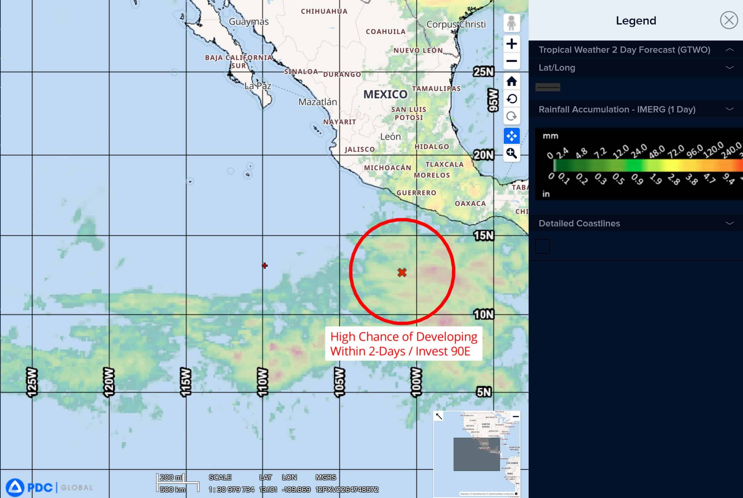
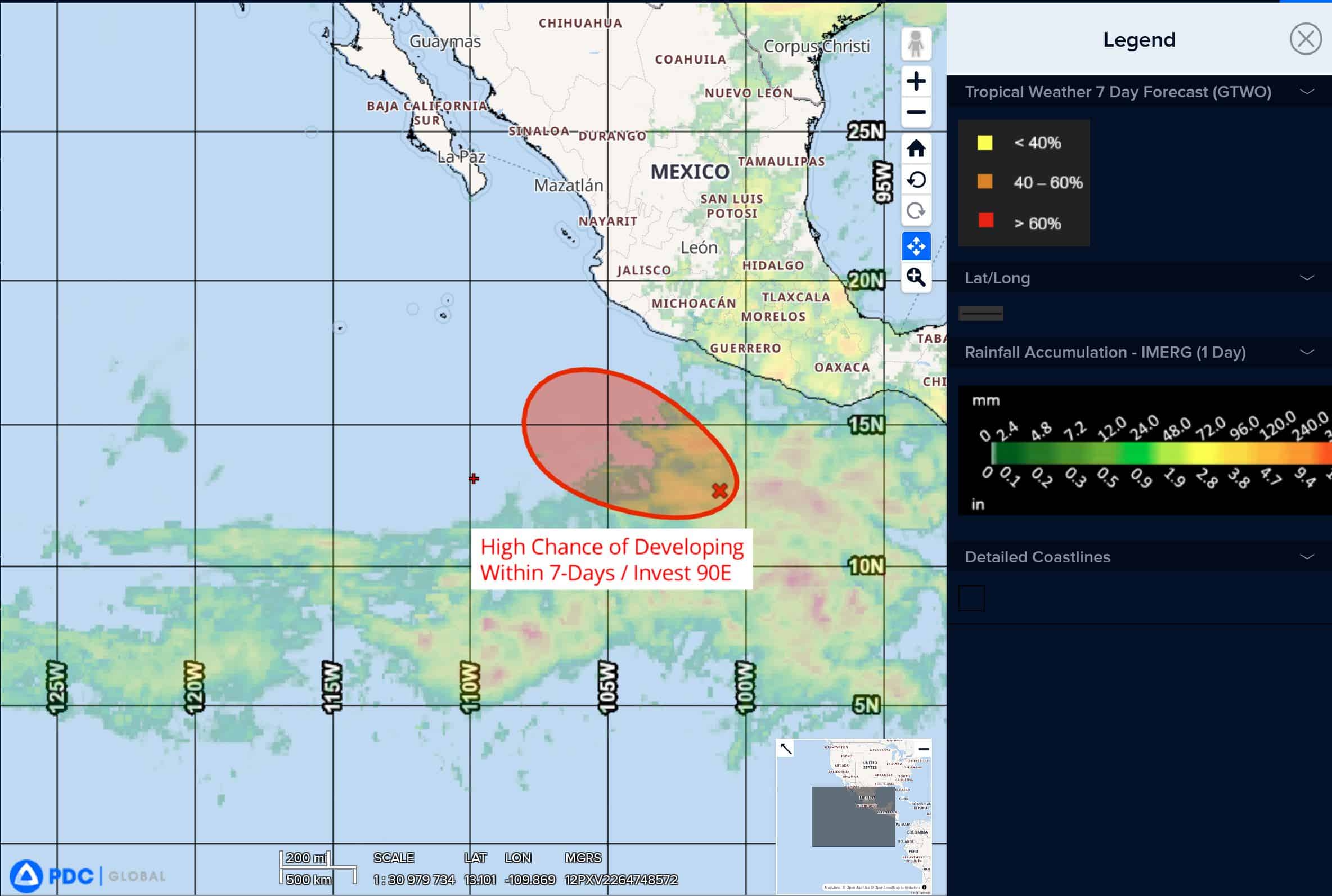
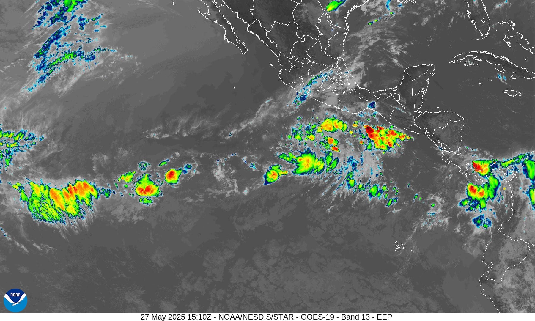
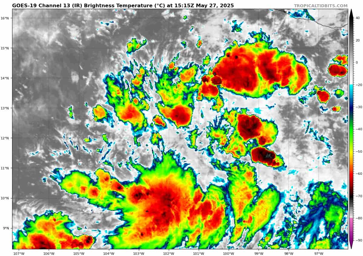
Invest 90E
>>> Satellite imagery shows showers and thunderstorms becoming better organized near a broad area of low pressure located several hundred miles south of the coast of southern Mexico. While the system still lacks a well-defined circulation, environmental conditions are favorable for further development, and a tropical depression or tropical storm is expected to form tonight or on Wednesday as the low moves generally west-northwestward at around 10 mph.
* Formation chance through 48 hours…high…100 percent
* Formation chance through 7 days…high…100 percent
Central Pacific Ocean: There are no Tropical Cyclones
The 2024 central North Pacific hurricane season has ended. As such, the final routine Tropical Cyclone Activity Report for the 2024 season has been issued. Routine issuance of this section of the PDC product will resume on June 1, 2025. During the off-season, Special Tropical Weather Outlooks will be issued as conditions warrant by the CPHC.
Western Pacific, Indian Ocean, and adjacent Seas: There are no Tropical Cyclones
>>> There’s an area of disturbed weather being referred to as Invest 94B, which is located approximately 205 NM south of Kolkata, India
Animated enhanced infrared (eir) satellite imagery depicts a broad llcc with extensive convective banding over the southern and eastern semicircles, with no distinct center. An ascat-c image indicates a large core of weak winds (0-5 knots), with an extensive swath of 25 to 30 knot winds associated with the convective banding.
Environmental analysis indicates generally favorable conditions with low to moderate vertical
wind shear (15-20 knots), good outflow aloft, and warm sea surface temperatures. However, the system is not expected to develop into a warm-core tropical cyclone due to the limited track over water.
Global models indicate a poleward track and steady deepening through landfall over northeast India and Bangladesh within the next 24-36 hours. Gale-force winds will develop prior to landfall.
Maximum sustained surface winds are estimated at 25 to 30 knots.
The potential for the development of a significant tropical cyclone within the next 24 hours is low.