As part of a Department of Defense (DoD) Joint Capability Technology Demonstration (JCTD) project, called Rapid Open Geospatial User-driven Enterprise (ROGUE), the second operational demonstration (OD2) was recently conducted in Tegucigalpa and Soto Cano Air Base in Honduras to reveal and evaluate a newly developed disaster response technology. The key outcome of this effort is a mapping technology known as GeoSHAPE, which has been designed to transform the way government and nongovernmental organizations collaborate on collecting, curating and sharing geospatial data during disaster response and humanitarian relief efforts. The open source GeoSHAPE tools facilitate mobile and “disconnected” data collection and editing, allowing multiple organizations to contribute to building and maintaining GIS information which improves overall situational awareness.
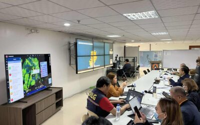
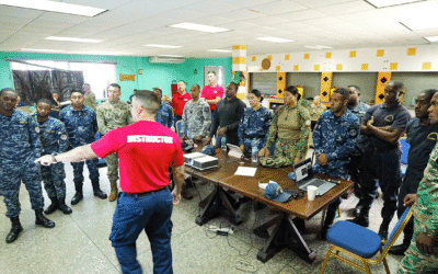
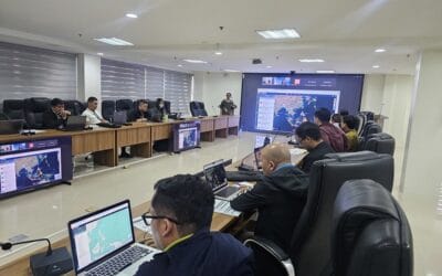
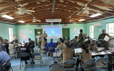
Between June 9 and 12, the United States and Honduras collaborated to demonstrate and evaluate GeoSHAPE during a hurricane response simulation for Central America. Organized by the Science, Technology and Experimentation Division at the United States Southern Command (USSOUTHCOM), the exercise tested processes and procedures for a large-scale, multi-organizational response. Participating in the scenario event were role players from the Permanent Contingency Comission of Honduras (Comisión Permanente de Contingencias, COPECO), the local Red Cross, World Vision–Honduras, and U.S. Joint Task Force-Bravo (JTF-B). Other organizations included U.S. Army Engineer Research and Development Center, the US Department of State Humanitarian Information Unit, Pacific Disaster Center (PDC), and LMN Solutions.
PDC is serving as the Transition Manager (XM) for the ROGUE JCTD. Upon successful evaluation, GeoSHAPE will be incorporated into PDC’s DisasterAWARE platform, known for providing continuous up-to-the minute hazard information globally and functioning as a hub for accessing, updating, and sharing relevant data before, during and after a disaster. Juan Hurtado, Science Advisor to USSOUTHCOM, Juan Hurtado commented on the event saying, “We are very fortunate to have PDC as a transition manager. By integrating GeoSHAPE into DisasterAWARE, which has been used operationally for over 15 years, disaster managers will have comprehensive and rapid access to critical information that can help avoid redundant relief efforts, support informed decision making, and reduce congestion at response hubs.”
Participants considered the ROGUE OD2 and GeoSHAPE demonstration a significant milestone in humanitarian assistance and disaster relief (HA/DR) capabilities. As the project moves forward, other potential applications will be explored for the newly developed capabilities.
Learn more about the FEW Project with these resources:
• Look at SOUTHCOM’s press release,
• Watch a video on GeoSHAPE software testing, or other demonstrations from the exercise on UAV, COMCUBE, or UAS,
• Read about the first ROGUE Operational Demonstration last year,
• View the ROGUE-JCTD white paper (Februay 2013), or
• View more information on SOUTHCOM’s ROGUE project.
ABOUT PDC
Pacific Disaster Center (PDC) is a leading scientific innovator of global risk reduction science and technology. As a University of Hawai’i applied science and research center, our work intersects with a variety of government, community, academic, and scientific organizations at home and around the world to build resilience to natural and man-made hazards—enhancing the capacity to quickly and accurately anticipate and prepare for new and emerging threats. Our innovations in multi-hazard early warning systems, predictive analytics, data science, and machine learning provide decision-makers with the powerful tools and insights they need to navigate today’s complex and interconnected risk landscape.