
")
Current Snapshot
For all the latest updates visit: DisasterAWARE
1800x1080ec
grant
09S_271200sair
meteosat9_ir_09S_202512271506_lat-12.0-lon88.3
09S_tracks_latest
himawari9_ir_96S_202512271430_lat-12.0-lon120.0
96S_tracks_latest
By PDC’s Senior Weather
Specialist Glenn James

The Pacific Disaster Center’s (PDC Global) Saturday, December 27, 2025, Tropical Cyclone Activity Report…for the Pacific Ocean, the Indian Ocean, and adjacent Seas
Current Tropical Cyclones:
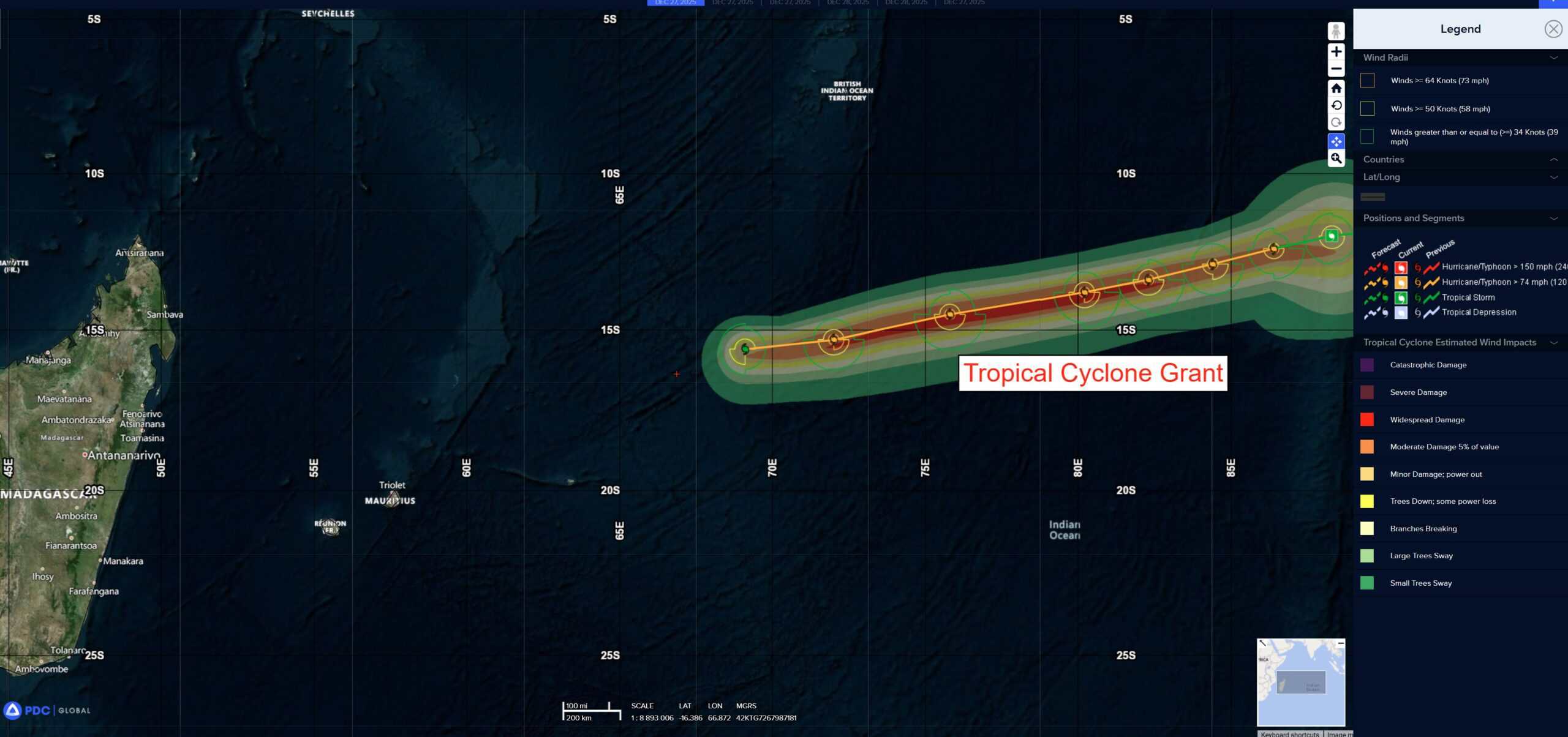
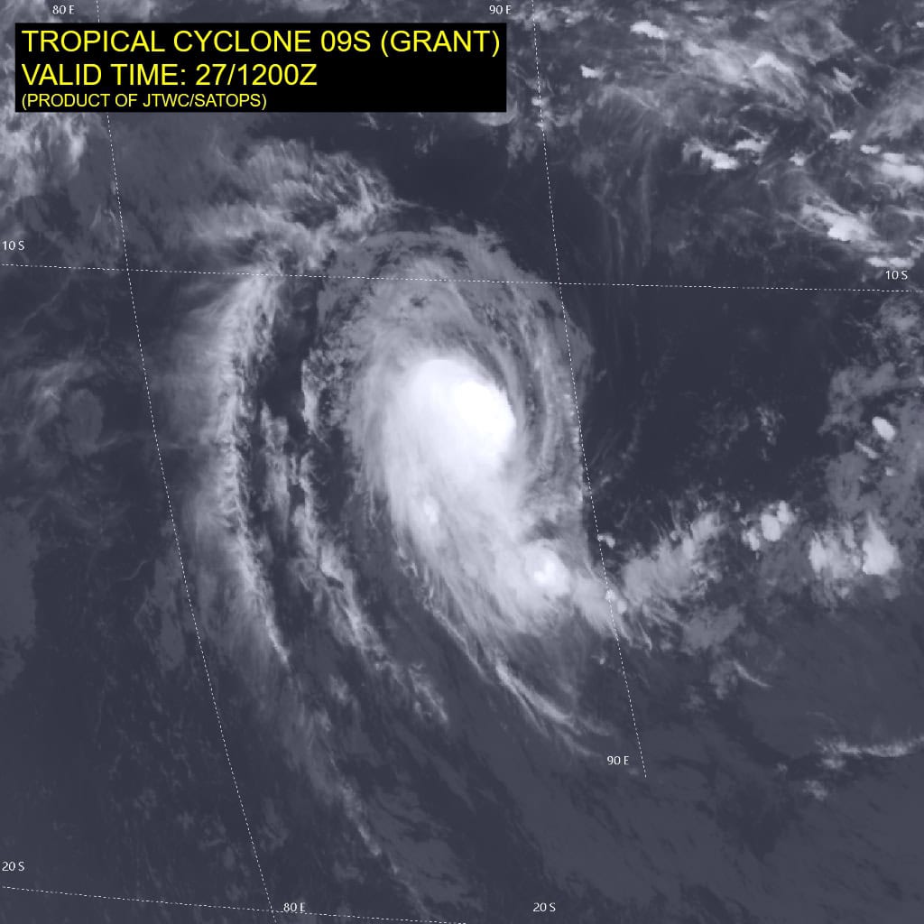
Tropical Cyclone 09S (Grant) is located approximately 896 NM east-southeast of Diego Garcia
Northeast Pacific Ocean: There are no Tropical Cyclones
The last regularly scheduled Tropical Cyclone Activity Report of the 2025 eastern North Pacific Hurricane Season has been issued. Routine issuance of this section of the PDC product will resume on May 15, 2026. During the off-season, Special Tropical Weather Outlooks will be issued as conditions warrant by the NHC.
Central Pacific Ocean: There are no Tropical Cyclones
The 2025 central North Pacific hurricane season has ended. As such, the final routine Tropical Cyclone Activity Report for the 2025 season has been issued. Routine issuance of this section of the PDC product will resume on June 1, 2026. During the off-season, Special Tropical Weather Outlooks will be issued as conditions warrant by the CPHC.
Western Pacific, Indian Ocean, and adjacent Seas:
South Indian Ocean
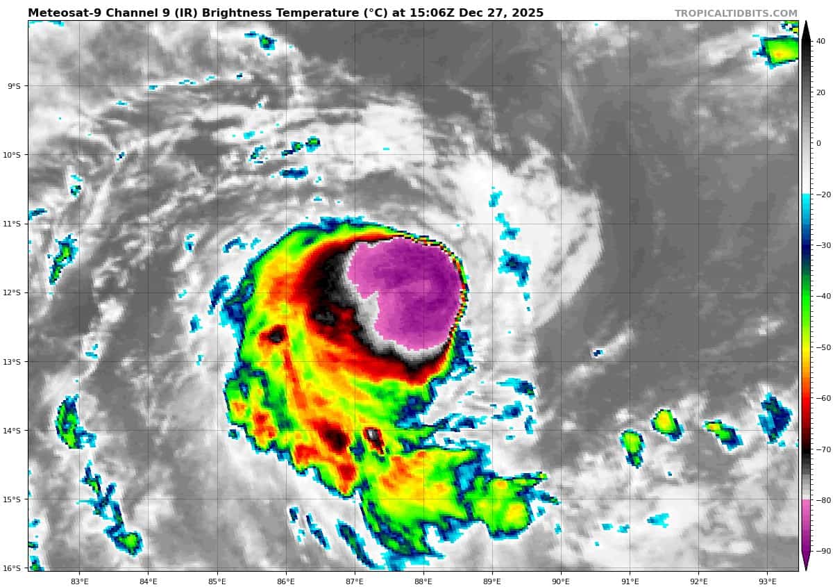
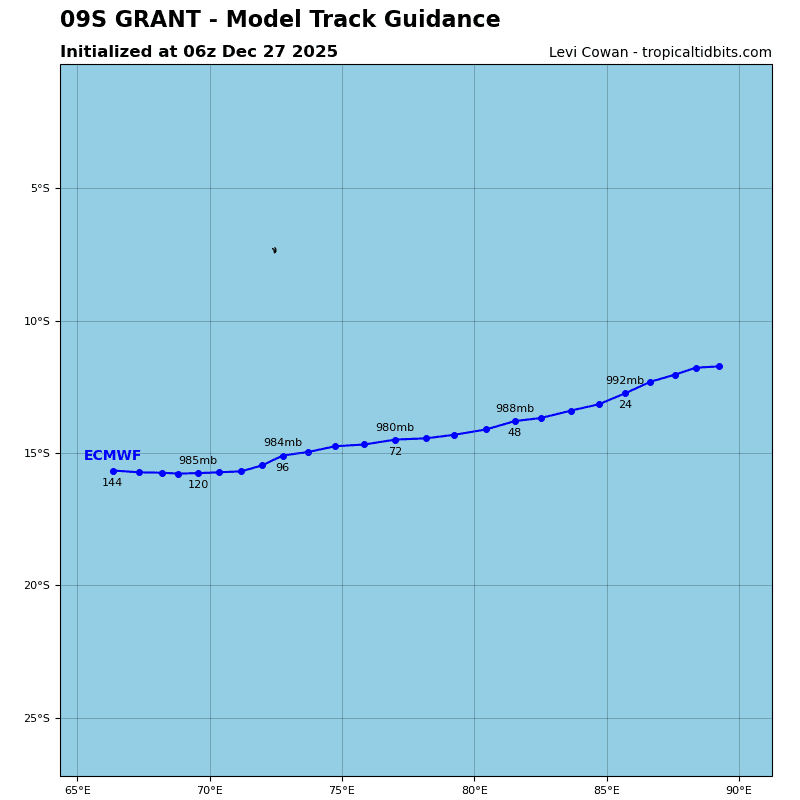
Tropical Cyclone 09S (Grant)
According to the JTWC warning number 22, sustained winds are 65 knots with 80 knot gusts
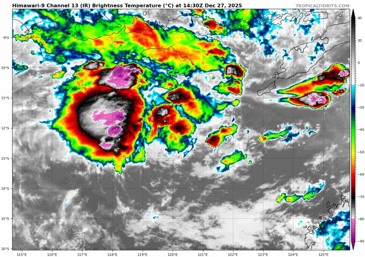
Animated multi-spectral satellite imagery (msi) depicts deep convective banding persisting over the center of a very compact circulation. TC 09S has maintained intensity over the past 12 hours with development constrained by persistent, moderate easterly vertical wind shear, which is now beginning to decrease.
TC 09S is expected to continue tracking west-southwestward throughout the forecast period, steered through 72 hours by the subtropical ridge to the south and thereafter by a second ridge building to the southwest of the system.
Slow to steady intensification is anticipated in the near-term, supported by decreasing vertical wind shear and poleward outflow enhanced by the flow associated with an upper-level trough passing to the south of the system over the next 48 hours.
Modest weakening is anticipated thereafter as easterly vertical wind shear again increases, the outflow pattern becomes more restricted, and the system begins to entrain slightly drier air.
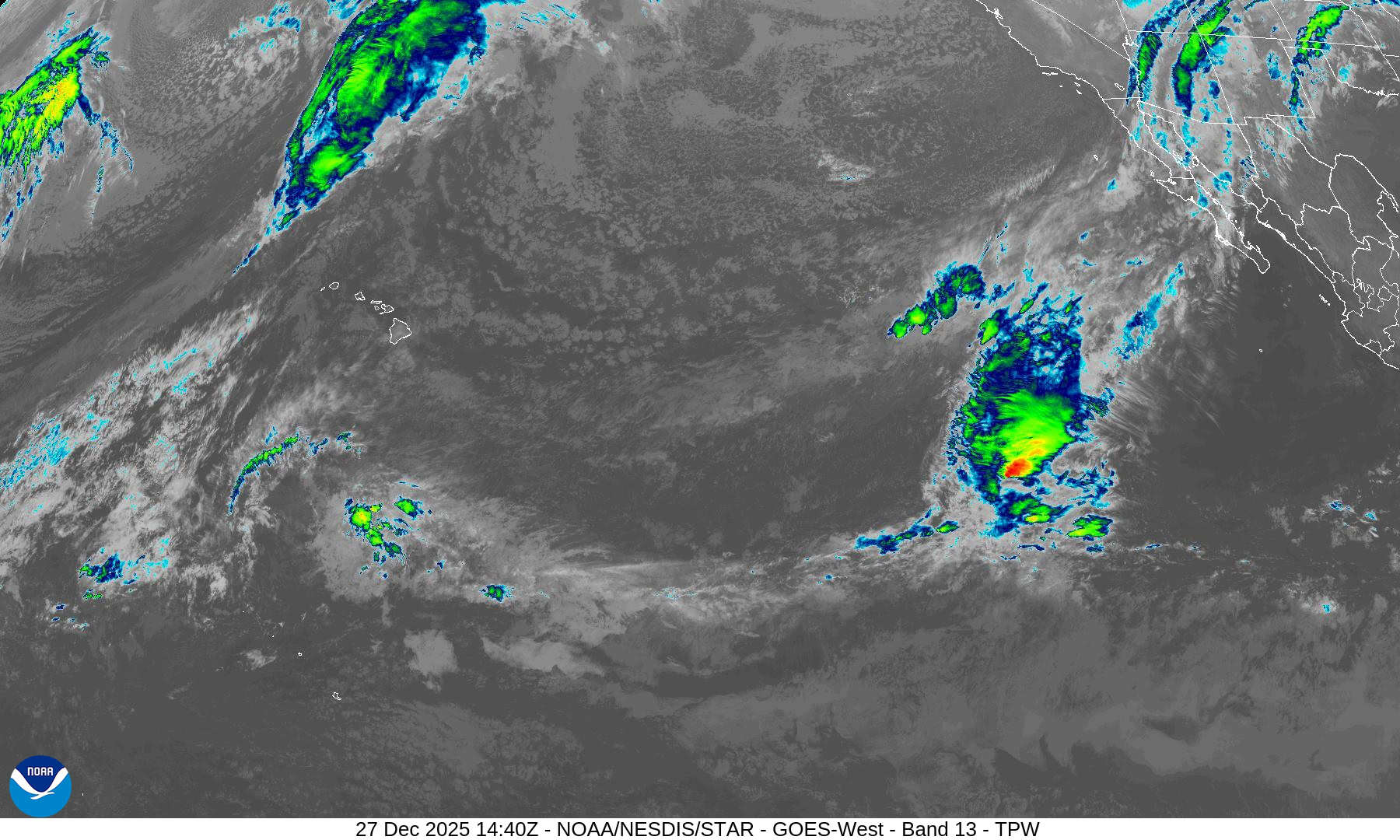
>>> There’s an area of disturbed weather being referred to as Invest 96S, which is located approximately 360 NM north-northwest of Broome, Australia
Enhanced infrared imagery depicts a steadily consolidating low-level circulation center with disorganized flaring convection.
Environmental analysis reveals a favorable environment for development with poleward upper level outflow, low to moderate vertical wind shear (15 to 20 kts), and warm sea surface temperatures (29 to 30 c).
Global ensemble models show 96S continuing to develop over the next 24-48 hours, with ecens showing a more intense system. Deterministic models disagree on development, with gfs being the only deterministic model showing any significant intensification.
Models do generally agree on a southward track over the next 48 hours.
Maximum sustained surface winds are estimated at 23 to 28 knots.
The potential for the development of a significant tropical cyclone within the next 24 hours is upgraded to high.
>>> There’s an area of disturbed weather being referred to as Invest 99P, which is located approximately 56 NM north-northwest of Pago Pago
Animated multispectral satellite imagery depicts a broad area of turning obscured by spotty flaring convection. A 280421 ascat (metop-b) shows overall broad rotation with 15- to 20-knot associated surface winds.
Environmental analysis reveals a marginally favorable environment for
development with moderate vertical wind shear (15 to 20 kts), warm sea surface temperatures (29-30 c), and moderate divergence aloft.
Ensembles and deterministic models agree that invest 99P will continue to develop as it tracks eastward over the next 24-48 hours.
Maximum sustained surface winds are estimated at 18 to 23 knots.
The potential for the development of a significant tropical cyclone within the next 24 hours is low.