
")
Current Snapshot
For all the latest updates visit: DisasterAWARE
1800x1080ec
grant
09S_251200sair
himawari9_ir_09S_202512251450_lat-12.3-lon95.0
09S_tracks_latest
By PDC’s Senior Weather
Specialist Glenn James

The Pacific Disaster Center’s (PDC Global) Thursday, December 25, 2025, Tropical Cyclone Activity Report…for the Pacific Ocean, the Indian Ocean, and adjacent Seas
Current Tropical Cyclones:
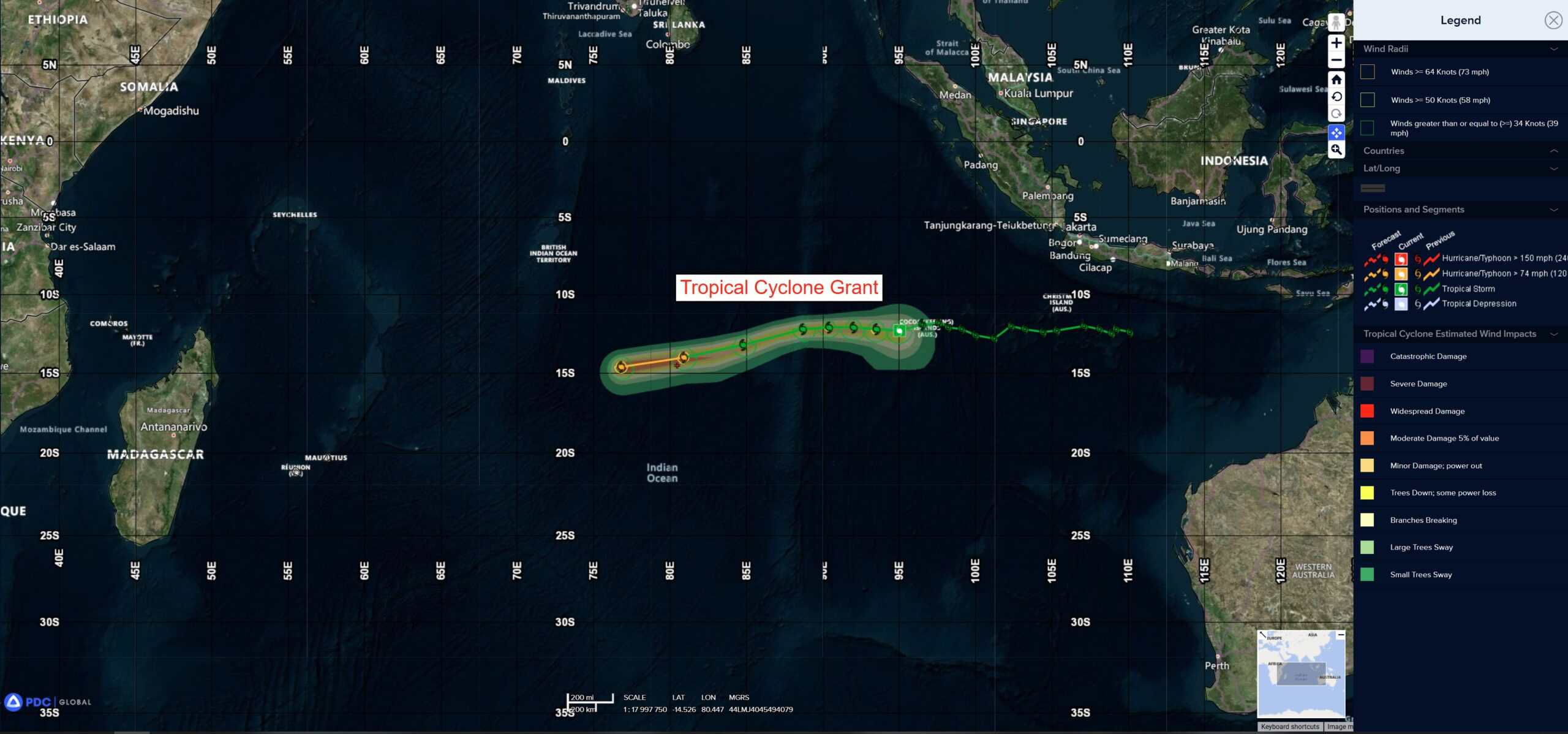
Tropical Cyclone 09S (Grant) is located approximately 206 NM west of the Cocos Islands
Northeast Pacific Ocean: There are no Tropical Cyclones
The last regularly scheduled Tropical Cyclone Activity Report of the 2025 eastern North Pacific Hurricane Season has been issued. Routine issuance of this section of the PDC product will resume on May 15, 2026. During the off-season, Special Tropical Weather Outlooks will be issued as conditions warrant by the NHC.
Central Pacific Ocean: There are no Tropical Cyclones
The 2025 central North Pacific hurricane season has ended. As such, the final routine Tropical Cyclone Activity Report for the 2025 season has been issued. Routine issuance of this section of the PDC product will resume on June 1, 2026. During the off-season, Special Tropical Weather Outlooks will be issued as conditions warrant by the CPHC.
Western Pacific, Indian Ocean, and adjacent Seas:
South Indian Ocean
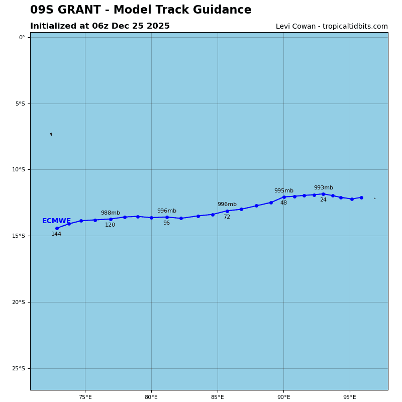
Tropical Cyclone 09S (Grant)
According to the JTWC warning number 18, sustained winds are 50 knots with 65 knot gusts
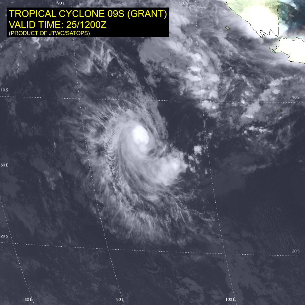
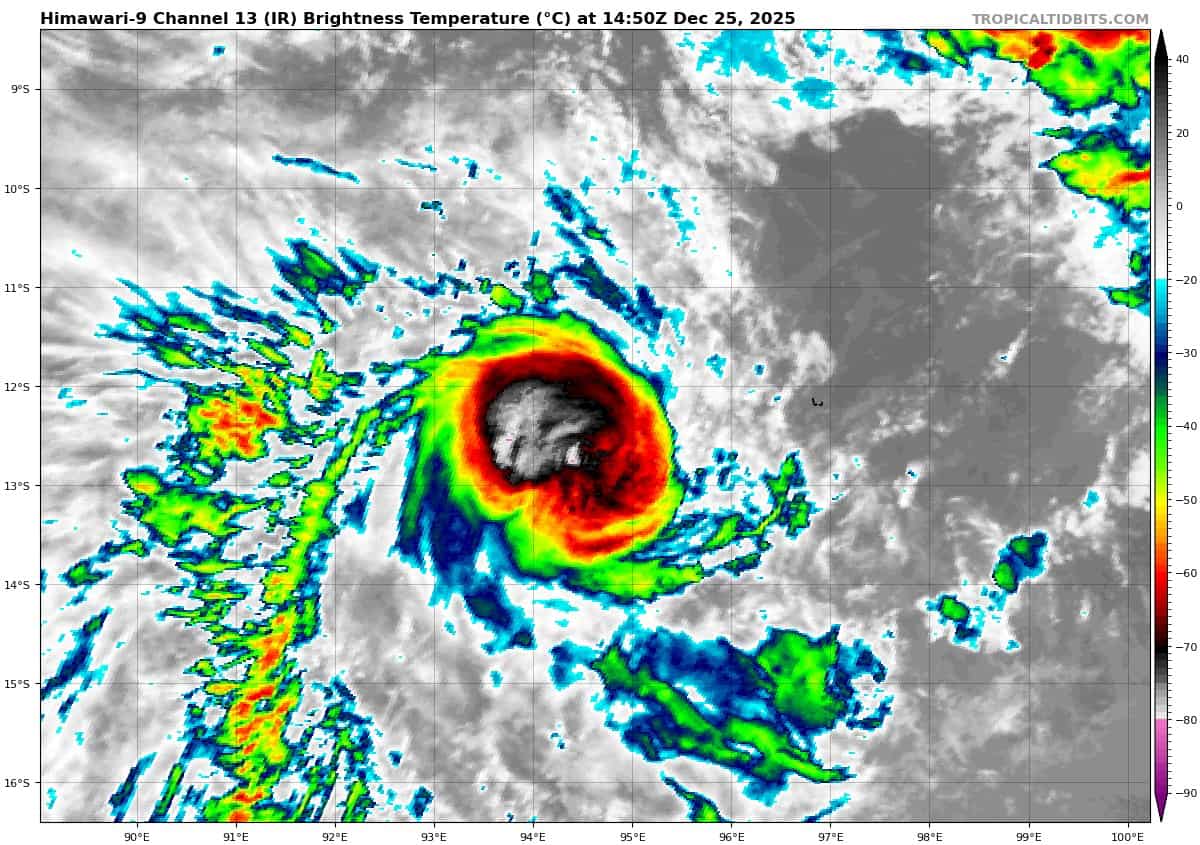
Tropical cyclone 09S (Grant) continues to maintain compact structure with deep convection wrapping tightly around the low level circulation center as depicted by animated enhanced infrared (eir) satellite imagery.
Cloud top temperatures have cooled over the past six hours with most activity in the northern semicircle. A 251202z sentinel-1c sar image supports the initial position and indicates a 43 knot mean vmax, with a peak value of 55 knots over the southeastern quadrant.
Tropical cyclone 09S (Grant) will continue tracking westward under the influence of subtropical ridging to the south while struggling against moderate vertical wind shear (20-25 kts) and dry air intrusion.
These forecast conditions will only allow the system to intensify up to 55 kts around 36 hours. After 72 hours the decrease in forecast vertical wind shear and a better outflow will allow the circulation to undergo another period of intensification with a peak intensity expected to reach 75 kts by 120 hours.