
")
Current Snapshot
For all the latest updates visit: DisasterAWARE

ec
09s
09S_211200sair
himawari9_ir_09S_202512211450_lat-12.2-lon103.2
09S_tracks_latest
By PDC’s Senior Weather
Specialist Glenn James

The Pacific Disaster Center’s (PDC Global) Sunday, December 21, 2025, Tropical Cyclone Activity Report…for the Pacific Ocean, the Indian Ocean, and adjacent Seas
Current Tropical Cyclones:
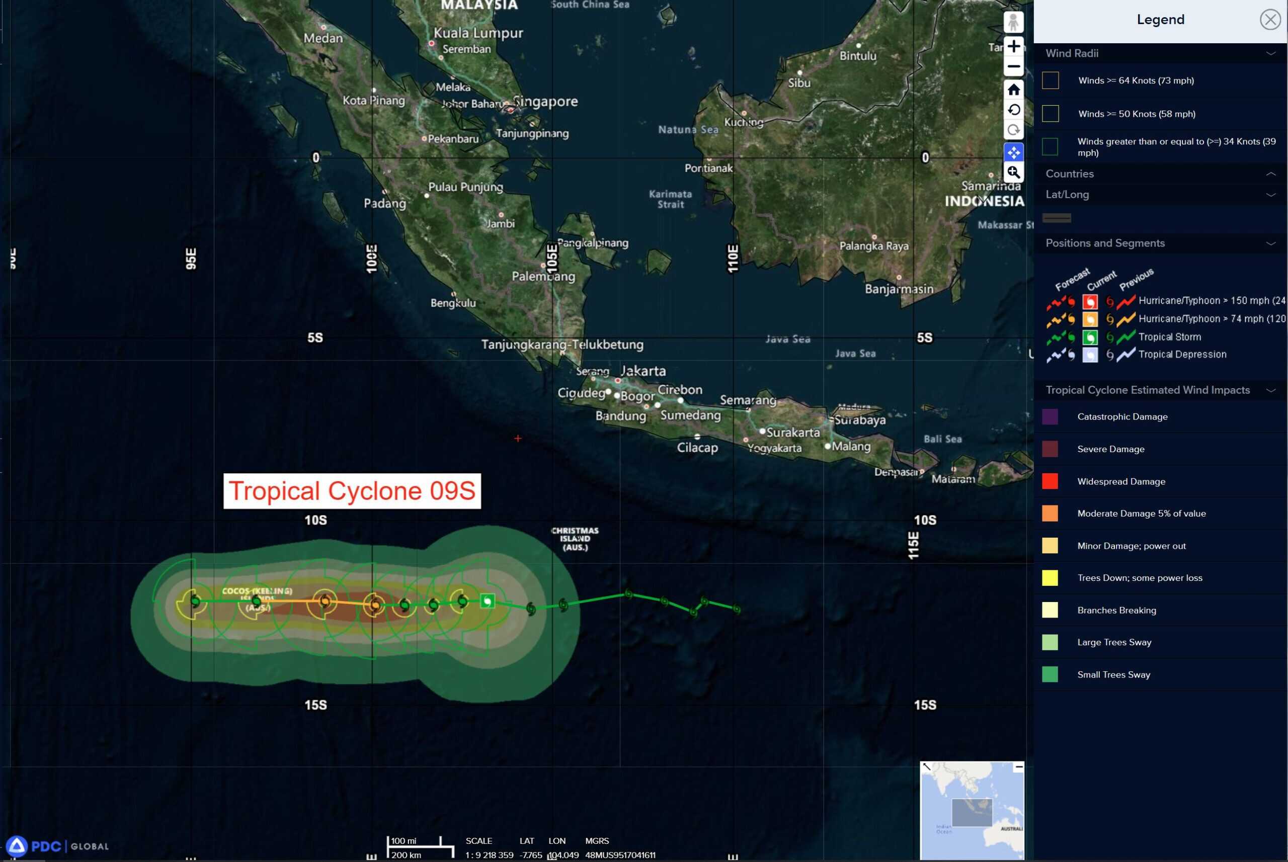
Tropical Cyclone 09S is located approximately 317 NM east of the Cocos Islands
Northeast Pacific Ocean: There are no Tropical Cyclones
The last regularly scheduled Tropical Cyclone Activity Report of the 2025 eastern North Pacific Hurricane Season has been issued. Routine issuance of this section of the PDC product will resume on May 15, 2026. During the off-season, Special Tropical Weather Outlooks will be issued as conditions warrant by the NHC.
Central Pacific Ocean: There are no Tropical Cyclones
The 2025 central North Pacific hurricane season has ended. As such, the final routine Tropical Cyclone Activity Report for the 2025 season has been issued. Routine issuance of this section of the PDC product will resume on June 1, 2026. During the off-season, Special Tropical Weather Outlooks will be issued as conditions warrant by the CPHC.
Western Pacific, Indian Ocean, and adjacent Seas:
South Indian Ocean
Tropical Cyclone 09S
According to the JTWC warning number 10, sustained winds are 40 knots with 50 knot gusts
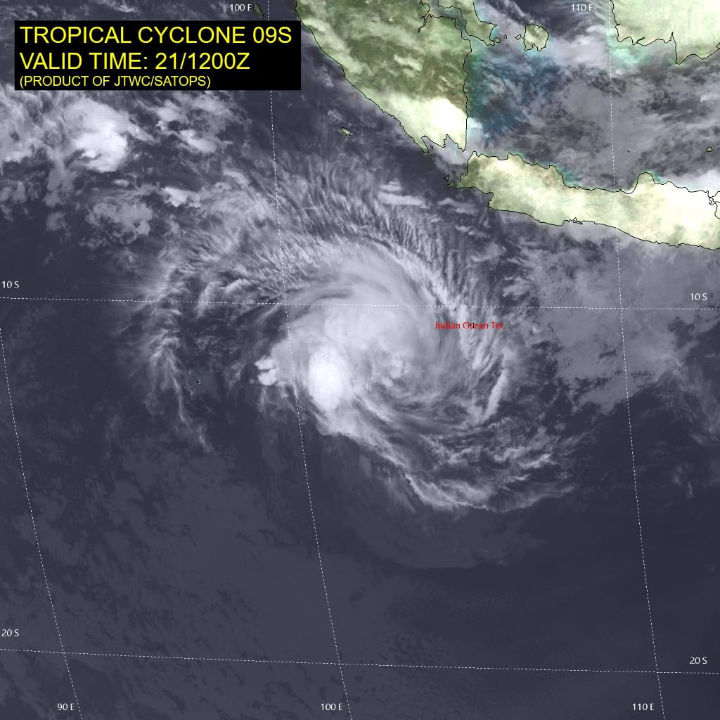
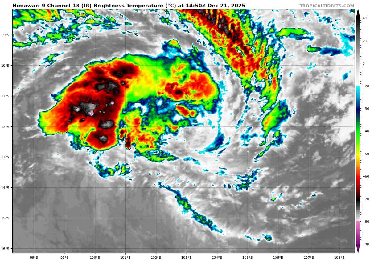
Animated enhanced infrared (eir) satellite imagery depicts tropical cyclone 09S with a small but loosely organized low level circulation center with convection displaced to the west due to mid level shear. Cloud top temperatures have warmed slightly over the last few hours as the system has continued to track westward.
Environmental analysis remains marginally favorable with low vertical wind shear (5-10 kts), warm sea surface temperatures (27 c to 28 c), and moderate equatorward outflow.
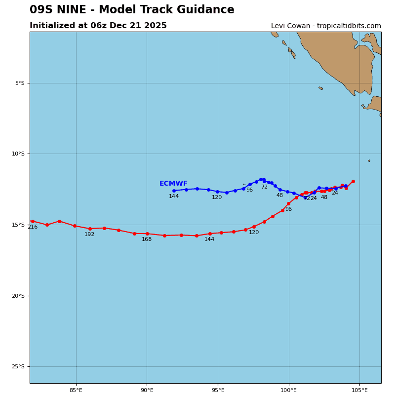
Tropical cyclone 09S is forecast to continue westward along the northeast periphery of the subtropical ridge located directly to the southeast while steadily increasing in intensity. The system is expected to reach a maximum intensity of 70 kts near 48 hours.
Following 48 hours, 09S will begin a slow, but steady weakening trend as dry air begins wrapping around the core-inhibiting continued development, despite the forecast environmental conditions remaining marginally favorable.
From 48 hours until the end of the forecast period, TC 09S will continue westward along the northern extent of the subtropical steering
ridge to the south, through the southern Indian Ocean and steadily decreasing in intensity to 55 kts by 120 hours.