
")
Current Snapshot
For all the latest updates visit: DisasterAWARE

1800×1080
09S_181200sair
09S_tracks_latest
By PDC’s Senior Weather
Specialist Glenn James

The Pacific Disaster Center’s (PDC Global) Thursday, December 18, 2025, Tropical Cyclone Activity Report…for the Pacific Ocean, the Indian Ocean, and adjacent Seas
Current Tropical Cyclones:
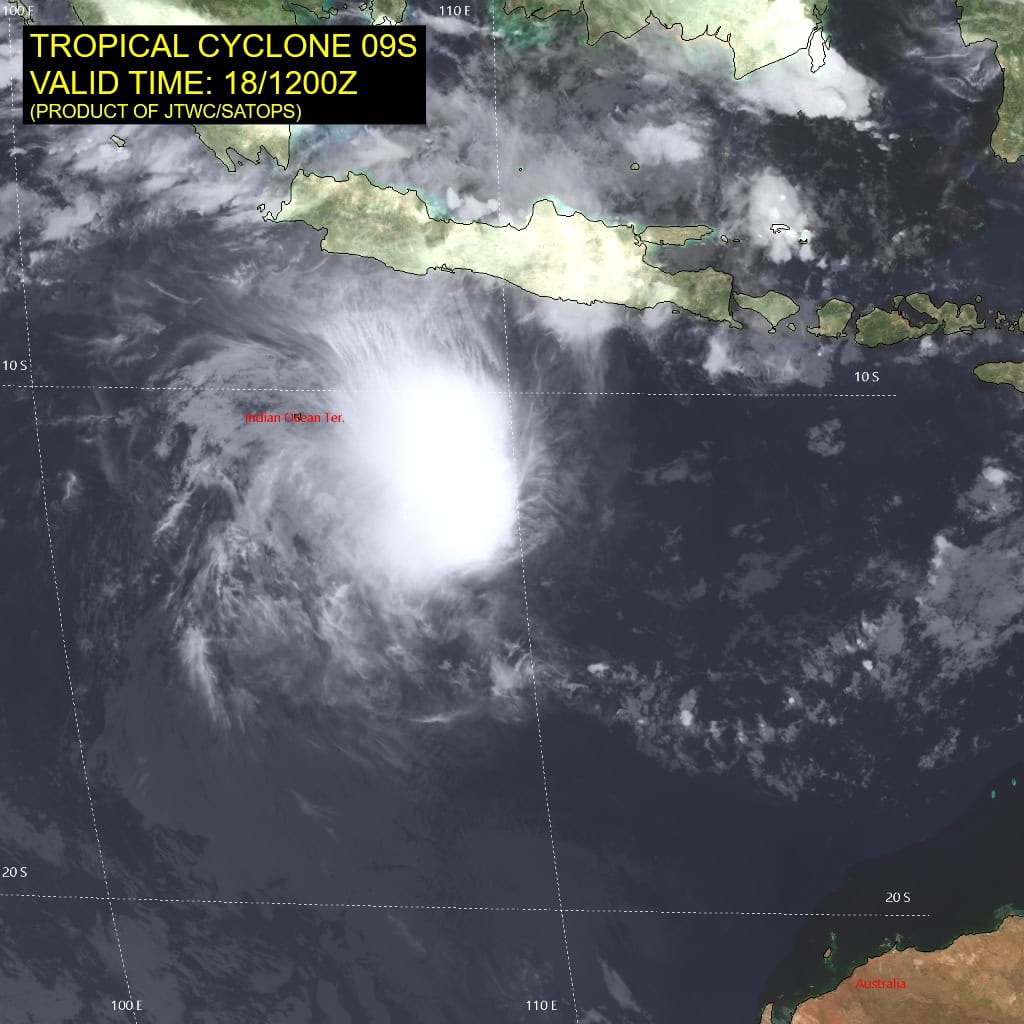
Tropical Cyclone 09S is located approximately 659 NM north-northwest of Learmonth, Australia
Northeast Pacific Ocean: There are no Tropical Cyclones
The last regularly scheduled Tropical Cyclone Activity Report of the 2025 eastern North Pacific Hurricane Season has been issued. Routine issuance of this section of the PDC product will resume on May 15, 2026. During the off-season, Special Tropical Weather Outlooks will be issued as conditions warrant by the NHC.
Central Pacific Ocean: There are no Tropical Cyclones
The 2025 central North Pacific hurricane season has ended. As such, the final routine Tropical Cyclone Activity Report for the 2025 season has been issued. Routine issuance of this section of the PDC product will resume on June 1, 2026. During the off-season, Special Tropical Weather Outlooks will be issued as conditions warrant by the CPHC.
Western Pacific, Indian Ocean, and adjacent Seas:
South Indian Ocean
Tropical Cyclone 08S
According to the JTWC warning number 4, sustained winds are 35 knots with 45 knot gusts
Animated enhanced infrared (eir) satellite imagery depicts a mostly exposed low level circulation center (llcc), displaced to the east of an area of persistent deep convection due to the continued pressure of moderate easterly shear. An 180906z ssmis 89ghz microwave image revealed a small and exposed llcc positioned to the east of an area of elongated (east-west) deep convection.
The environment continues to be marginal at best, with moderate easterly shear, limited and weak radial outflow, dry mid-level air along the eastern flank and warm ssts.
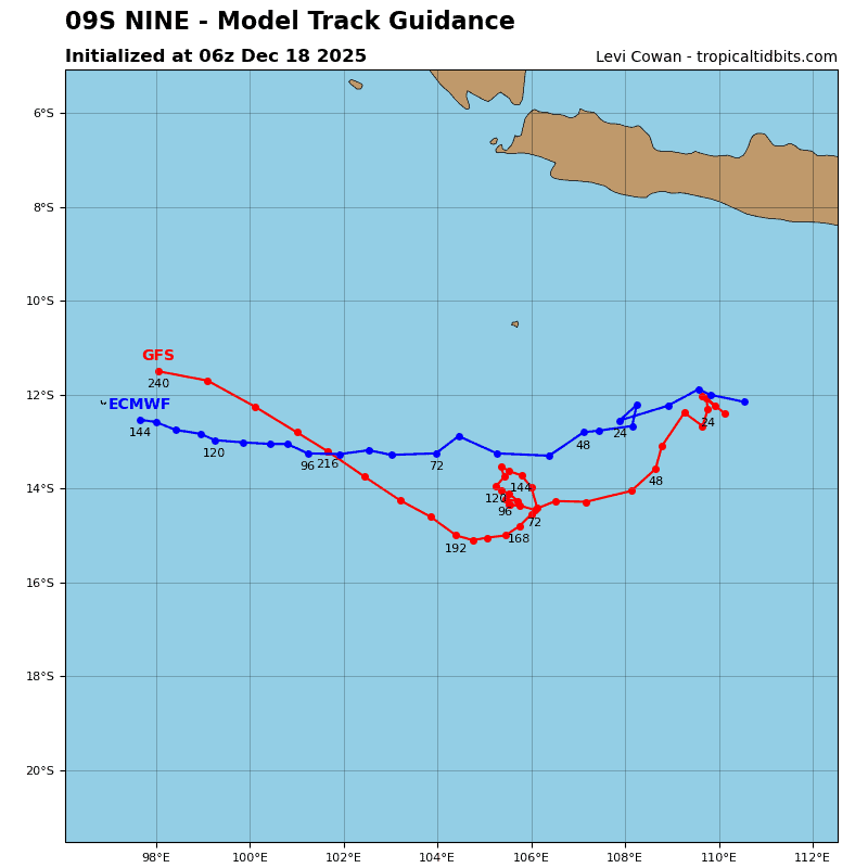
Tropical cyclone 09S has turned to the west-southwest over the past six hours based on the best track positions. a hot-off-the-presses ascat pass coming in at this moment indicates a center near 12.2s 109.7e or just a bit northwest of the 1200z initial position.
with this new data, it appears the llcc has tracked westward over the past six hours, along the northern side of the str over northwestern Australia, as analyzed by the ecmwf. Though recent communications issues at JTWC have resulted in a limited set of model data for this forecast cycle, there is no major shift in the synoptic situation, and this forecast is very similar to the last, except for a slower track speed after 72 hours and a gradual turn towards the northwest by the end of the forecast period.
In terms of intensity, due to the extremely limited guidance available, there is no change to the JTWC forecast. The system is expected to maintain its current intensity for 24 to 36 hours and may in fact weaken below the 35 knot threshold during this time frame, as moderate easterly shear and dry air persist and hinder development. After 36 hours, shear conditions are expected to improve, and the atmosphere will moisten, allowing the system to slowly intensify through the remainder of the forecast period.