
")
Current Snapshot
For all the latest updates visit: DisasterAWARE
1800x1080e
b
07S_170600sair
himawari9_ir_07S_202512171430_lat-12.6-lon92.3
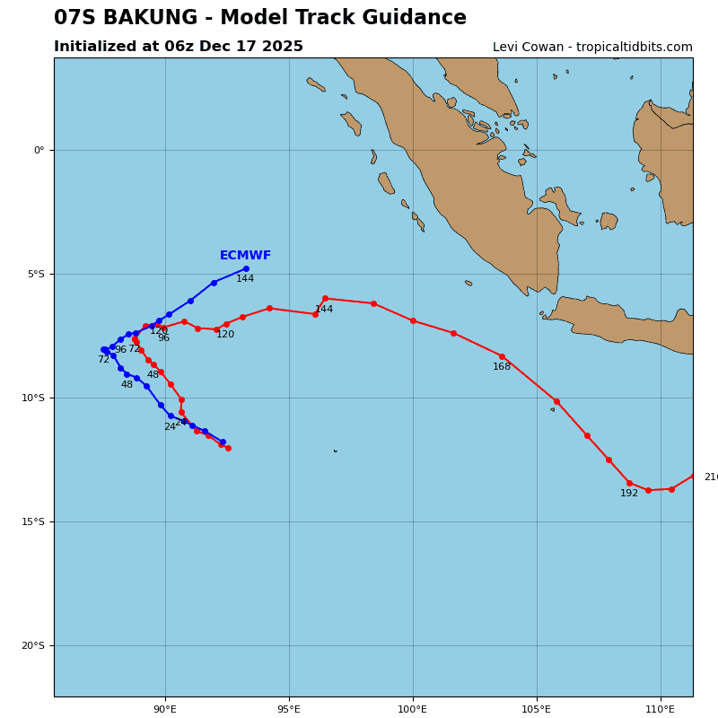
07S_tracks_latest
93s
himawari9_ir_93S_202512171430_lat-12.7-lon112.9
93S_tracks_latest
By PDC’s Senior Weather
Specialist Glenn James

The Pacific Disaster Center’s (PDC Global) Wednesday, December 17, 2025, Tropical Cyclone Activity Report…for the Pacific Ocean, the Indian Ocean, and adjacent Seas
Current Tropical Cyclones:
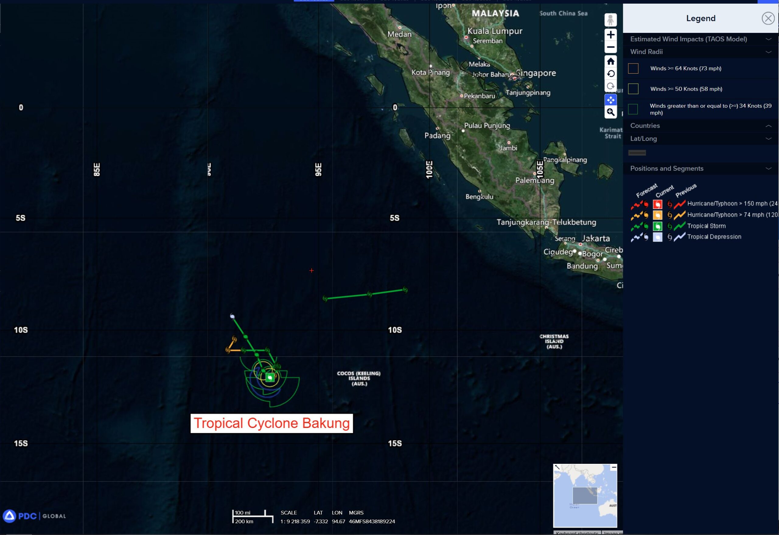
Tropical Cyclone 07S (Bakung) is located approximately 241 NM west of the Cocos Islands
Northeast Pacific Ocean: There are no Tropical Cyclones
The last regularly scheduled Tropical Cyclone Activity Report of the 2025 eastern North Pacific Hurricane Season has been issued. Routine issuance of this section of the PDC product will resume on May 15, 2026. During the off-season, Special Tropical Weather Outlooks will be issued as conditions warrant by the NHC.
Central Pacific Ocean: There are no Tropical Cyclones
The 2025 central North Pacific hurricane season has ended. As such, the final routine Tropical Cyclone Activity Report for the 2025 season has been issued. Routine issuance of this section of the PDC product will resume on June 1, 2026. During the off-season, Special Tropical Weather Outlooks will be issued as conditions warrant by the CPHC.
Western Pacific, Indian Ocean, and adjacent Seas:
South Indian Ocean
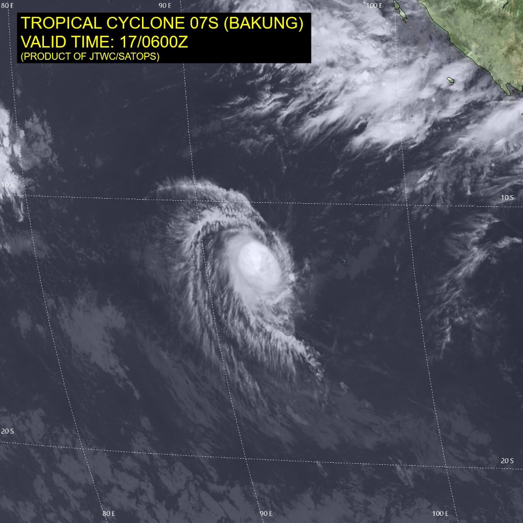
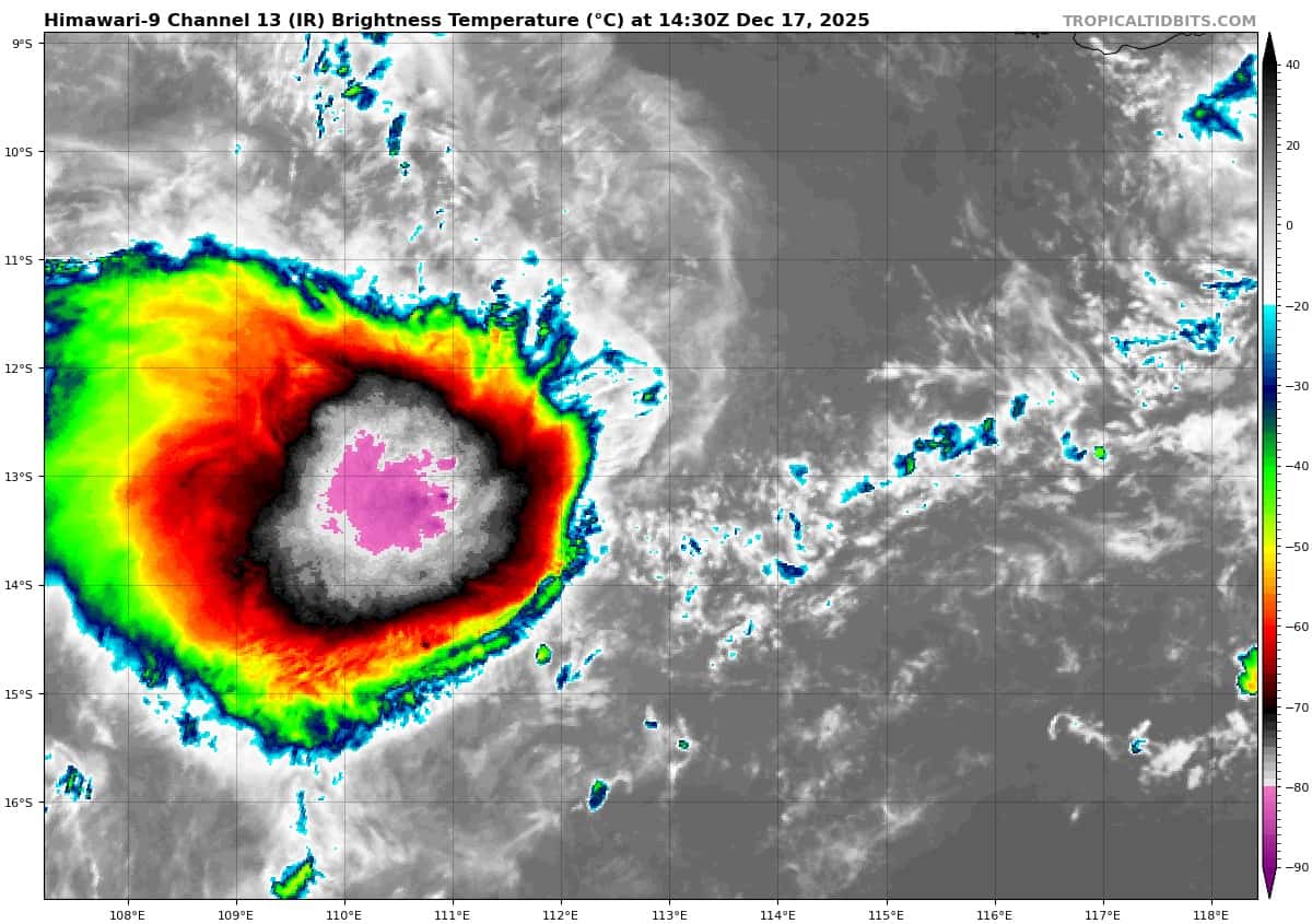
Tropical Cyclone 07S (Bakung)
According to the JTWC warning number 13, sustained winds are 55 knots with 70 knot gusts
Tropical cyclone 07S (Bakung) has experienced some weakening over the past six hours with a much more compact area of convection and increasing tilt as depicted via animated multispectral satellite imagery (msi). Animated enhanced infrared (eir) satellite imagery shows a warming trend in cloud top temperatures. A 170341z ascat pass corroborates these observations with a tight circulation and 45 kt wind barbs on the quality controlled product.
Tropical cyclone 07S has ceased rapid intensification and is displaying signs of slow weakening which should continue at least for the next 12 hrs. Afterwards more rapid weakening will take place as the vortex becomes further decoupled while the system continues to track through an area of moderate to high vertical wind shear with dry air wrapping in from the western side of the vortex.
Guidance remains ahead of reality with 07S still tracking west-southwestward which would delay the effects of dry air entrainment and decoupling of the vortex. Majority of the numerical models continue to insist on the shallowing of the vortex within the next 12-24 hours, resulting in a northwestward track driven by a predominantly southeasterly low-level flow.
South Indian Ocean
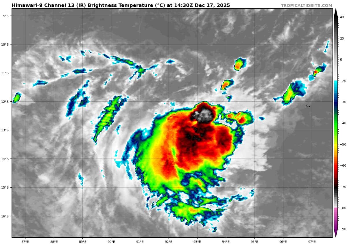
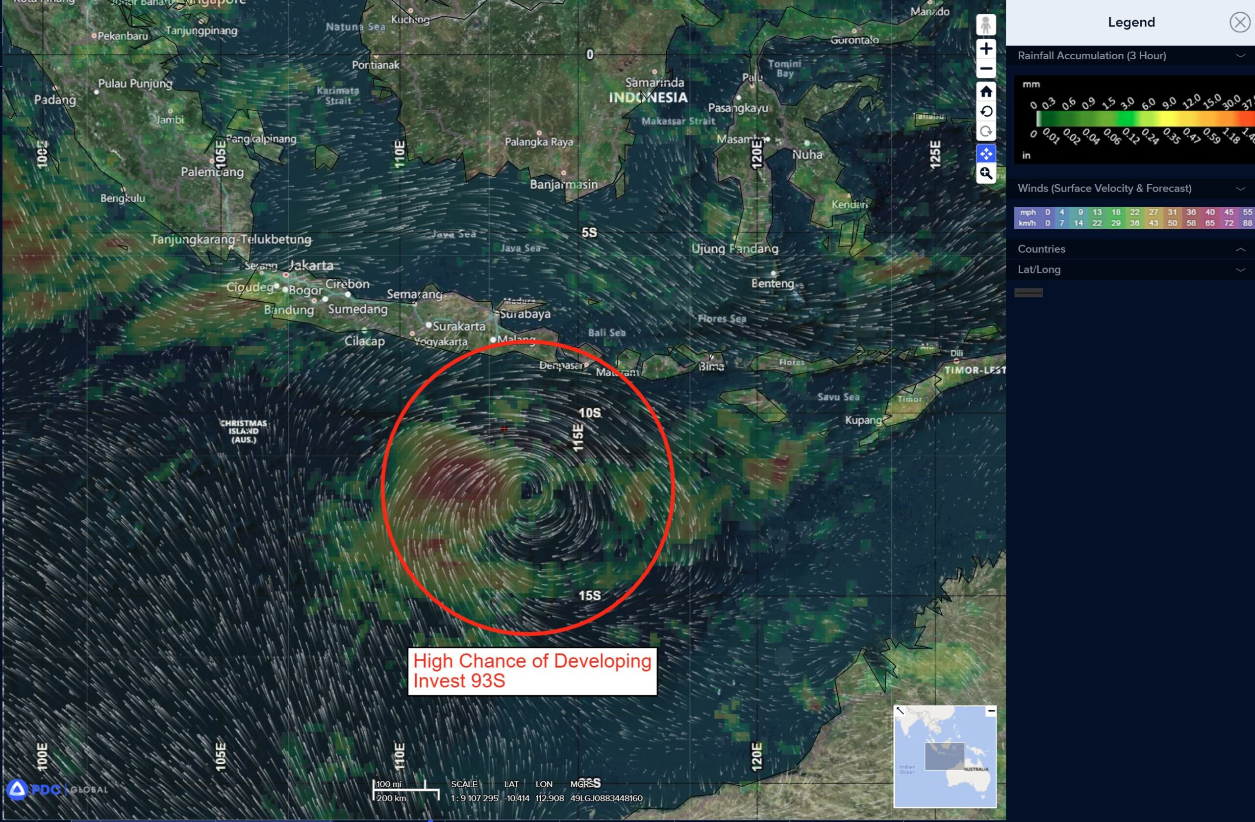
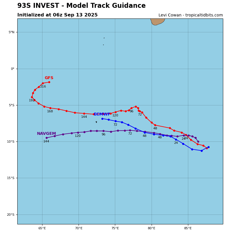
>>> There’s an area of disturbed weather being referred to as Invest 93S, which is located approximately 451 NM east of Christmas Island
Animated multispectral satellite imagery (msi) depicts deep convection building over the western side of a compact and rapidly rotating llcc, with curved deep convective banding over the western periphery of the circulation evident in a 162143z ssmis image.
Environmental analysis reveals a moderately favorable environment with moderate vertical wind shear (15-20 kts), warm sea surface temperatures (28-29 c), and persistent westward and poleward outflow.
Deterministic global models are in general agreement on further development of 93S over the next 24 to 36 hours, with GFS consolidating most quickly. Deterministic and ensemble models are in good agreement on a gradual southwestward motion of 93S over the next 24 hours.
Maximum sustained surface winds are estimated at 28 to 33 knots.
The potential for the development of a significant tropical cyclone within the next 24 hours is upgraded to high.