
")
Current Snapshot
For all the latest updates visit: DisasterAWARE
epac
1800x1080e
fina
close
05S_241200sair
himawari8_ir_05S_202511241430_lat-14.4-lon127.9
92W_tracks_latest
By PDC’s Senior Weather
Specialist Glenn James

The Pacific Disaster Center’s (PDC Global) Monday, November 24, 2025, Tropical Cyclone Activity Report…for the Pacific Ocean, the Indian Ocean, and adjacent Seas
Current Tropical Cyclones:
Tropical Cyclone 33W…is located 254 NM south-southeast of Manila, Philippines
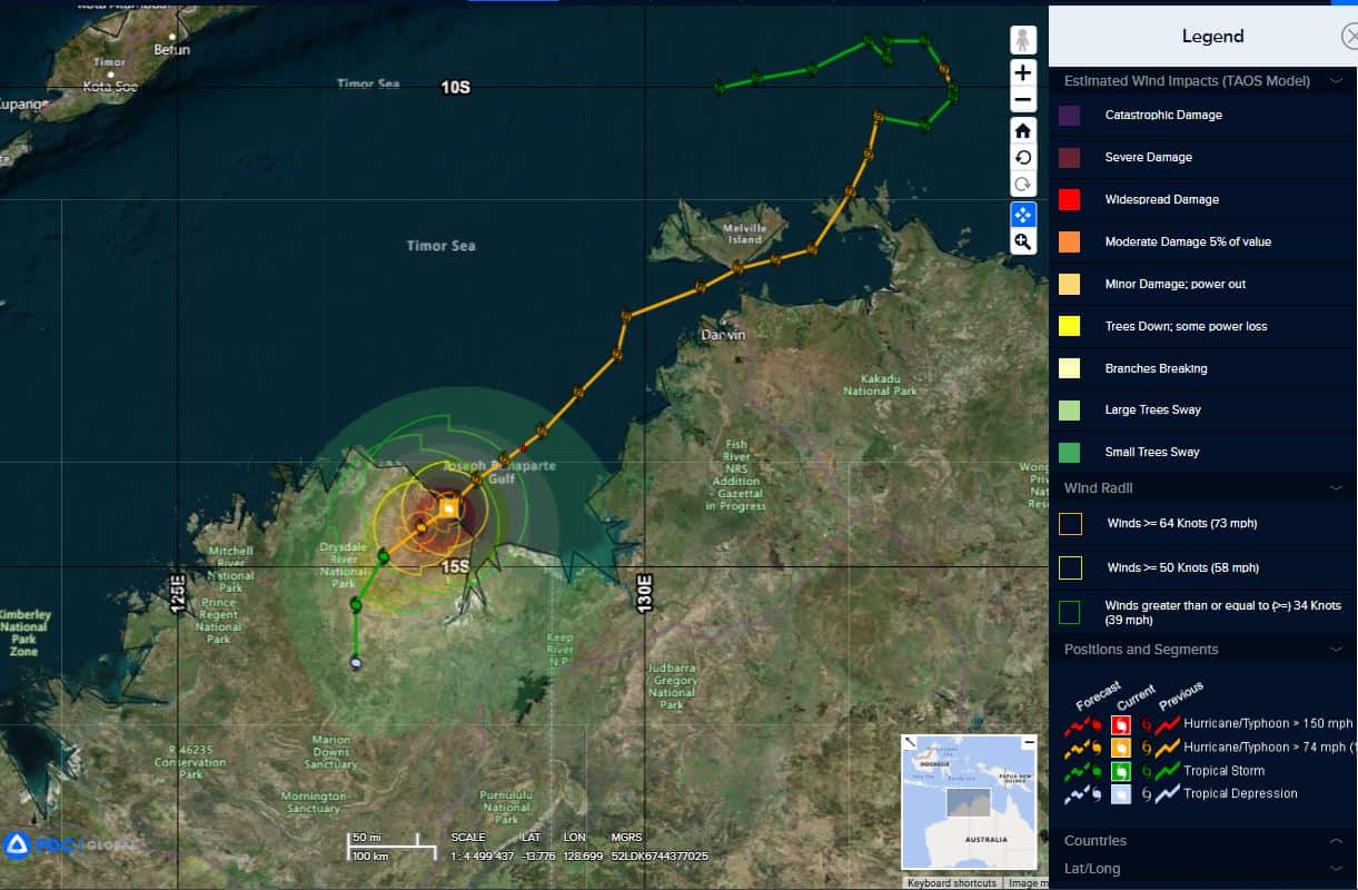
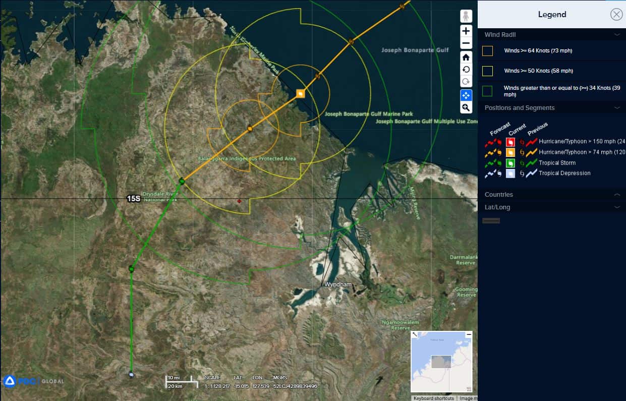
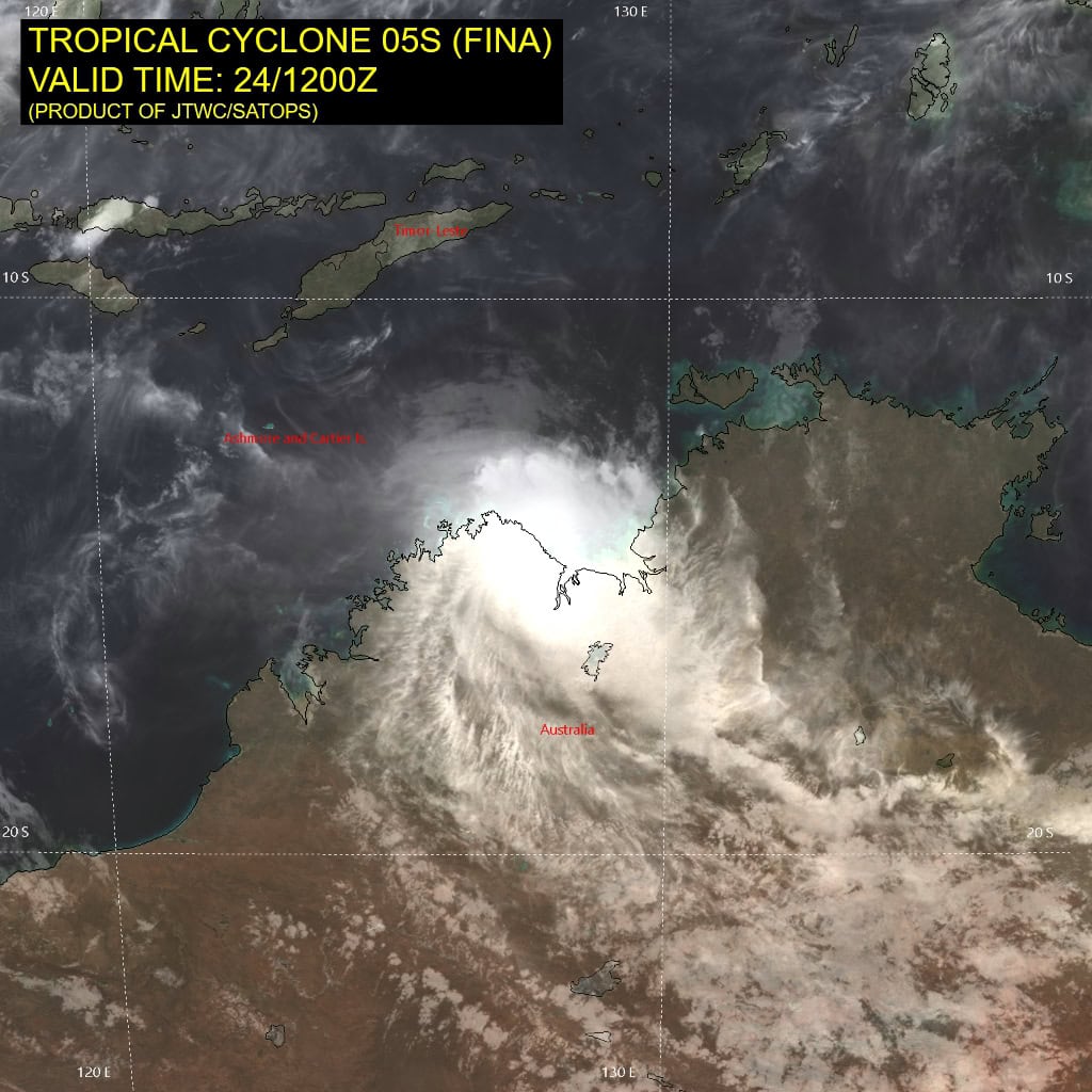
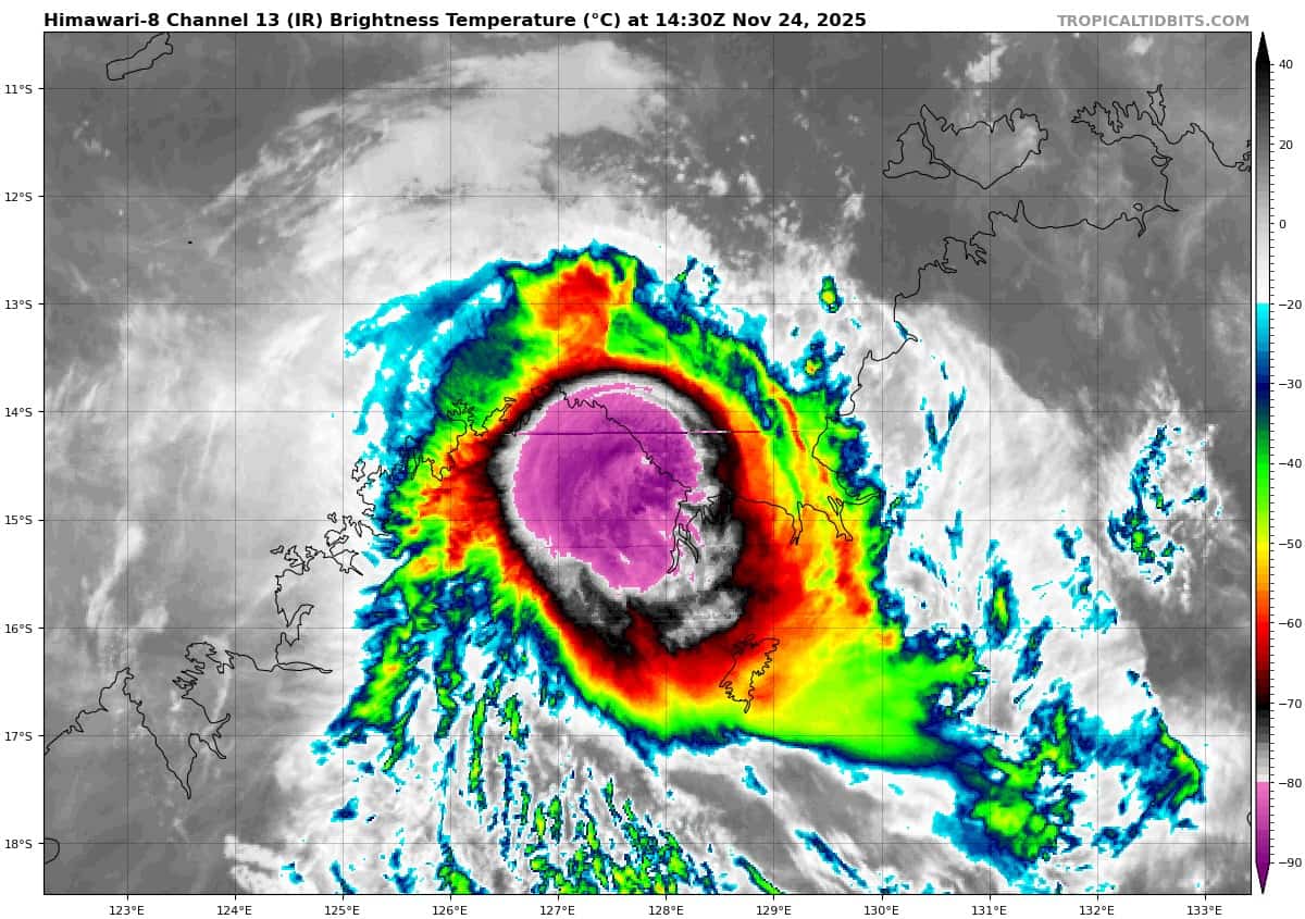
Tropical Cyclone 05S (Fina)…is located 222 NM west-southwest of Darwin, Australia – Final Warning
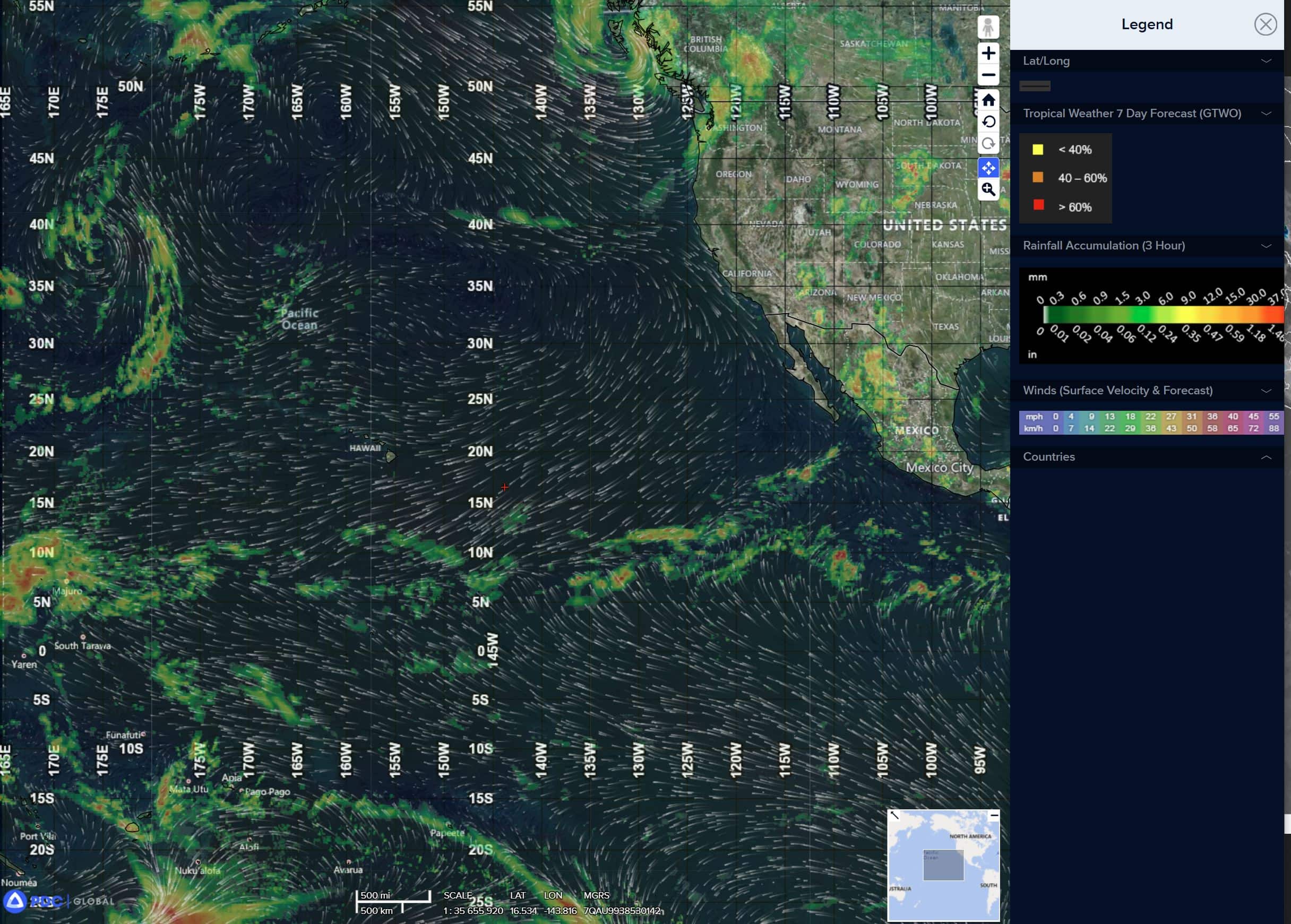
Northeast Pacific Ocean: There are no Tropical Cyclones
Tropical cyclone formation is not expected during the next 7 days.
Central Pacific Ocean: There are no Tropical Cyclones
Tropical cyclone formation is not expected during the next 7 days.
Western Pacific, Indian Ocean, and adjacent Seas:
Western Pacific
Tropical Cyclone 33W
According to the JTWC warning number 2, sustained winds were 30 knots, with gusts to near 40 knots
Animated multi-spectral satellite imagery (msi) depicts a rapidly
consolidating circulation, with persistent deep convection beginning to form into a more symmetrical central dense overcast (cdo), as the system passed over southern Panay Island it was accompanied by an impressive burst of inner-core lightning, suggestive of rapid consolidation of the inner core of the system.
A 242308z ssmis 91ghz microwave image revealed nascent banding features wrapping into a still somewhat ill-defined circulation center, at least in the upper-levels. Animated radar data from Pagasa shows the nascent low level circulation center (llcc) becoming increasingly defined as it passes over the far southern portion of Panay Island.
Environmental conditions continue to improve, now characterized by low deep-layer easterly shear, warm ssts and strong poleward and equatorward outflow.
Having completed, or very nearly completed, its traverse across the central Philippine Islands, tropical depression 33W is set to imminently move over the relatively open waters of the northern Sulu Sea. The system is then expected to pass through the Linapacan Strait north of Palawan and emerge into the South China Sea (scs) within the next 12 hours.
Continuing northwestward along the southwestern periphery of the deep str, TD 33S will move into the central scs by 48 hours, where it will begin to slow down and turn more westward to west-southwestward as it moves into a competing steering pattern, trapped between ridging to the east and west and a weakness in the ridge pattern to the north.
After 72 hours, the system slows to a crawl, nearly quasi-stationary, trapped as it will be in the weak and competing steering pattern. Overall, TD 33W is expected to drift slowly northwestward along the coast of Vietnam after 72 hours, but there is significant uncertainty in this portion of the forecast, with a possibility of highly erratic, and looping motion.
The system has slowly intensified over the past six hours, held back as it moved over the rugged terrain a series of islands. Now that it is poised to move back over relatively open waters, the system is primed for a faster pace, potentially even rapid, intensification. Once getting its feet wet again, the system will still need a bit of time to achieve a vertically aligned vortex, but now that the shear has dropped off to just 5-10 knots, this process is expected to be relatively quick.
By the time it moves into the scs, TD 33W will be a weak tropical storm and several models suggest it could undergo a period of ri after 36 hours. The official forecast stops just short of ri, though if the current trend continues, the next forecast may go for it. Regardless, the system only has about 48 hours of good conditions before it slams into a strong northeasterly cold-surge
and very strong (30-35 knots) southerly shear gives it a good whack on the ol noggin.
The rapid increase in shear shortly after 48 hours could even lead to decapitation, but even if it does not, the system will weaken steadily beyond 48 hours. shear looks to decrease again after 96 hours, which will allow the system to at least maintain its intensity after this point, and potentially re-intensify
by the end of the forecast period.
South Indian Ocean
Tropical Cyclone 05S (Fina) – Final Warning
approaching trough moving in from the west. TC 05S is forecast to weaken below tropical storm strength within the next 36 hours.
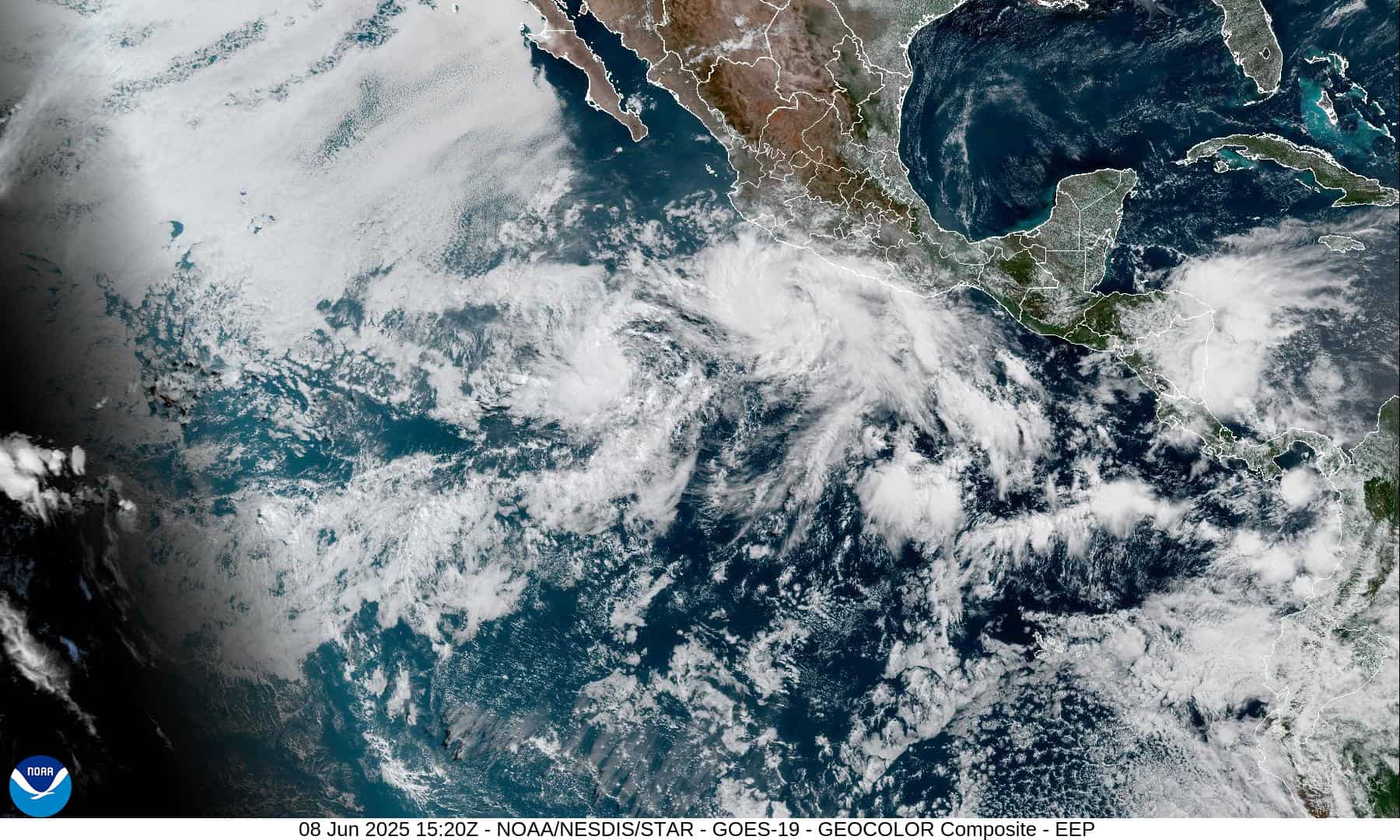
>>> There’s an area of disturbed weather being referred to as Invest 95B, which is located approximately 225 NM south-southeast of Phuket, Thailand
Animated multi-spectral satellite imagery depicts persistent convection forming near the assessed center of 95B. A recent 250208z ascat metop-b pass reveals a well-defined low level circulation center (llcc), in the middle of the Straits of Malacca, with 25-30 knot winds surrounding most of the circulation, a significant and dramatic structural improvement over the past six to twelve hours.
Environmental analysis reveals a moderate environment for development with moderate to high vertical wind shear (vws) of 20-25 knots, duel-channel outflow, and warm sea surface temperatures (sst) of 28-29 c.
Deterministic and ensemble models, with gfs being the most aggressive, are not in good agreement, tracking 95B across a wide-range of potential tracks. eceps and ecmwf track the system northwestward over northern Sumatra, hindering developing, while gfs tracks the system northwest but keeps it over water, resulting in more significant intensification, while navgem forecasts 95B to take a southward track along the coast of the Malay Peninsula.
Maximum sustained surface winds are estimated at 23 to 27 knots.
The potential for the development of a significant tropical cyclone within the next 24 hours is upgraded to medium.