

")
Current Snapshot
For all the latest updates visit: DisasterAWARE
epac
1800x1080eeeeee
fina
fina close

05S_211200sair
himawari8_ir_05S_202511211430_lat-11.1-lon132.2
05S_tracks_latest
By PDC’s Senior Weather
Specialist Glenn James

The Pacific Disaster Center’s (PDC Global) Friday, November 21, 2025, Tropical Cyclone Activity Report…for the Pacific Ocean, the Indian Ocean, and adjacent Seas
Current Tropical Cyclones:
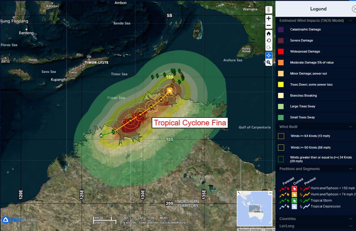
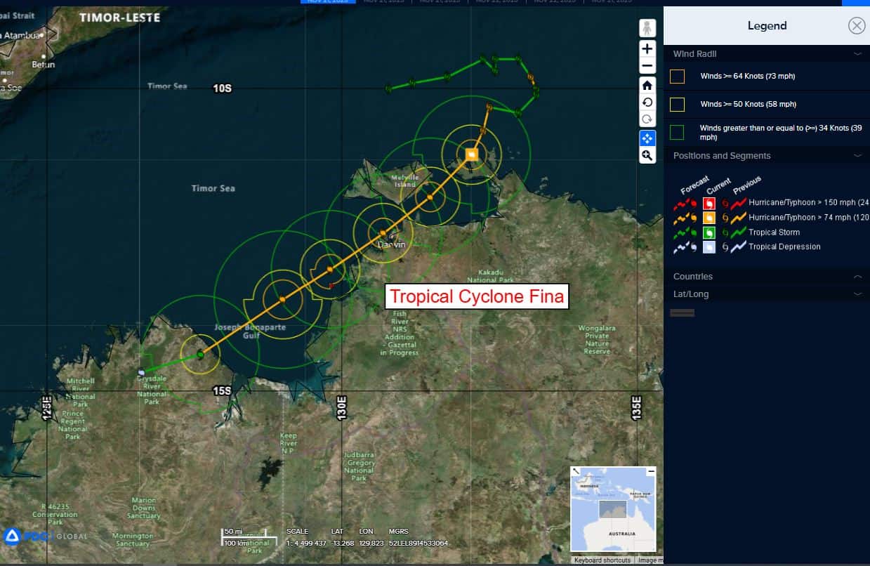
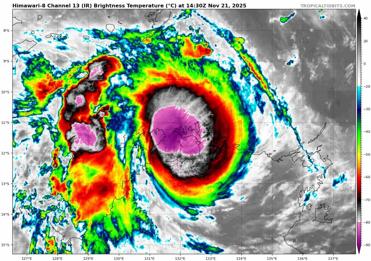
Tropical Cyclone 05S (Fina)…is located 51 NM northeast of Darwin, Australia
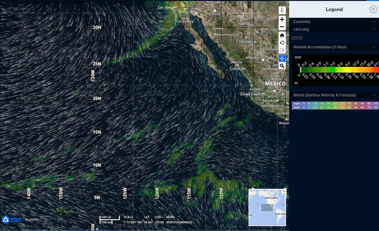
Northeast Pacific Ocean: There are no Tropical Cyclones
Tropical cyclone formation is not expected during the next 7 days.
Central Pacific Ocean: There are no Tropical Cyclones
Tropical cyclone formation is not expected during the next 7 days.
Western Pacific, Indian Ocean, and adjacent Seas:
South Indian Ocean
Tropical Cyclone 05S (Fina)
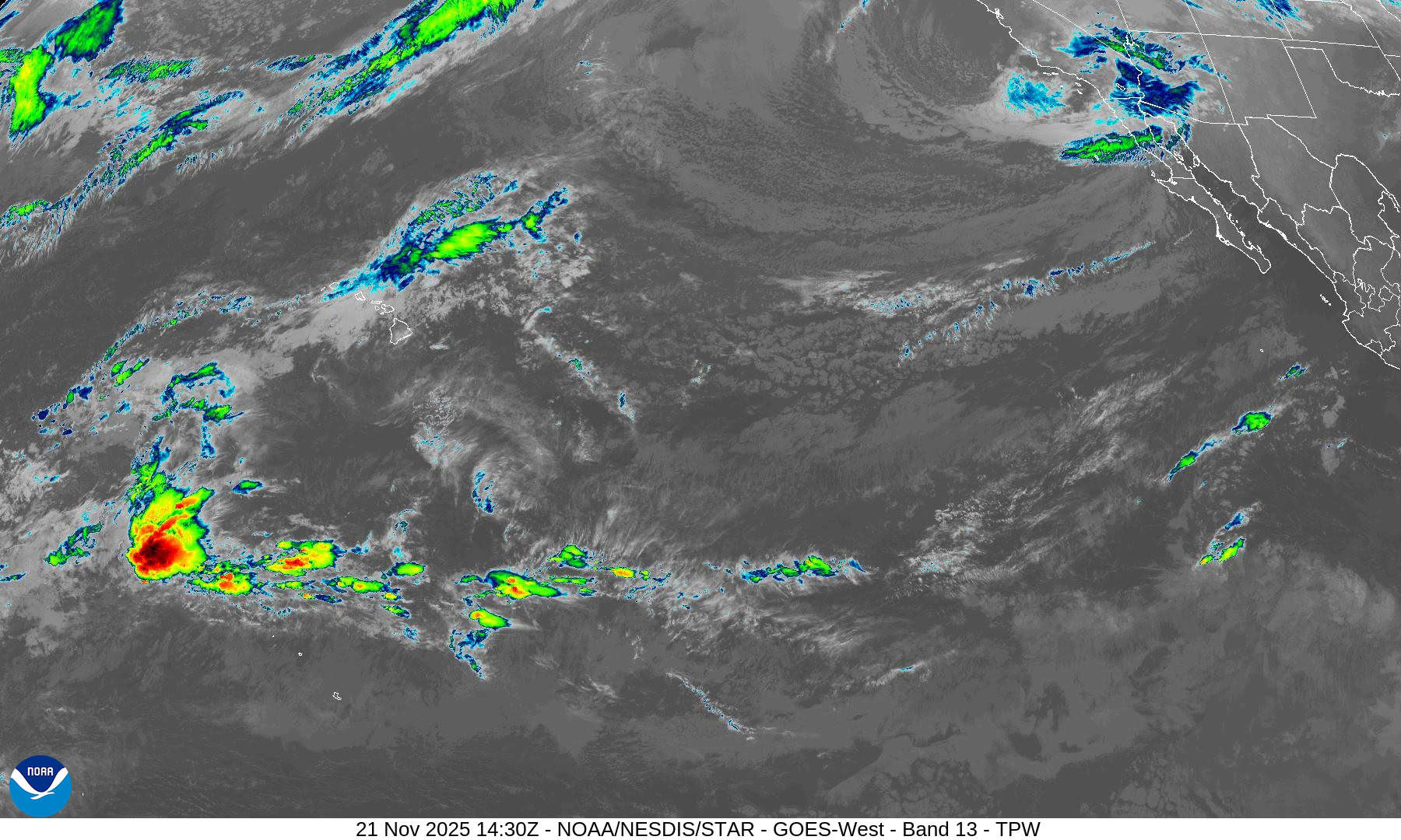
Animated multi-spectral satellite imagery (msi) depicts tropical cyclone 05S (Fina) with vigorous bursts of deep convection obscuring the compact low-level circulation center (llcc). 05S is
analyzed to have initiated its southwestward track over the past 6 hours. Animated radar imagery from Warruwi shows the system has formed a well-defined inner core with spiral rain bands wrapping into the center.
Environmental analysis indicates that 05S is now in a favorable
environment characterized by moderate poleward and equatorward outflow aloft, low (5-10 kts) deep-layer vertical wind shear, sufficient mid-level moisture, and very warm (30-31 c) sea surface temperatures. The only negative factor remains some moderate (15-20 kts) northerly mid-level shear acting on the vortex.
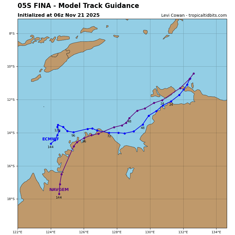
TC 05S is forecast to continue tracking southwestward, along the northwestern periphery of the subtropical ridge centered south of the Gulf of Carpentaria throughout the entirety of the forecast period. 05S is forecast to make an initial landfall along the western edge of the Qarig Gunak Barlu national park around 12 hours before entering the Van Diemen Gulf.
05S will then track through the Clarence Strait and skirt the coast through 36 hours, passing just off the coast of Darwin near 30 hours. 05S is then expected to enter the northern portion of the Bonaparte Gulf around 48 hours. A final landfall is forecast to occur within the northern Kimberley coast just after 72 hours.
Regarding intensity, 05S is forecast to steadily intensify over the next 48 hours as the environment remains overall favorable with low shear and a moist environment. The vortex is forecast to remain off the coast, limiting frictional effects, and allowing 05S to take advantage of the very warm sea surface temperatures in the area.
After 48 hours, northwesterly shear increases to around 20 kts and dry air begins to impact the vortex. This is expected to cause 05S to weaken as it approaches the coast near 72 hours. Once 05S makes its final landfall, terrain interaction will cause the vortex to quickly deteriorate with dissipation forecast to occur around 120 hours.