

")
Current Snapshot
For all the latest updates visit: DisasterAWARE
epac
1800x1080e
fina
05S_191200sair
05S_tracks_latest
By PDC’s Senior Weather
Specialist Glenn James

The Pacific Disaster Center’s (PDC Global) Wednesday, November 19, 2025, Tropical Cyclone Activity Report…for the Pacific Ocean, the Indian Ocean, and adjacent Seas
Current Tropical Cyclones:
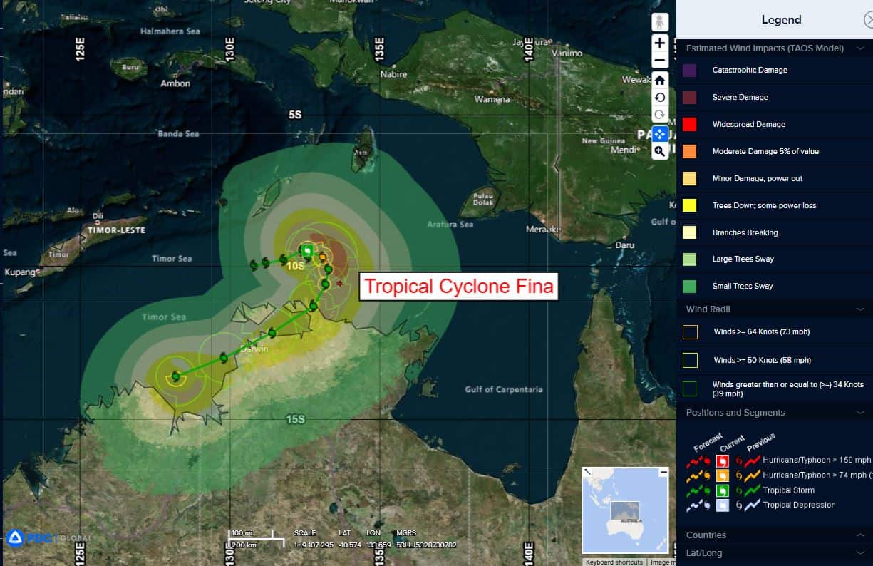
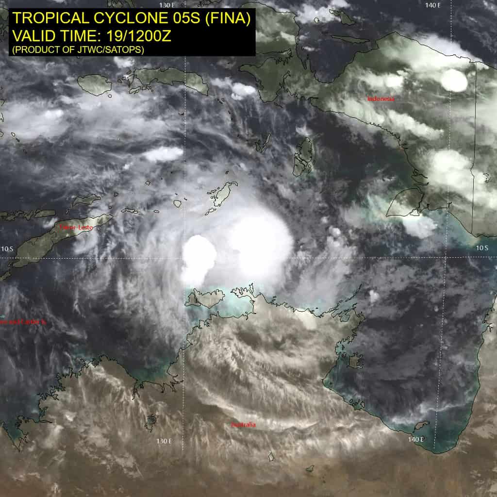
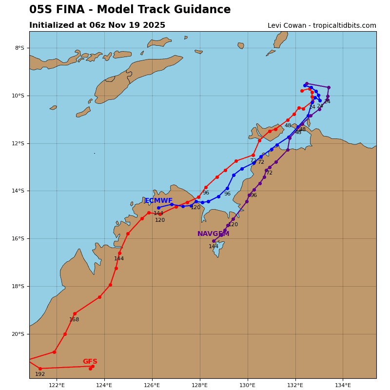
Tropical Cyclone 05S (Fina)…is located 206 NM north-northeast of Darwin, Australia
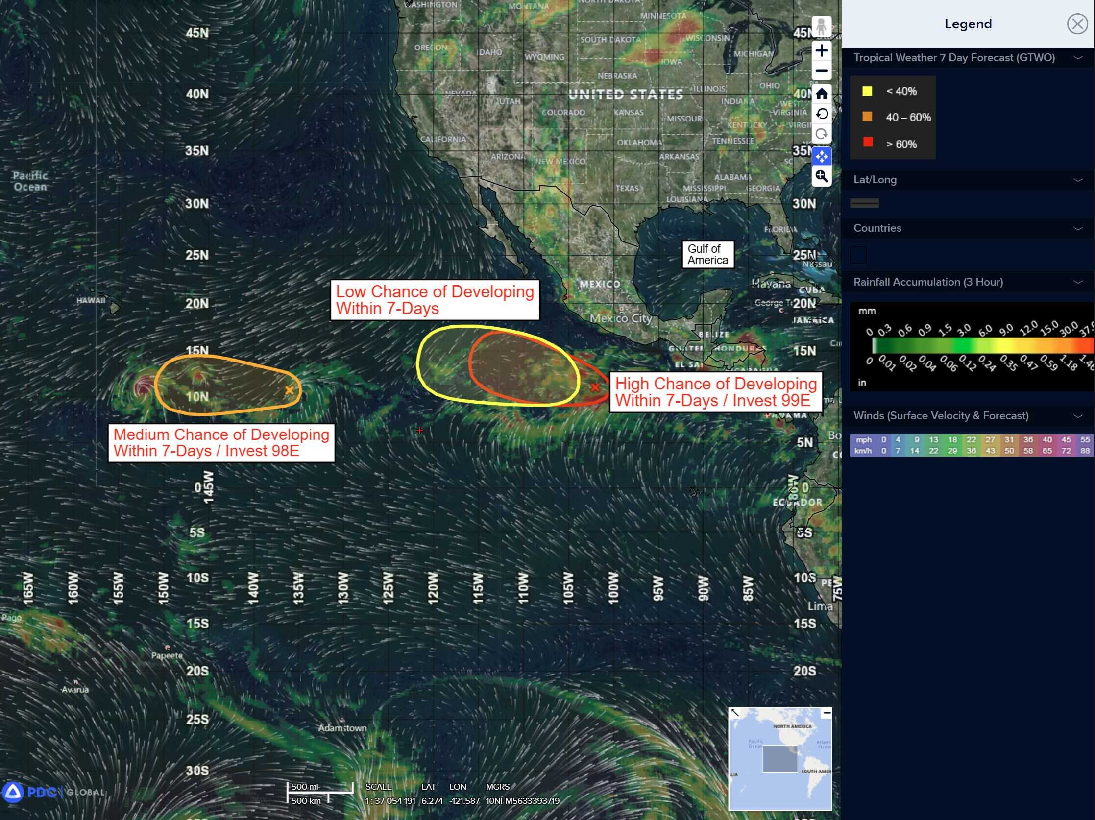
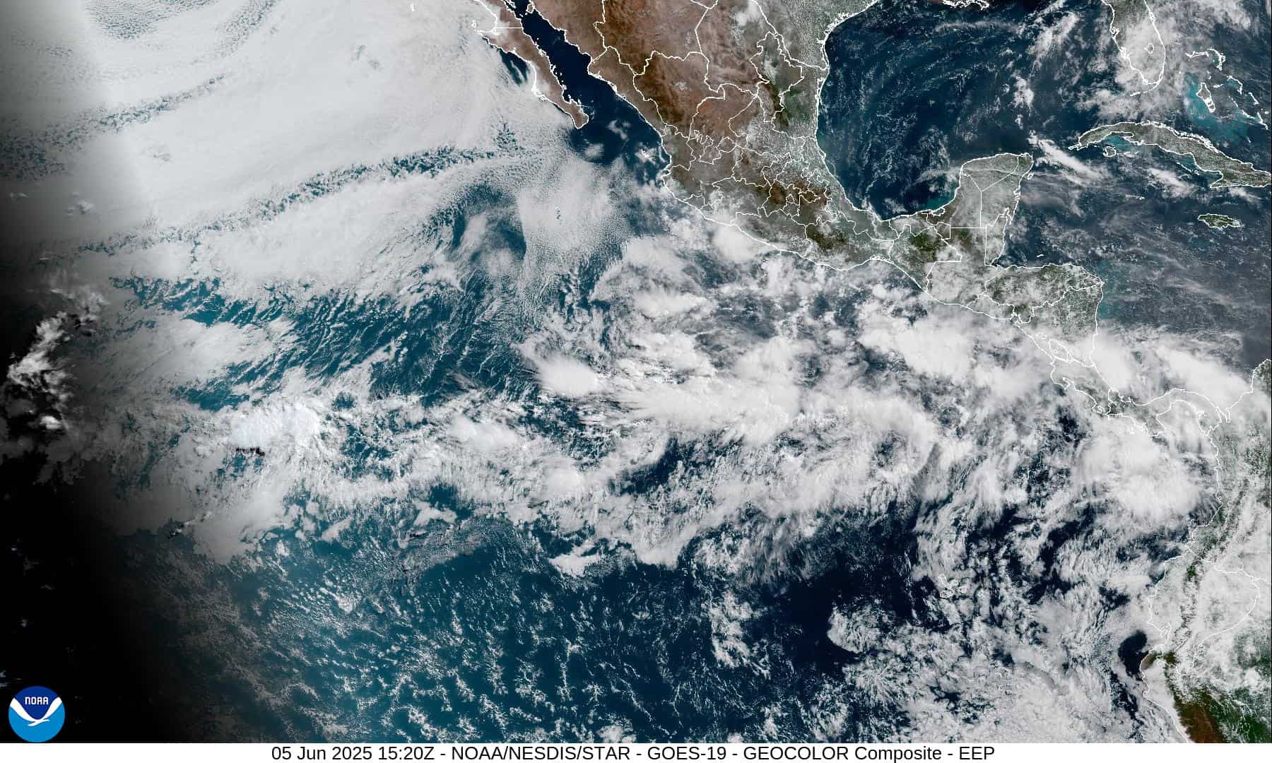
Northeast Pacific Ocean: There are no Tropical Cyclones
Tropical cyclone formation is not expected during the next 7 days.
Central Pacific Ocean: There are no Tropical Cyclones
Tropical cyclone formation is not expected during the next 7 days.
Western Pacific, Indian Ocean, and adjacent Seas:
South Indian Ocean
Tropical Cyclone 05S (Fina)
Upper-level outflow has improved markedly over the eastern quadrant of the system over the past six hours, with decreasing pressure depicted in both the animated rgb water vapor imagery and animated enhanced infrared (eir) satellite imagery. Animated water vapor imagery shows expanding eastward outflow, with upper-level outflow striations along the eastern edge of the central dense overcast (cdo).
EIR imagery indicates the previously tight temperature gradient along the eastern quadrant has eased. Additionally, the cimss tc-scale atmospheric motion vectors imagery shows that the northerly flow has deflected south-southeastward due to the expanding eastward outflow, with the narrow convergent region shifting further east away from the system. Consequently, the system has continued to consolidate while becoming quasi-stationary.
Animated radar imagery briefly showed a developing eye and well-defined low-level circulation center, which has subsequently weakened over the past two hours. Additionally, a 191148z ascat-b bullseye image showed a compact core with numerous 50-55 knot winds and an isolated 60 knot wind.
Despite the brief respite, northerly vertical wind shear is forecast to persist and increase leading to a steady weakening trend from 12 through 48 hours. Interaction with land from 48 to 96 hours will also aid in weakening the system as it skirts the northern coast of Australia.
A slight intensification to 65 knots may occur within the next 12 hours if the system can continue to cocoon itself from the increasing vws and dry air entrainment. After 96 hours, TC 05S will track back over water with potential for a short period of intensification before it is overcome by extensive dry air
entrainment.
TC 05S is forecast to turn sharply southward over the next 24 hours as the str to the south builds quickly. After 36 hours, the system will turn southwestward to west-southwestward as it tracks along the northern periphery of the str through 120 hours.