

")
Current Snapshot
For all the latest updates visit: DisasterAWARE
epac
1800x1080eee
fung
32W_121200sair
himawari8_ir_32W_202511121520_lat22.2-lon120.6
32W_tracks_latest
By PDC’s Senior Weather
Specialist Glenn James

The Pacific Disaster Center’s (PDC Global) Wednesday, November 12, 2025, Tropical Cyclone Activity Report…for the Pacific Ocean, the Indian Ocean, and adjacent Seas
Current Tropical Cyclones:
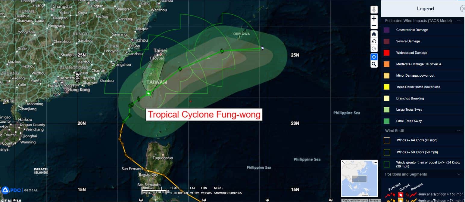
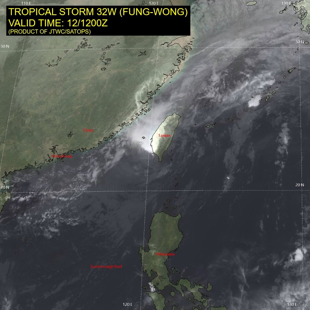
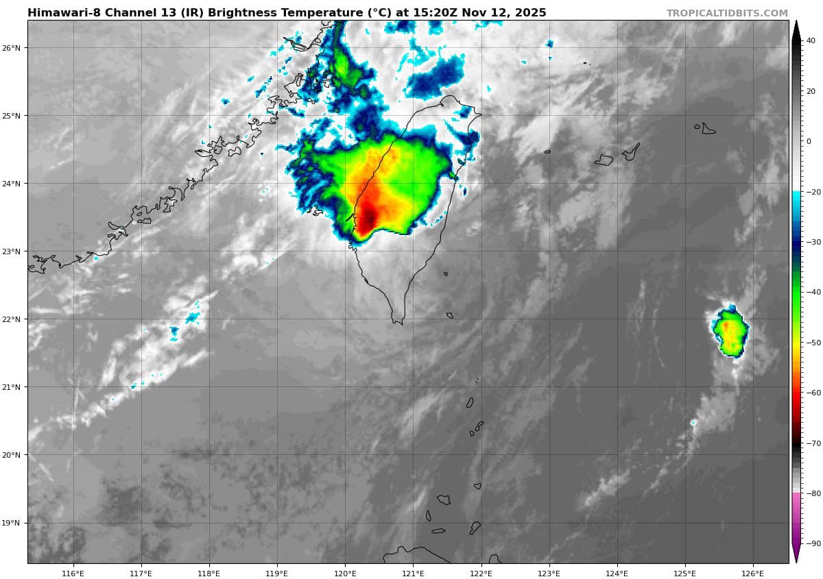
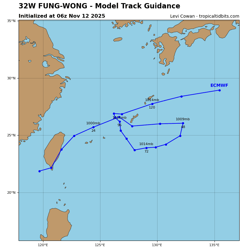
Tropical Cyclone 32W (Fung-wong)…is located 299 NM south of Taipei, Taiwan
Northeast Pacific Ocean: There are no Tropical Cyclones
Tropical cyclone formation is not expected during the next 7 days.
Central Pacific Ocean: There are no Tropical Cyclones
Tropical cyclone formation is not expected during the next 7 days.
Western Pacific, Indian Ocean, and adjacent Seas:
Western Pacific
Tropical Cyclone 32W (Fung-wong)
According to the JTWC warning number 36…sustained winds are 35 knots with gusts to 45 knots
Animated enhanced infrared (eir) satellite imagery depicts tropical storm 32W (Fung-wong) with a slightly ragged low-level circulation center (llcc) that was analyzed to be just off the coast at 121200z. As of 121400z, the llcc appears to have quickly jumped across the southern portion of Taiwan and emerged back over water. The system remains completely devoid of convection besides a small area within the northwestern periphery.
Environmental analysis indicates that 32W is in an unfavorable environment characterized by moderate poleward outflow, high (20-25 kts) southwesterly vertical wind shear, significant dry air entrainment, and warm (27-28 c) sea surface temperatures.
TS 32W is forecast to continue rounding the western extent of the subtropical ridge through 24 hours with an east-northeastward track. Track speeds are forecast to considerably increase over the next 24 hours as the system begins to interact with the upper-level jet. 32W is expected to begin wrapping in the northeasterly surge winds again, allowing the system to maintain intensity through 24 hours.
32W is then expected to quickly stretch and become ill-defined as it becomes absorbed into the forming frontal boundary. this merge with the frontal boundary is forecast to complete around 36 hours, marking the point where 32W is stated to be dissipated as a significant tropical cyclone. A final intensity of 30 kts is representative of the background winds associated with the northeasterly surge as the vortex of 32W completely washes out.