

")
Current Snapshot
For all the latest updates visit: DisasterAWARE
epac
1800x1080eeeeeeee
fung
32W_111200sair
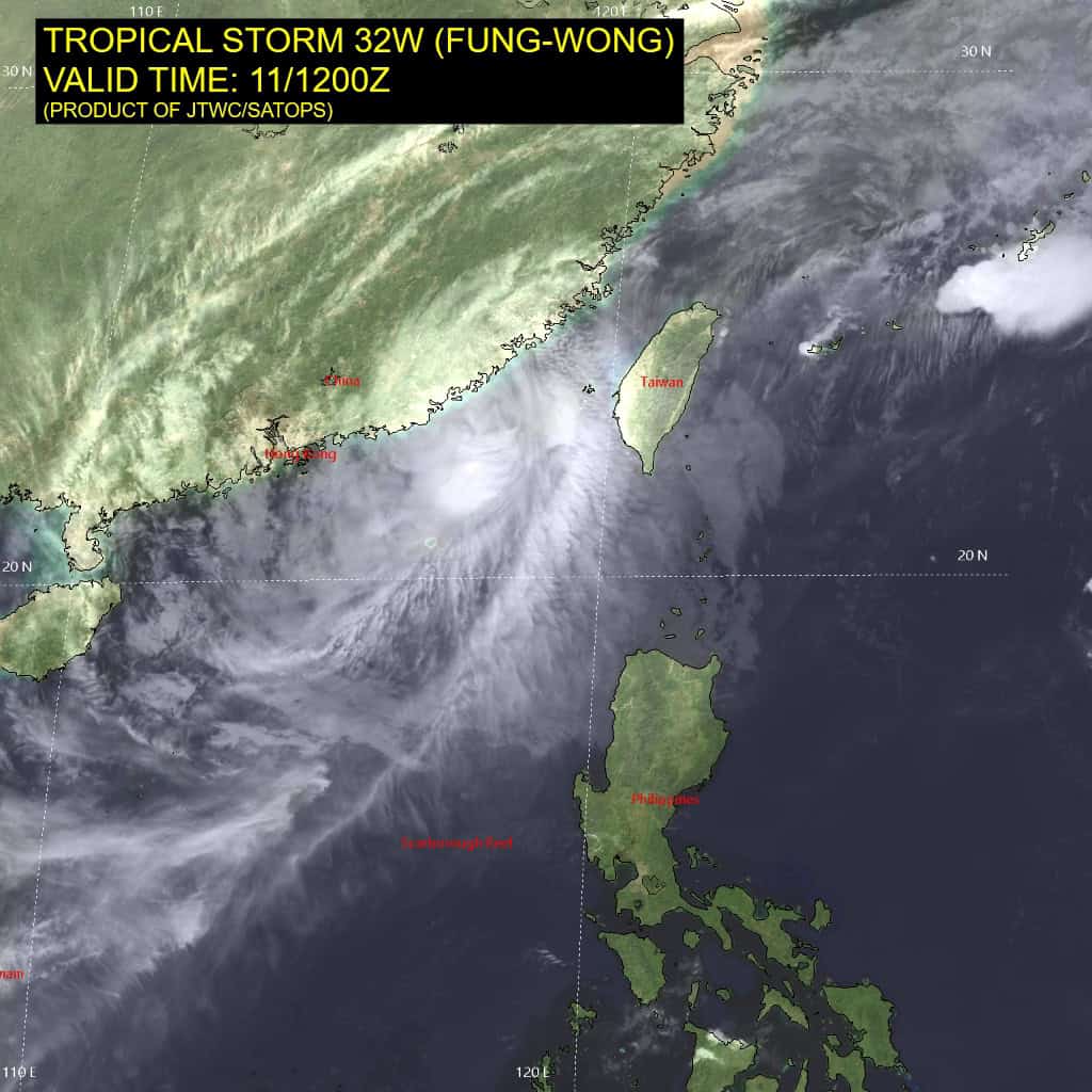
himawari8_ir_32W_202511111430_lat20.6-lon119.1
32W_tracks_latest
By PDC’s Senior Weather
Specialist Glenn James

The Pacific Disaster Center’s (PDC Global) Tuesday, November 11, 2025, Tropical Cyclone Activity Report…for the Pacific Ocean, the Indian Ocean, and adjacent Seas
Current Tropical Cyclones:
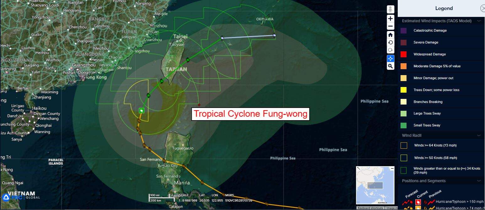
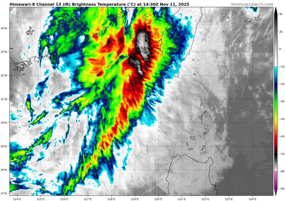
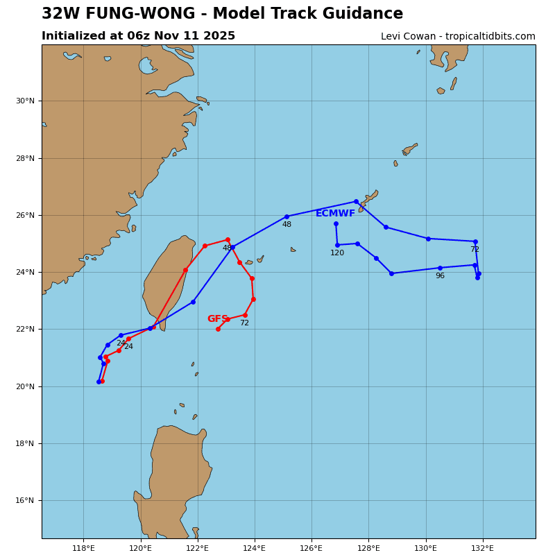
Tropical Cyclone 32W (Fung-wong)…is located 253 NM south-southwest of Taipei, Taiwan
Northeast Pacific Ocean: There are no Tropical Cyclones
Tropical cyclone formation is not expected during the next 7 days.
Central Pacific Ocean: There are no Tropical Cyclones
Tropical cyclone formation is not expected during the next 7 days.
Western Pacific, Indian Ocean, and adjacent Seas:
Western Pacific
Tropical Cyclone 32W (Fung-wong)
According to the JTWC warning number 32…sustained winds are 45 knots with gusts to 55 knots
Animated multi-spectral satellite imagery (msi) depicts tropical storm 32W (Fung-wong) with widespread shallow convection obscuring the low-level circulation center (llcc). An 110152z metop-b ascat image revealed gale-force winds associated with the enhanced northwesterly surge extending all the way through the Taiwan Strait. The ascat also revealed that the strongest winds are confined to a swath of westerly winds within the southern semicircle.
Environmental analysis indicates that 32W is in an unfavorable environment characterized by strong poleward outflowand warm (27-28 c) sea surface temperatures, greatly offset by moderate (15-20 kts) southeasterly vertical wind shear and significant dry air entrainment.
TS 32W is forecast to continue rounding the western extent of the subtropical ridge through 48 hours with a generally northeastward track. Landfall within the southwestern coast of Taiwan is expected to occur just after 24 hours.
The environment will continue to be unfavorable, causing 32W to weaken through the approach to Taiwan. The system will then quickly track across southern Taiwan and emerge back over water. The combination of effects from the mountainous terrain, increasing westerly vertical wind shear, and dry air will further deteriorate the vortex.
32W is then expected to quickly become absorbed into the forming frontal boundary no later than 72 hours, near Okinawa. The winds associated with Fung-wong are forecast to weaken, however, gale-force winds associated with the overall frontal boundary are still possible for Okinawa.