

")
Current Snapshot
For all the latest updates visit: DisasterAWARE

eee
1800x1080eee
fun
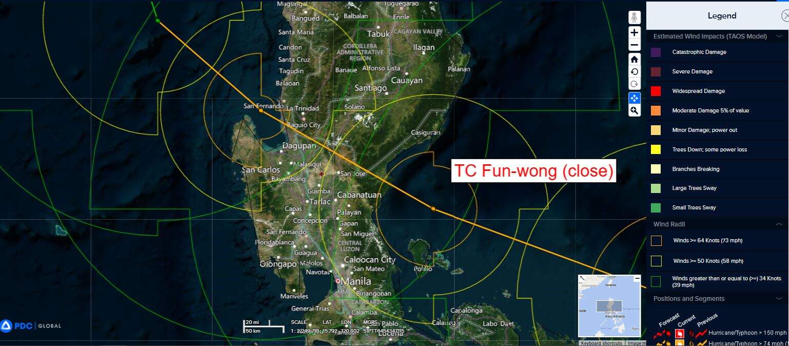
close
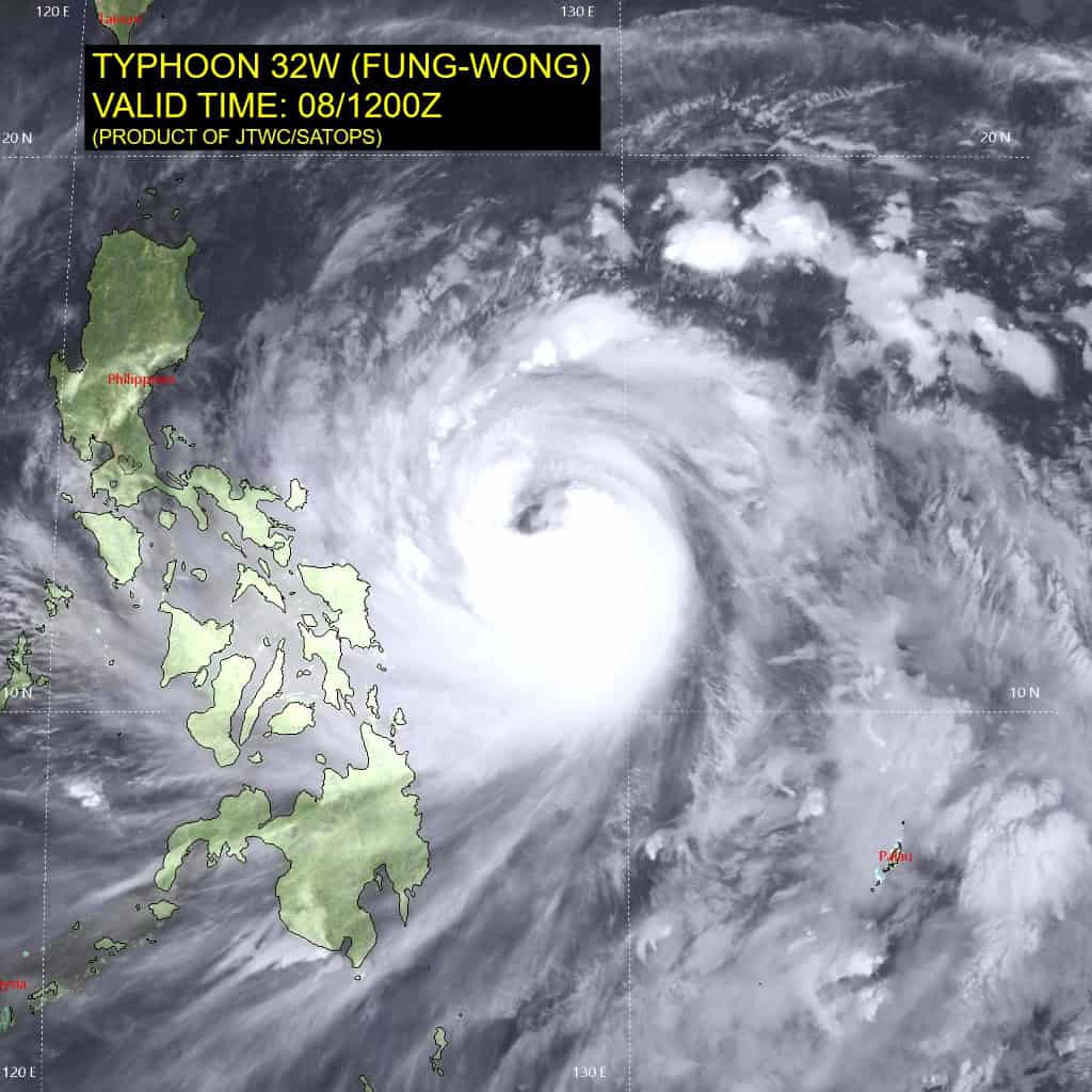
32W_081200sair
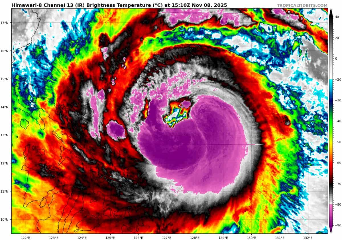
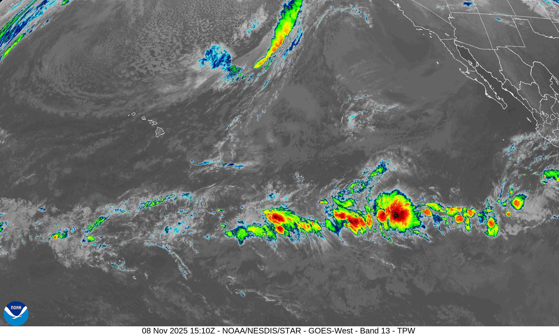
himawari8_ir_32W_202511081510_lat13.3-lon128.1
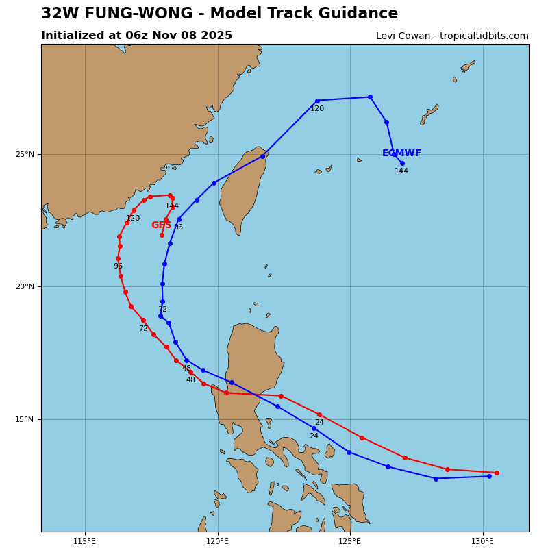
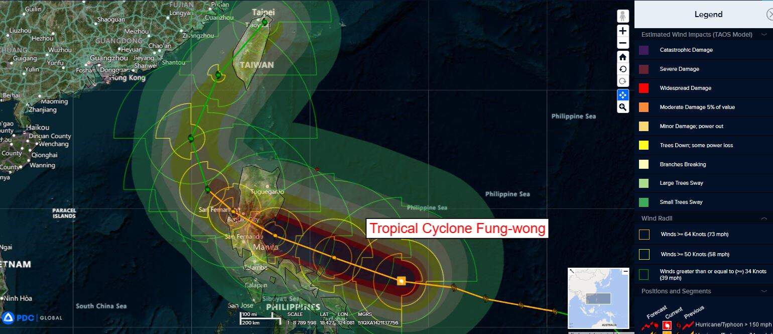
32W_tracks_latest
By PDC’s Senior Weather
Specialist Glenn James

The Pacific Disaster Center’s (PDC Global) Saturday, November 8, 2025, Tropical Cyclone Activity Report…for the Pacific Ocean, the Indian Ocean, and adjacent Seas
Current Tropical Cyclones:
Tropical Cyclone 32W (Fung-wong)…is located 421 NM east of Manila, Philippines
Northeast Pacific Ocean: There are no Tropical Cyclones
Tropical cyclone formation is not expected during the next 7 days.
Central Pacific Ocean: There are no Tropical Cyclones
Tropical cyclone formation is not expected during the next 7 days.
Western Pacific, Indian Ocean, and adjacent Seas:
Western Pacific
Tropical Cyclone 32W (Fung-wong)
According to the JTWC warning number 18…sustained winds are 95 knots with gusts to 115 knots
Typhoon 32W (Fung-wong) continues to exhibit strong radial outflow with deep convective activity surrounding the center. The system has consolidated and strengthened over the past 6 hours as depicted by animated enhanced infrared (eir) satellite imagery.
Environmental conditions remain marginally favorable with warm sea surface temperatures (29 c to 30 c) offset by strong vertical wind shear (25-30 kts).
TY 32W will remain on a northwestward track under the influence of the subtropical ridge to the northeast through 48 hours. High vertical wind shear remains an obstacle as the system will continue to attempt higher intensities before landfall over Luzon. Landfall is forecast south of Casiguran, Philippines between 24 and 36 hours.
Afterwards, the circulation will track into the South China Sea where dry air and persistent high vertical wind shear will weaken and slow TY Fung-wong dramatically. Around 60 hours, a weaker str to the northwest will significantly weaken, allowing the str to the east to dominate the steering and result in TY 32W to begin recurving along its western periphery.
The system will continue weakening as it tracks northeastward toward Taiwan. Landfall is forecast between 96 and 120 hours over southwestern Taiwan and tracking across the central portion of the landmass.