

")
Current Snapshot
For all the latest updates visit: DisasterAWARE
epac
1800x1080e
wpac
31W_051200sair
31W_tracks_latest
32W_051200sair
32W_tracks_latest
By PDC’s Senior Weather
Specialist Glenn James

The Pacific Disaster Center’s (PDC Global) Wednesday, November 5, 2025, Tropical Cyclone Activity Report…for the Pacific Ocean, the Indian Ocean, and adjacent Seas
Current Tropical Cyclones:
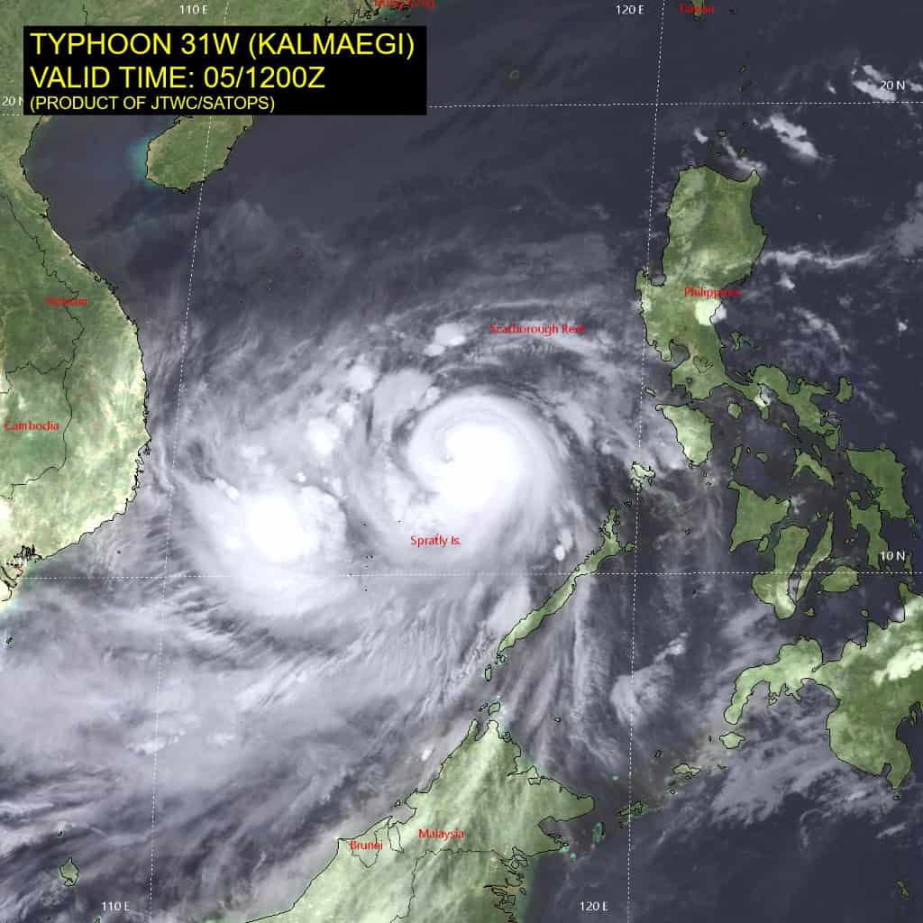
Tropical Cyclone 31W (Kalmaegi)…is located 277 NM southeast of Da Nang, Vietnam
Tropical Cyclone 32W (Fung-wong)…is located 120 NM east-northeast of Yap
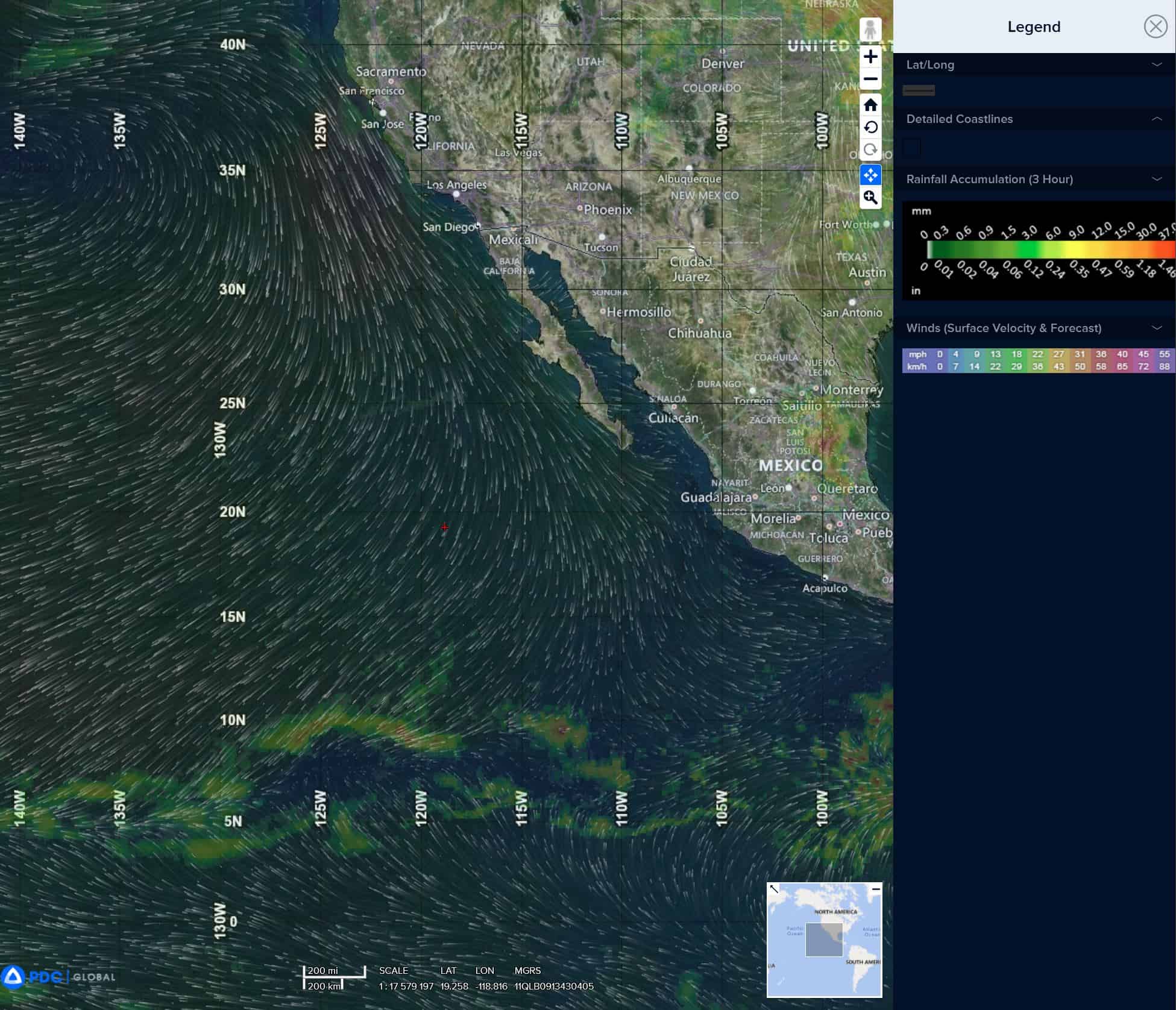
Northeast Pacific Ocean: There are no Tropical Cyclones
Tropical cyclone formation is not expected during the next 7 days.
Central Pacific Ocean: There are no Tropical Cyclones
Tropical cyclone formation is not expected during the next 7 days.
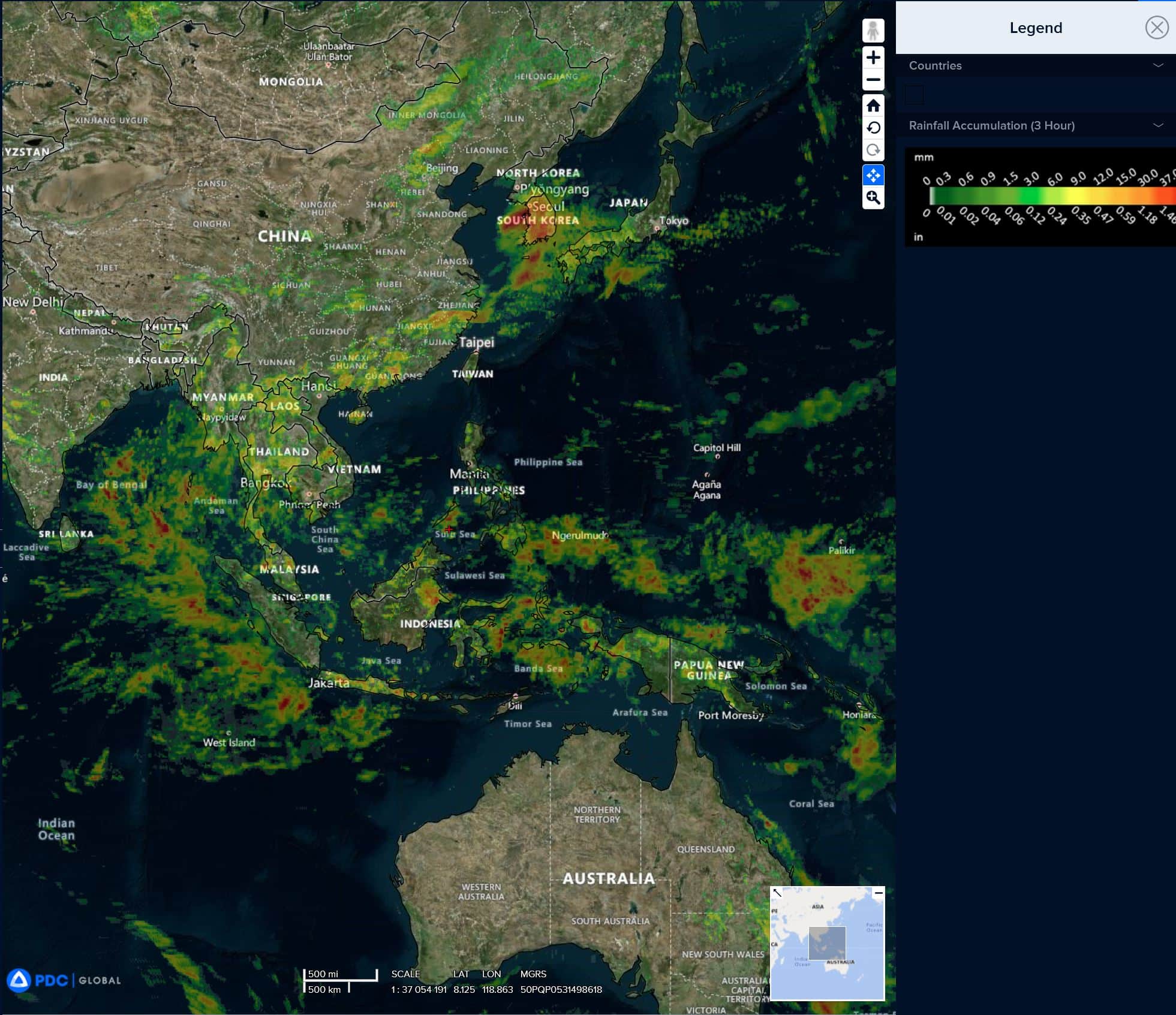
Western Pacific, Indian Ocean, and adjacent Seas:
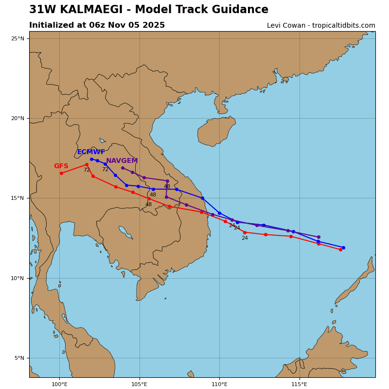
Tropical Cyclone 31W (Kalmaegi)
According to the JTWC warning number 20A…sustained winds are 115 knots with gusts to 140 knots
Typhoon 31W (Kalmaegi) has begun a northwest transit across the South China Sea improving in structure and convective activity as evidenced by animated enhanced infrared (eir) satellite imagery. The structure of the storm has tightened and an eye feature will likely develop over the next 6 hours.
Environmental conditions are favorable with warm sea surface temperatures (29 c to 30 c), good outflow, and low vertical wind shear (10-15 kts).
TY Kalmaegi will continue on its northwestward track under the influence of the subtropical ridging to the northwest and northeast. As it tracks across the warm waters of the South China Sea with little vertical wind shear to inhibit it, the system will be able to reach wind speed maximum by 24 hours.
Afterwards TY Kalmaegi will begin a slow weakening trend initiated by higher wind shear (20-25 kts) and aided later by topographic interaction as the system approaches landfall. TY Kalmaegi is forecast to make landfall just south of Tam Quan, Vietnam between 24 and 36 hours. The system will fully dissipate over land by 72 hours.
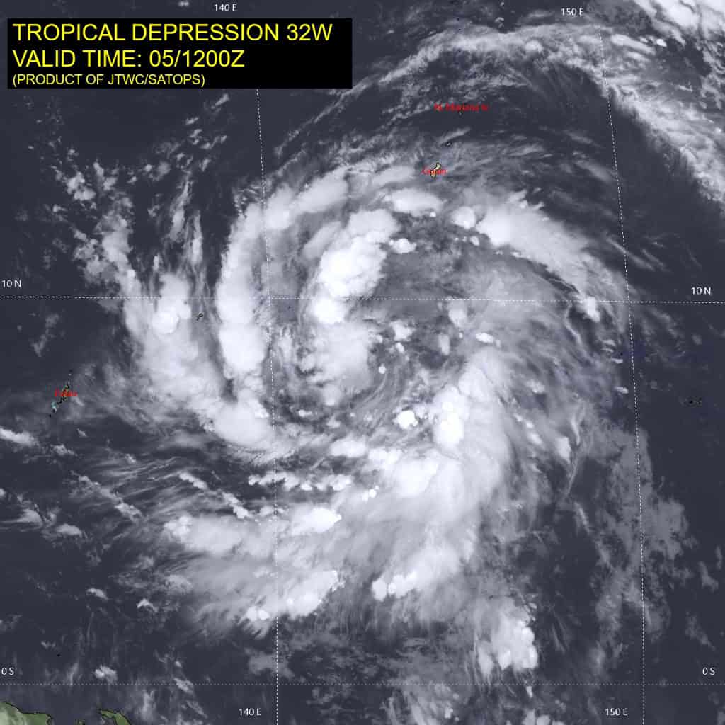
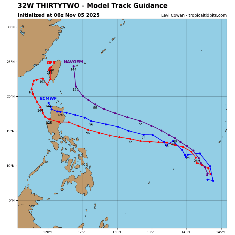
Tropical Cyclone 32W (Fung-wong)
According to the JTWC warning number 8…sustained winds are 40 knots with gusts to 50 knots
Animated enhanced infrared (eir) satellite imagery depicts tropical depression 32W as a broad circulation still trying to gain some organization. pockets of convective activity have been flaring at the edges of all quadrants of the circulation.
Environmental conditions are favorable with warm sea surface temperatures (29 c to 30 c), low vertical wind shear (10-15 kts), and moderate outflow. TD 32W will get a slow start off to the northwest as the system continues to organize itself while being steered by the subtropical ridge to the north. Conditions are prime for the circulation to undergo a significant amount of strengthening as it approaches the coast of the Philippines with warm sea surface temperatures and little change expected to vertical wind shear magnitudes.
Maximum intensities of around 115 kts are forecast just prior to landfall between 96 and 120 hours. Slight weakening is expected afterwards due to interaction with the Philippine landmass before the system makes its way out over the South China Sea.