

")
Current Snapshot
For all the latest updates visit: DisasterAWARE
1800x1080e

1800×1080

2
7
kal
31W_021200sair
31W_tracks_latest
By PDC’s Senior Weather
Specialist Glenn James

The Pacific Disaster Center’s (PDC Global) Sunday, November 2, 2025, Tropical Cyclone Activity Report…for the Pacific Ocean, the Indian Ocean, and adjacent Seas
Current Tropical Cyclones:
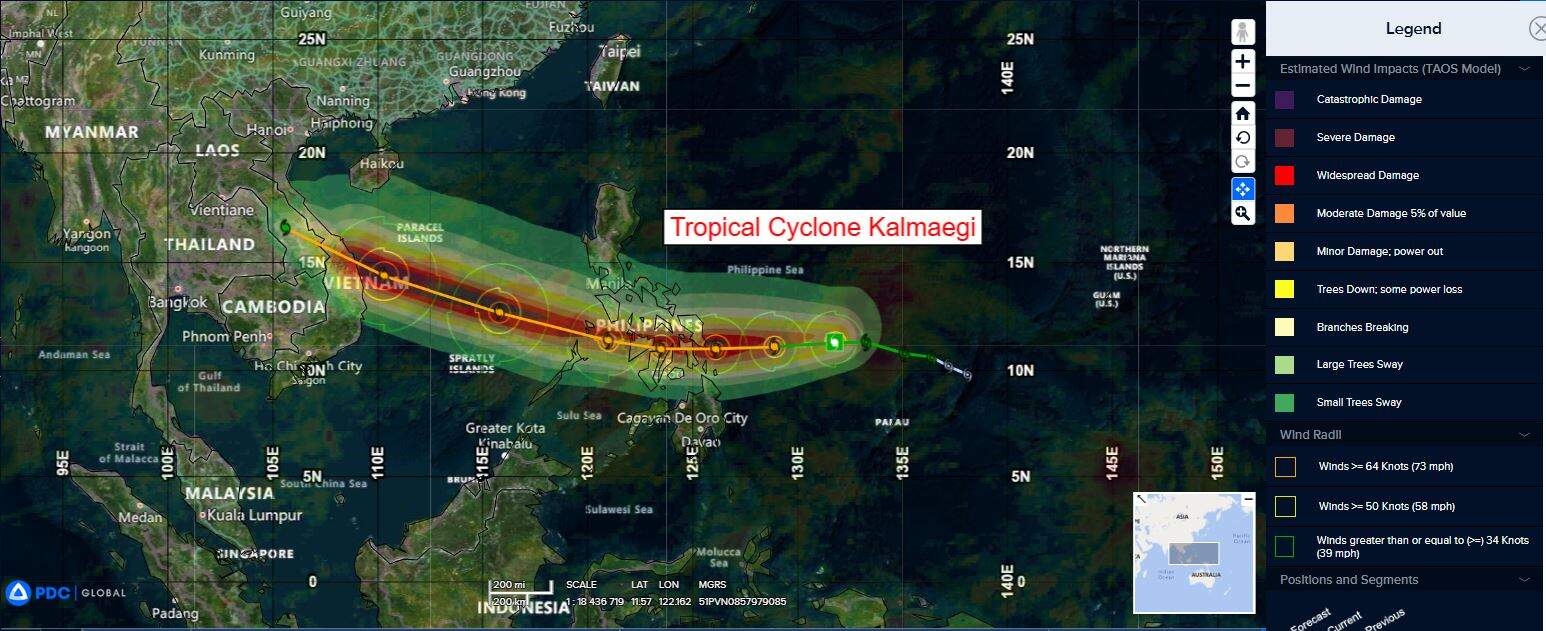
Tropical Cyclone 31W (Kalmaegi)…is located 662 NM east-southeast of Manila, Philippines
Northeast Pacific Ocean: There are no Tropical Cyclones
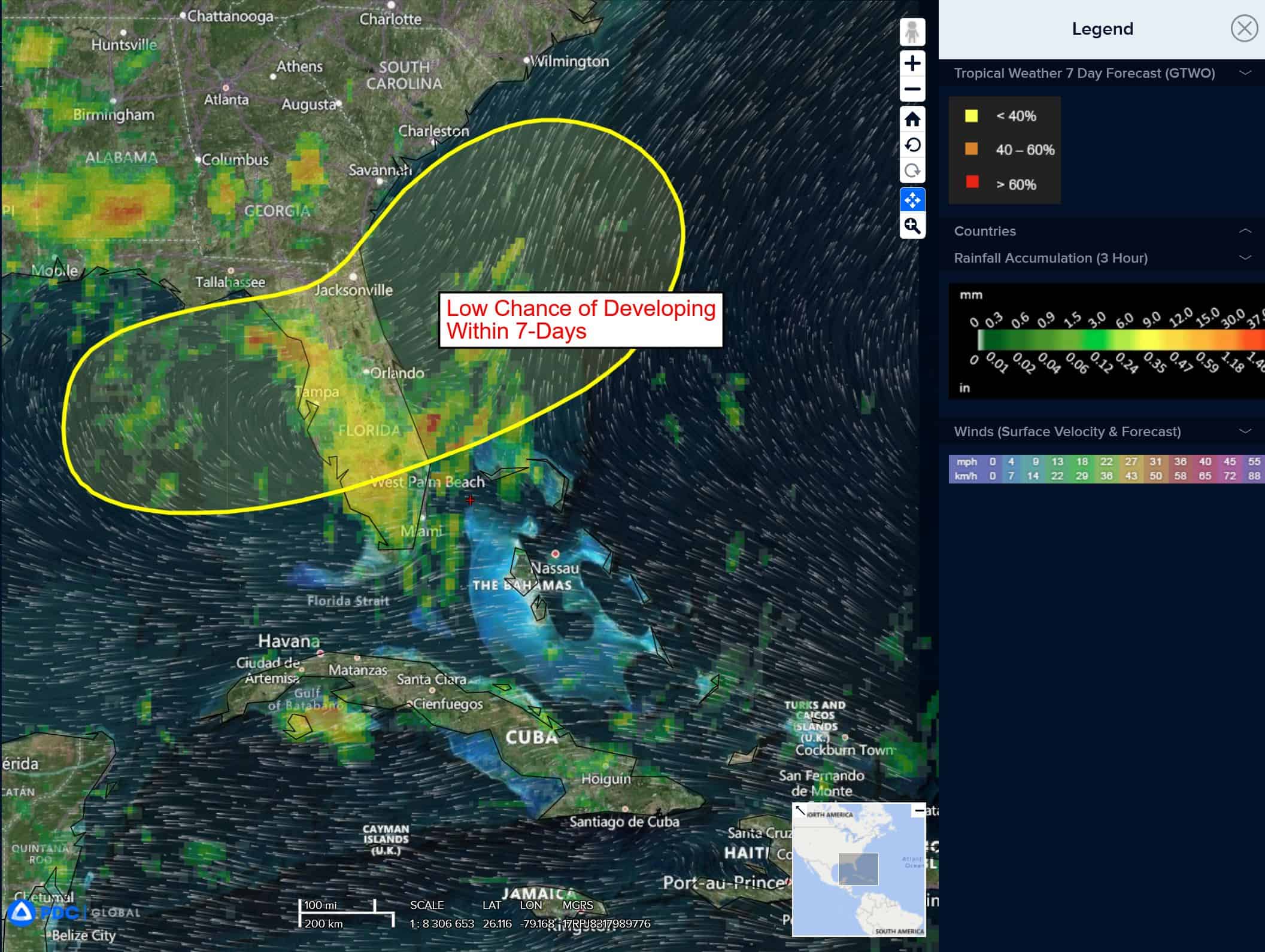
Central East Pacific:
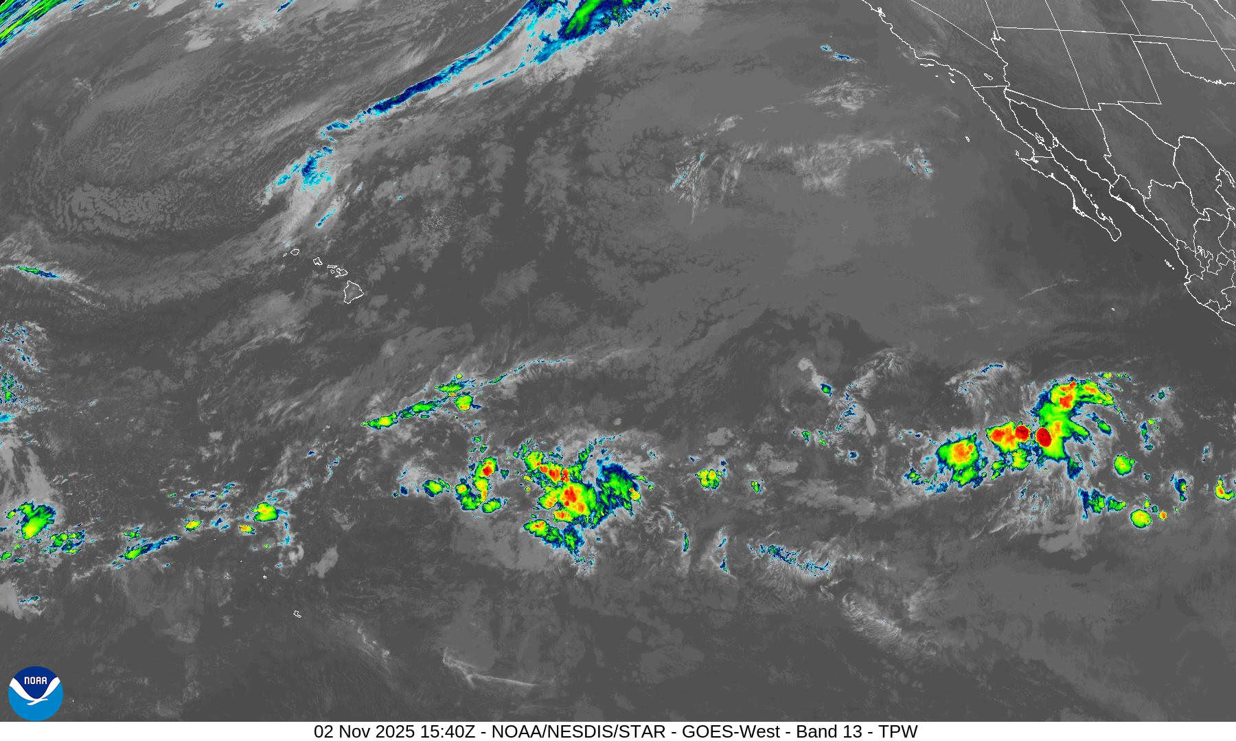
>>> A broad area of low pressure located several hundred miles southwest of the Baja California Peninsula is producing disorganized showers and thunderstorms.
Additional development of this system appears unlikely as it moves slowly westward across the central part of the eastern Pacific during the next couple of days.
* Formation chance through 48 hours…low…10 percent
* Formation chance through 7 days…low…10 percent
Central Pacific Ocean: There are no Tropical Cyclones
Tropical cyclone formation is not expected during the next 7 days.
Western Pacific, Indian Ocean, and adjacent Seas:
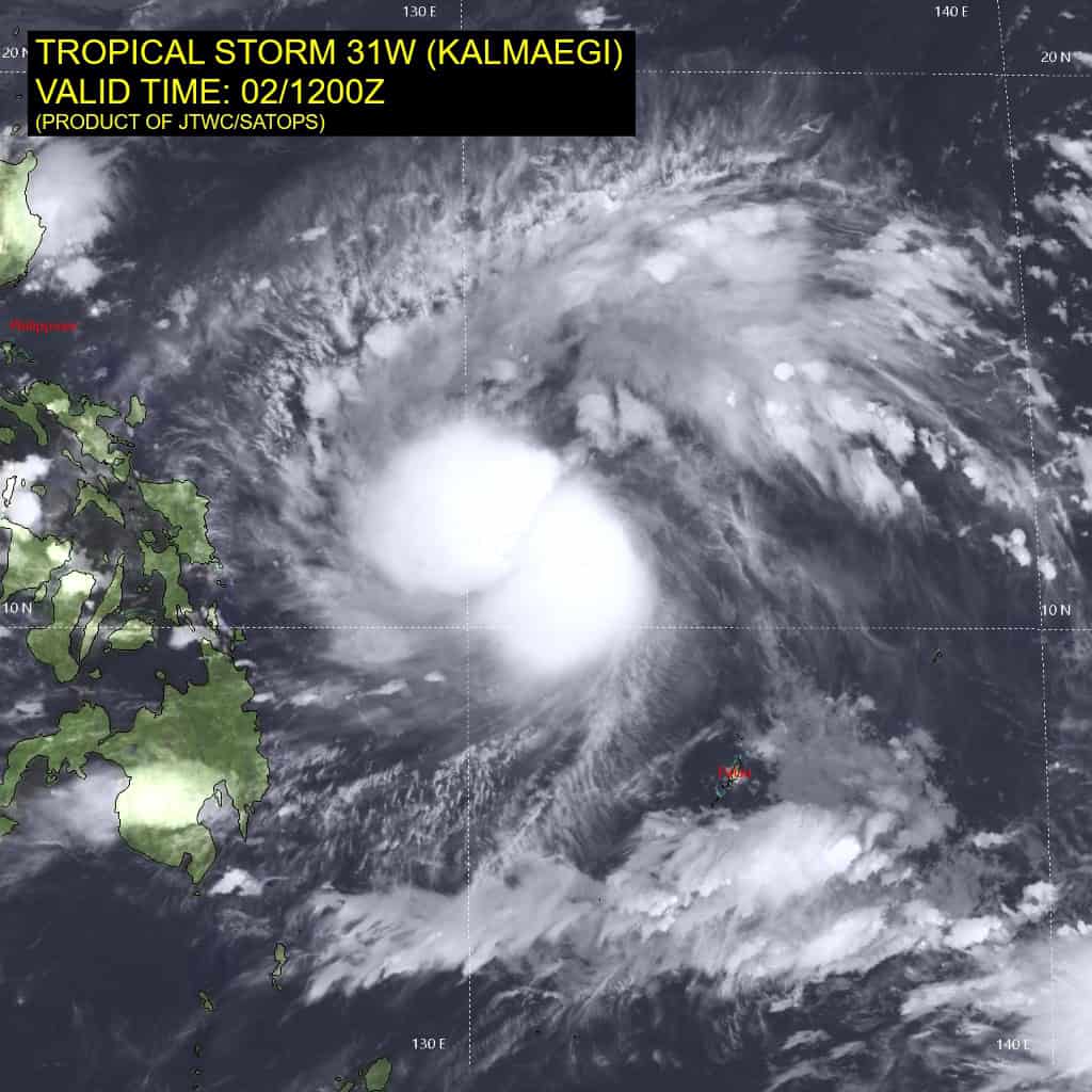
Tropical Cyclone 31W (Kalmaegi)
According to the JTWC warning number 6…sustained winds are 55 knots with gusts to 70 knots
Animated enhanced infrared (eir) satellite imagery depicts tropical storm 31W (Kalmaegi) with two distinct clusters of deep convection creating an oblong central dense overcast (cdo) over the
circulation. The low-level circulation center (llcc) is analyzed to be underneath the southeastern lobe of convection, which is confirmed by a 021141z gmi 37 ghz microwave image. The gmi
microwave image also revealed the highly compact core with a small microwave eye feature, supporting the initial position with high confidence.
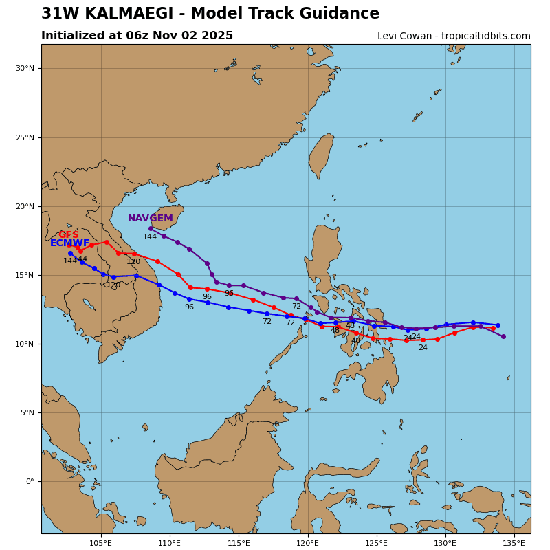
31W is forecast to track generally westward through 36 hours, under the influence of extensions of subtropical ridges to both the northeast and northwest. An initial landfall is forecast to occur around 30 hours near Tacloban City. After 36 hours, the track is expected to turn northwestward as the ridge southwest of Taiwan becomes the primary steering mechanism. 31W will then track through the South China Sea before making a final landfall in central Vietnam just after 96 hours.
Regarding intensity, 31W is forecast to rapidly intensify over the next 24-30 hours, leading up to landfall in the Philippines. Very warm sea surface temperatures, high ohc values, and robust outflow will support the intensification of the storm. An intensity of 90 kts is forecast for 24 hours, but an even higher peak just before landfall is likely to occur. Kalmaegi will then briefly weaken as it tracks across the Visayas.
However, the intensification trend will continue once the vortex emerges within the South China Sea. Strong equatorward outflow and warm sea surface temperatures will allow for a second peak of around 105 kts before landfall in Vietnam. Rugged terrain interaction will rapidly weaken the system as it tracks through Vietnam and into southern Laos.