

")
Current Snapshot
For all the latest updates visit: DisasterAWARE
1800x1080e
2
7
k
31W_011200sair
31W_tracks_latest
By PDC’s Senior Weather
Specialist Glenn James

The Pacific Disaster Center’s (PDC Global) Saturday, November 1, 2025, Tropical Cyclone Activity Report…for the Pacific Ocean, the Indian Ocean, and adjacent Seas
Current Tropical Cyclones:
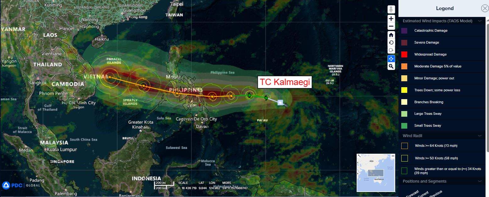
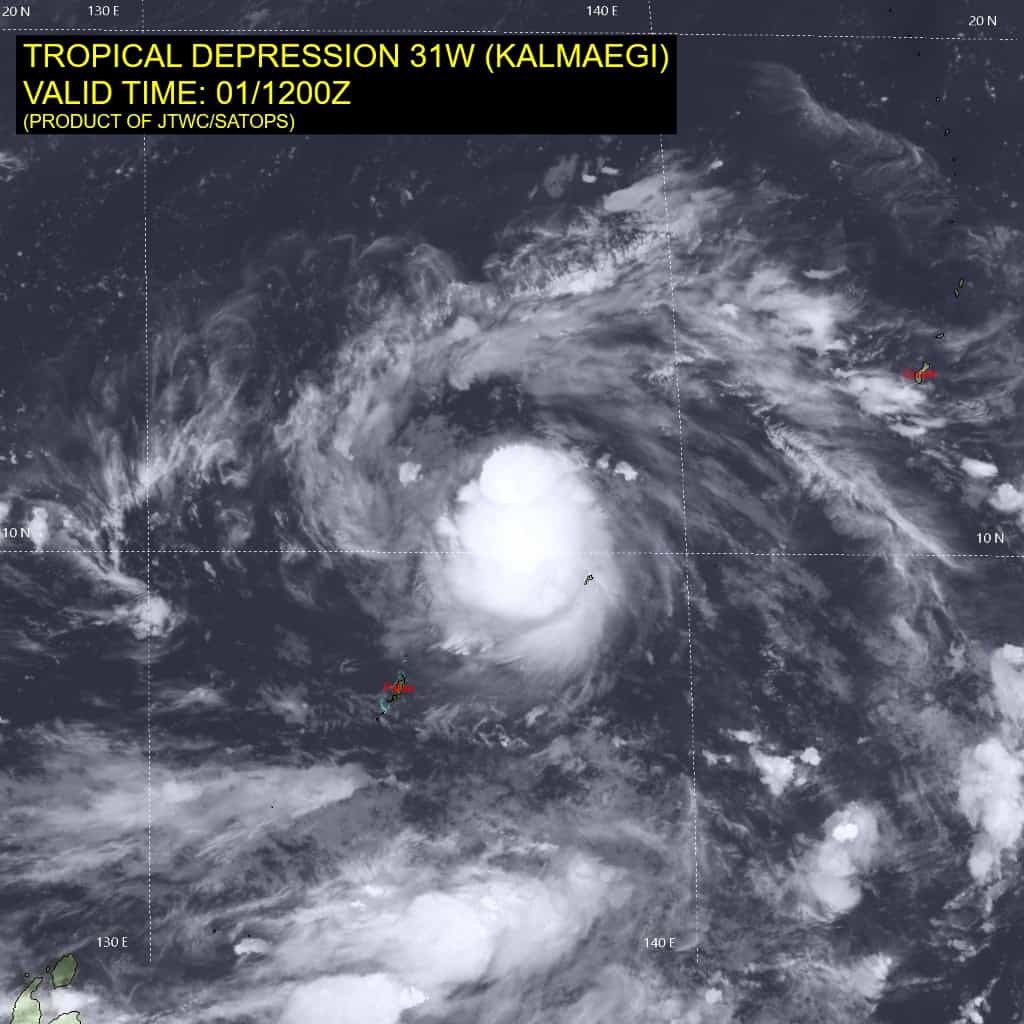
Tropical Cyclone 31W (Kalmaegi)…is located 164 NM north of Yap
Northeast Pacific Ocean: There are no Tropical Cyclones
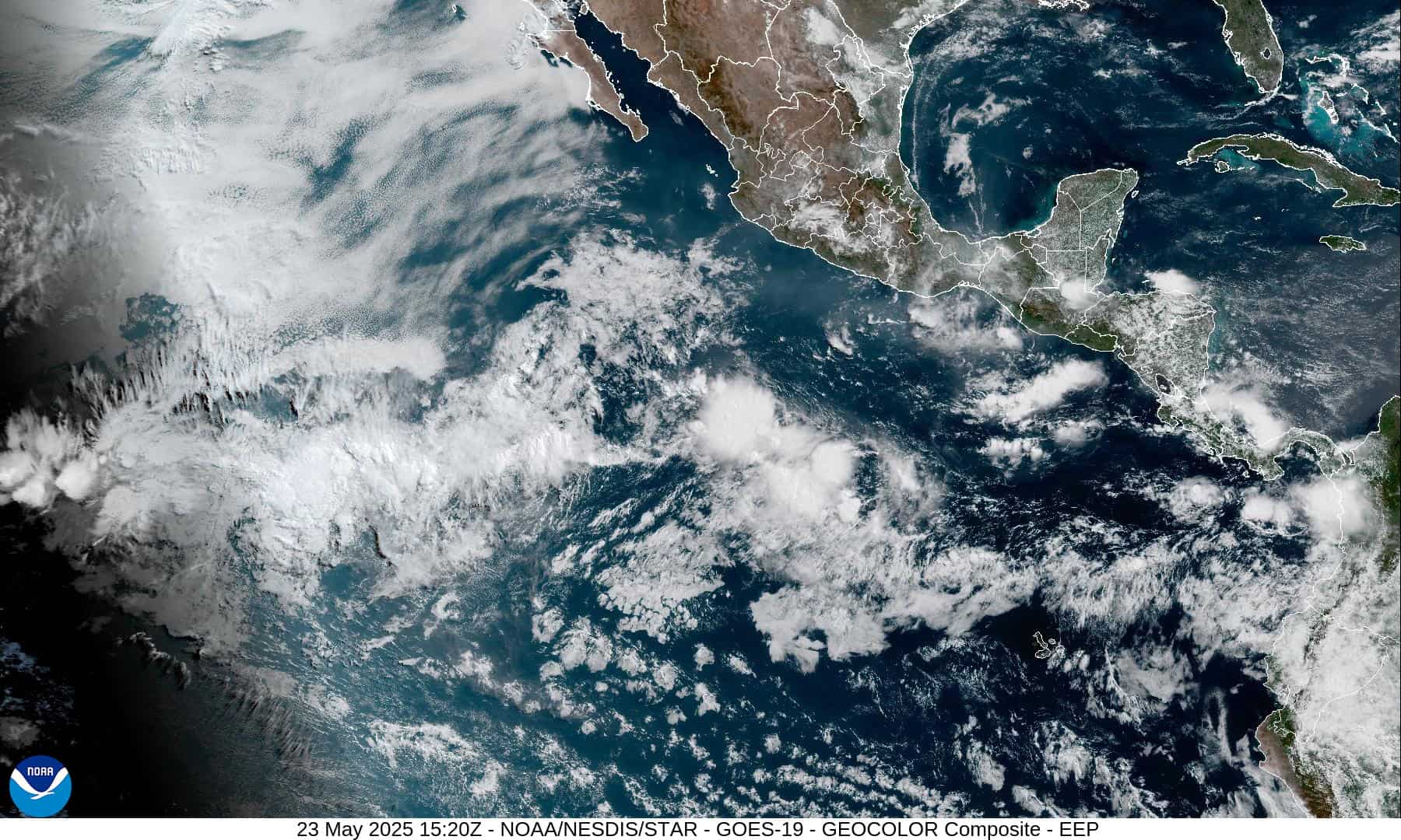
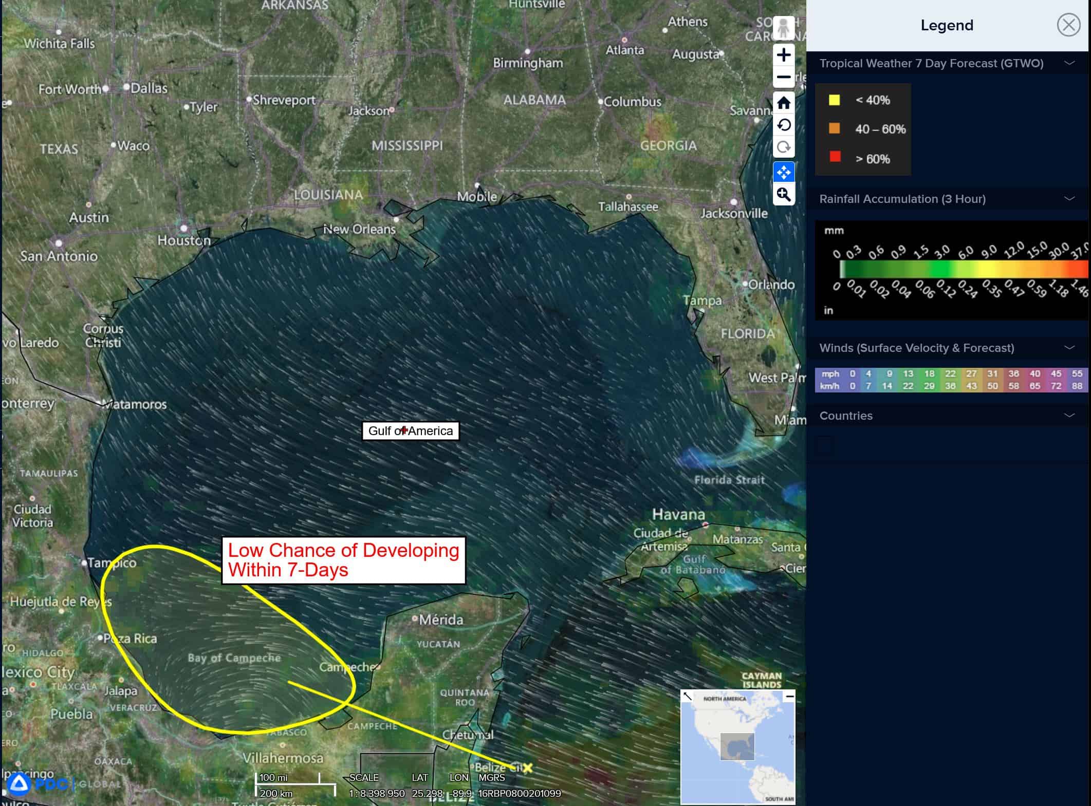
Central East Pacific:
>>> Shower and thunderstorm activity associated with a broad area of low pressure located several hundred miles south of the Baja California Peninsula remains limited and disorganized.
Development of this system is unlikely as it moves slowly westward across the central part of the eastern Pacific during the next few days.
* Formation chance through 48 hours…low…10 percent
* Formation chance through 7 days…low…10 percent
Central Pacific Ocean: There are no Tropical Cyclones
Tropical cyclone formation is not expected during the next 7 days.
Western Pacific, Indian Ocean, and adjacent Seas: There are no Tropical Cyclones
Tropical Cyclone 31W (Kalmaegi)
According to the JTWC warning number 4
Animated enhanced infrared (eir) satellite imagery depicts tropical depression 31W (Kalmaegi) with a symmetric central dense overcast (cdo) obscuring the low-level circulation center (llcc). The system is rather compact with the cdo measuring about 190 nm in diameter. A 011122z metop-b ascat image revealed an ill-defined center with primarily 25-30 knot winds. A small patch of 35 kts just northwest of the assessed center was analyzed to likely be rain contaminated,
Environmental analysis continues to indicate that 31W is in a favorable environment characterized by moderate radial outflow aloft, low (5-10 kts) vertical wind shear, and warm (29-30 c) sea surface temperatures.
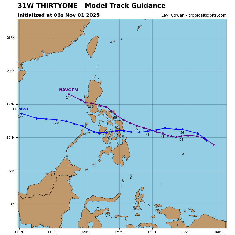
west-northwestward from 72 hours onward, as the system traverses through the South China Sea.