
")
Current Snapshot
For all the latest updates visit: DisasterAWARE
sonia

1800×1080
goes18_ir_18E_202510251445_lat13.4-lon-117.8

18E_tracks_latest
chenge
04S_250600sair
04S_tracks_latest
meteosat9_ir_95S_202510251451_lat-7.5-lon76.1
95S_tracks_latest
meteosat9_ir_94B_202510251451_lat12.0-lon88.0
94B_tracks_latest
meteosat9_ir_92A_202510251451_lat15.7-lon66.8
92A_tracks_latest
By PDC’s Senior Weather
Specialist Glenn James

The Pacific Disaster Center’s (PDC Global) Saturday, October 25, 2025, Tropical Cyclone Activity Report…for the Pacific Ocean, the Indian Ocean, and adjacent Seas
Current Tropical Cyclones:
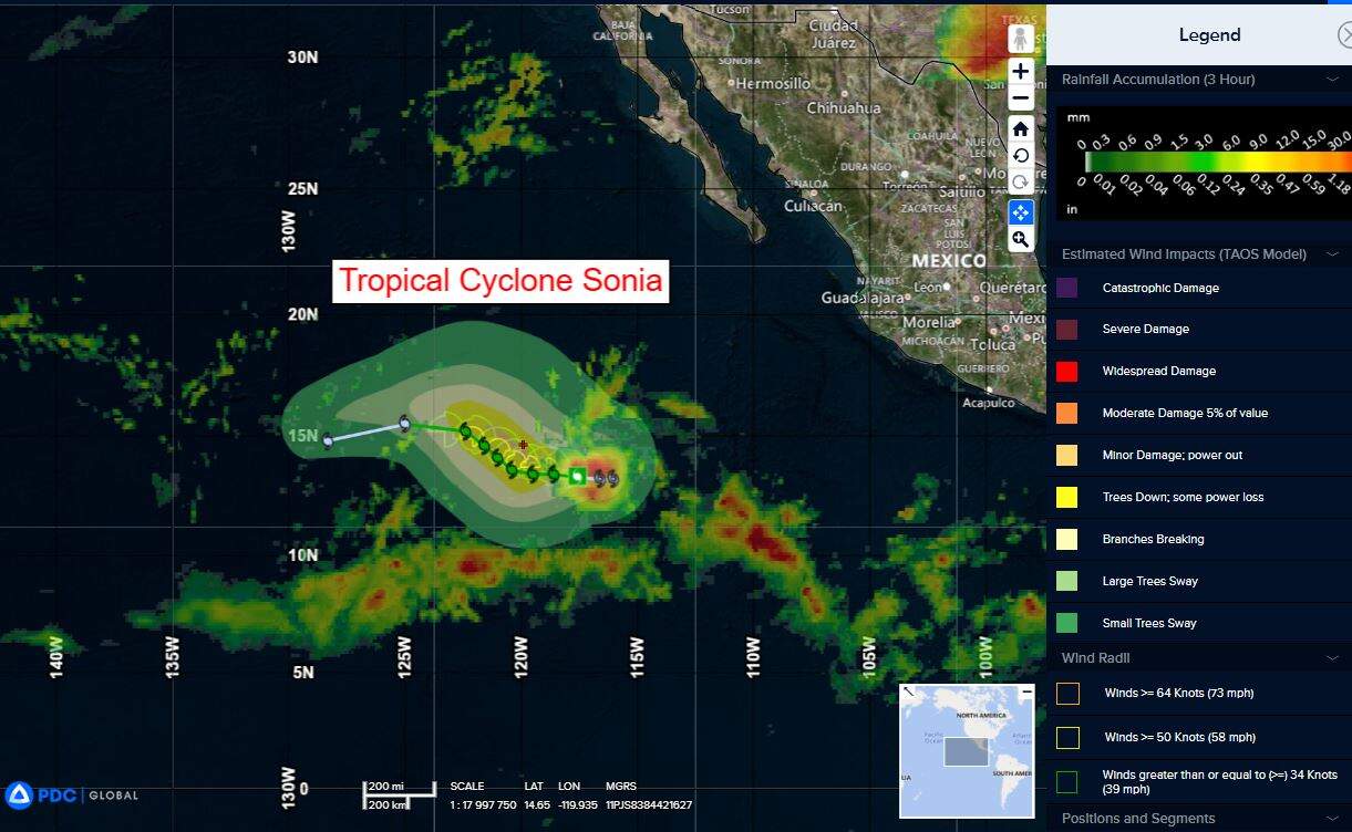
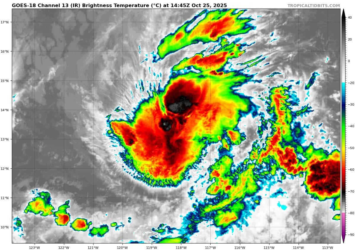
Tropical Cyclone 18E (Sonia)…is located approximately 875 miles southwest of the southern tip of Baja California
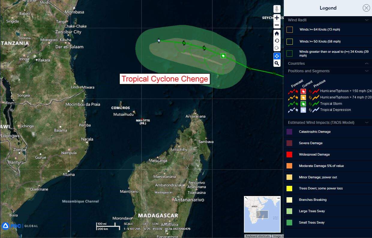
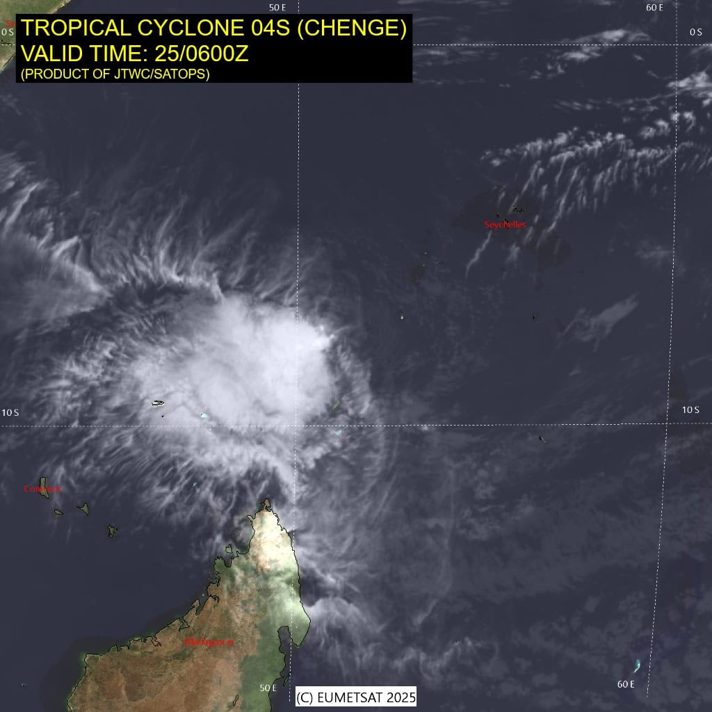
Tropical Cyclone 04S (Chenge)…is located approximately 706 NM north-northeast of Antananarivo, Madagascar – Final Warning
Northeast Pacific Ocean:
Tropical Cyclone 18E (Sonia)
SONIA SLIGHTLY BETTER ORGANIZED AND HEADING WESTWARD
According to the NHC advisory number 5
Sonia is moving toward the west near 8 mph (13 km/h). The tropical storm is forecast to continue moving westward today. A slower forward motion with a turn toward the west-northwest or northwest is expected on Sunday.
Maximum sustained winds are near 50 mph (85 km/h) with higher gusts. Some strengthening is possible this weekend and Sonia could approach hurricane strength on Sunday. Gradual weakening is expected by early next week.
Tropical-storm-force winds extend outward up to 45 miles (75 km) from the center. The estimated minimum central pressure is 1001 mb (29.56 inches).
Central Pacific Ocean: There are no Tropical Cyclones
Tropical cyclone formation is not expected during the next 7 days.
Western Pacific, Indian Ocean, and adjacent Seas:
South Indian Ocean
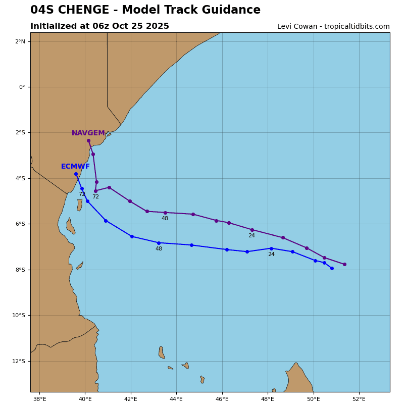
Tropical Cyclone 04S (Chenge) – Final Warning
According to the JTWC warning number 20, sustained winds are 30 knots with gusts to near 40 knots
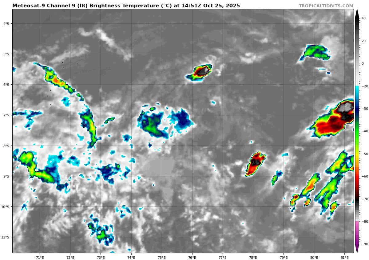
Tropical storm 04S (Chenge) is being heavily sheared with associated convection displaced to the southwest as depicted in
animated enhanced infrared (eir) satellite imagery.
Environmental conditions remain unfavorable with high vertical wind shear (25-30 kts), sea surface temperatures of 26 c to 27 c, and moderate equatorward outflow.
TS Chenge will remain on a west-northwestward track for the remainder of the forecast period under the influence of a subtropical ridge to the south.
Little change is expected in the circulation till after 12 hours at which time prolonged exposure to high wind shear will start to weaken TS Chenge below tropical storm intensity. By 36 hours TS Chenge will have fully dissipated over water.
North Indian Ocean
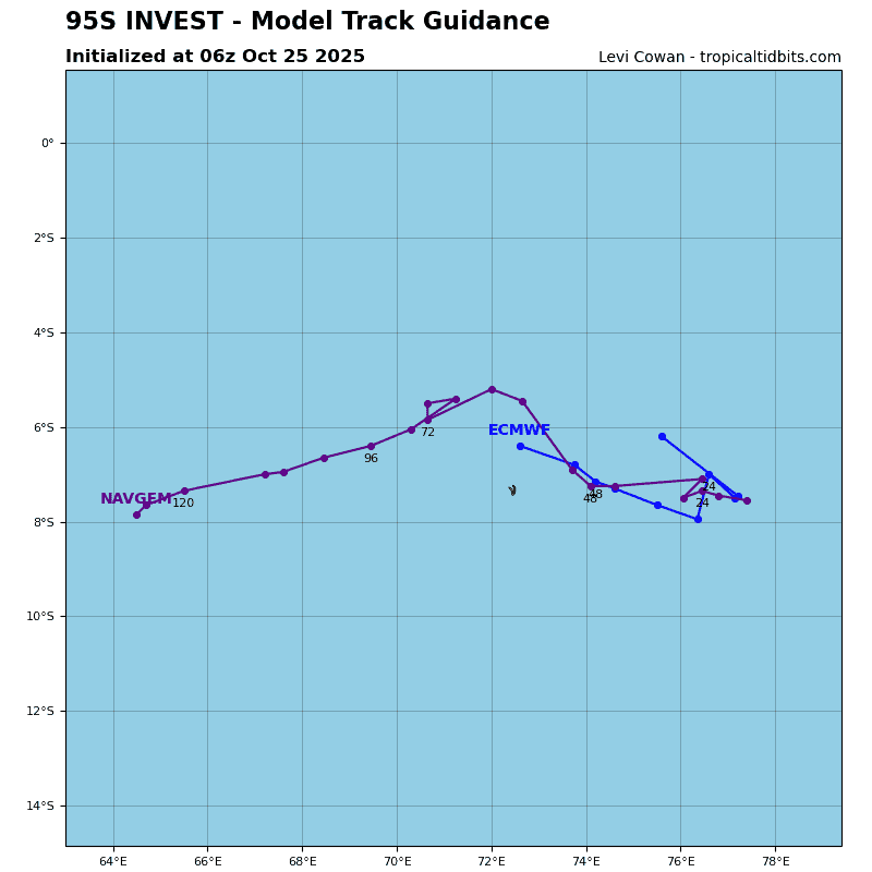
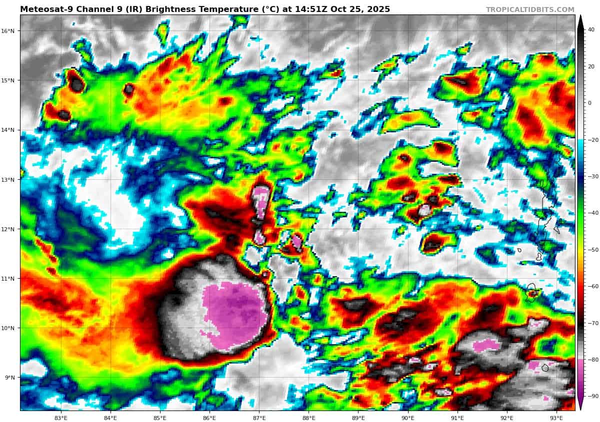
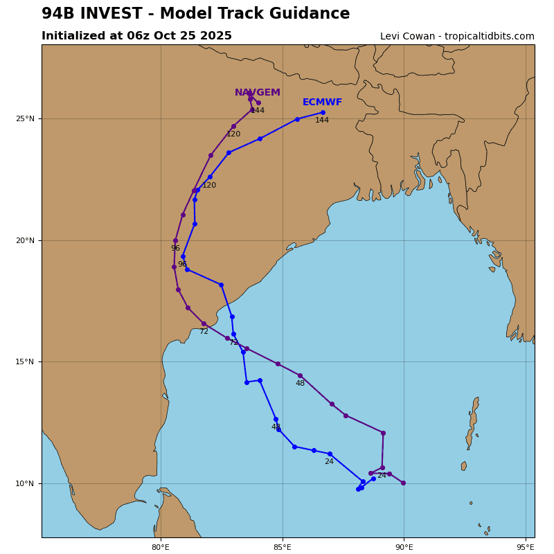
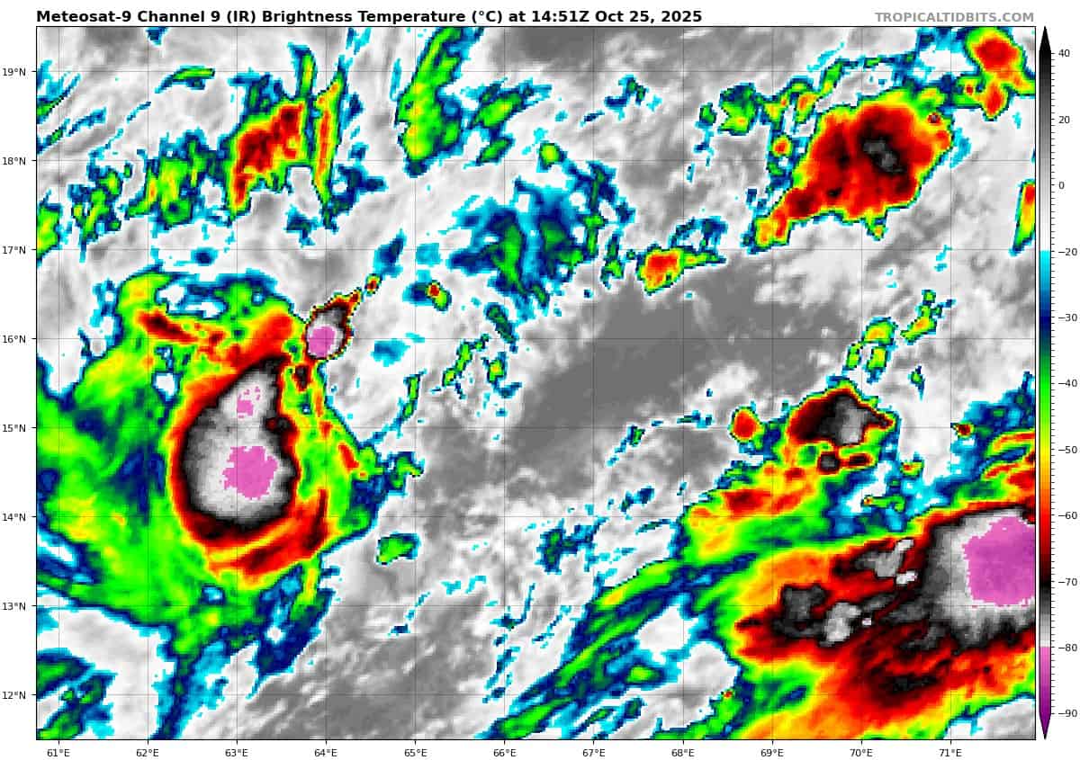
>>> There’s an area of disturbed weather being referred to as Invest 94B…which is located approximately 452 NM east-southeast of Chennai, India
Enhanced infrared satellite imagery (eir) depicts a consolidating llcc embedded within a trough that extends from the coast of southeastern India to the Andaman Island chain. Convection continues to flare near the llcc but is sheared by the persistent easterly vertical wind shear.
Environmental analysis reveals a favorable environment for development with moderate westward and equatorward upper level outflow, low (5-15 kts ) vertical wind shear, and warm sea surface temperatures of 28-29 c.
Global deterministic and ensemble models show 94B consolidating over the next 24-48 hours before tracking generally northwestward.
Maximum sustained surface winds are estimated at 28 to 32 knots.
The potential for the development of a significant tropical cyclone within the next 24 hours remains medium.
Arabian Sea
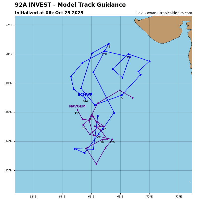
>>> There’s an area of disturbed weather being referred to as Invest 92A…which is located approximately 498 NM southwest of Mumbai, India
Enhanced infrared satellite imagery (eir) depicts a broad circulation with flaring convection associated with the low-level circulation center (llcc).
Environmental analysis reveals marginal conditions for development with moderate to unfavorable vertical wind shear (20-25 knots), moderate poleward and equatorward outflow, and warm surface temperatures (28-29 c).
Global deterministic and ensemble models depict a broad circulation with gradual development.
Maximum sustained surface winds are estimated at 18 to 23 knots.
The potential for the development of a significant tropical cyclone within the next 24 hours remains low.