
")
Current Snapshot
For all the latest updates visit: DisasterAWARE

1800×1080
2
777
feng
30W_230000sair
chenge
04S_230600sair
meteosat9_ir_95S_202510231351_lat-9.5-lon85.9
95S_tracks_latest
92a
meteosat9_ir_92A_202510231351_lat11.6-lon71.0
92A_tracks_latest
By PDC’s Senior Weather
Specialist Glenn James

The Pacific Disaster Center’s (PDC Global) Thursday, October 23, 2025, Tropical Cyclone Activity Report…for the Pacific Ocean, the Indian Ocean, and adjacent Seas
Current Tropical Cyclones:
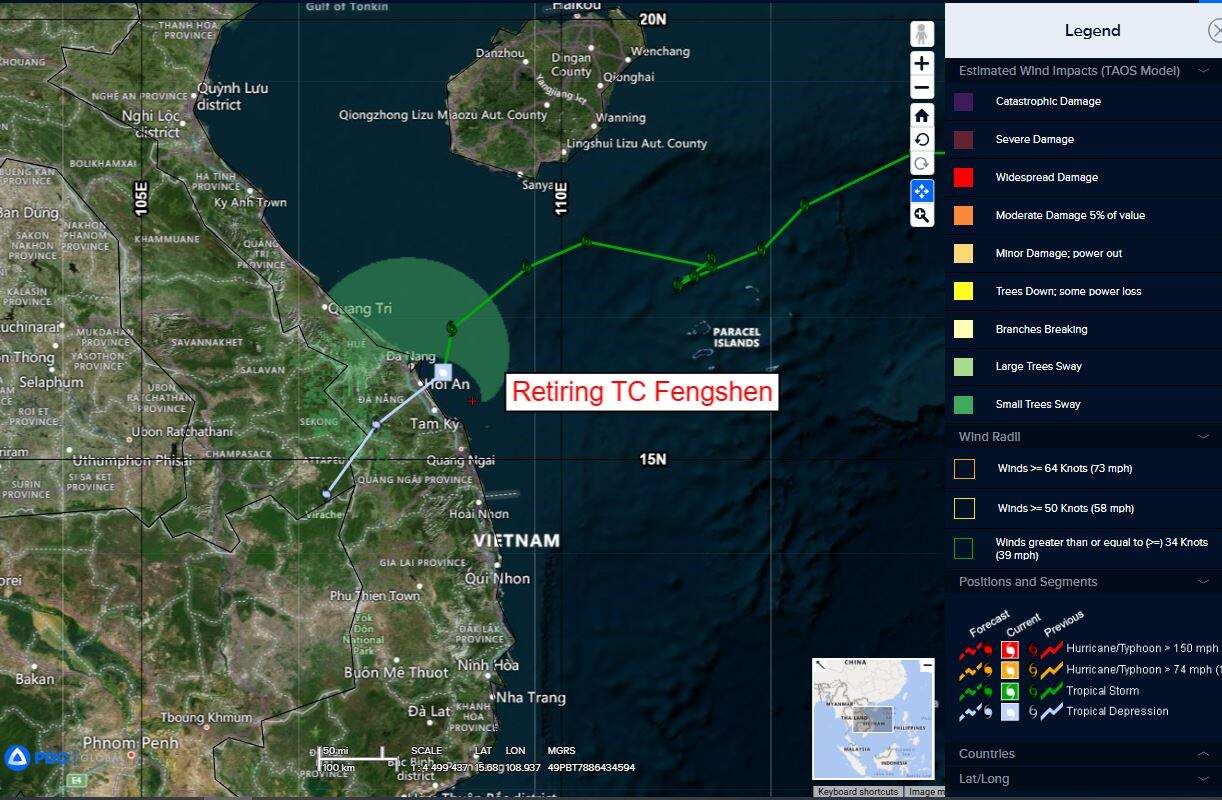
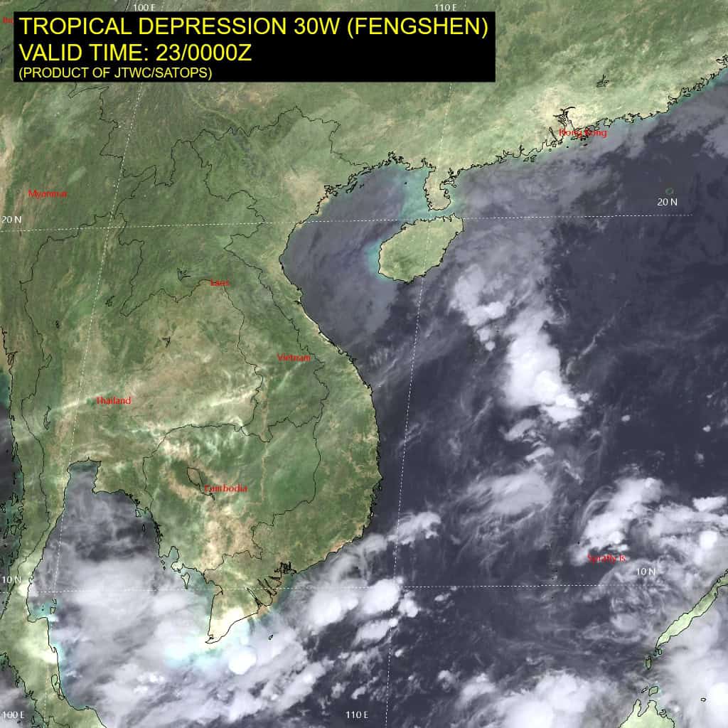
Tropical Cyclone 03W (Fengshen)…is located approximately 17 NM east of Da Nang, Vietnam – Final Warning
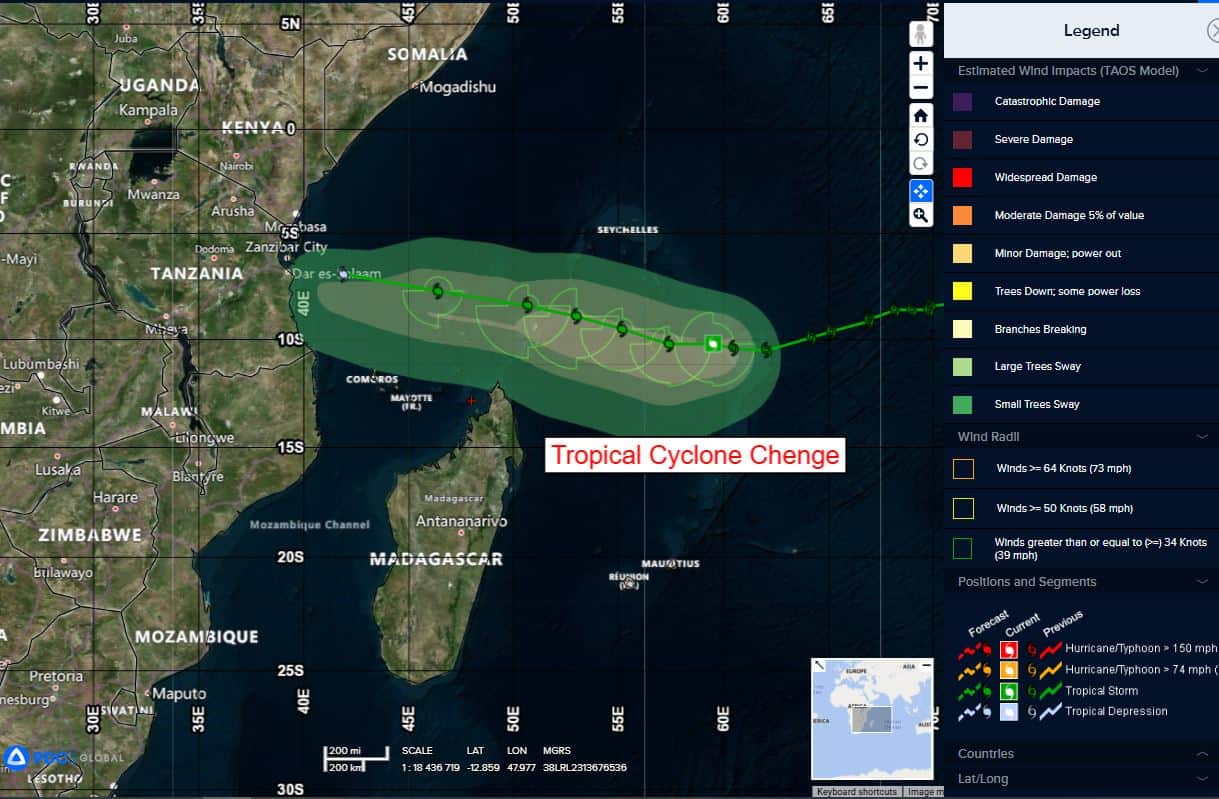
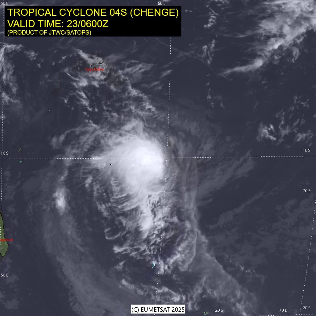
Tropical Cyclone 04S (Chenge)…is located approximately 607 NM north-northeast of Port Louis, Mauritius
Northeast Pacific Ocean: There are no Tropical Cyclones
Central East Pacific:
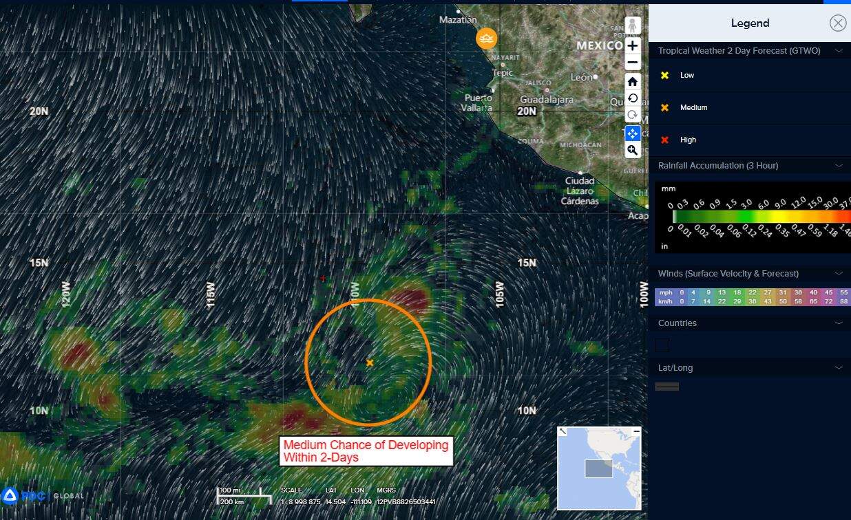
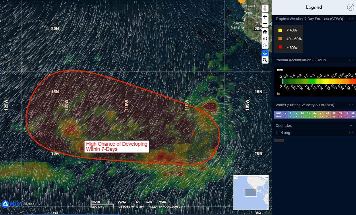
Invest 92E
>>> Showers and thunderstorms associated with a tropical wave located well south of the southern tip of the Baja California Peninsula have become slightly better organized since yesterday. Environmental conditions appear conducive for additional development of this system, and a tropical depression is likely to form during the next couple of days or over the weekend while it moves generally westward at 10 to 15 mph.
* Formation chance through 48 hours…medium…50 percent
* Formation chance through 7 days…high…80 percent
Central Pacific Ocean: There are no Tropical Cyclones
Tropical cyclone formation is not expected during the next 7 days.
Western Pacific, Indian Ocean, and adjacent Seas:
Western Pacific
Tropical Cyclone 03W (Fengshen) – Final Warning
According to the JTWC warning number 21, sustained winds are 25 knots with gusts to near 35 knots
Animated multi-spectral imagery reveals that the low-level circulation center is fully exposed and located just off the coast of Da Nang, Vietnam. The significant dry air entrainment and southwesterly vertical wind shear has considerably weakened 30W over the past 6 hours.
As Fengshen has tracked closer to land, terrain interaction has become an additional factor in expediting Fengshen’s terminal weakening. 30W will continue tracking southwestward while over land in Vietnam, and dissipation is expected within 24 hours of landfall.
South Indian Ocean
Tropical Cyclone 04S (Chenge)
According to the JTWC warning number 15, sustained winds are 40 knots with gusts to near 50 knots
Animated multi-spectral satellite imagery (msi) depicts a partial
exposed low level circulation center (llcc) displaced to the east of an area of persistent deep convection. A 230514z ascat-b pass revealed a well-defined llcc with 35-40 knot winds surrounding the bulk of the center, and most expansive to the southeastern quadrant. Animated water vapor imagery and the current cimss amv analysis indicate an upper-level anticyclone positioned far to the east, imparting easterly deep-layer flow and shear over tc 04s, but also providing strong poleward outflow, along with some weaker westward outflow.
200mb winds continue to split upstream of TC 04S providing for a localized reduction in the shear magnitude, which is allowing the convection to continually cycle, briefly cover the llcc and then back off again, which is the pattern seen over the last several days.
Environmental conditions are marginal, with moderate to high easterly shear, marginal ssts near 26c and strong poleward outflow.
TC 04S has been tracking slightly south of due west over the last day, along the northwestern periphery of a deep-layer str to the southeast and towards a weak break in the ridge pattern in the vicinity of la reunion. The ridge is expected to build and move westward to a position over northern Madagascar over the course of the few days.
After 12 hours, TC 04S will resume a more west-northwestward track along the northern side of the steering, tracking north of Madagascar and towards the east coast of Africa through the remainder of the forecast.
The system has steadily weakened over the past 24 hours under the influence of increasing shear and repeated intrusions of dry mid-level air. Going forward, the system is forecast to experience repeated episodes of dry air entrainment interspersed with brief periods of enhanced moistening which will enable cyclical bursts in convective activity. This in turn is depicted as highly cyclical variations in deep-layer shear in the model guidance, as the convective flare-ups will briefly push back against the shear for a time, before the entire cycle repeats.
In aggregate, the system will maintain its current intensity for the next day or so, though short-duration excursions to 45 knots are possible. More significant dry air intrusion and increases in shear are expected after 48 hours, which will lead to a more generalized weakening through the end of the forecast period.
The remnants of TC 04S, even though they will be below the basin warning threshold, will continue to track towards the coast of east Africa, likely making landfall on the coast of Tanzania or Kenya around 120 hours.
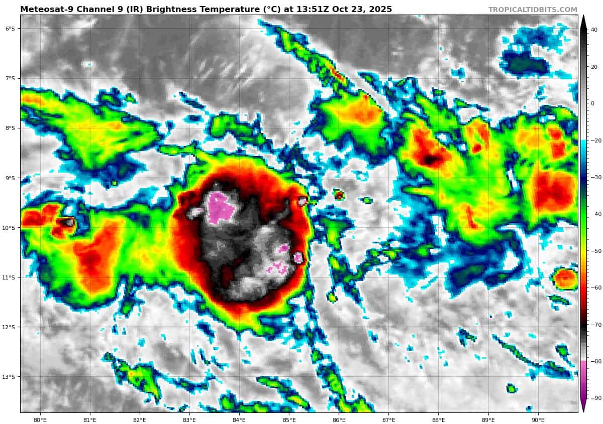
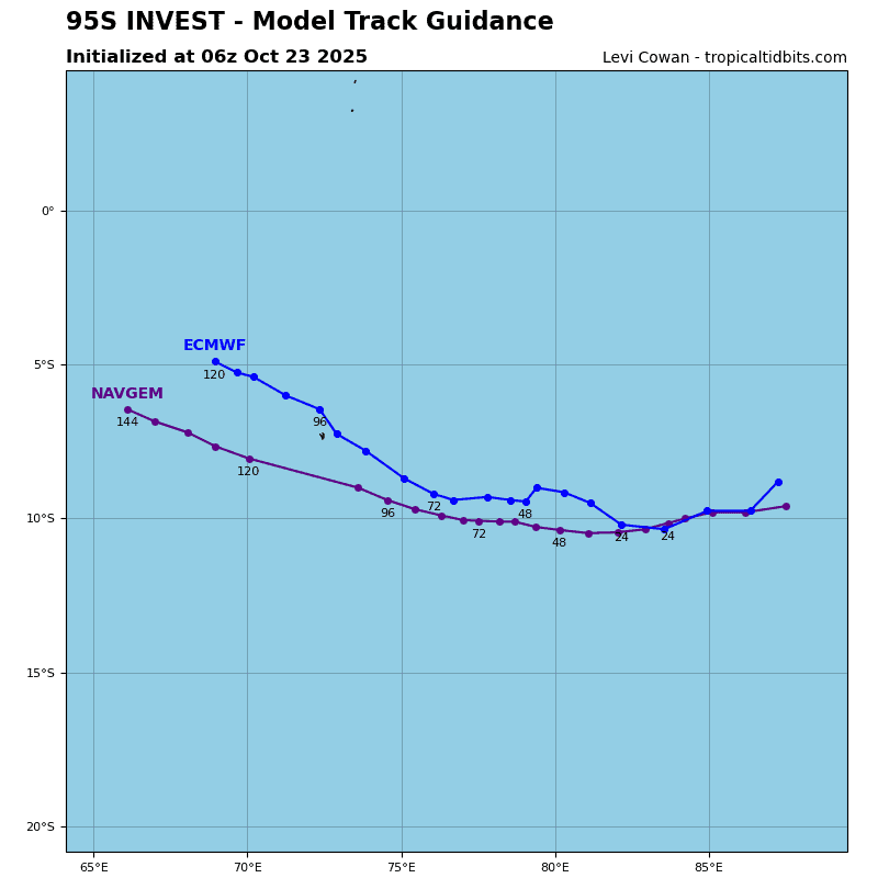
>>> There’s an area of disturbed weather being referred to as Invest 95S…which is located approximately 719 NM east-southeast of Diego Garcia
Enhanced infrared satellite imagery (eir) depicts a slow consolidating circulation with persistent deep convection associated with the low-level circulation center.
Environmental analysis reveals marginal conditions for development with moderate vertical wind shear (20-25 knots) good poleward outflow aloft, and warm sea surface temperatures (28-29 c).
Global models reveal a trackable circulation, with weak development and a west-southwest track over the next 24-48 hours.
Maximum sustained surface winds are estimated at 22 to 28 knots.
The potential for the development of a significant tropical cyclone within the next 24 hours is downgraded to low.
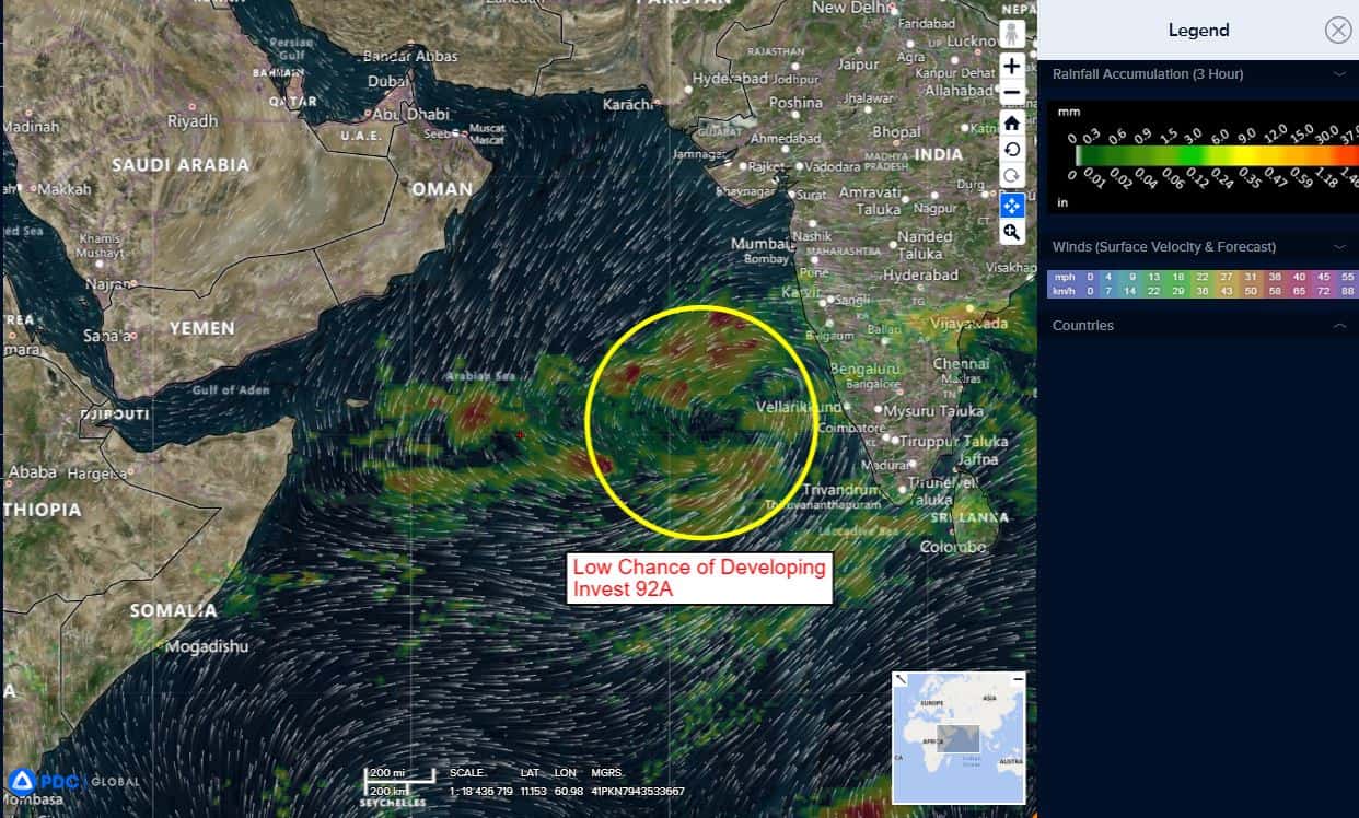
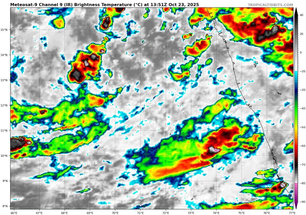
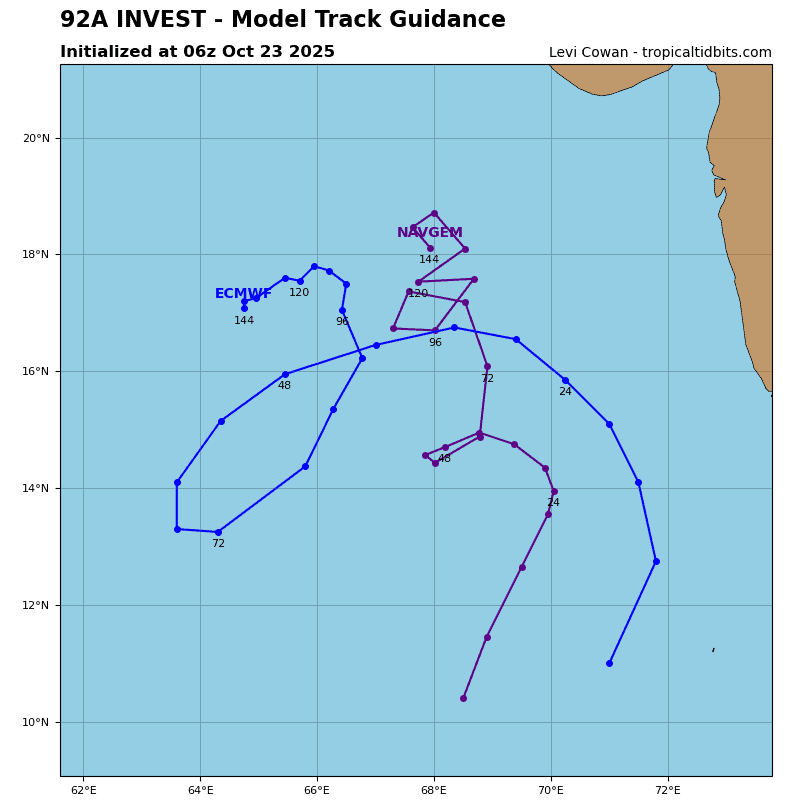
Arabian Sea
>>> There’s an area of disturbed weather being referred to as Invest 92A…which is located approximately 324 NM west-northwest of Cochin.
Enhanced infrared satellite imagery (eir) depicts a poorly disorganized broad circulation with minimal, but flaring convection throughout the greater broad turning associated with invest 92A.
Environmental analysis reveals marginal conditions for development with moderate to high vertical wind shear (20-25 knots), diffluent outflow, and warm sea surface temperatures (28-29 c).
Global models are in fair agreement that invest 92A will remain a broad disorganized circulation with a northwestern track within the next 24-48 hours.
Maximum sustained surface winds are estimated at 18 to 23 knots.
The potential for the development of a significant tropical cyclone within the next 24 hours remains low.