
")
Current Snapshot
For all the latest updates visit: DisasterAWARE
1800x1080a
jerry
1000x1000j
101441_earliest_reasonable_toa_34
101441INTQPF_sm
10L_tracks_latest
By PDC’s Senior Weather
Specialist Glenn James

The Pacific Disaster Center’s (PDC Global) Friday, October 10, 2025, Tropical Cyclone Activity Report…for the Atlantic Ocean, the Caribbean Sea, and the Gulf of America
Current Tropical Cyclones:
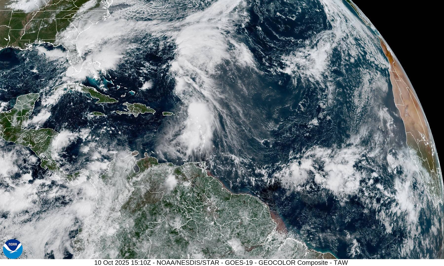
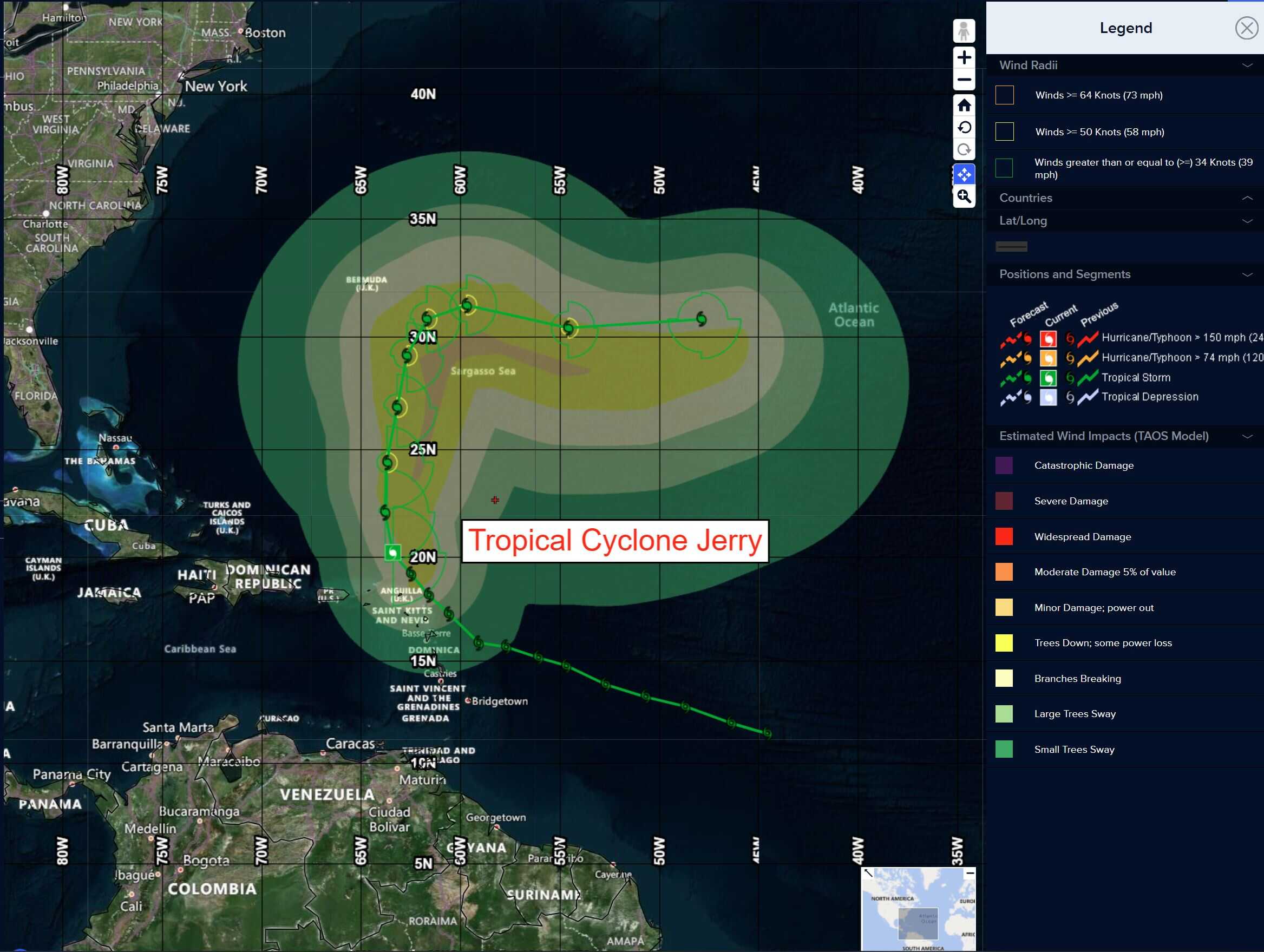
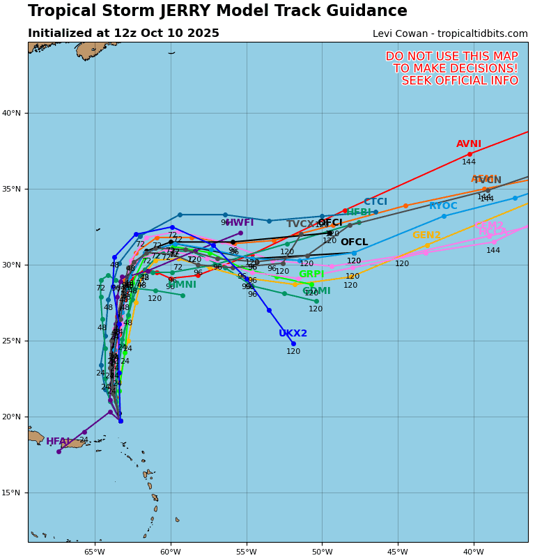
Tropical Cyclone Jerry…is located about 655 miles south of Bermuda
Atlantic Ocean:
Tropical Cyclone Jerry
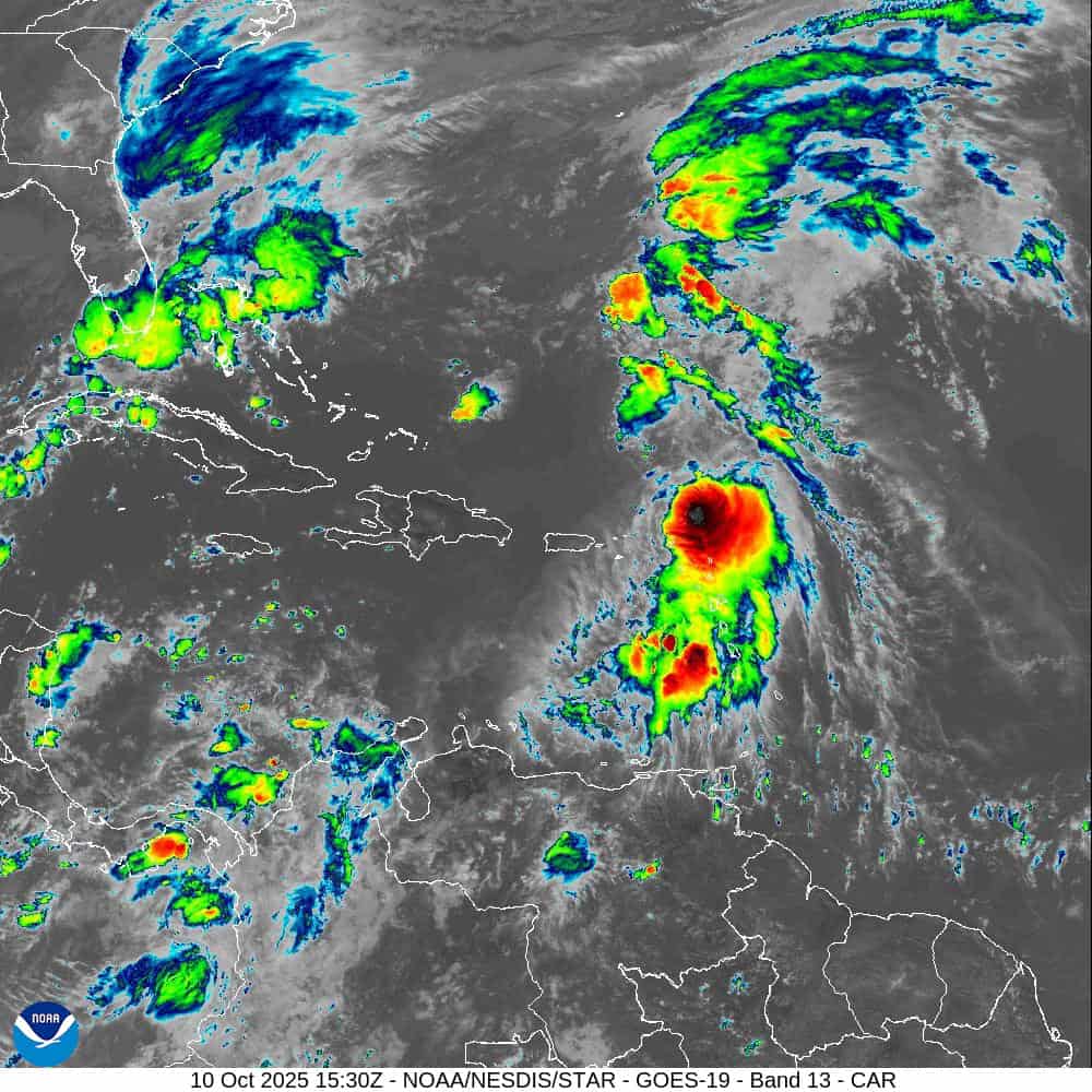
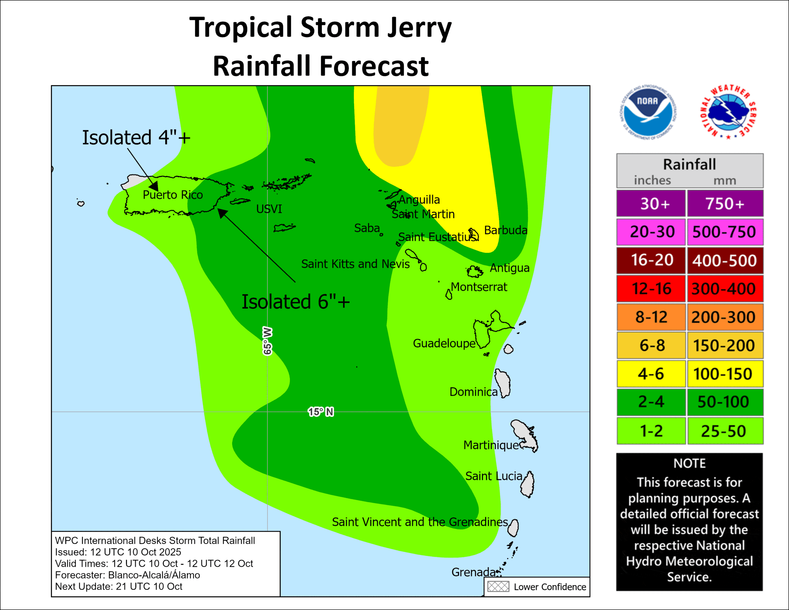
JERRY PULLING AWAY FROM NORTHEASTERN CARIBBEAN SEA BUT HEAVY RAINS REMAIN POSSIBLE THROUGH THE OVERNIGHT HOURS FOR NORTHERN LEEWARD AND VIRGIN ISLANDS
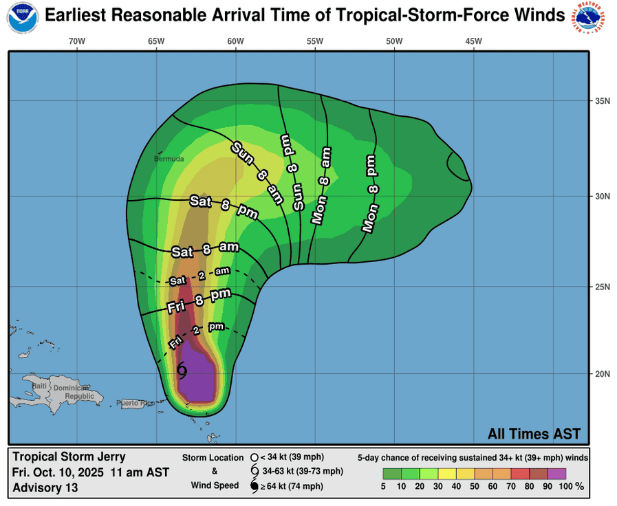
According to the NHC advisory number 15
Jerry is moving toward the north near 15 mph (24 km/h), and this motion is expected to continue through Saturday night. A northeastward to eastward motion is forecast on Sunday and Monday. Satellite-derived wind data indicate that maximum sustained winds are near 60 mph (95 km/h) with higher gusts. Little change in strength is forecast during the next few days. Tropical-storm-force winds extend outward up to 175 miles (280 km) from the center. The estimated minimum central pressure is 1004 mb (29.65 inches).
HAZARDS AFFECTING LAND
RAINFALL: Through today, 4 to 6 inches of rain are expected across the island of Barbuda. Elsewhere across the Leeward and Virgin Islands, 2 to 4 inches of rain are expected. This rainfall brings a risk of flash flooding, especially in urban areas and in steep terrain. For portions of Puerto Rico, moisture associated with Jerry may result in up to 2 to 4 inches of rain, with isolated 6 inches possible.
SURF: Swells generated by Jerry are affecting the Leeward Islands, Windward Islands, the Virgin Islands, and Puerto Rico, and are likely to cause life-threatening surf and rip current conditions. These swells are expected to spread toward the rest of the Greater Antilles today and tonight.
Tropical Atlantic:
>>> A tropical wave located well to the south of the Cabo Verde Islands is producing a broad area of disorganized showers and thunderstorms. Some slow development of this system is possible over the next several days while it moves west-northwestward to northwestward at 10 to 15 mph across the eastern and central tropical Atlantic.
* Formation chance through 48 hours…low…near 0 percent
* Formation chance through 7 days…low…20 percent
Caribbean Sea: There are no active tropical cyclones
Tropical cyclone formation is not expected during the next 7-days.
Gulf of America: There are no active tropical cyclones
Tropical cyclone formation is not expected during the next 7-days.