The Pacific Disaster Center’s (PDC Global) Saturday, October 4, 2025, Tropical Cyclone Activity Report…for the Pacific Ocean, the Indian Ocean, and adjacent Seas
Current Tropical Cyclones:
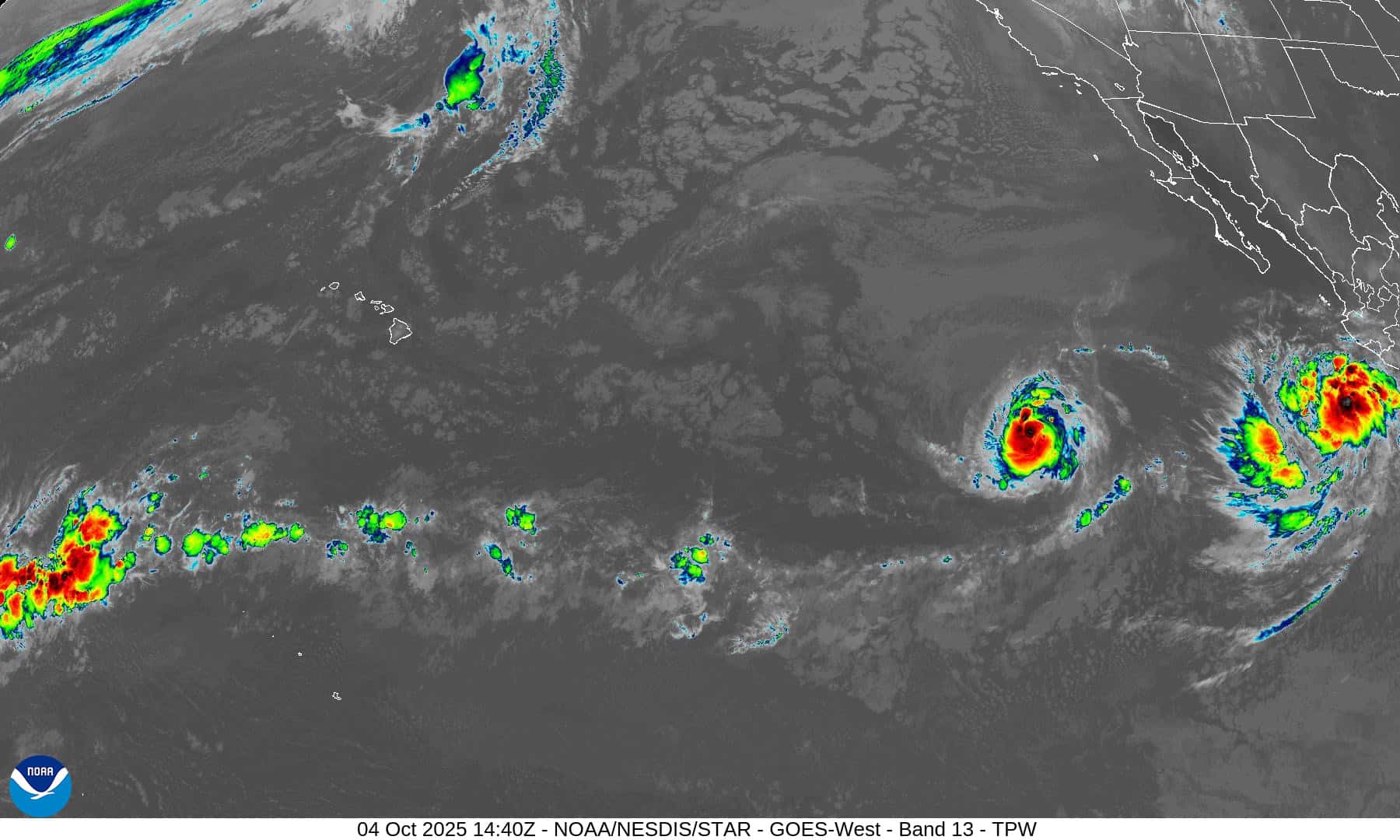
Tropical Cyclone 15E (Octave) is located about 1060 miles west-southwest of the southern tip of Baja California
Tropical Cyclone 16E (Priscilla) is located about 545 miles south-southeast of the southern tip of Baja California
Tropical Cyclone 27W (Matmo) is located about 192 NM southwest of Hong Kong
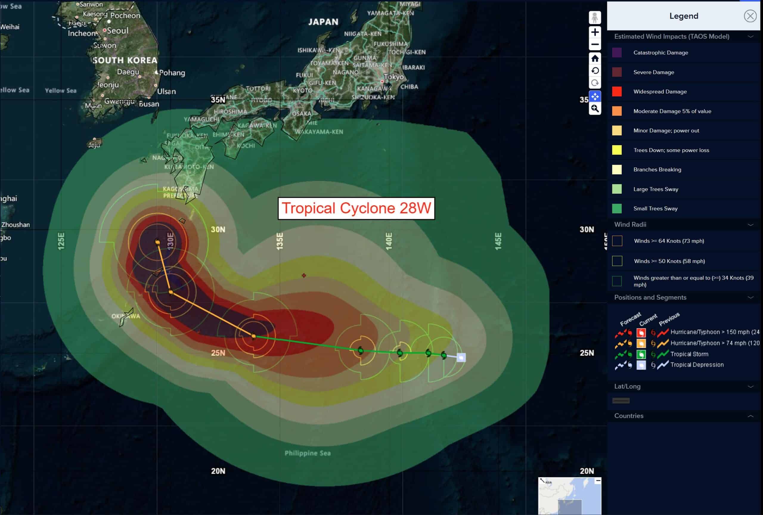
Tropical Cyclone 28W (Halong) is located approximately 812 NM east of Kadena AB
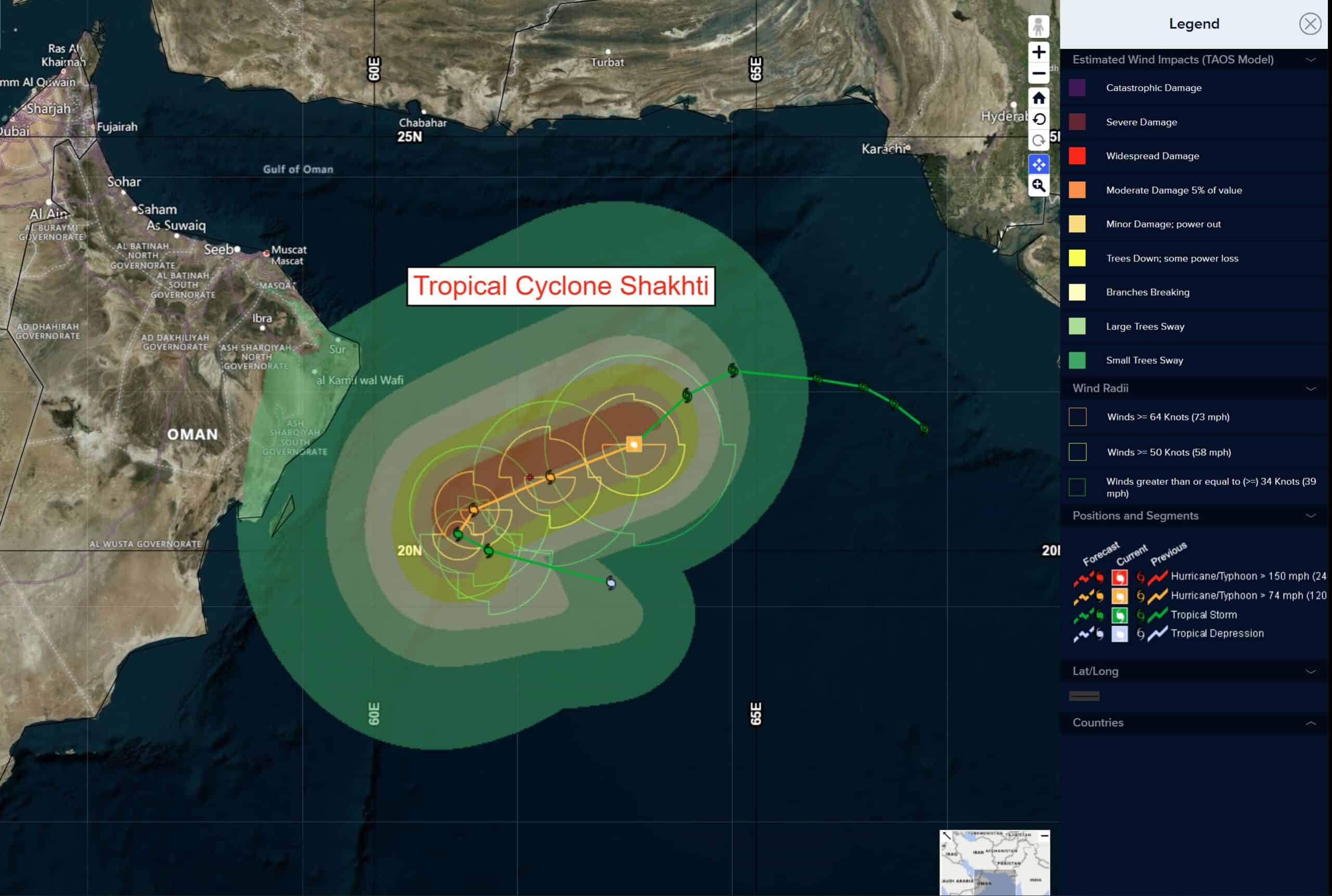
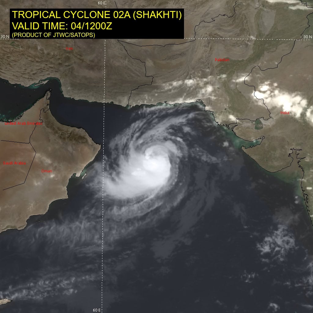
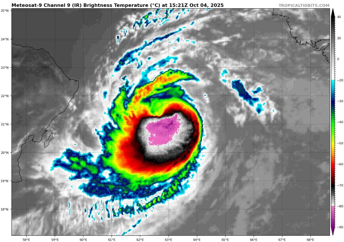
Tropical Cyclone 02A (Shakhti) is located approximately 145 NM east-northeast of Masirah Island
Northeast Pacific Ocean:
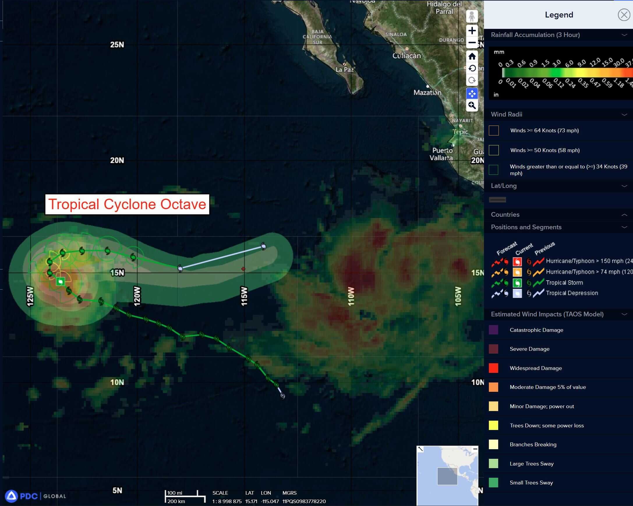
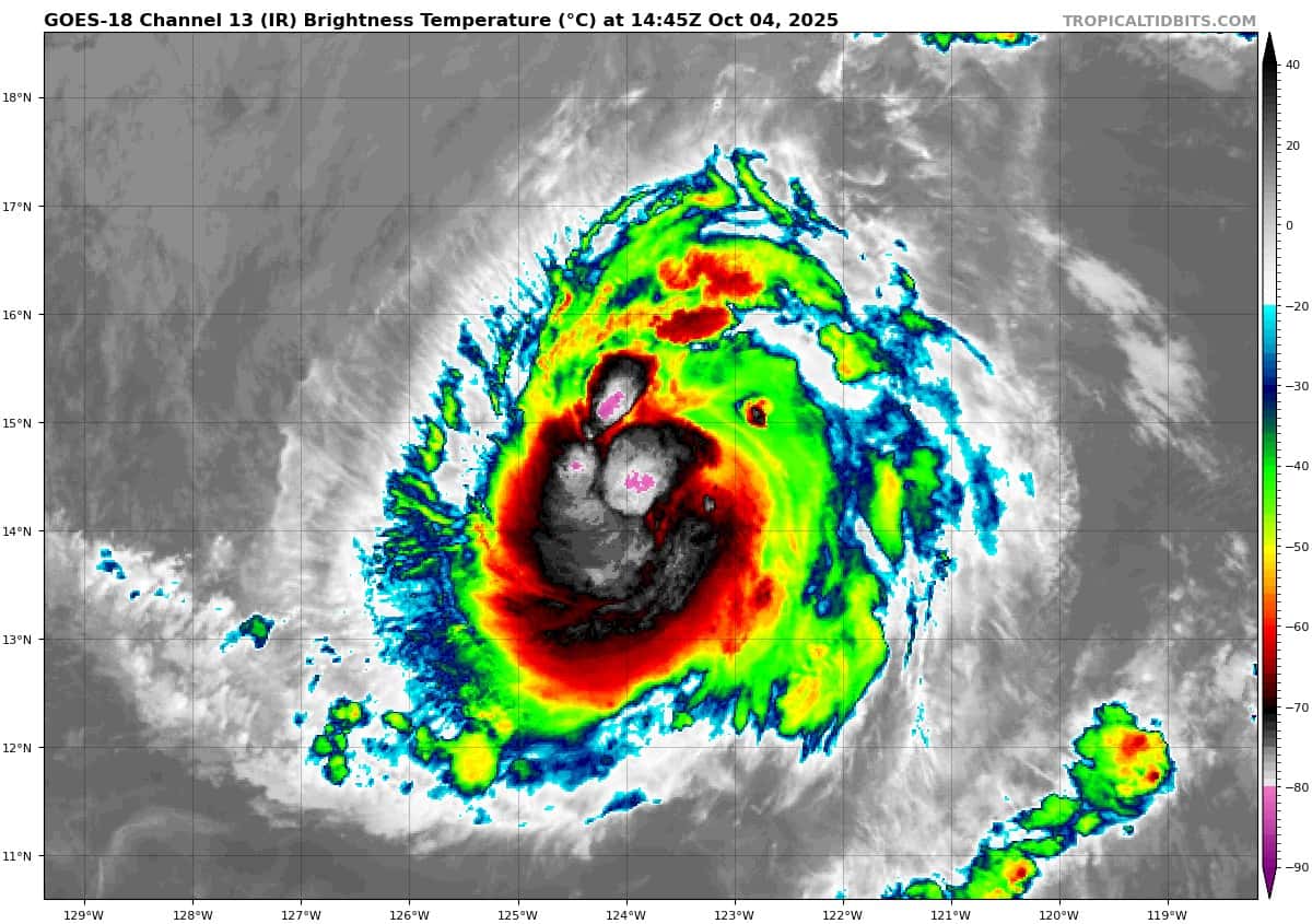
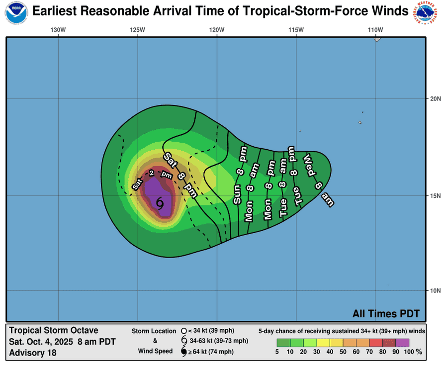
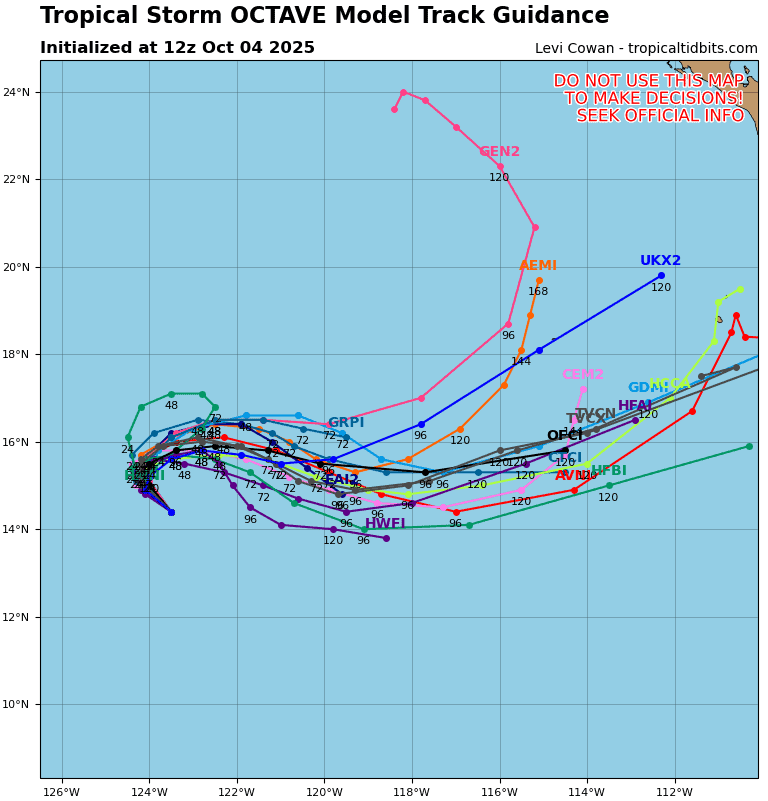
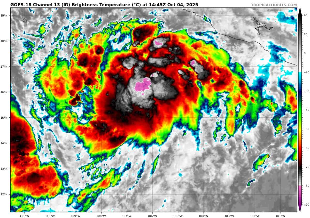
Tropical Cyclone 15E (Octave)
OCTAVE SLOWLY MOVING NORTH-NORTHWESTWARD
According to the NHC advisory number 20
Octave is moving toward the north-northwest near 5 mph (7 km/h), and the tropical storm is expected to turn northward tonight or Sunday morning and then eastward in the next day or so. Maximum sustained winds are near 65 mph (100 km/h) with higher gusts. Some slight strengthening is possible during the next day or so. Tropical-storm-force winds extend outward up to 80 miles (130 km) from the center. The estimated minimum central pressure is 997 mb (29.44 inches).
Tropical Cyclone 16E (Priscilla)
PRISCILLA MOVING SLOWLY NORTHWESTWARD…TROPICAL STORM WATCH IN EFFECT FOR PORTIONS OF THE COAST OF SOUTHWESTERN MEXICO
According to the NHC advisory number 2
Priscilla is moving toward the northwest near 3 mph (6 km/h). A slow, generally northward drift is expected through Sunday, followed by a faster northwestward motion beginning on Monday. On the forecast track, the center of Priscilla is expected to move offshore of and parallel to the coast of southwestern Mexico through early next week. Maximum sustained winds are near 45 mph (75 km/h) with higher gusts. Strengthening is forecast during the next few days, and Priscilla is expected to become a hurricane by Sunday night or Monday. Priscilla is a large tropical storm, with tropical-storm-force winds extending outward up to 140 miles (220 km) from the center. The estimated minimum central pressure is 1000 mb (29.53 inches).
HAZARDS AFFECTING LAND WIND:
WIND: Tropical storm conditions are possible within the watch area along the southwestern coast of Mexico on Sunday and Monday.
RAINFALL: Outer bands from Priscilla will bring heavy rain to portions of southwestern Mexico through Monday. Across coastal portions of Michoacán and far western Guerrero, rainfall amounts of 4 to 6 inches are expected, with local amounts up to 8 inches. Across Colima, western Jalisco, and the rest of Guerrero along the coast, 2 to 4 inches of rain are expected. This rainfall will bring a risk of flash flooding, especially in areas of higher terrain.
SURF: Swells generated by Priscilla are affecting portions of the coast of southwestern Mexico and will reach portions of the coast of west-central Mexico and the southern Baja California peninsula by Monday. These swells are likely to cause life-threatening surf and rip current conditions.
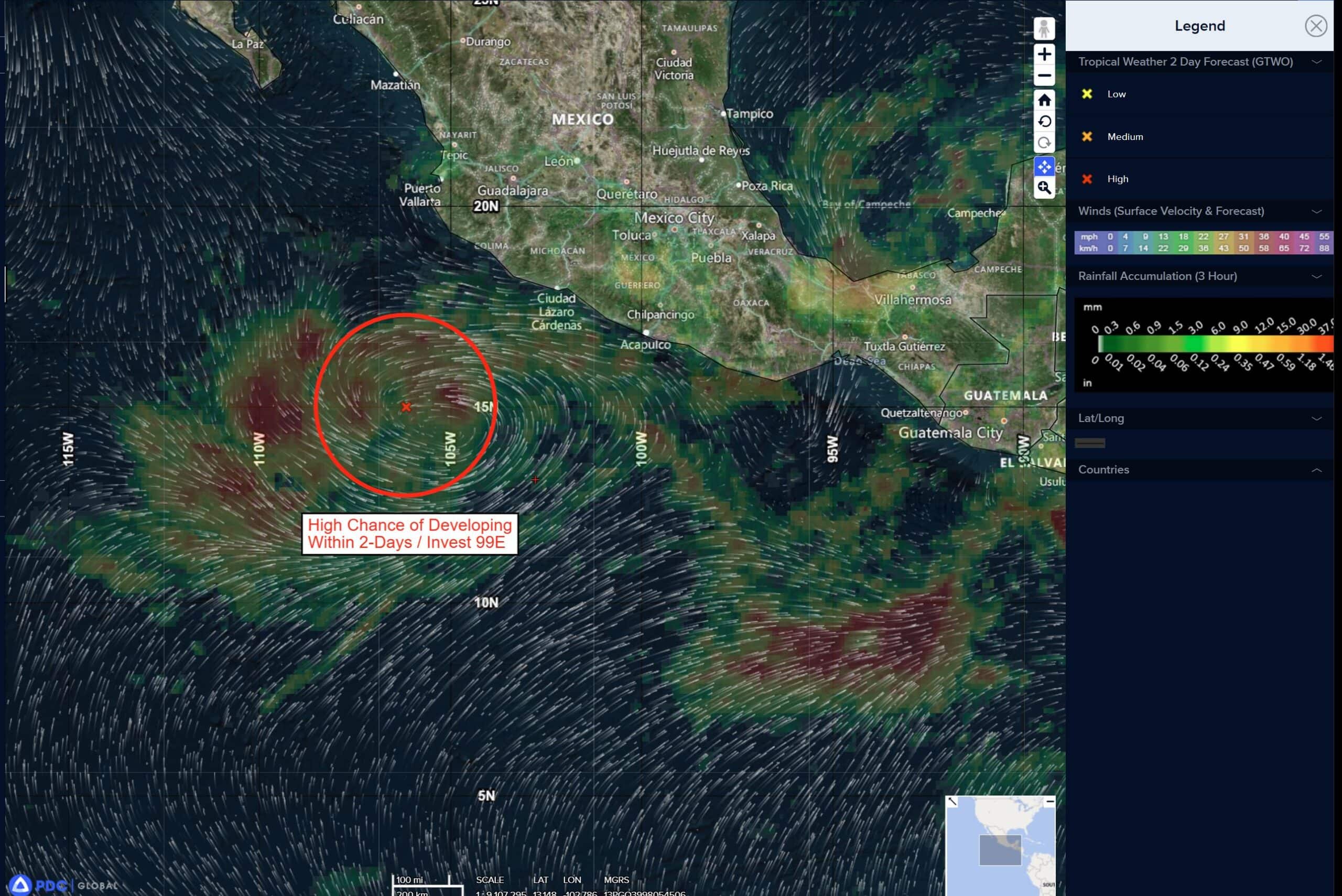
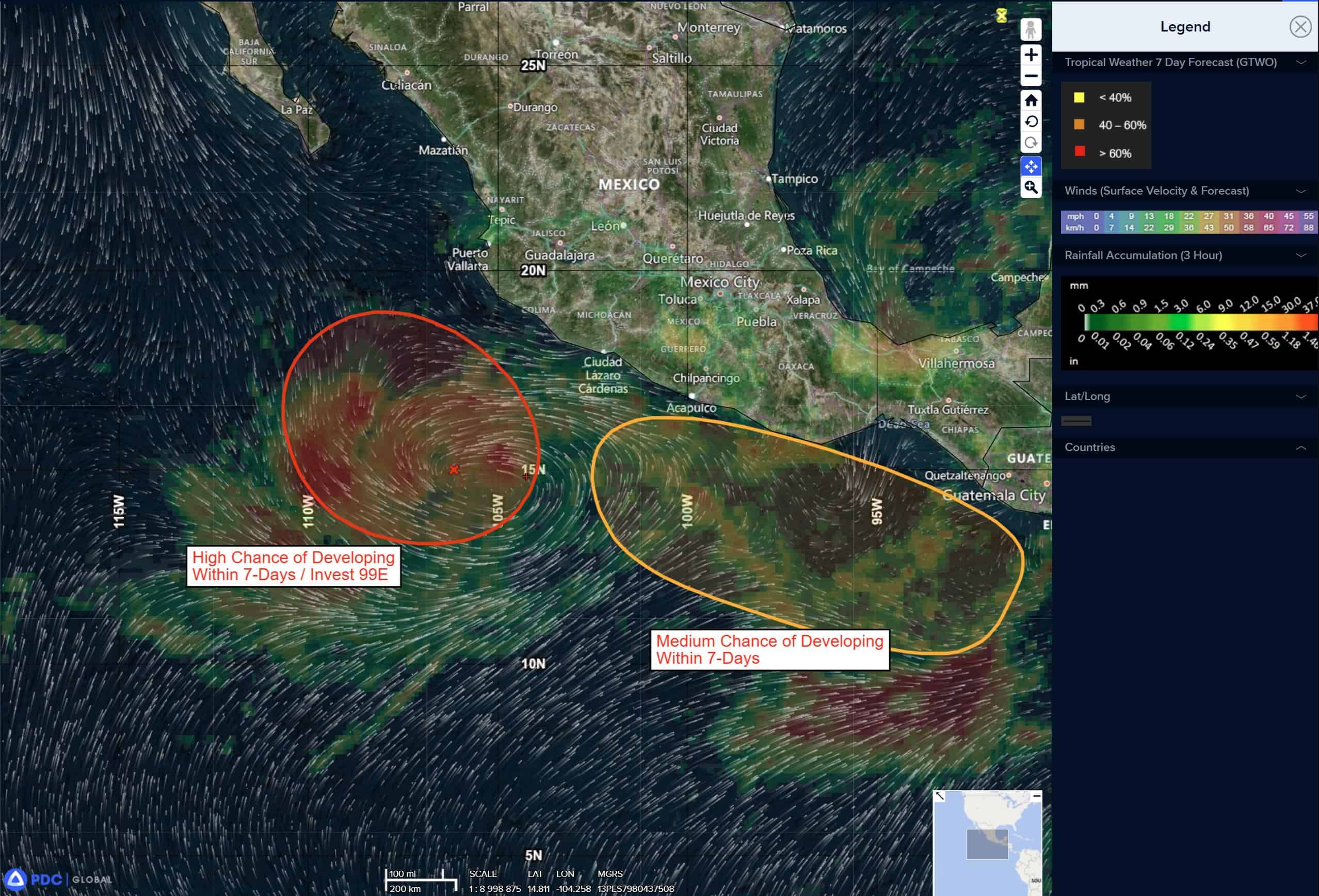
South of Southern Mexico:
>>> An area of low pressure is expected to form off the southern coast of Mexico by the middle of next week. Gradual development of this system is likely thereafter, and a tropical depression could form during the middle to latter part of next week while moving west-northwestward to northwestward, near or parallel to the coast of Mexico.
* Formation chance through 48 hours…low…near 0 percent
* Formation chance through 7 days…medium…60 percent
Central Pacific Ocean: There are no Tropical Cyclones
Tropical cyclone formation is not expected during the next 7 days.
Western Pacific, Indian Ocean, and adjacent Seas:
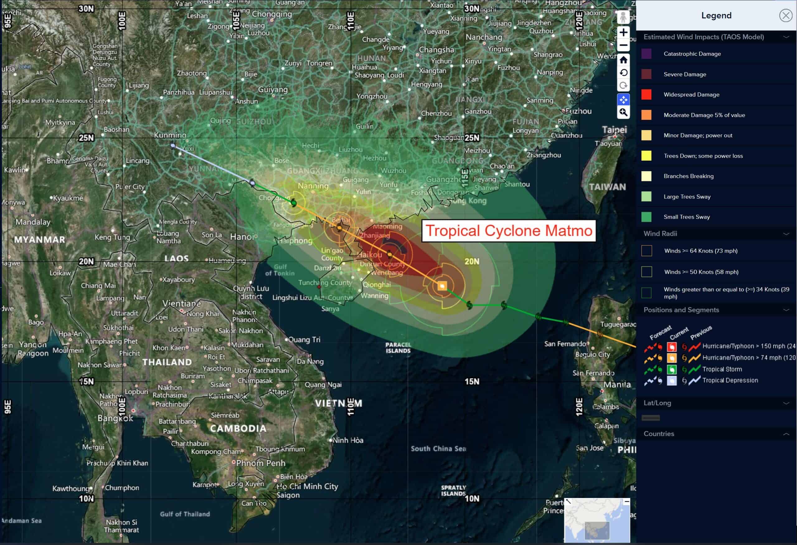
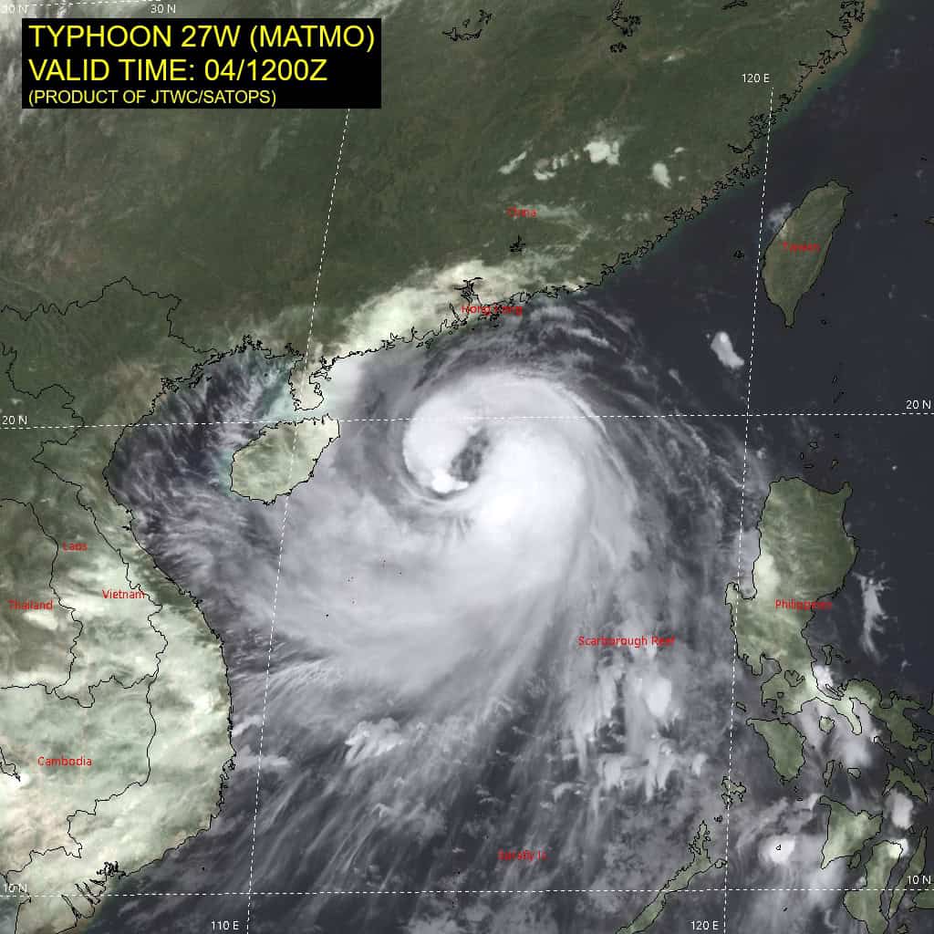
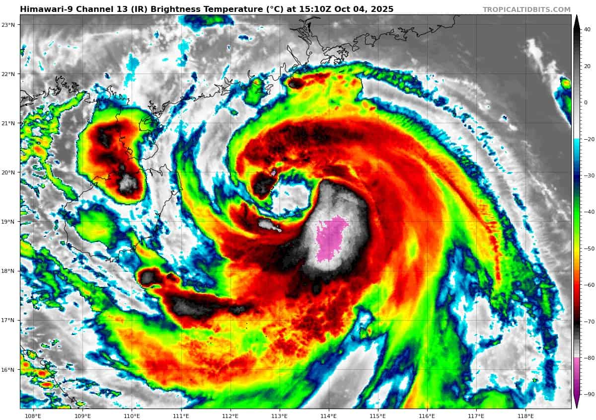
Tropical Cyclone 27W (Matmo)
According to the JTWC warning number 16, sustained winds were 90 knots with gusts to 110 knots
Animated multi-spectral satellite imagery (msi) depicts tropical storm 27W (Matmo) with improving convective banding wrapping around the low-level circulation center (llcc). Cloud tops have cooled over the past 6 hours, particularly within deep bursts of convection in the southeastern quadrant. A 040223z metop-c ascat image revealed 40-45 knots within the eastern semicircle.
Environmental analysis indicates that 27W is in a highly favorable environment characterized by strong radial outflow aloft, low (5-10 knots) vertical wind shear, and warm (29-30 c) sea surface temperatures.
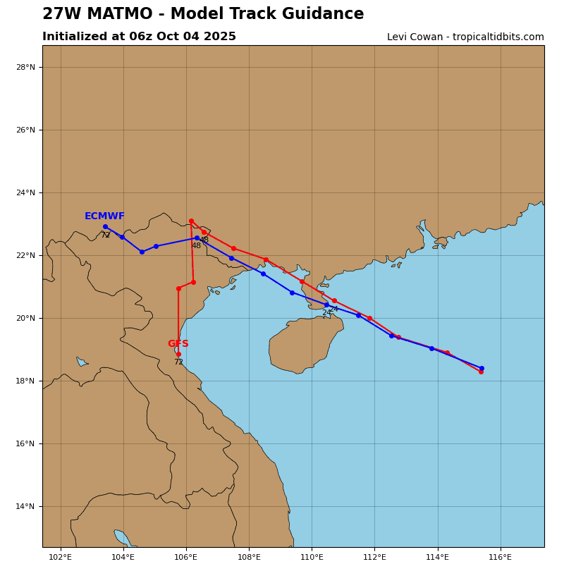
27W is forecast to track northwestward, along the southwestern periphery of the subtropical ridge throughout the forecast period. An initial landfall is forecast to occur along the southern Leizhou Peninsula near 24 hours. The system is then forecast to briefly emerge within the Gulf of Tonkin before making a second landfall just east of the Vietnam-China border around 36 hours.
Regarding intensity, 27W is forecast to near-rapidly intensify over the next 24 hours as the system remains in a highly favorable environment. The peak intensity will likely occur around 18 hours, which is not able to be captured by the forecast.
After 24 hours, land interaction with southern China will deteriorate the vortex. After making its final landfall, 27W will rapidly weaken and the remnant vortex will likely fully dissipate no later than 72 hours, north of Vietnam and Laos.
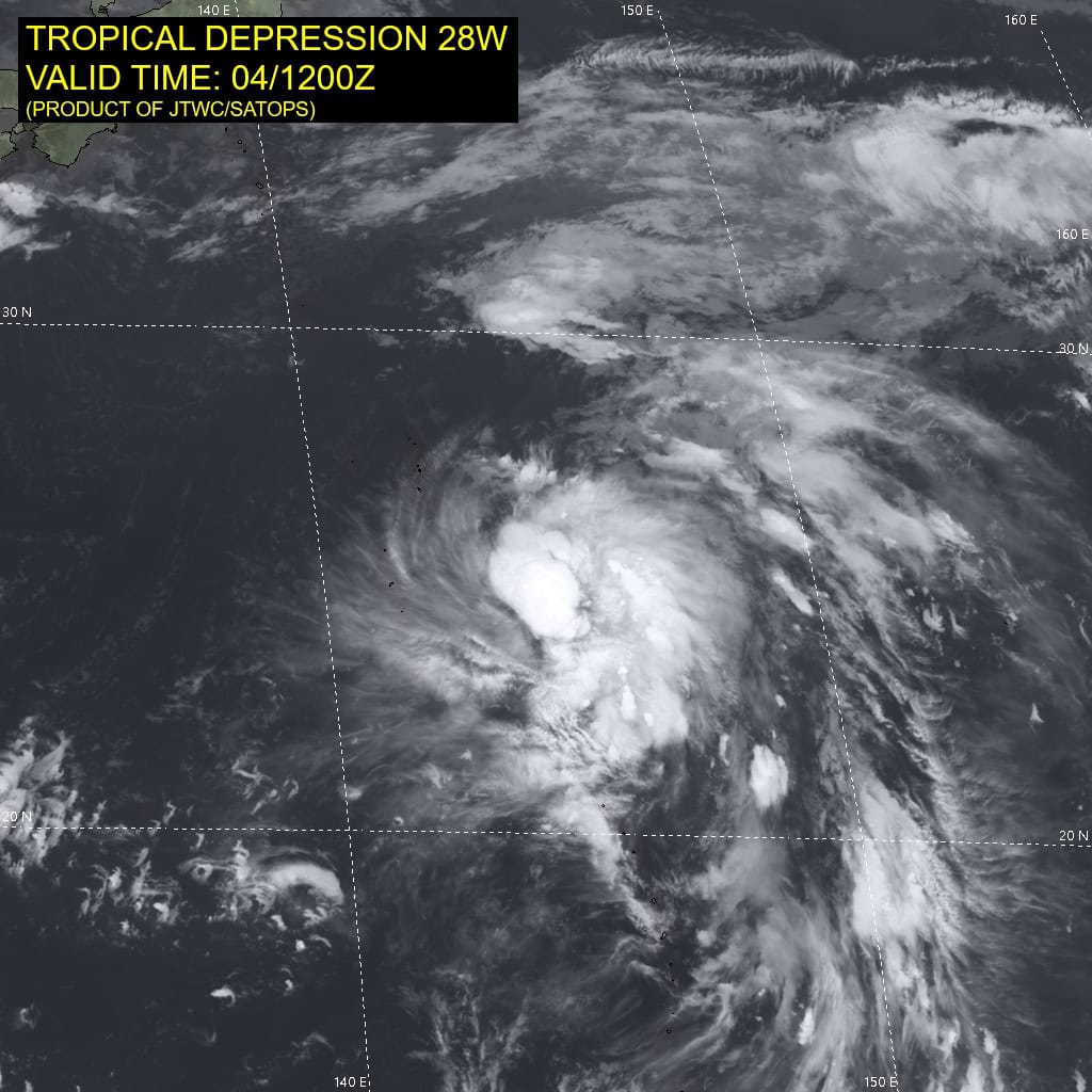
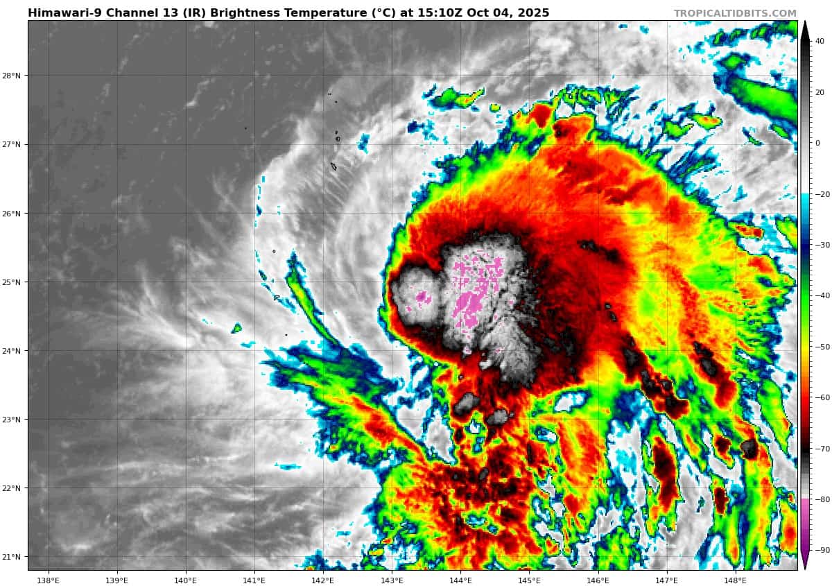
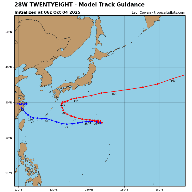
Tropical Cyclone 28W (Halong)
According to the JTWC warning number 3, sustained winds were 35 knots with gusts to 45 knots
Animated enhanced infrared (eir) satellite imagery depicts tropical depression 28W with deep convection confined to the eastern semicircle of a partially exposed low-level circulation center (llcc). The vortex appears to be tilted with height. the mid-level center is analyzed to be offset to the east, and models are
currently reflecting that.
Environmental analysis indicates that 28W is in a favorable environment characterized by moderate poleward outflow aloft, low (10-15 knots) vertical wind shear, and warm (29-30 c) sea surface temperatures.
28W is forecast to track slowly westward through 24 hours as the steering pattern remains weak. After 24 hours, track speeds are expected to increase as ridging to the east extends north of the system and becomes the primary steering mechanism. Near 72 hours, 28W is forecast to turn northwestward as it begins to round the southwestern extent of the ridge. A track northward, along the western extent of the ridge, is forecast to occur near the end of the forecast period (120 hours).
However, there is also a strong ridge centered over eastern China that could potentially extend to the north of 28W near 72 hours, which would prevent a recurve and cause a further westward track. If a more southern track is taken during the first 72 hours, a further westward track will be more likely, and potential impacts to Okinawa would be more likely. However, a more northward track during the first 72 hours would favor an early recurve.
Regarding intensity, 28W is forecast to steadily intensify through 48 hours to around 60 knots. The environment will be favorable, but it will take some time for the vortex to be fully aligned. Once that happens, rapid intensification (ri) is likely to occur. A strong poleward outflow channel is expected to form near 60 hours, which will further aid in the potential ri.
An intensity of around 105 knots is currently forecast for 96 hours, as 28W begins to recurve. Near 120 hours, southwesterly shear is expected to increase, putting a cap on intensification.
Tropical Cyclone 02A (Shakhti)
According to the JTWC warning number 9, sustained winds were 70 knots with gusts to 85 knots
Animated enhanced infrared (eir) satellite imagery depicts a well defined low-level circulation center (llcc), with cooling upper-level clouds tops that are beginning to wrap around the llcc in the southwest quadrant.
Environmental analysis indicates a favorable environment, characterized by low (10-15 knot) vertical wind shear, warm (28-29c) sea surface temperatures, and moderate outflow, slightly offset by dry air in the mid-levels.
Tropical cyclone 02A is forecast to continue its west-southwestward track through 36 hours as 02A is influenced by the southeastern periphery of the primary steering ridge. Between 36-48 hours, the weaker str over the Indian subcontinent will build and extend southwest, causing 02A to stall in the increasingly competitive steering environment.
02A is forecast to slowly turn south during this time, but models are in significant disagreement over when and where the turn will occur. Once the turn is completed, around 48 hours, 02A is expected to be picked up by the now dominant str to its south and track east-southeastward until dissipation around 72 hours.
Regarding intensity, 02A is expected to intensify slightly to 60 knots at 12 hours, before beginning a consistent weakening trend between 24-72 hours. Dissipation is forecast to occur no later than 72 hours, due to significant dry air entrainment that is expected to smother the system. Shear is also expected to increase during this time, to 20-25 knots, contributing to expedited dissipation.


")