Western Pacific, Indian Ocean, and adjacent Seas:
Western Pacific

")

By PDC’s Senior Weather
Specialist Glenn James

The Pacific Disaster Center’s (PDC Global) Monday, September 29, 2025, Tropical Cyclone Activity Report…for the Pacific Ocean, the Indian Ocean, and adjacent Seas
Current Tropical Cyclones:
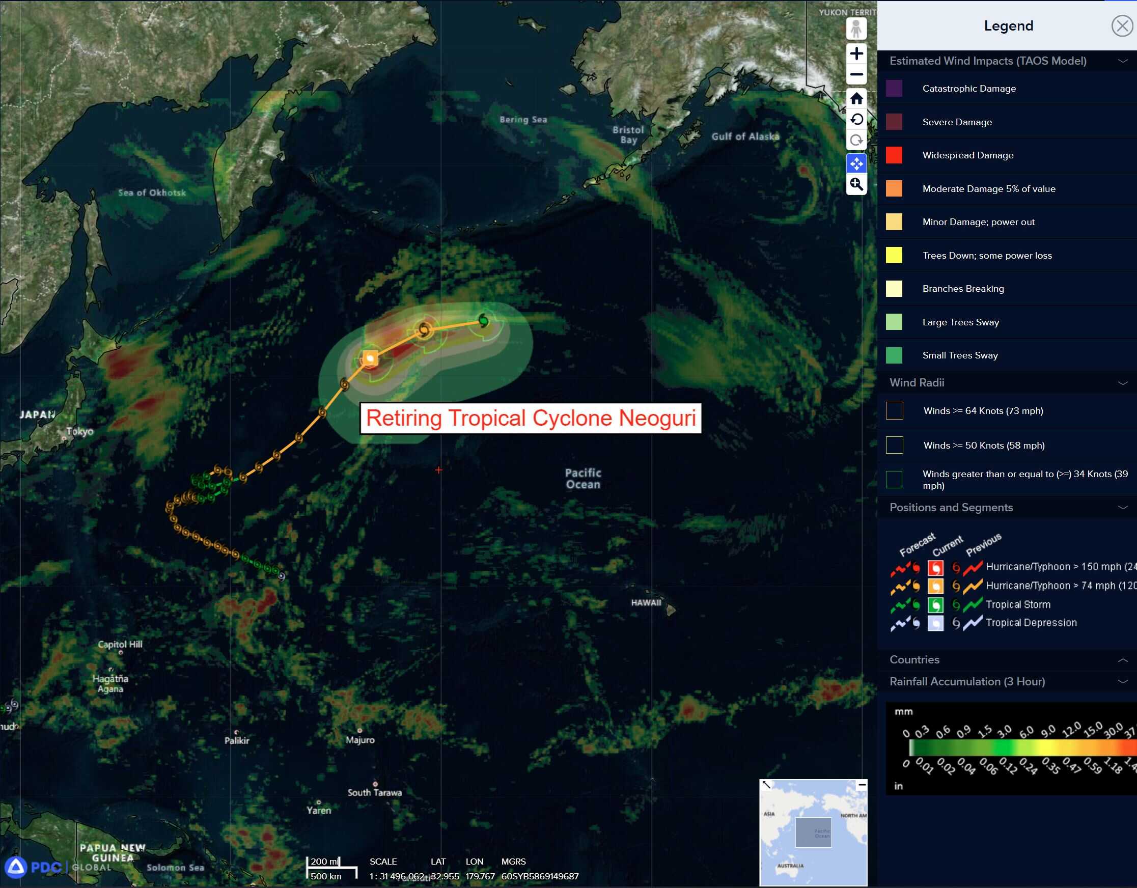
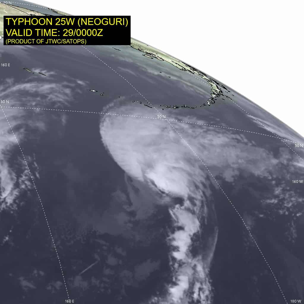
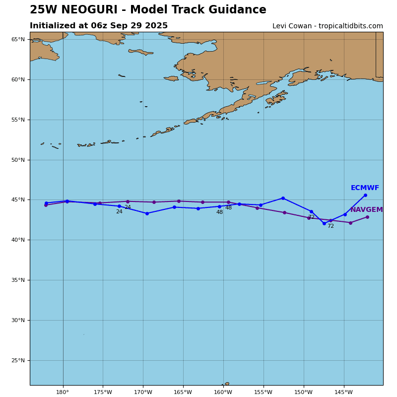
Tropical Cyclone 25W (Neoguri) is located approximately 1417 NM north of Wake Island – Final Warning
Northeast Pacific Ocean:
Well South of the Baja California Peninsula:
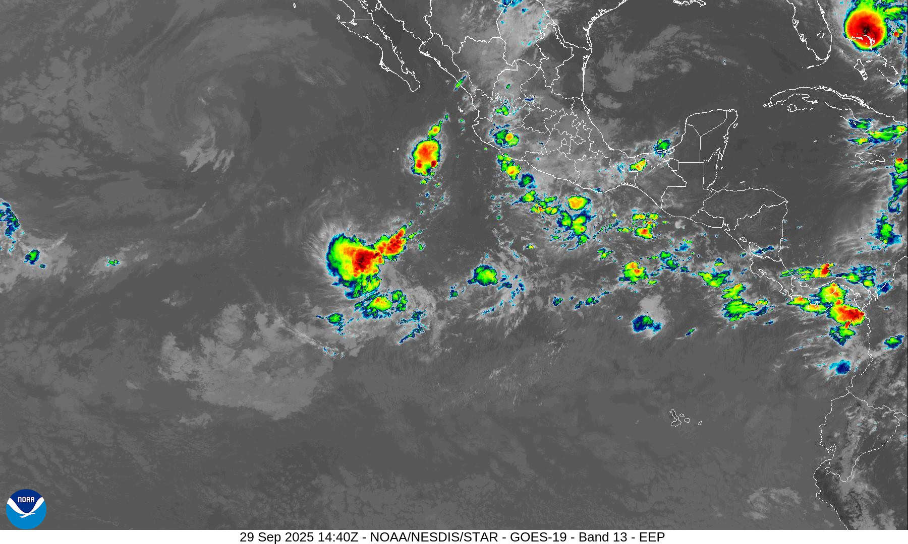
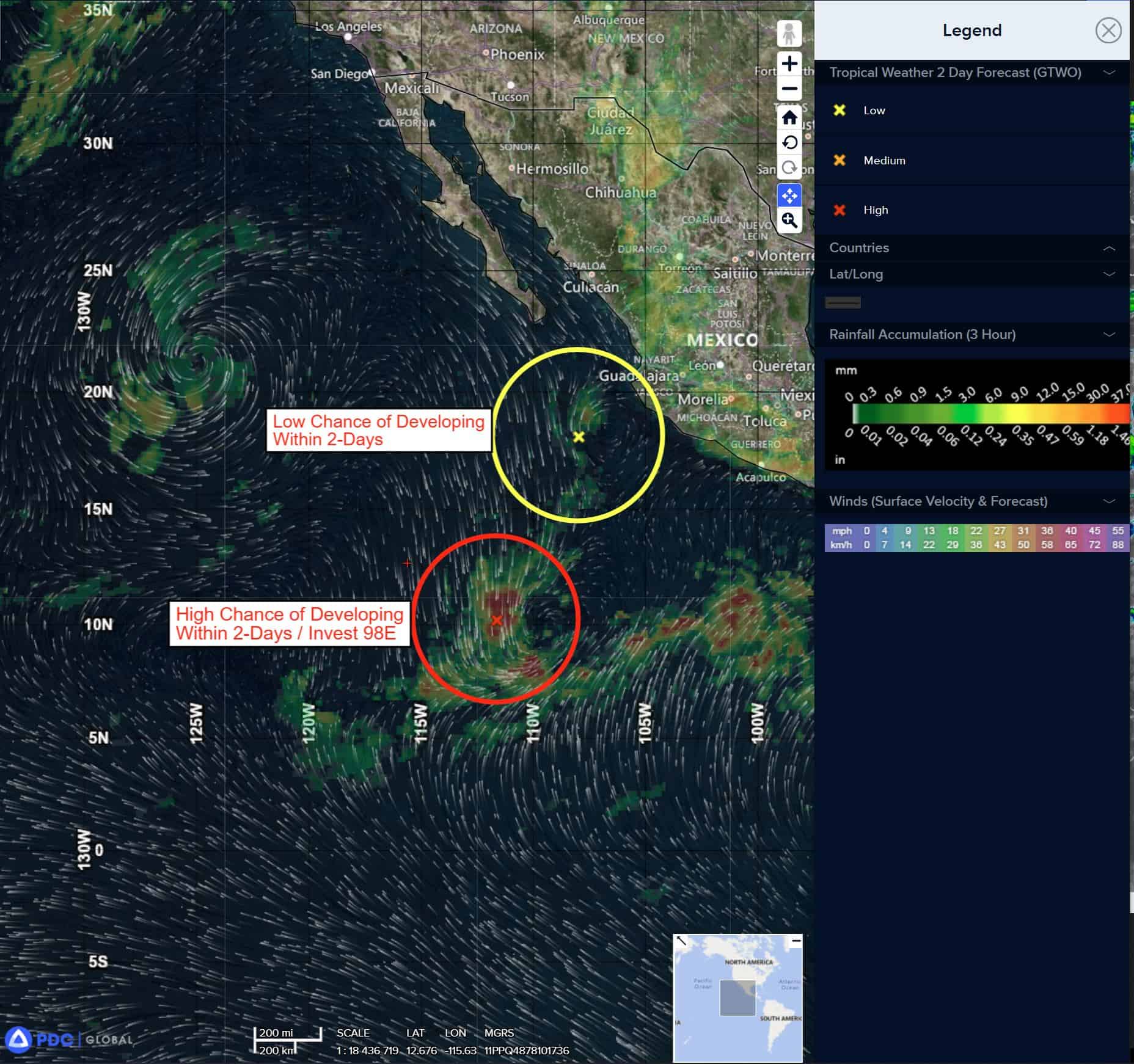
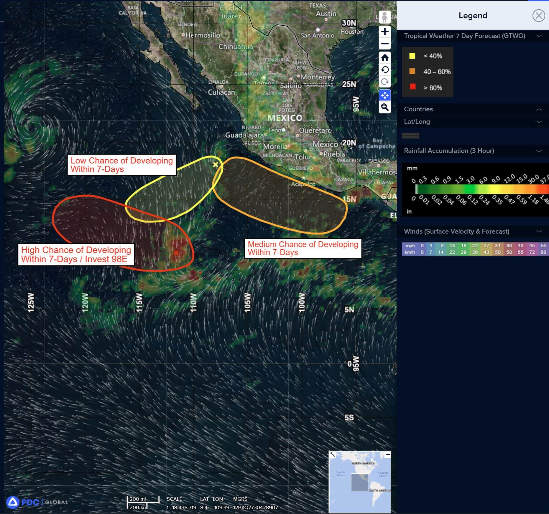
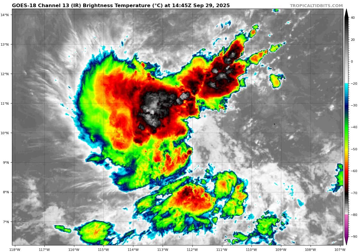
Invest 98E
>>> A small area of low pressure has developed within a broader area of disturbed weather located several hundred miles offshore of the southwest coast of Mexico. First light visible satellite imagery and recent scatterometer imagery suggests a well-defined circulation is developing. In addition, convection continues to show signs of organization. If these trends continue, a tropical depression is likely to form as soon as this afternoon. The system is forecast to drift westward over the next day or so, then turn west-northwestward or northwestward thereafter, remaining over the open waters of the central to western part of the Eastern Pacific.
* Formation chance through 48 hours…high…90 percent
* Formation chance through 7 days…high…90 percent
South of the Baja California Peninsula:
>>> Shower and thunderstorm activity has not become any better organized in association with a small area of low pressure located a few hundred miles west-southwest of Manzanillo, Mexico. Additional development of this system appears unlikely over the next day or two before it is absorbed by a larger area of disturbed weather (EP98) to its southwest.
* Formation chance through 48 hours…low…10 percent
* Formation chance through 7 days…low…10 percent
Near the Southwest Coast of Mexico:
>>> Another area of low pressure is expected to develop off the southwest coast of Mexico near the end of the week. Environmental conditions are forecast to be conducive for additional development of the system thereafter and a tropical depression could form by the early portion of next week as the system moves generally west-northwestward, near the coast of Mexico.
* Formation chance through 48 hours…low…near 0 percent
* Formation chance through 7 days…medium…50 percent
Central Pacific Ocean: There are no Tropical Cyclones
Tropical cyclone formation is not expected during the next 7 days.
Western Pacific, Indian Ocean, and adjacent Seas:
Western Pacific
Tropical Cyclone 25W (Neoguri) – Final Warning
According to the JTWC warning number 43…sustained winds are 90 knots with gusts to near 110 knots.
Typhoon 25W has put on an amazing show over the last couple of days, but it is time to turn off the lights, the party is over. Just in the last six to eight hours, the system has changed remarkably, going from a fully coupled vortex with a 20 NM wide eye, to a rapidly decoupling vortex and clear frontogenesis.
A 282257z ascat-c pass revealed an elongated low level circulation center (llcc), with a very sharp warm frontal region extending to the northeast and a more diffuse cold front extending to the south of the llcc.
Maximum winds in the scatterometer were pegged at 65 knots,
particularly in the northwestern quadrant, likely reflecting the
presence of a sting jet in that region.
The system is undergoing rapid extratropical transition (ett) and will fully transition to a storm force extratropical low within the next 12 hours as it passes south of the Aleutian Islands.
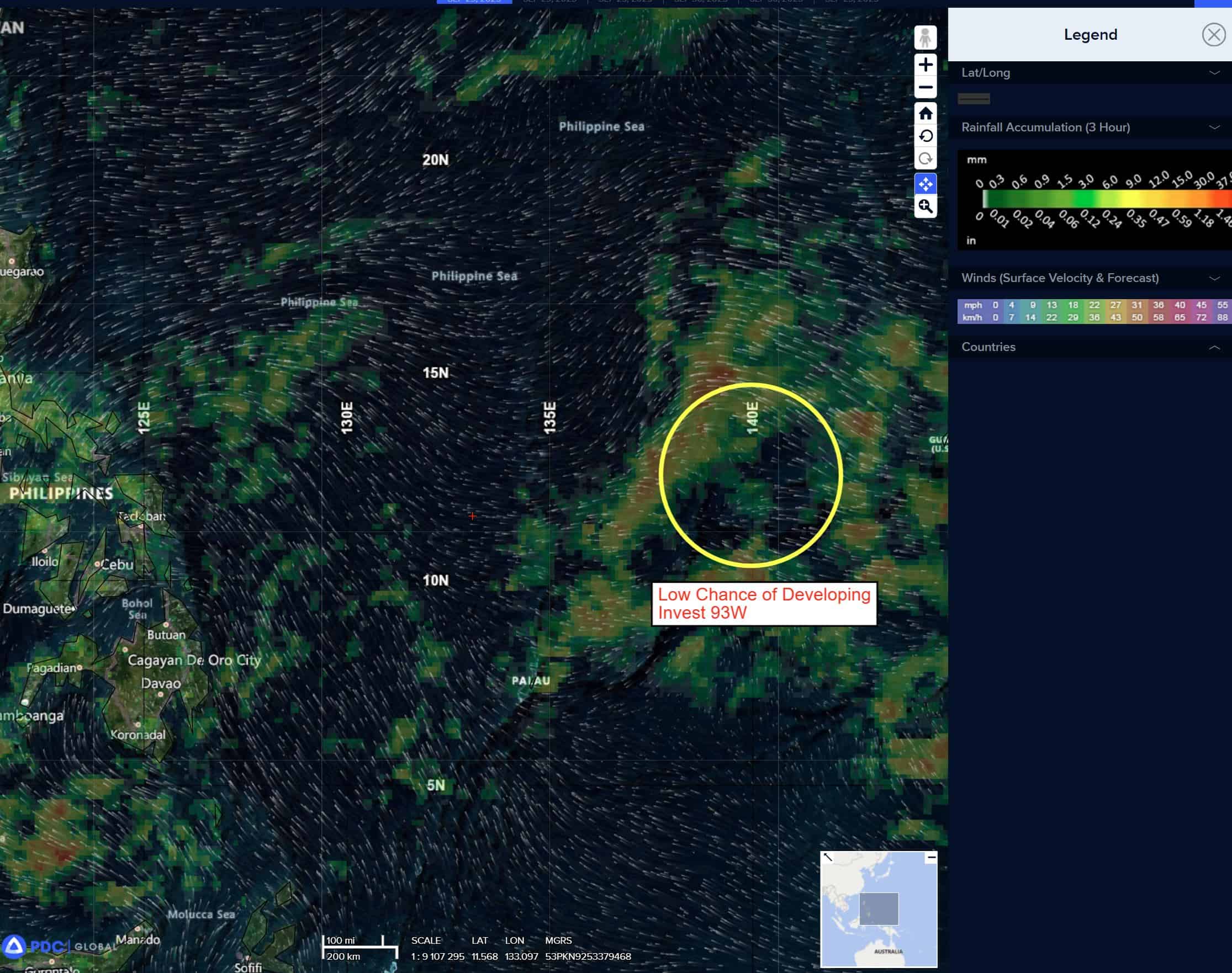
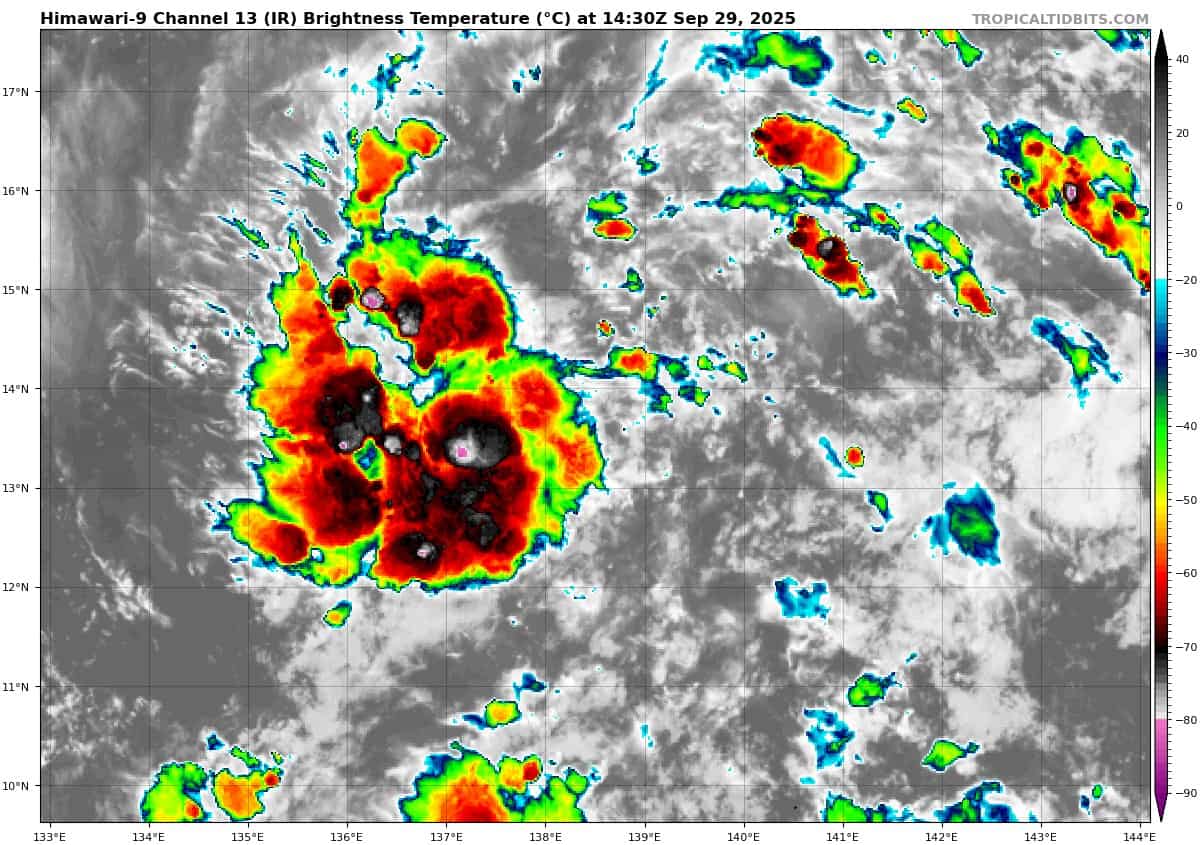
>>> There’s an area of disturbed weather being referred to as Invest 93W, which is located approximately 241 NM north-northeast of Yap.
Animated multi-spectral satellite imagery depicts a weak area of turning with dislodged cells of flaring convection along the western boundary of this poorly defined area.
Environmental conditions are relatively favorable for development with low (5kt-10 knot) vws, warm (28c-30c) ssts and good outflow aloft.
Global deterministic and ensemble models are confident this broad area of displaced convection will consolidate and continue to track westward over the next 36-48 hours.
Maximum sustained surface winds are estimated at 13 to 18 knots.
The potential for the development of a significant tropical cyclone within the next 24 hours is low.
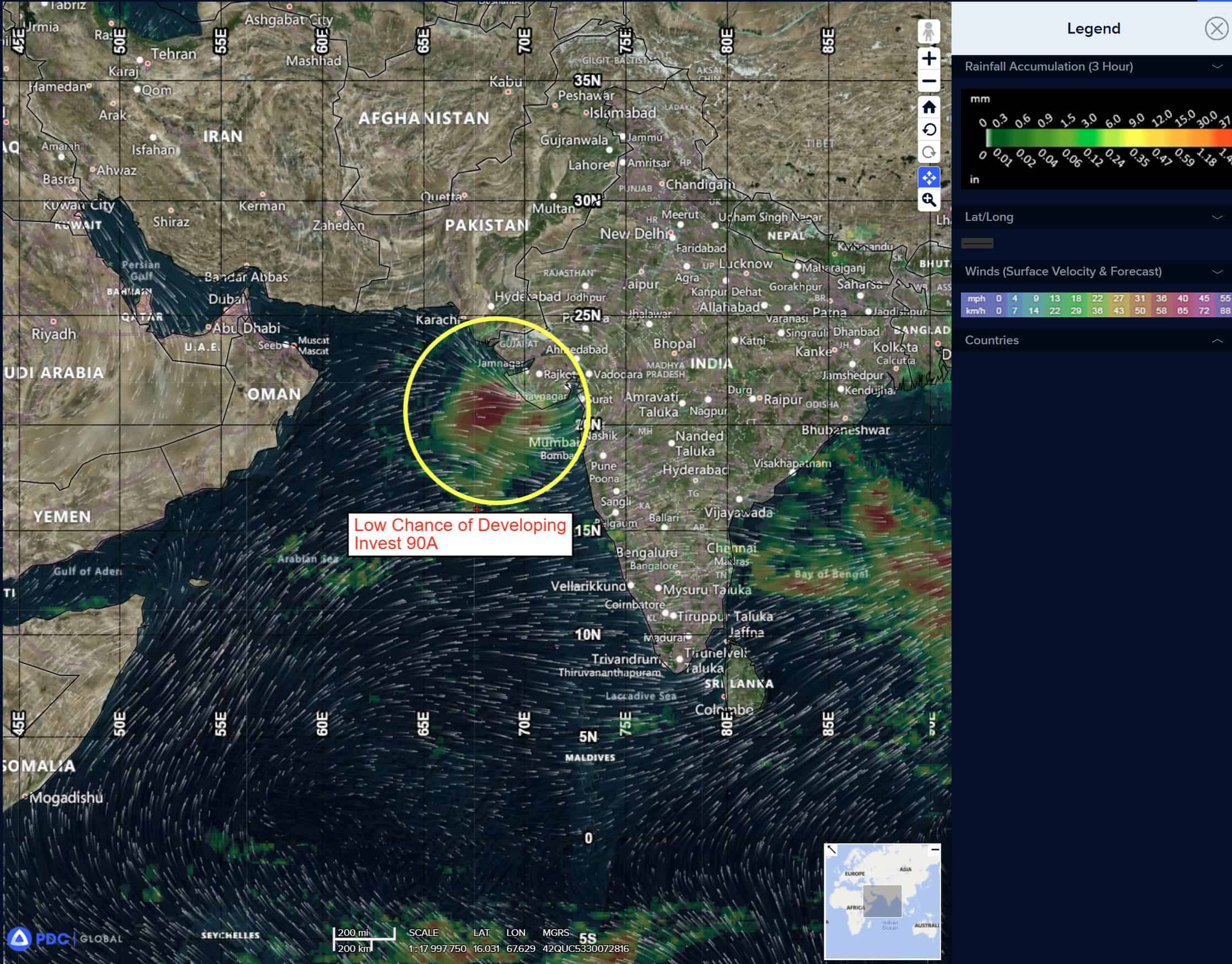
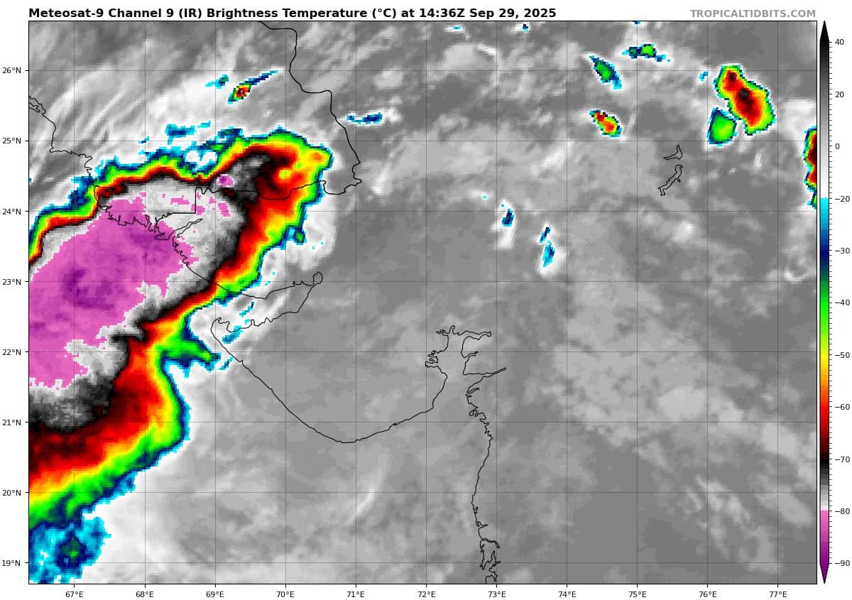
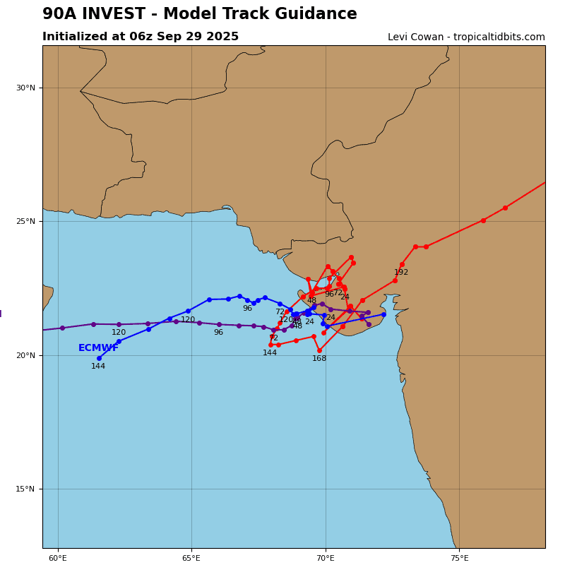
>>> There’s an area of disturbed weather being referred to as Invest 90A, which is located approximately 259 NM east-southeast of Karachi
Animated enhanced infrared (eir) satellite imagery and a 291233z gmi 89 ghz microwave image depict an exposed low level circulation center (llcc) with persistent convection displaced to the west of the llcc. A recent 291500z observation from Porbandar, India shows 10 knot winds from the west.
Environmental analysis reveals a marginal environment for development with low to moderate vertical wind shear (vws) of 15-20 knots, good poleward upper-level outflow, and warm sea surface temperatures (sst) of 28-29 c. however, the system is overland and weak due to frictional effects.
Deterministic and ensemble models are in good agreement with ECMWF being the sole outlier, portraying 90A to maintain its position over land as it tracks northwest toward Karachi, Pakistan over the next 24-48 hours.
Maximum sustained surface winds are estimated at 25 to 30 knots.
The potential for the development of a significant tropical cyclone within the next 24 hours is low.