Western Pacific, Indian Ocean, and adjacent Seas:
Western Pacific

")
By PDC’s Senior Weather
Specialist Glenn James

The Pacific Disaster Center’s (PDC Global) Sunday, September 28, 2025, Tropical Cyclone Activity Report…for the Pacific Ocean, the Indian Ocean, and adjacent Seas
Current Tropical Cyclones:
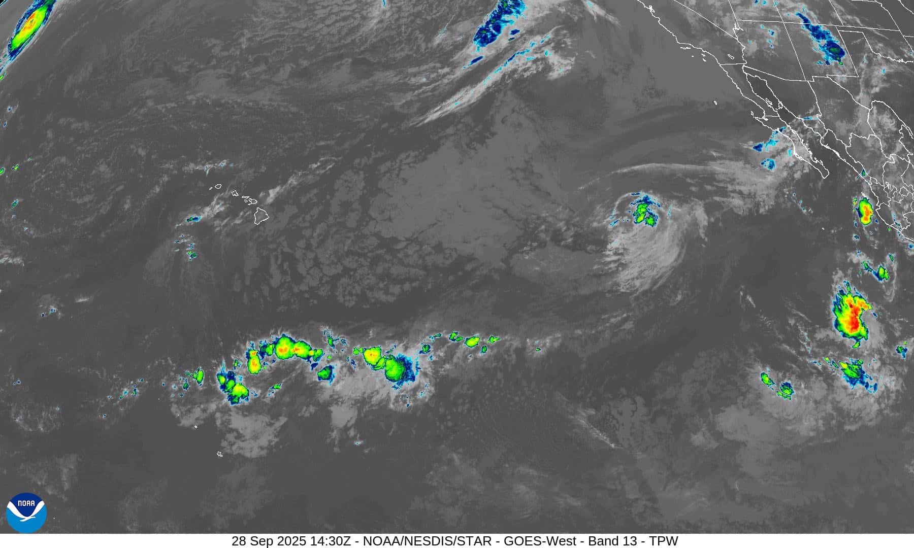
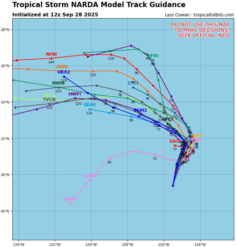
Post-Tropical Cyclone 14E (Narda) is located approximately 985 NM west of the southern tip of Baja CA – Last Advisory
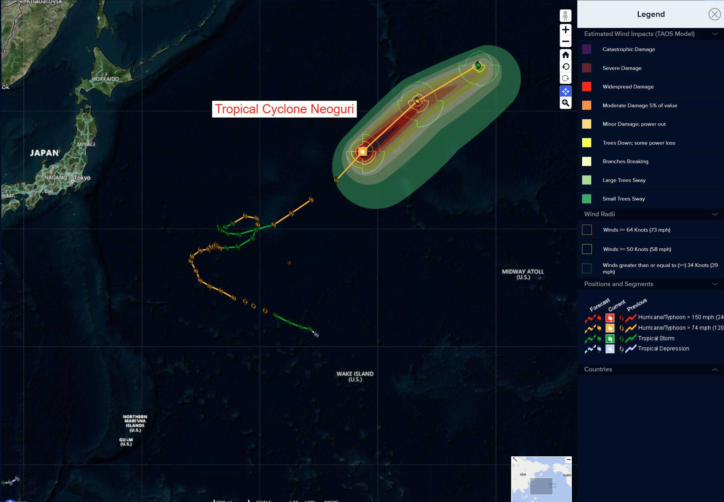
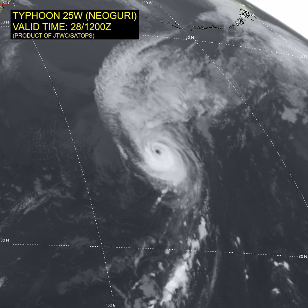
Tropical Cyclone 25W (Neoguri) is located approximately 1417 NM north of Wake Island – Final Warning
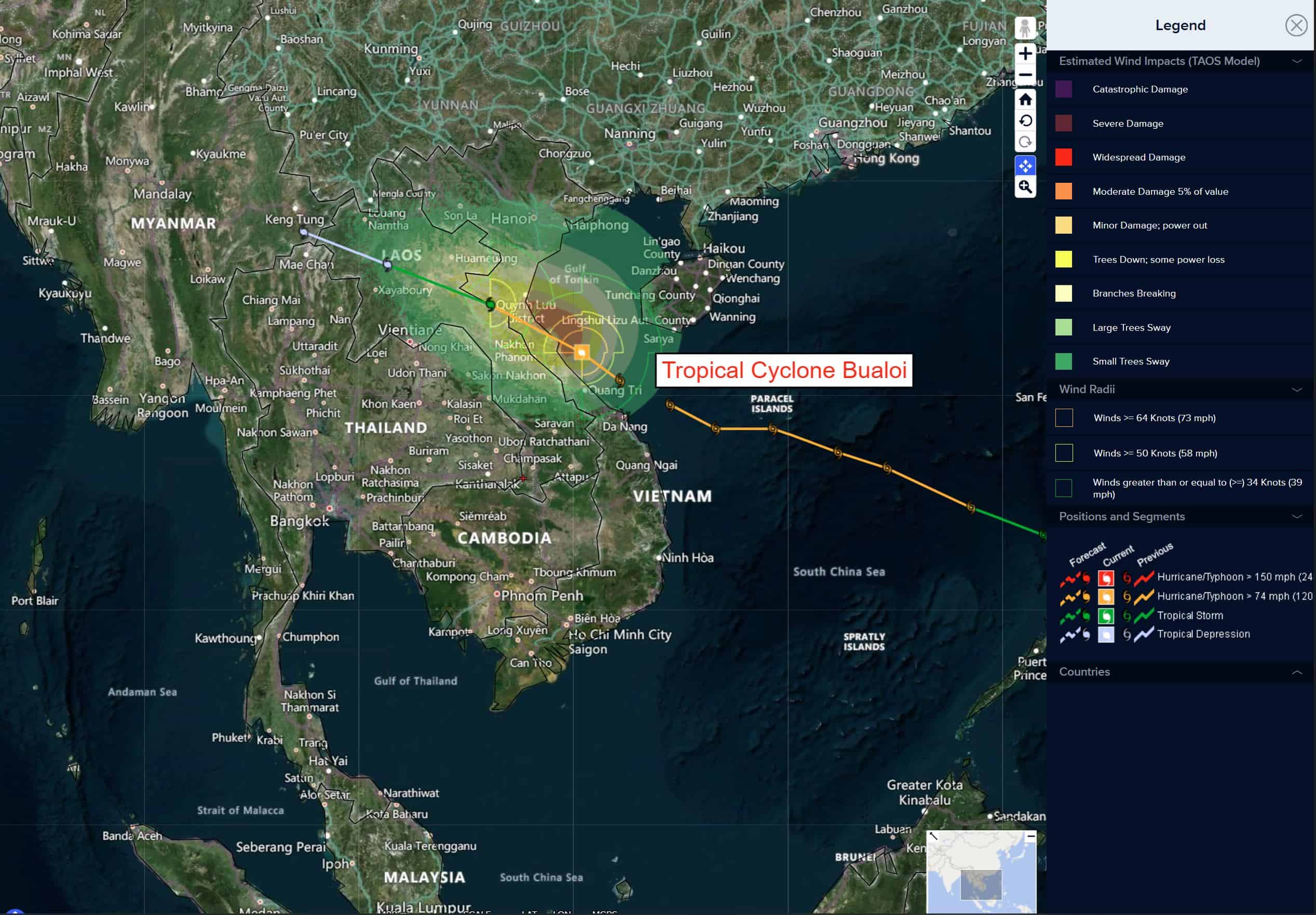
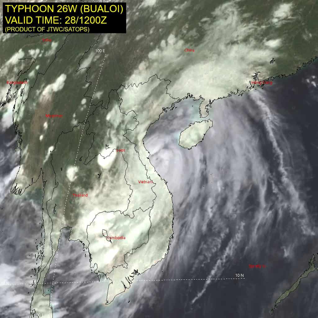
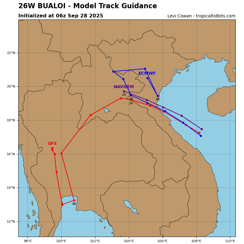
Tropical Cyclone 26W (Bualoi) is located approximately 169 NM south of Hanoi, Vietnam – Final Warning
Northeast Pacific Ocean:
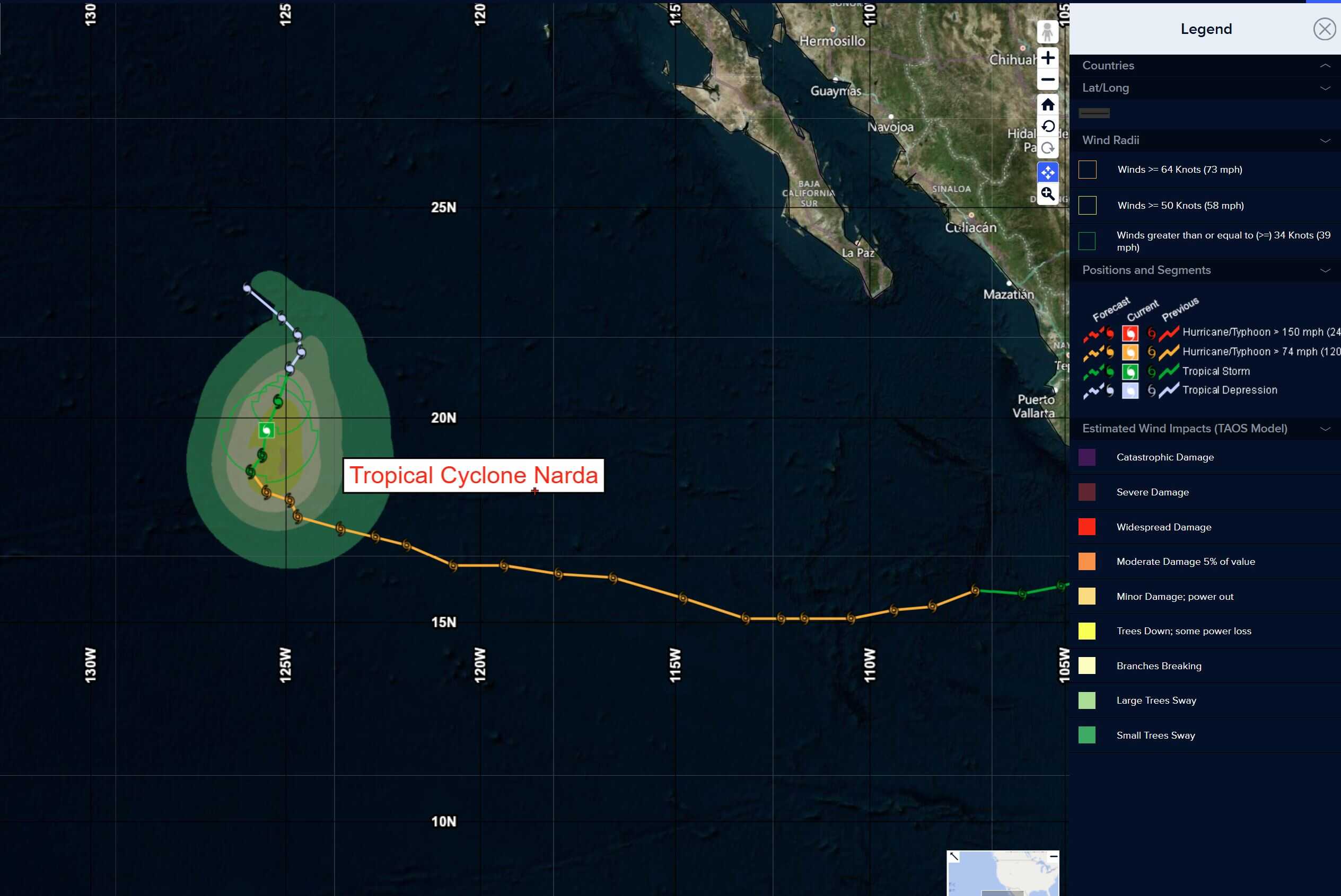
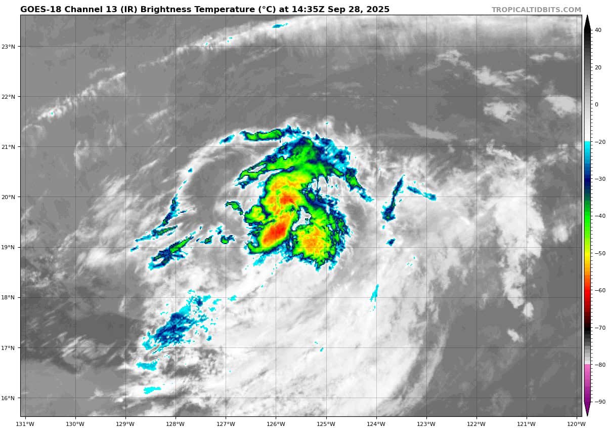
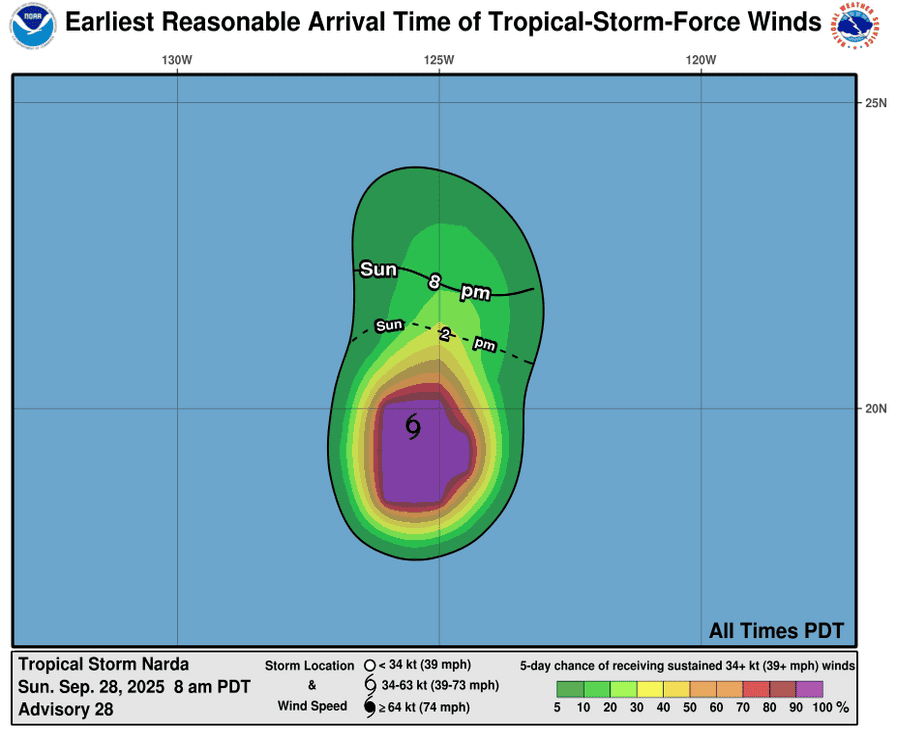
Post-Tropical Cyclone Narda – Last Advisory
NARDA HAS BECOME A REMNANT LOW
According to the NHC advisory number 28
The post-tropical cyclone is moving toward the north-northeast near 6 mph (9 km/h) and this motion is expected to persist into Monday. A gradual turn toward the northwest is expected by Tuesday. Maximum sustained winds are near 35 mph (55 km/h) with higher gusts. Some additional weakening is forecast, and the remnant low is forecast to dissipate by Thursday. The estimated minimum central pressure is 1009 mb (29.80 inches).
HAZARDS AFFECTING LAND
Surf: Swells generated by Narda are affecting portions of the coast of west-central Mexico, the Baja California peninsula, and southern California. These swells are likely to cause life-threatening surf and rip current conditions.
Well Southwest of the Southwest Coast of Mexico:
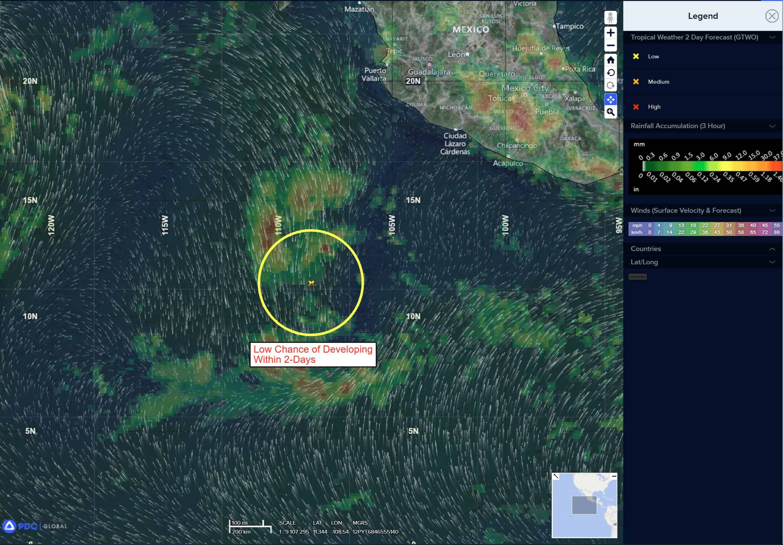
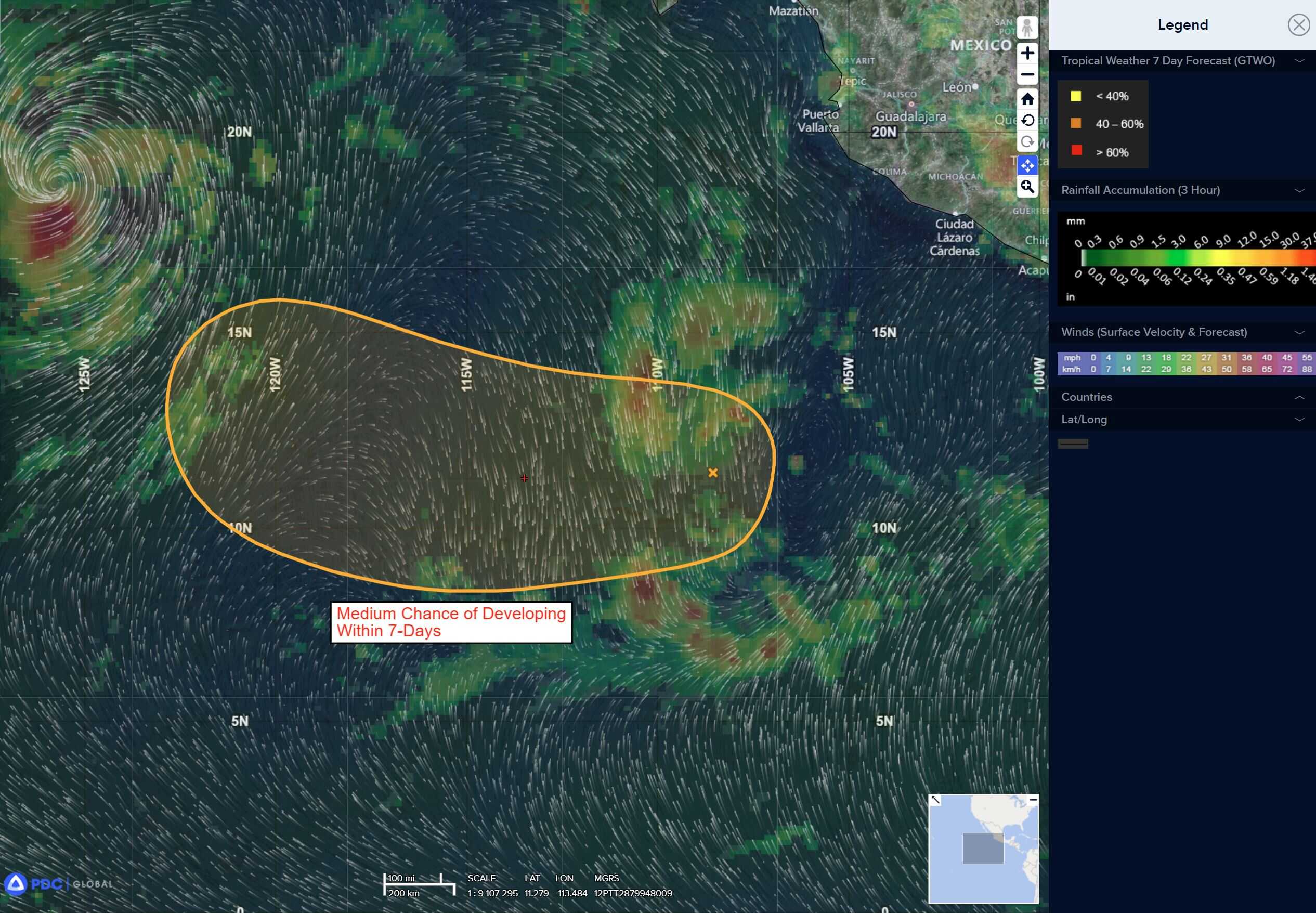
Invest 98E
>>> A disorganized area of disturbed weather associated with a tropical wave is located several hundred miles offshore of southwest Mexico. Environmental conditions are expected to be conducive for gradual development of this system and a tropical depression could form around the middle portion of this week while the system moves generally westward around 10 mph.
* Formation chance through 48 hours…high…70 percent
* Formation chance through 7 days…high…90 percent
Central Pacific Ocean: There are no Tropical Cyclones
Tropical cyclone formation is not expected during the next 7 days.
Western Pacific, Indian Ocean, and adjacent Seas:
Western Pacific
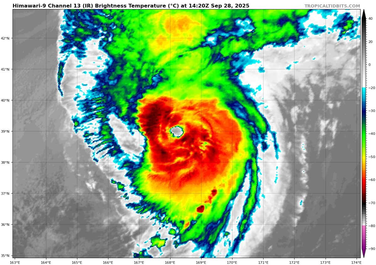
Tropical Cyclone 25W (Neoguri) – Final Warning
According to the JTWC warning number 43…sustained winds are 90 knots with gusts to near 110 knots.
Typhoon 25W has put on an amazing show over the last couple of days, but it is time to turn off the lights, the party is over. Just in the last six to eight hours, the system has changed remarkably, going from a fully coupled vortex with a 20 NM wide eye, to a rapidly decoupling vortex and clear frontogenesis.
A 282257z ascat-c pass revealed an elongated low level circulation center (llcc), with a very sharp warm frontal region extending to the northeast and a more diffuse cold front extending to the south of the llcc.
Maximum winds in the scatterometer were pegged at 65 knots,
particularly in the northwestern quadrant, likely reflecting the
presence of a sting jet in that region.
The system is undergoing rapid extratropical transition (ett) and will fully transition to a storm force extratropical low within the next 12 hours as it passes south of the Aleutian Islands.
Tropical Cyclone 26W (Bualoi) – Final Warning
According to the JTWC warning number 22…sustained winds are 80 knots with gusts to near 100 knots.
Based on radar analysis, the eye of typhoon 26W 281600z hour and has continued to skirt northwestward along the coastline through the 251800z hour. at 1800z, the eye was located in the vicinity of Ha Tinh and should pass south of Vinh within the next few hours.
The system rapidly intensified over the previous 12 hours, and a 281104z rcm-2 sar pass revealed a wide swath of winds exceeding 80-90 knots, resulting in a reanalysis of the previous intensity estimates upward to 85 knots.
The system is forecast to continue to track northwestward while rapidly weakening as it tracks into Laos and ultimately dissipates over northeastern Myanmar by 36 hours.