Western Pacific, Indian Ocean, and adjacent Seas:
Western Pacific

")
By PDC’s Senior Weather
Specialist Glenn James

The Pacific Disaster Center’s (PDC Global) Saturday, September 27, 2025, Tropical Cyclone Activity Report…for the Pacific Ocean, the Indian Ocean, and adjacent Seas
Current Tropical Cyclones:
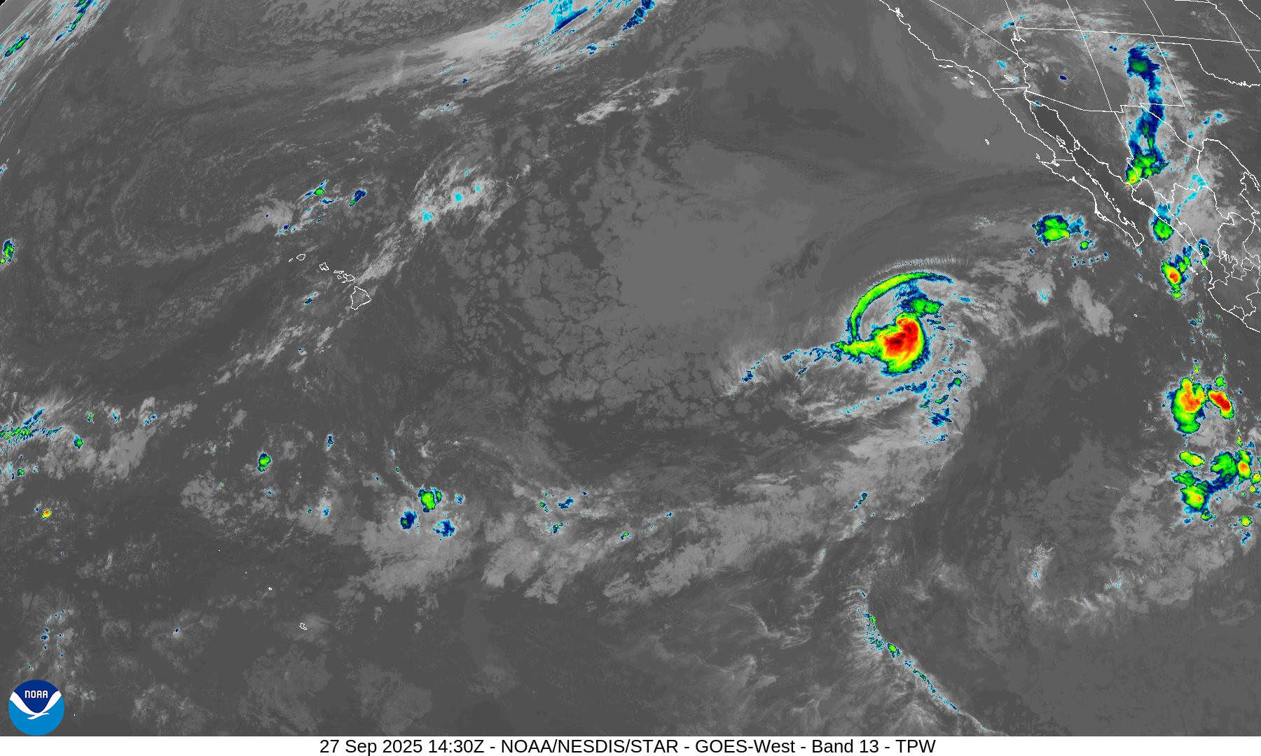
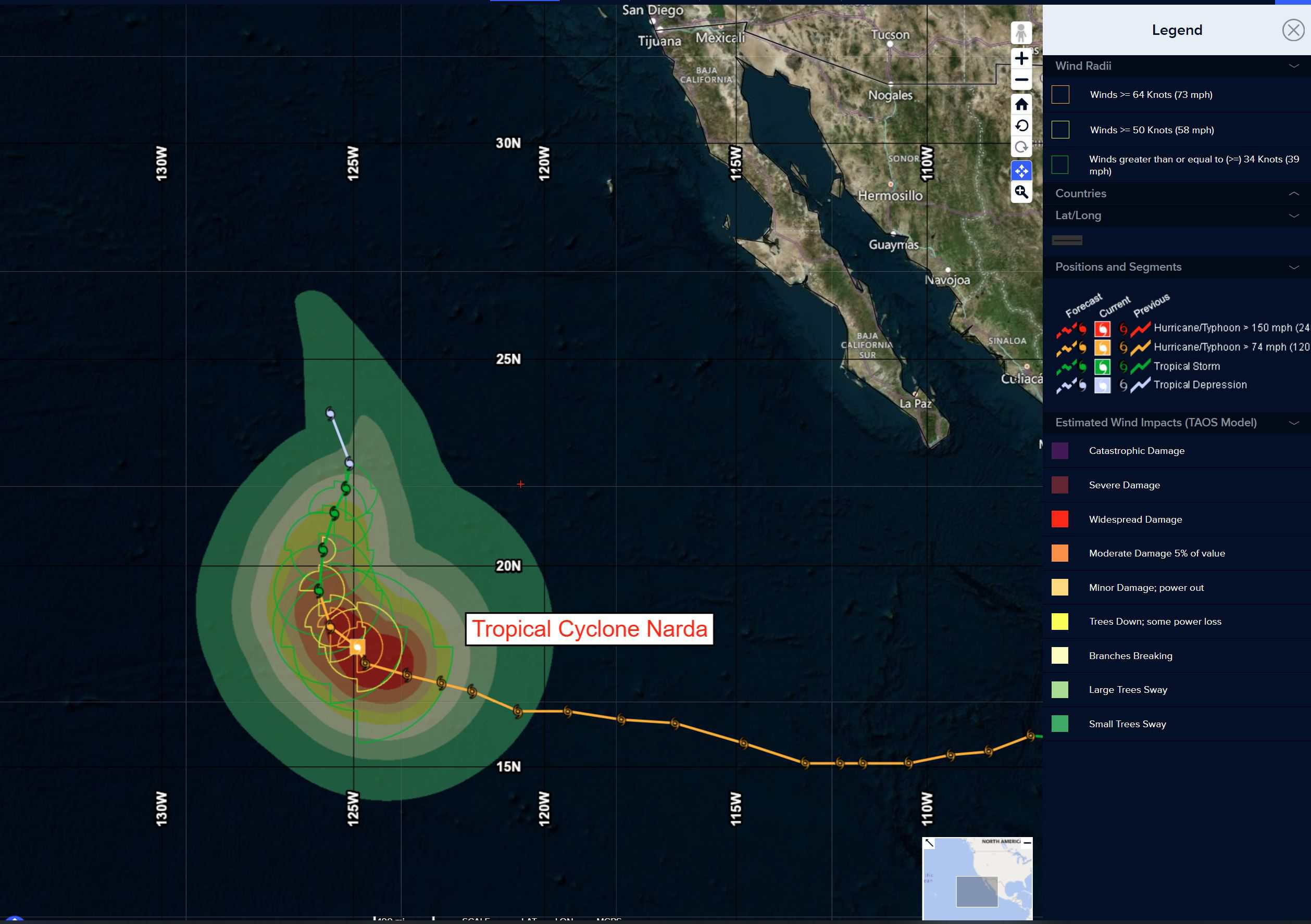
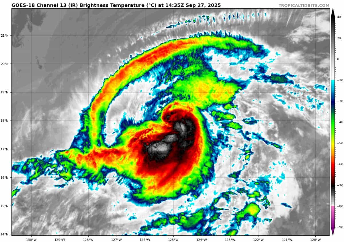
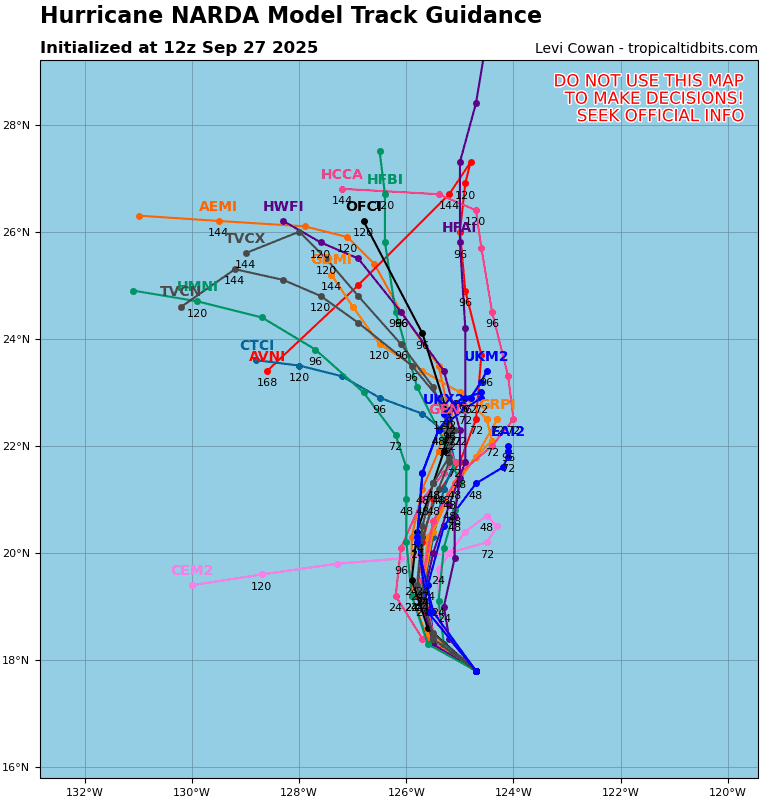
Tropical Cyclone 14E (Narda) is located approximately 1025 NM west-southwest of the southern tip of Baja CA
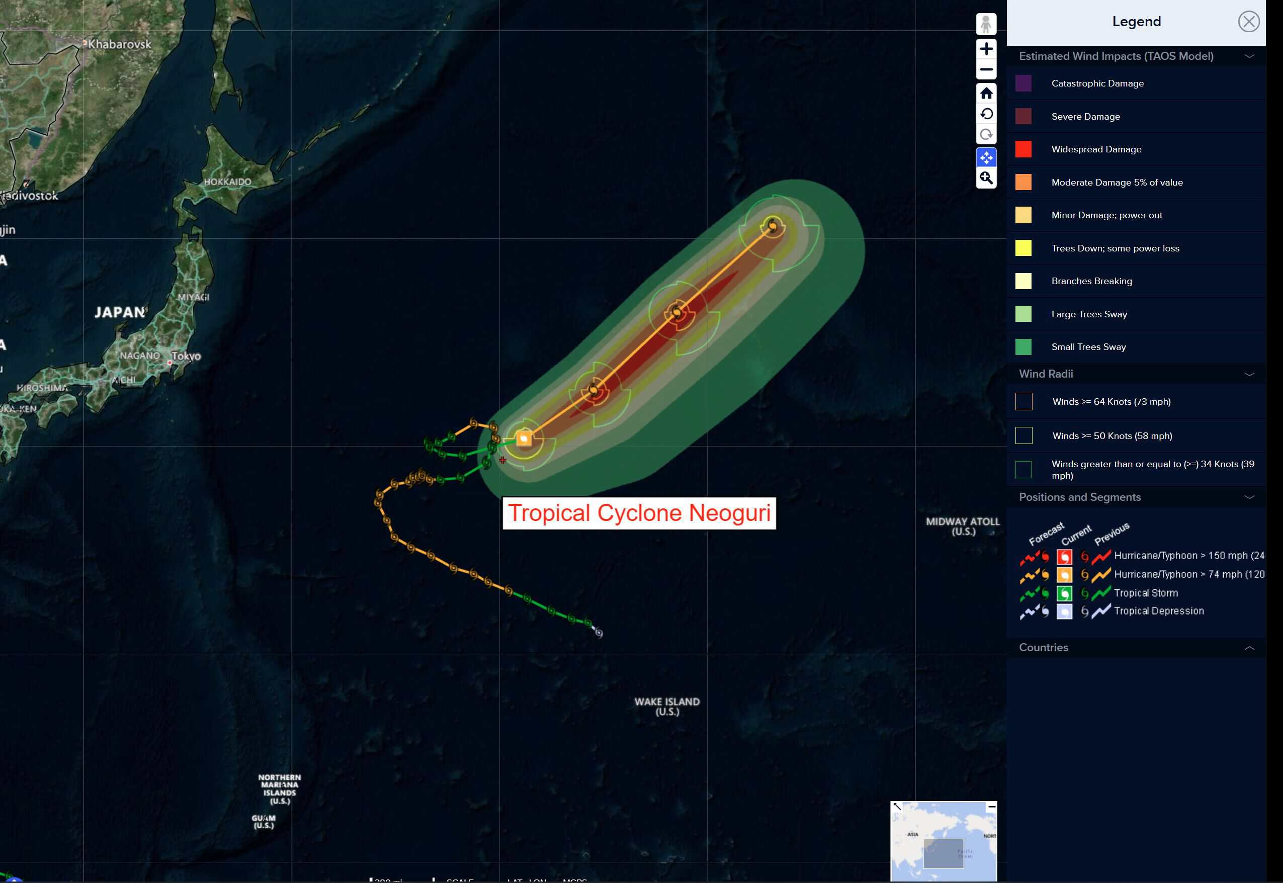
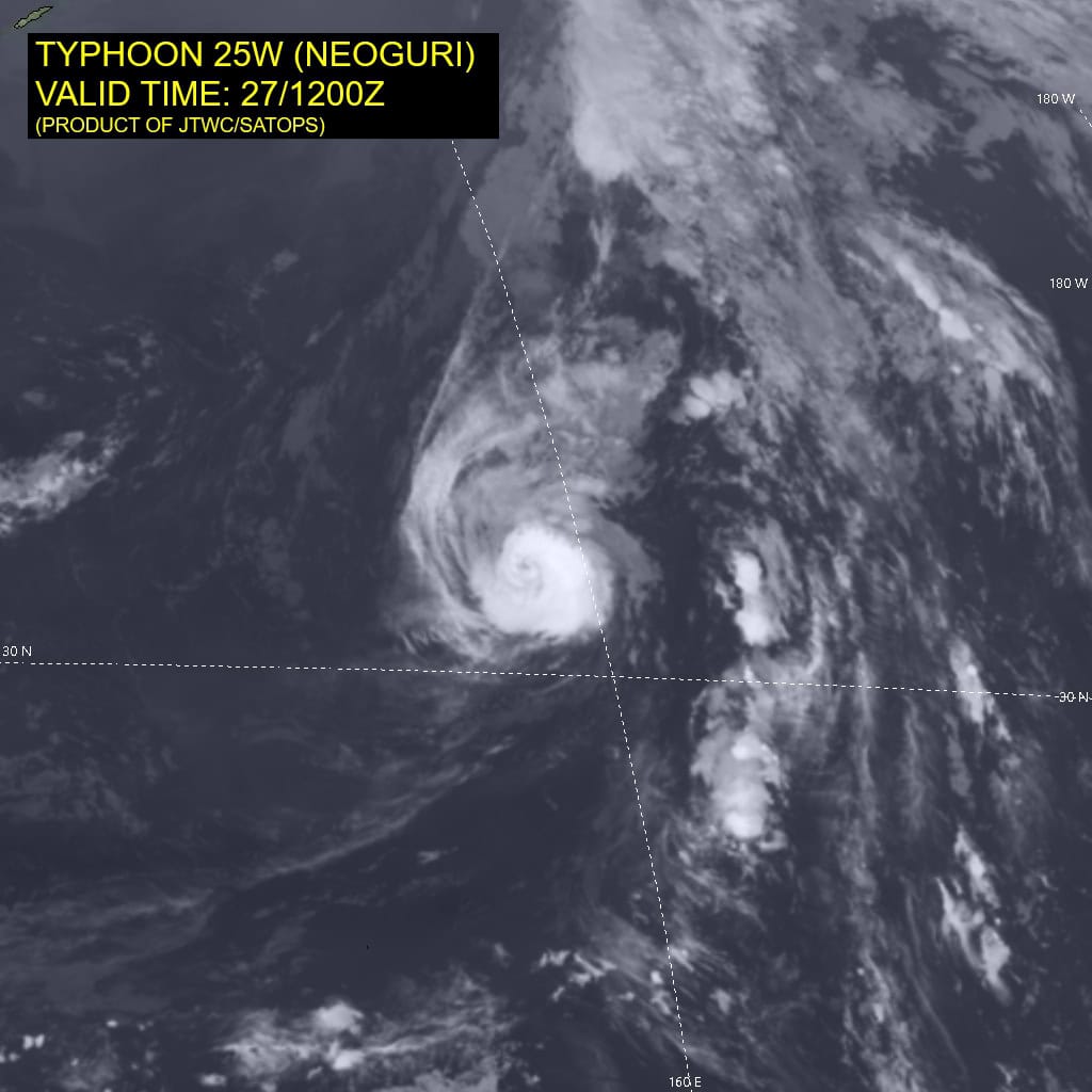
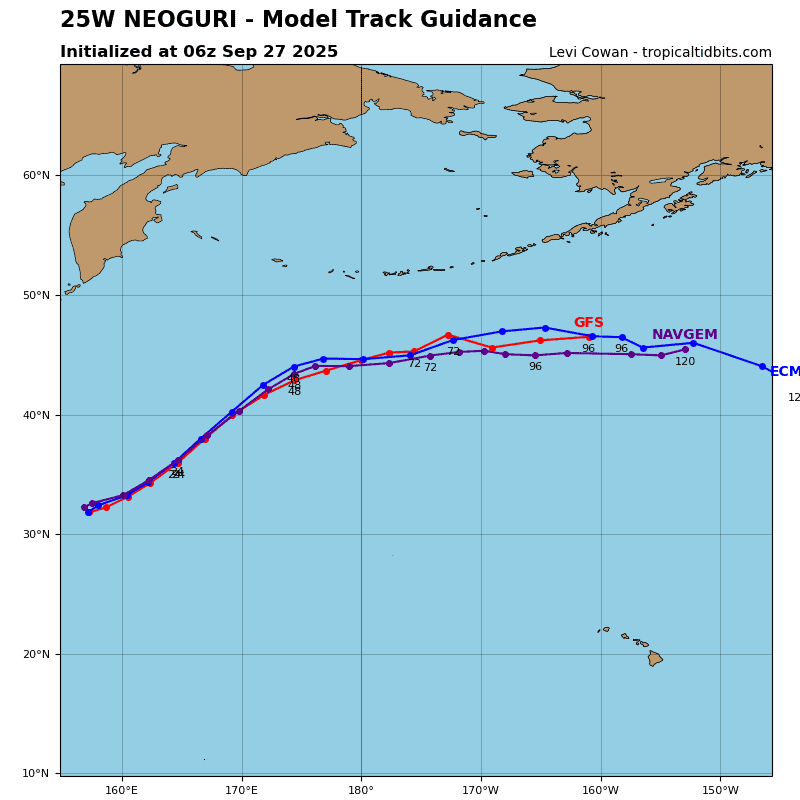
Tropical Cyclone 25W (Neoguri) is located approximately 548 NM north-northeast of Minami Tori Shima
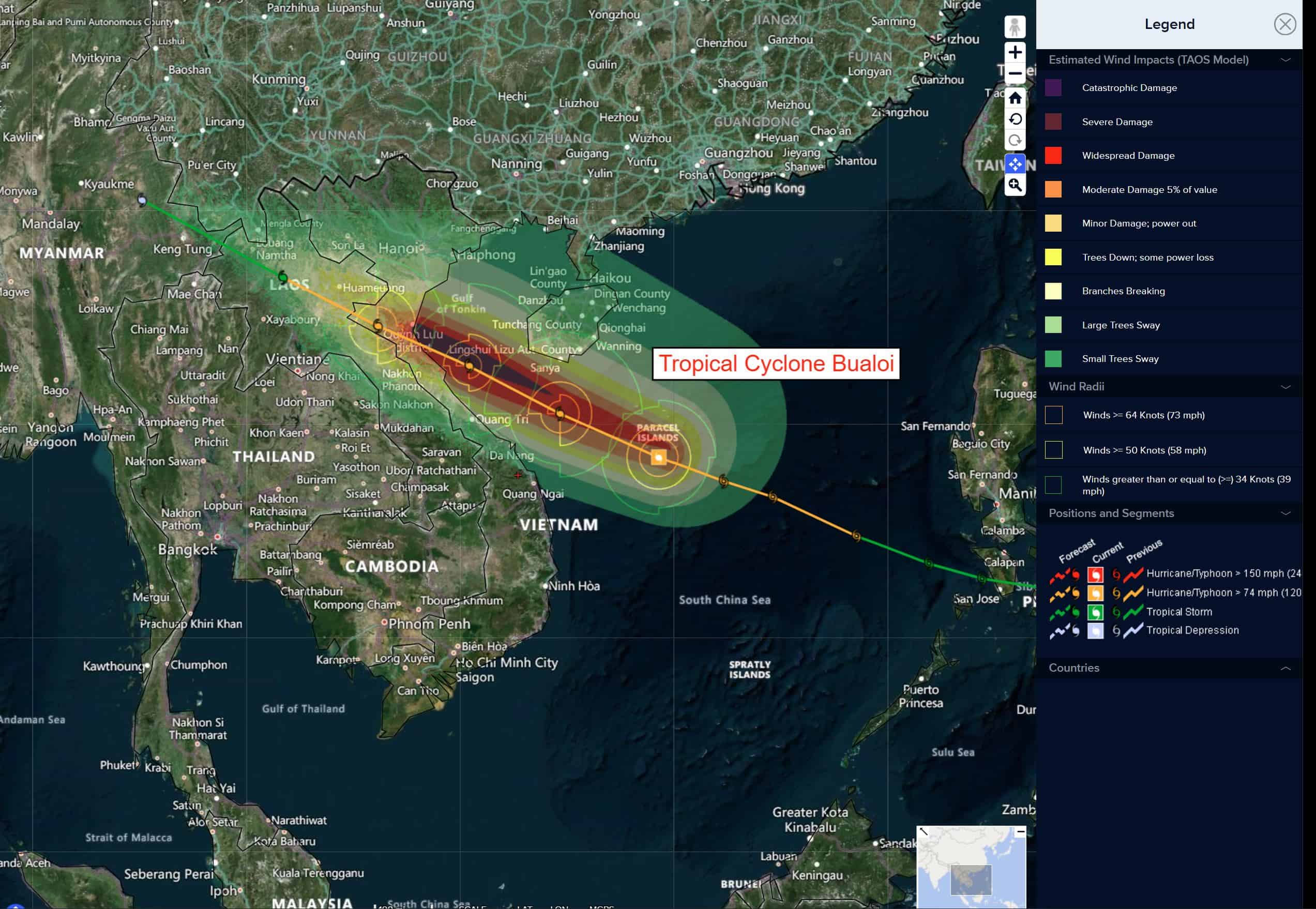
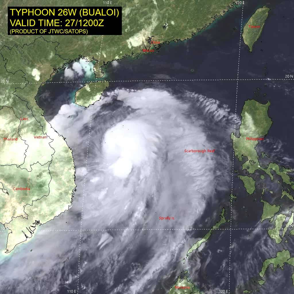
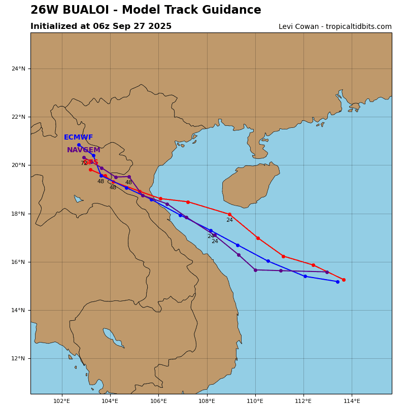
Tropical Cyclone 26W (Bualoi) is located approximately 220 NM east of Da Nang, Vietnam
Northeast Pacific Ocean:
Tropical Cyclone Narda
NARDA EXPECTED TO BEGIN WEAKENING SOON
According to the NHC advisory number 24
Narda is moving toward the west-northwest near 9 mph (15 km/h). A gradual turn toward the north with a decrease in forward speed is forecast during the next day or so. Maximum sustained winds remain near 90 mph (150 km/h) with higher gusts. Gradual weakening is expected to begin later today, and Narda is forecast to weaken below hurricane strength tonight or early Sunday. Hurricane-force winds extend outward up to 45 miles (75 km) from the center and tropical-storm-force winds extend outward up to 175 miles (280 km). The estimated minimum central pressure is 979 mb (28.91 inches).
HAZARDS AFFECTING LAND
Surf: Swells generated by Narda are affecting portions of the coast of west-central Mexico and portions of the Baja California peninsula. The swells should reach southern California later today or tonight. These swells are likely to cause life-threatening surf and rip current conditions.
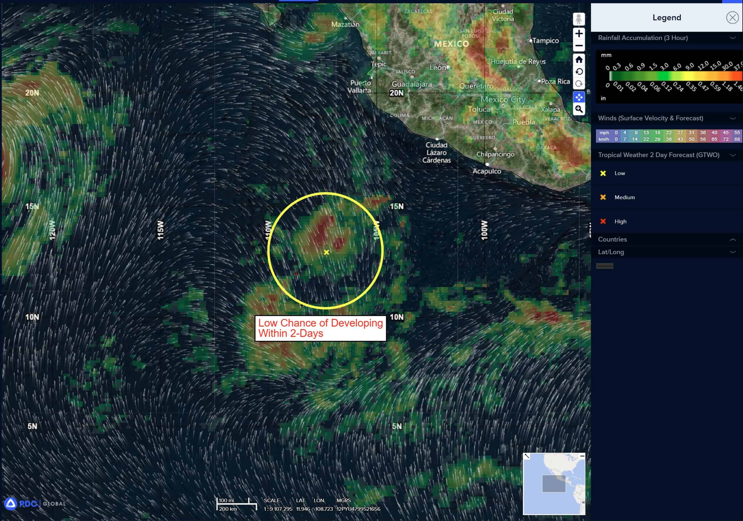
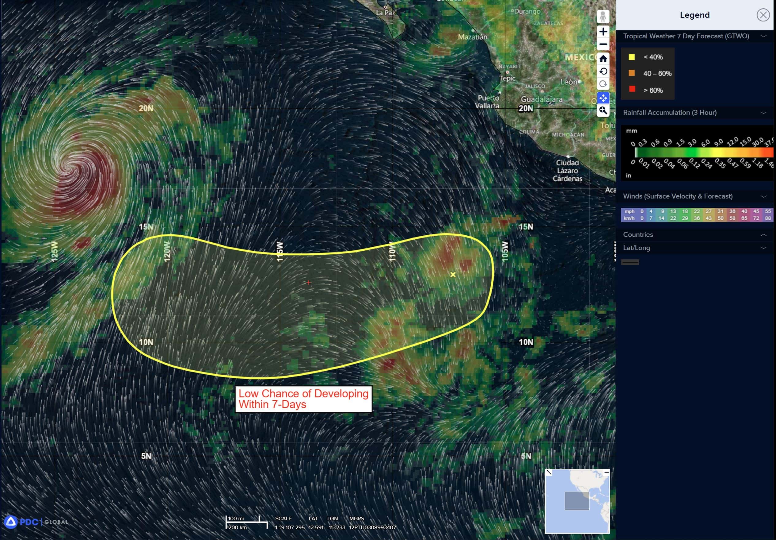
Well Southwest of the Southwest Coast of Mexico:
>>> An area of disturbed weather is located a few hundred miles southwest of the southwest coast of Mexico. The system is producing a small area of concentrated thunderstorms, but it does not appear to have a surface wind circulation. Environmental conditions are expected to be marginally conducive for gradual development of this system while it moves slowly west-southwestward, then westward through most of next week.
* Formation chance through 48 hours…low…10 percent
* Formation chance through 7 days…low…20 percent
Central Pacific Ocean: There are no Tropical Cyclones
Tropical cyclone formation is not expected during the next 7 days.
Western Pacific, Indian Ocean, and adjacent Seas:
Western Pacific
Tropical Cyclone 25W (Neoguri)
According to the JTWC warning number 37…sustained winds are 65 knots with gusts to near 80 knots.
Animated multi-spectral satellite imagery (msi) depicts tropical storm 25W (Neoguri) on a northeastward track, under a primary influence from a subtropical ridge (str) to the east-northeast. While the system is approaching the axis of the ridge, it still remains within a marginally favorable, tropical environment characterized by low (10-15 kts) vertical wind shear (vws), relatively warm (27-28 c) sea surface temperatures (sst) and strong poleward outflow.
The vortex remains fairly symmetrical and the system is managing to maintain a moist core, despite surrounding dry air. The initial position is placed with high confidence based on animated visible satellite imagery showing distinct, curved convective wrapping into the predominantly obscured low-level circulation center (llcc).
TS 25W is forecast to continue its northeastward track under the influence of a str to the east-northeast throughout its tropical lifecycle phase. Intensity guidance and environmental analysis indicates that the system will slightly intensify over the next 24 hours. Around 36 hours however, TS Neoguri will encounter significantly cooler (23-24 c) ssts, as well as drastically increasing vws associated with an approaching upper-level shortwave trough.
Simultaneously, the system is expected to begin its extratropical transition, which is expected to conclude around 48 hours. cold ssts, injection of dry air and increasing vws will result in a weakening trend toward the end of the forecast period.
Tropical Cyclone 26W (Bualoi)
According to the JTWC warning number 17…sustained winds are 75 knots with gusts to near 90 knots.
Animated multi-spectral satellite imagery (msi) depicts persistent central convection associated with typhoon 26W (Bualoi), as well as pulsating radial outflow bursts paired with moderate equatorward outflow channel. While the convection is vigorous, the system still struggles to achieve full vortex symmetry, as a result of slight pressure and dry air centered over the northern
semicircle of the circulation.
Additional environmental analysis however, indicates otherwise favorable environment, characterized by low (10-15 kts) vertical wind shear (vws) and warm (28-29 c) sea surface temperatures (sst).
TY 26W is forecast to continue tracking northwestward along the periphery of a str to the northeast. The environment is expected to remain favorable throughout landfall over northern Vietnam and the system is forecast to reach peak intensity of approximately 95 knots around 24 hours.
Within the next 12 hours, numerical model guidance indicates that TY 26W will be able to overcome the dry air intrusion from the north, while becoming more symmetrical. After that, particularly closer to 36 hours, proximity to land and its frictional effects on the wind field will result in gradual weakening, which is expected to rapidly increase after landfall.