Western Pacific, Indian Ocean, and adjacent Seas:
Western Pacific

")

By PDC’s Senior Weather
Specialist Glenn James

The Pacific Disaster Center’s (PDC Global) Friday, September 26, 2025, Tropical Cyclone Activity Report…for the Pacific Ocean, the Indian Ocean, and adjacent Seas
Current Tropical Cyclones:
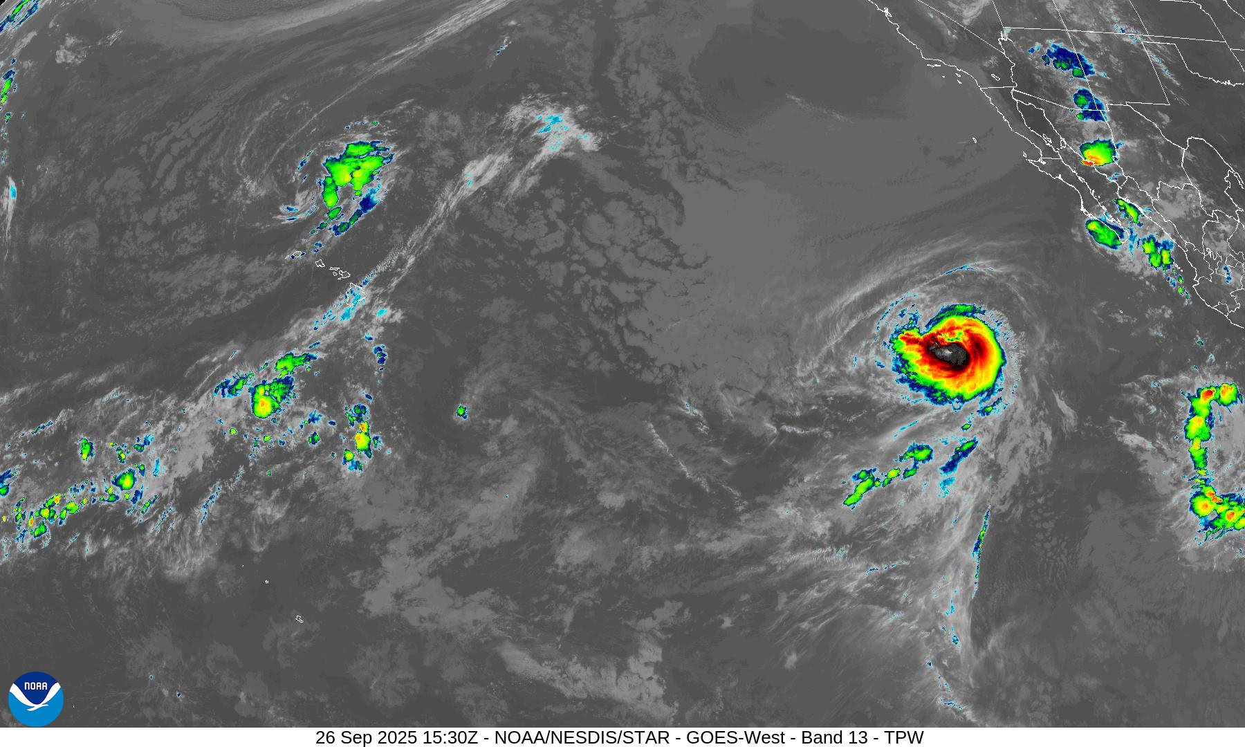
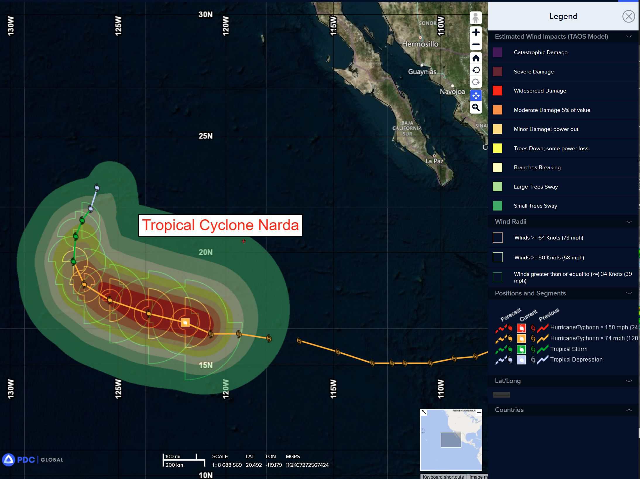
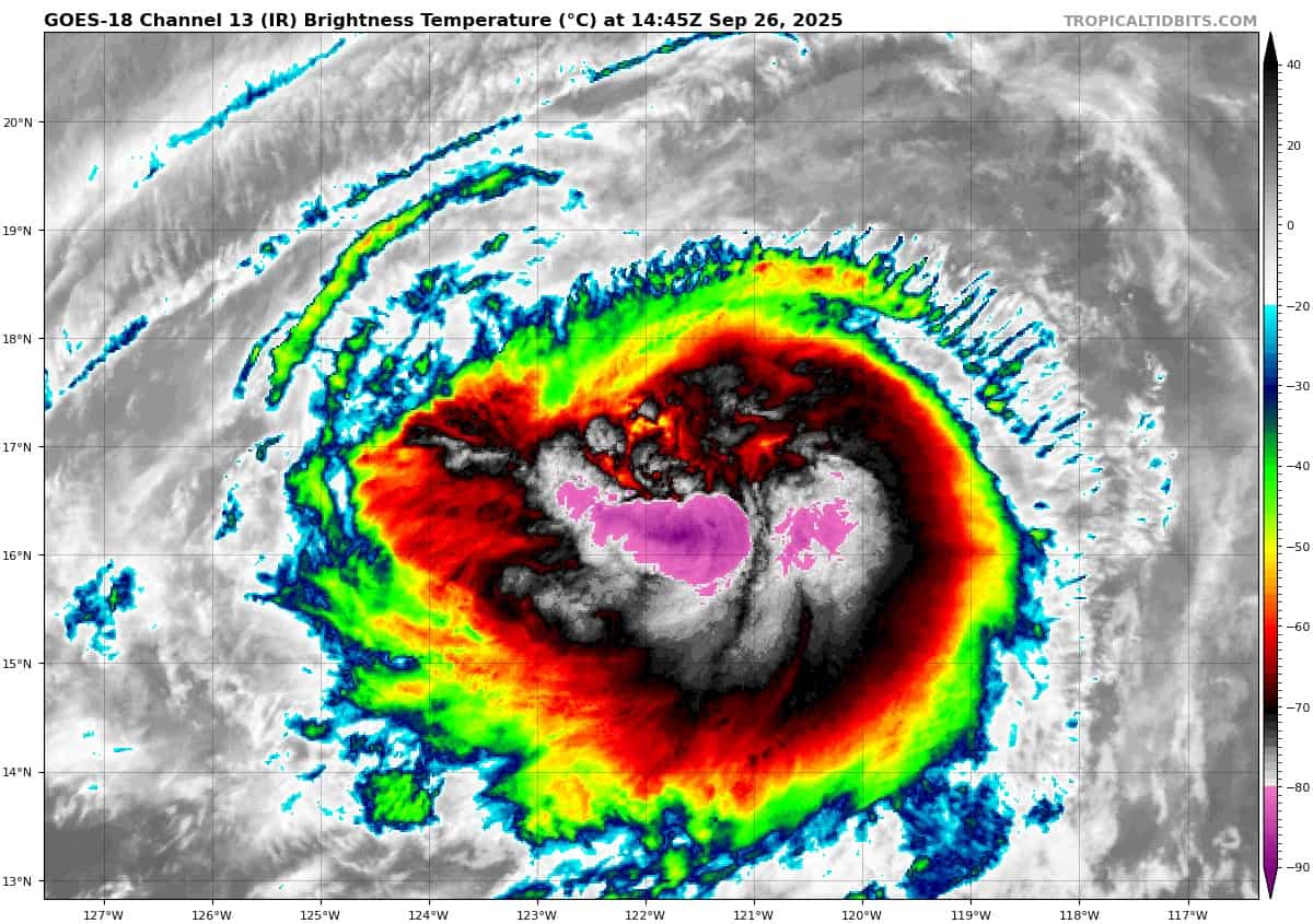
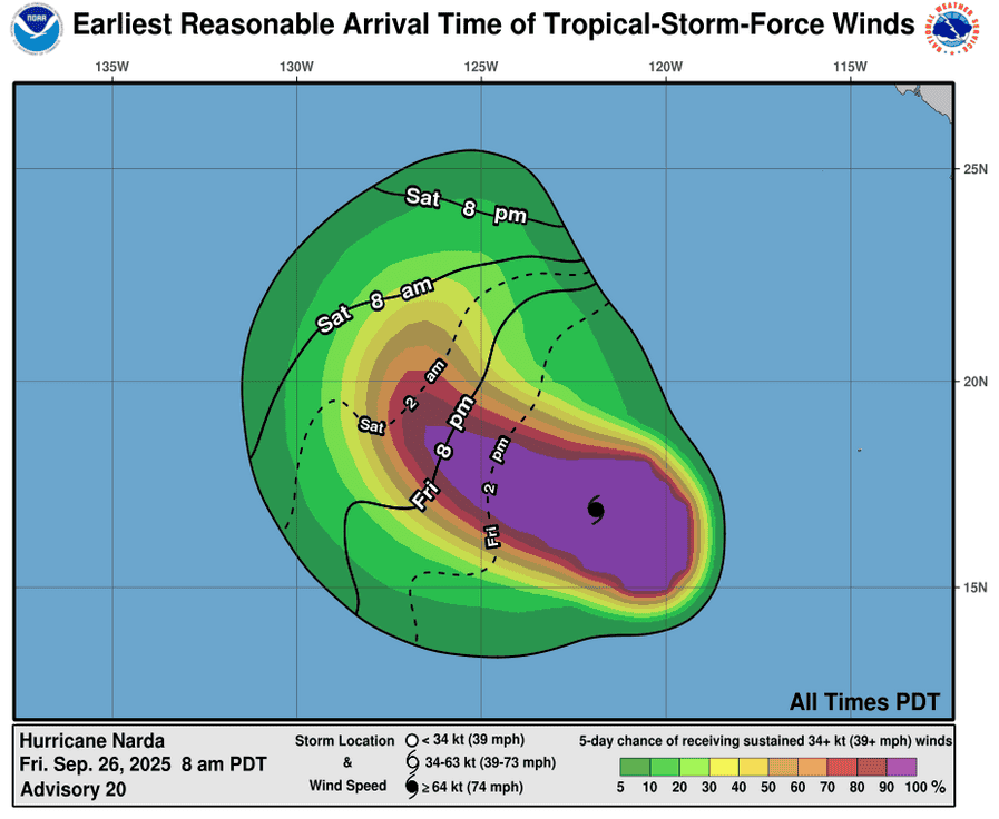
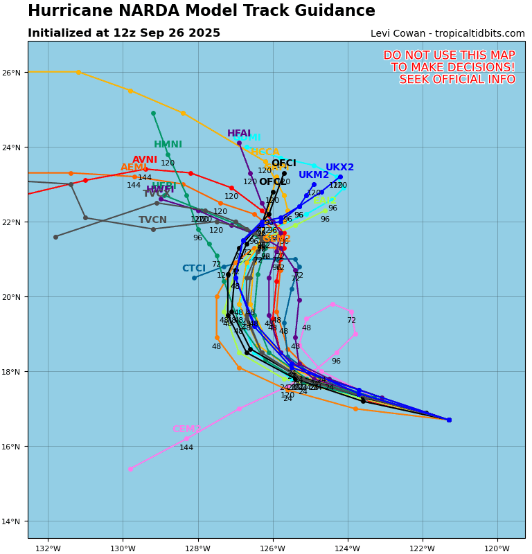
Tropical Cyclone 14E (Narda) is located approximately 970 NM west-southwest of the southern tip of Baja CA
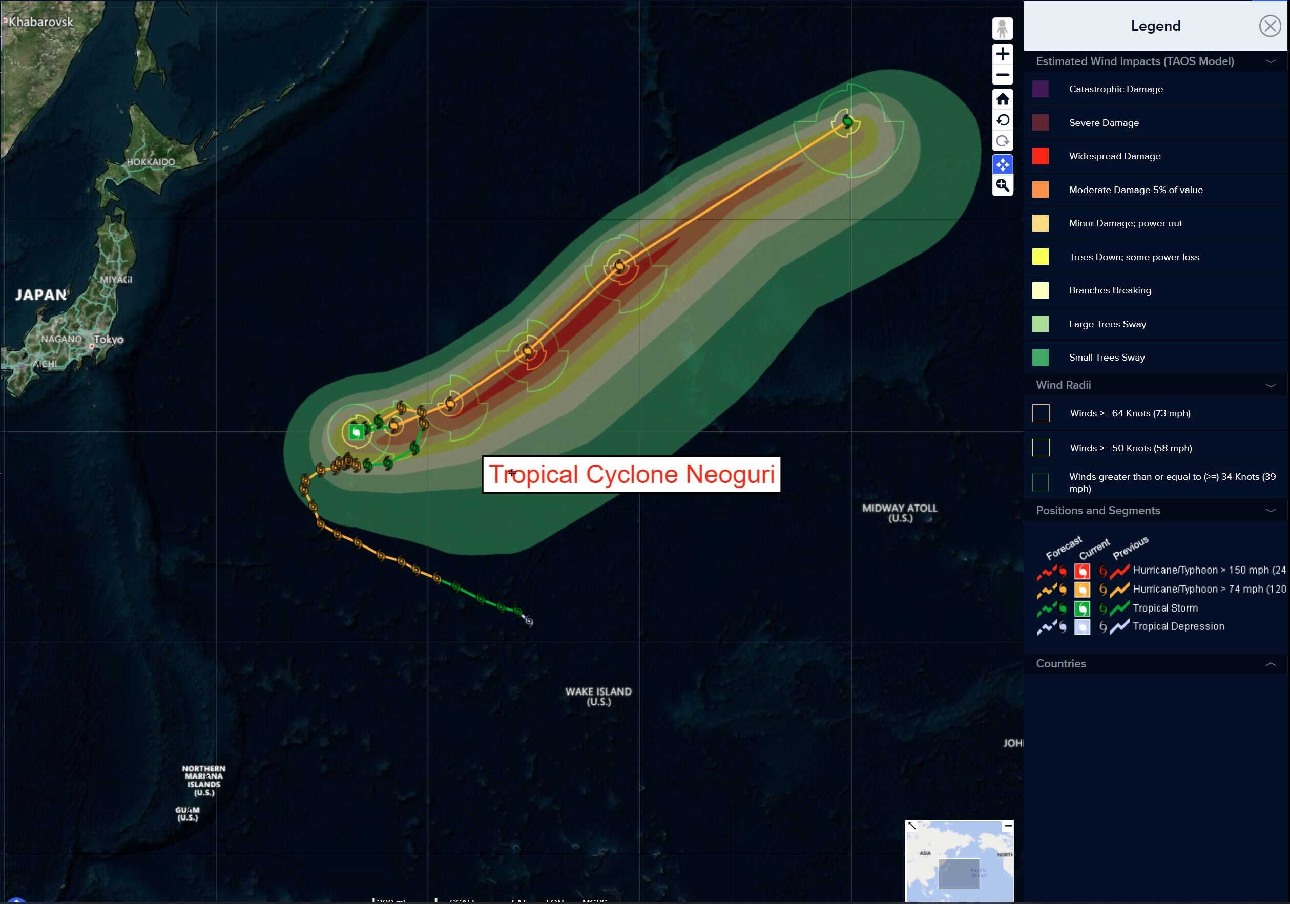
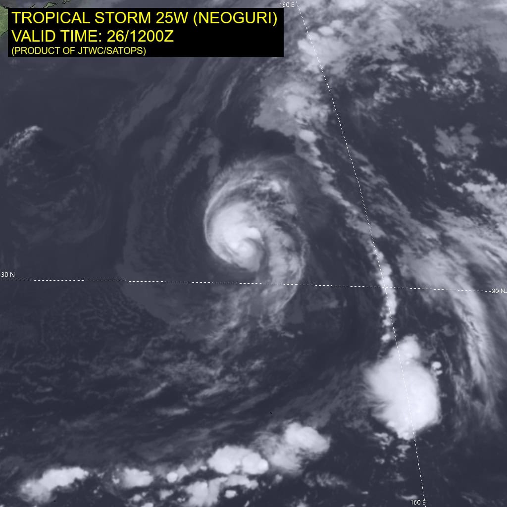
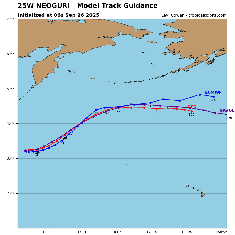
Tropical Cyclone 25W (Neoguri) is located approximately 445 NM north of Minami Tori Shima
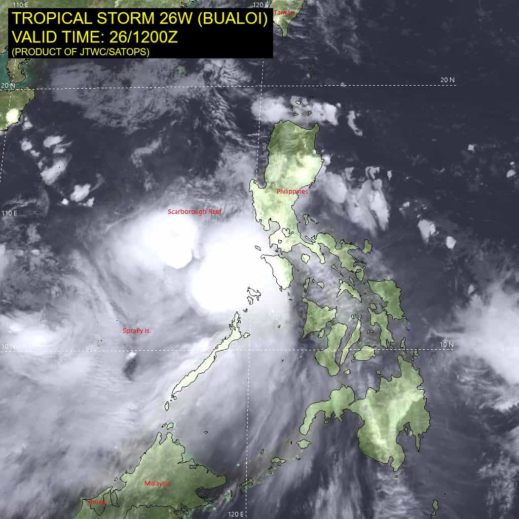
Tropical Cyclone 26W (Bualoi) is located approximately 343 NM west of Manila, Philippines
Northeast Pacific Ocean:
Tropical Cyclone Narda
NARDA HOLDING STEADY WHILE CONTINUING WEST-NORTHWESTWARD
According to the NHC advisory number 22
Narda is moving toward the west-northwest near 13 mph (20 km/h), and this general motion is expected to continue into early Saturday. A gradual turn toward the north with a decrease in forward speed is forecast over the weekend. Maximum sustained winds are near 90 mph (150 km/h) with higher gusts. Narda is expected to maintain its strength into early Saturday, followed by steady weakening over the weekend. Hurricane-force winds extend outward up to 45 miles (75 km) from the center and tropical-storm-force winds extend outward up to 185 miles (295 km). The estimated minimum central pressure is 979 mb (28.91 inches).
HAZARDS AFFECTING LAND
Surf: Swells generated by Narda are affecting portions of the coast of southwestern and west-central Mexico, and portions of Baja California Sur. These swells should reach southern California over the weekend. Swells are likely to cause life-threatening surf and rip current conditions.
Central Pacific Ocean: There are no Tropical Cyclones
Tropical cyclone formation is not expected during the next 7 days.
Western Pacific, Indian Ocean, and adjacent Seas:
Western Pacific
Tropical Cyclone 25W (Neoguri)
According to the JTWC warning number 35…sustained winds are 60 knots with gusts to near 75 knots.
Animated enhanced infrared (eir) satellite imagery depicts a marginally improved appearance of tropical storm 25W, with
building convection obscuring the low-level circulation center
(llcc). Additionally, poleward outflow has improved significantly over the past 6 hours.
25W continues to emulate ”the little engine that could” and has maintained its intensity against a marginally favorable environment characterized by moderate equatorward outflow aloft and low (5-10 kts) vertical wind shear, offset by upwelling caused by the storm’s quasi-stationary movement. a 261119z mtc ascat bullseye image reveals the llcc, lending high confidence to the initial position.
TS 25W remains confined between two competing subtropical ridges positioned to the east and west of the storm. Neither ridge is dominating the steering environment and has caused 25W to remain quasi-stationary over the past 24 hours. The southern
periphery of the eastern ridge has begun to build, and now flanks 25W to the south.
25W is forecast to begin its northeastward track between 0-12 hours, picking up speed as the eastern str takes control of the steering environment. 25w is expected to enter under influence of the mid-level jet at 36 hours, beginning its extratropical transition (ett) and accelerating to the northeast through the end of the forecast period. ETT is expected to be complete no later than 72 hours.
Regarding intensity, 25W is forecast to intensify from 55 knots to 65 knots between 0-12 hours, with further intensification expected from 36 hours onward due to jet interaction. 25W is forecast to peak at 80 knots at 48 hours, but a higher peak is
possible. 25W will weaken again by 72 hours, after completing ett due to the extreme vertical wind shear and dry air.
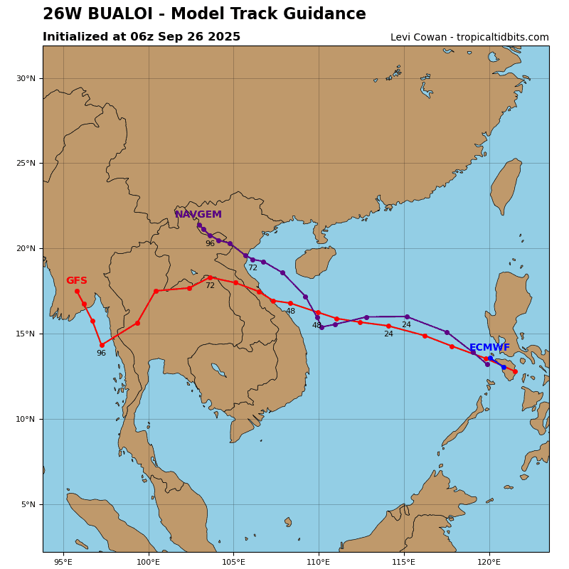
Tropical Cyclone 26W (Bualoi)
According to the JTWC warning number 15…sustained winds are 75 knots with gusts to near 90 knots.
Animated enhanced infrared (eir) satellite imagery depicts tropical storm 26W (Bualoi) with a broad area of deep convection entirely obscuring the low-level circulation center (llcc). The lack of any recent microwave imagery on the system has caused the structure to be a bit of a mystery for now. Central convection has certainly improved over the past 6 hours as the vortex further distances itself from the Philippines.
Environmental analysis indicates that 26W is in a favorable environment characterized by moderate radial outflow aloft, low to moderate (15-20 knots) northeasterly vertical wind shear, and warm (29-30 c) sea surface temperatures.
26W is forecast to track west-northwestward along the southern periphery of the subtropical ridge through 36 hours. After 36 hours, the trajectory will turn slightly more northwestward as the system tracks along the southwestern extent of the ridge. Landfall is forecast to occur near 48 hours, north of Hue.
The environment is expected to be conducive for further development throughout the South China Sea with low vertical wind shear and warm sea surface temperatures. As a result, 26W is forecast to gradually intensify to around 75 knots before making landfall in Vietnam. Rapid deterioration will then occur as the remnant vortex tracks into Laos, with dissipation around 72 hours.