Western Pacific, Indian Ocean, and adjacent Seas:
Western Pacific

")
By PDC’s Senior Weather
Specialist Glenn James

The Pacific Disaster Center’s (PDC Global) Tuesday, September 23, 2025, Tropical Cyclone Activity Report…for the Pacific Ocean, the Indian Ocean, and adjacent Seas
Current Tropical Cyclones:
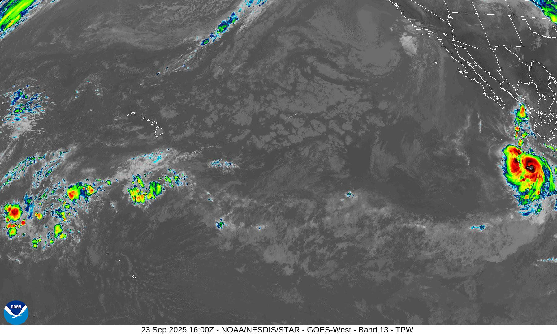
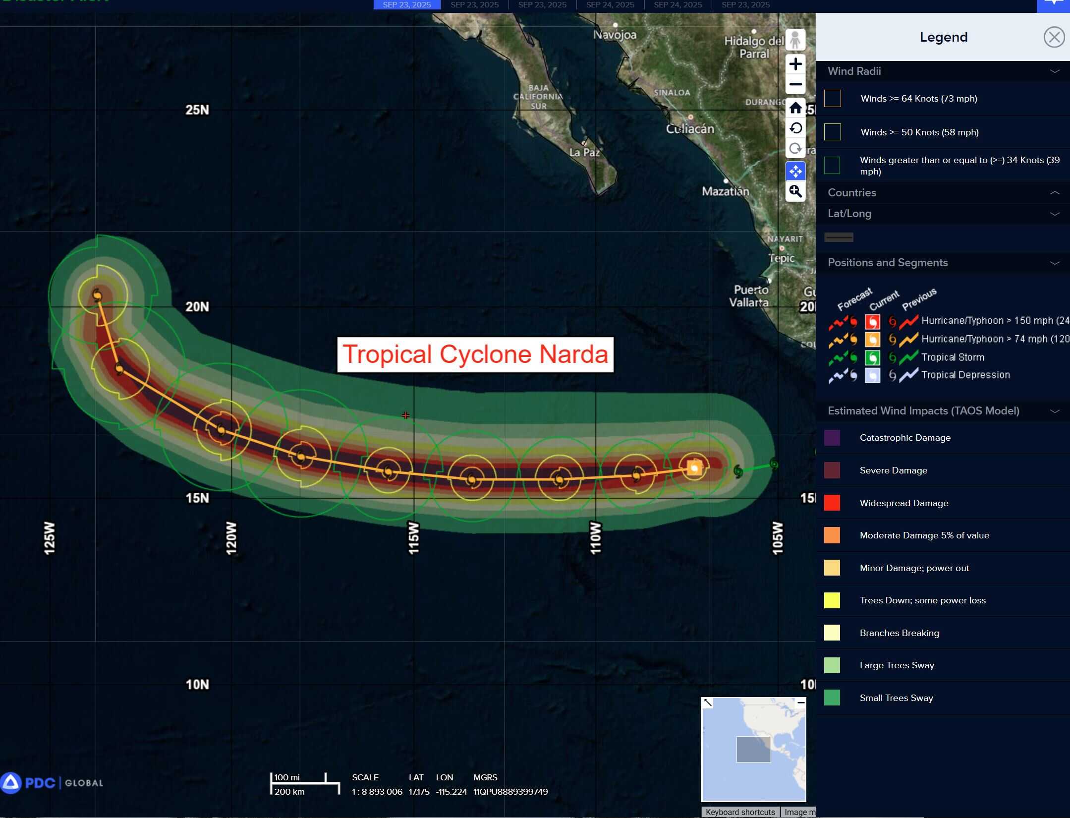
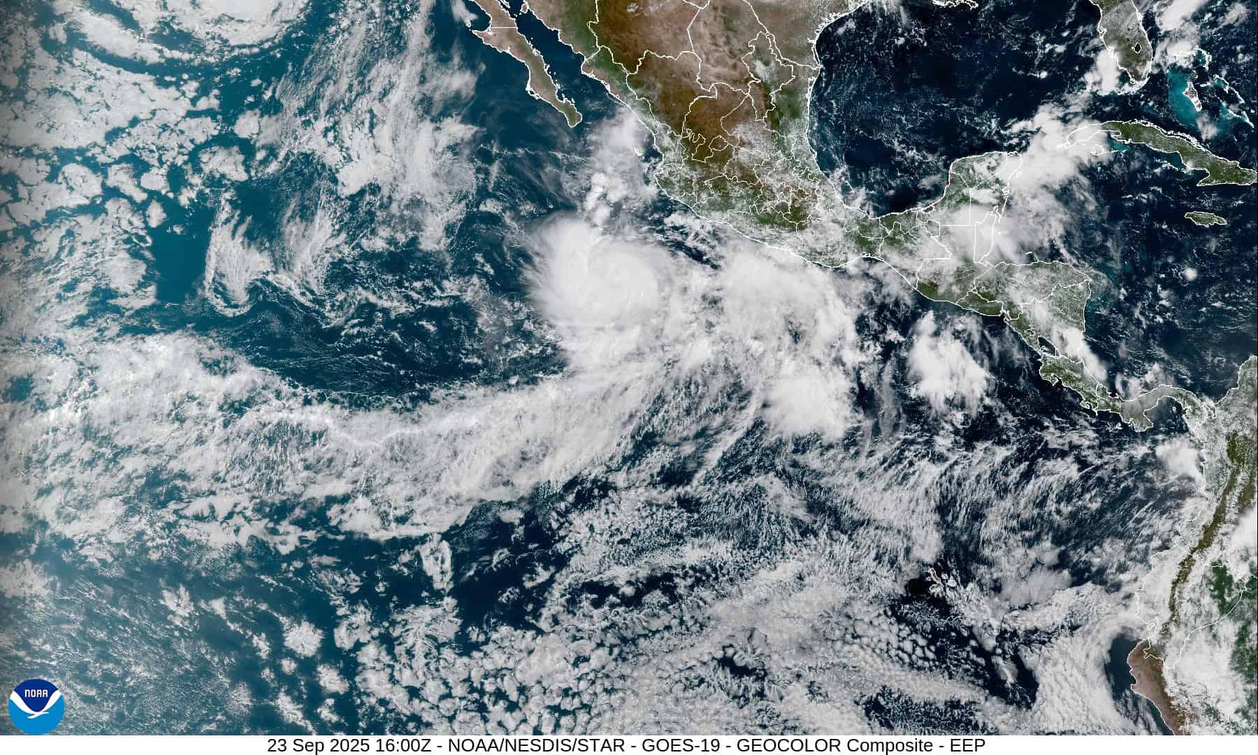
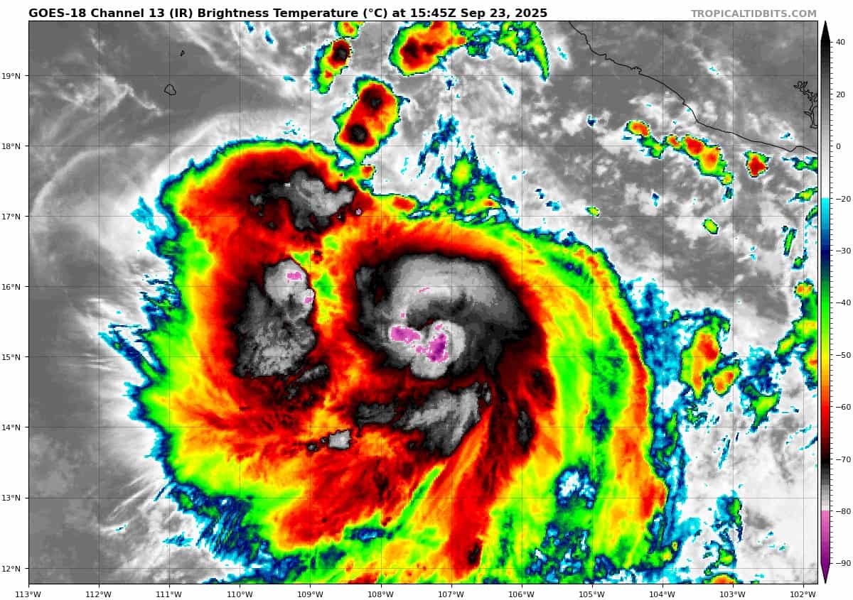
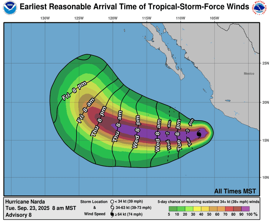
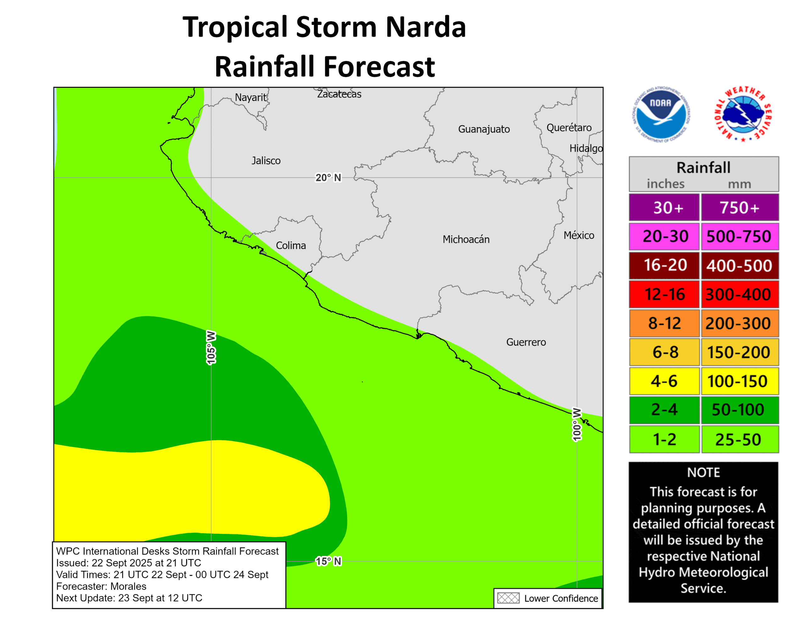
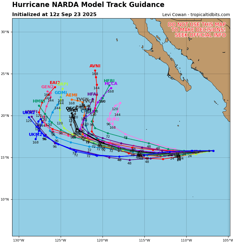
Tropical Cyclone 14E (Narda) is located approximately 365 NM southwest of Manzanillo, Mexico
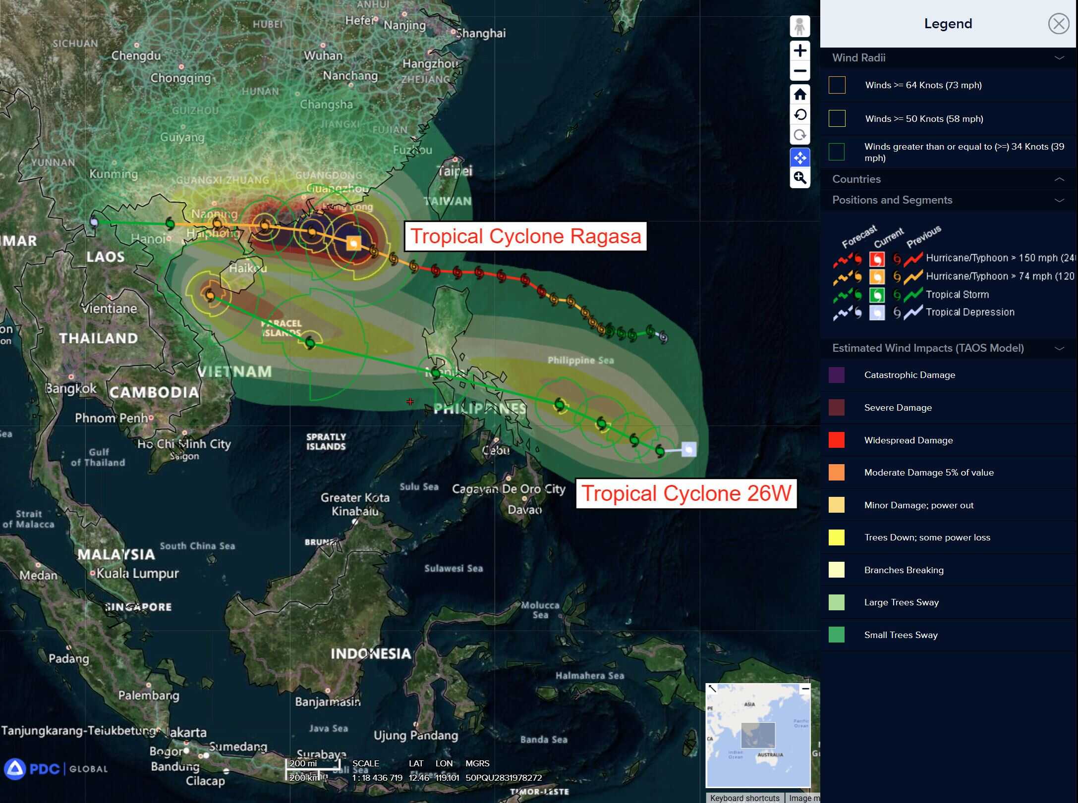
Tropical Cyclone 24W (Ragasa) is located approximately 79 NM south-southeast of Hong Kong
Tropical Cyclone 25W (Neoguri) is located approximately 764 NM east-southeast of Yokosuka, Japan
Tropical Cyclone 26W (Bualoi) is located approximately 138 NM north-northwest of Koror
Northeast Pacific Ocean:
Tropical Cyclone Narda
NARDA CONTINUES TO MOVE AWAY FROM MEXICO
According to the NHC advisory number 9
Narda is moving toward the west near 13 mph (20 km/h) and this general motion is expected to continue during the next few days. Maximum sustained winds remain near 85 mph (140 km/h) with higher gusts. Some strengthening is forecast through tonight, but little change in strength is expected on Wednesday and Thursday. Hurricane-force winds extend outward up to 15 miles (30 km) from the center and tropical-storm-force winds extend outward up to 90 miles (150 km). The estimated minimum central pressure is 981 mb (28.97 inches).
Western Pacific, Indian Ocean, and adjacent Seas:
Western Pacific
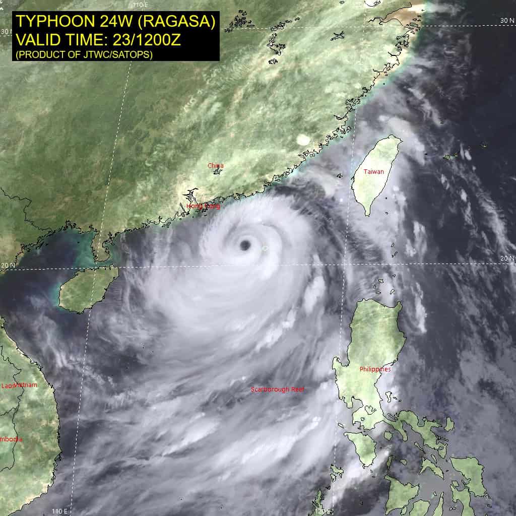
Tropical Cyclone 24W (Ragasa)
According to the JTWC warning number 22…sustained winds are 115 knots with gusts to near 140 knots.
Animated multi-spectral satellite imagery (msi) depicts a well-defined, symmetrical eye with a developing moat around the eyewall, potentially indicating a second eyewall replacement cycle.
Animated enhanced infrared (eir) satellite imagery reveals further weakening in the northwestern quadrant, with additional weakening now occurring along the northeastern quadrant.
Environmental analysis indicates a highly favorable environment, characterized by strong radial outflow, warm sea surface temperatures (28-29 c), and low vertical wind shear (10-15 knots). There is a streak of dry air to the west of the storm, however, it is expected to have a negligible impact on intensity.
Typhoon (TY) 24W is forecast to maintain its west-northwestward trajectory until landfall in southern Guangdong Province just after 24 hours. After landfall, the building str to the north is expected to take 24W on a more westward track. 24W will then traverse southern China, skirting the coast of the Gulf of Tonkin at around 36 hours. After 36 hours, 24W will track into northern Vietnam and Laos.
Until landfall, 24W will remain in a favorable environment to maintain its intensity, only weakening slightly over water due to moderate southeasterly shear (15-20 knots). Once 24W is over land, orographic interaction will cause rapid deterioration, leading to dissipation by 72 hours.
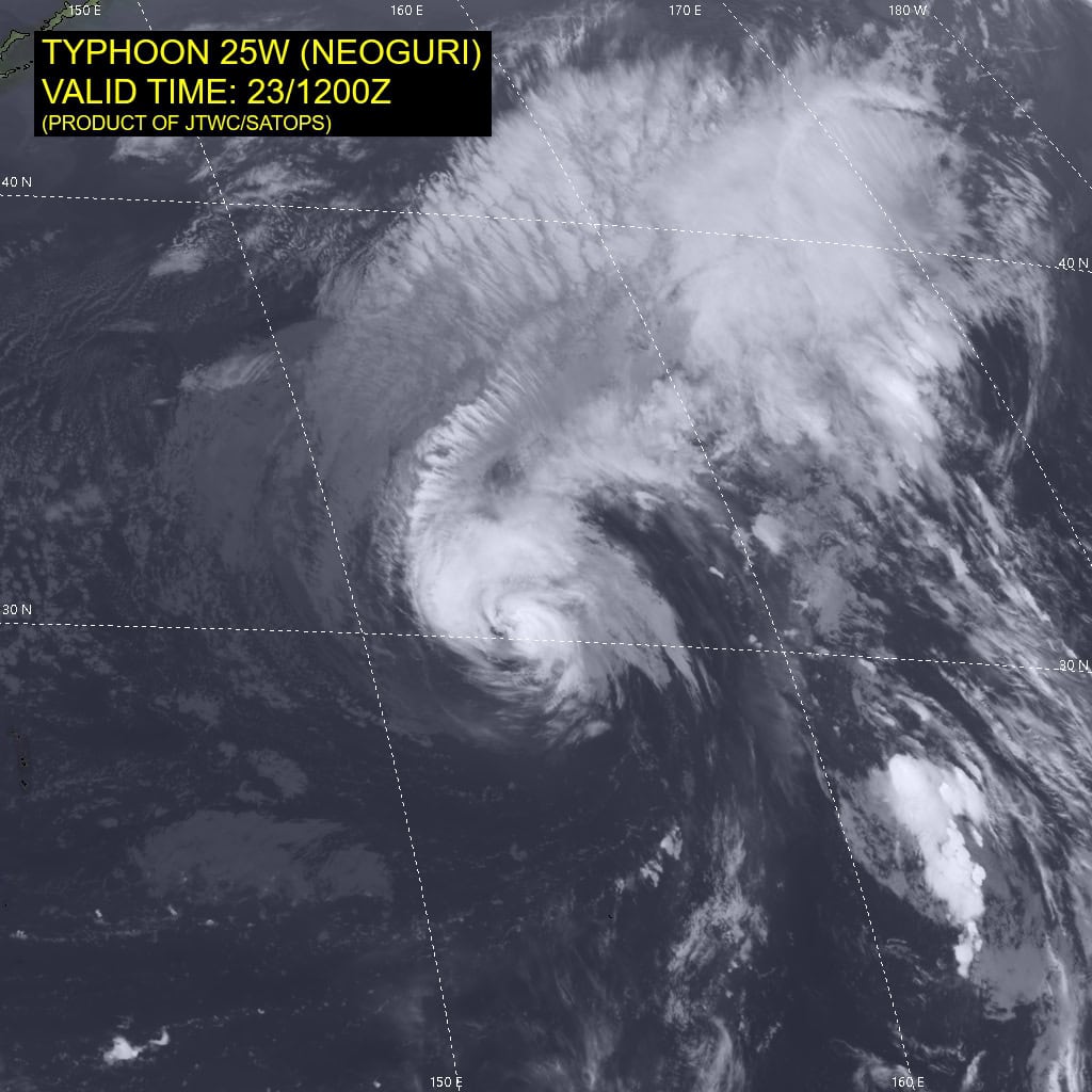
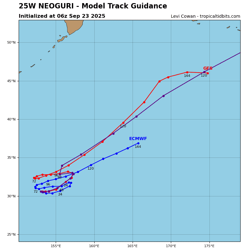
Tropical Cyclone 25W (Neoguri)
According to the JTWC warning number 22…sustained winds are 65 knots with gusts to near 80 knots.
Animated enhanced infrared (eir) satellite imagery depicts typhoon 25W (Neoguri) with a redevelopment of robust central convection over the past 6 hours. A field of stratocumulus clouds can be seen wrapping into the system along the western boundary of 25W, showing an increasing amount of dry air interacting with the vortex. A 231041z metop-c ascat pass revealed a core of strong winds (over 50 knots) with a large band of gale force winds extending far to the north-northwest.
Environmental analysis indicates that 25W is in a marginally favorable environment characterized by strong poleward outflow aloft, low to moderate (15-20 knots) westerly vertical wind shear, dry air entrainment, and warm (28-29 c) sea surface temperatures.
25W is forecast to continue tracking generally northeastward over the next 36 hours. Near 36 hours, the eastern ridge will build and extend to the north of the system, driving 25W back westward through 72 hours. Around 72 hours, a shortwave trough will propagate eastward and break down the ridge, allowing the vortex to recurve to the northeast through the remainder of the forecast period. Extratropical transition is forecast to begin at 96 hours and complete at 120 hours, as 25W becomes embedded within the baroclinic zone and strong upper-level winds.
Regarding intensity, 25W is forecast to weaken after 24 hours through 72 hours as upwelling continues to be a factor in response to the slow track speeds. Additionally, dry air will continue to entrain into the core of the system, aiding in the weakening trend. As the system begins to speed up at 96 and 120 hours, baroclinic forcing and robust poleward outflow will allow 25W to marginally re-intensify as extratropical transition ensues.
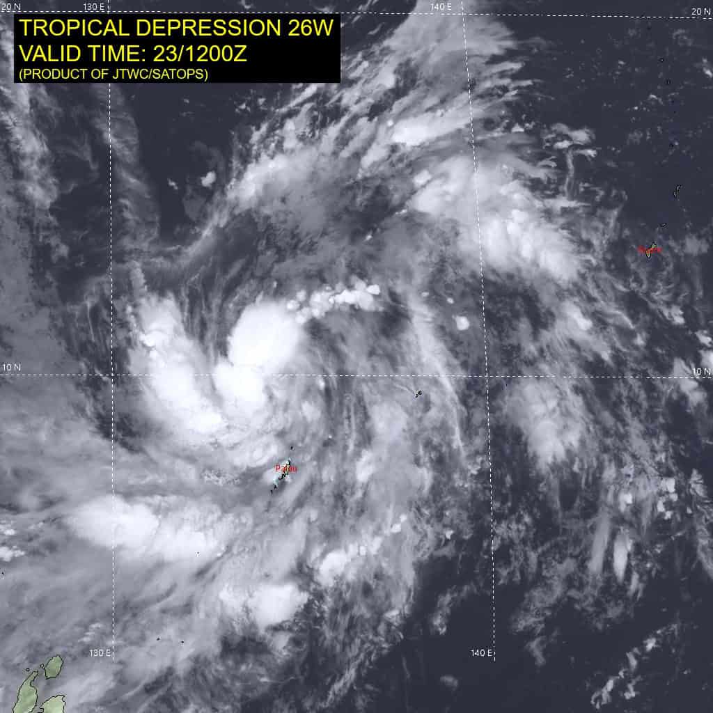
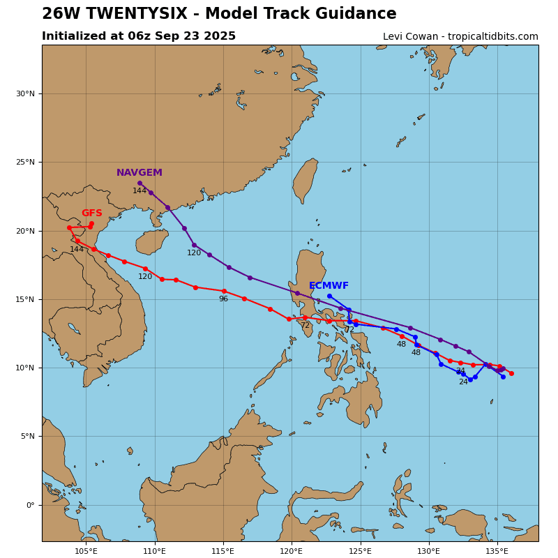
Tropical Cyclone 26W (Bualoi)
According to the JTWC warning number 2…sustained winds are 30 knots with gusts to near 40 knots.
Animated enhanced infrared (eir) satellite imagery depicts tropical depression 26W with two distinct convective bands wrapping around the northern and western peripheries of the circulation. 231127z and 231217z ascat passes showed swaths of 25 knot winds within the northwestern and southwestern quadrants with weaker winds along the eastern side.
Environmental analysis indicates that 26W is in a favorable environment characterized by moderate poleward and equatorward outflow aloft, low (10-15 knot) vertical wind shear, and warm (29-30 c) sea surface temperatures.
26W is forecast to track generally northwestward throughout the entire forecast period. The system will track along the southwestern periphery of the subtropical ridge, which will propagate westward, following 26w. An initial landfall is forecast to occur around 60 hours, near Legazpi. 26W will then emerge within the South China Sea and continue northwestward, and track south of Hainan near the end of the forecast period.
Regarding intensity, 26W is forecast to steadily intensify over the next 48 hours to around 55 knots before making the first landfall. Interaction with central Philippines will briefly deteriorate the system. Then after 72 hours, conditions in the South China Sea will be conducive with low shear, allowing for 26W to re-intensify.
Conditions within the southern Gulf of Tonkin are expected to be highly favorable with very warm sea surface temperatures, which will allow 26W to intensify to typhoon intensity near the end of the forecast period.