Western Pacific, Indian Ocean, and adjacent Seas:
Western Pacific

")

By PDC’s Senior Weather
Specialist Glenn James

The Pacific Disaster Center’s (PDC Global) Monday, September 22, 2025, Tropical Cyclone Activity Report…for the Pacific Ocean, the Indian Ocean, and adjacent Seas
Current Tropical Cyclones:
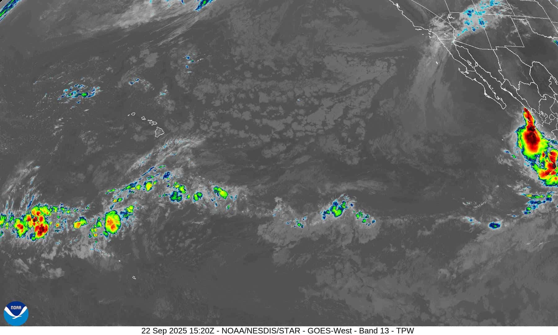
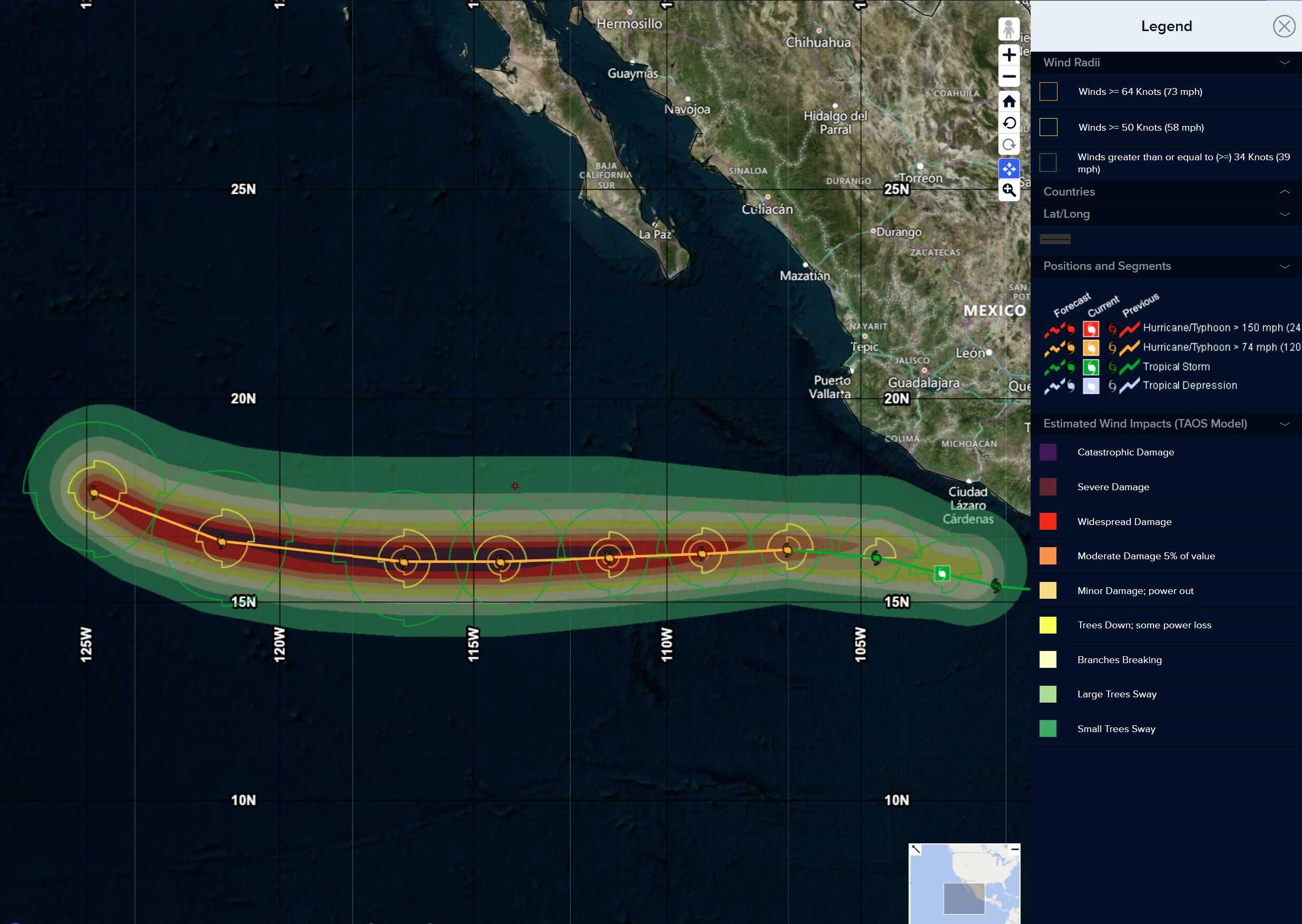
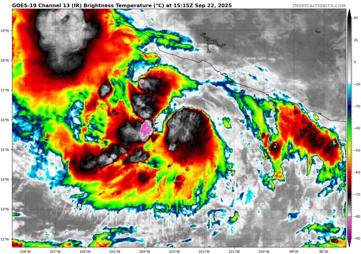
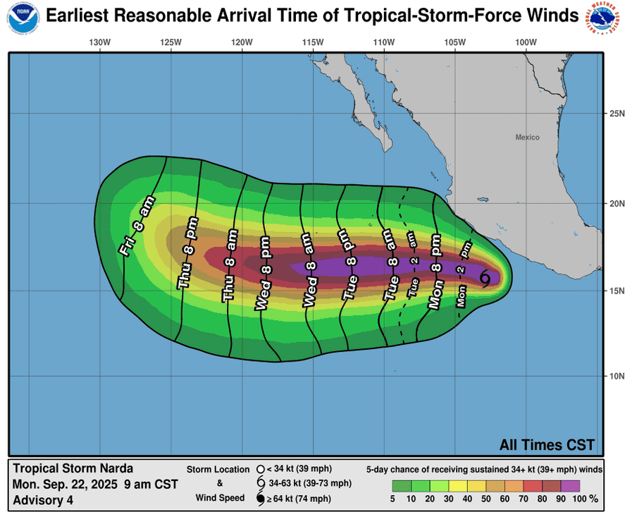
Tropical Cyclone 14E (Narda) is located approximately 220 NM south-southwest of Manzanillo, Mexico
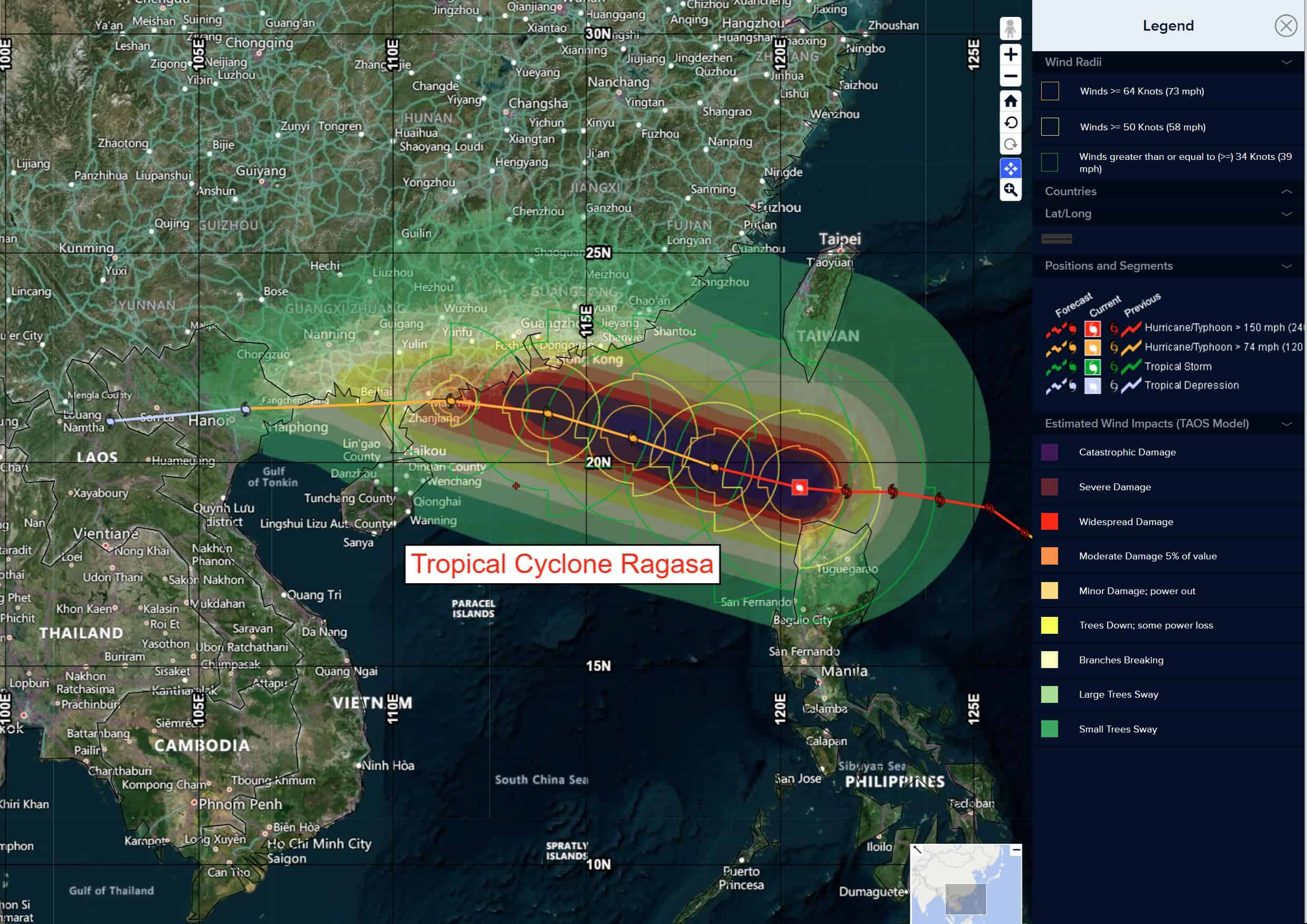
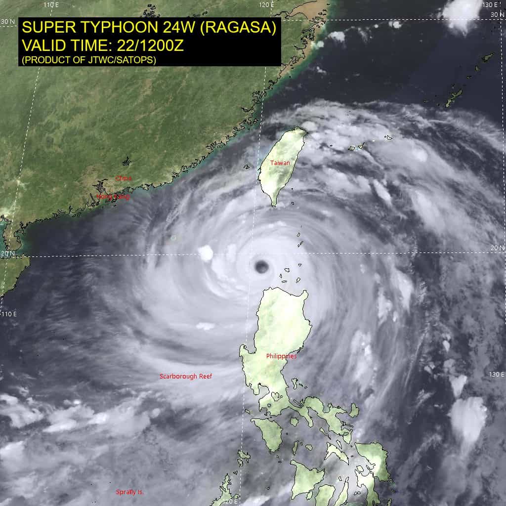
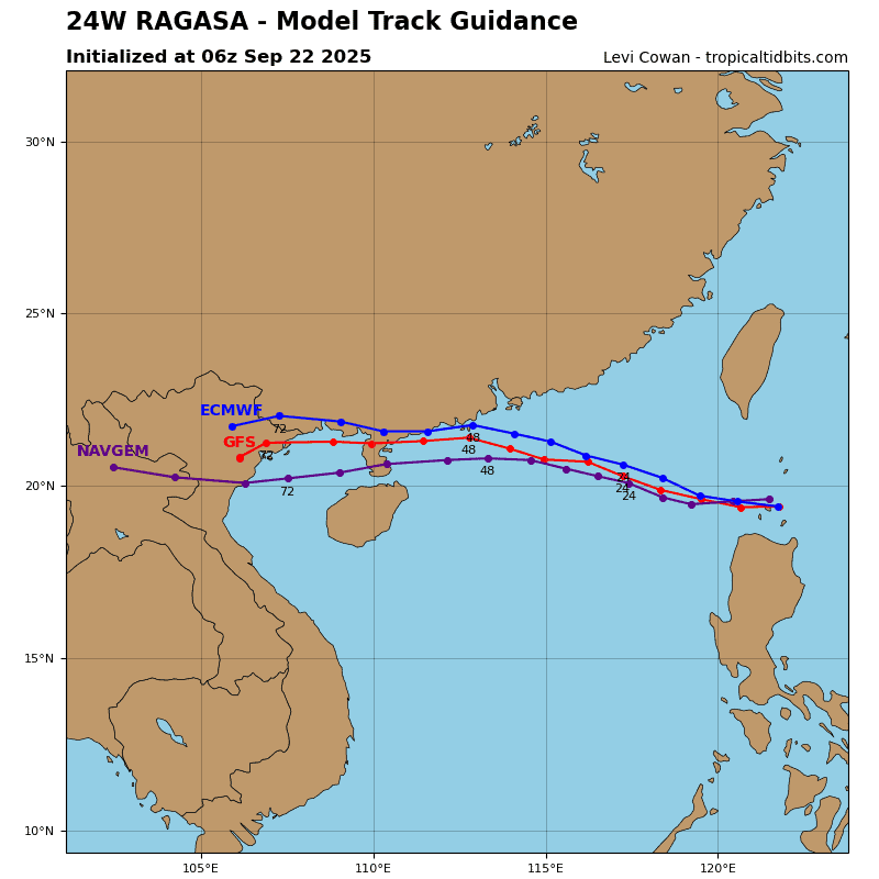
Tropical Cyclone 24W (Ragasa) is located approximately 263 NM east-southeast of Hong Kong
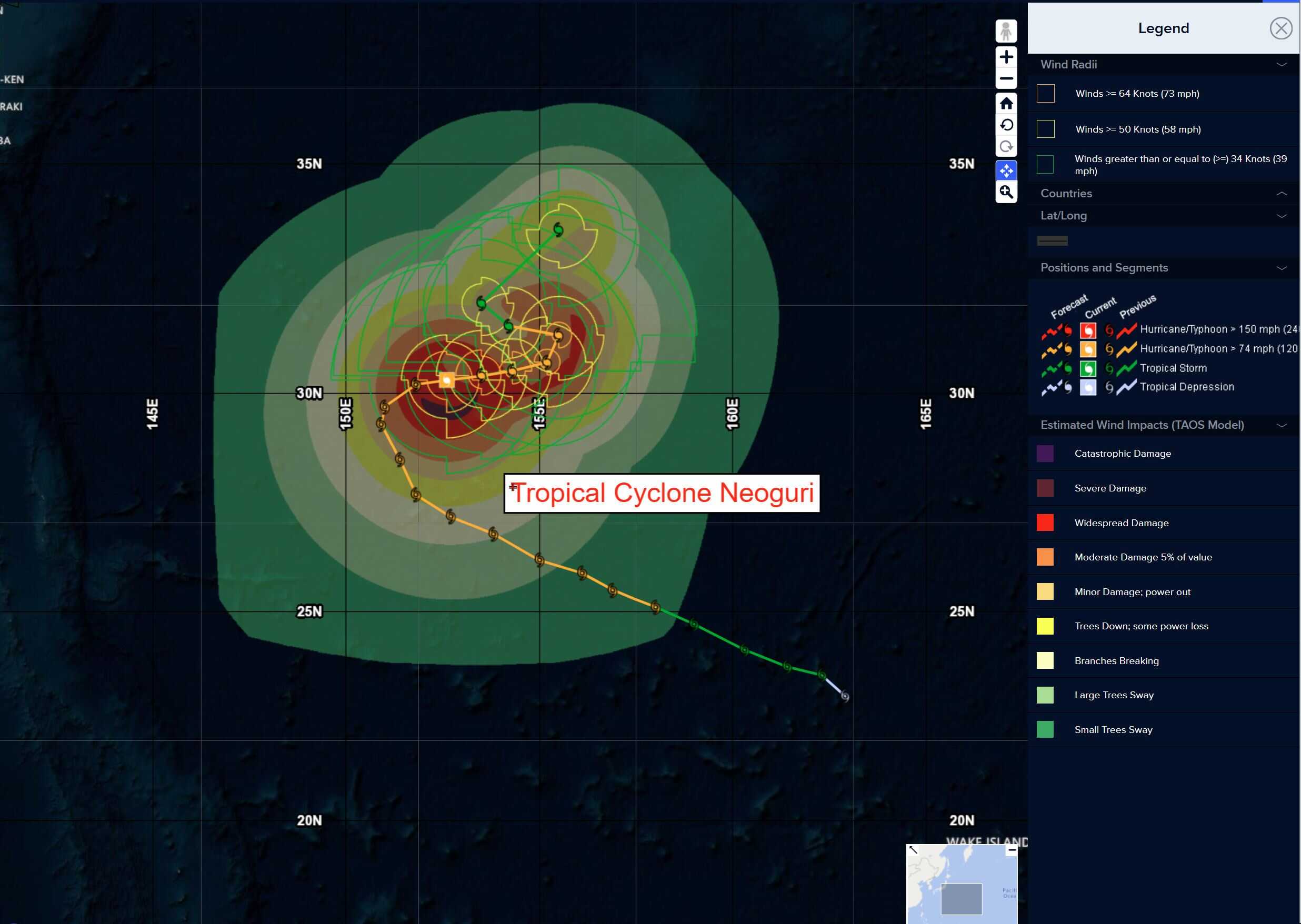
Tropical Cyclone 25W (Neoguri) is located approximately 381 NM north of Minami Tori Shima
Northeast Pacific Ocean:
Tropical Cyclone Narda
NARDA STRENGTHENS SOME MORE AND HEADING WESTWARD AWAY FROM MEXICO
According to the NHC advisory number 6
Narda is moving toward the west near 13 mph (20 km/h), and this general motion is expected to continue over the next several days. Maximum sustained winds are near 65 mph (100 km/h) with higher gusts. Steady strengthening is forecast during the next couple of days, and Narda is expected to become a hurricane later tonight or early Tuesday. Tropical-storm-force winds extend outward up to 80 miles (130 km) from the center. The estimated minimum central pressure is 993 mb (29.33 inches).
HAZARDS AFFECTING LAND
RAINFALL: Tropical Storm Narda will lead to storm total rainfall of 1 to 2 inches, with local amounts up to 4 inches, for coastal sections of southern Mexico through tonight. This brings a risk of flash flooding, especially in areas of higher terrain.
Central Pacific Ocean: There are no Tropical Cyclones
Tropical cyclone formation is not expected during the next 7 days.
Western Pacific, Indian Ocean, and adjacent Seas:
Western Pacific
Tropical Cyclone 24W (Ragasa)
According to the JTWC warning number 19…sustained winds are 125 knots with gusts to near 155 knots.
Animated enhanced infrared (eir) satellite imagery depicts a large banding eye feature slightly contracting and becoming cloud-filled as super typhoon (STY) 24W continues tracking westward into the South China Sea. An eyewall replacement cycle (erc) is in progress and the formation of a secondary eyewall is evident in a 221113z gpm gmi 89ghz microwave image.
STY 24W will remain under the steering influence of the subtropical ridge to the north for the next 36 hours. After 48 hours, a building ridge to the northeast will alter the track slightly westward for the remainder of the forecast period.
STY 24W will gradually weaken for the next 48 hours as upwelling and interaction with the coastline of China weakens the storm. Greater topographic interaction at and after 48 hours with the Chinese coast will increase the rate of weakening. Landfall between 48-72 hours on the northern coast of Vietnam will lead the storm to dissipation over land by the end of the forecast period.
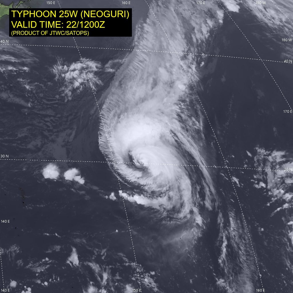
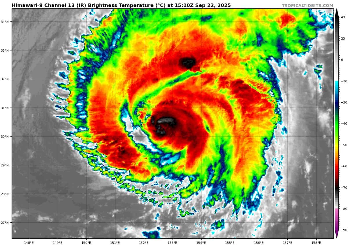
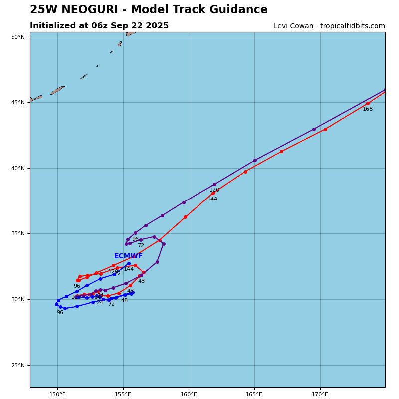
Tropical Cyclone 25W (Neoguri)
According to the JTWC warning number 19…sustained winds are 85 knots with gusts to near 105 knots.
Animated enhanced infrared (eir) satellite imagery depicts a highly asymmetric typhoon (TY) with deep convection struggling to rebuild against 20-25 knot southwesterly vertical wind shear. An eye is no longer evident and is continuing on a weakening trend due to the shear and upwelling.
An upper-level trough to the northwest is both enhancing poleward outflow and unfavorably overwhelming the system.
The initial position is placed with medium confidence based on the aforementioned disorganized nature of the typhoon and the tilted vertical structure.
TY 25W will continue to track erratically while in a complex and competing steering environment between two subtropical ridges to the east and west. The track forecast is slow and east-northeastward for the next 36 hours, but unusual movement
such as looping or doubling back may occur and is not captured in the warning graphic.
After 48 hours, a deep-layer trough will weaken the ridge to the east, causing TY 25W to complete a near u-turn while coming under the steering influence over the ridge to the west. After 96 hours, both ridges will strongly continue to compete with one another.
The slow track motion will result in significant upwelling of cool water throughout the forecast period. the lack of heat will primarily drive weakening, but the elevated vertical wind shear will also support the weakening. Given the slow motion, the thermal boundary remains to the north of the typhoon, and transition is not expected during the forecast period.
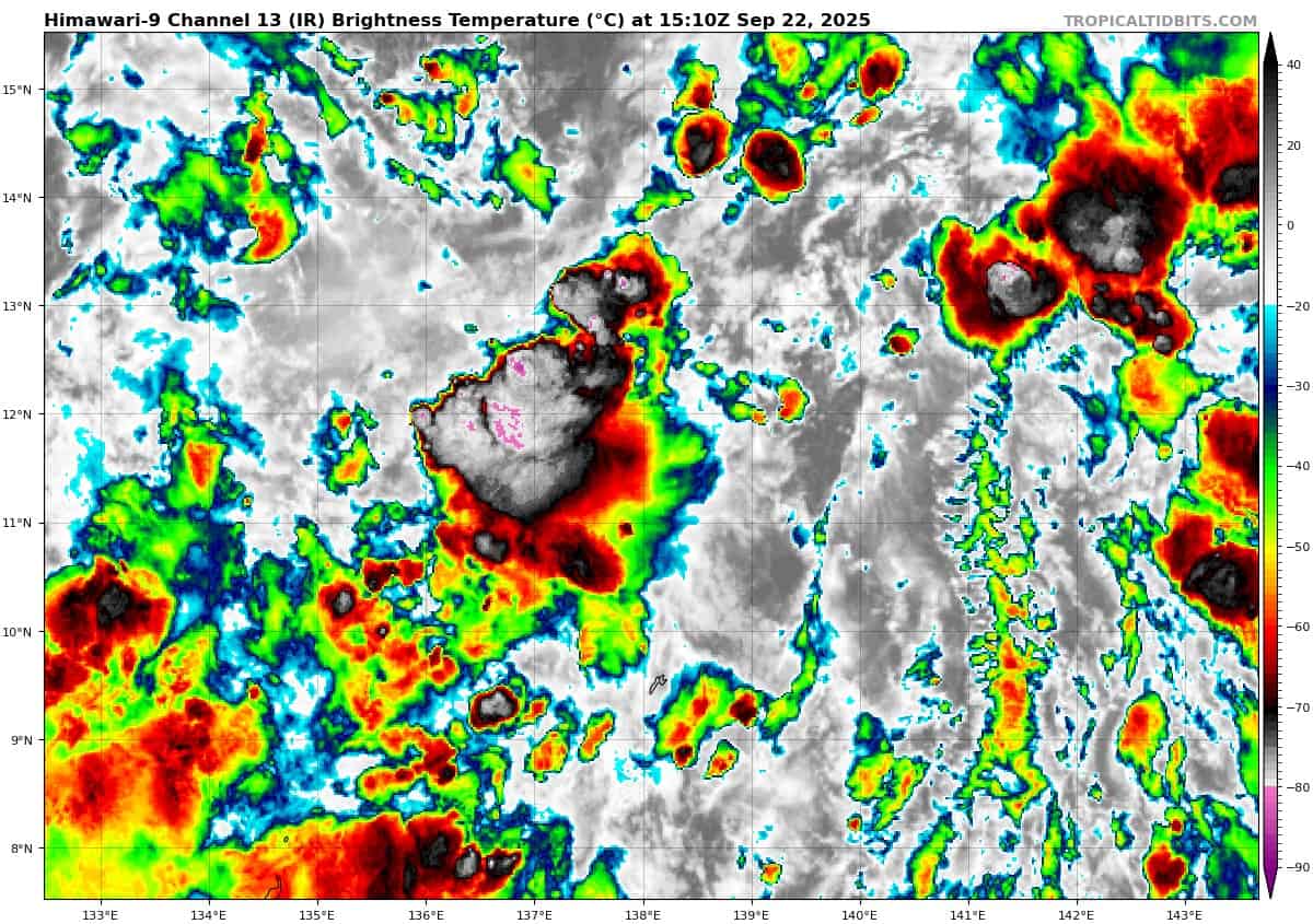
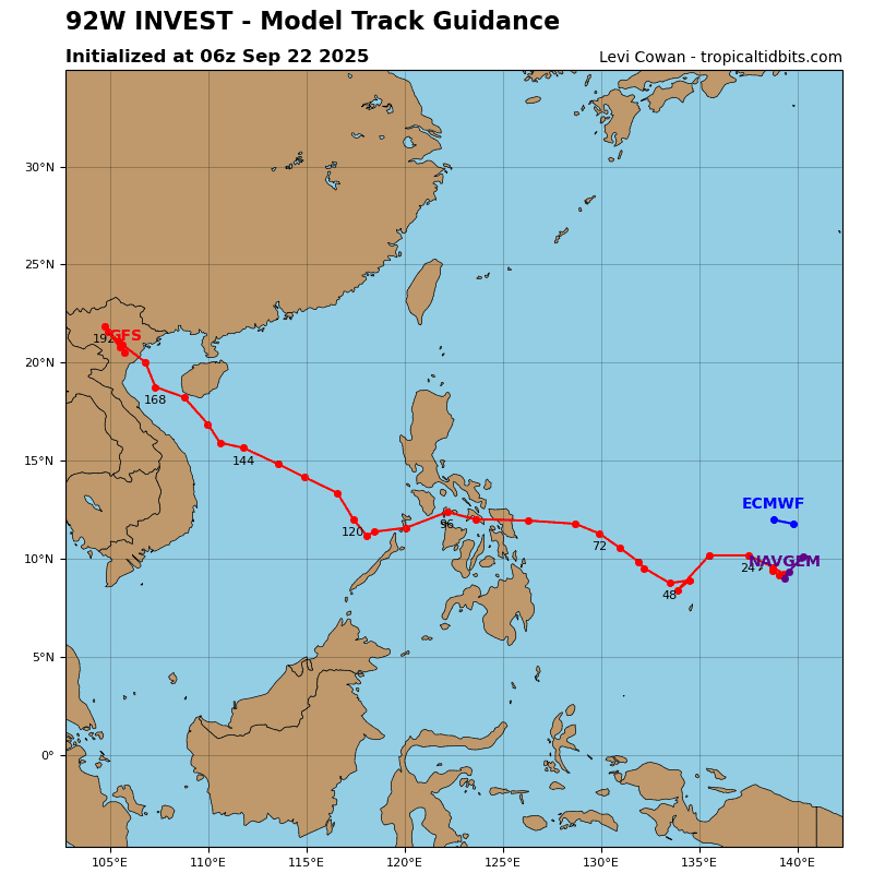
>>> There’s an area of disturbed weather being referred to as Invest 92W, which is located approximately 40 NM north of Yap
Animated multi-spectral imagery (msi) depicts a disorganized broad area of flaring convection featuring moderate convergence along the northwest periphery. A 212330z ascat-c pass shows a broad circulation with strengthening winds along the northwestern periphery of the weakly defined area of convection.
Environmental analysis reveals marginal conditions for development with high vertical wind shear (20-25 knots), moderate poleward outflow, and warm sea surface temperatures.
Global models indicate that Invest 92W will have a northwestward track with steady development within the next 24-48 hours.
Maximum sustained surface winds are estimated at 13 to 18 knots.
The potential for the development of a significant tropical cyclone within the next 24 hours is upgraded to high.