Western Pacific, Indian Ocean, and adjacent Seas:
Western Pacific

")


By PDC’s Senior Weather
Specialist Glenn James

The Pacific Disaster Center’s (PDC Global) Sunday, September 21, 2025, Tropical Cyclone Activity Report…for the Pacific Ocean, the Indian Ocean, and adjacent Seas
Current Tropical Cyclones:
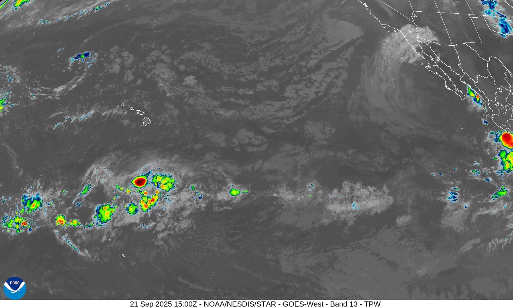
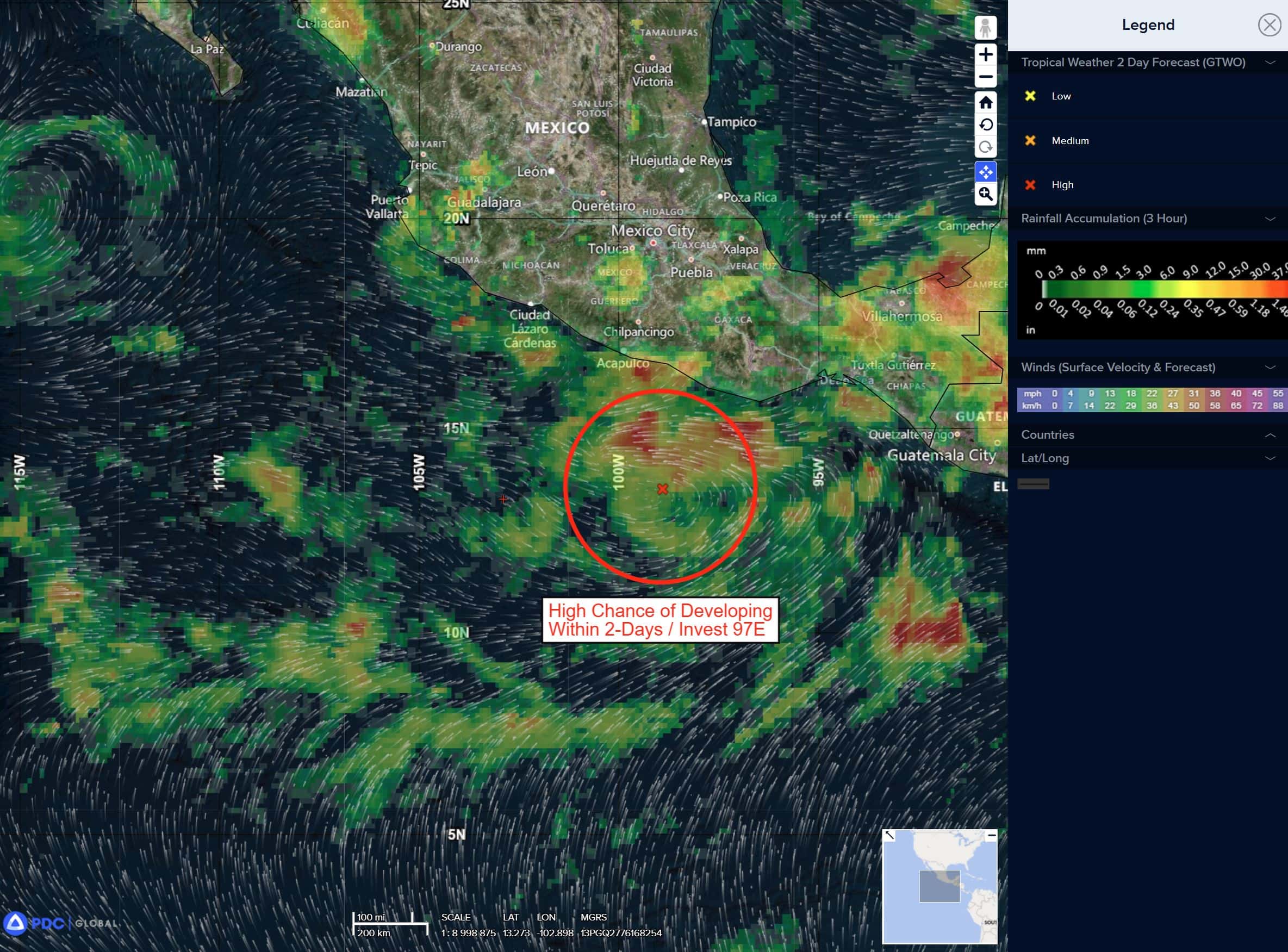
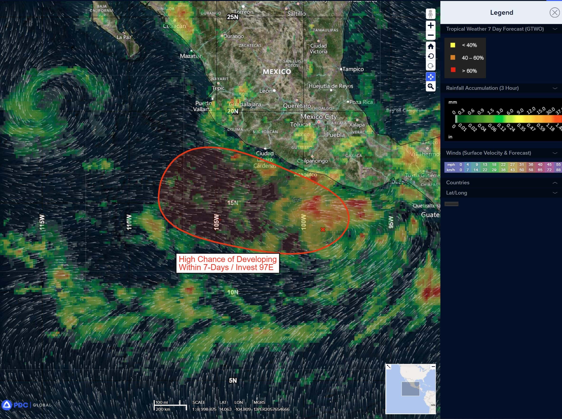
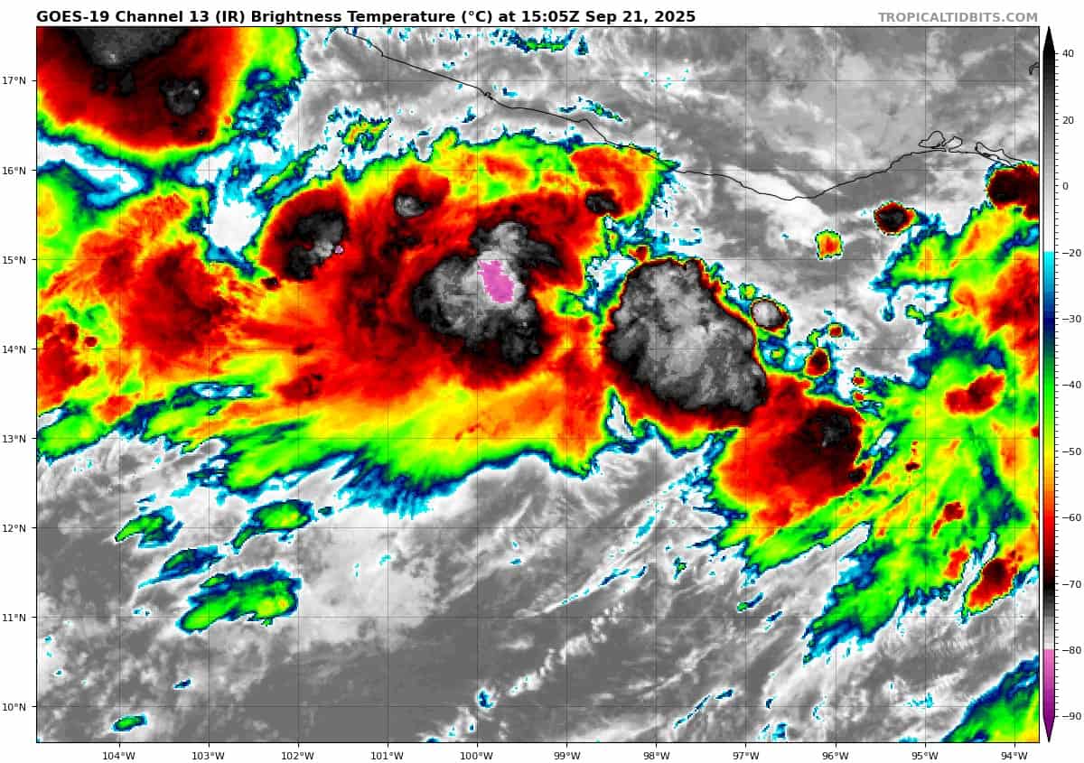
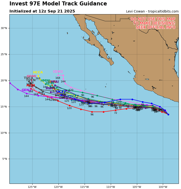
Tropical Cyclone 14E (Narda) is located approximately 180 NM south-southeast of Zihuatanejo, Mexico
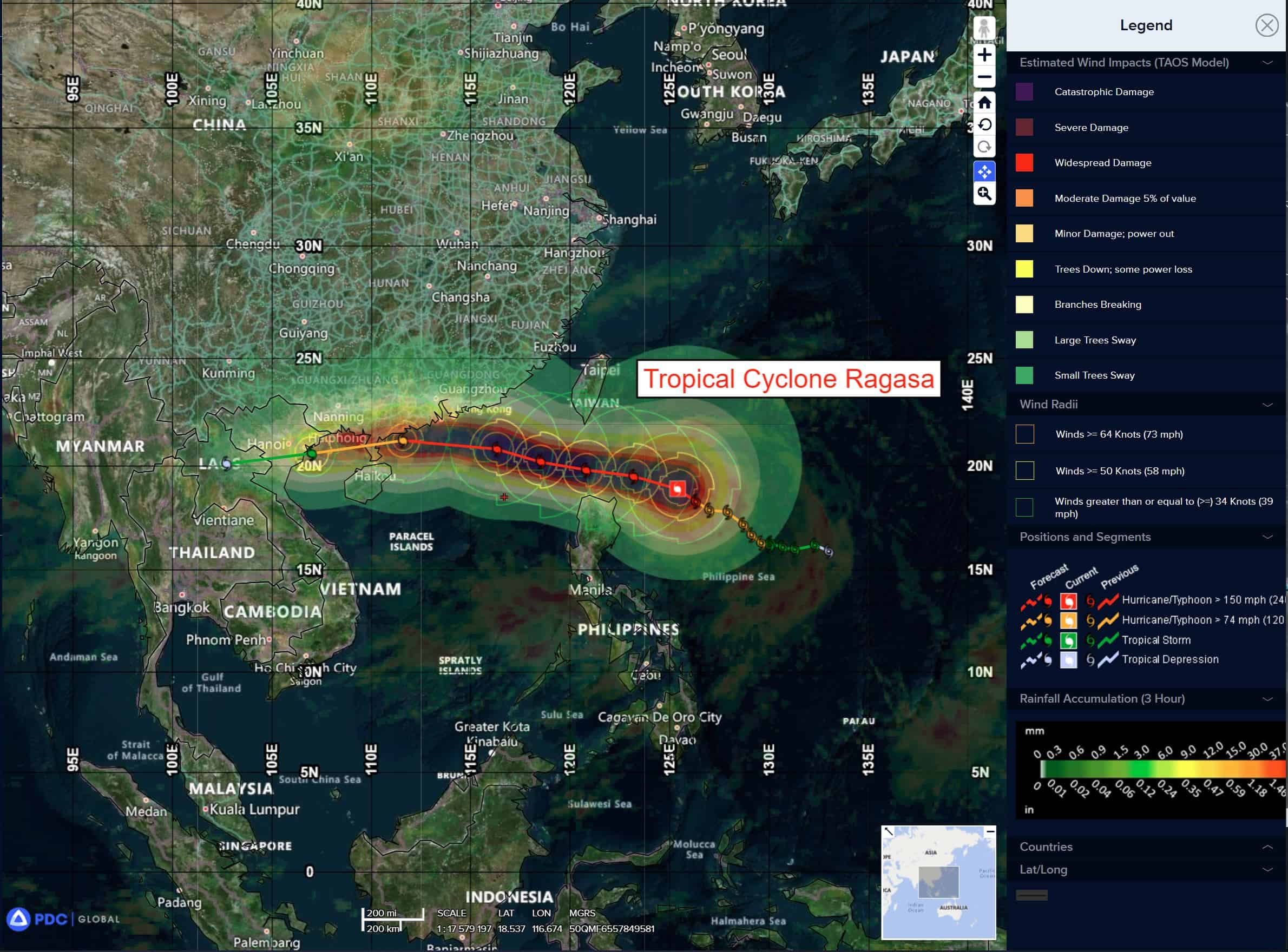
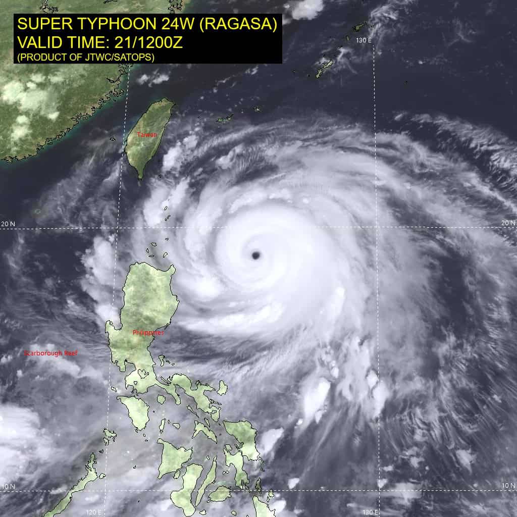
Tropical Cyclone 24W (Ragasa) is located approximately 520 NM east-southeast of Hong Kong
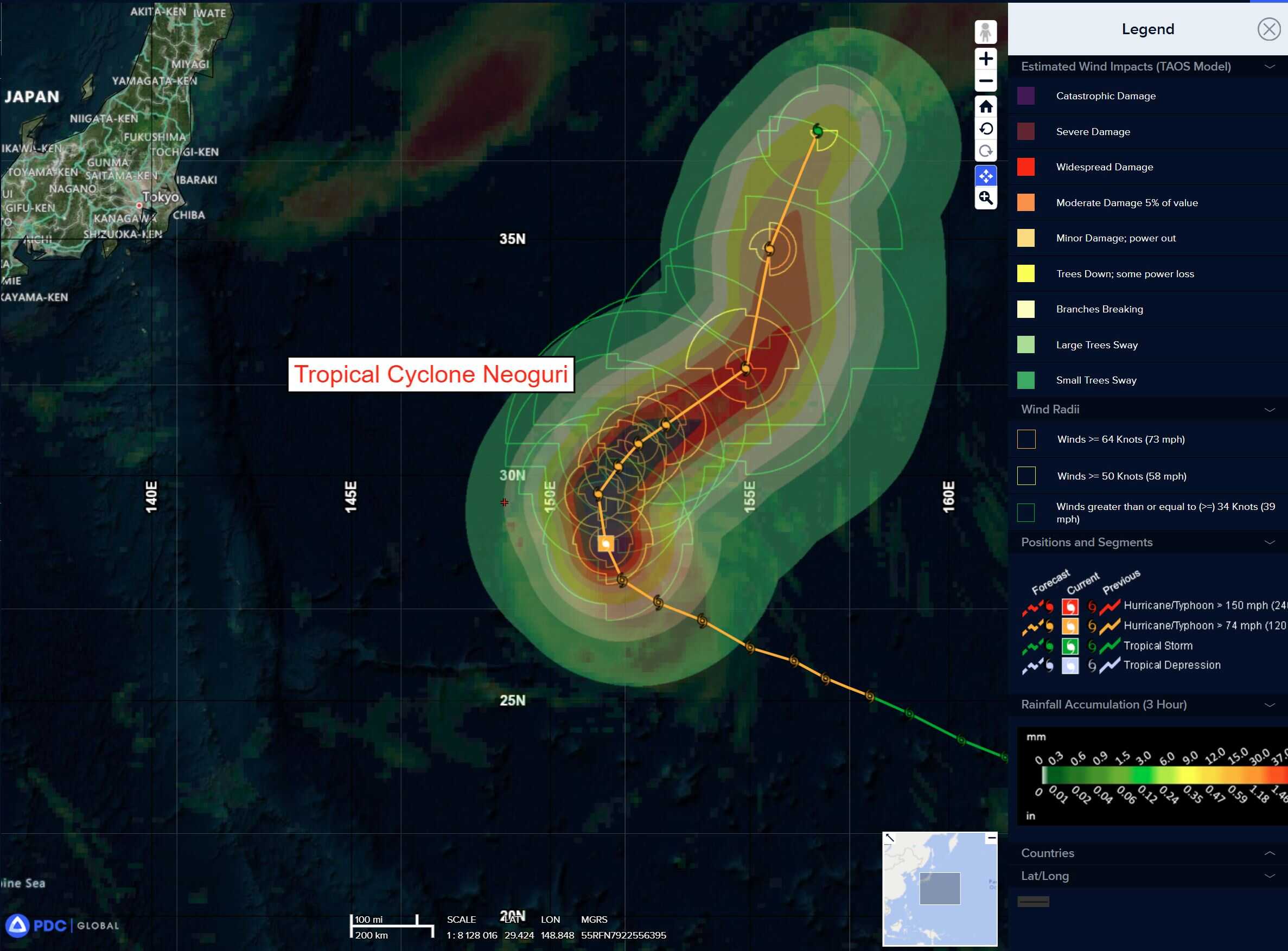
Tropical Cyclone 25W (Neoguri) is located approximately 367 NM north-northeast of Minami Tori Shima
Northeast Pacific Ocean:
Tropical Cyclone Narda
NARDA LIKELY TO INTENSIFY WHILE REMAINING OFFSHORE OF MEXICO
According to the NHC advisory number 2
Narda is moving toward the northwest near 10 mph (17 km/h), and a turn to the west-northwest is expected by tomorrow. Narda should be moving faster to the west by midweek. Maximum sustained winds are near 40 mph (65 km/h) with higher gusts. Strengthening is forecast during the next 48 hours, and Narda could become a hurricane on Tuesday. Tropical-storm-force winds extend outward up to 70 miles (110 km) from the center. The estimated minimum central pressure is 1005 mb (29.68 inches).
HAZARDS AFFECTING LAND
RAINFALL: Tropical Storm Narda will lead to storm total rainfall of 1 to 2 inches, with local amounts up to 4 inches, for coastal sections of southern Mexico through Tuesday. This brings a risk of flash flooding, especially in areas of higher terrain.
Central Pacific Ocean: There are no Tropical Cyclones
Tropical cyclone formation is not expected during the next 7 days.
Western Pacific, Indian Ocean, and adjacent Seas:
Western Pacific
Tropical Cyclone 24W (Ragasa)
According to the JTWC warning number 15…sustained winds are 145 knots with gusts to near 175 knots.
Animated multi-spectral satellite imagery (msi) depicts super typhoon (sty) 24W tracking west-northwestward over the last six
hours. A warm eye feature is evident and highlights the mature
structure of the system. the initial position is placed with high
confidence based on a 211208z metop-b mhs 89ghz image revealing a well-defined microwave eye and symmetrical deep convective banding.
STY 24W will continue to track west-northwestward along the southern periphery of a subtropical ridge to the north. After 72 hours, STY 24W will curve west-southwestward, tracking briefly over the Leizhou Peninsula. Following 96 hours, STY 24W will make landfall on the northern Vietnam coast.
STY 24W will stagnate intensification for the next 12 hours as the system approaches Luzon and begins to interact with the islands in the Luzon Strait. STY 24W will begin weakening at 24 hours and continue as the system approaches the coastal region of the South China Sea. Topographic interaction and upwelling along the coast will further weakening until STY 24W makes landfall.
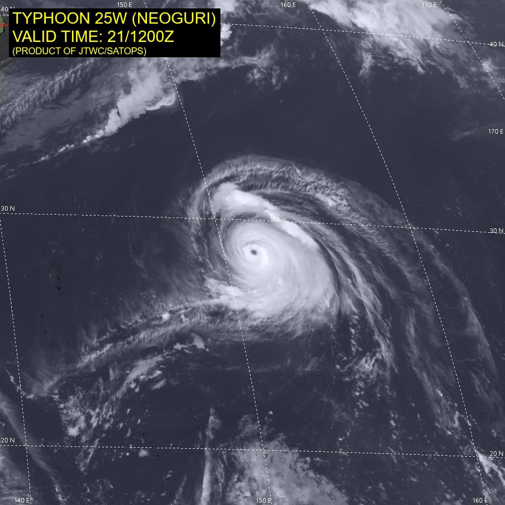
Tropical Cyclone 25W (Neoguri)
According to the JTWC warning number 15…sustained winds are 105 knots with gusts to near 130 knots.
Animated enhanced infrared (eir) satellite imagery depicts weakening banding along the western periphery of typhoon (TY) 25W. The erosion is also evident in a 211029z metop-b mhs 89ghz microwave image highlighting the strongest convection along the eastern periphery and a slight eastward tilt. The initial position is placed with high confidence based on the aforementioned animated eir and microwave imagery.
TY 25W will continue to gradually curve to a northeastward track over the next 12 hours. During the northeastward track between 12-48 hours, the track motion will be slow and irregular due to a complex steering environment between a subtropical ridge to the east and a subtropical ridge to the west.
After 72 hours, TY 25W will increase speed northeastward while remaining in the competing steering environment. While tracking
slowly during the next 48 hours, TY 25W will weaken due to significant upwelling of cool water. Additionally, an approaching trough from the northwest will increase vertical wind shear unfavorably above 20 knots, furthering the rate of weakening through the end of the forecast.
It is evident that the thermal boundary remains on the northern side of the system until 72 hours, when TY 25W begins extratropical transition due to interaction with a major shortwave
trough. TY 25w will become fully extratropical by the end of the forecast period.
>>> There’s an area of disturbed weather being referred to as Invest 92W, which is located approximately 82 NM northeast of Yap
Animated multi-spectral imagery (msi) depicts a disorganized broad area of flaring convection featuring moderate convergence along the northwest periphery. A 212330z ascat-c pass shows a broad circulation with strengthening winds along the northwestern periphery of the weakly defined area of convection.
Environmental analysis reveals marginal conditions for development with high vertical wind shear (20-25 knots), moderate poleward outflow, and warm sea surface temperatures.
Global models indicate that Invest 92W will have a northwestward track with steady development within the next 24-48 hours.
Maximum sustained surface winds are estimated at 18 to 23 knots.
The potential for the development of a significant tropical cyclone within the next 24 hours is low.