Western Pacific, Indian Ocean, and adjacent Seas:
Western Pacific
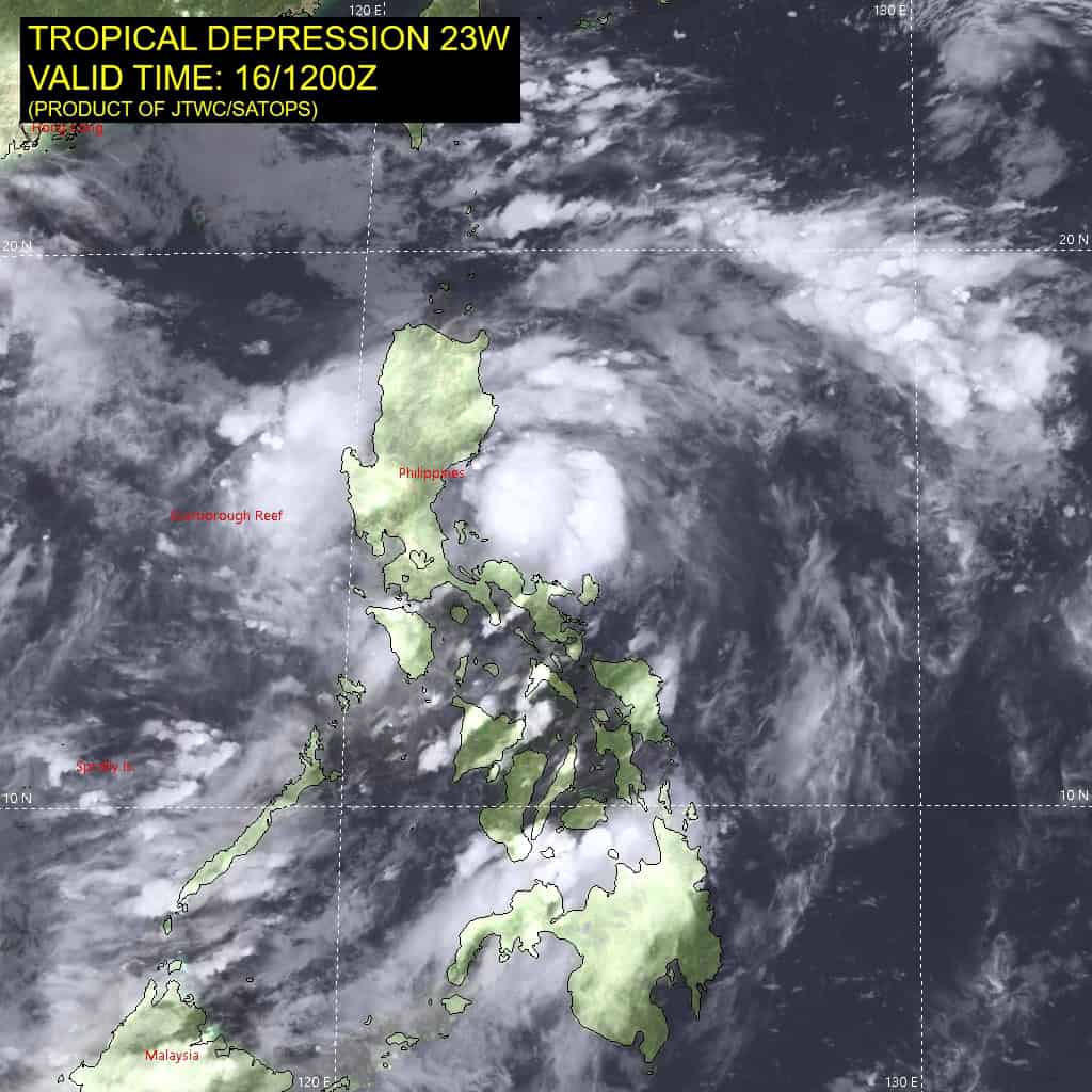
Tropical Cyclone 23W

")
By PDC’s Senior Weather
Specialist Glenn James

The Pacific Disaster Center’s (PDC Global) Tuesday, September 16, 2025, Tropical Cyclone Activity Report…for the Pacific Ocean, the Indian Ocean, and adjacent Seas
Current Tropical Cyclones:
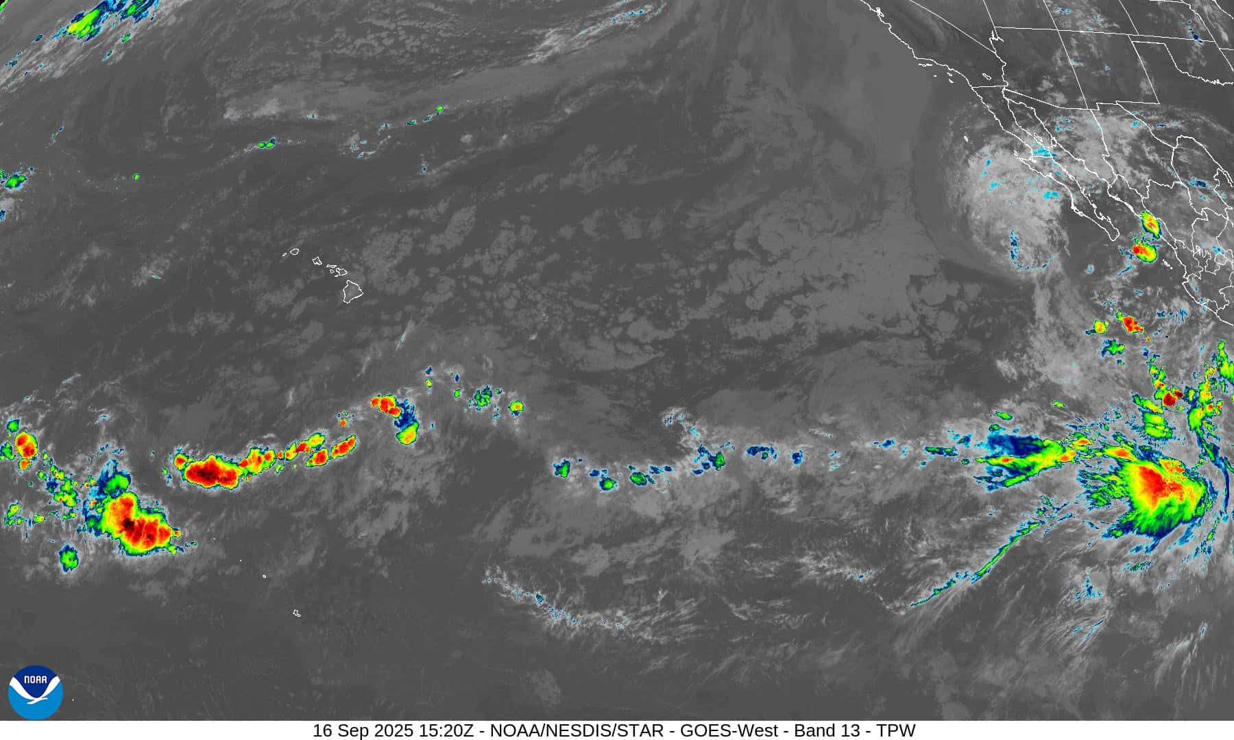
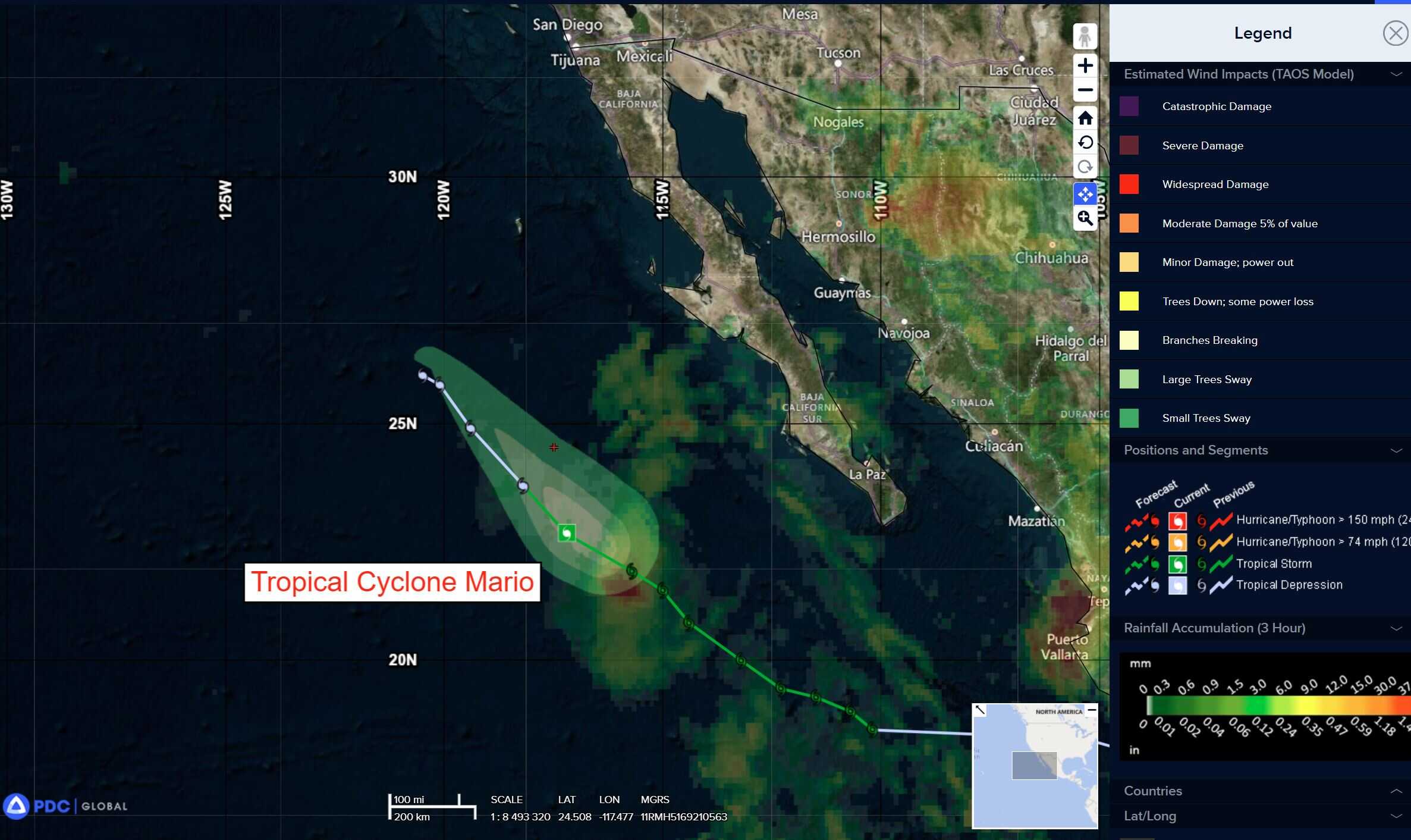
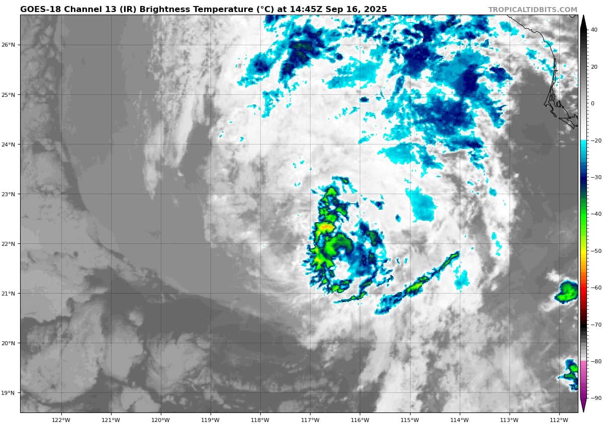
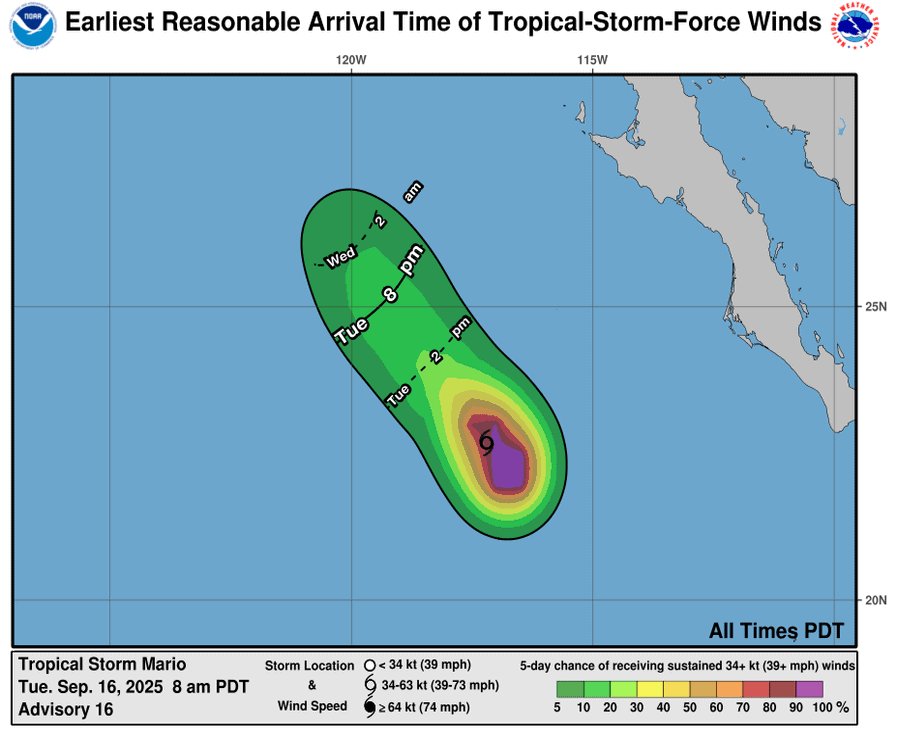
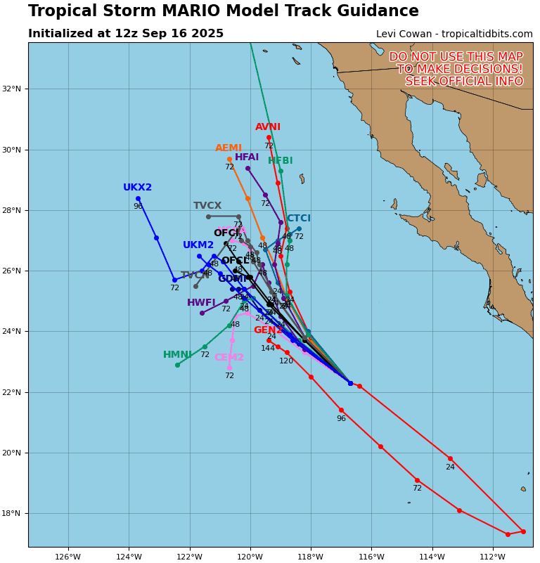
Tropical Cyclone Mario is located about 495 miles west of the southern tip of Baja California
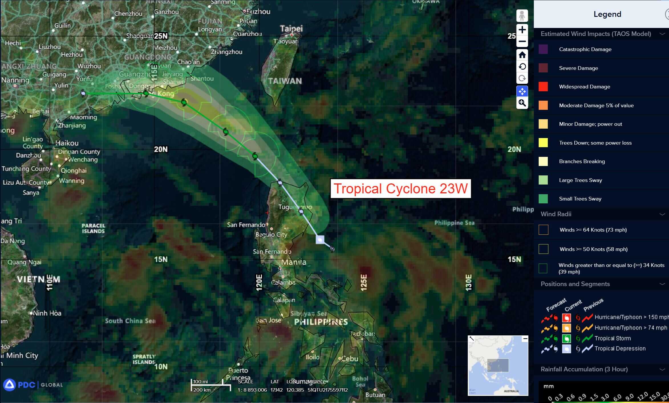
Tropical Cyclone 23W is located approximately 114 NM northeast of Manila, Philippines
Northeast Pacific Ocean:
Tropical Cyclone Mario
MOISTURE FROM MARIO COULD AFFECT THE SOUTHWESTERN UNITED STATES BY THURSDAY
According to the NHC advisory number 17
The depression is moving toward the northwest near 10 mph (17 km/h), and this general motion is expected to continue with a decrease in forward speed over the next day.
Satellite-derived winds indicate maximum sustained winds have decreased to near 35 mph (55 km/h) with higher gusts. Mario will continue to weaken and is expected to become a post-tropical remnant low tonight.
The estimated minimum central pressure is 1005 mb (29.68 inches).
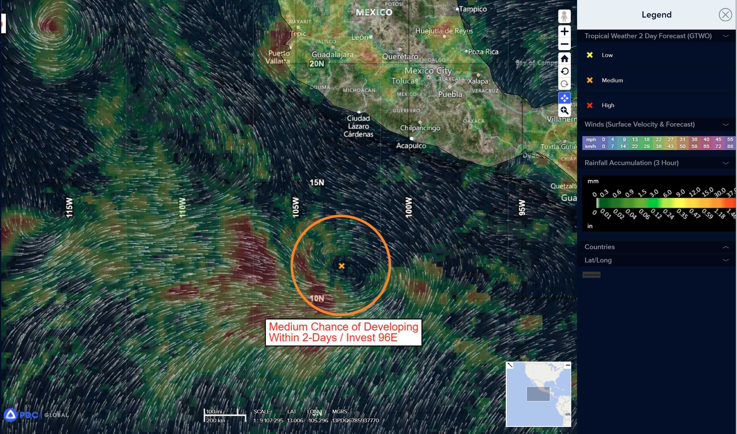
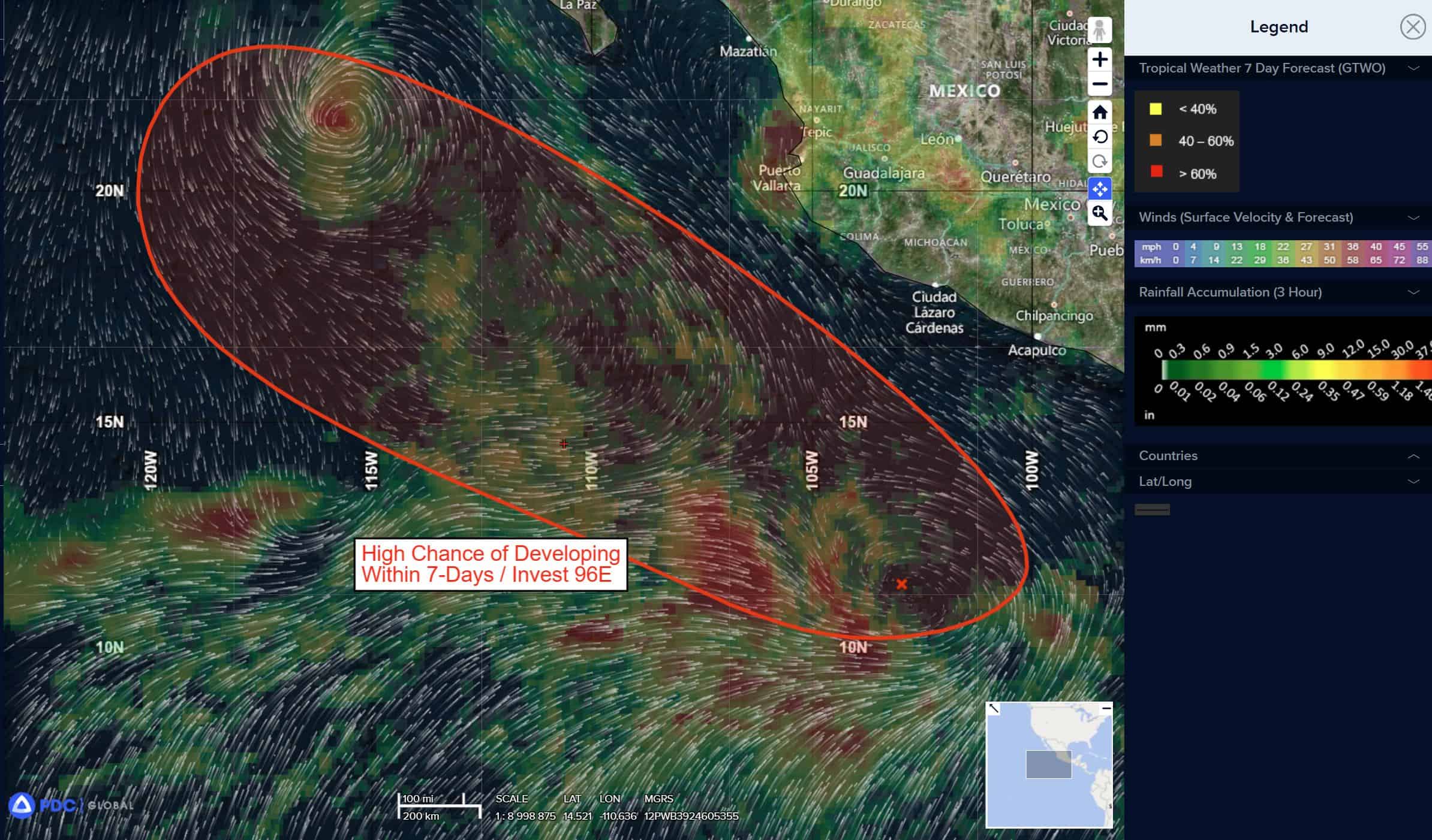
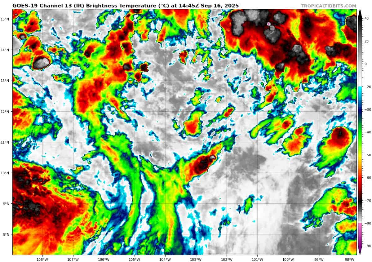
Off the coast of Southwestern Mexico:
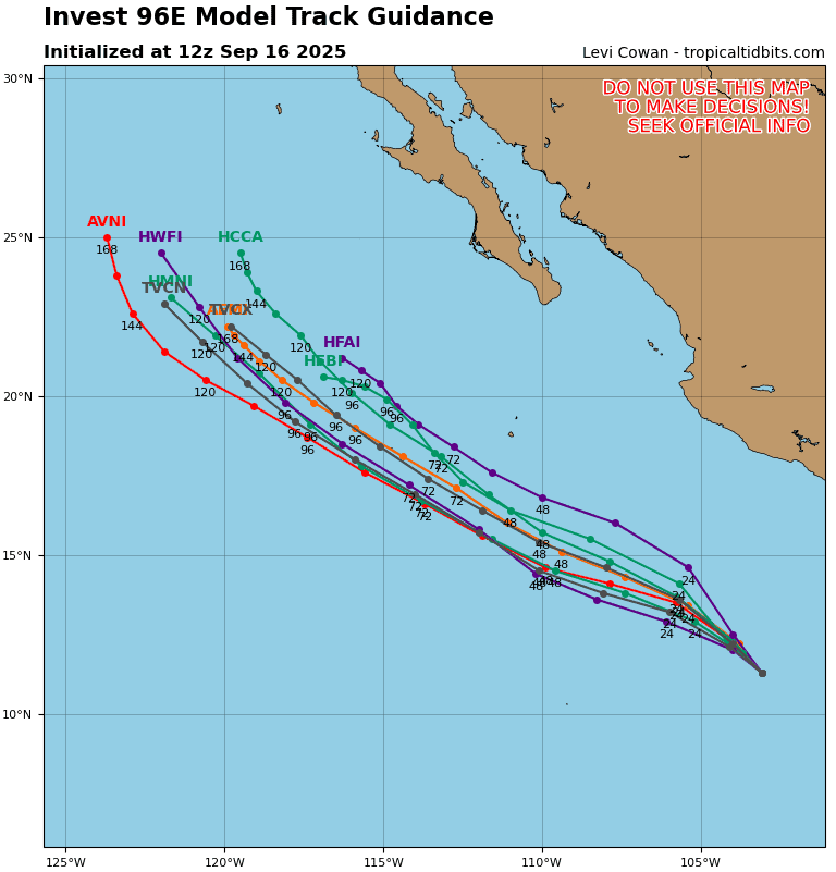
Invest 96E
>>> An area of low pressure located several hundred miles off the coast of southern Mexico continues to produce a large area of disorganized showers and thunderstorms. Environmental conditions appear conducive for additional development of this system, and a tropical depression is likely to form during the next couple of days as it moves west-northwestward at 10 to 15 mph over the central east Pacific.
*Formation chance through 48 hours…high…70 percent
*Formation chance through 7 days…high…90 percent
Central Pacific Ocean: There are no Tropical Cyclones
Tropical cyclone formation is not expected during the next 7 days.
Western Pacific, Indian Ocean, and adjacent Seas:
Western Pacific
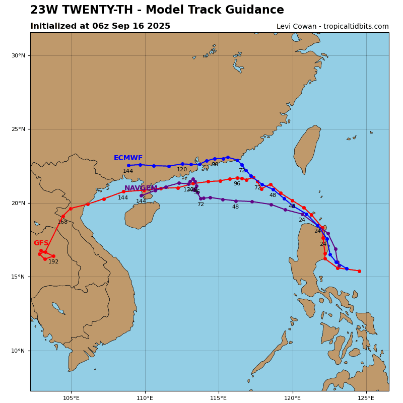
Tropical Cyclone 23W
According to the JTWC warning number 3…sustained winds are 45 knots with gusts to near 55 knots
Animated enhanced infrared (eir) satellite imagery depicts deep convection building over a partially obscured low-level circulation center (llcc) which is representative of the developing trend tropical depression 23W has continued on over the last six hours.
TD 23W will track in a northwestward direction for the next 48 hours while under the steering influence of a subtropical ridge to the northeast. While on this track, TD 23W will pass over luzon between 0-24 hours and inhibit intensification. When the system passes back out over water at 36 hours, the system will resume intensification to a peak of 55kts while in a favorable environment of low vertical wind shear, warm sea surface
temperatures, and strong upper-level divergence.
A new subtropical ridge approaching from the northwest will become the primary steering influence between 48-72 hours, which will result in a westward track for the remainder of the forecast period. TD 23W will make landfall in the vicinity of Hong Kong following 72 hours, causing the system to begin dissipating by the end of the forecast period.
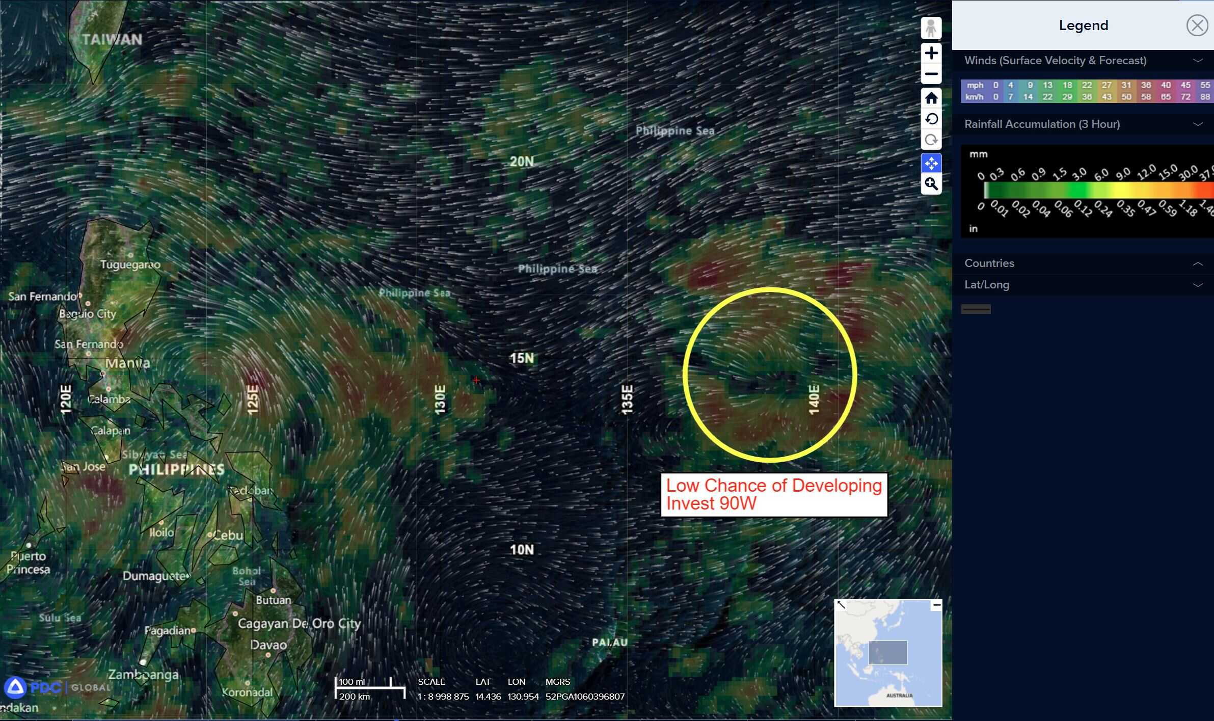
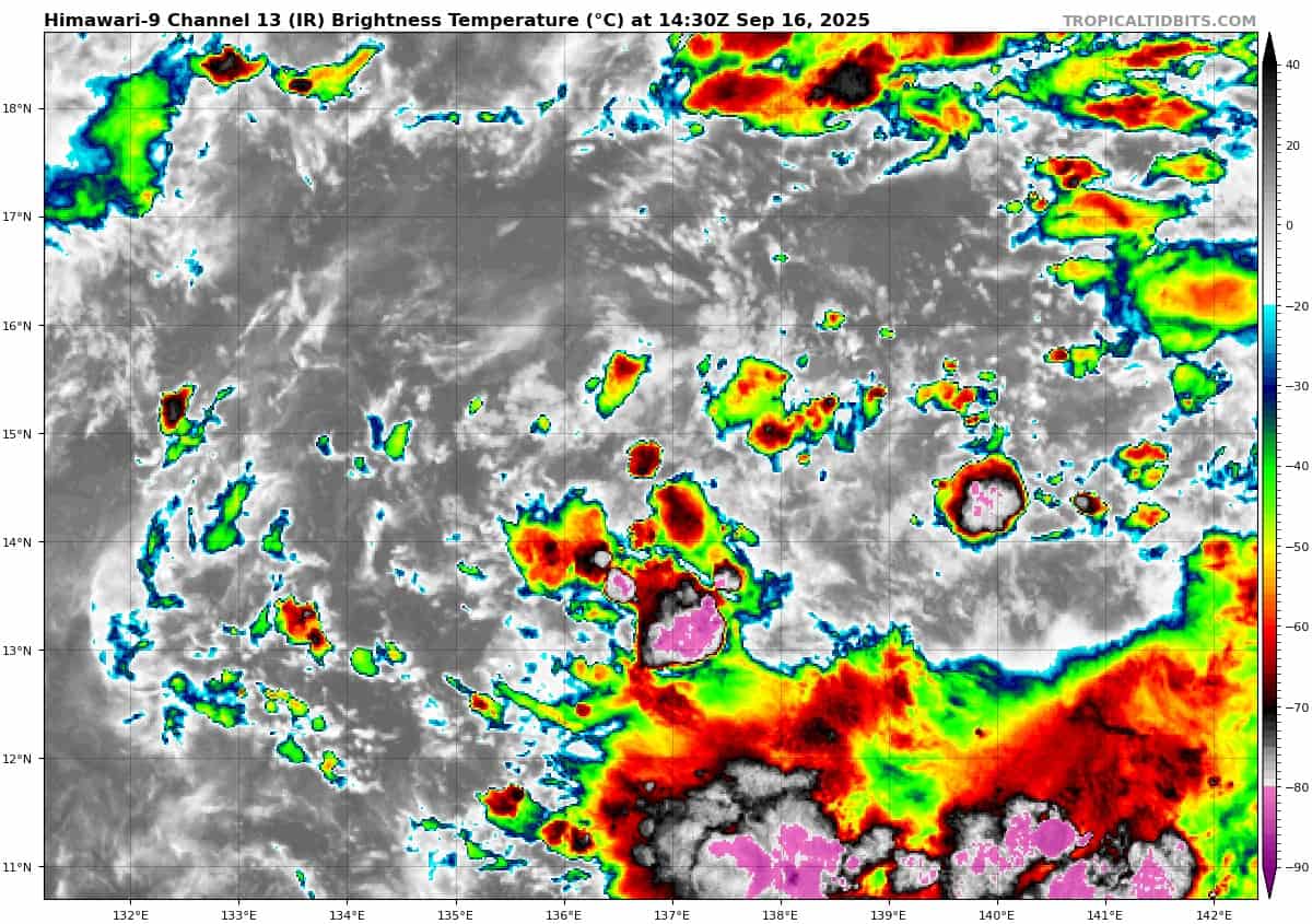
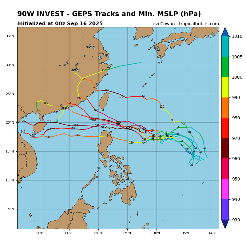
>>> There’s a, area of disturbed weather being referred to as Invest 90W, which is located approximately 333 NM north of Yap
Animated multi-spectral satellite imagery depicts a compacting developing system with troughing and broad turning.
Environmental analysis reveals favorable conditions with low vertical wind shear, improved equatorward outflow, and warm sea surface temperatures.
Global models indicate circulation development and increasing wind speeds over the next 24-48 hours.
Maximum sustained surface winds are estimated at 13 to 18 knots.
The potential for the development of a significant tropical cyclone within the next 24 hours is low.