The Pacific Disaster Center’s (PDC Global) Sunday, September 14, 2025, Tropical Cyclone Activity Report…for the Pacific Ocean, the Indian Ocean, and adjacent Seas
Current Tropical Cyclones:
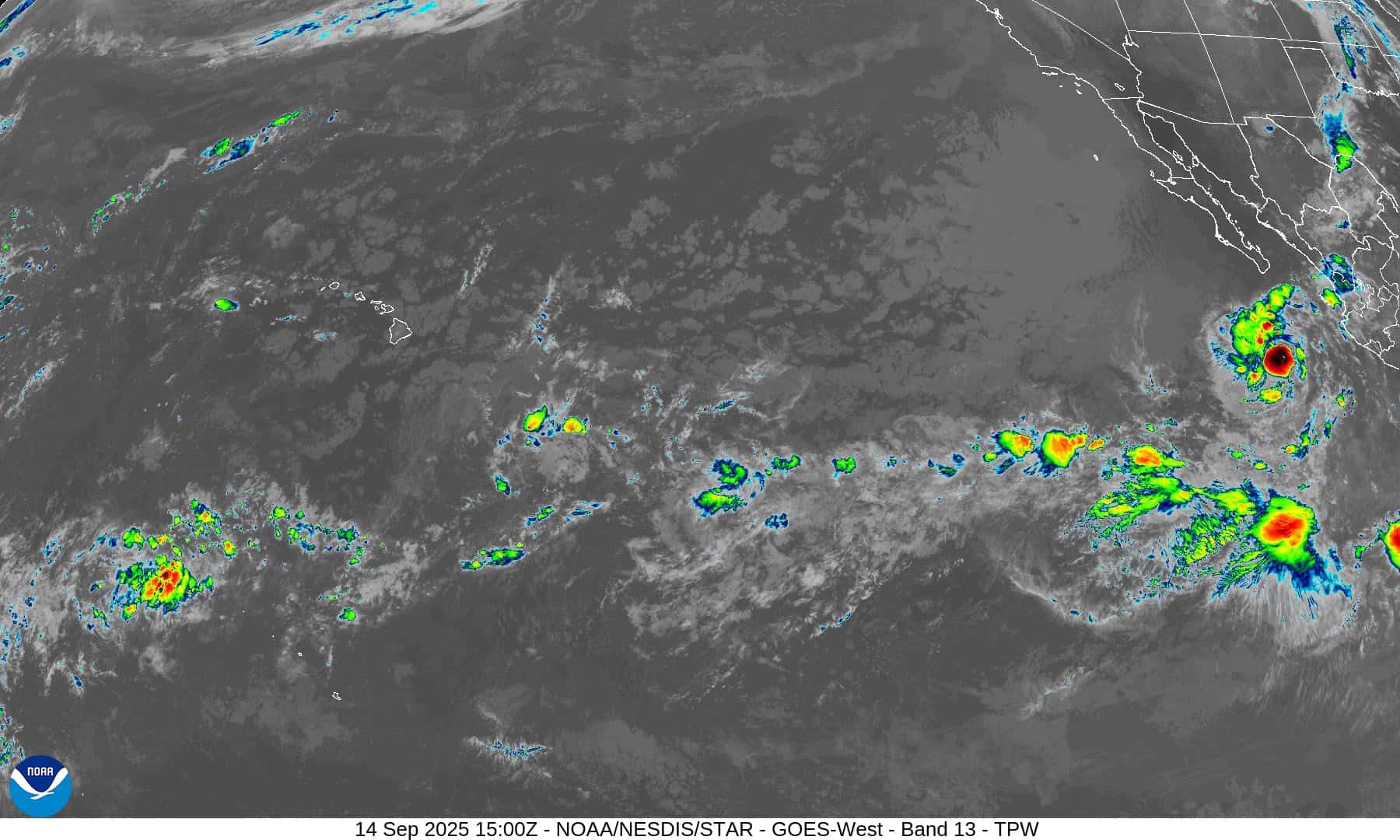
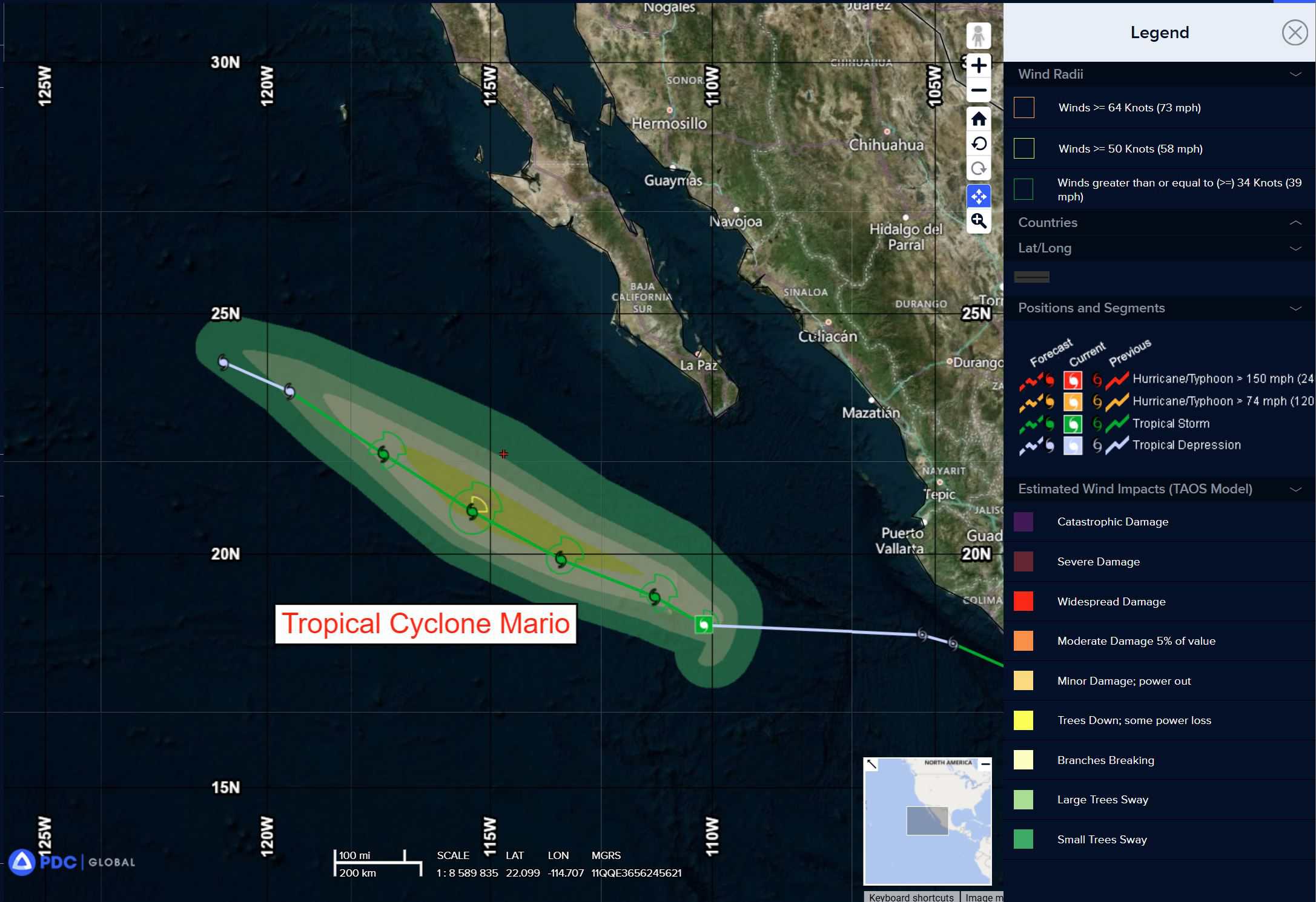
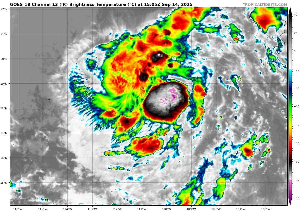
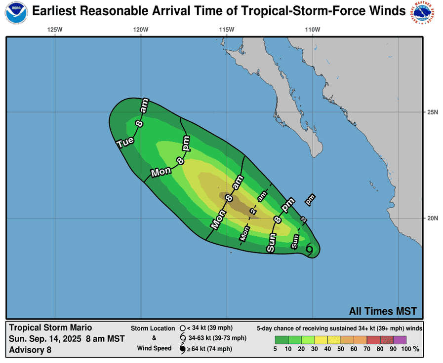
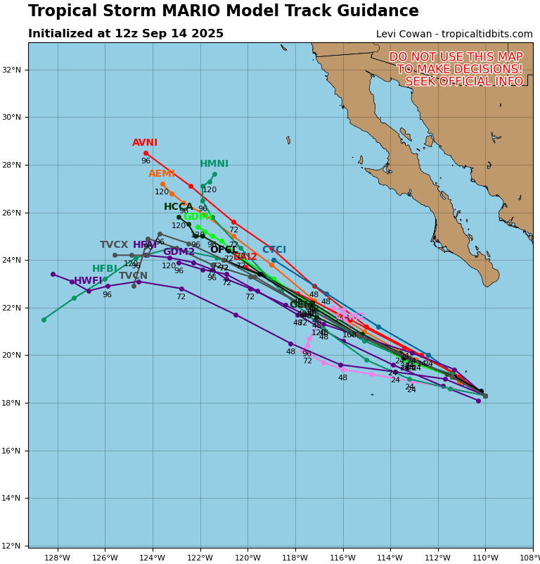
Tropical Cyclone Mario is located about 275 miles south-southwest of the southern tip of Baja California
Northeast Pacific Ocean:
Tropical Cyclone Mario
MARIO MAINTAINING INTENSITY WHILE PASSING NEAR SOCORRO ISLAND
According to the NHC advisory number 10
Mario is moving toward the west-northwest near 9 mph (15 km/h), and this general motion is expected to continue over the next couple of days. Maximum sustained winds are near 45 mph (75 km/h) with higher gusts. Some slight strengthening is expected into Monday, followed by a weakening trend beginning Monday night and Tuesday. Tropical-storm-force winds extend outward up to 25 miles (35 km) from the center. The estimated minimum central pressure is 1001 mb (29.56 inches).
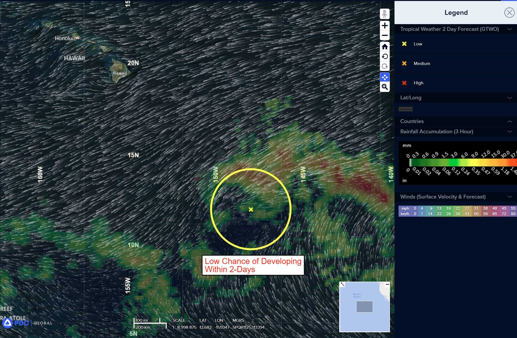
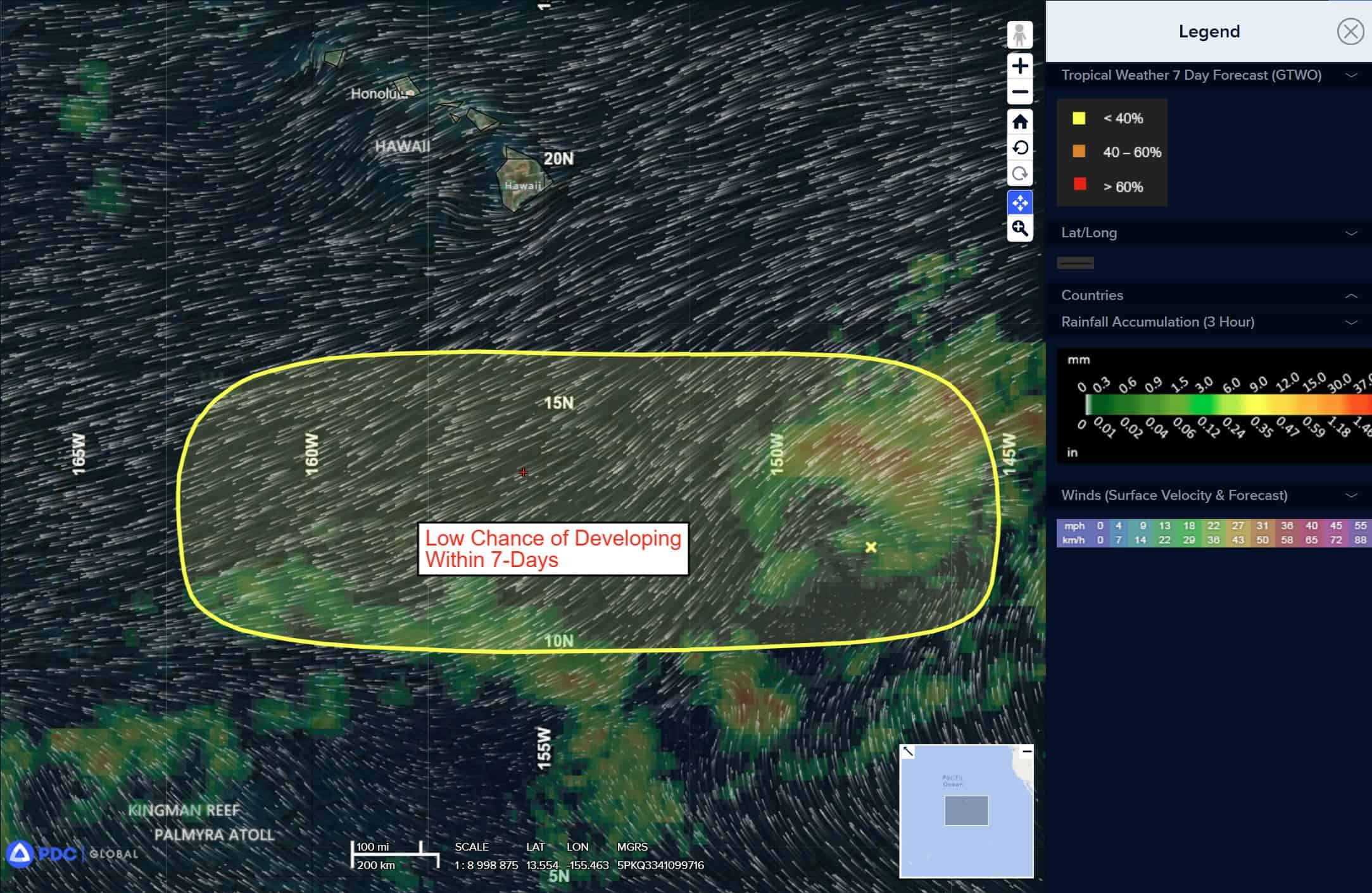
Off the coast of Southwestern Mexico:
>>> An elongated trough of low pressure located several hundred miles off the coast of southern Mexico is producing disorganized showers and thunderstorms.
Environmental conditions appear conducive for some gradual development of this system, and a tropical depression could form during the middle to latter part of this week as it moves west-northwestward at 10 to 15 mph over the central east Pacific.
*Formation chance through 48 hours…low…10 percent
*Formation chance through 7 days…medium…50 percent
Central Pacific Ocean: There are no Tropical Cyclones
Tropical cyclone formation is not expected during the next 7 days.
Western Pacific, Indian Ocean, and adjacent Seas: There are no Tropical Cyclones
Western Pacific
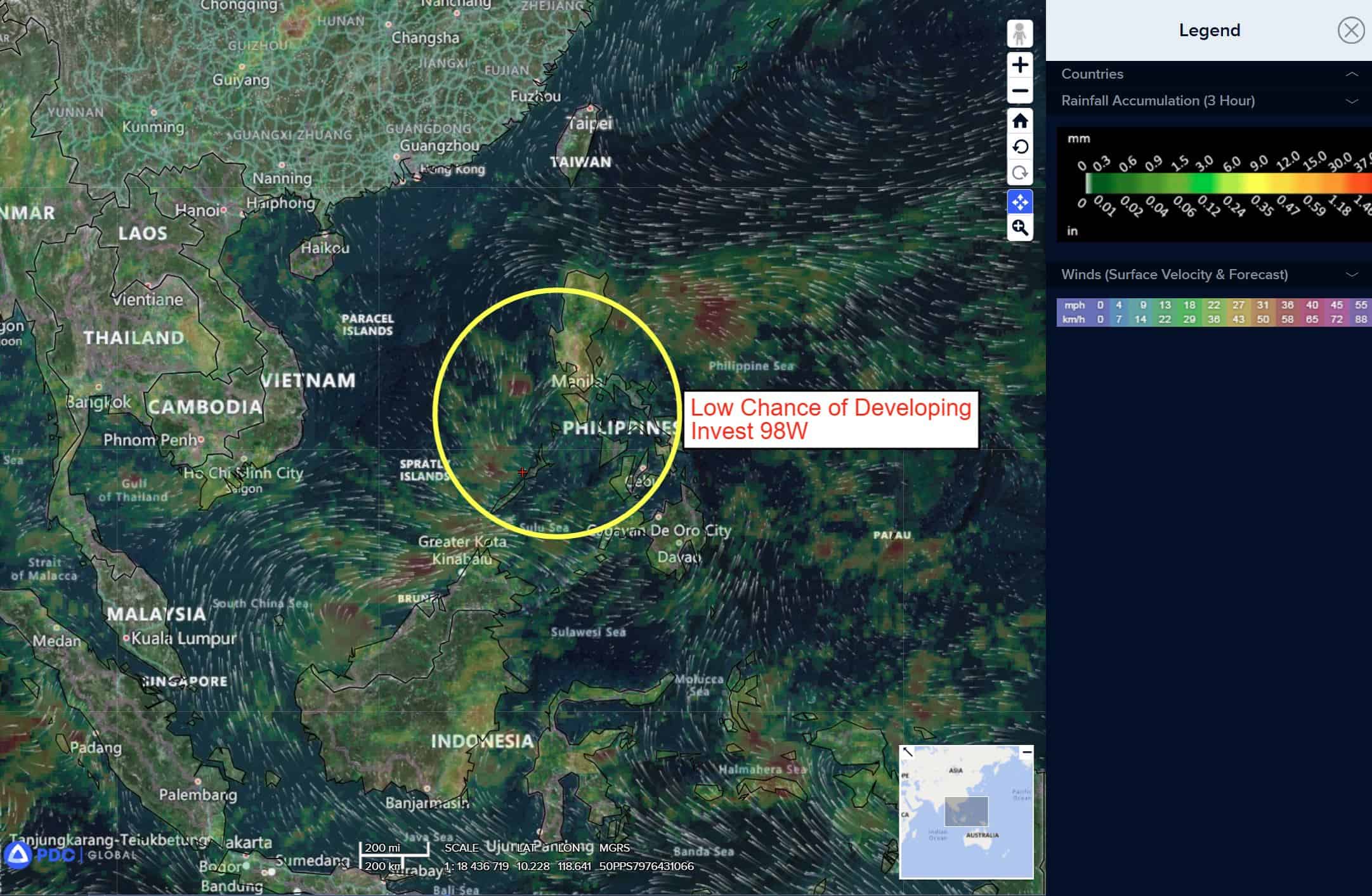
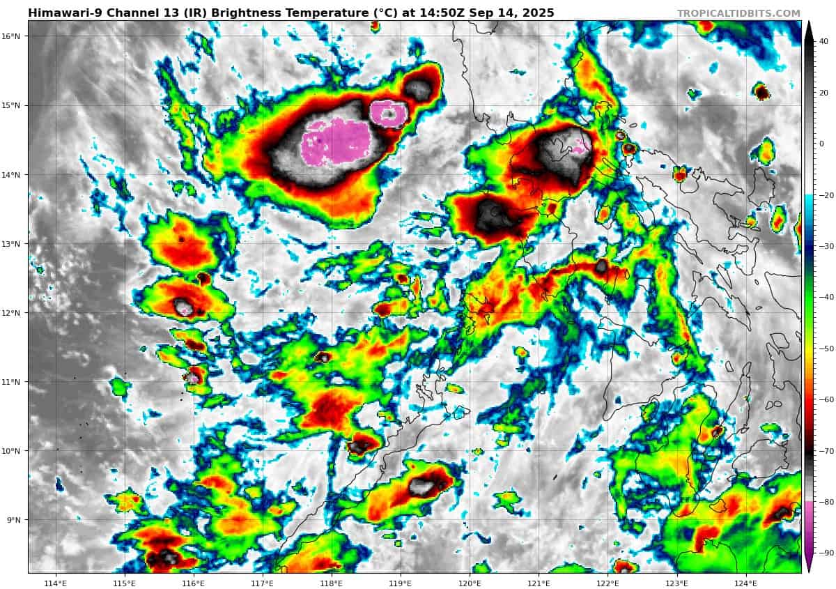
>>> There’s an area of disturbed weather being referred to as Invest 98W, which is located approximately 615 NM east-southeast of Da Nang, Vietnam
Animated multi-spectral satellite imagery (msi) depicts a poorly defined low-level circulation with flaring convection in the northern and western peripheries. A 150217z metop-c ascat pass revealed a broad low level circulation with 10-15 kt winds wrapping from the northern portion of the system.
Environmental analysis indicates marginally favorable conditions for development with low vertical wind shear (5-10 kts), and warm (29-30 c) sea surface temperatures, offset by weak equatorward outflow aloft and the broad nature of the wind field.
Global deterministic models are in agreement that 98W will propagate northwestward through the South China Sea with little development. Ensemble models are also in agreement on a northwestward track over the next 24 hours, with ECENS being more aggressive with the intensity of the system.
Maximum sustained surface winds are estimated at 13 to 18 knots.
The potential for the development of a significant tropical cyclone within the next 24 hours remains low.

")