The Pacific Disaster Center’s (PDC Global) Thursday, September 11, 2025, Tropical Cyclone Activity Report…for the Pacific Ocean, the Indian Ocean, and adjacent Seas
Tropical Cyclone 13E is located about 65 miles south-southeast of Acapulco, Mexico
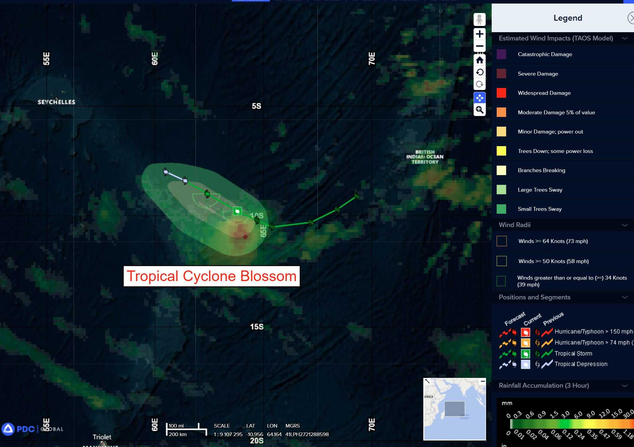
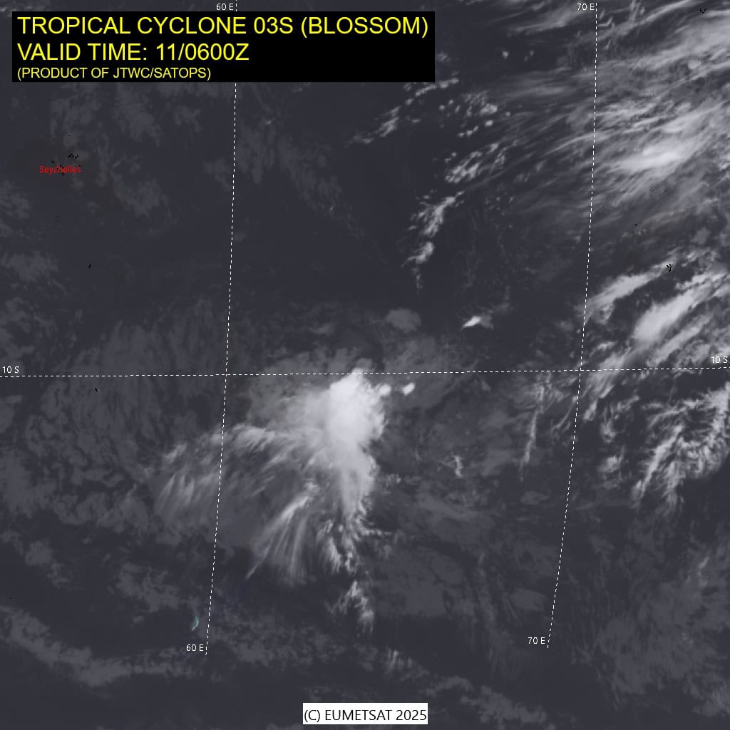
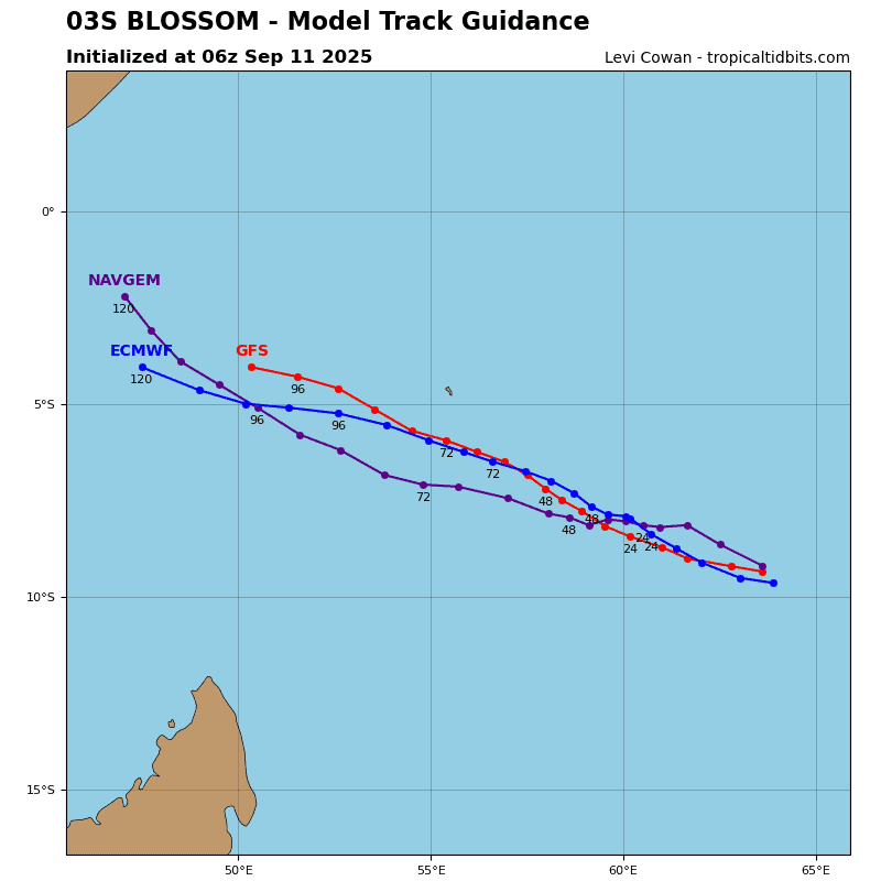
Tropical Cyclone 03S (Blossom) is located approximately 587 NM west-southwest of Diego Garcia
Northeast Pacific Ocean:
Tropical Cyclone 13E
TROPICAL DEPRESSION THIRTEEN-E HEADING WEST-NORTHWESTWARD OFF THE COAST OF SOUTHERN MEXICO
According to the NHC advisory number 2…
The depression is moving toward the west-northwest near 12 mph (19 km/h), and this general motion is expected to continue during the next couple of days. On the forecast track, the center of the depression will move parallel to, but offshore of, the southwestern coast of mainland Mexico.
Maximum sustained winds are near 35 mph (55 km/h) with higher gusts. Some strengthening is forecast during the next 48 hours.
Slow strengthening is expected during the next couple of days, and Thirteen-E is forecast to become a Tropical Storm later tonight.
The estimated minimum central pressure is 1007 mb (29.74 inches).
HAZARDS AFFECTING LAND
RAINFALL: Tropical Depression Thirteen-E will lead to rainfall totals of 2 to 4 inches, with local amounts of 6 inches, across southern and southwestern Mexico through Sunday. This brings a risk of flash flooding, especially in areas of higher terrain.
WIND: Gusty winds are possible over portions of the southern coast of Mexico from Punta Maldonado through Manzanillo during the next day or so.
Central Pacific Ocean: There are no Tropical Cyclones
Tropical cyclone formation is not expected during the next 7 days.
Western Pacific, Indian Ocean, and adjacent Seas:
South Indian Ocean
Tropical Cyclone 03S (Blossom)
According to the JTWC warning number 7, sustained winds are 35 knots with gusts to near 45 knots
Animated enhanced infrared (eir) satellite imagery depicts a compact, exposed low-level circulation (llc) with flaring deep convection over the southwestern quadrant. a bullseye 110529z
ascat-c image reveals a broad circulation with 30-35 kt winds
confined to the southern semicircle associated with the gradient
flow to the south.
Environmental analysis indicates a marginal environment characterized by high vertical wind shear (vws) and dry air entrainment, offset slightly by moderate poleward outflow and warm sea surface temperatures (ssts).
Tropical cyclone 03S is expected to track west-northwestward along the northeast periphery of the low-level str for the duration of the forecast period. The system is expected to weaken significantly over the forecast period due to extensive dry air entrainment and increasing vws (40-45 kts). 03S is forecast to dissipate no later than 36 hours.
>>> There’s an area of disturbed weather being referred to as Invest 93S, which is located approximately 338 NM west-northwest of Cocos Islands
Animated multi-spectral satellite imagery (msi) and a 110400z mwr 89ghz microwave image depict an obscured, low level circulation (llc) with persistent, disorganized convection over the center.
Environmental analysis reveals a marginal environment for development with high vertical wind shear (vws) of 40-50 knots, good poleward upper-level outflow, and warm sea surface
temperatures (sst) of 28-29 c.
Deterministic and ensemble models are in disagreement on the intensity of the system but are in good agreement on a generally southwestward track.
Maximum sustained surface winds are estimated at 22 to 28 knots.
The potential for the development of a significant tropical cyclone within the next 24 hours is downgraded to low.

")