Western Pacific, Indian Ocean, and adjacent Seas:
Tropical Cyclone 21W (Peipah)

")

By PDC’s Senior Weather
Specialist Glenn James

The Pacific Disaster Center’s (PDC Global) Wednesday, September 3, 2025, Tropical Cyclone Activity Report…for the Pacific Ocean, the Indian Ocean, and adjacent Seas
Current Tropical Cyclones:
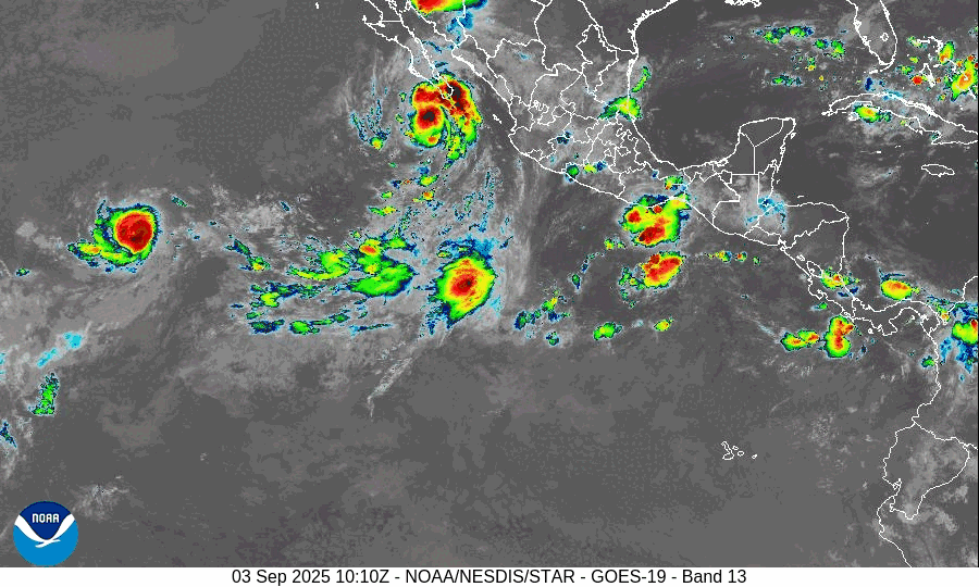
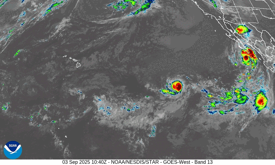
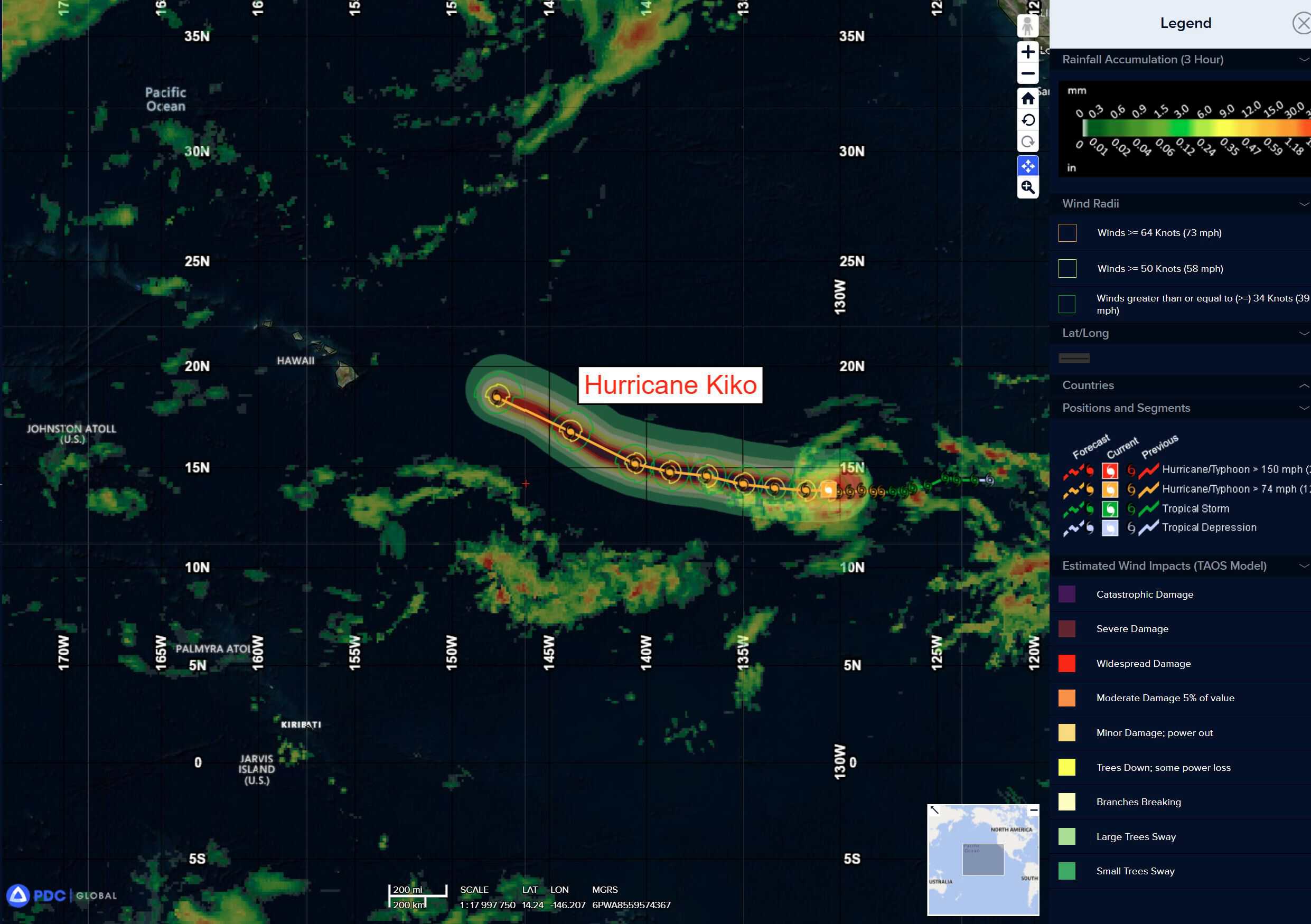
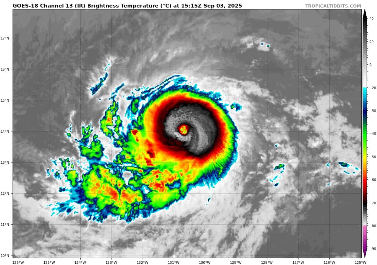
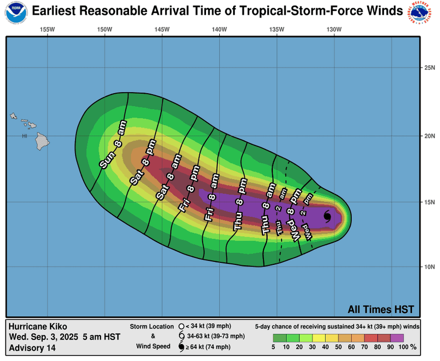
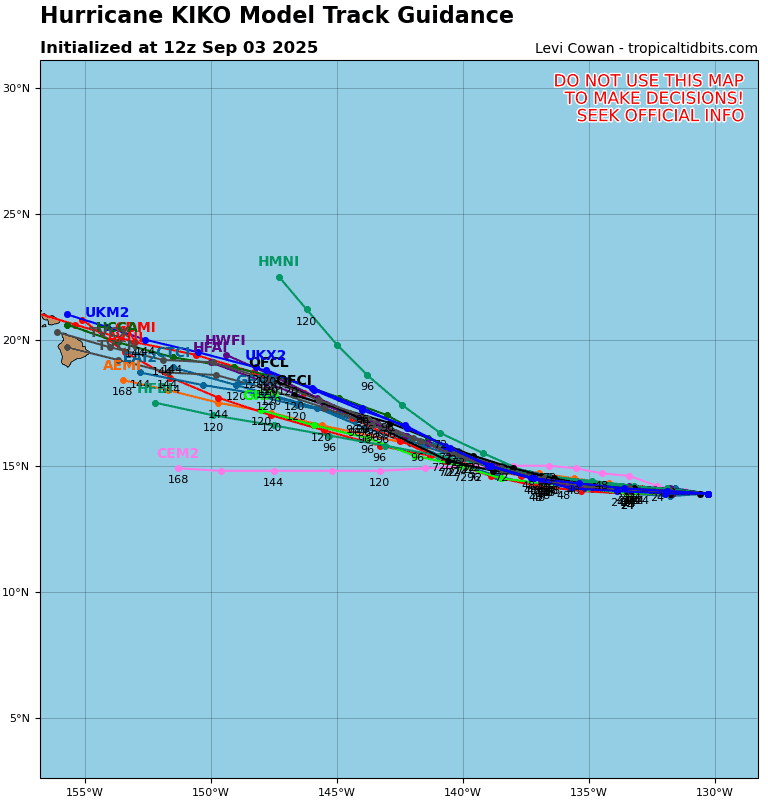
Tropical Cyclone 11E (Kiko) is located about 1560 miles east of Hilo, Hawaii
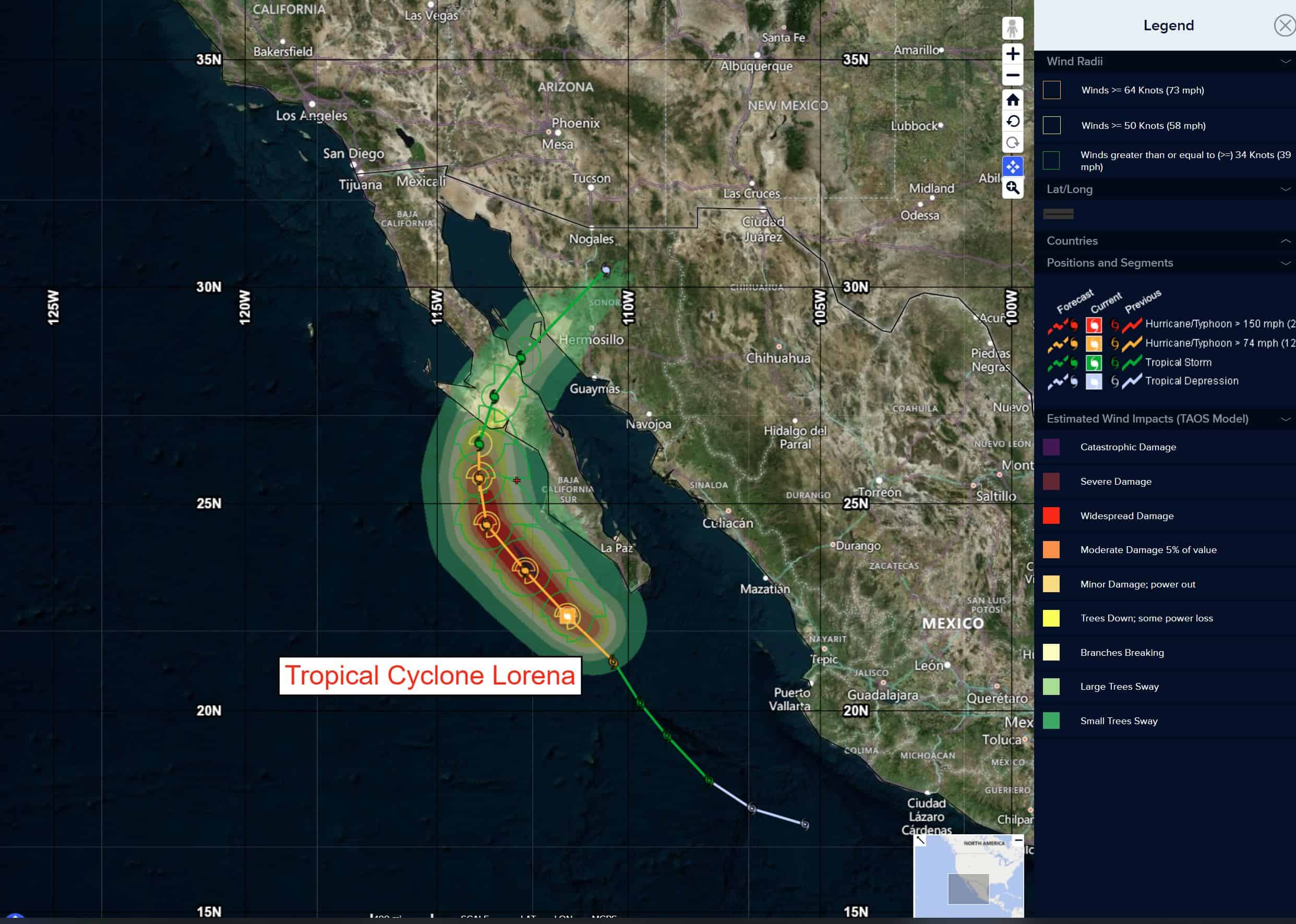
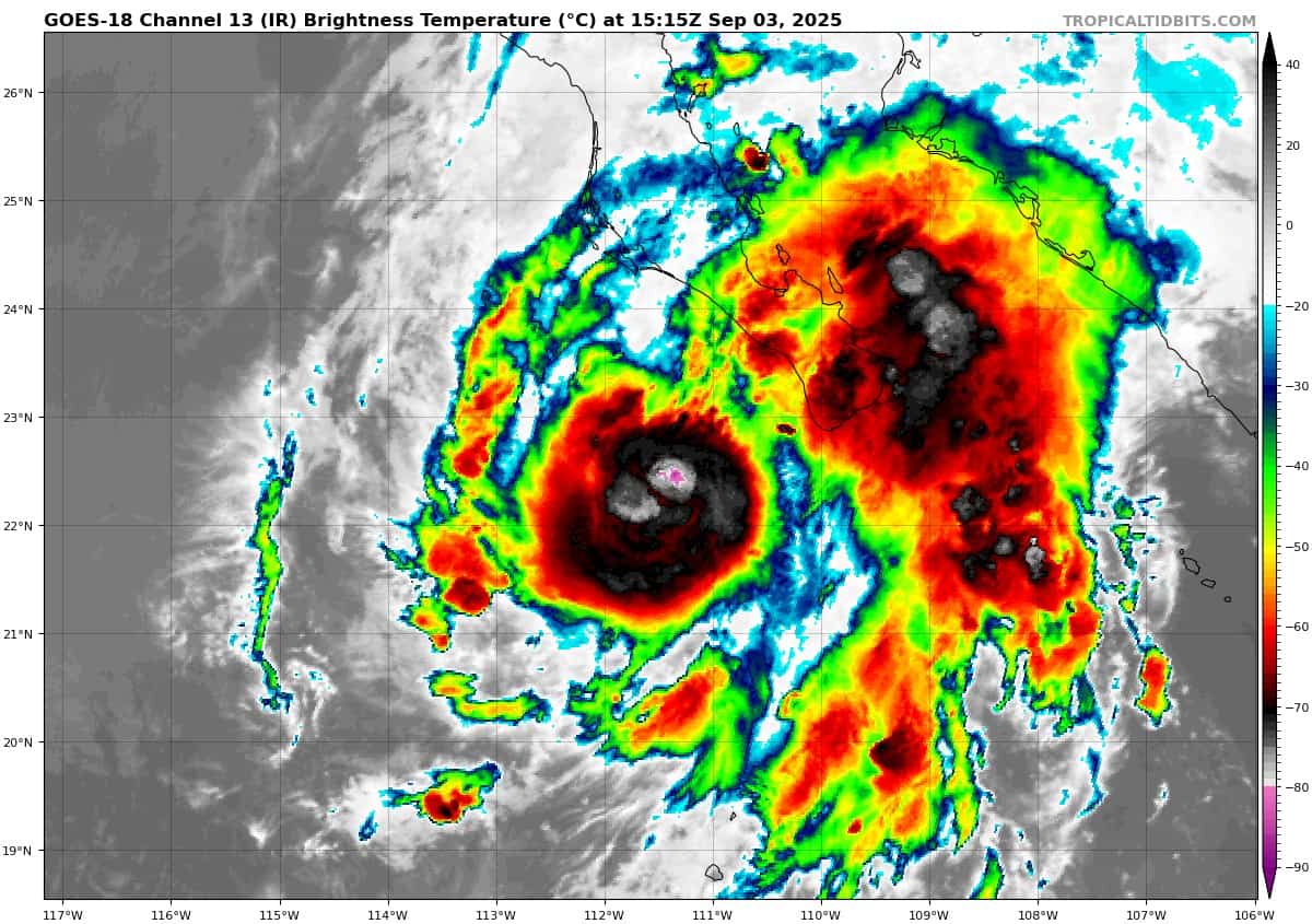
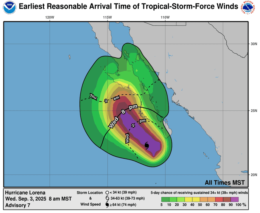
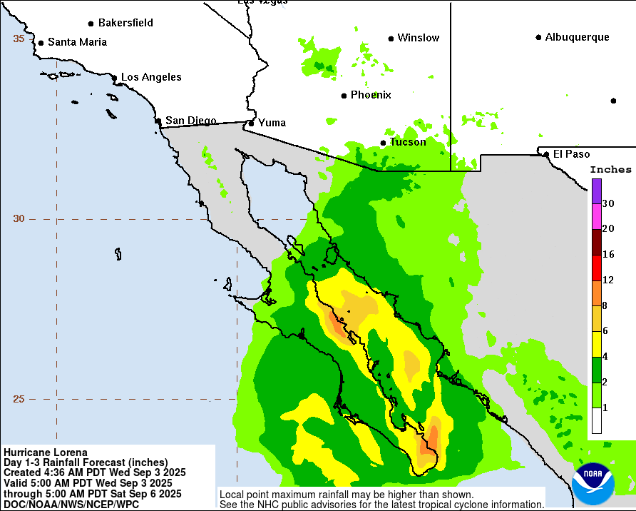
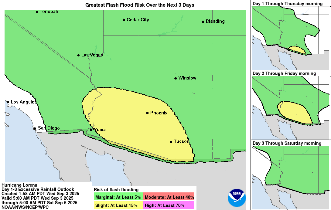
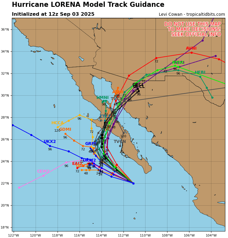
Tropical Cyclone 12E (Lorena) is located about 210 miles west of Cabo San Lucas, Mexico
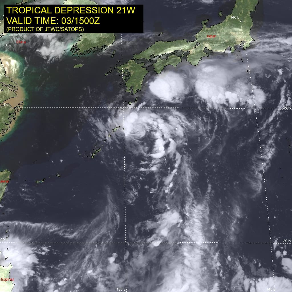
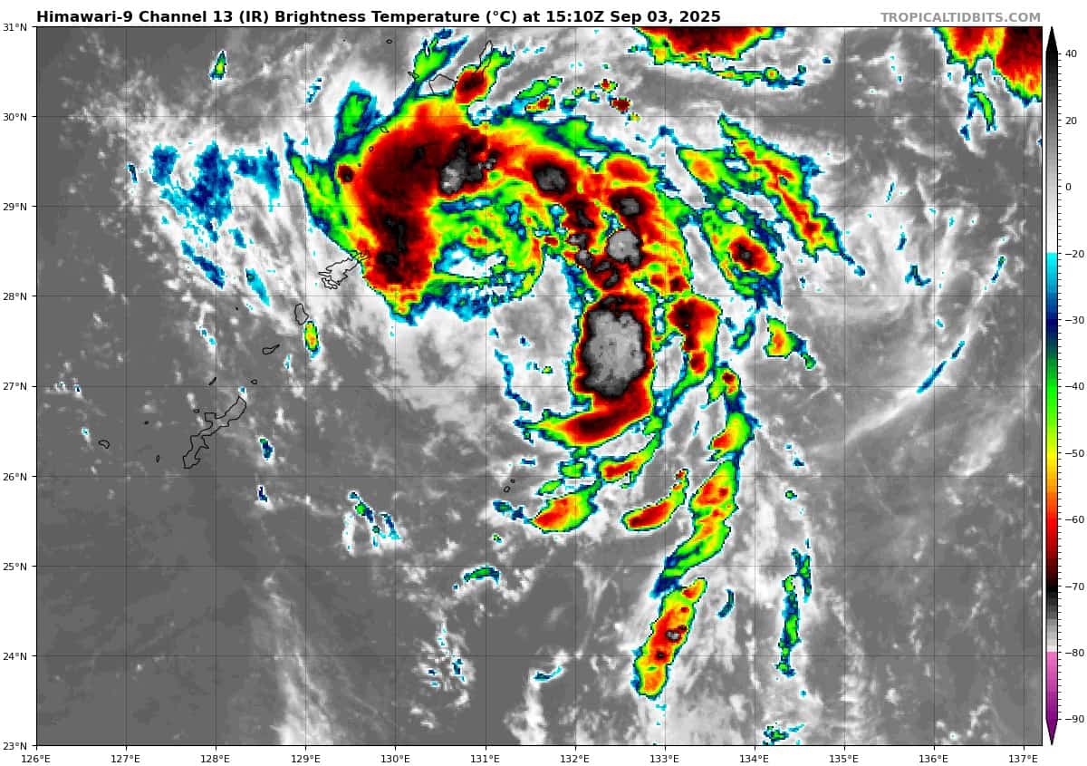
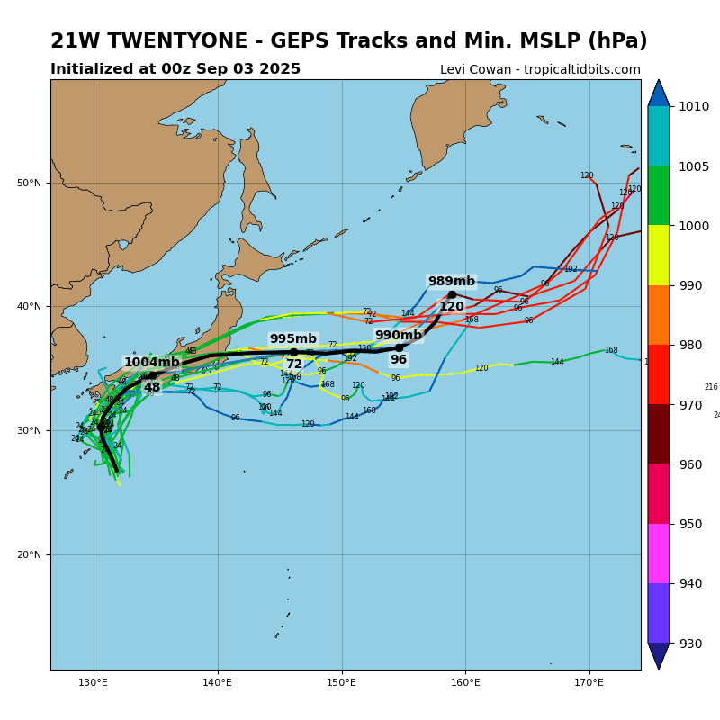
Tropical Cyclone 21W (Peipah) is located about 216 miles south-southeast of Sasebo, Japan
Northeast Pacific Ocean:
Tropical Cyclone 11E (Kiko)
KIKO STRENGTHENS SOME MORE WELL TO THE EAST-SOUTHEAST OF THE HAWAIIAN ISLANDS
According to the NHC advisory number 16
Kiko is moving toward the west near 9 mph and this general motion is expected to continue through Thursday night. A turn toward the west-northwest is expected on Friday, with a gradual increase in forward speed expected over the weekend as Kiko approaches the Hawaiian Islands from the east. Maximum sustained winds are near 145 mph with higher gusts. Kiko is a category 4 hurricane on the Saffir-Simpson Hurricane Wind Scale. Little change in strength is forecast through Friday, followed by gradual weakening over the weekend. Hurricane-force winds extend outward up to 25 miles from the center and tropical-storm-force winds extend outward up to 80 miles.
Tropical Cyclone 12E (Lorena)
LORENA A LITTLE STRONGER BUT EXPECTED TO WEAKEN QUICKLY ON THURSDAY AND FRIDAY…RISK OF LIFE-THREATENING FLASH FLOODING CONTINUES FOR BAJA CALIFORNIA SUR AND SOUTHWESTERN SONORA
According to the NHC advisory number 9
Lorena is moving toward the northwest near 12 mph, and this motion with a decrease in forward speed is expected through early Thursday. A slow northward or north-northeastward motion is expected to begin on Thursday and continue into the weekend. On the forecast track, the center of Lorena is expected to move parallel to the west coast of the Baja California peninsula through Thursday, approach the coast of Baja California Sur Thursday night, and move inland over the Baja California peninsula on Friday. Maximum sustained winds are near 85 mph with higher gusts. Lorena is expected to begin weakening quickly and become a tropical storm on Thursday. Lorena is likely to degenerate into a remnant low near or over the Baja California peninsula by early Saturday. Hurricane-force winds extend outward up to 15 miles from the center and tropical-storm-force winds extend outward up to 80 miles.
HAZARDS AFFECTING LAND
RAINFALL: Bands of heavy rainfall will continue to impact Baja California Sur and move into southeastern Baja California and southwestern Sonora by Thursday, with this rainfall potentially persisting through Friday. Rainfall totals of 5 to 10 inches, with maximum amounts of 15 inches, are possible across portions of Baja California Sur, far southeast Baja California and southwestern Sonora through Friday. This will bring the risk of life-threatening flash floods and mudslides, especially in areas of higher terrain.
Within the moisture surge ahead of Lorena, 1 to 3 inches of rain, with localized totals up to 4 inches, are expected from the Mexico states of Sinaloa northward into Arizona through Friday, bringing the potential for isolated to scattered flash flooding.
WIND: Tropical storm conditions are expected in the warning area beginning tonight and will spread northward within the warning area in Baja California Sur through Thursday and into Friday. Tropical storm conditions are possible within the watch area south of Santa Fe through tonight, and in the watch area on the east coast of the Baja California peninsula Friday into Friday night.
STORM SURGE: Coastal flooding from storm surge is likely along the coast of Baja California Sur near and to the right of where Lorena makes landfall.
SURF: Swells generated by Lorena will continue affecting portions of the south and west coasts of Baja California Sur through Friday. These swells are likely to cause life-threatening surf and rip current conditions.
Central Pacific Ocean: There are no active tropical cyclones
The National Hurricane Center is issuing advisories on Hurricane Kiko, located in the East Pacific basin well east-southeast of the Hawaiian Islands. Kiko is expected to cross into the central Pacific basin Friday night.
The National Hurricane Center is also issuing advisories on Hurricane Lorena, located in the East Pacific basin just off the west coast of Baja California Sur.
Tropical cyclone formation is not expected during the next 7 days.
Western Pacific, Indian Ocean, and adjacent Seas:
Tropical Cyclone 21W (Peipah)