Western Pacific, Indian Ocean, and adjacent Seas:
Western Pacific

")


By PDC’s Senior Weather
Specialist Glenn James

The Pacific Disaster Center’s (PDC Global) Tuesday, September 2, 2025, Tropical Cyclone Activity Report…for the Pacific Ocean, the Indian Ocean, and adjacent Seas
Current Tropical Cyclones:
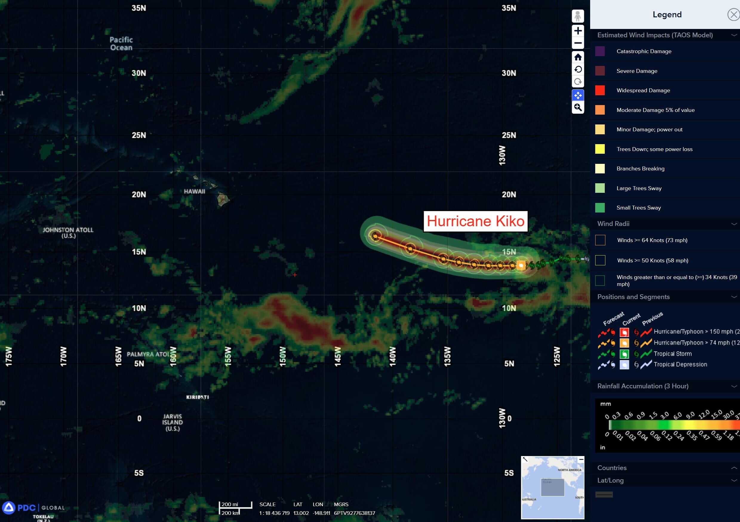
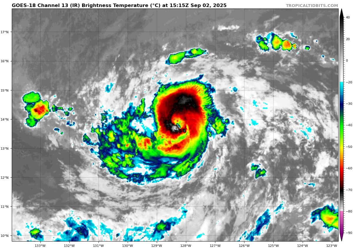
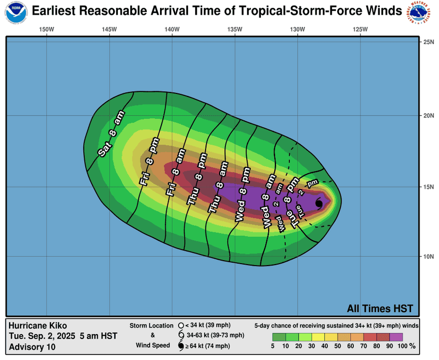
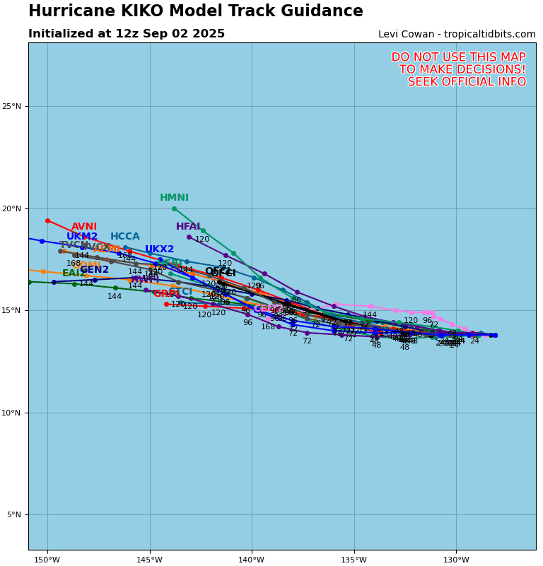
Tropical Cyclone 11E (Kiko) is located about 1740 miles east of Hilo, Hawaii
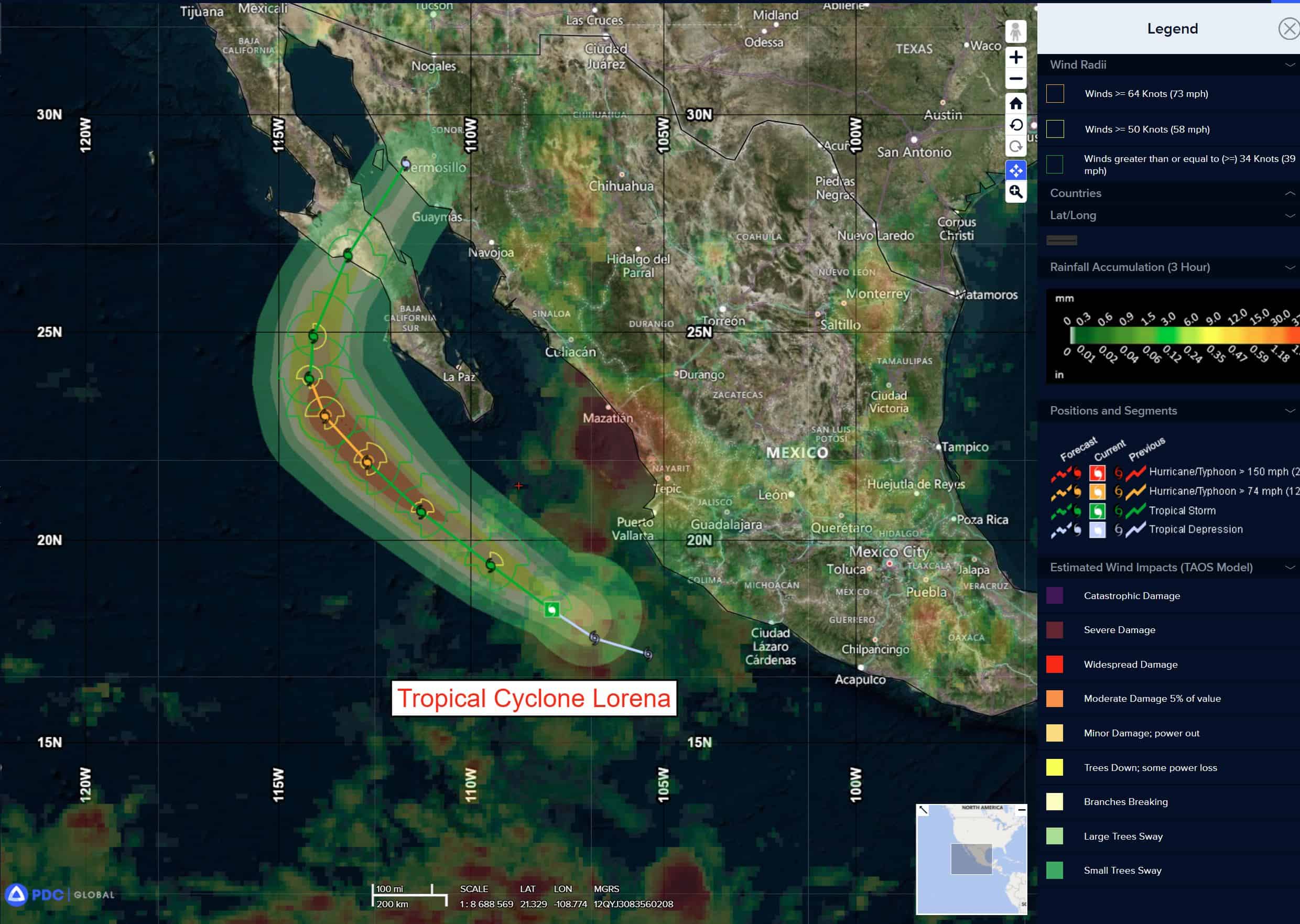
Tropical Cyclone 12E (Lorena) is located about 55 miles south of Cabo San Lucas, Mexico
Northeast Pacific Ocean:
Tropical Cyclone 11E (Kiko)
According to the NHC advisory number 12
KIKO INTENSIFIES TO CATEGORY 2 STRENGTH
Kiko is moving toward the west near 7 mph (11 km/h) and this general motion is expected to continue during the next couple of days. A gradual turn toward the west-northwest is expected late this week. Maximum sustained winds are near 105 mph (165 km/h) with higher gusts. Some additional strengthening is expected during the next day or so, and Kiko is forecast to become a major hurricane on Wednesday. Hurricane-force winds extend outward up to 15 miles (30 km) from the center and tropical-storm-force winds extend outward up to 80 miles (130 km).
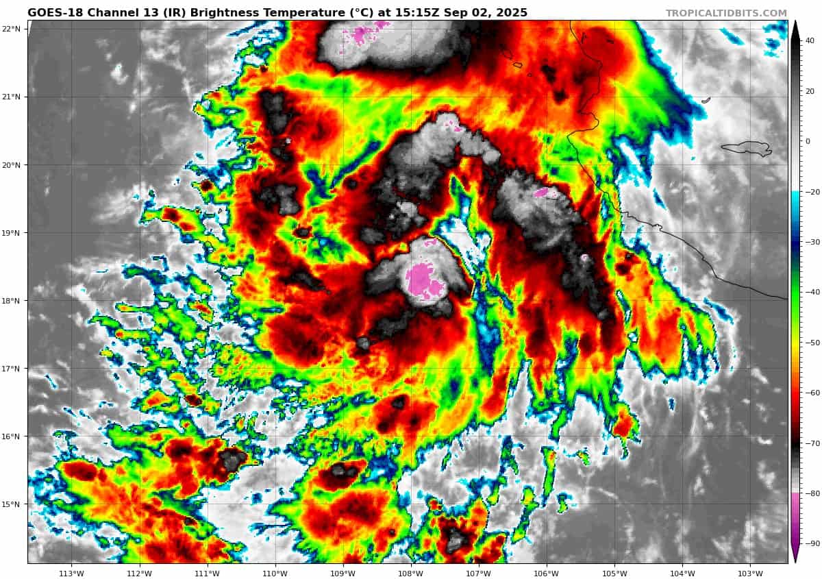
Tropical Cyclone 12E (Lorena)
According to the NHC advisory number 5A
LORENA STRENGTHENING AND EXPECTED TO BECOME A HURRICANE DURING THE NEXT SEVERAL HOURS
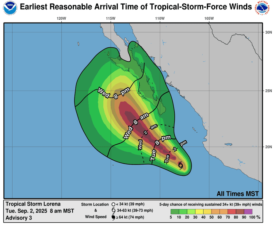
Lorena is moving toward the northwest near 14 mph (22 km/h), and this motion with a decrease in forward speed is expected through early Thursday. A generally slow northward motion is expected to begin by late Thursday and continue into late Friday. On the forecast track, the center of Lorena is expected to move parallel to the west coast of the Baja California peninsula on Wednesday and Thursday and then could approach the coast on Friday. Maximum sustained winds have increased to near 70 mph (110 km/h) with higher gusts. Rapid strengthening is forecast during the next day or so, and Lorena is likely to become a hurricane during the next several hours. Fast weakening is expected to begin on Thursday, and Lorena could be back to tropical storm status by early Friday. Tropical-storm-force winds extend outward up to 45 miles (75 km) from the center.
HAZARDS AFFECTING LAND
RAINFALL: Areas of heavy rainfall well east and northeast of Tropical Storm Lorena will continue to impact portions of northwestern Mexico from the states of Colima to Sinaloa today, with isolated flash flooding possible in areas of mountainous terrain.
Bands of heavy rainfall are expected to begin impacting Baja California Sur by Wednesday and potentially persist through Friday, with rainfall totals of 4 to 8 inches, with maximum amounts of 12 inches possible across portions of Baja California Sur and southwestern Sonora through Friday. Uncertainty remains with these totals, and locally higher or lower amounts are possible depending on the track and strength of the system. Potentially significant flash flooding is a possibility.
WIND: Tropical storm conditions are possible within the watch area by late Wednesday into Thursday.
Central Pacific Ocean: There are no active tropical cyclones
The National Hurricane Center is issuing advisories on Hurricane Kiko, located in the East Pacific basin well east-southeast of the Hawaiian Islands. Kiko is expected to cross into the central Pacific basin over the weekend.
The National Hurricane Center is also issuing advisories on Tropical Storm Lorena, located in the East Pacific basin around 155 miles south of Cabo San Lucas, Mexico.
Tropical cyclone formation is not expected during the next 7 days.
Western Pacific, Indian Ocean, and adjacent Seas:
Western Pacific