Western Pacific, Indian Ocean, and adjacent Seas:
Western Pacific

")


By PDC’s Senior Weather
Specialist Glenn James

The Pacific Disaster Center’s (PDC Global) Monday, September 1, 2025, Tropical Cyclone Activity Report…for the Pacific Ocean, the Indian Ocean, and adjacent Seas
Current Tropical Cyclones:
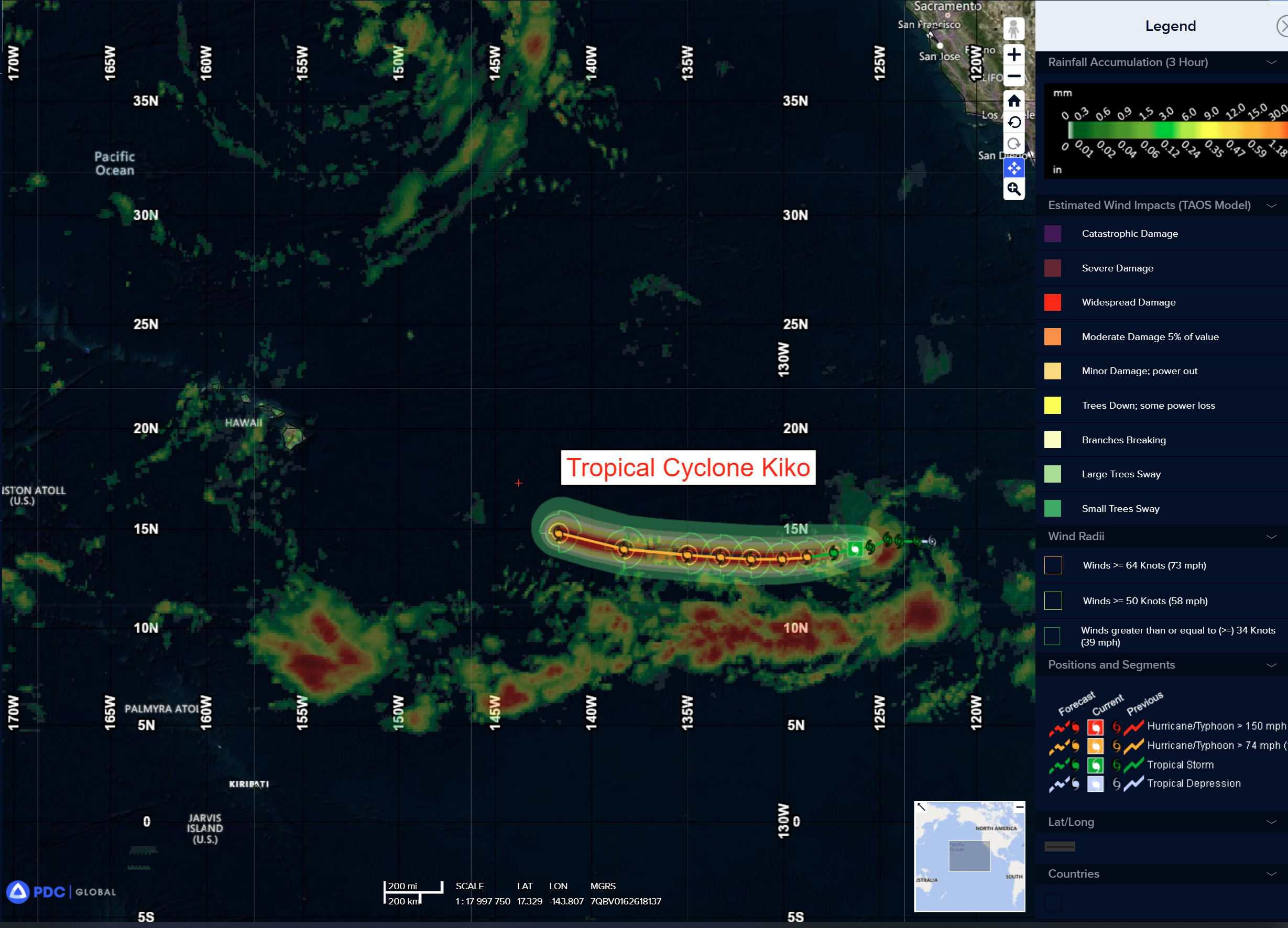
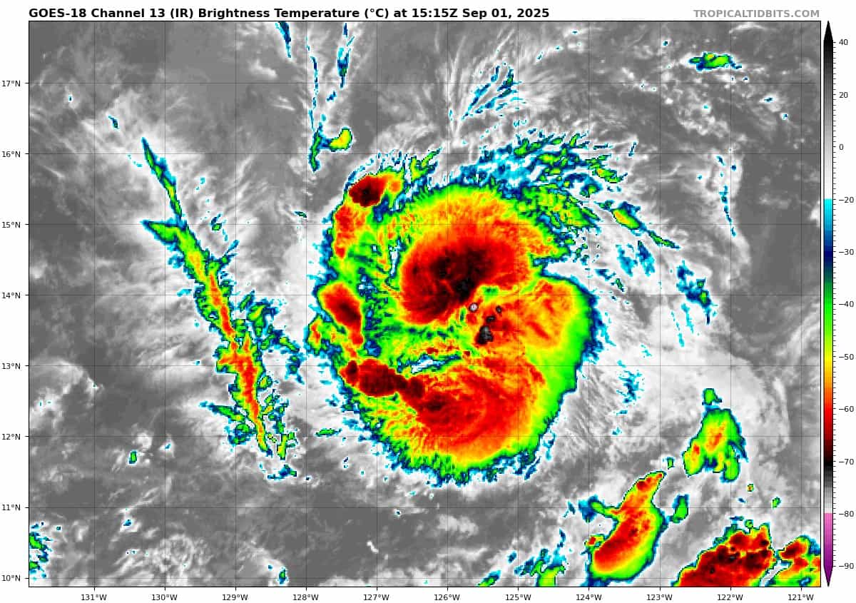
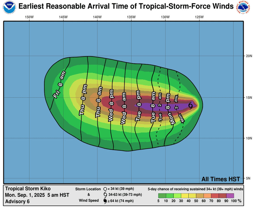
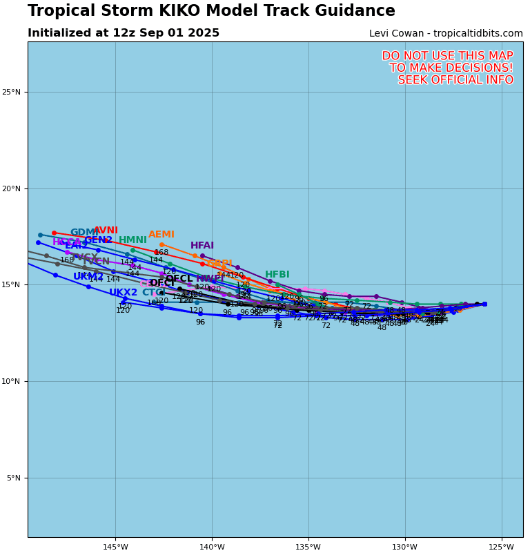
Tropical Cyclone 11E (Kiko) is located about 1265 miles west-southwest of the southern tip of Baja California
Tropical Cyclone 12E is located about 145 miles south-southwest of Manzanillo, Mexico
Northeast Pacific Ocean:
Tropical Cyclone 11E (Kiko)
According to the NHC advisory number 7
KIKO CONTINUES TO STRENGTHEN
Kiko is moving toward the west-southwest near 7 mph (11 km/h) and this motion is expected to continue through tonight, followed by a turn back toward the west on Tuesday. Maximum sustained winds have increased to near 65 mph (100 km/h) with higher gusts. Steady strengthening is forecast during the next couple of days, and Kiko is expected to become a hurricane by tonight. Tropical-storm-force winds extend outward up to 45 miles (75 km) from the center.
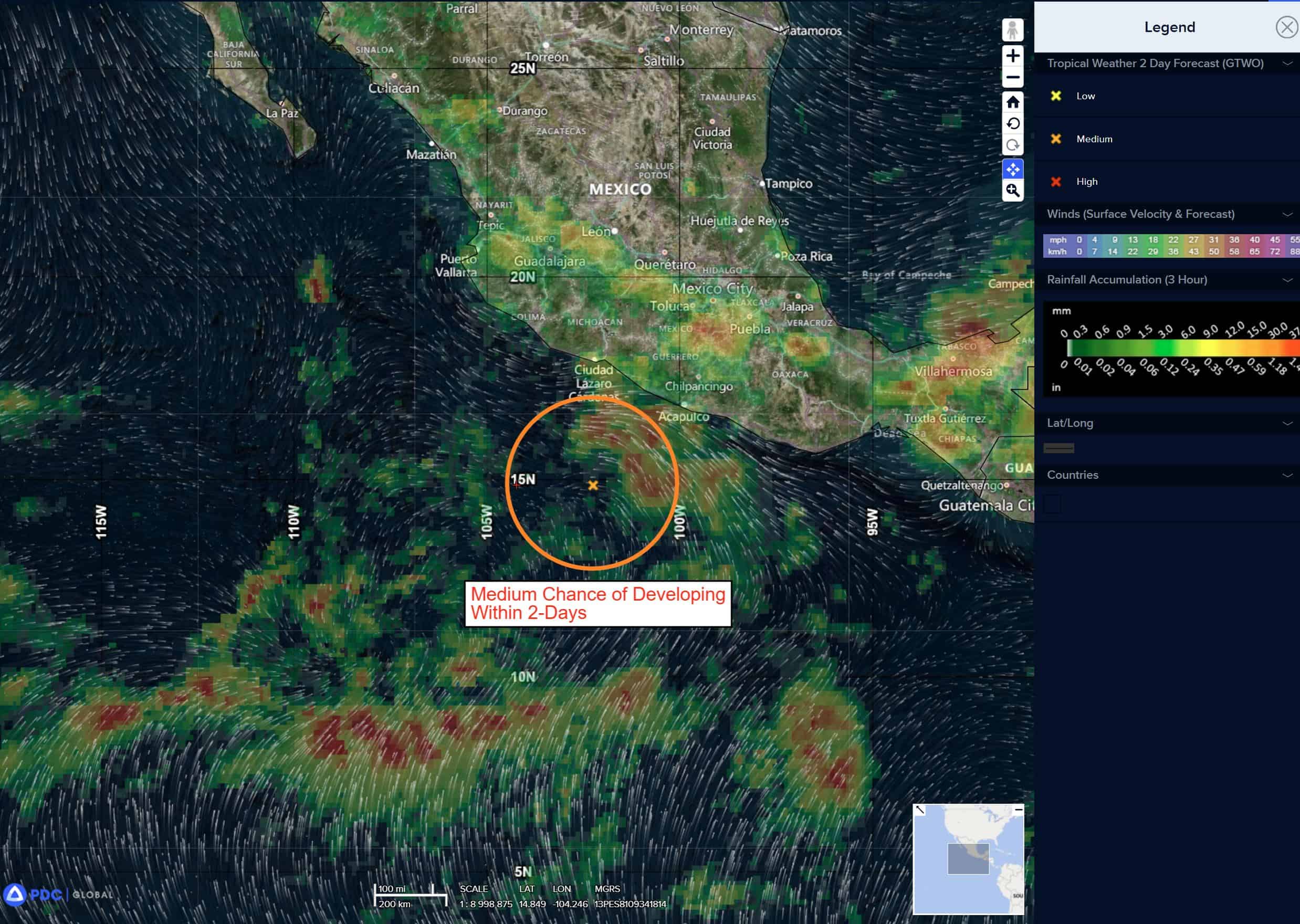
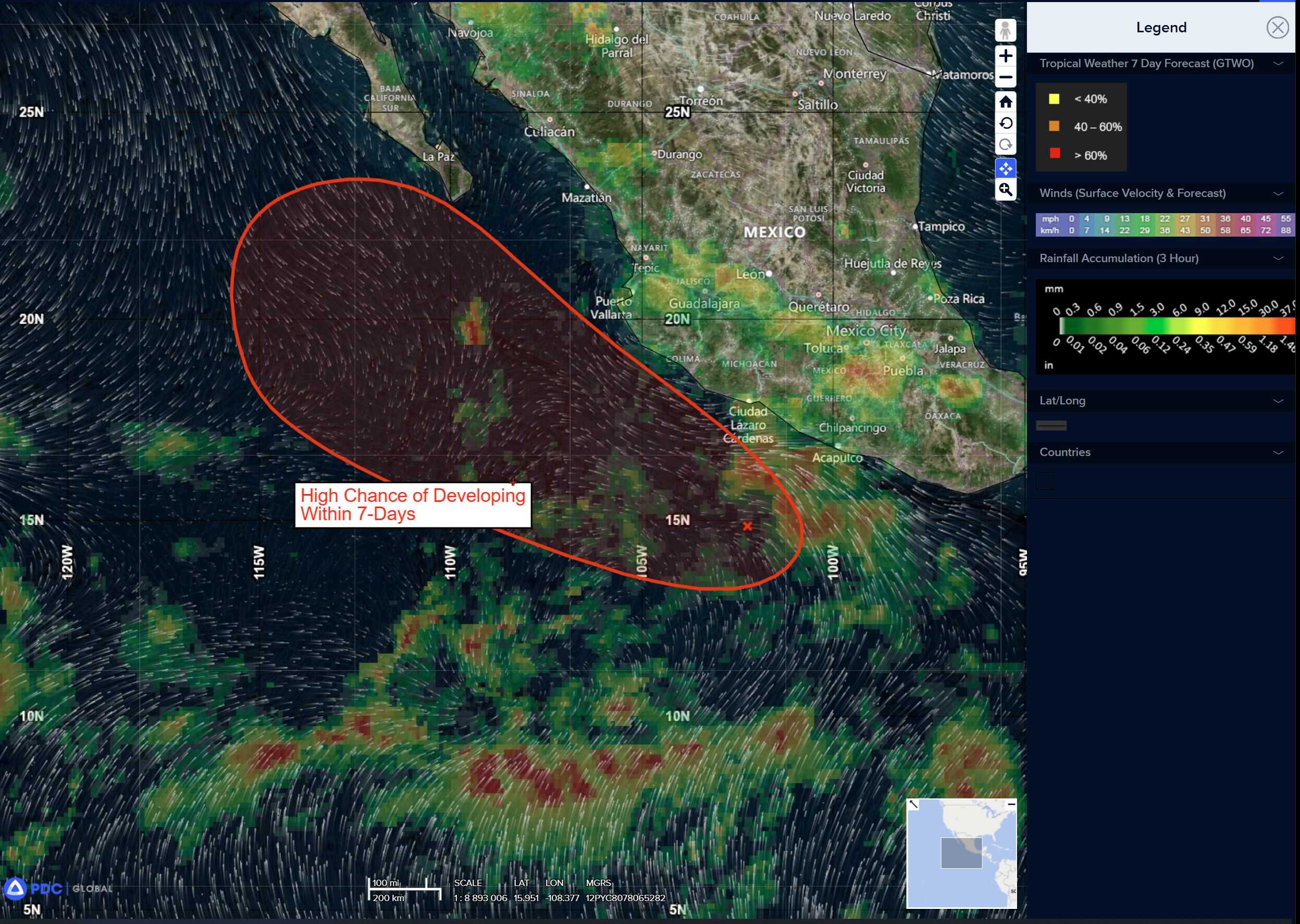
Tropical Cyclone 12E
According to the NHC advisory number 1
TROPICAL DEPRESSION FORMS TO THE SOUTH OF SOUTHWESTERN MEXICO
The depression is moving toward the west-northwest near 14 mph (22 km/h), and a gradual turn toward the northwest and north-northwest with a decrease in forward speed is expected over the next couple of days. Maximum sustained winds are near 35 mph (55 km/h) with higher gusts. Strengthening is forecast, and the system will likely become a tropical storm on Tuesday.
Central Pacific Ocean: There are no active tropical cyclones
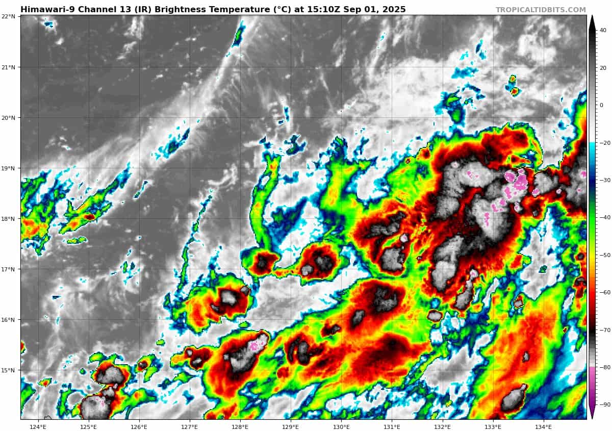
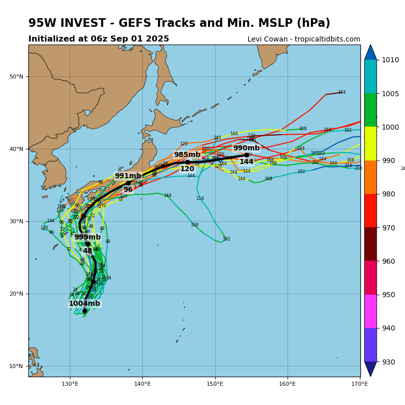
Western Pacific, Indian Ocean, and adjacent Seas:
Western Pacific