
Western Pacific, Indian Ocean, and adjacent Seas: There are no active tropical cyclones
")
Invest 92W / 91W – Pacific
Saturday, August 16, 2025
Current Snapshot
For all the latest updates visit: DisasterAWARE
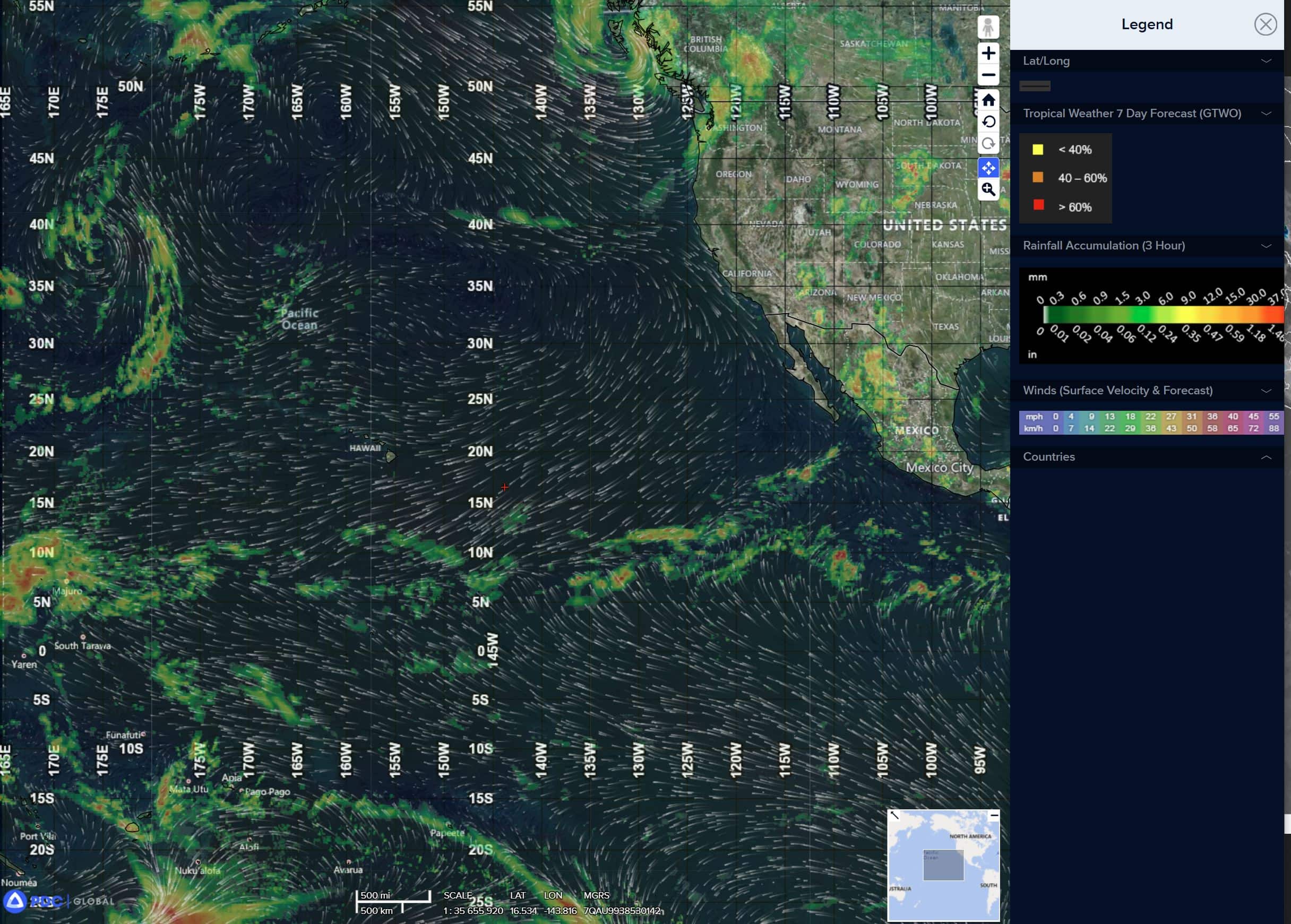
epac
1800×1080
92w
92W_tracks_latest
By PDC’s Senior Weather
Specialist Glenn James

The Pacific Disaster Center’s (PDC Global) Saturday, August 16, 2025, Tropical Cyclone Activity Report…for the Pacific Ocean, the Indian Ocean, and adjacent Seas
Current Tropical Cyclones:
There are not active tropical cyclones
Northeast Pacific Ocean: There are no active tropical cyclones
Tropical cyclone formation is not expected during the next 7 days.
Central Pacific Ocean: There are no active tropical cyclones
Tropical cyclone formation is not expected during the next 7 days.
>>> There’s an area of disturbed weather being referred to as Invest 92W, which is located approximately 320 NM south of Kadena AB
Animated multi-spectral satellite imagery (msi) as well as a 170419z atms 88.2 ghz image depicts a slowly consolidating and highly elongated low level circulation (llc), embedded within a reverse oriented monsoon trof. Flaring convection is forming along the southeastern flank of the llc in the convergent flow south of the trof axis. Animated water vapor imagery indicates a
tutt-cell positioned approximately 200 NM northeast of 92W, which is imparting northerly shear over 92W and drawing in dry mid-level across the region to the north of the llc.
Environmental analysis for the area indicates marginally favorable conditions for development with moderate northerly vertical wind shear (20 knots) and dry mid-level air to the north, offset by warm sea surface temperatures (30 c) and moderate equatorward outflow aloft.
Global models are in good agreement that 92W will track northward over the next 24 to 48 hours. Global models are also in agreement that 92W will very slowly consolidate and only minimally intensify over the next couple of days, hindered by persistent dry air and moderate shear.
Maximum sustained surface winds are estimated at 13 to 18 knots.
The potential for the development of a significant tropical cyclone within the next 24 hours is upgraded to medium.
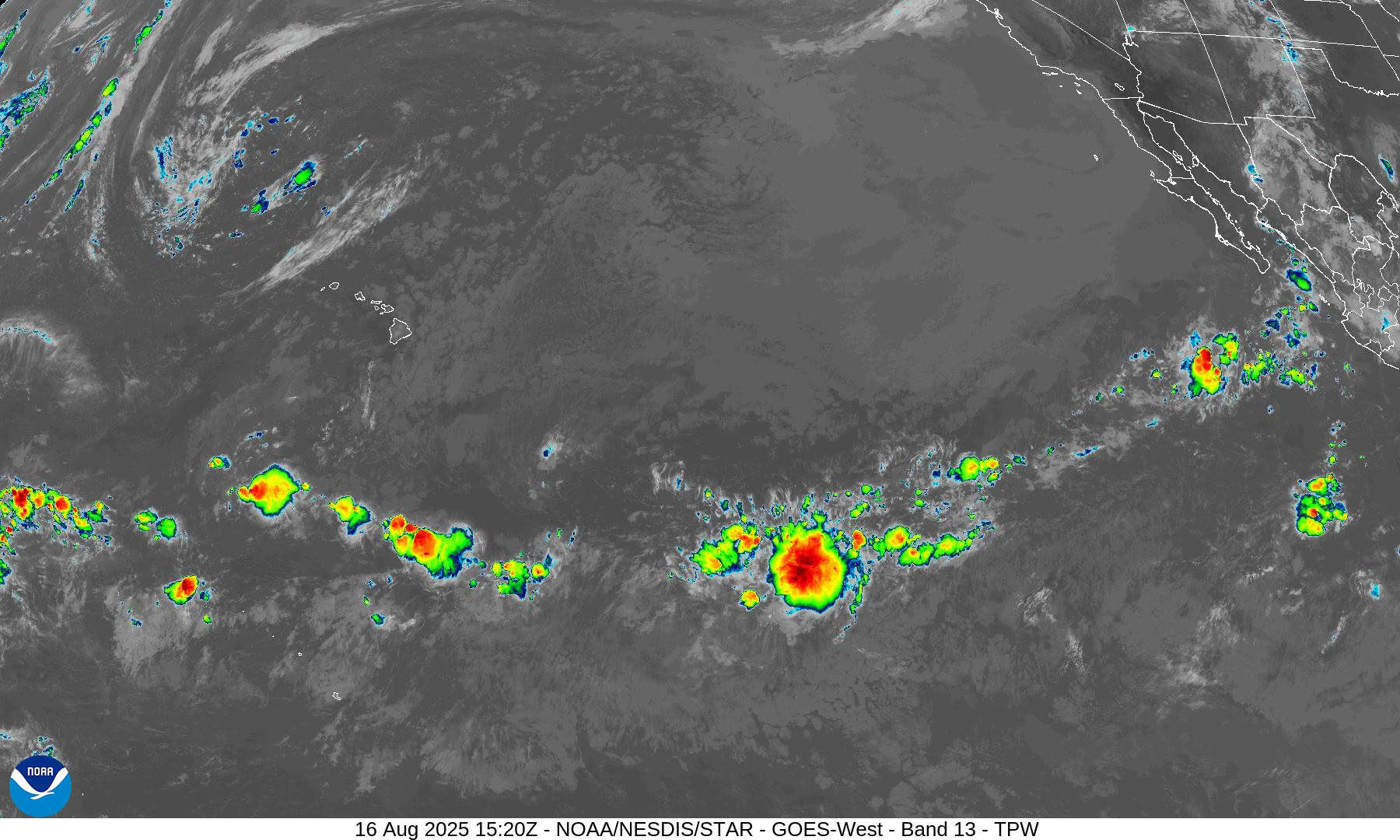
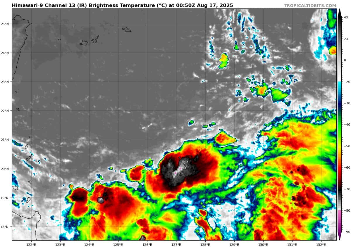
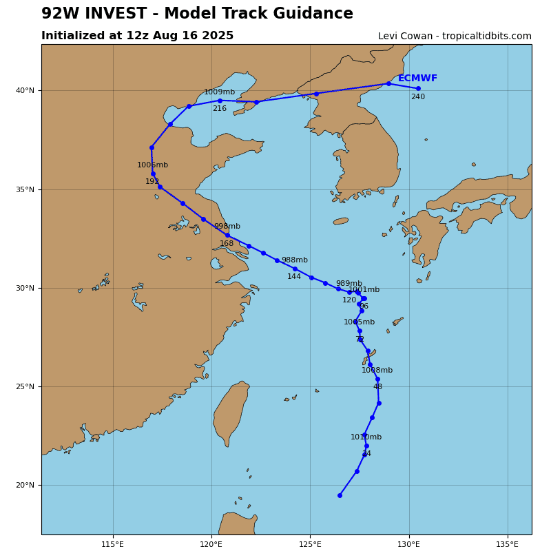
>>> There’s a second area of disturbed weather being referred to as Invest 91W, which is located approximately 165 NM south-southeast of Haikou, China
The system is currently classified as a monsoon depression, generally characterized as a large cyclonic circulation, greater than 600 NM diameter, with higher winds over the eastern periphery and a weak core of light winds.
Animated multi-spectral satellite imagery (msi) as well as a 180212z metop-c 89 ghz microwave image indicate a very broad circulation with fragmented convective banding along the eastern periphery of the circulation. A 170216z partial ascat pass reveals 25 knot winds along the Chinese coast to the east of Hainan, with a radius of maximum winds of at least 200 NM. The ascat as well as the msi suggest pockets of enhanced rotation and vorticity along with isolated areas of elevated winds, in the northeastern corner of the circulation, wrapping up the eastern periphery.
Environmental factors for this system are moderately unfavorable with moderate upper level vws (20 knots) as well as a lack of poleward outflow aloft, offset by warm ssts of (28-29c).
Global deterministic models are currently in agreement that the area of convection 91W will not consolidate and continue a sluggish north-northwesterly track towards Hainan Island over the next 24 hours.
Maximum sustained surface winds are estimated at 23 to 88 knots.
The potential for the development of a significant tropical cyclone within the next 24 hours is low.