
")
Current Snapshot
For all the latest updates visit: DisasterAWARE
GOES19-TAW-Sandwich-900×540
erin
goes19_ir_05L_202508151445_lat18.0-lon-55.3
151446_earliest_reasonable_toa_34
151446INTQPF_sm

05L_tracks_latest

1000×1000
goes19_ir_98L_202508151452_lat25.0-lon-96.8

98L_tracks_latest
By PDC’s Senior Weather
Specialist Glenn James

The Pacific Disaster Center’s (PDC Global) Friday, August 15, 2025, Tropical Cyclone Activity Report…for the Atlantic Ocean, the Caribbean Sea, and the Gulf of America
Current Tropical Cyclones:
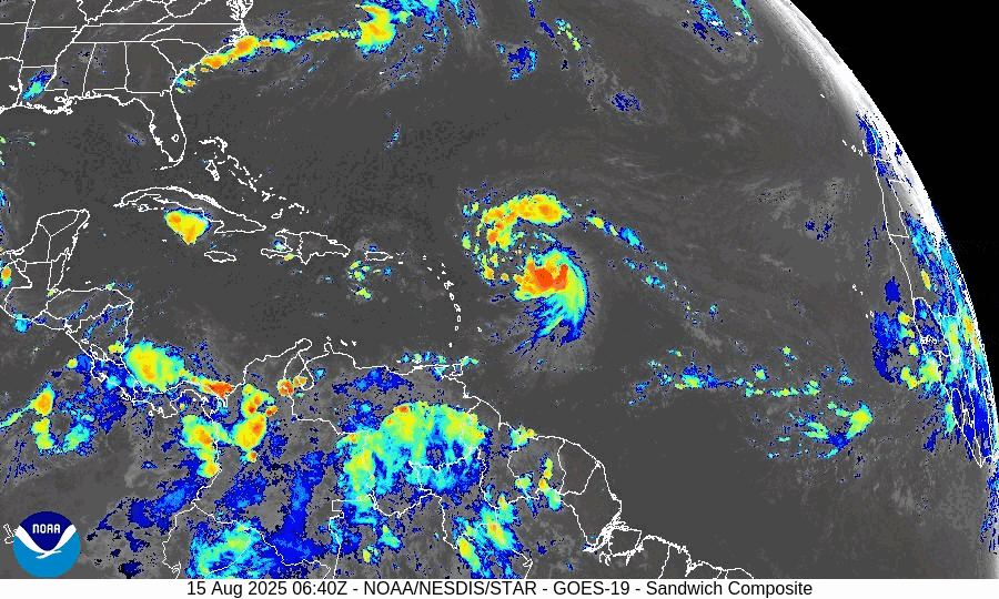
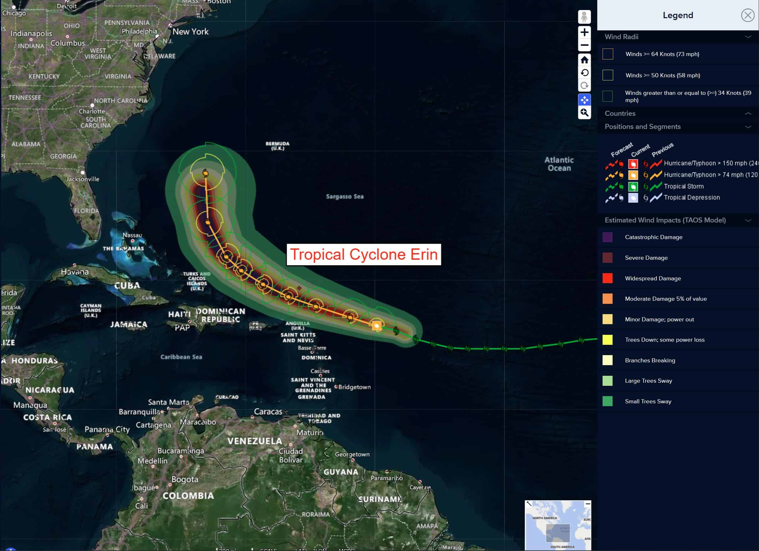
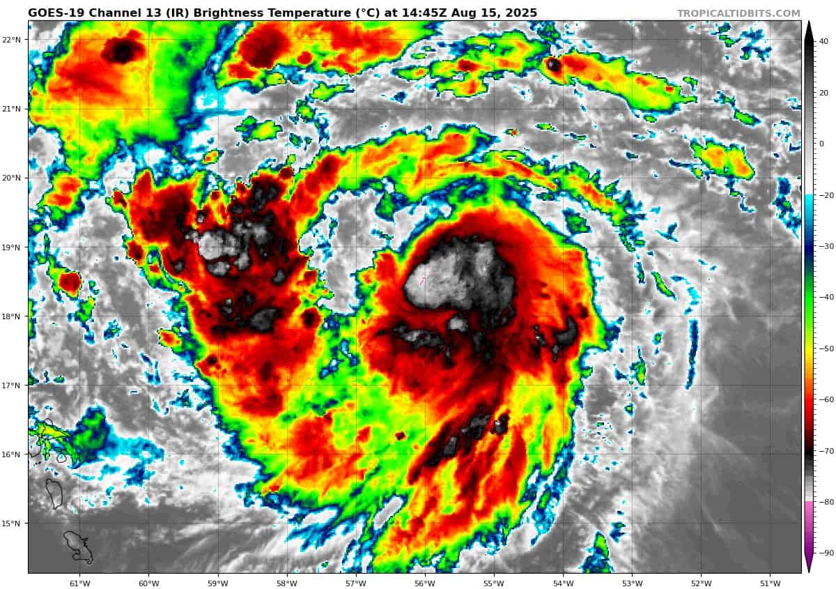
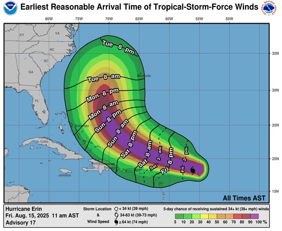
Tropical Cyclone Erin…is located about 195 miles east-northeast of Anguilla
Atlantic Ocean
Tropical Cyclone Erin
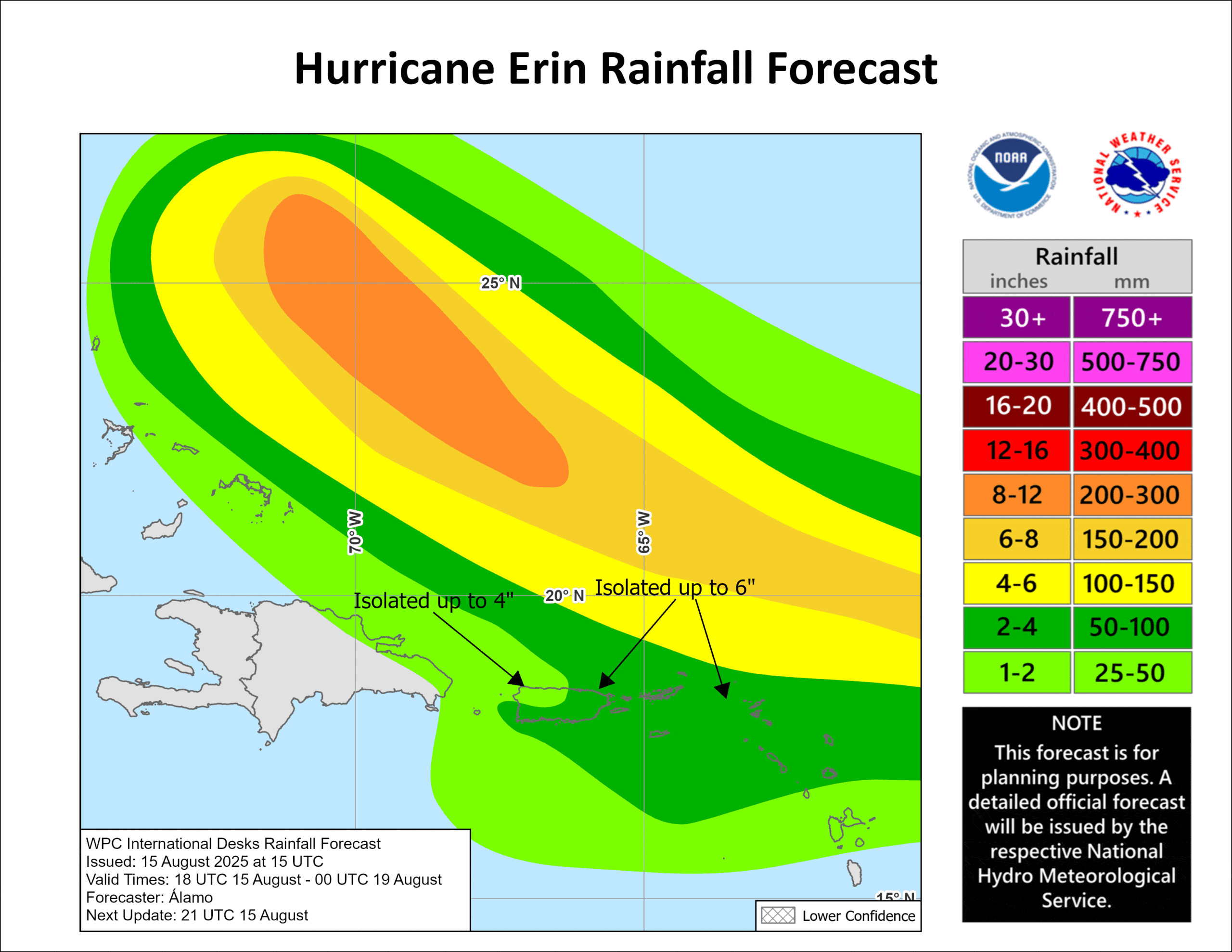
ERIN FORECAST TO BECOME A MAJOR HURRICANE LATER IN THE WEEKEND…OUTER RAINBANDS BEGINNING TO AFFECT THE NORTHERN LEEWARD ISLANDS
According to the NHC advisory number 19A
Erin is moving toward the west-northwest near 17 mph (28 km/h). This motion is expected to continue through the weekend with a gradual decrease in forward speed. On the forecast track, the center of Erin is expected to move just north of the northern Leeward Islands, the Virgin Islands, and Puerto Rico over the weekend. Maximum sustained winds are near 100 mph (155 km/h) with higher gusts. Rapid strengthening is expected over the next 24 to 36 hours, and Erin is forecast to become a major hurricane later in the weekend. Hurricane-force winds extend outward up to 30 miles (45 km) from the center and tropical-storm-force winds extend outward up to 125 miles (205 km).
HAZARDS AFFECTING LAND
RAINFALL: The outer bands of Erin are expected to produce areas of heavy rainfall tonight into Sunday across the northern Leeward Islands, the Virgin Islands, and Puerto Rico. Rainfall totals of 2 to 4 inches, with isolated totals of 6 inches, are expected. This rainfall may lead to isolated and locally considerable flash and urban flooding, along with landslides or mudslides.
WIND: Tropical storm conditions are possible within the watch area by early Saturday.
SURF: Swells generated by Erin will begin affecting portions of the northern Leeward Islands, the Virgin Islands and Puerto Rico by this weekend, and will likely spread to the western Atlantic next week. These swells are likely to cause life-threatening surf and rip current conditions.
Caribbean Sea: There are no active tropical cyclones
Tropical cyclone formation is not expected during the next 7-days.
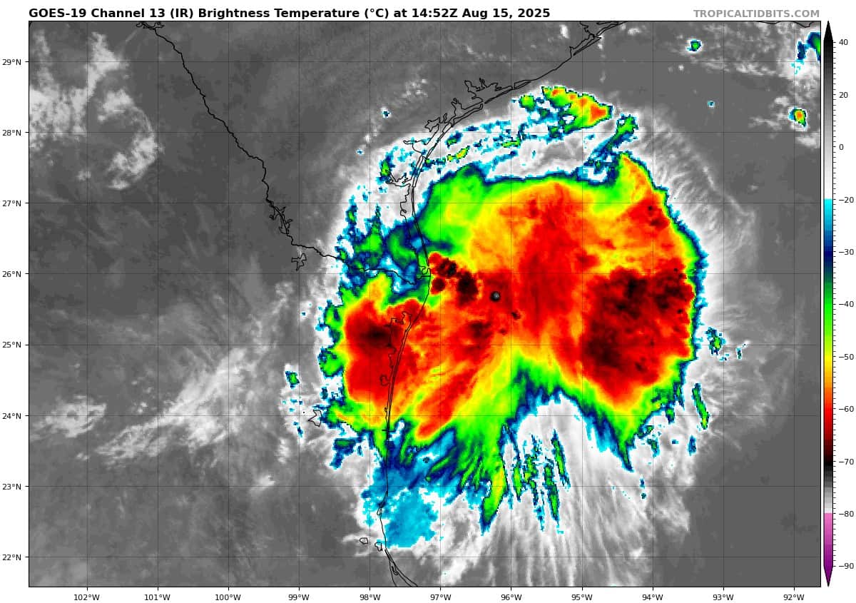
Gulf of America: There are no active tropical cyclones
Western Gulf
Invest 98L
>>> Satellite and coastal Doppler radar data indicate the center of the disturbance has moved inland near the mouth of the Rio Grande. Showers and thunderstorms have diminished in the past few hours and additional development is no longer expected. Lingering showers and thunderstorms could still produce locally heavy rainfall along portions of northeastern Mexico and southern Texas through the day.
* Formation chance through 48 hours…low…near 0 percent
* Formation chance through 7 days…low near 0 percent