
")
Current Snapshot
For all the latest updates visit: DisasterAWARE
1800
erin
goes19_ir_05L_202508131505_lat16.4-lon-42.7
131434_earliest_reasonable_toa_34

05L_tracks_latest
2
7
1000×1000
By PDC’s Senior Weather
Specialist Glenn James

The Pacific Disaster Center’s (PDC Global) Wednesday, August 13, 2025, Tropical Cyclone Activity Report…for the Atlantic Ocean, the Caribbean Sea, and the Gulf of America
Current Tropical Cyclones:
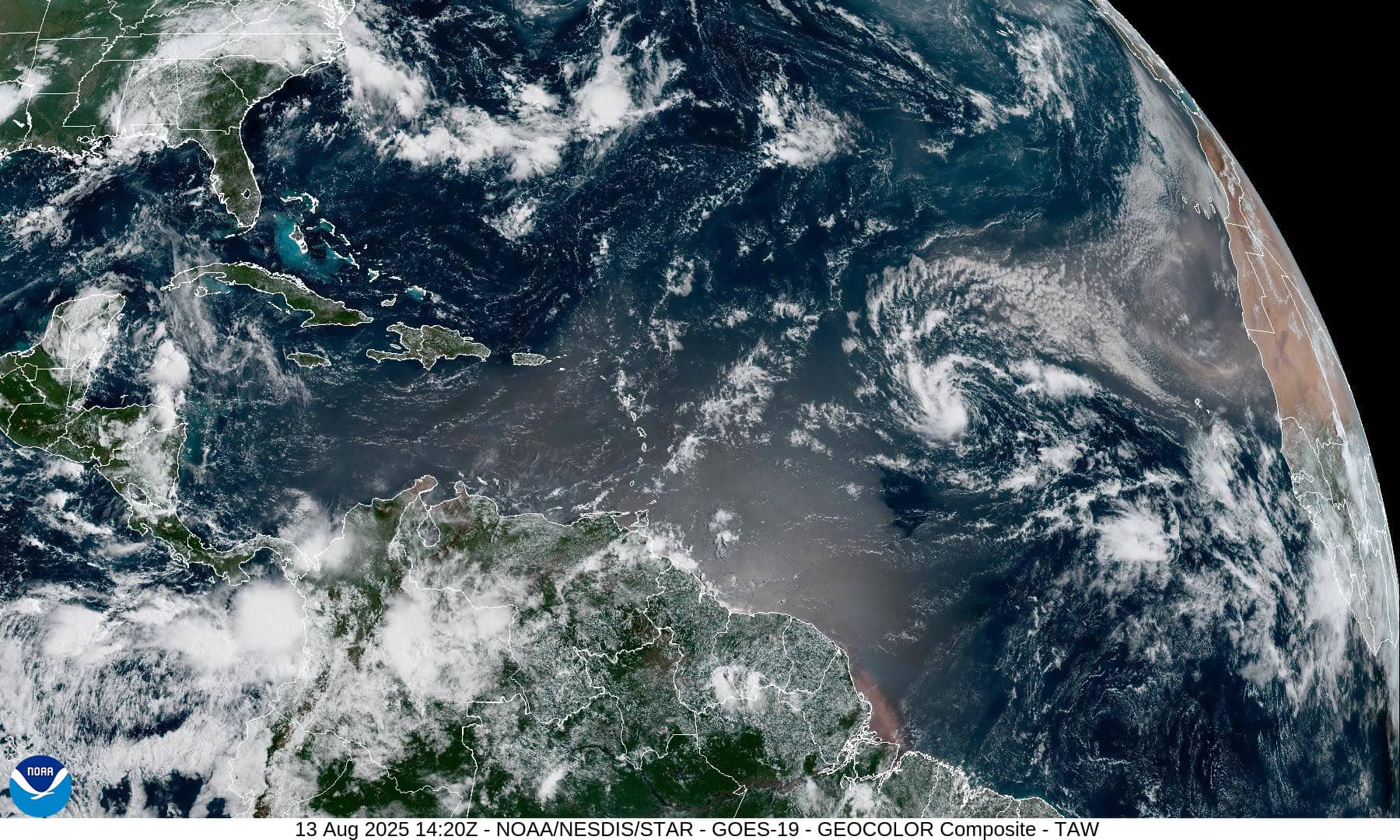
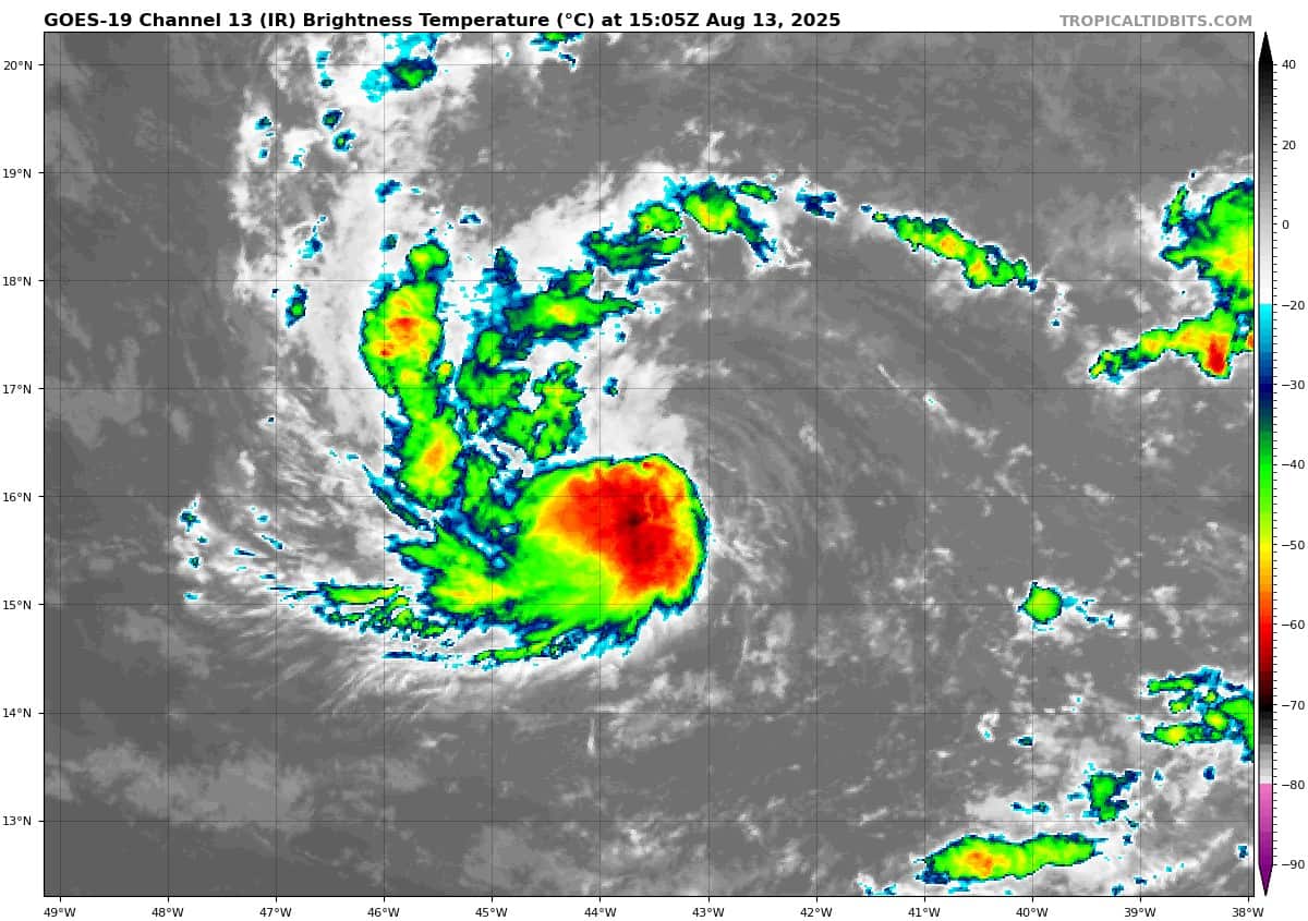
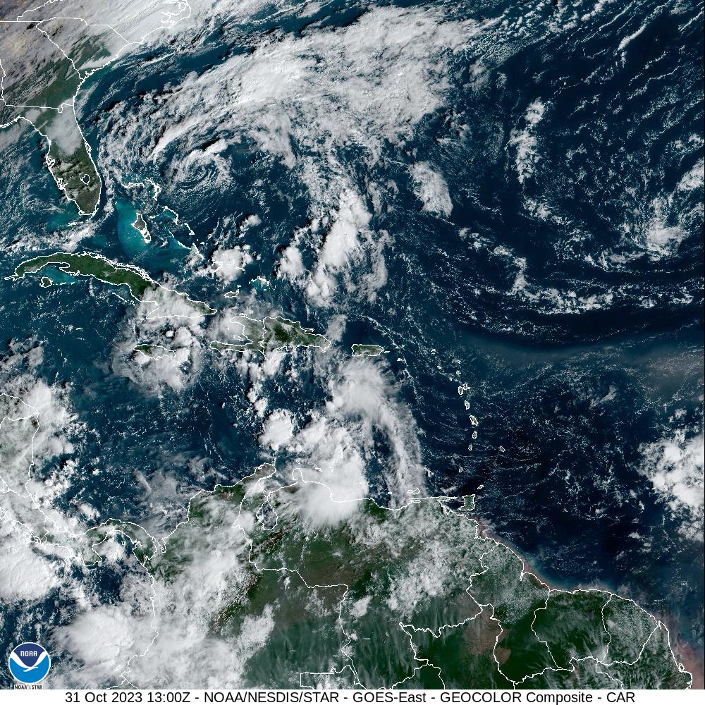
Tropical Cyclone Erin…is located about 1095 miles east of the Northern Leeward Islands
Atlantic Ocean
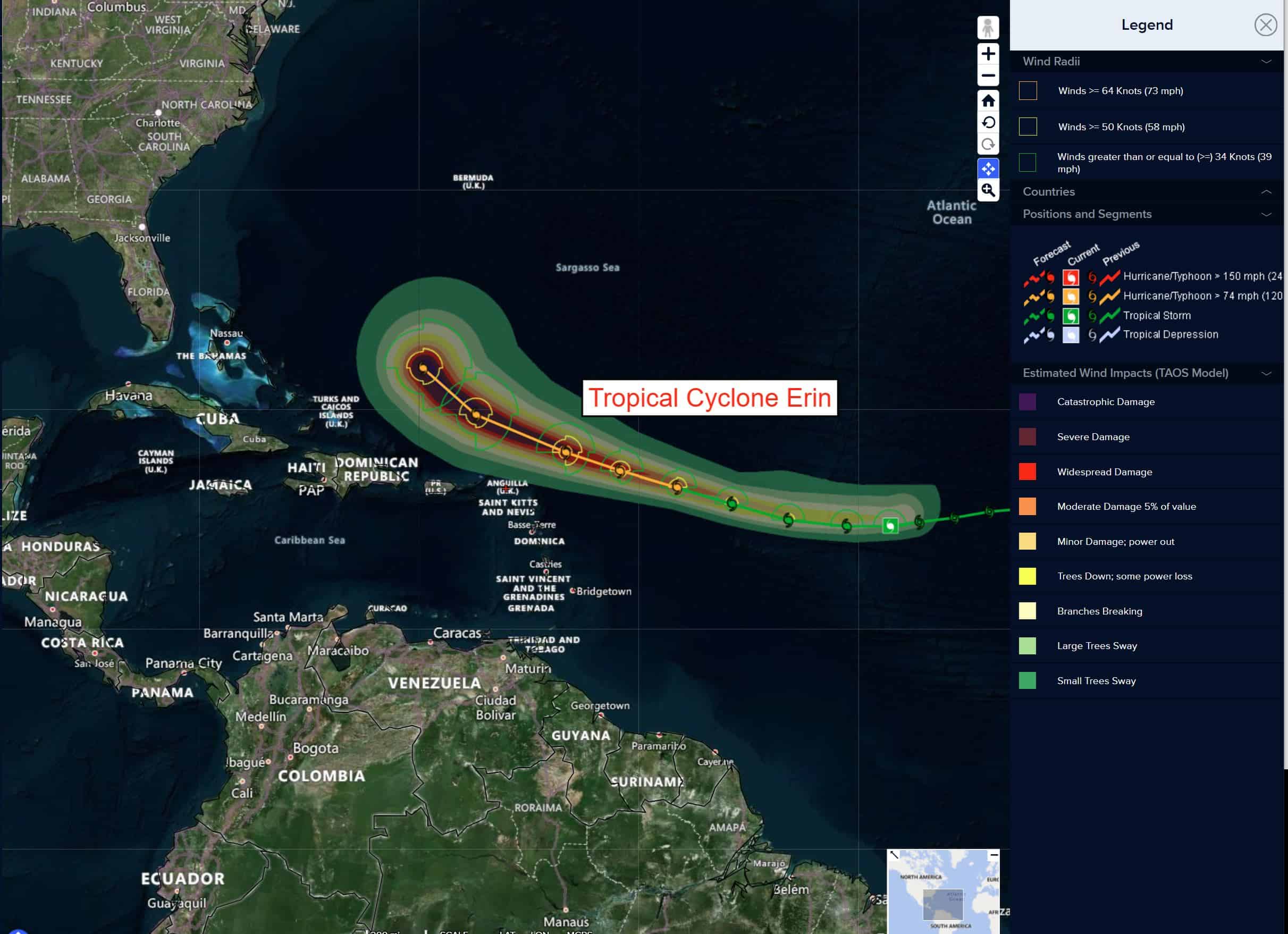
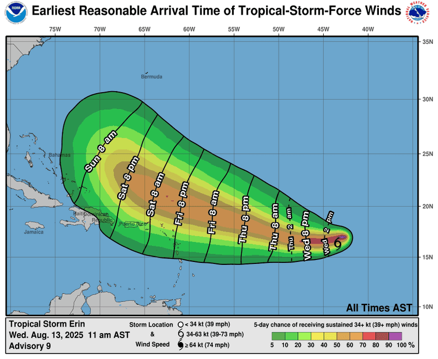
Tropical Cyclone Erin
ERIN FORECAST TO BECOME A HURRICANE BY FRIDAY
According to the NHC advisory number 11
Erin is moving toward the west near 16 mph (26 km/h). This general motion is expected to continue into Thursday, with a west-northwestward motion beginning Thursday night and continuing into the weekend. On the forecast track, the center of Erin is likely to move near or just north of the northern Leeward Islands over the weekend. Maximum sustained winds remain near 50 mph (85 km/h) with higher gusts. Gradual strengthening is forecast during the next day or so, with more significant intensification possible on Friday and Saturday. Tropical-storm-force winds extend outward up to 60 miles (95 km) from the center.
Caribbean Sea: There are no active tropical cyclones
Tropical cyclone formation is not expected during the next 7-days.
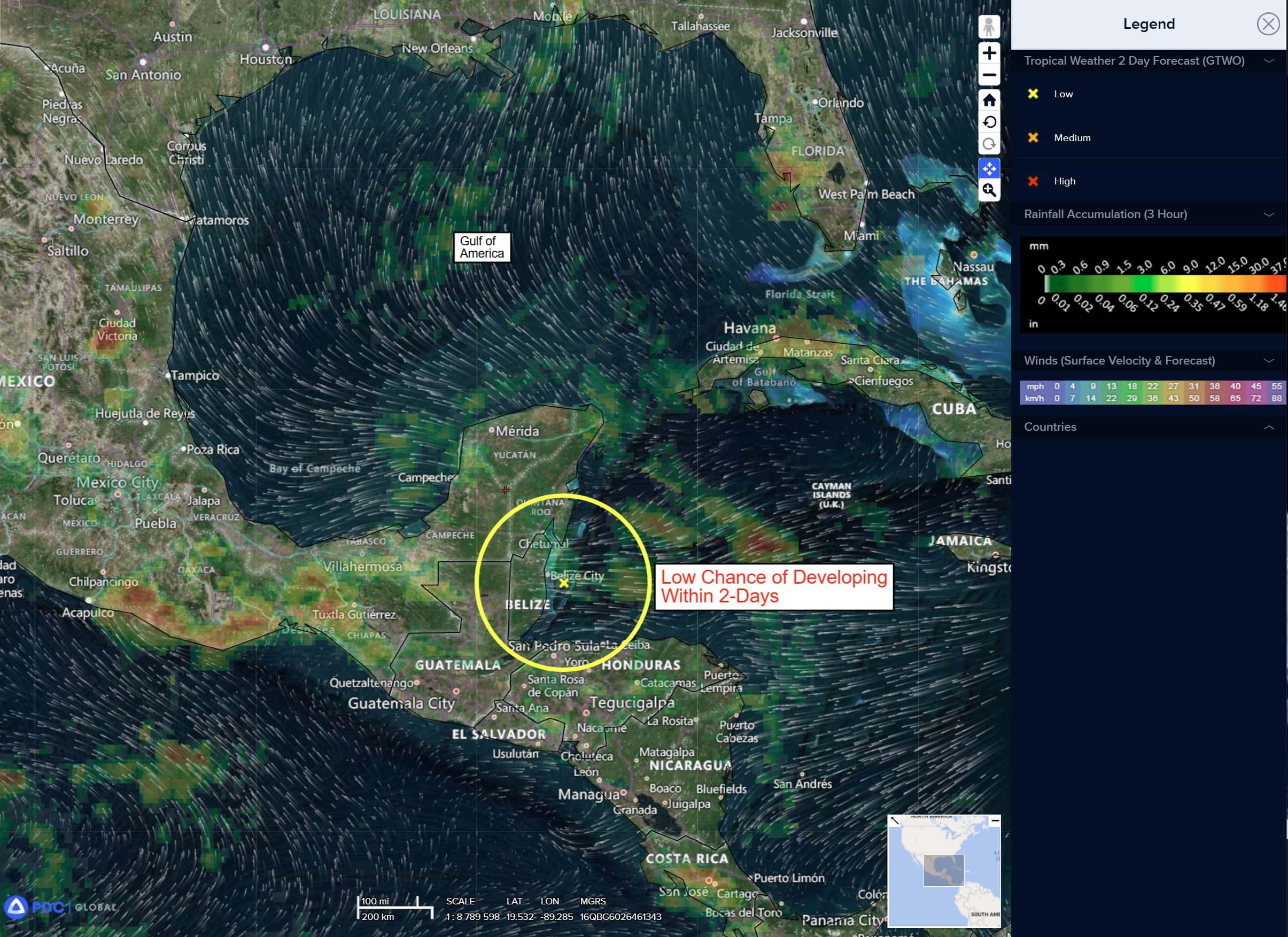
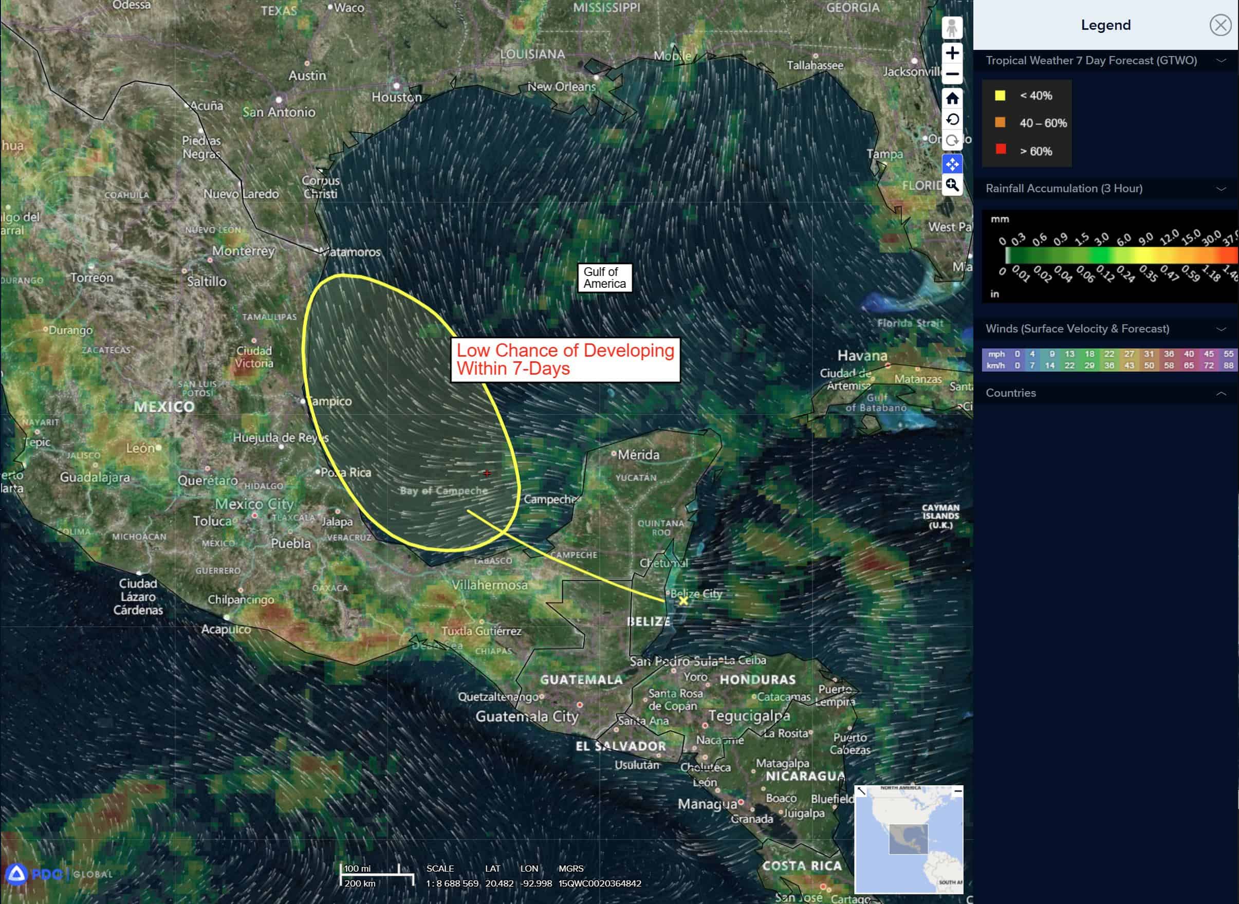
Gulf of America: There are no active tropical cyclones
Southwestern Gulf
Invest 98L
>>> A broad area of low pressure near the west coast of the Yucatan Peninsula is producing disorganized showers and thunderstorms. The broad low is forecast to emerge off the coast later this morning and move west-northwestward across the southwestern Gulf during the next day or two, where environmental conditions are marginally conducive for further development. The system is forecast to move inland over northeastern Mexico by late Friday, ending its chances of formation.
* Formation chance through 48 hours…low…20 percent
* Formation chance through 7 days…low…20 percent