
")
Current Snapshot
For all the latest updates visit: DisasterAWARE
1800x1080a
2
7
goa2
By PDC’s Senior Weather
Specialist Glenn James

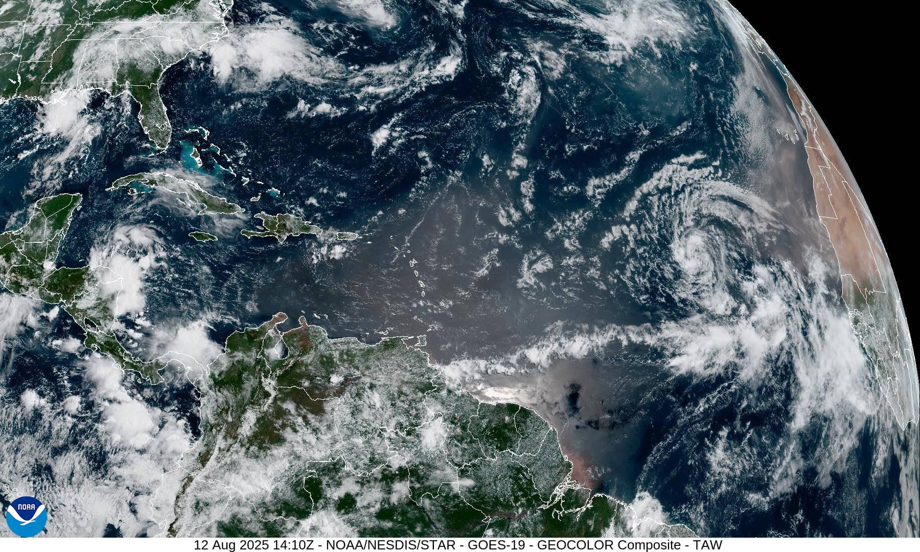
The Pacific Disaster Center’s (PDC Global) Tuesday, August 12, 2025, Tropical Cyclone Activity Report…for the Atlantic Ocean, the Caribbean Sea, and the Gulf of America
Current Tropical Cyclones:
Tropical Cyclone Erin…is located about 1520 miles east of the Northern Leeward Islands
Atlantic Ocean
Tropical Cyclone Erin
ERIN LIKELY TO BECOME A HURRICANE OVER THE CENTRAL TROPICAL ATLANTIC IN A COUPLE OF DAYS
According to the NHC advisory number 7
Erin is moving toward the west near 20 mph (31 km/h). This general motion is expected tonight through Thursday, with a west-northwestward motion beginning Thursday night and continuing into the weekend. On the forecast track, the center of Erin is likely to move near or just north of the northern Leeward Islands over the weekend. Maximum sustained winds remain near 45 mph (75 km/h) with higher gusts. Little change in strength is expected during the next day or so, and gradual strengthening is forecast to begin by late Wednesday. Erin will likely become a hurricane by late Thursday. Tropical-storm-force winds extend outward up to 60 miles (95 km) from the center.
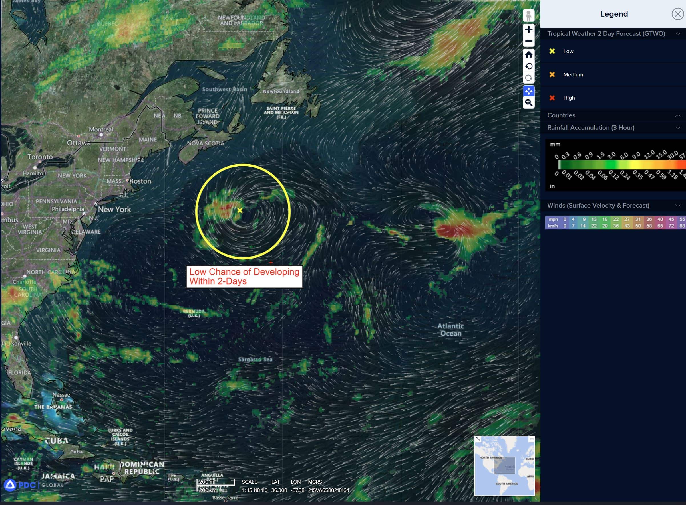
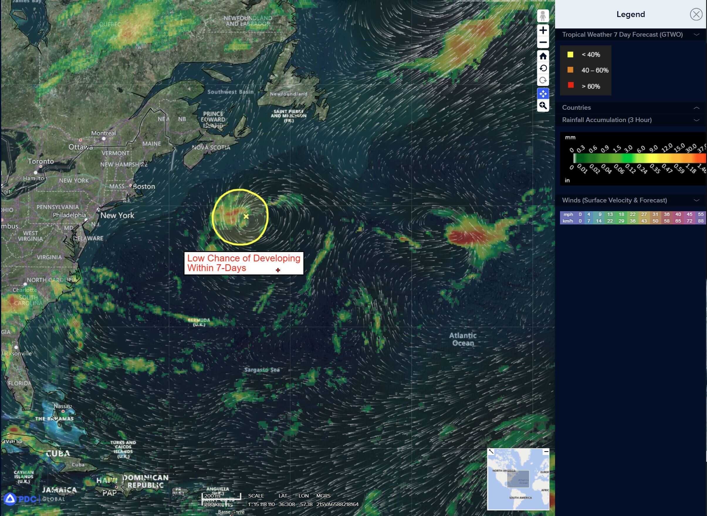
Northwestern Atlantic: There are no active tropical cyclones
>>> A non-tropical area of low pressure, located a few hundred miles southeast of Nova Scotia, Canada, is producing showers and thunderstorms, mainly to the southwest of the center. Limited tropical or subtropical development remains possible today as the low lingers near the relatively warm waters of the Gulf Stream. However, by tonight, the system is forecast to move northward over cooler waters, which will diminish its chances for any tropical development.
* Formation chance through 48 hours…low…10 percent
* Formation chance through 7 days…low…10 percent
Caribbean Sea: There are no active tropical cyclones
Tropical cyclone formation is not expected during the next 7-days.
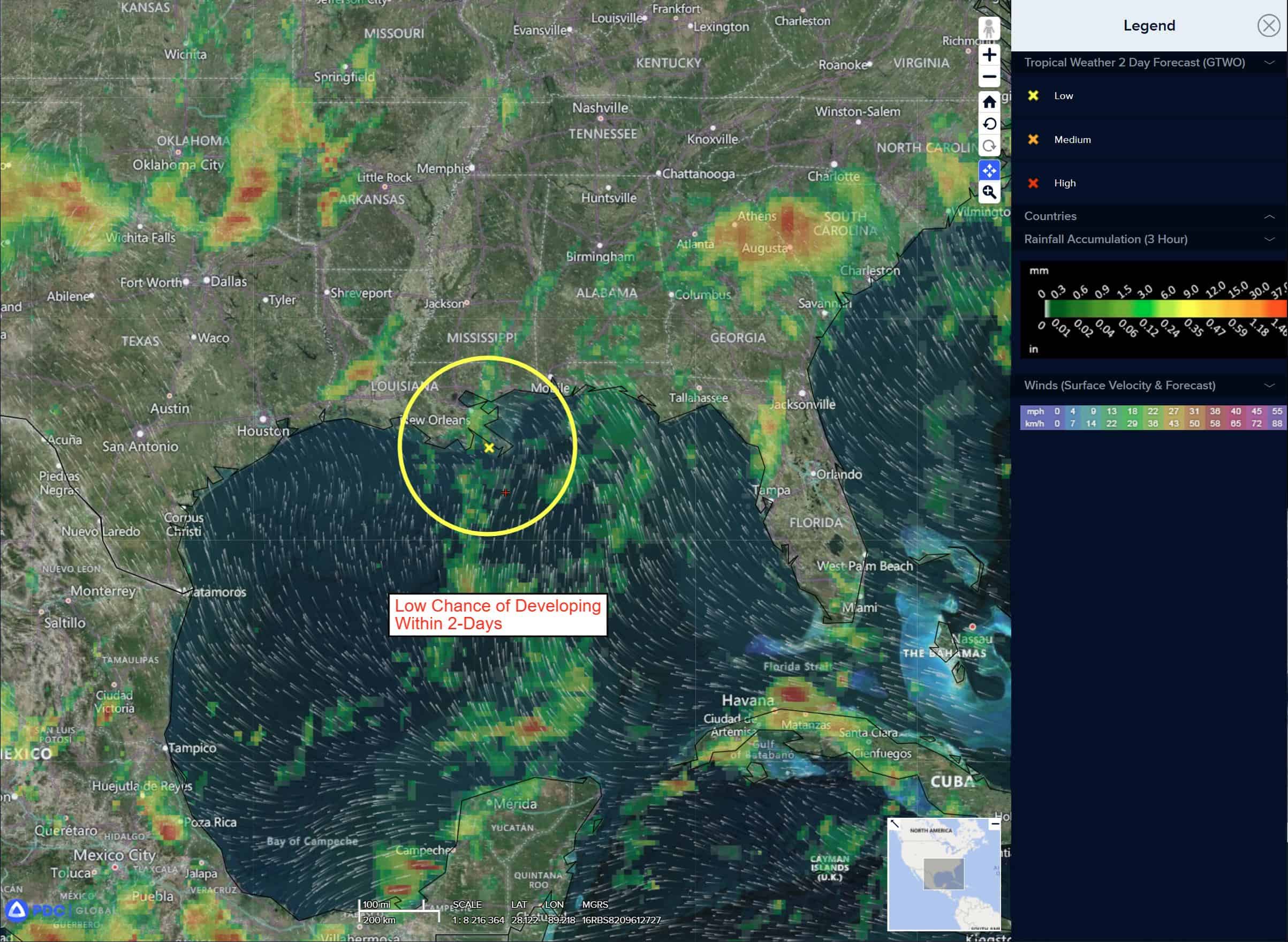
Gulf of America: There are no active tropical cyclones
Southwestern Gulf
>>> A tropical wave over the northwestern Caribbean Sea is producing disorganized showers and thunderstorms this morning. This disturbance is forecast to move west-northwestward and cross the Yucatan Peninsula later today with no significant increase in organization. Some development of this system is possible after it emerges across the southwestern Gulf beginning on Thursday while the system moves to the west-northwest or northwest at 10 to 15 mph.
* Formation chance through 48 hours…low…10 percent
* Formation chance through 7 days…low…20 percent