Tropical cyclone formation is not expected during the next 7 days.
Western Pacific, Indian Ocean, and adjacent Seas:

")
By PDC’s Senior Weather
Specialist Glenn James

The Pacific Disaster Center’s (PDC Global) Wednesday, August 6, 2025, Tropical Cyclone Activity Report…for the Pacific Ocean, the Indian Ocean, and adjacent Seas
Current Tropical Cyclones:
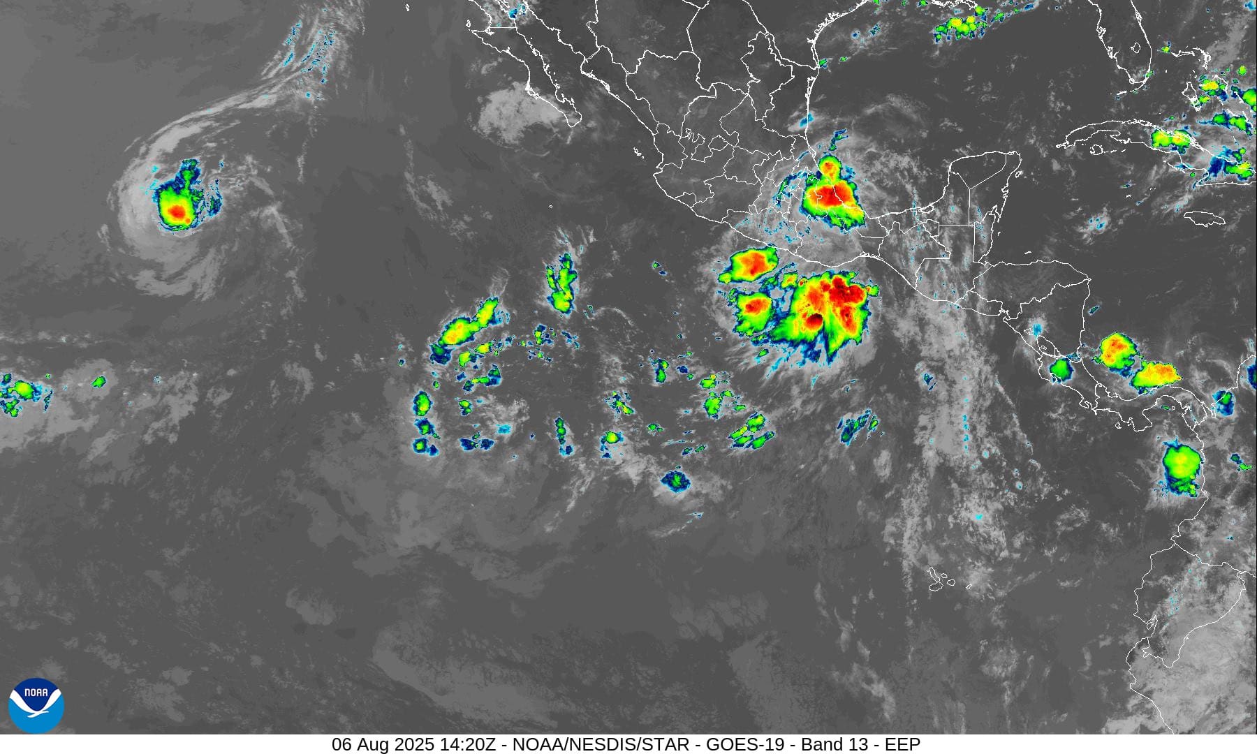
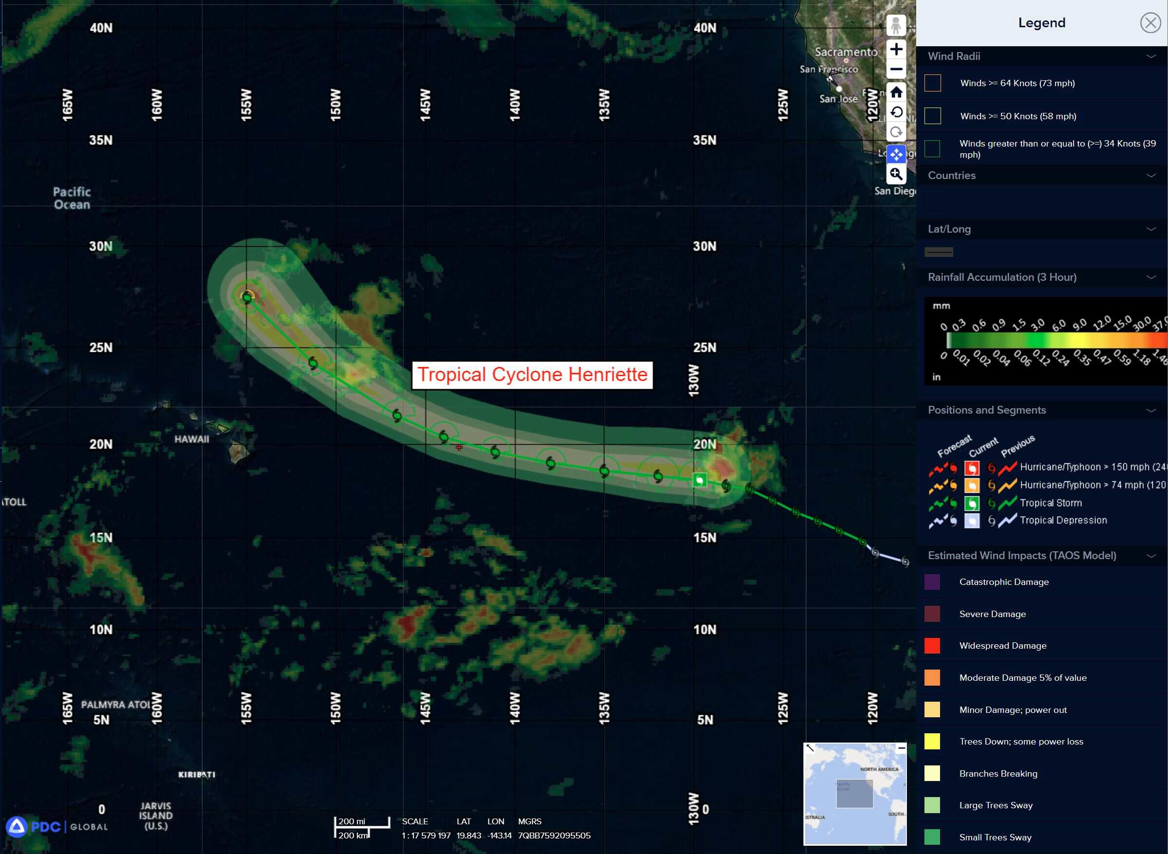
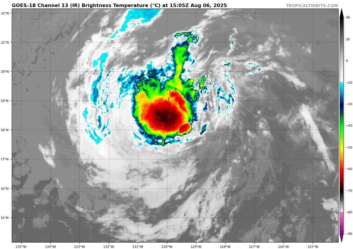
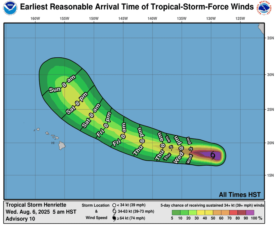
Tropical Cyclone 08E (Henriette)…is located approximately 1485 NM east of Hilo, Hawaii
Tropical Cyclone 09E (Ivo)…is located approximately 145 NM south-southwest of Acapulco, Mexico
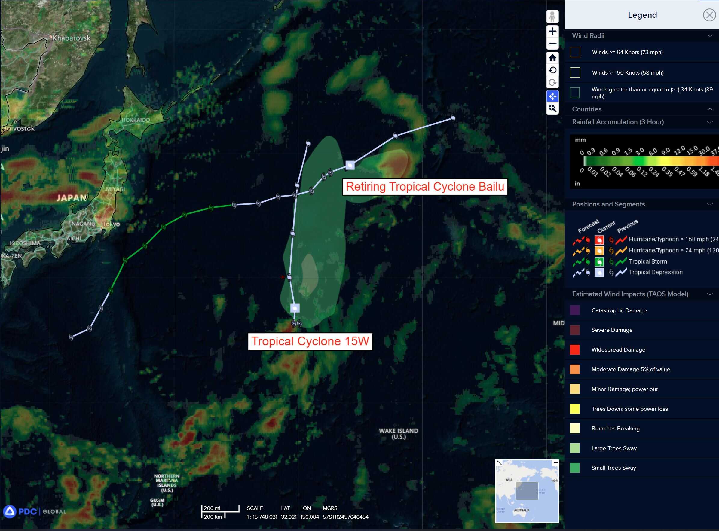
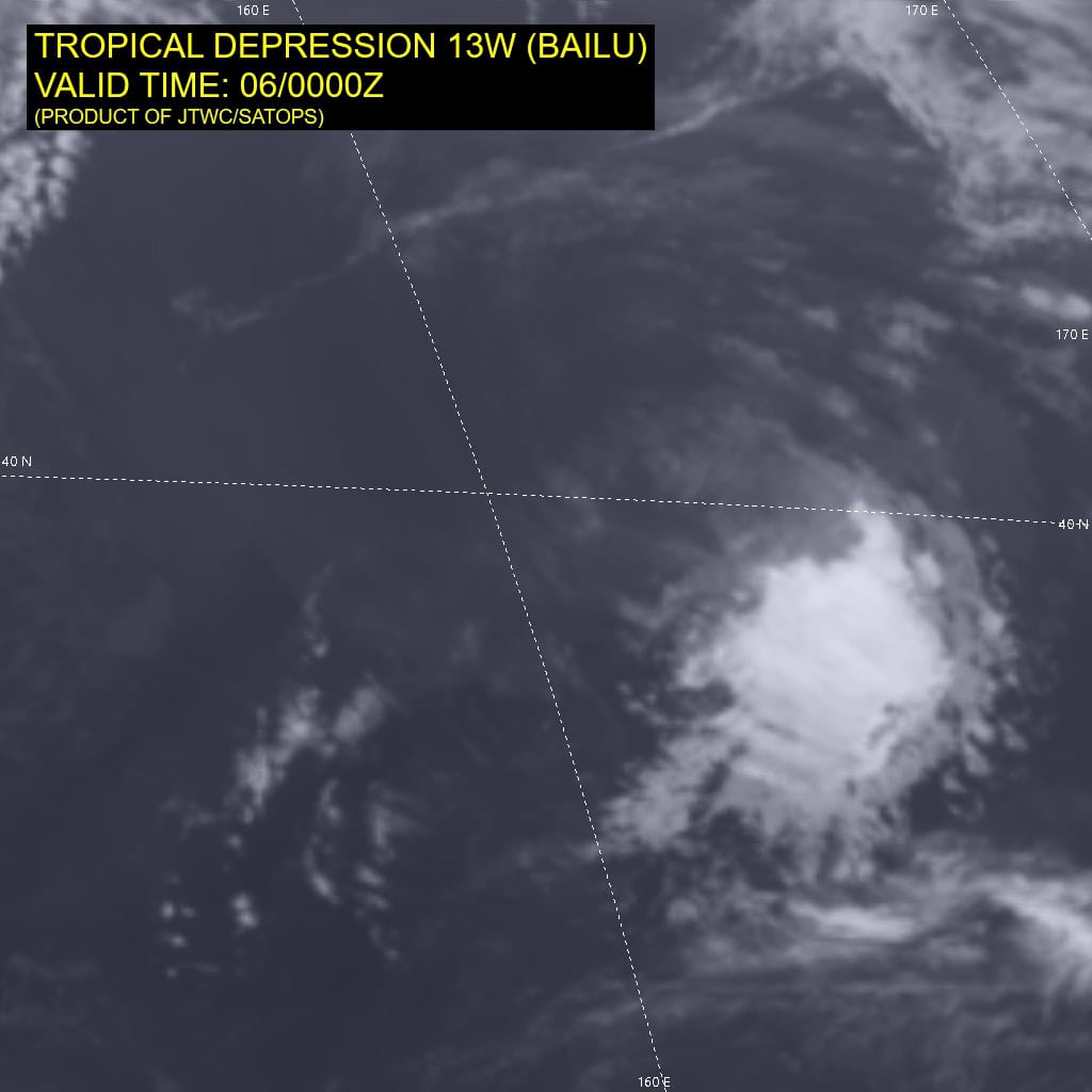
Tropical Cyclone 15W…is located approximately 849 NM east of Yokosuka, Japan – Final Warning
Tropical Cyclone 16W…is located approximately 224 NM north-northeast of Saipan
Tropical Cyclone 02S…is located approximately 631 NM west of Diego Garcia
Northeast Pacific Ocean:
Tropical Cyclone 08E (Henriette)
HENRIETTE HEADING WESTWARD WELL TO THE EAST OF HAWAII
According to the NHC advisory number 12
Henriette is moving toward the west near 16 mph (26 km/h) and this motion is expected to continue over the next couple of days. Henriette is then forecast to start a more northwestward turn, keeping the center well to the north of the Hawaiian islands. Maximum sustained winds are near 50 mph (85 km/h) with higher gusts. Little change in strength is forecast during the next 48 hours. Tropical-storm-force winds extend outward up to 70 miles (110 km) from the center.
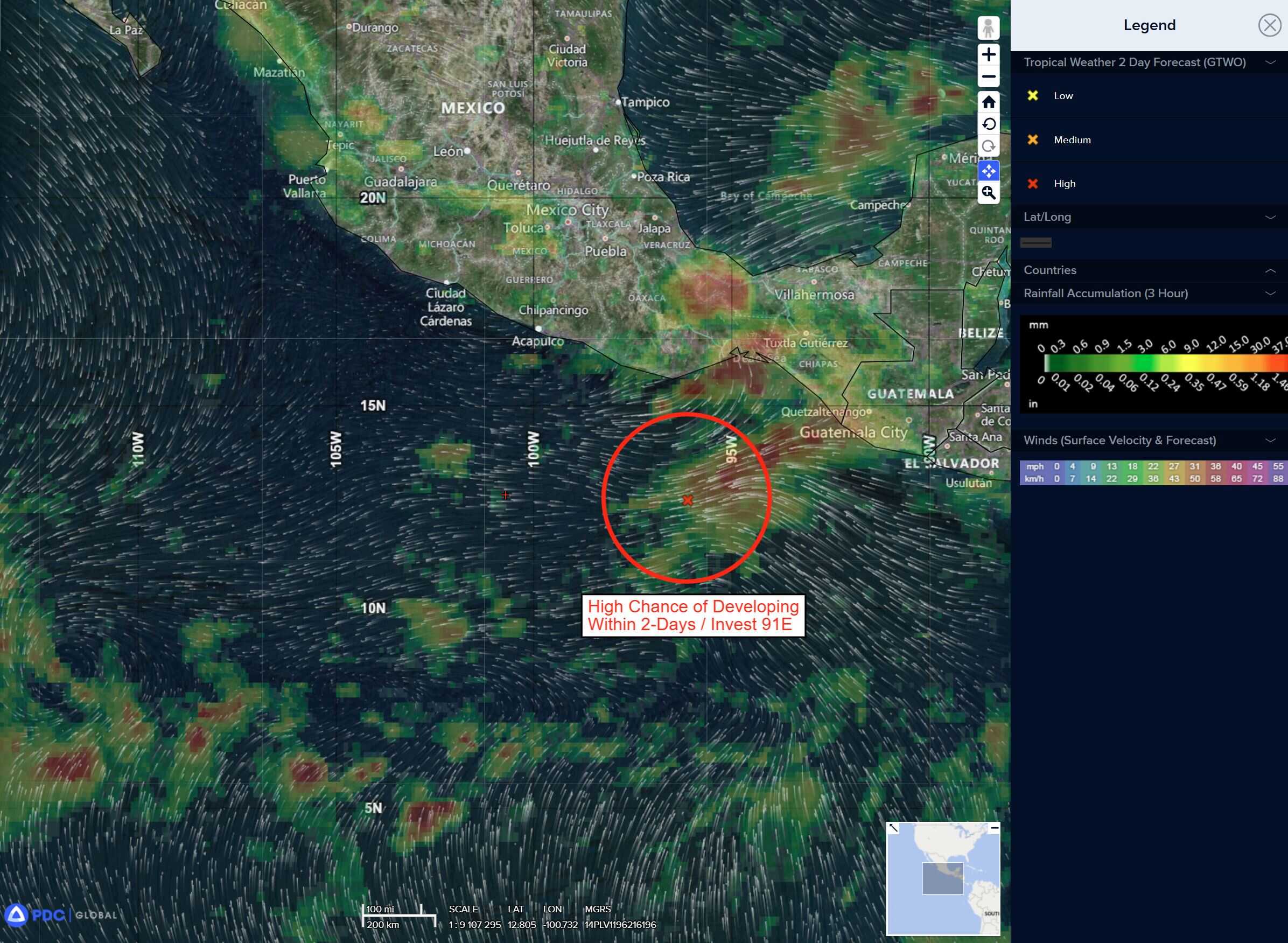
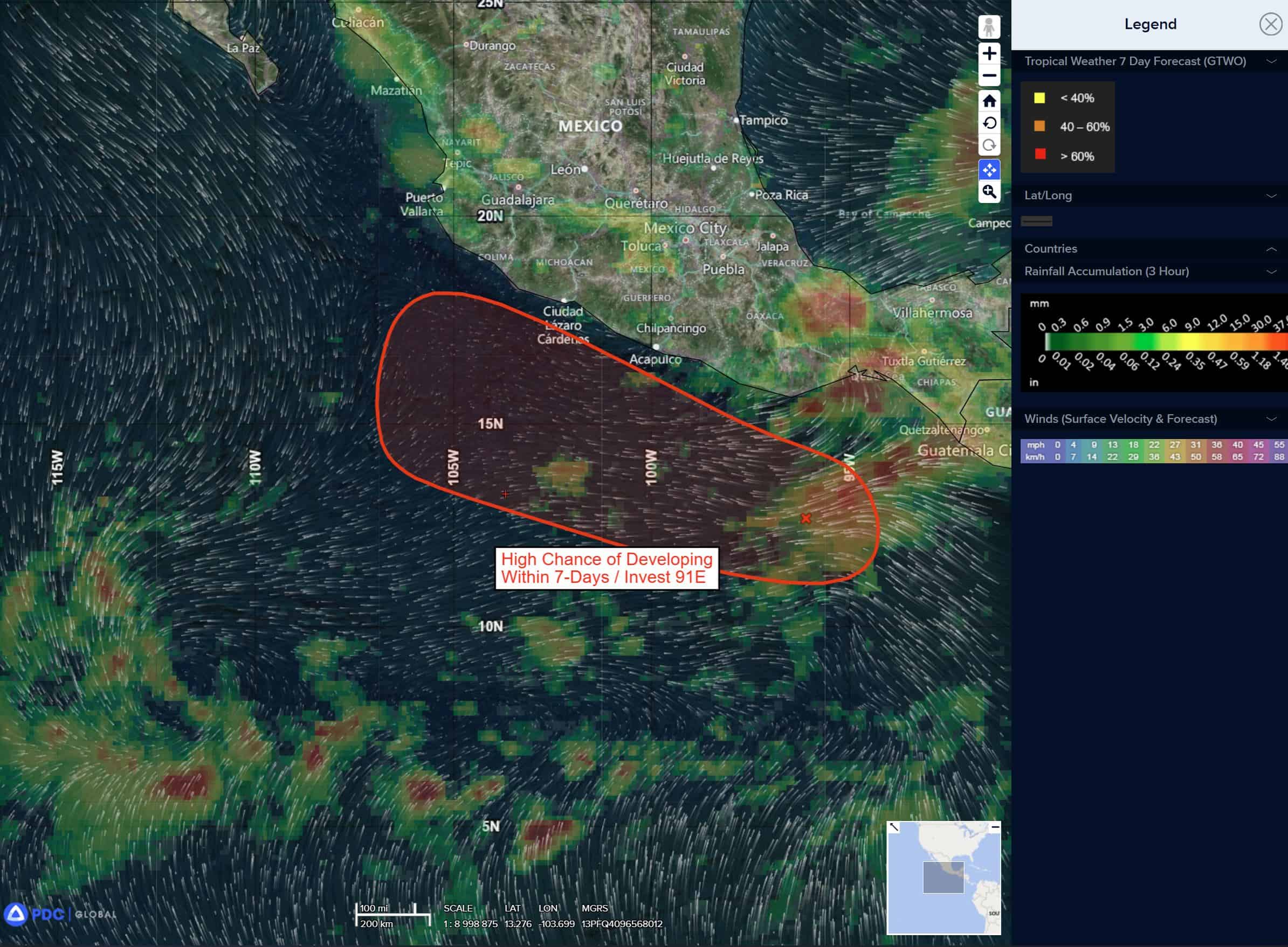
Tropical Cyclone 09E (Ivo)
IVO BRINGING LOCALLY HEAVY RAINS TO PORTIONS OF THE COAST OF SOUTHWESTERN MEXICO
According to the NHC advisory number 2
Ivo is moving toward the west-northwest near 22 mph (35 km/h). The system is forecast to move generally parallel to, but offshore of, the coast of Mexico during the next day or two and move away from Mexico thereafter. Maximum sustained winds are near 40 mph (65 km/h) with higher gusts. Strengthening is forecast, and Ivo is expected to be near hurricane strength by the end of the week. Tropical-storm-force winds extend outward up to 35 miles (55 km) from the center.
HAZARDS AFFECTING LAND
RAINFALL: Tropical Storm Ivo is expected to produce storm total rainfall of 2 to 4 inches, with isolated maximum totals of 6 inches, across portions of the Mexican states of Guerrero, Michoacan and southwestern Oaxaca through Saturday. This rainfall could lead to flash flooding.
SURF: Swells generated by Ivo will be affecting the southwestern coast of Mexico during the next couple of days. These swells are likely to cause life-threatening surf and rip current conditions.
Central Pacific Ocean: There are no Tropical Cyclones
Tropical cyclone formation is not expected during the next 7 days.
Western Pacific, Indian Ocean, and adjacent Seas:
Western Pacific
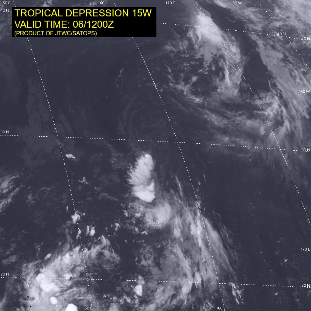
Tropical Cyclone 15W – Final Warning
According to the JTWC warning number 5 sustained winds are 25 knots with gusts to near 35 knots
Animated enhanced infrared (eir) satellite imagery depicts a fully exposed low-level circulation center (llcc) with deep convection sheared to the south-southwest. The initial position is placed with high confidence based on the aforementioned animated eir and a 061213z gpm gmi 89ghz image revealing the shallow and sheared structure of Tropical Depression 15W. The llcc is elongated along a north-south axis. dry air bounds the northern periphery of TD 15W.
TD 15W will track northward on the western periphery of a subtropical ridge to the east, curving slightly to the north-northeast by the end of the forecast period. Over the next 12 hours, TD 15W will slightly intensify to a peak of 30 knots at 12 hours while the core remains moist.
High vertical wind shear will inhibit further intensification beyond 30 knots. The current unfavorable dry air threatening the llcc will overtake the system by 24 hours, resulting in gradual weakening. Ultimately, the unfavorable features will lead to dissipation within the next 48 hours as the system weakens into the larger flow.
Tropical Cyclone 16W
According to the JTWC warning number 1 sustained winds are 25 knots with gusts to near 35 knots
South Indian Ocean
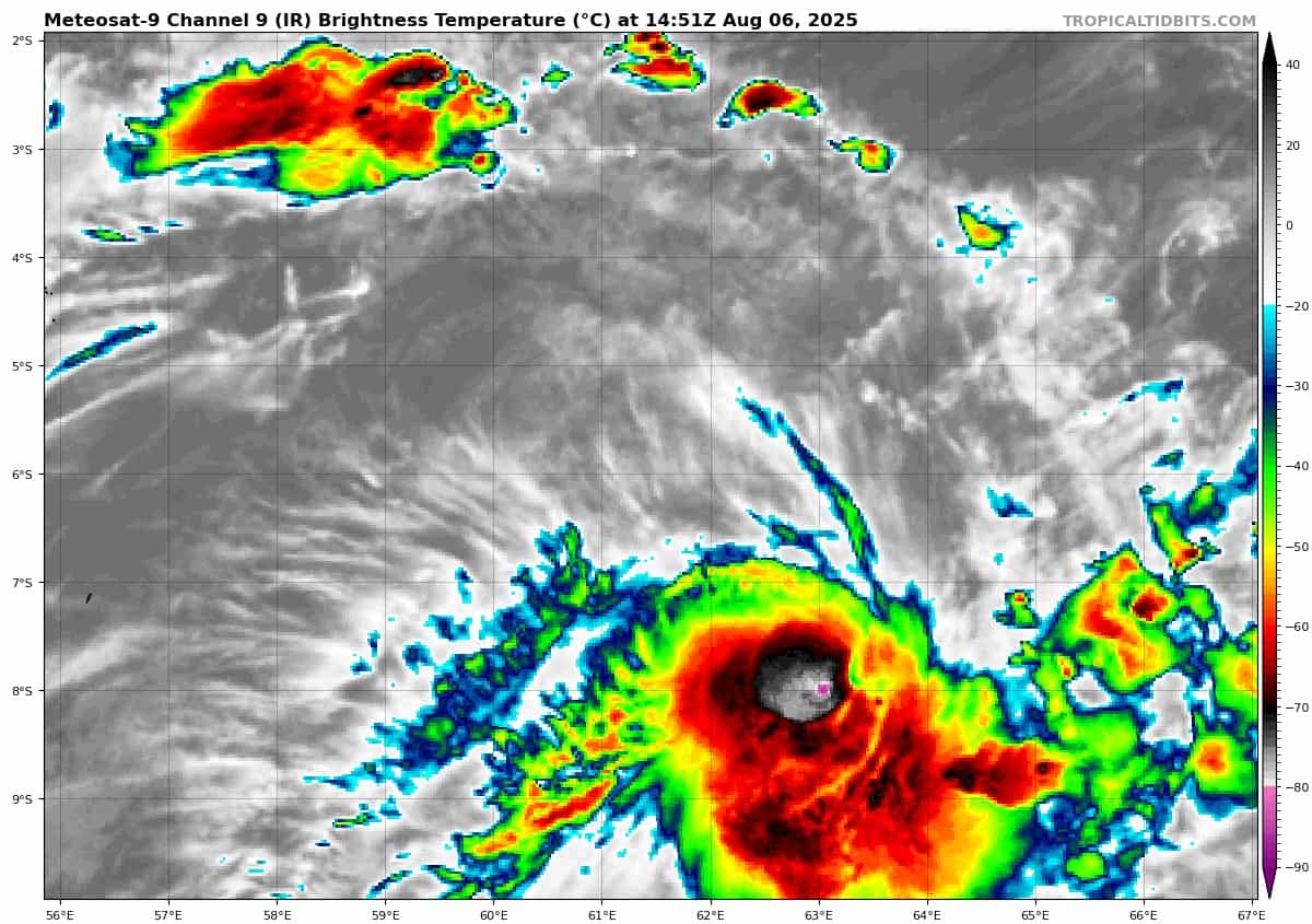
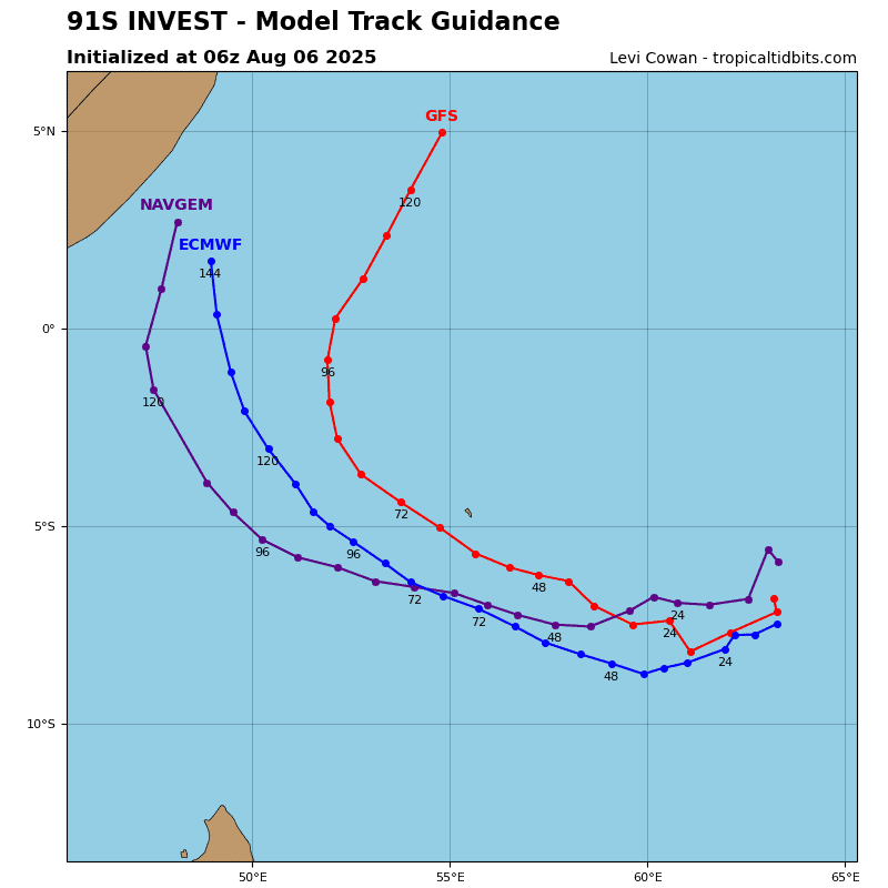
Tropical Cyclone 02S
According to the JTWC warning number 1 sustained winds are 35 knots with gusts to near 45 knots