Tropical Cyclone (Gil)
GIL MOVING FASTER
According to the NHC Advisory number 4

")
By PDC’s Senior Weather
Specialist Glenn James

The Pacific Disaster Center’s (PDC Global) Thursday, July 31, 2025, Tropical Cyclone Activity Report…for the Pacific Ocean, the Indian Ocean, and adjacent Seas
Current Tropical Cyclones:
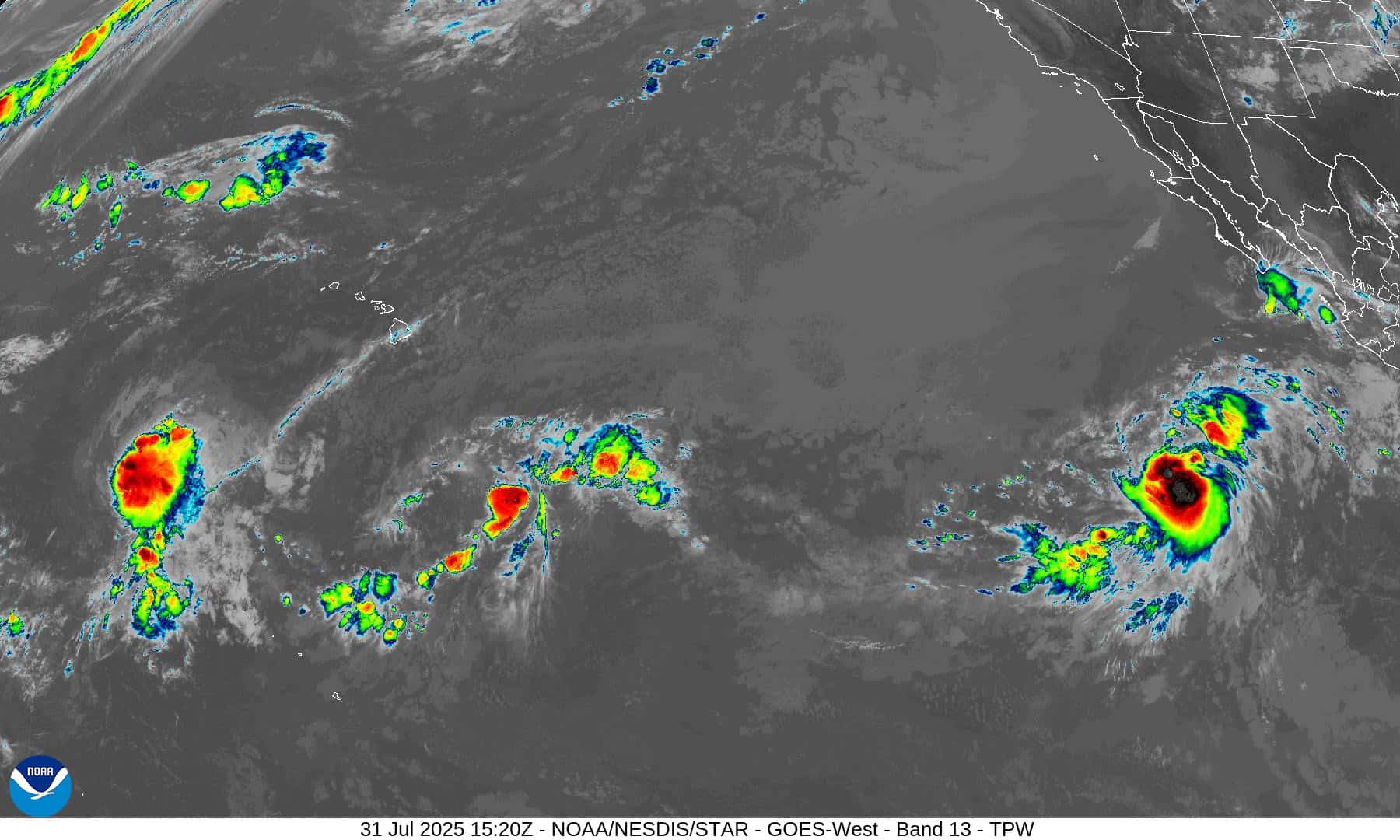
Tropical Cyclone (Gil)…is located about 825 miles southwest of the southern tip of Baja California
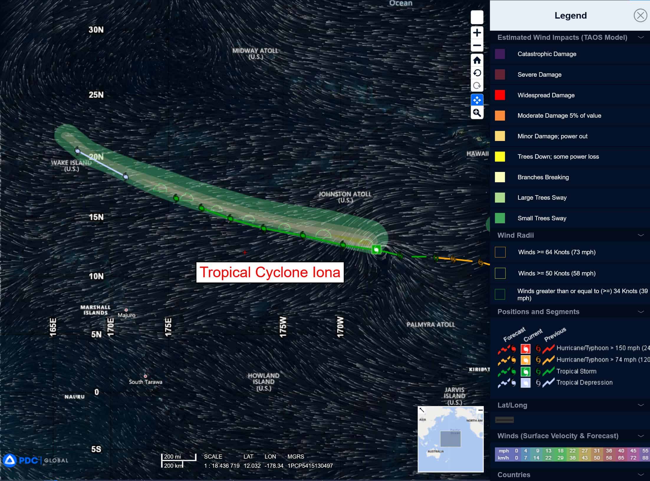
Tropical Cyclone 01C (Iona)…is located about 1105 miles west-southwest of Honolulu, Hawaii
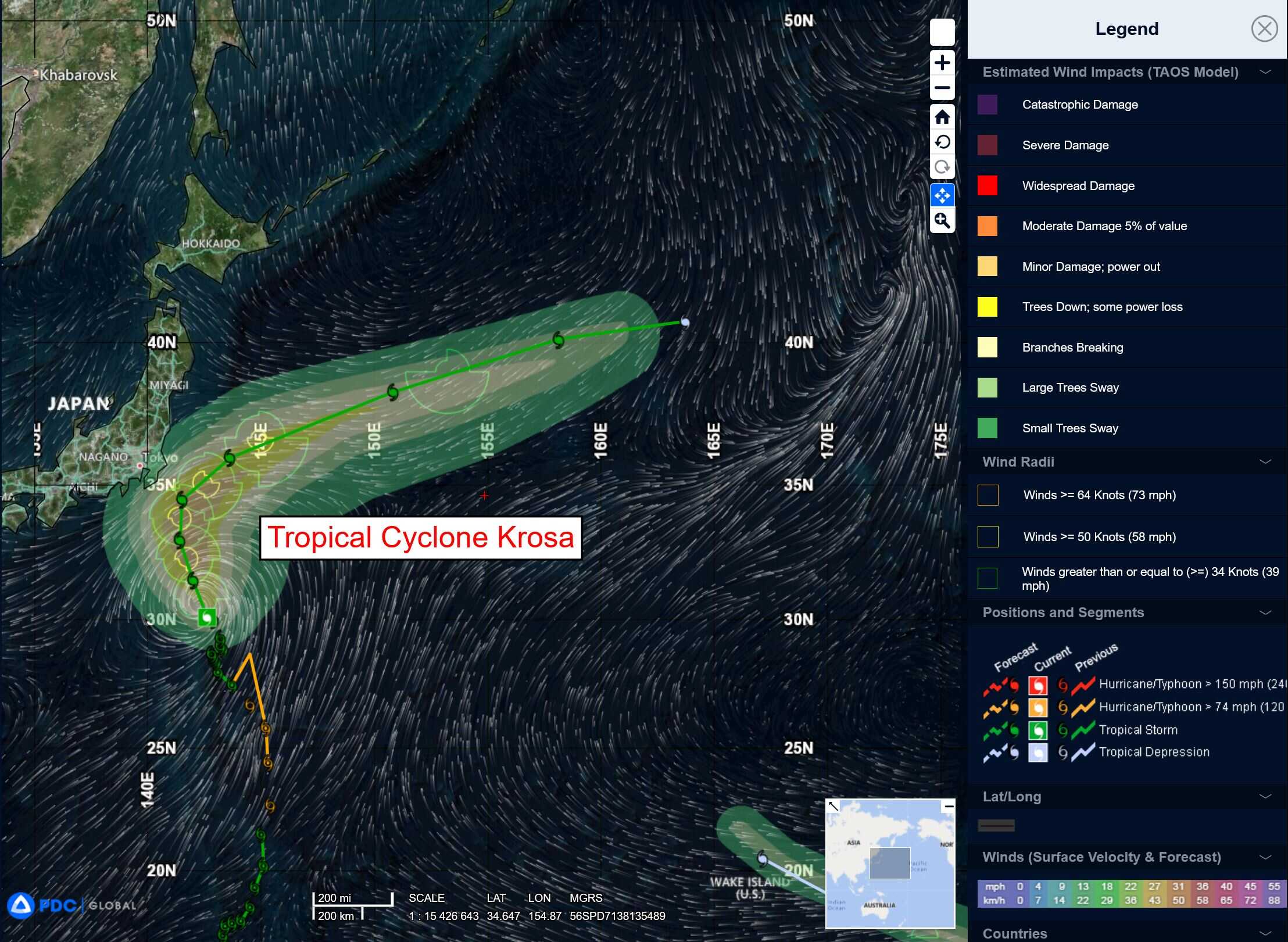
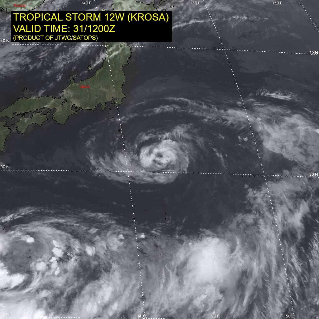
Tropical Cyclone 12W (Krosa)…is located 190 NM south-southeast of Yokosuka, Japan
Northeast Pacific Ocean:
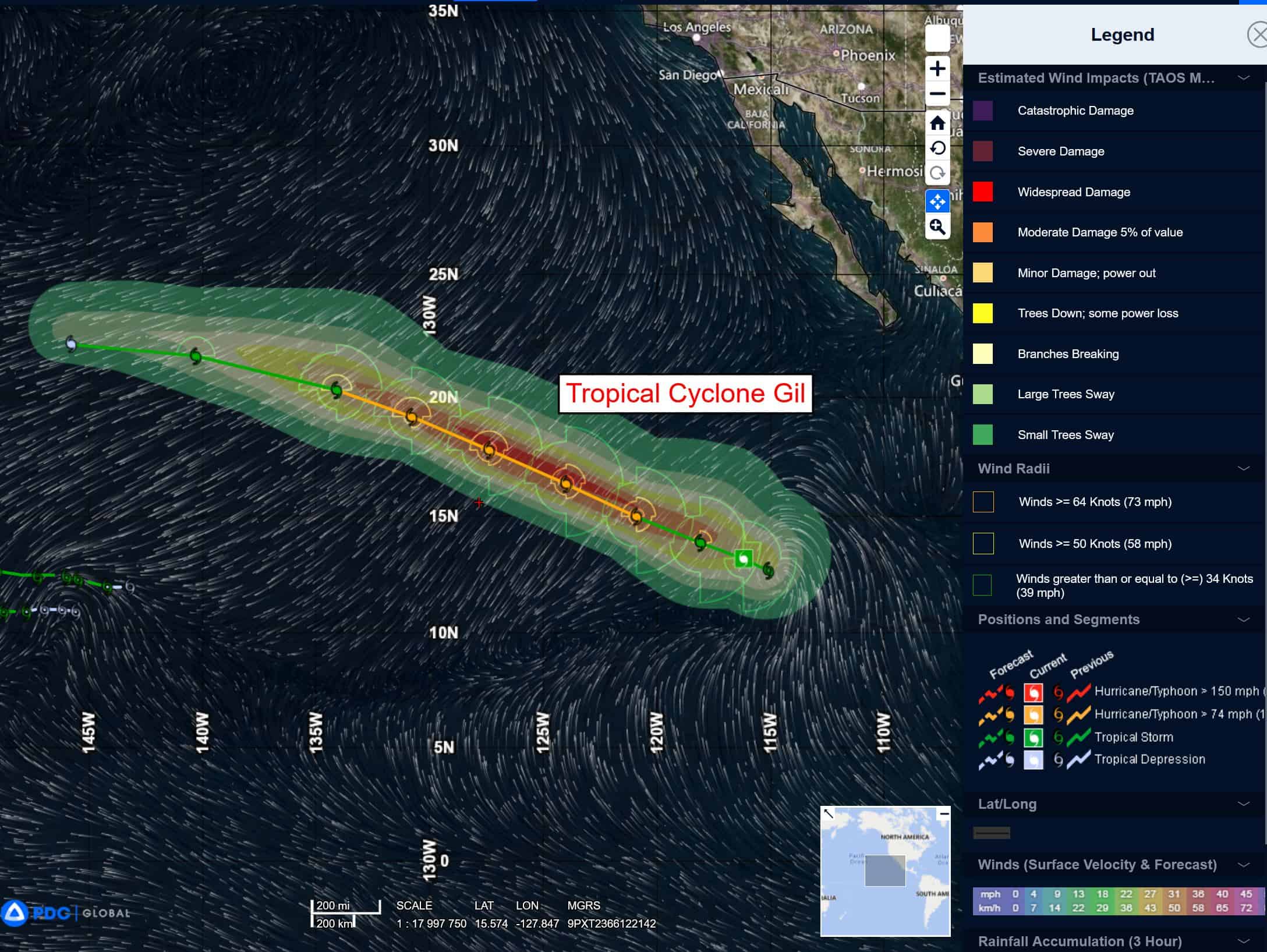
Tropical Cyclone (Gil)
GIL MOVING FASTER
According to the NHC Advisory number 4
Gil is moving toward the west-northwest near 16 mph (26 km/h) and this general motion with an additional increase in forward speed is expected over the next couple of days. Maximum sustained winds have increased to near 60 mph (95 km/h) with higher gusts. Further strengthening is forecast, and Gil will likely become a hurricane on Friday. Tropical-storm-force winds extend outward up to 160 miles (260 km) from the center.
Central East Pacific:
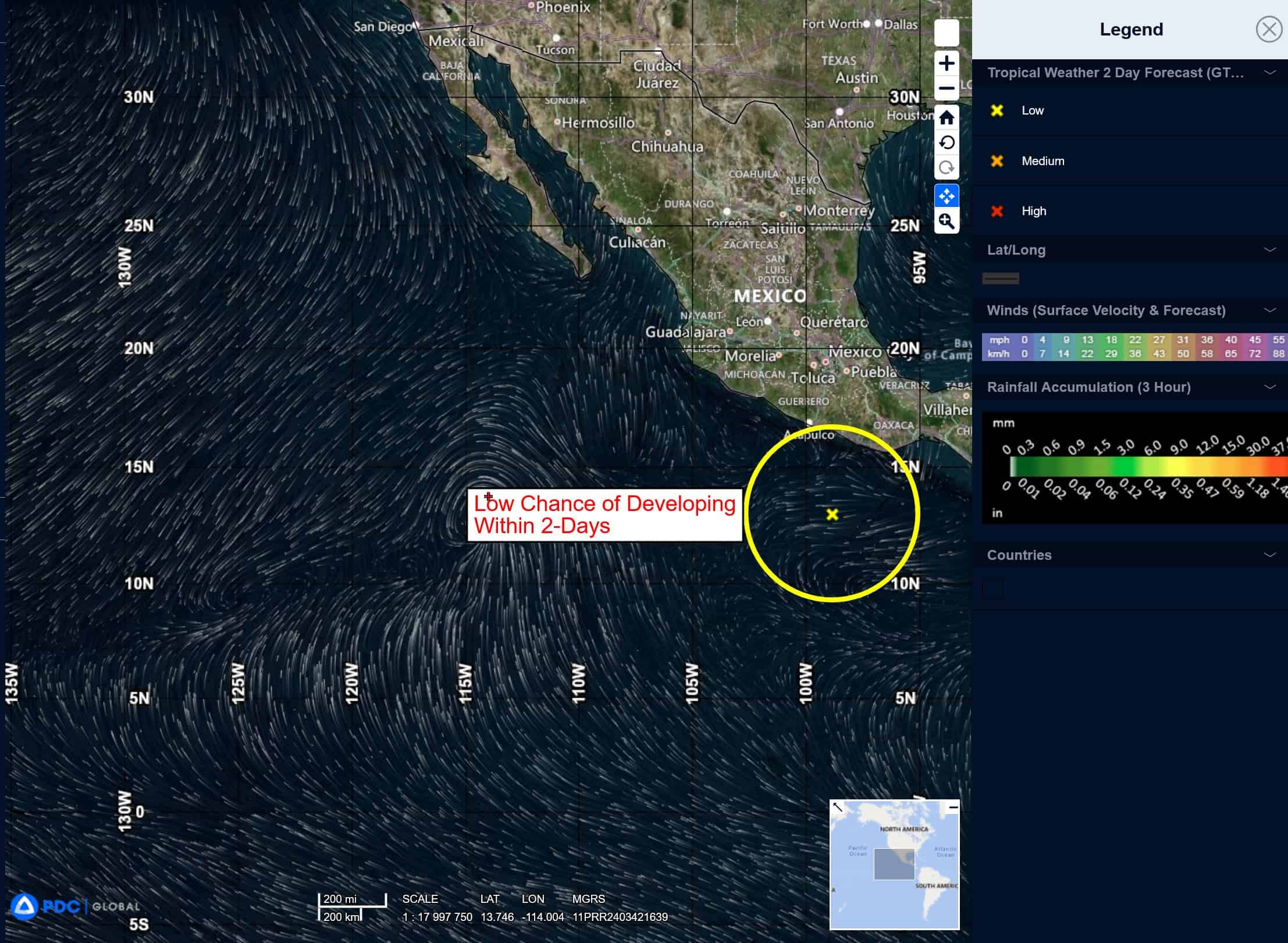
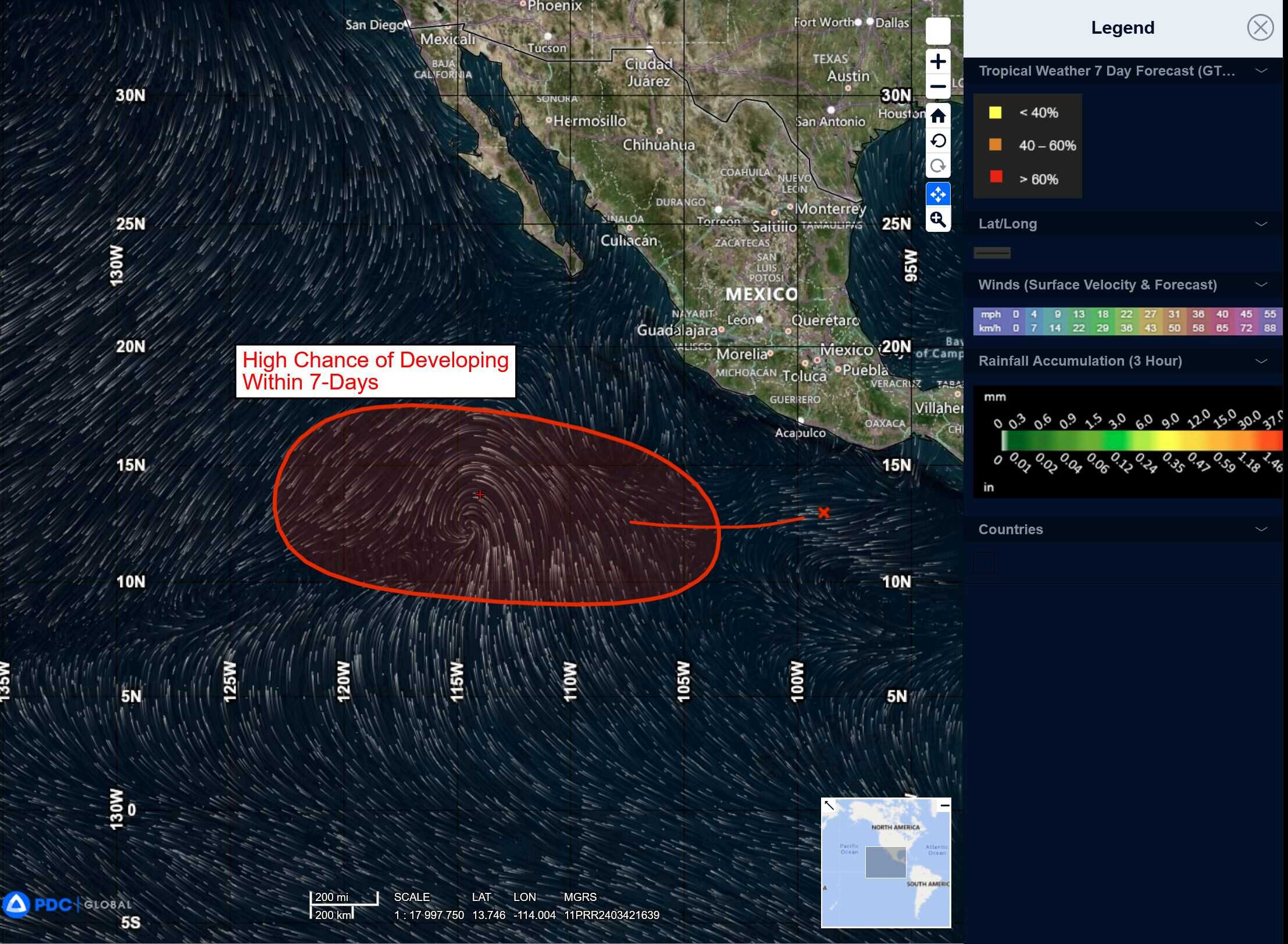
>>> An area of low pressure is expected to form well south of southwestern Mexico in the next couple of days. Environmental conditions appear conducive for some gradual development of this system, and a tropical depression is likely to form over the weekend or early next week as the system moves west-northwestward at 10 to 15 mph.
* Formation chance through 48 hours…low…10 percent
* Formation chance through 7 days…high…70 percent
Central Pacific Ocean:
Tropical Cyclone 01C (Iona)
IONA CONTINUES WEST-NORTHWESTWARD WITH MINIMAL CHANGE IN INTENSITY
According to the NHC advisory number 20
Iona is moving toward the west-northwest near 23 mph (37 km/h), and this general motion is expected to continue for the next couple of days with a gradual decrease in forward speed. Maximum sustained winds are near 50 mph (85 km/h) with higher gusts. Little change in strength is forecast during the next 48 hours. Tropical-storm-force winds extend outward up to 60 miles (95 km) from the center.
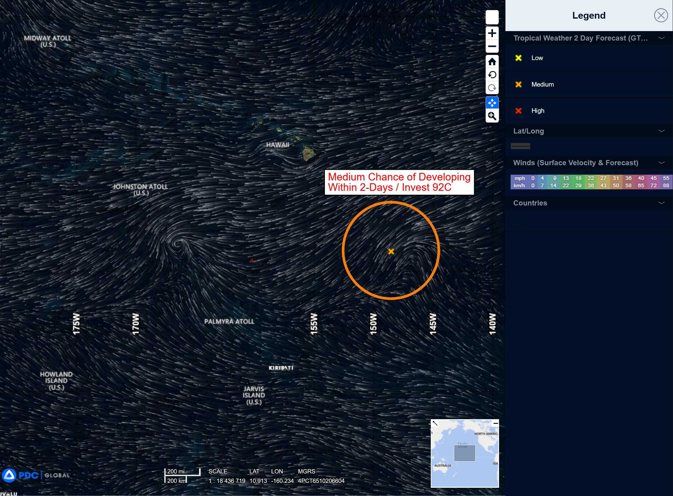
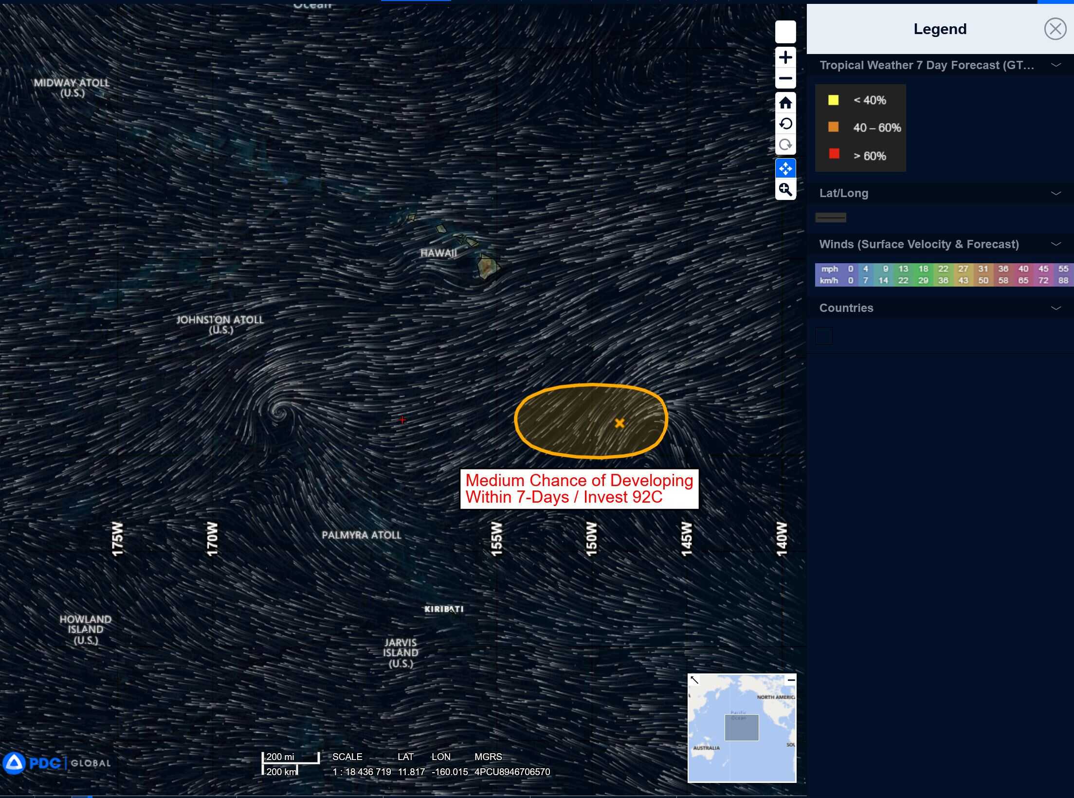
Well South-southeast of the Hawaiian Islands:
Invest 92C
>>> Disorganized showers and thunderstorms associated with a trough of low pressure located about 650 miles south-southeast of Hilo, Hawaii, continue to persist. While the system currently lacks a well-defined low-level center, some development is possible during the next day or so. By this weekend, environmental conditions are expected to become less conducive for further development.
* Formation chance through 48 hours…low…10 percent
* Formation chance through 7 days…low…10 percent
Western Pacific, Indian Ocean, and adjacent Seas:
Western Pacific
Tropical Cyclone 12W (Krosa)
According to the JTWC warning number 34 sustained winds are 55 knots with gusts to near 70 knots
Animated enhanced infrared (eir) satellite imagery depicts flaring convective bands wrapping into a broad and weak low-level circulation center. The llcc is unidentifiable on eir, but an earlier microwave image reveals the broad with fragmented banding along the southern periphery. Water vapor imagery reveals moderate poleward outflow and dry air encapsulating tropical storm 12W.
TS 12W has weakly tracked north-northwestward over the last six hours and will continue to do so for the next 24 hours while remaining in a weak steering environment between a subtropical ridge (str) to the northwest and a near equatorial ridge (ner) to the southeast.
An approaching deep-layer trough will break down the str from 12-36 hours, resulting in TS 12W to curve to the northeast for the remainder of the forecast period. The deep-layer trough will begin to interact with TS 12W after 48 hours as the system enters the baroclinic zone and becomes fully extratropical by 96 hours.
During the first 24 hours of the forecast TS 12W will intensify to a peak of 60 knots while tracking over a warm extension of the Kuroshio current. During the period of intensification, the vertical wind shear will remain low and favorable, and the upper-level environment will remain marginally divergent poleward.
Dry air will continue to confine TS 12W and inhibit stronger intensification. After 36 hours, TS 12W will pass into cold waters north of the Kuroshio current, initiating a weakening trend. Vertical wind shear will increase unfavorably as the system tracks northeastward and begins to interact with the approaching upper-level trough. By the end of the forecast period, TS 12W will weaken to 30 knots as an extratropical cyclone.