IONA REMAINS A TROPICAL STORM AS IT CONTINUES WESTWARD
According to the NHC advisory number 16

")
By PDC’s Senior Weather
Specialist Glenn James

The Pacific Disaster Center’s (PDC Global) Wednesday, July 30, 2025, Tropical Cyclone Activity Report…for the Pacific Ocean, the Indian Ocean, and adjacent Seas
Current Tropical Cyclones:
Tropical Cyclone 01C (Iona)…is located about 800 miles southwest of Honolulu, Hawaii
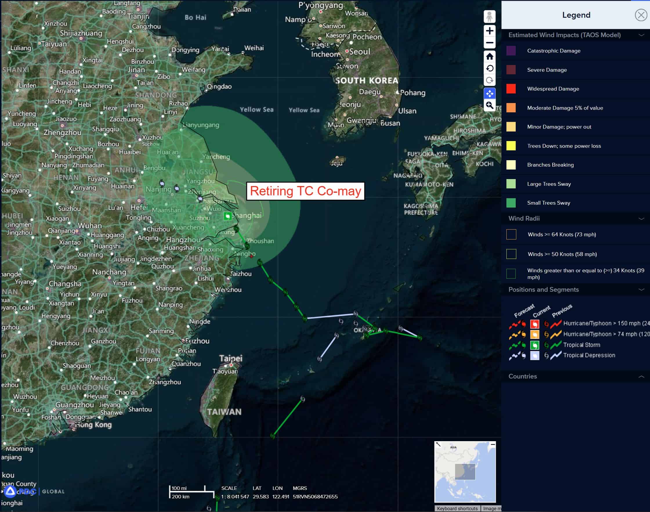
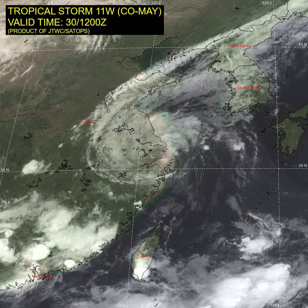
Tropical Cyclone 11W (Co-may)…is located 5 NM west of Shanghai, China – Final Warning
Tropical Cyclone 12W (Krosa)…is located 357 NM south-southeast of Yokosuka, Japan
Northeast Pacific Ocean: There are no Tropical Cyclones
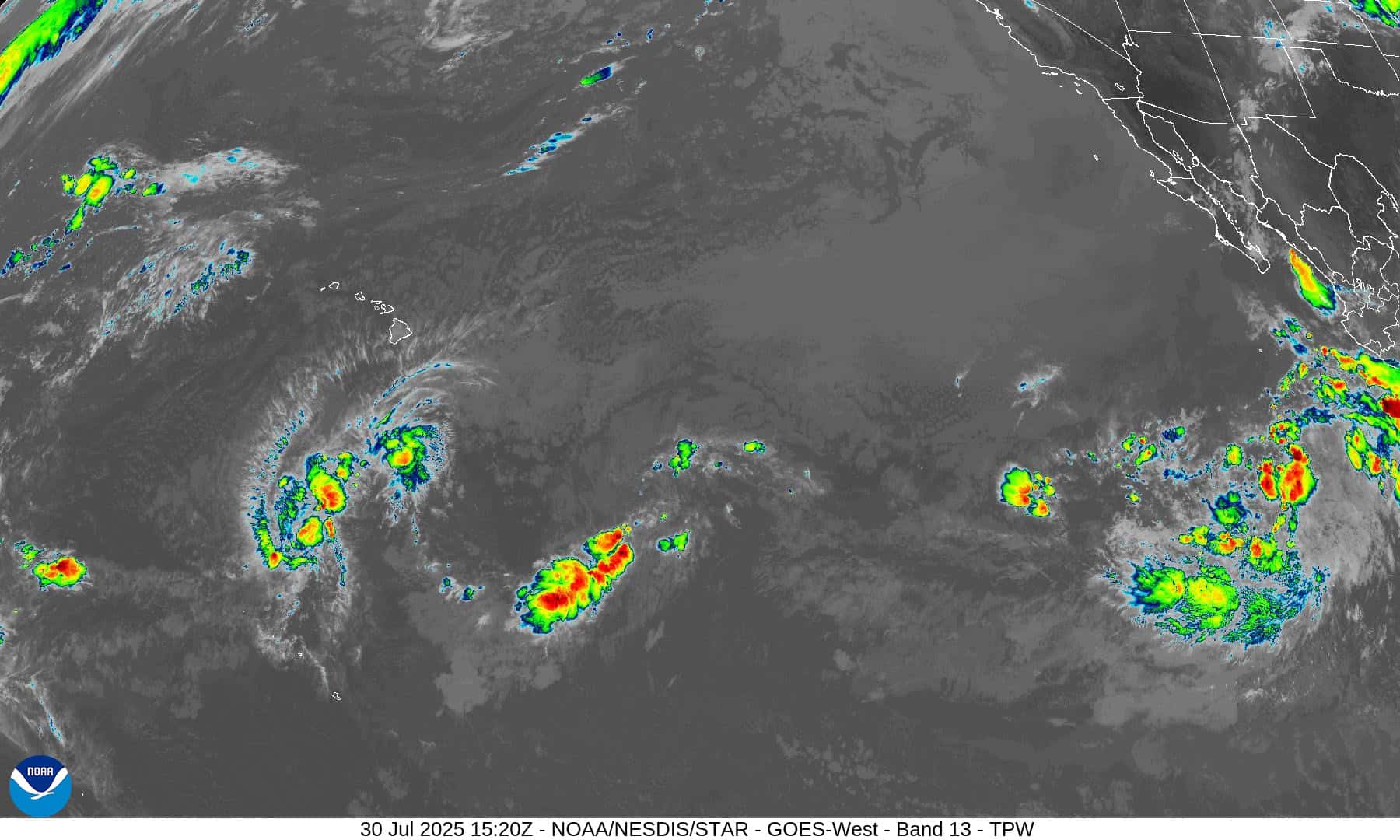
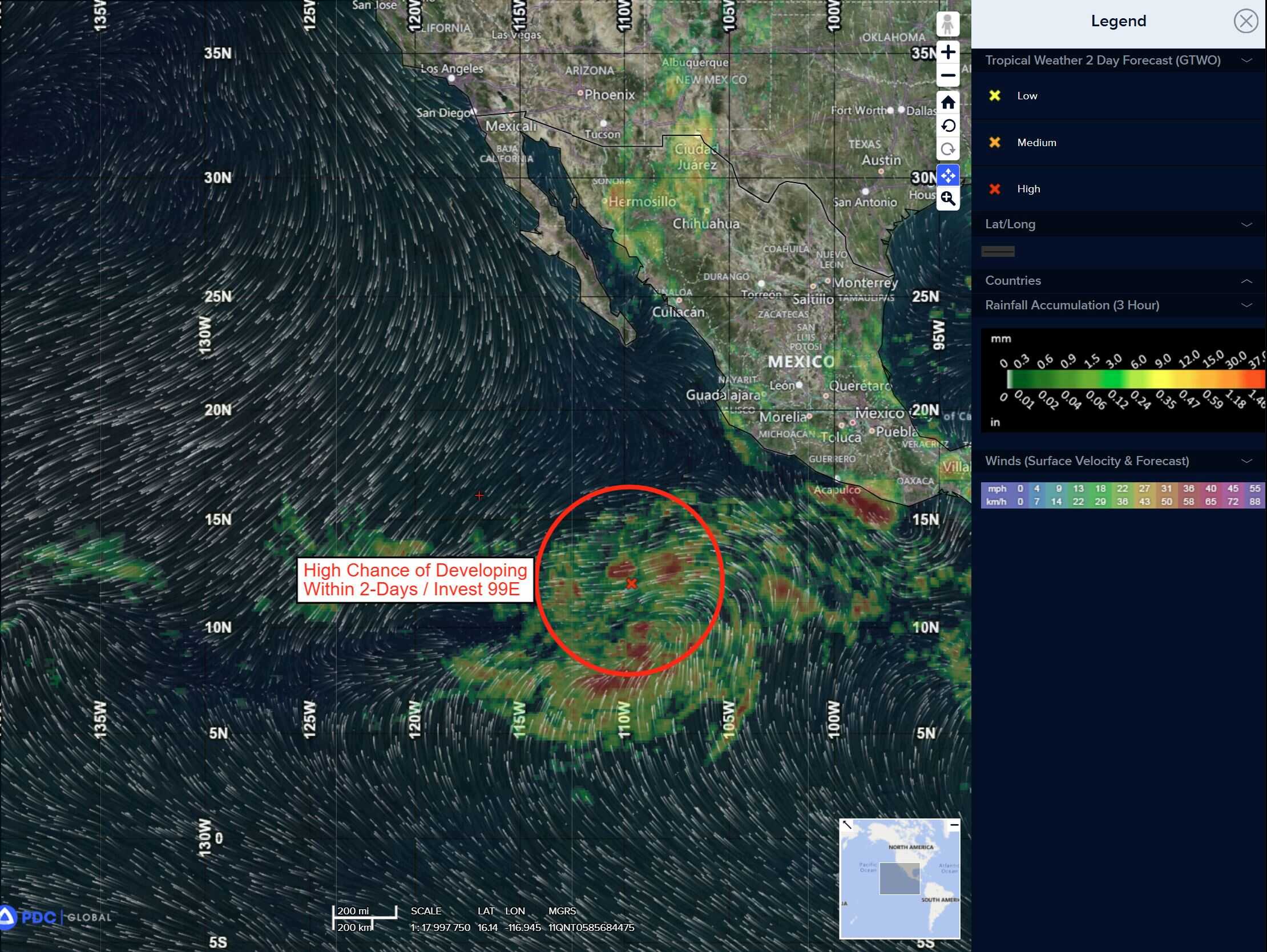
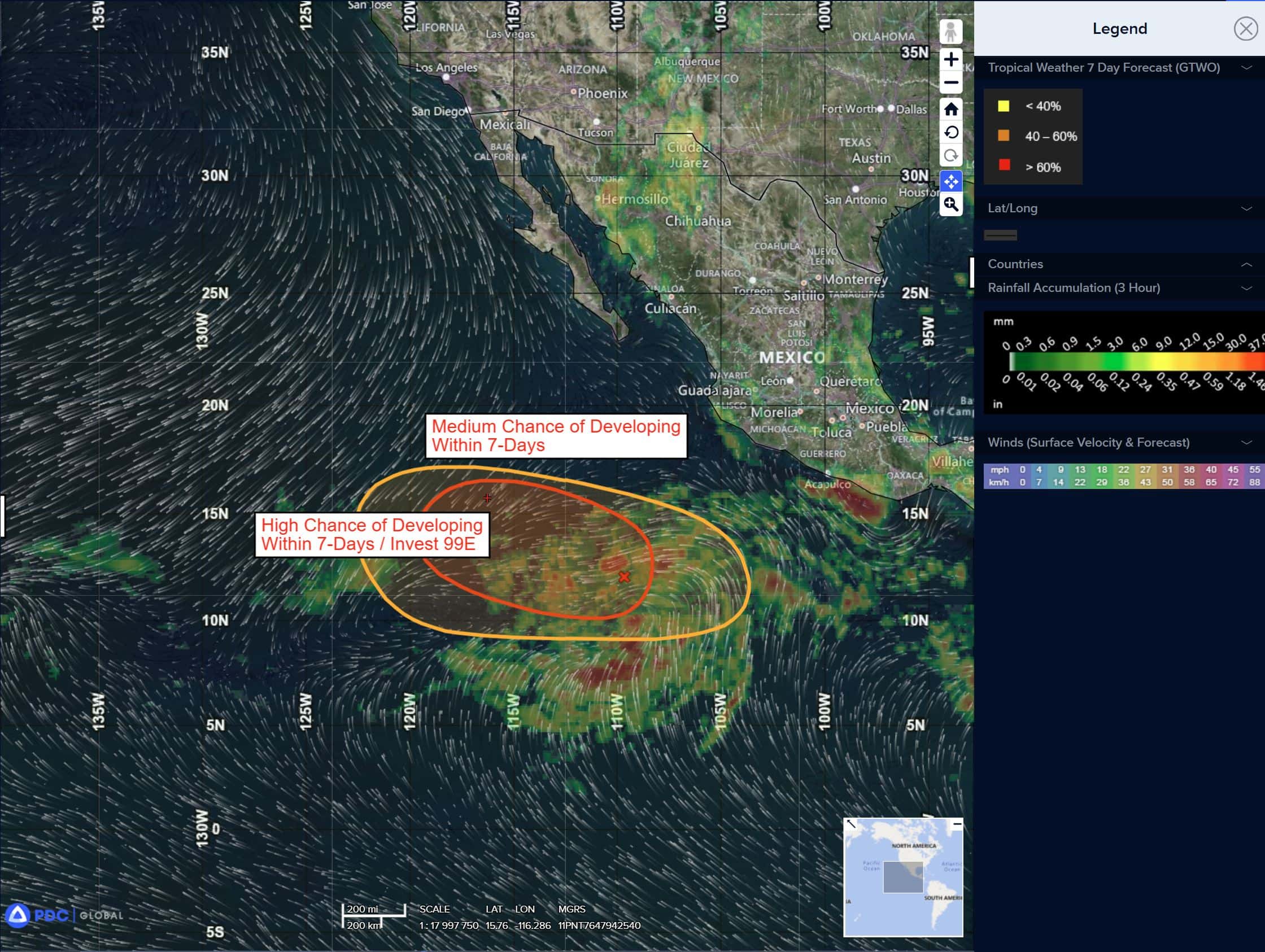
South of Southwestern Mexico:
Invest 99E
>>> Showers and thunderstorms associated with a low pressure system located several hundred miles south-southwest of the southern tip of the Baja California Peninsula continue to become better organized. Environmental conditions appear conducive for further development, and if current trends persist, a tropical depression or tropical storm is expected to form on Thursday. The system is forecast to move west-northwestward at around 15 mph over the open waters of the eastern Pacific.
* Formation chance through 48 hours…high…100 percent
* Formation chance through 7 days…high…100 percent
Central East Pacific:
>>> An area of low pressure is expected to form well south of southwestern Mexico in the next couple of days. Environmental conditions appear conducive for some gradual development of this system, and a tropical depression could form over the weekend or early next week as the system moves west-northwestward at 10 to 15 mph.
* Formation chance through 48 hours…low…near 0 percent.
* Formation chance through 7 days…high…70 percent
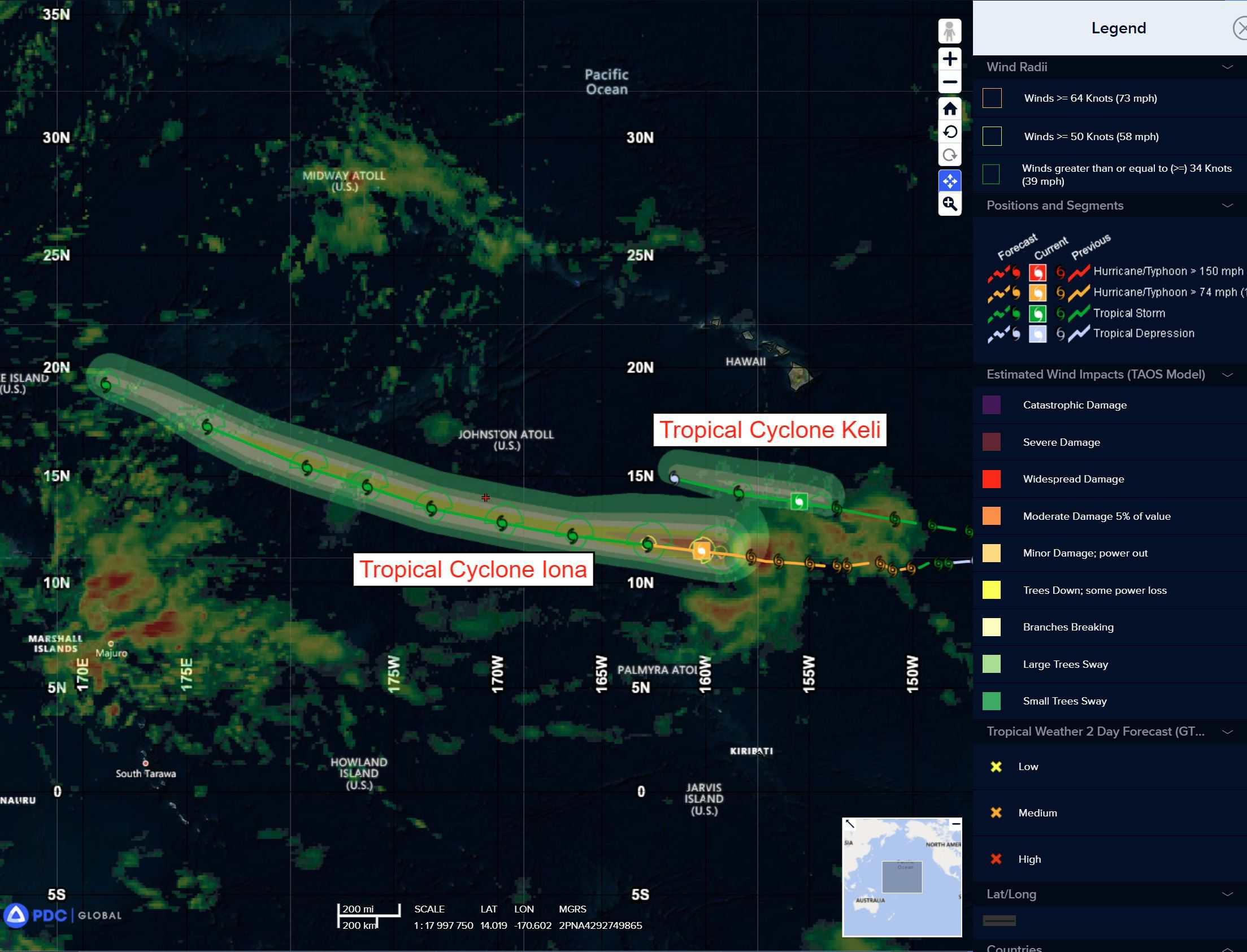
Central Pacific Ocean:
Tropical Cyclone 01C (Iona)
IONA REMAINS A TROPICAL STORM AS IT CONTINUES WESTWARD
According to the NHC advisory number 16
Iona is moving toward the west near 23 mph (37 km/h), and this general motion is expected to continue during the next couple of days, with a gradual turn to the west-northwest. Maximum sustained winds have decreased to near 50 mph (85 km/h) with higher gusts. Additional weakening is expected through tonight, while little change in strength is expected on Thursday. Tropical-storm-force winds extend outward up to 60 miles (95 km) from the center.
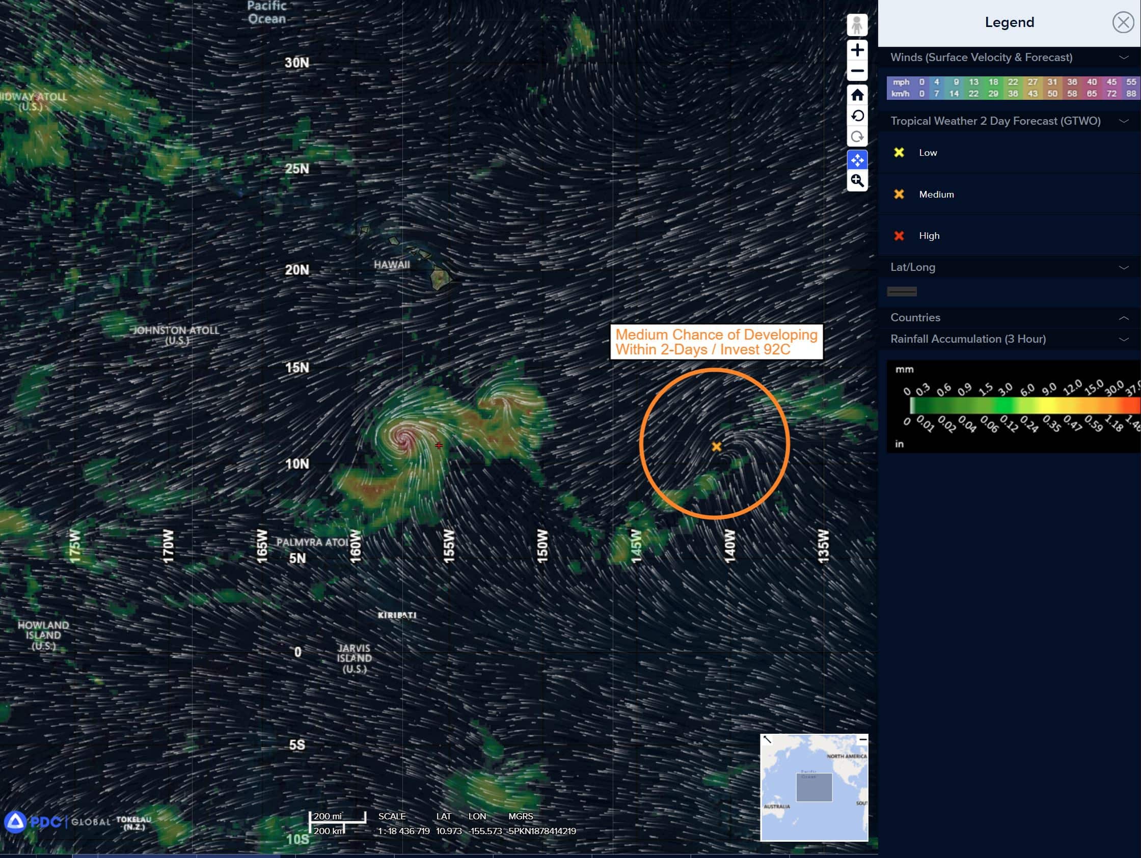
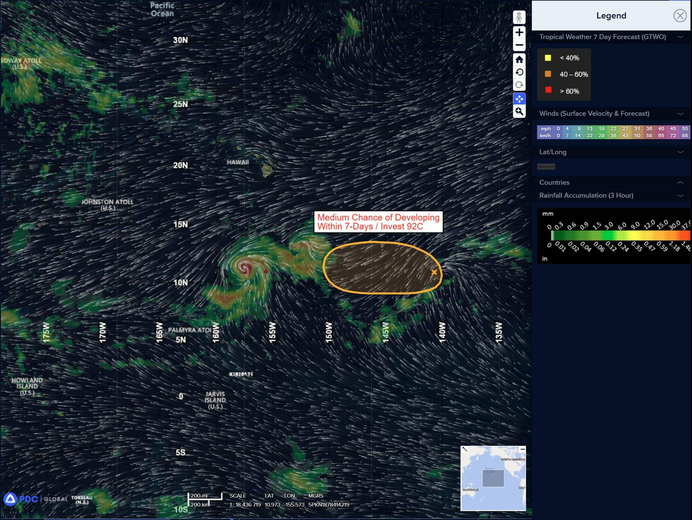
Well East-Southeast of the Hawaiian Islands:
Invest 92C
>>>
Disorganized showers and thunderstorms associated with a broad area of low pressure located about 800 miles southeast of Hilo, Hawaii, continue to persist. Although the system lacks a well-defined low-level center at this time, some additional development is possible, and a short-lived tropical depression could still form during the next day or so. After that time, environmental conditions are expected to become less conducive for further development.
* Formation chance through 48 hours…medium…40 percent
* Formation chance through 7 days…medium…40 percent
Western Pacific, Indian Ocean, and adjacent Seas:
Western Pacific
Tropical Cyclone 11W (Co-may) – Final Warning
According to the JTWC warning number 31 sustained winds are 35 knots with gusts to near 45 knots
Animated enhanced infrared imagery (eir) reveals the broad and ragged circulation of tropical storm 11W degrading over the coast. A deep-layer trough to the north strongly enhances poleward outflow, but also introduces unfavorable high vertical wind shear.
TS 11W will continue to dissipate for the next 36 hours due to topographic interaction. It is possible that the remnants of TS 11W will track into the Yellow Sea, but there is low likelihood of redevelopment due to unfavorable dry air, high vertical wind shear, and upper-level troughing.
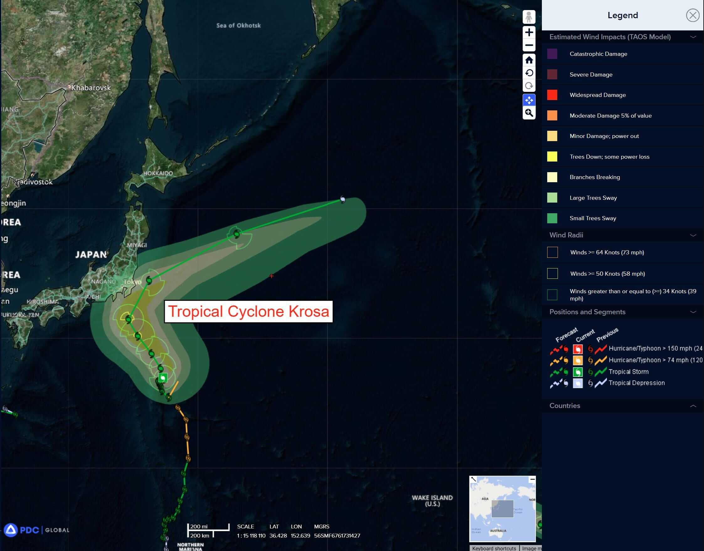
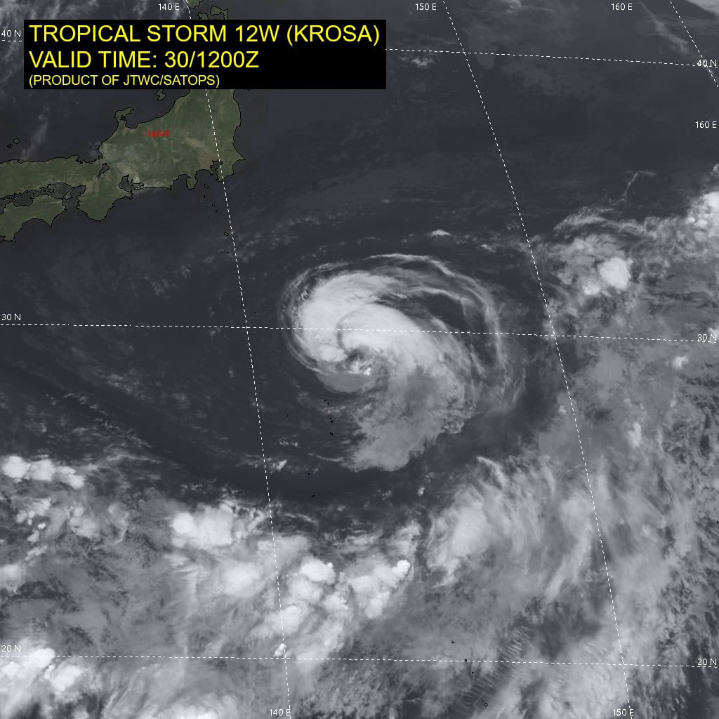
Tropical Cyclone 12W (Krosa)
According to the JTWC warning number 30 sustained winds are 50 knots with gusts to near 65 knots
Animated multi-spectral satellite imagery (msi) depicts a symmetric tropical storm with persistent convection embedded within a large expanse of dry air. Convection appears to have built over the last six hours as the system has slowly tracked northeastward into slightly warmer waters.
However, the cool water depth is shallow, and the improved structure may not continue if the system becomes slow and quasi-stationary. An earlier microwave image reveals the symmetric low-level structure, while the upper-level environment is broken and ragged.
TS 12W has tracked slowly northeastward over the last six hours, and the track will remain irregular and slow while in a competing steering environment between the subtropical ridge over Japan and monsoonal flow to the south. Gradually over the next 36 hours the ridge over Japan will weaken and the TS will
curve northeastward.
During this time, a vorticity maximum approaching from the southwest may result in moderate binary interaction, producing irregularity in the track as it curves northwestward at 48 hours. A building near equatorial ridge to the southeast will cause the system to curve northeastward after 48 hours.
The system will gradually intensify while moving northward, leaving a cool wake behind due to low ocean heat content (ohc). Any quasi-stationary period within the forecast will drain the ohc in the ocean below the system as the cool water depth is shallow. Additionally, a cold eddy south of Japan will inhibit intensification.
Sea surface temperatures will warm as the system approaches the Kuroshio current, leading to a peak intensity of 60 knots at 72 hours. TS 12W will weaken as the system tracks northeastward after 72 hours due to cool waters north of the Kuroshio current and increasing vertical wind shear.