
")
Current Snapshot
For all the latest updates visit: DisasterAWARE
two
seven
7

1800×1080
wpac
10W_251200sair
11W_251200sair
12W_251200sair
By PDC’s Senior Weather
Specialist Glenn James

The Pacific Disaster Center’s (PDC Global) Friday, July 25, 2025, Tropical Cyclone Activity Report…for the Pacific Ocean, the Indian Ocean, and adjacent Seas
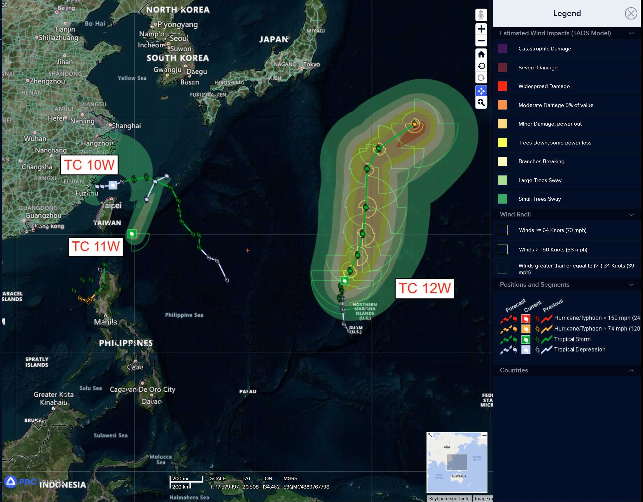
Current Tropical Cyclones:
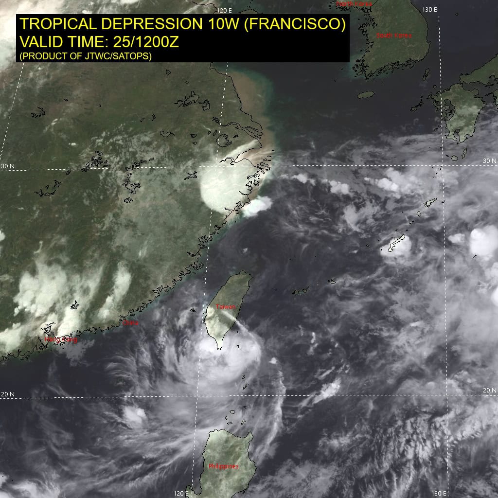
Tropical Cyclone 10W (Francisco)…is located 67 NM north of Taipei, Taiwan – Final Warning
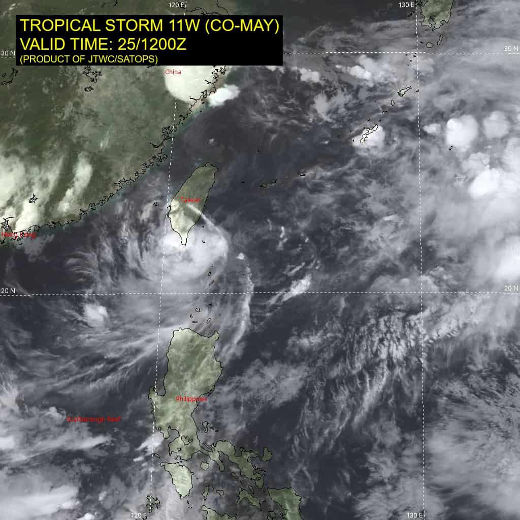
Tropical Cyclone 11W (Co-may)…is located 134 NM west-southwest of Kadena AB
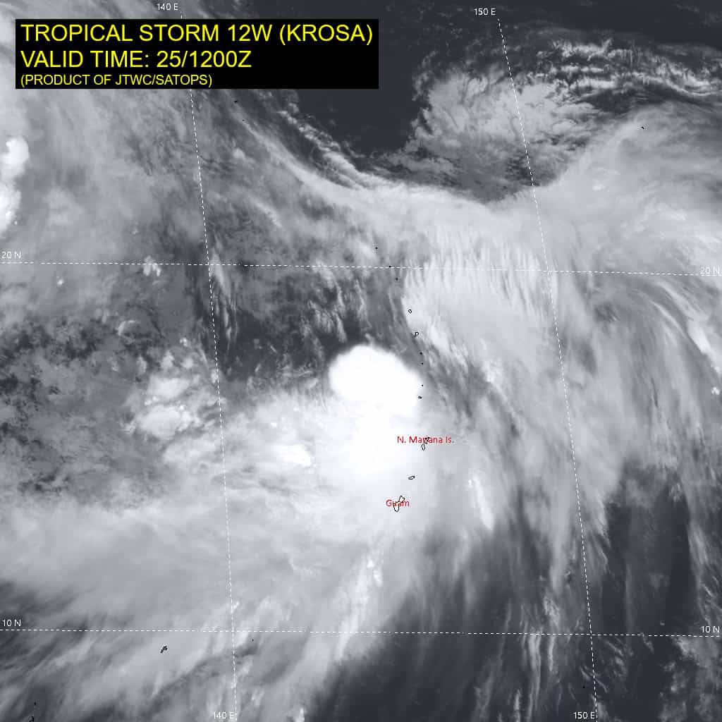
Tropical Cyclone 12W (Krosa)…is located 121 west of Alamagan
Northeast Pacific Ocean: There are no Tropical Cyclones
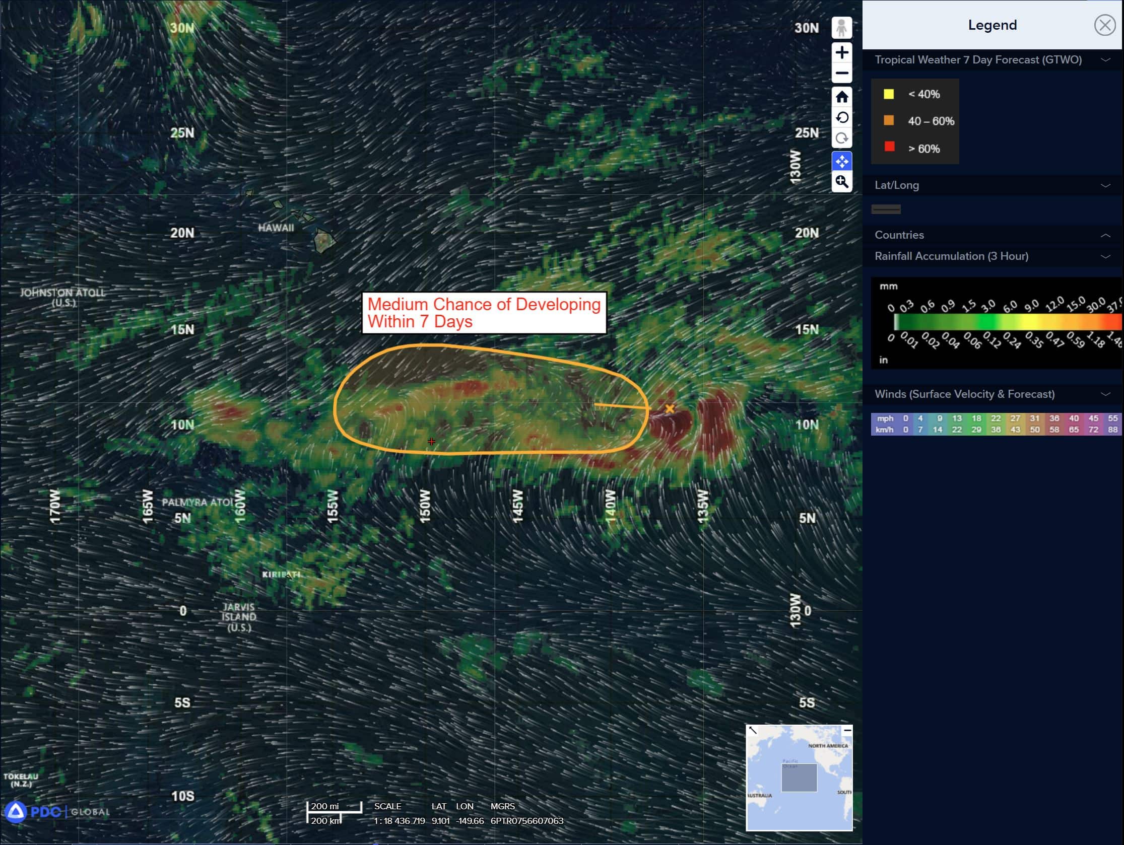
Eastern portion of Central Pacific:
Invest 90C
>>> Showers and thunderstorms associated with a broad area of low pressure located around 1100 miles southeast of the Hawaiian Islands have decreased since earlier today. Some gradual development of this system is possible, and a tropical depression could form this weekend or early next week as it moves generally westward at 10 to 15 mph across the Central Pacific basin.
* Formation chance through 48 hours…medium…50 percent
* Formation chance through 7 days…medium…60 percent
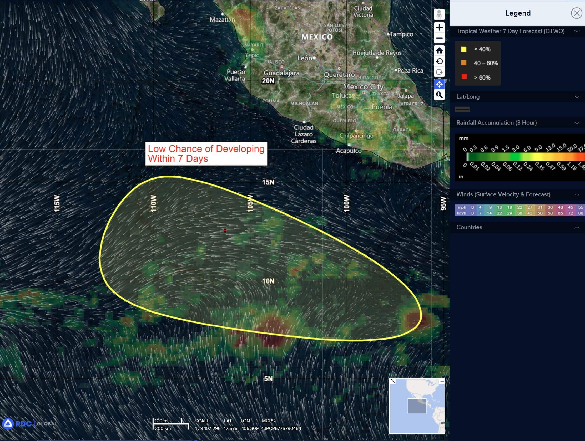
South of Southwestern Mexico:
>>> An area of low pressure is forecast to form offshore of the southwestern coast of Mexico early next week. Thereafter, environmental conditions appear conducive for some development and a tropical depression could form during the middle to latter part of next week as the system moves generally west-northwestward at 10 to 15 mph.
* Formation chance through 48 hours…low…near 0 percent.
* Formation chance through 7 days…medium…40 percent
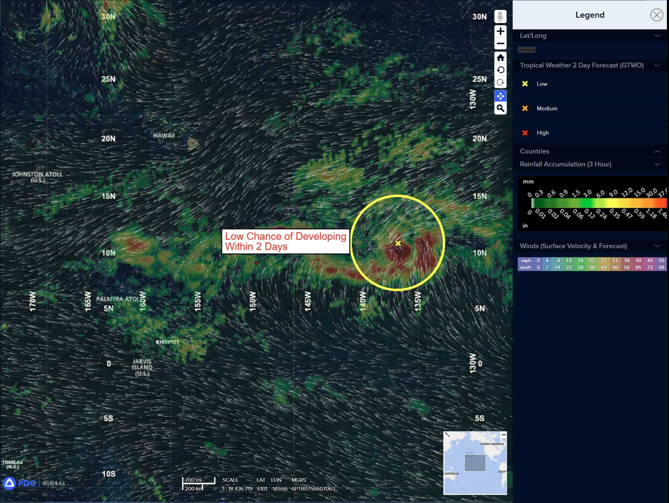
Western East Pacific:
>>> An area of low pressure is forecast to develop over 1500 miles east-southeast of the Hawaiian Islands during the next day or two. Some gradual development is possible thereafter, as the system moves generally westward around 10 mph.
* Formation chance through 48 hours…low…10 percent
* Formation chance through 7 days…low…20 percent
Central Pacific Ocean: There are no Tropical Cyclones
Eastern portion of Central Pacific:
Invest 90C
>>> Showers and thunderstorms associated with a broad area of low pressure located around 1100 miles southeast of the Hawaiian Islands have decreased since earlier today. Some gradual development of this system is possible, and a tropical depression could form this weekend or early next week as it moves generally westward at 10 to 15 mph across the Central Pacific basin.
* Formation chance through 48 hours…medium…50 percent
* Formation chance through 7 days…medium…60 percent
Western East Pacific:
>>> An area of low pressure is forecast to develop over 1500 miles east-southeast of the Hawaiian Islands during the next day or two. Some gradual development is possible thereafter, as the system moves generally westward around 10 mph.
* Formation chance through 48 hours…low…10 percent
* Formation chance through 7 days…low…20 percent
Western Pacific, Indian Ocean, and adjacent Seas:
Western Pacific
Tropical Cyclone 10W (Francisco) – Final Warning
According to the JTWC warning number 14 sustained winds are 25 knots with gusts to near 35 knots
Animated enhanced infrared (eir) satellite imagery depicts a deteriorating and elongating low-level circulation center (llcc). A 251212z metop-b ascat pass also confirms a stretched out llcc,
With maximum winds of 25 knots to the west of the system, and along the coastline. Remnants of tropical depression 10W may interact with the tropical storm 11W (Co-may) approaching from the southeast, but will likely be absorbed into a larger cyclonic circulation center over Taiwan, which is expected to reorient along a west-east axis.
Tropical Cyclone 11W (Co-may)
According to the JTWC warning number 13 sustained winds are 25 knots with gusts to near 35 knots
Animated enhanced infrared (eir) satellite imagery reveals a fully exposed low-level circulation center (llcc) associated with tropical storm 11W (Co-may). The system is currently transiting at an impressive 36 kt speed over water leaving behind the central convection, due to persistent easterly vertical wind shear (vws). TS 11W was able to accelerate significantly, with the assistance of a near equatorial ridge located to the southeast, as well as the tight gradient driven by the positioning of a large cyclonic circulation centered just east of Taiwan.
Environmental analysis reveals dry mid-level air along the path of TS 11W, moderate to high (15-20 knot) vertical wind shear region immediately to the east of the track and weak upper-level outflow. Predominantly unfavorable conditions are offset however by warm sea surface temperatures (sst).
TS 11W is forecast to continue its very fast transit along the northwestern periphery of a ner anchored to the southeast, simultaneously under the influence of a broader cyclonic
circulation extending across the region. During the next 12 hours, the system will interact with currently dissipating tropical depression 10W located to the north of Taiwan. A very weak fujiwhara effect is anticipated, though limited in magnitude due to the comparatively low vortex intensities of both systems.
Model guidance indicates a potential for TS 11W track deflection to the west, however if TD 10W dissipates completely faster than anticipated, this effect may be minimal. Simultaneously, the broad synoptic-scale cyclonic rotation centered just east of Taiwan is forecast to reorient from a southwest-northeast axis to one resembling a reverse-oriented monsoon trough.
This environment will contribute to an eastward recurvature of TS 11W by the time it begins to weaken below 25 knots. Dissipation is anticipated to complete by 36 hours, as the llcc further shallows out and becomes fully embedded within the deep-layer westerly flow regime, resulting in absorption into the larger synoptic-scale environment.
Tropical Cyclone 12W (Krosa)
According to the JTWC warning number 10 sustained winds are 50 knots with gusts to near 65 knots
Animated enhanced infrared (eir) satellite imagery depicts tropical storm 12W (Krosa) with an increasingly obscured low-level circulation center (llcc) as convective structures have started developing in close proximity to the systems immediate southern flank. With that being said, much of the northern and western quadrants remain free of any deep convection due to continued enhanced wind shear values, ranging from 25-30 knots and relatively low mid-level relative humidity. Aloft, moderate equatorward outflow has continued and remains evident through animated water vapor imagery, however, the system still lacks a well-formed supportive upper-level outflow channel.
With regard to the environmental analysis, high vertical wind shear (vws) between 25-30 knots continues to offset warm sea surface temperatures between and the aforementioned outflow aloft.
TS 12W is forecast to track to the north and north north-east over the initial 72 hours of the forecast period around the western periphery of the subtropical ridge located directly to the east. After 72 hours, the weakening ridge will begin allowing the system to begin its generally northeastward track until the end of the forecast period. During that same time, a southwest to northeast oriented belt of enhanced southwesterly winds will aid in the initial approach northeastward until 120 hours.
With regard to intensity, TS 12W is forecast to steadily intensify to 60 knots over the next 48 hours as vws decreases to less than 20 knots. After 48 hours, a slight weakening phase to 55 knots is expected as dry air wraps cyclonically around the central vortex from the west until 96 hours.
Following 96 hours, TS Krosa is forecast to re-moisten while also gaining a vigorous poleward outflow channel aloft to the northeast, allowing for re-intensification to 65 knots by 120 hours. While this is happening, vws is expected to sharply decline to below 10 knots, as the system becomes completely vertically aligned.