
")
Current Snapshot
For all the latest updates visit: DisasterAWARE
epac
1800x1080e
wipha
09W_191200sair
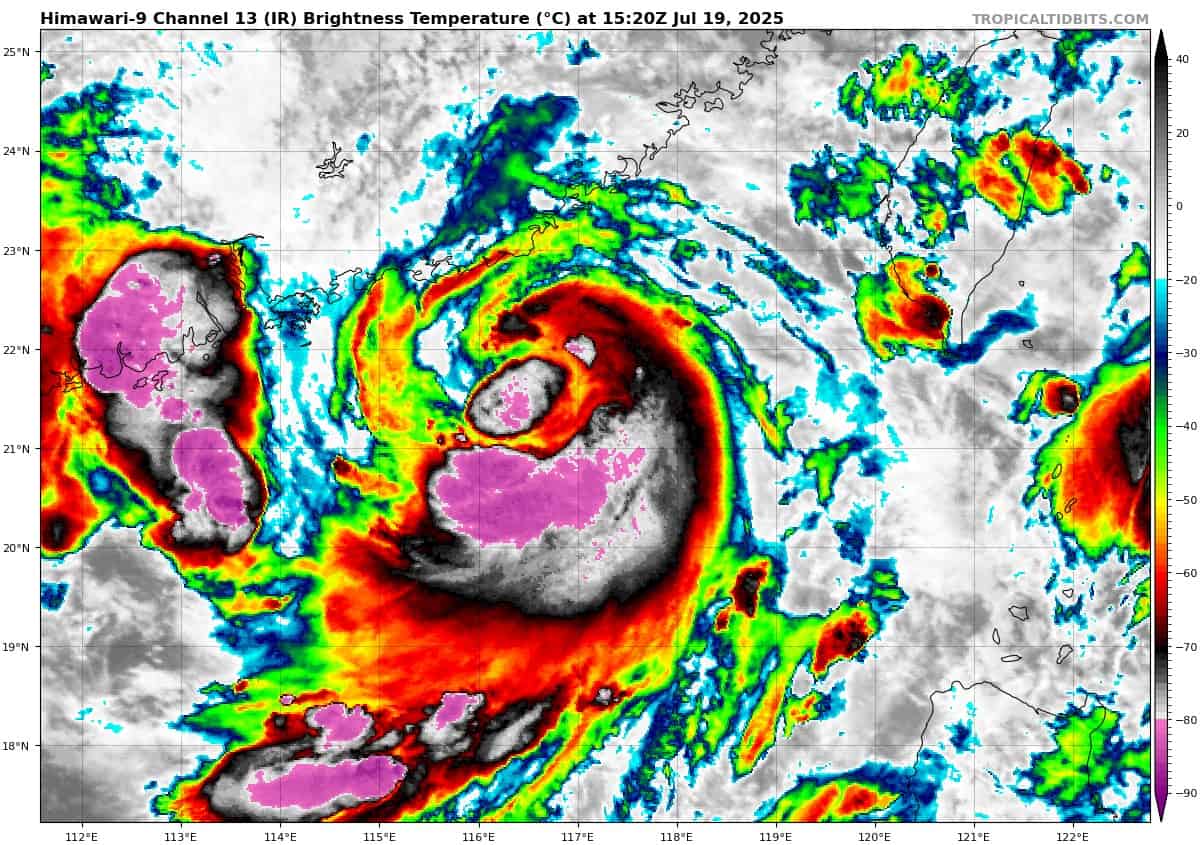
himawari9_ir_09W_202507191520_lat21.0-lon117.7

09W_tracks_latest
By PDC’s Senior Weather
Specialist Glenn James

The Pacific Disaster Center’s (PDC Global) Saturday, July 19, 2025, Tropical Cyclone Activity Report…for the Pacific Ocean, the Indian Ocean, and adjacent Seas
Current Tropical Cyclones:
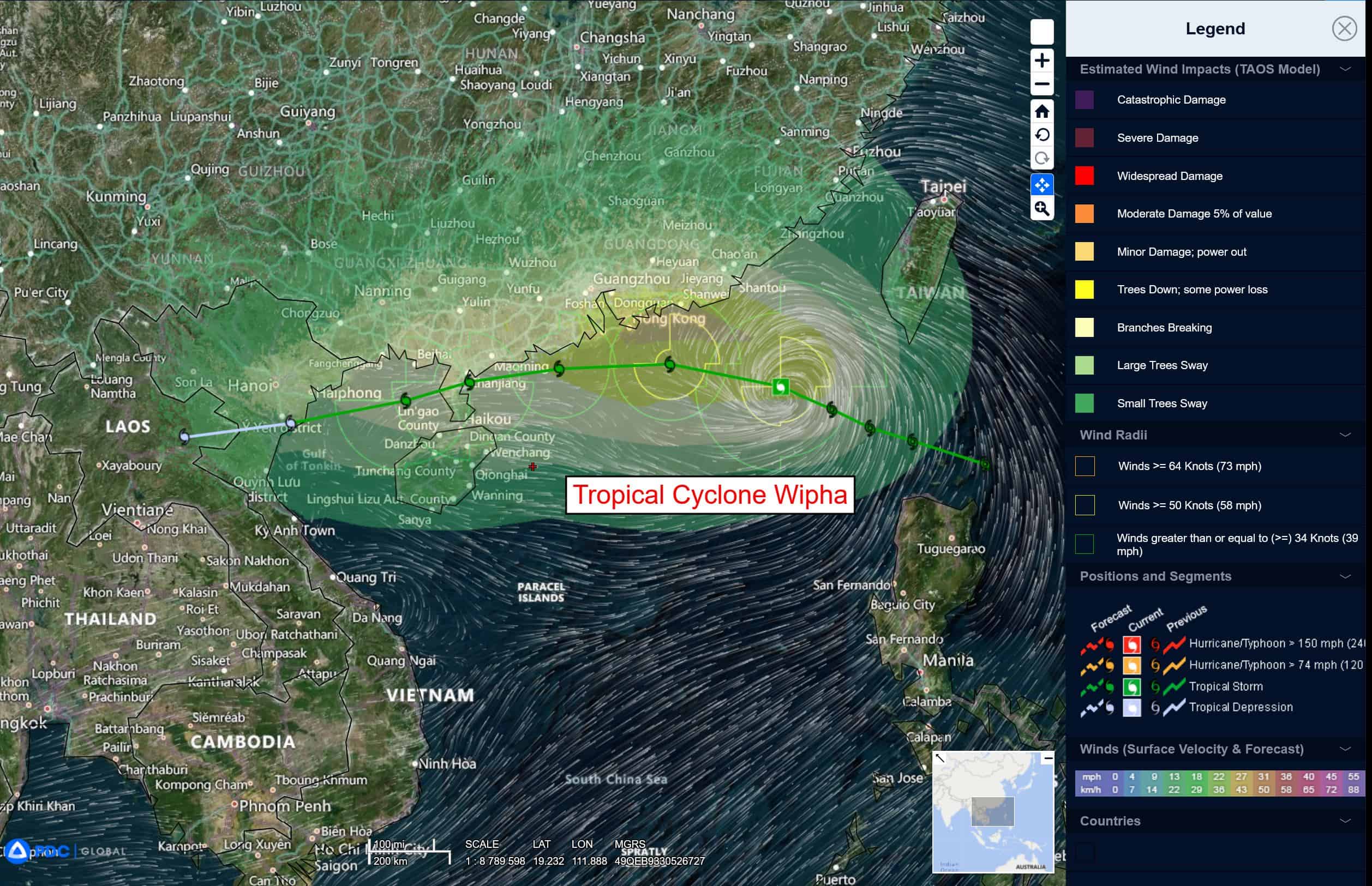
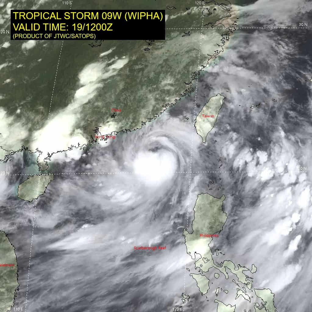
Tropical Cyclone 09W (Wipha)…is located 48 NM south-southeast of Hong Kong
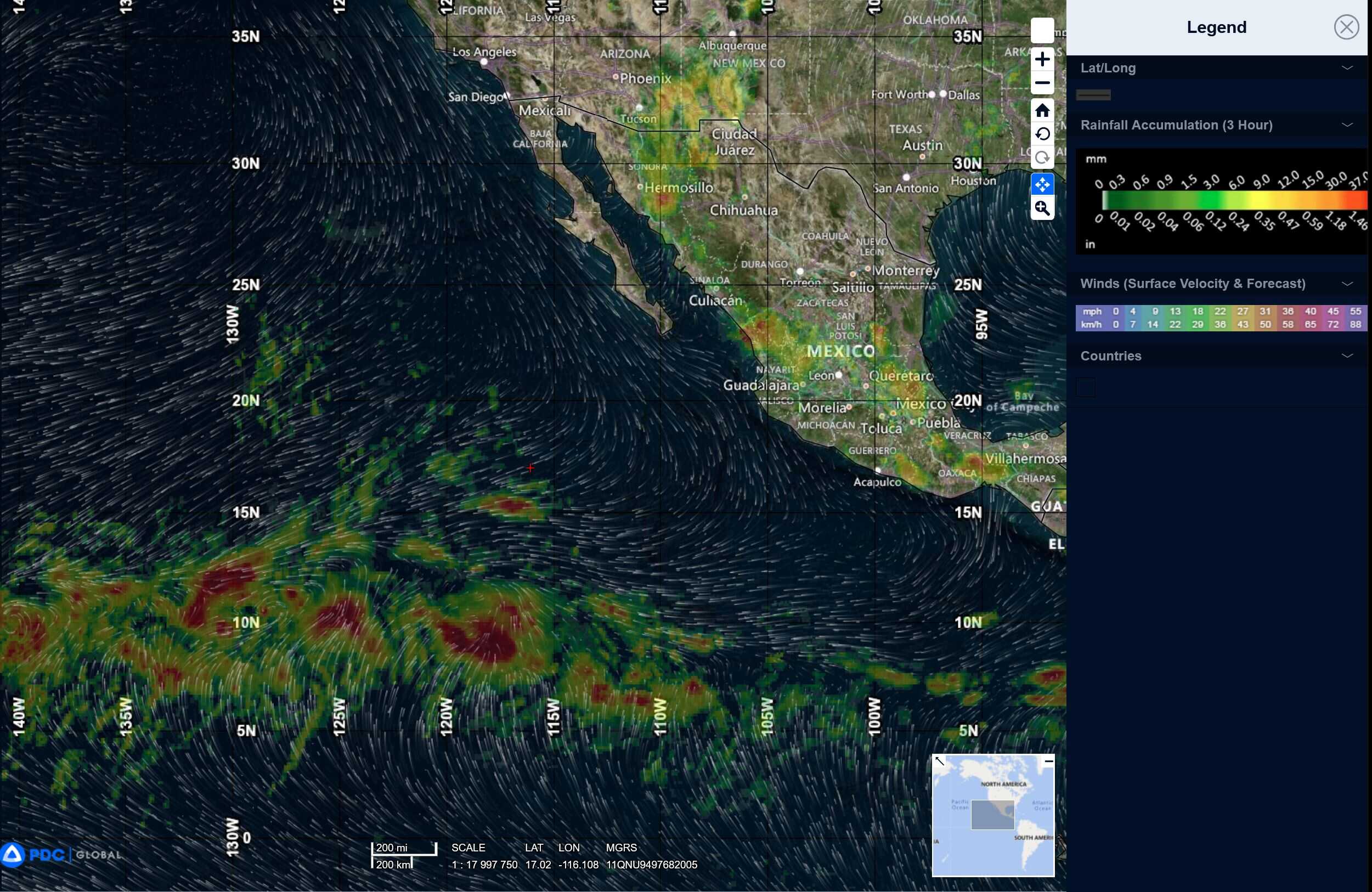
Northeast Pacific Ocean: There are no Tropical Cyclones
Tropical cyclone formation is not expected during the next 7-days.
Central Pacific Ocean: There are no Tropical Cyclones
Tropical cyclone formation is not expected during the next 7-days.
Western Pacific, Indian Ocean, and adjacent Seas:
Western Pacific
Tropical Cyclone 09W (Wipha)
According to the JTWC warning number 7 sustained winds are 65 knots with gusts to near 80 knots
Animated enhanced infrared (eir) satellite imagery reveals an obscured low-level circulation center (llcc) embedded within curved bands of deep convective activity associated with tropical storm 09W (Wipha).
Environmental analysis indicates a favorable synoptic setup characterized by high sea surface temperatures (sst), abundant tropospheric moisture, as well as an enhanced equatorward outflow evident in water vapor imagery, indicative of robust upper-tropospheric divergence. These positive parameters are partially offset by moderate to strong (20-25 knot) vertical wind shear (vws).
TS 09W is anticipated to track generally west-northwestward under the steering influence of a subtropical ridge (str) positioned to the northeast. Between 12 and 24 hours, the str is expected to amplify and extend westward, promoting a slight westward shift in the storm motion. Prior to that, the cyclone will remain embedded within a marginally conducive environment, supportive of maintained or slightly increased peak sustained winds.
Subsequently, as the ridge builds, the track is forecast to veer west-southwestward, bringing the system along the southern coastline of China toward a landfall in northeastern Vietnam. After 24 hours, a gradual weakening trend is expected due to terrain interaction and increasing vws.
However, upon entering the Gulf of Tonkin, TS 09W will traverse very warm sea surface temperatures, which may temporarily sustain or slightly increase maximum wind speeds. Beyond that point, rapid weakening and eventual dissipation are anticipated shortly after inland ingress east of Hanoi, Vietnam, with full dissipation expected around 96 hours.