
")
Current Snapshot
For all the latest updates visit: DisasterAWARE
epac

1800×1080
wpac

06W_141200sair
himawari9_ir_06W_202507141540_lat39.8-lon142.7
07W_140000sair
himawari9_ir_07W_202507141540_lat34.4-lon132.7
himawari9_ir_95W_202507141540_lat26.0-lon139.5

95W_tracks_latest
By PDC’s Senior Weather
Specialist Glenn James

The Pacific Disaster Center’s (PDC Global) Monday, July 14, 2025, Tropical Cyclone Activity Report…for the Pacific Ocean, the Indian Ocean, and adjacent Seas
Current Tropical Cyclones:
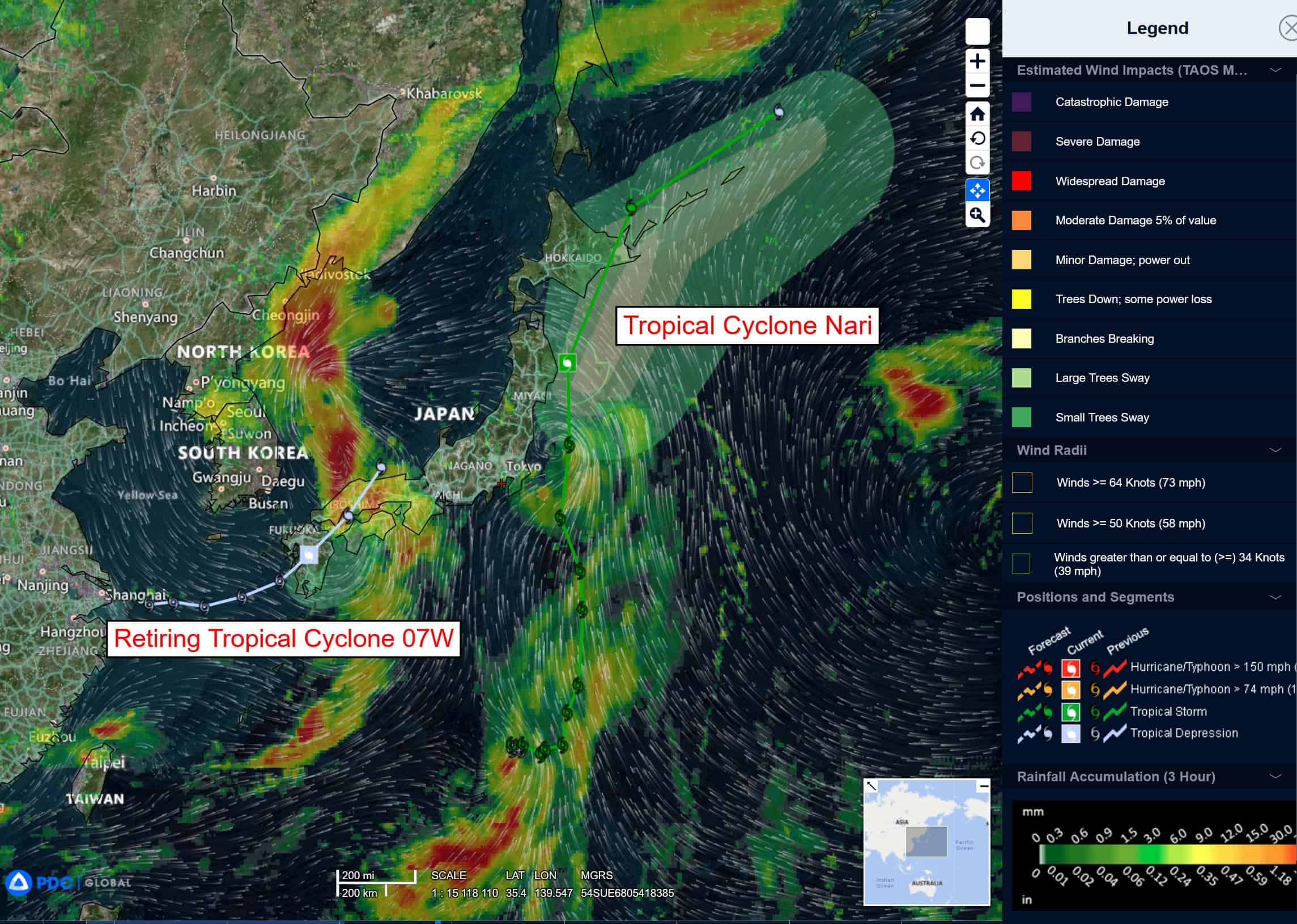
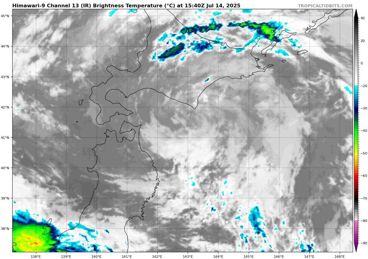
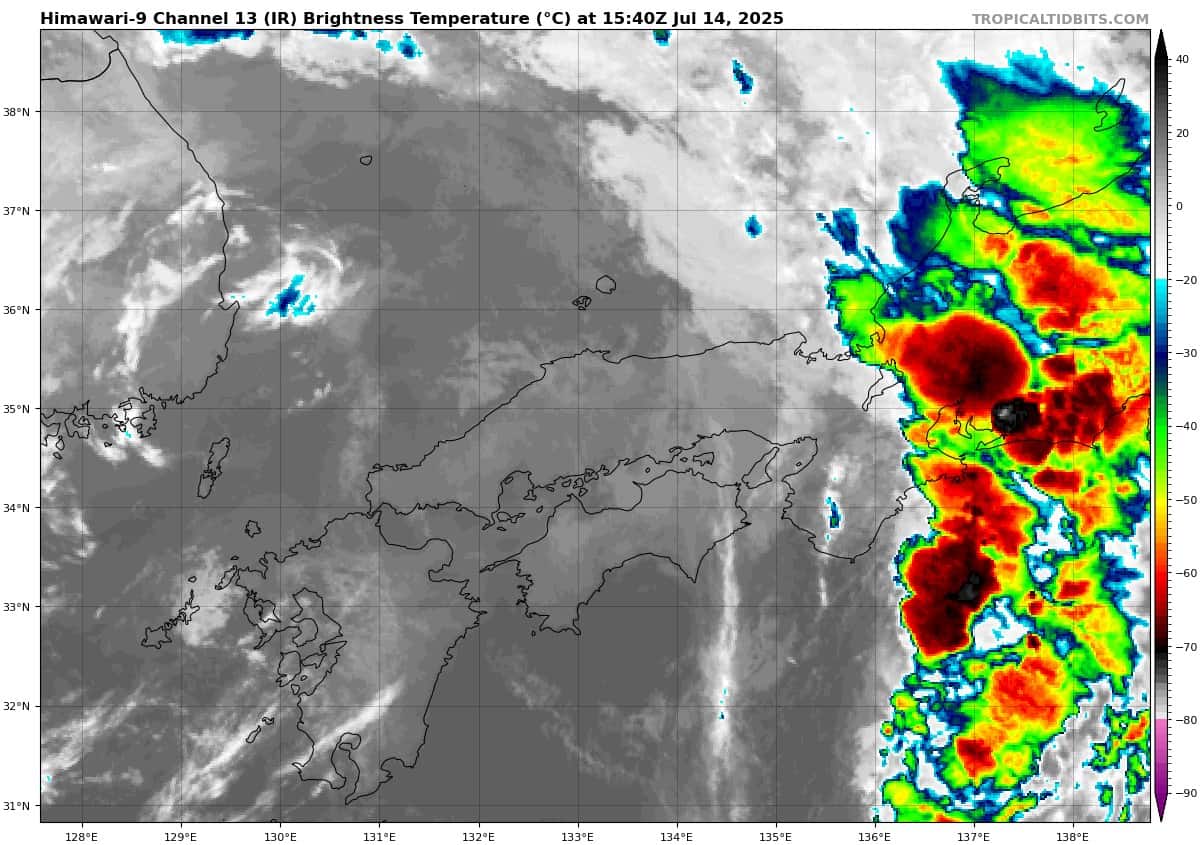
Tropical Cyclone 06W (Nari) is located approximately 166 NM northeast of Misawa, Japan – Final Warning
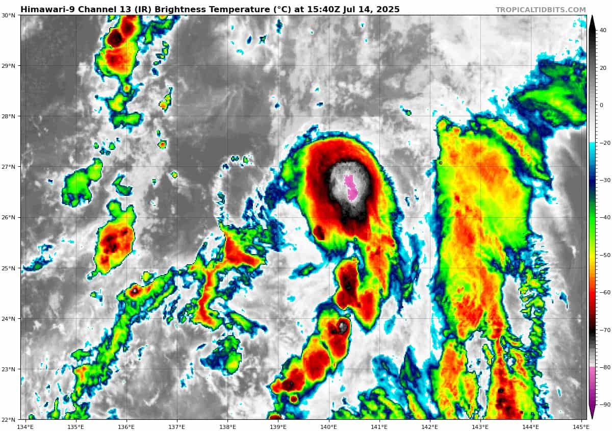
Tropical Cyclone 08W is located approximately 355 NM south of Yokosuka, Japan
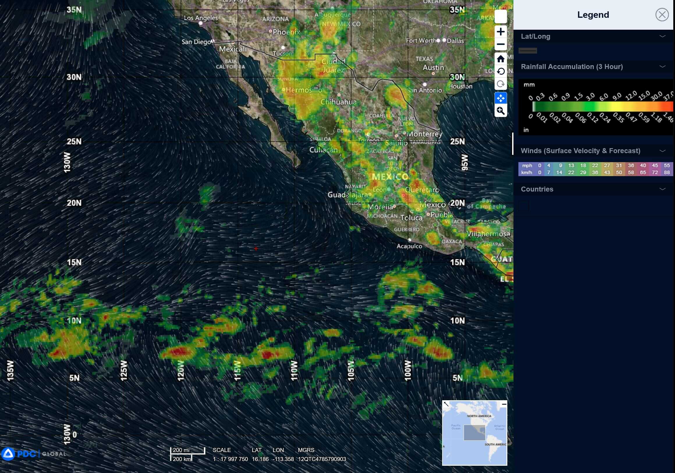
Northeast Pacific Ocean: There are no Tropical Cyclones
Tropical cyclone formation is not expected during the next 7-days.
Central Pacific Ocean: There are no Tropical Cyclones
Tropical cyclone formation is not expected during the next 7-days.
Western Pacific, Indian Ocean, and adjacent Seas:
Western Pacific
Tropical Cyclone 06W (Nari) – Final Warning
According to the JTWC Warning number 16, sustained winds were 40 knots with gusts to near 50 knots
Animated enhanced infrared satellite imagery depicts 06W with an exposed low-level circulation center (llcc) that is passing over the eastern extent of Hokkaido. The strongest winds remain within the southeastern quadrant, which is expected to remain the case over the next 24 hours. 06W is forecast to begin tracking more east- northeastward as interaction with the jet to the north increases.
Extratropical transition is forecast to complete at 12 hours as westerly shear rapidly increases and sea surface temperatures drastically drop. These environmental factors will also aid in the weakening of the vortex over the next 24 hours as the system becomes absorbed by the strong upper-level westerly flow.
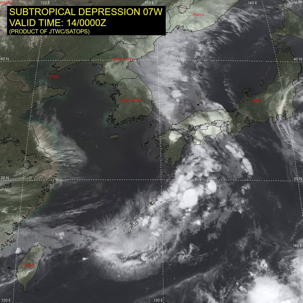
Tropical Cyclone 08W
According to the JTWC Warning number 1, sustained winds were 35 knots with gusts to near 45 knots
South Indian Ocean
>>> There’s an area of disturbed weather being referred to as Invest 90S, which is located approximately 626 northwest of the Cocos Islands
Animated enhanced infrared imagery as well as a 142153z 89ghz gmi image display an area of deep flaring convection along the southern portion of a weakly defined llcc, infrared satellite also depicts formative convective along the edges of southern portion of the semicircle.
Environmental conditions are marginally favorable with good upper level outflow, and warm sea surface temperatures. However, this will be offset by very high (greater than 35 knots) vertical wind shear.
Global deterministic model analysis has the Invest 90S progressing on a easterly track over the next 48 hours, but never fully reaching tropical cyclone criteria .
Maximum sustained surface winds are estimated at 23 to 27 knots.
The potential for the development of a significant tropical cyclone within the next 24 hours is low.