
")
Current Snapshot
For all the latest updates visit: DisasterAWARE
1800x1080e
96e2
epac7
ddddddddd
05W_071200sair
himawari9_ir_05W_202507071510_lat27.1-lon121.7
By PDC’s Senior Weather
Specialist Glenn James

The Pacific Disaster Center’s (PDC Global) Monday, July 7, 2025, Tropical Cyclone Activity Report…for the Pacific Ocean, the Indian Ocean, and adjacent Seas
Current Tropical Cyclones:
Tropical Cyclone 04W (Mun)…is located about 370 NM east of Misawa, Japan – Final Warning
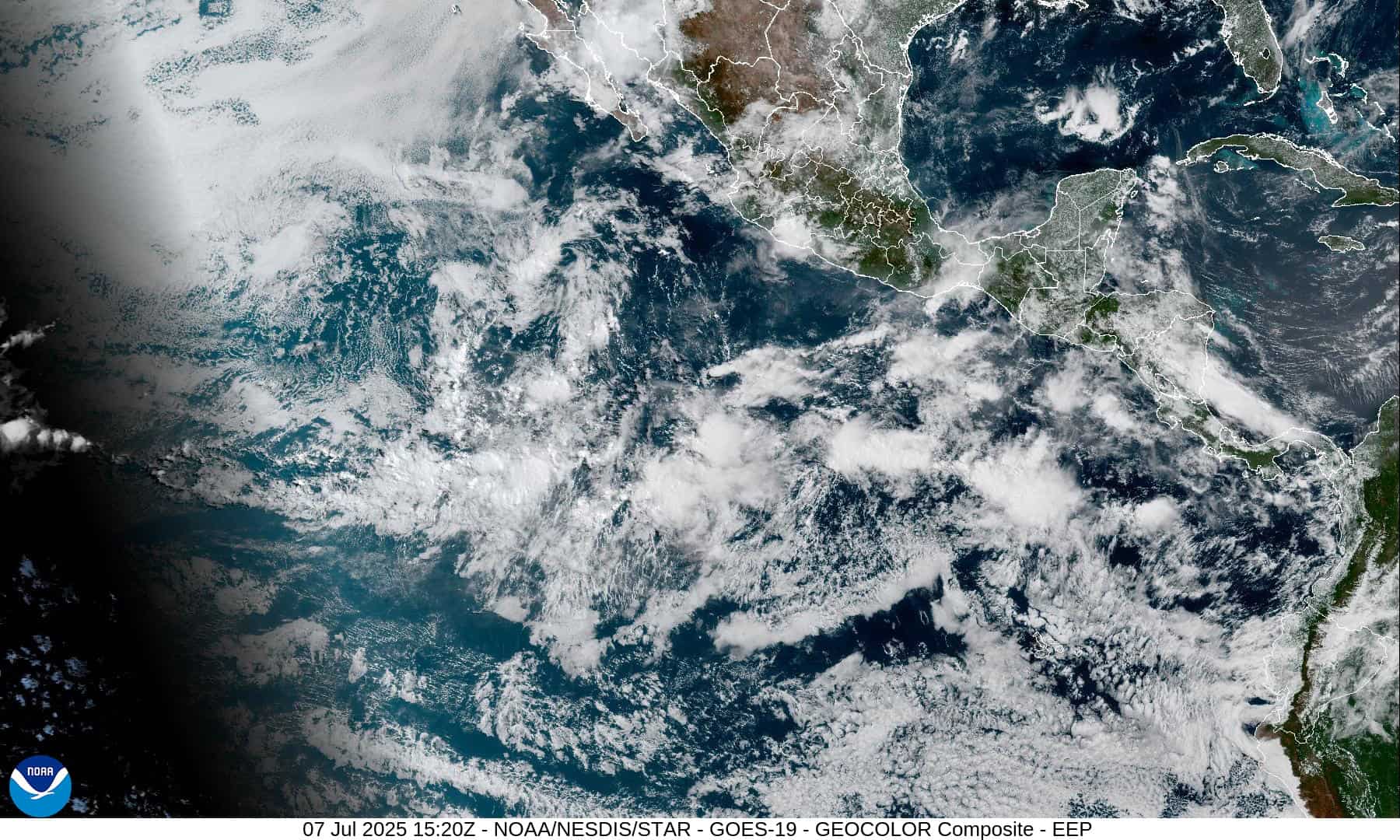
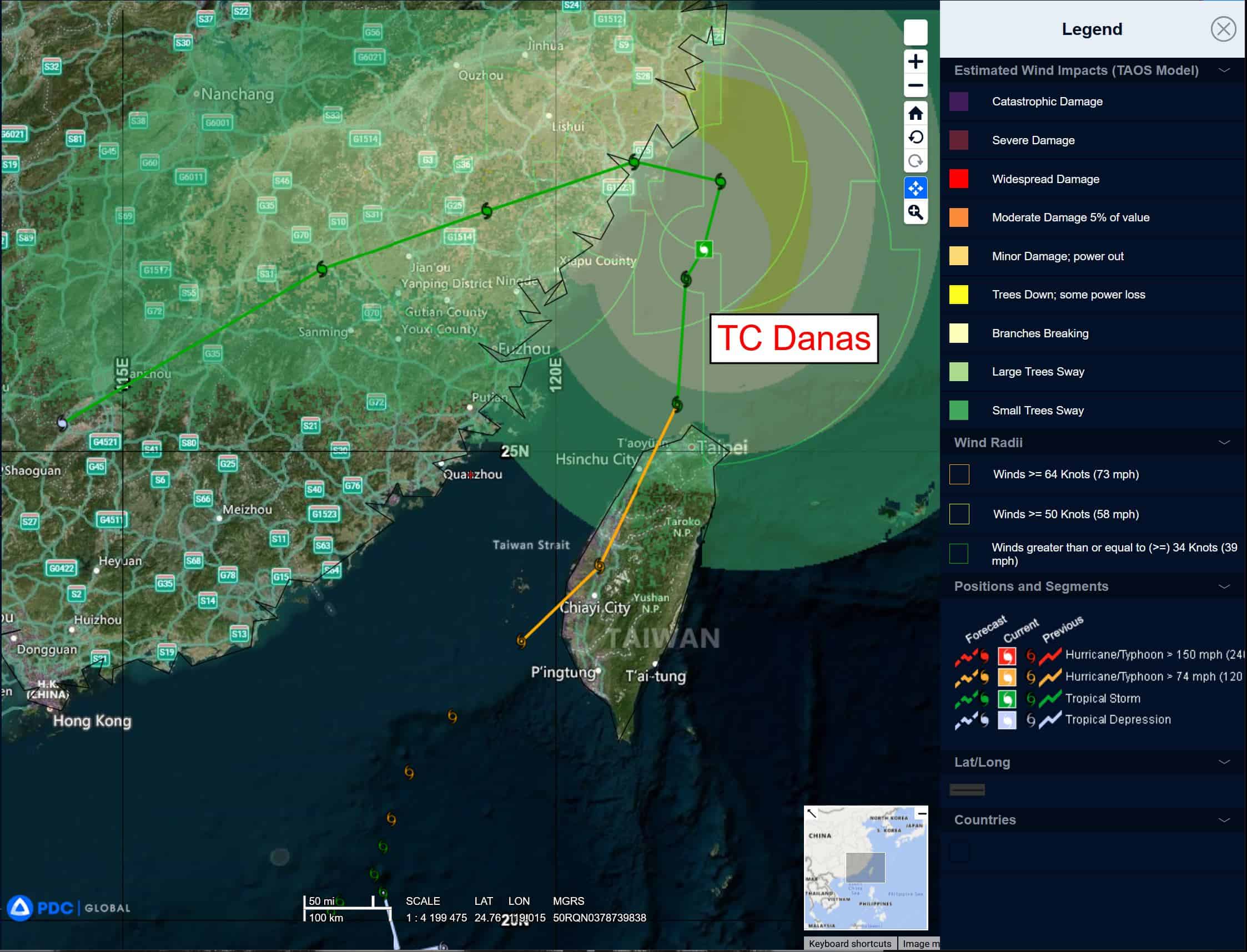
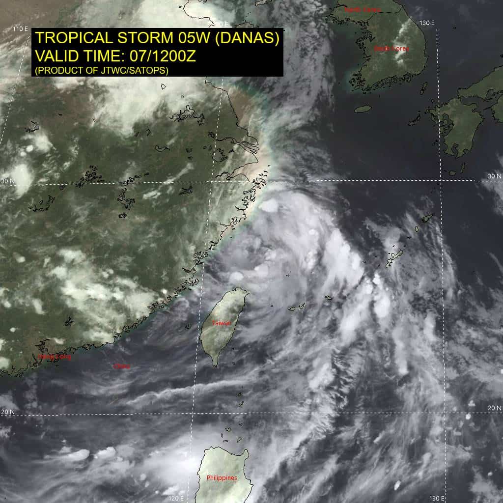
Tropical Cyclone 05W (Danas)…is located about 185 NM north-northeast of Taipei, Taiwan
Northeast Pacific Ocean: There are no Tropical Cyclones
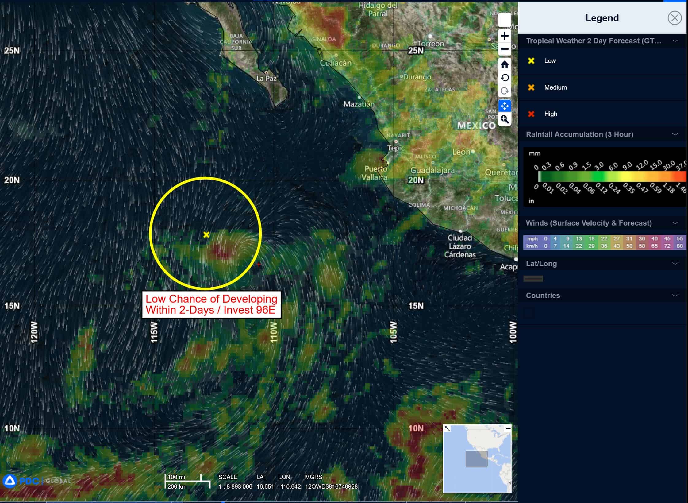
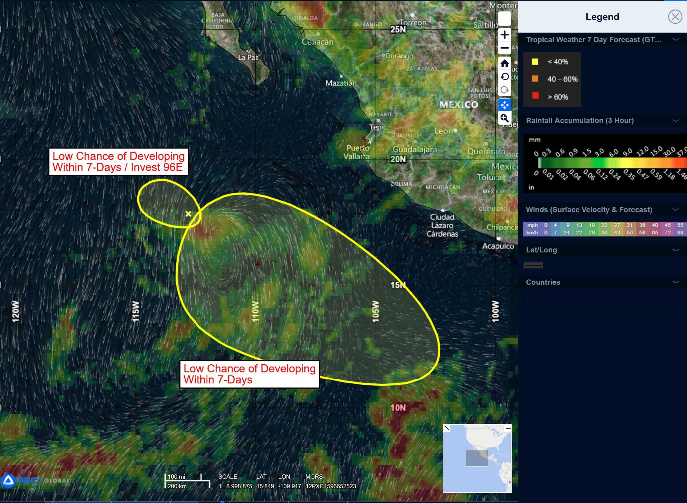
South of Southwestern Mexico:
>>> An area of low pressure could form several hundred miles offshore of southwestern Mexico late this week. Environmental conditions are expected to only be marginally conducive for development of this system as it moves to the west-northwest, well off the coast of Mexico.
* Formation chance through 48 hours…near 0 percent
* Formation chance through 7 days…low…10 percent
Central Pacific Ocean: There are no Tropical Cyclones
Tropical cyclone formation is not expected during the next 7-days.
Western Pacific, Indian Ocean, and adjacent Seas:
Western Pacific
Tropical Cyclone 04W (Mun) – Final Warning
According to the JTWC Warning number 26A, sustained winds are 25 knots with gusts to 35 knots
All deep convection has collapsed as the cooler sea surface can no longer support a warm core system. The system is entering a transition phase to a subtropical cyclone. Stratocumulus fields are showing the early signs of relaxing and expanding away from the exposed low level circulation center, but enough momentum exists to sustain the system another 24 hours.
The jet stream extends over the Kurils so the system has too far to go before it undergoes the extra-tropical transition process typical of Westpac. TD Mun is cooling from below and will lose its warm core during the next 24 hours before it gets to the baroclinic zone.
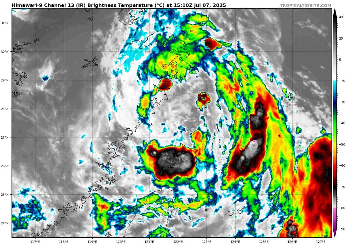
Tropical Cyclone 05W (Danas)
According to the JTWC Warning number 17, sustained winds are 40 knots with gusts to 50 knots
Animated multi-spectral satellite imagery (msi) and regional radar loops verify that tropical storm Danas (05W) has finished the turn to the west and is making a run for the Chinese coast. Current momentum is pointing the vortex at Zhantai town, but the windfields are broad enough to bring effects from Taizhou through Pingyang County.
The latest frames of the visual animation show a broad swath of vigorous convection over the southern semicircle as the system throws one last punch. Water vapor animation shows impingement over the poleward semicircle but equatorial outflow is excellent. Otherwise, the environment is ideal for intensification and TS 05W is peaking just prior to encountering the degrading effects of land interaction.
Tropical storm Danas has entered its terminal leg and will not intensify any further due to the effects of land interaction. Once inland, the system will steadily decay along a southwestward bearing, decaying to under 25 knots within 36 hours from now. in addition to the rainfall and storm surge hazards along the coast, tropical storm 05W has set up the southwest monsoon through the entire South China Sea, with straight and steady southwesterlies extending from Singapore through the Taiwan Strait, indicating a 6 to 10 week respite from tropical cyclone activity in the South China Sea
basin and narrowing the potential area of future storm genesis to the East China and Philippine Sea.
As 05W tracks inland, a very high latitude monsoon trough will become established, with the axis of the seasonal trough expected to settle in from north of Taiwan through south of Okinawa between the 25th and 26th latitudes.