
")
Current Snapshot
For all the latest updates visit: DisasterAWARE
1800x1080e
flossie
epac7
goes18_ir_06E_202507021515_lat18.8-lon-108.7
021434_earliest_reasonable_toa_34
021434INTQPF_sm
06E_tracks_latest
04w

04w
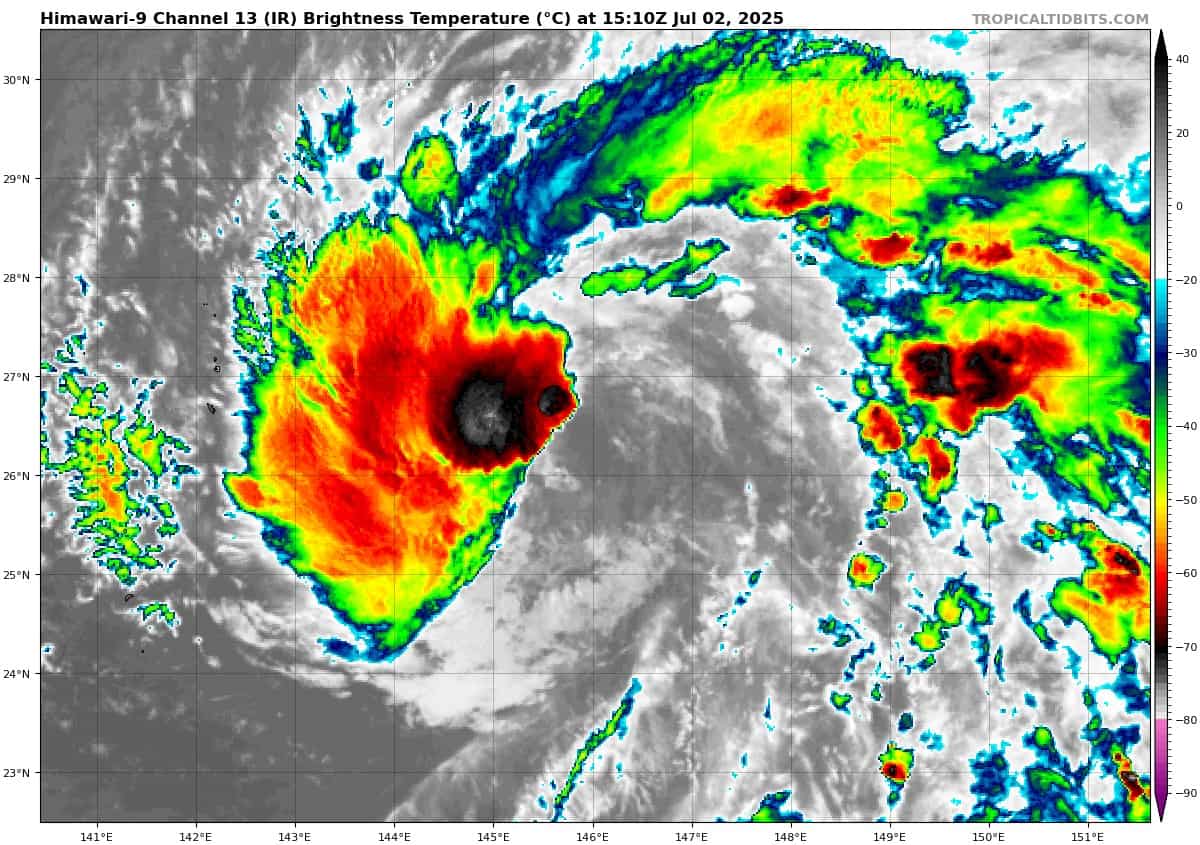
himawari9_ir_04W_202507021510_lat26.2-lon146.3

04W_tracks_latest
98w
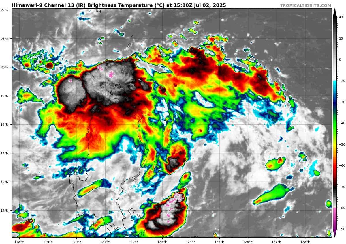
himawari9_ir_98W_202507021510_lat17.9-lon123.4

98W_tracks_latest
By PDC’s Senior Weather
Specialist Glenn James

The Pacific Disaster Center’s (PDC Global) Wednesday, July 2, 2025, Tropical Cyclone Activity Report…for the Pacific Ocean, the Indian Ocean, and adjacent Seas
Current Tropical Cyclones:
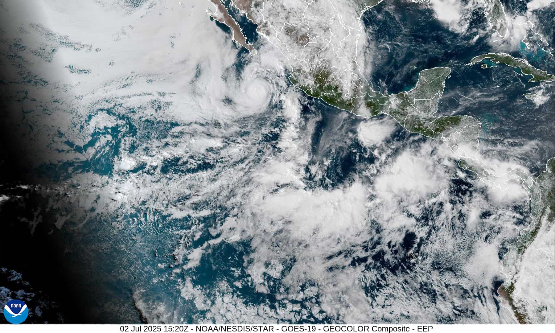
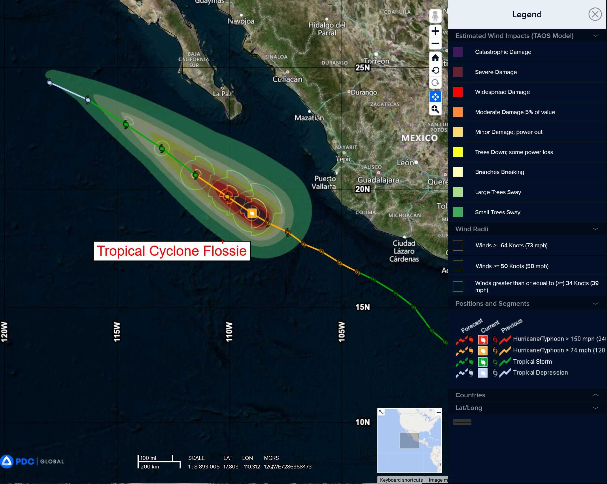
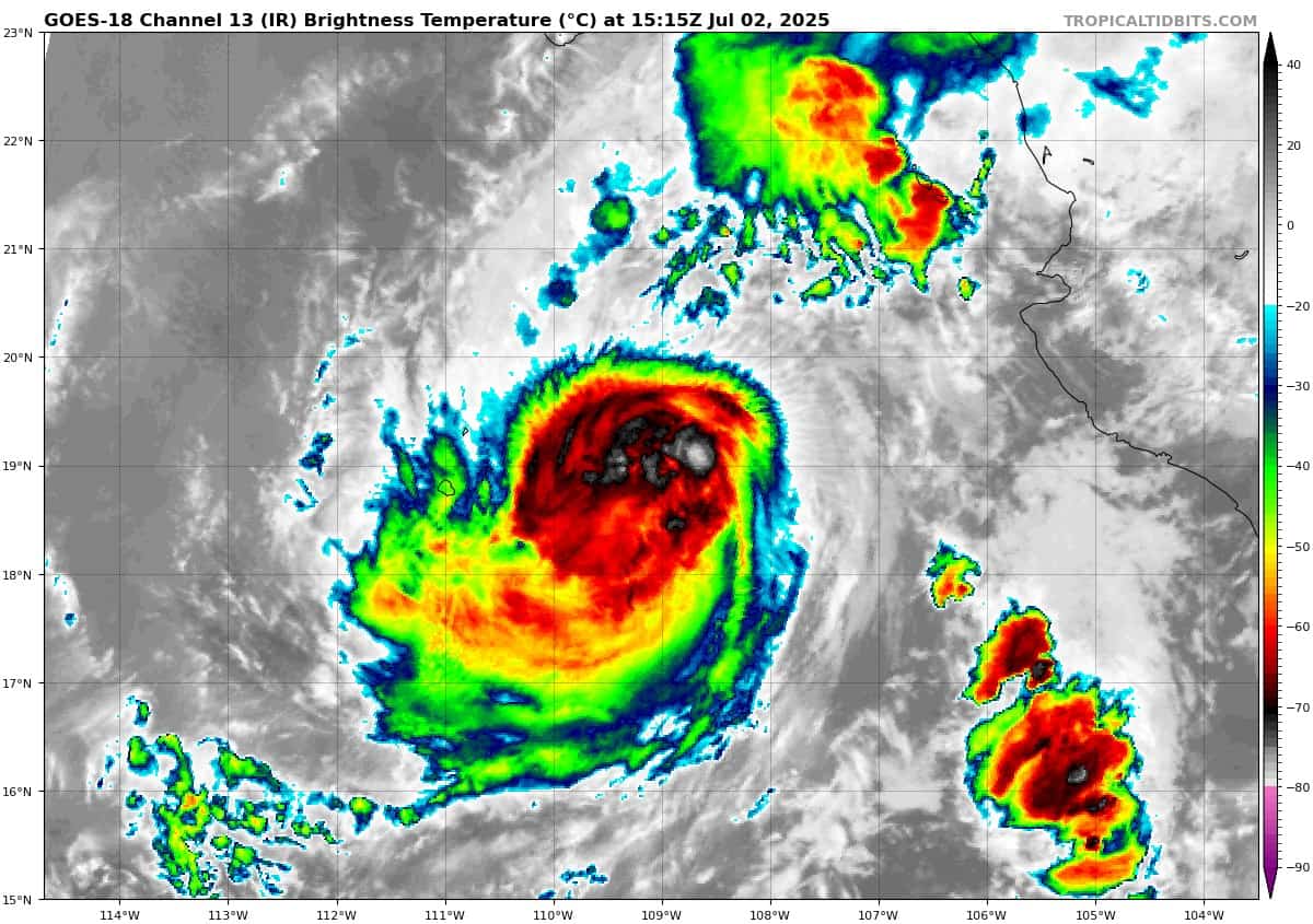
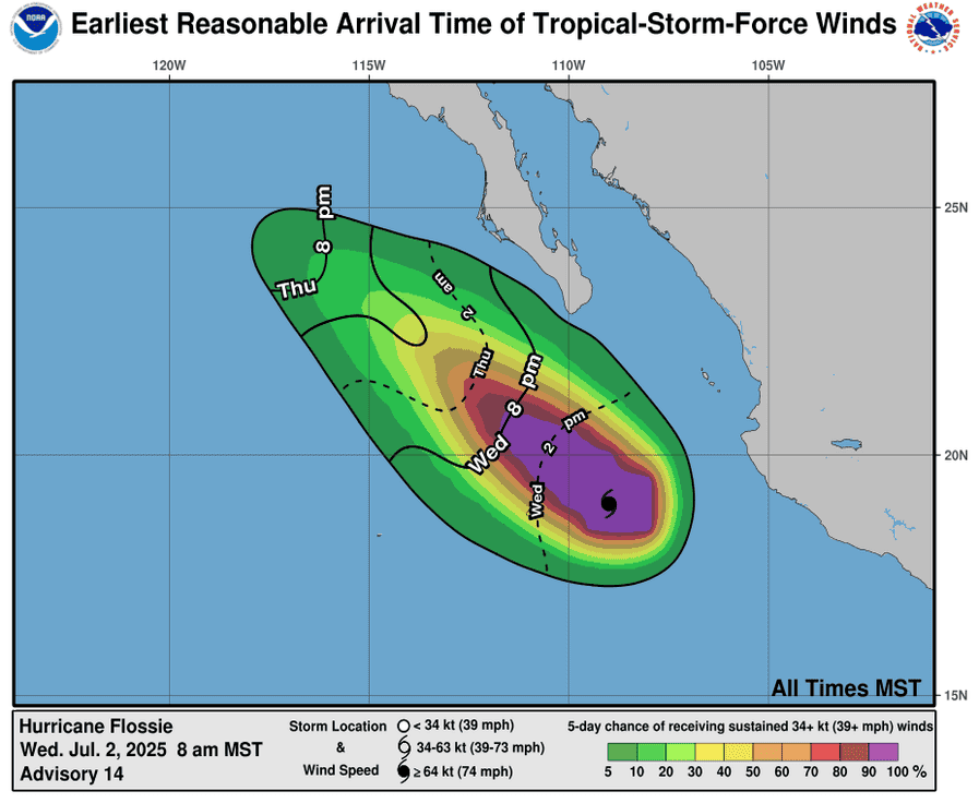
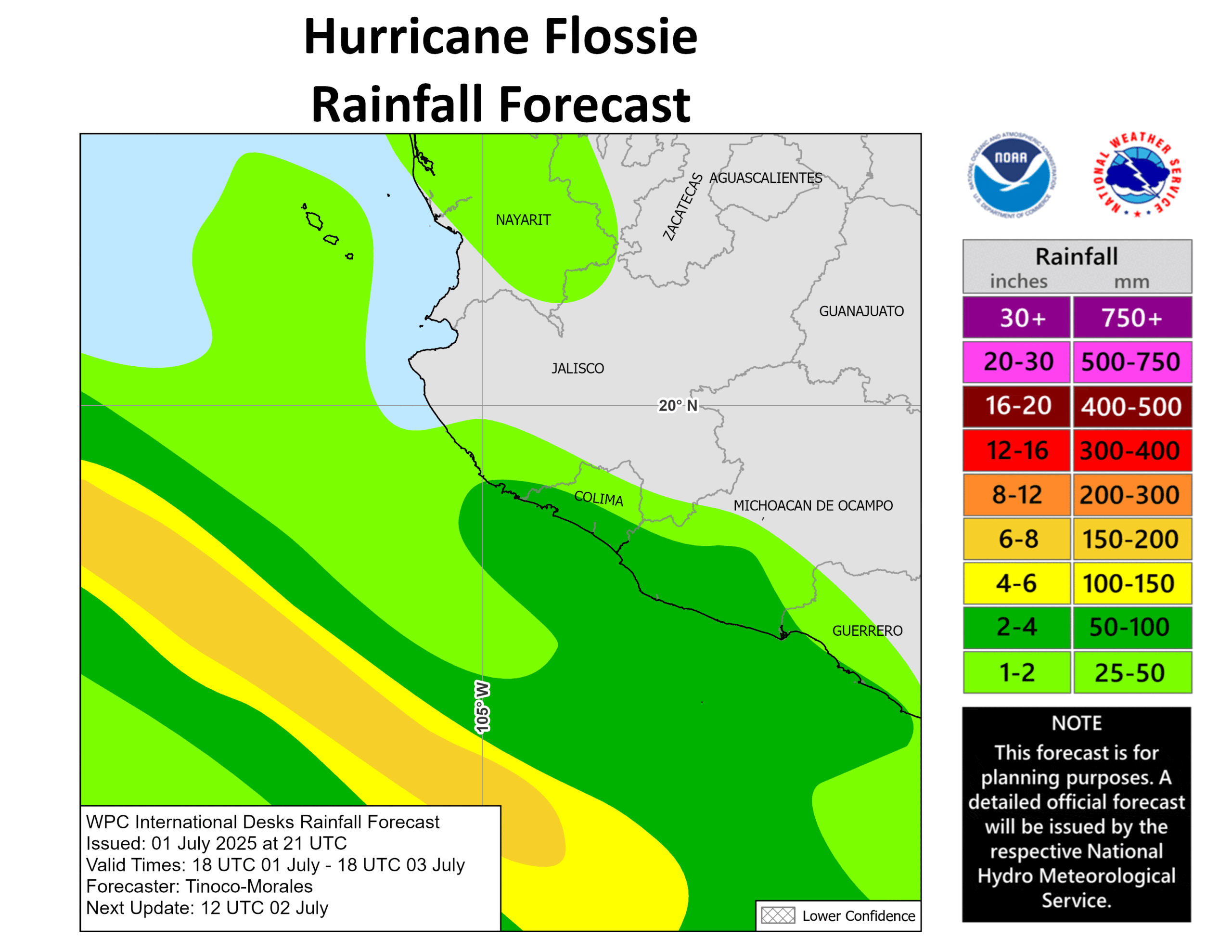
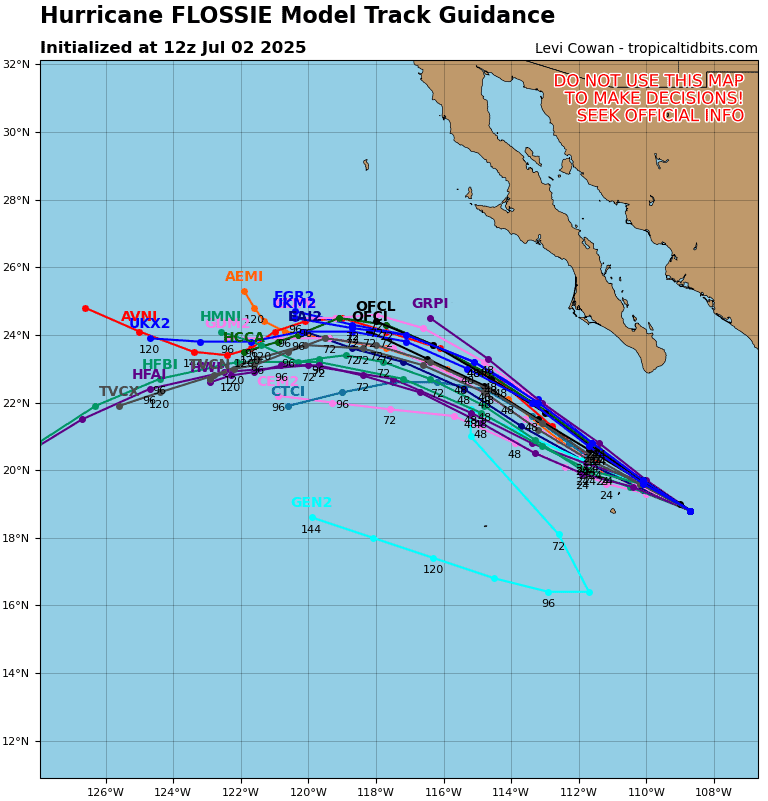
Tropical Cyclone 06E (Flossie)…is located about 215 miles south of Cabo San Lucas, Mexico
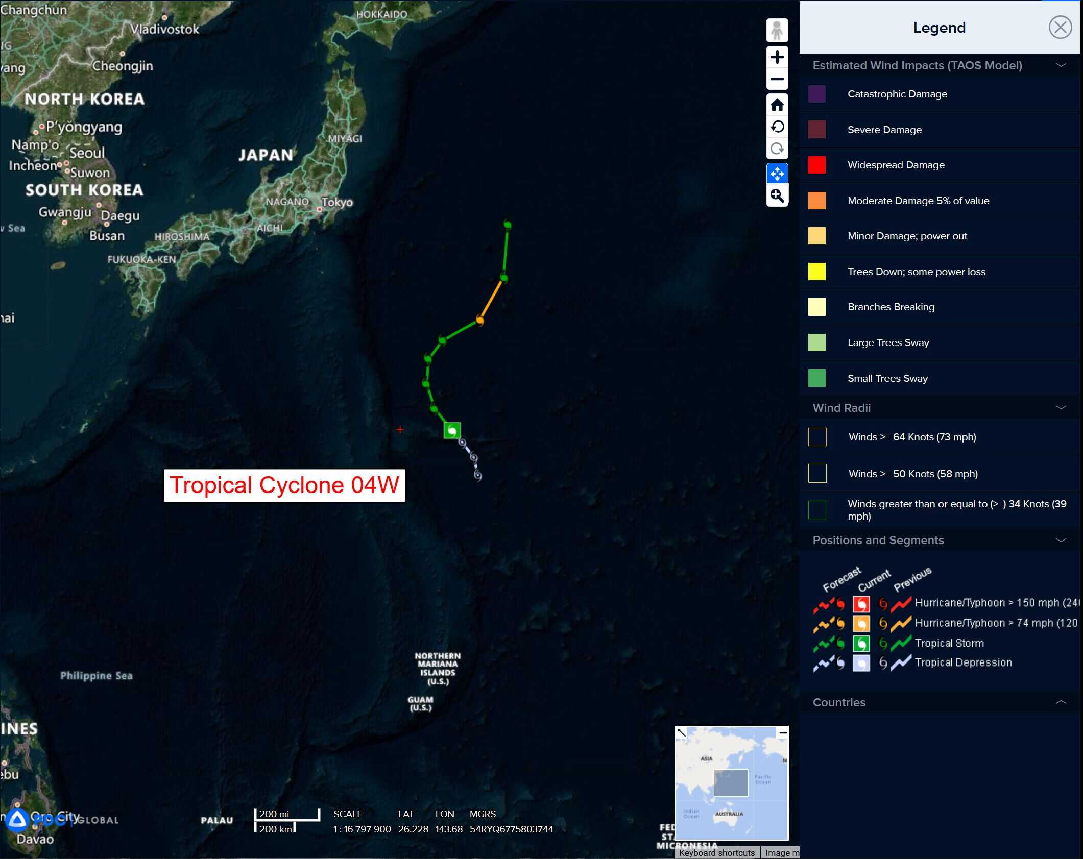
Tropical Cyclone 04W (Mun)…is located about 577 NM south-southeast of Yokosuka, Japan
Northeast Pacific Ocean:
Tropical Cyclone 06E (Flossie)
FLOSSIE RAPIDLY WEAKENING AS IT PASSES SOUTH OF BAJA CALIFORNIA SUR
According to the NHC advisory number 16
Flossie is moving toward the northwest near 8 mph (13 km/h), and this general motion is expected to continue during the next couple of days. Maximum sustained winds are near 75 mph (120 km/h) with higher gusts. Rapid weakening is expected during the next day or so, with the system forecast to become a post-tropical cyclone late Thursday. Hurricane-force winds extend outward up to 25 miles (35 km) from the center and tropical-storm-force winds extend outward up to 70 miles (110 km).
HAZARDS AFFECTING LAND
SURF: Swells generated by Flossie will affect portions of the coast of southwestern Mexico, and the Baja California peninsula during the next few days. These swells are likely to cause life-threatening surf and rip current conditions.
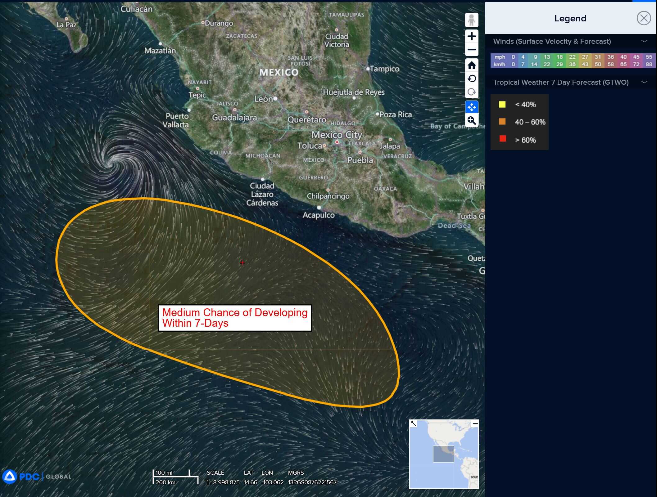
South of the Gulf of Tehuantepec:
>>> An area of disturbed weather associated with a tropical wave is producing disorganized showers and thunderstorms several hundred miles south of the Gulf of Tehuantepec. Environmental conditions appear conducive for some gradual development of this system during the next few days, and a tropical depression is likely to form over the weekend or early next week while it moves generally west-northwestward.
* Formation chance through 48 hours…low…20 percent
* Formation chance through 7 days…high…70 percent
Central Pacific Ocean: There are no Tropical Cyclones
Tropical cyclone formation is not expected during the next 7-days.
Western Pacific, Indian Ocean, and adjacent Seas:
Western Pacific
Tropical Cyclone 04W (Mun)
According to the JTWC Warning number 6, sustained winds are 45 knots with gusts to 55 knots
Animated enhanced infrared (eir) satellite imagery reveals a well-defined and fully exposed low-level circulation center (llcc) associated with tropical storm 04W. The unambiguous presentation of the llcc allows for a high-confidence position assessment.
Environmental analysis indicates marginally conducive environment, as witnessed by a 15-20 knot southerly vertical wind shear (vws), warm sea surface temperatures (sst), robust poleward outflow, partially negated by the proximity of a tutt cell situated to the southwest of the llcc, as well as dry air
entrainment affecting the convective structure of the TS.
TS 04W is projected to track northwestward initially under the steering influence of a subtropical ridge (str) positioned to the northeast. By 24 hours, this ridge will reorient and extend along a southwest-northeast axis. This evolving synoptic pattern will result in a poleward acceleration, with the system tracking north to northeast through 96 hours. Beyond this, further ridge amplification east of the system will initiate a secondary poleward turn.
The intensity forecast calls for steady intensification through 72 hours as vws becomes more favorable and the system continues to distance itself from the suppressive influence of the tutt cell. Peak intensity is forecast to reach 65 knots during this period. Thereafter, increased dry air entrainment, in conjunction with progressively decreasing sst along the poleward track, are expected to induce weakening. Interaction with an approaching upper-level trough is anticipated late in the forecast period, likely resulting in a sharp increase in vws.
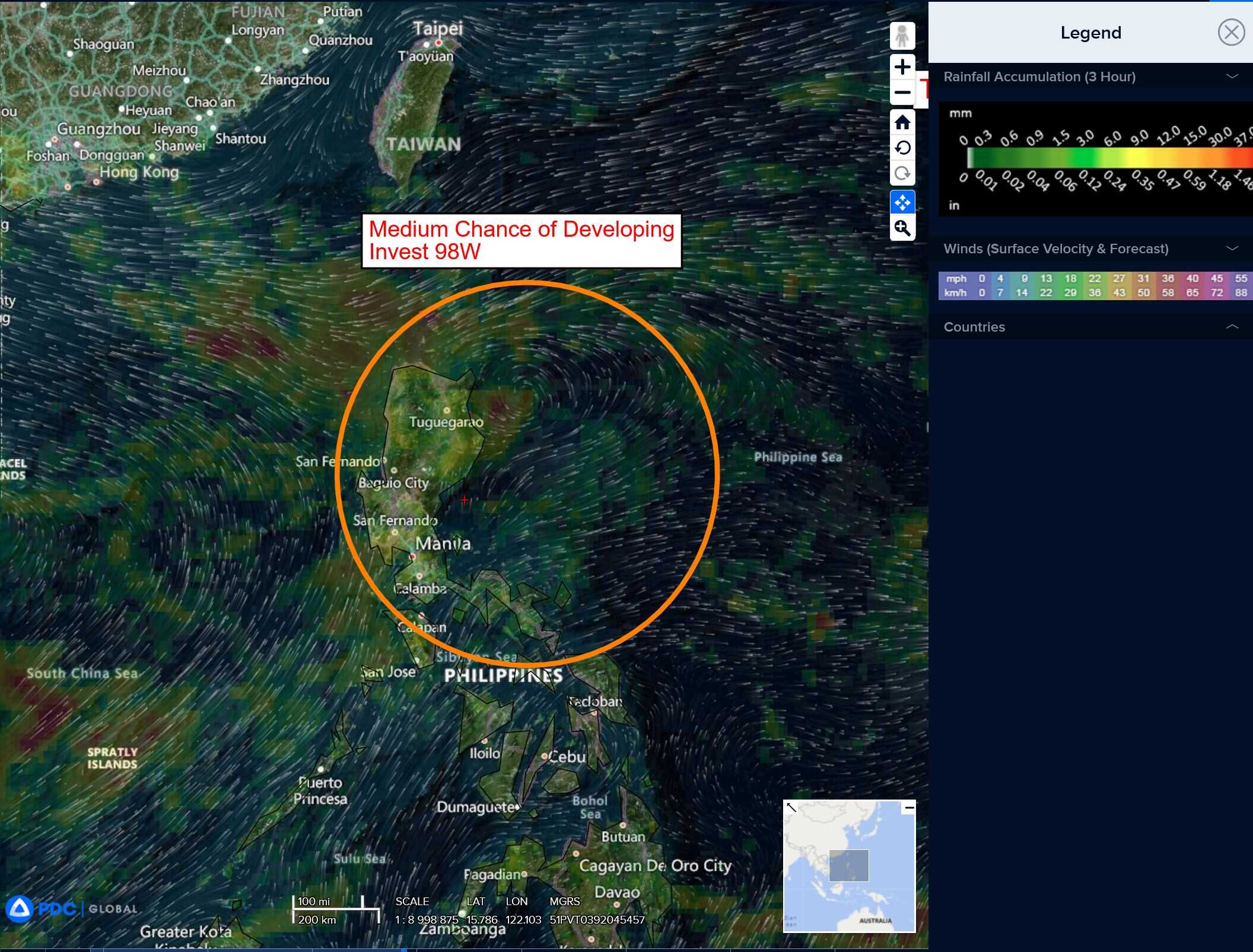
>>> An area of disturbed weather, which is being referred to as Invest 98W, is located approximately 162 NM south-southeast of Kaohsiung, Taiwan
multi-spectral satellite imagery depicts an exposed low level circulation (llc) with persistent convection sheared over the southwest quadrant of the llc. Recent observations south of the system from Calayan, Philippines report westerly winds at 8 knots and another to the north from a ship is reporting east-northeasterly winds at 14 knots.
Environmental analysis reveals a marginally favorable environment for further development with low to moderate vertical wind shear (vws) of 15-20 knots, good equatorward upper-level outflow and warm sea surface temperatures.
Deterministic and ensemble models indicate high uncertainty in the forecast track over the next 48
hours, with ecens tracking the system slowly westward and gefs showing erratic, slow track motion. In general, ensemble guidance indicates slow, gradual development through the next 48 hours.
Maximum sustained surface winds are estimated at 18 to 23 knots.
The potential for the development of a significant tropical cyclone within the next 24 hours remains medium.