
")
Current Snapshot
For all the latest updates visit: DisasterAWARE
1800x1080e
95e2
77777777
goes19_ir_95E_202506251515_lat8.8-lon-92.2
95E_tracks_latest
sepat
02W_251200sair

02W_tracks_latest
03w
03W_251200sair
By PDC’s Senior Weather
Specialist Glenn James

The Pacific Disaster Center’s (PDC Global) Wednesday, June 25, 2025, Tropical Cyclone Activity Report…for the Pacific Ocean, the Indian Ocean, and adjacent Seas
Current Tropical Cyclones:
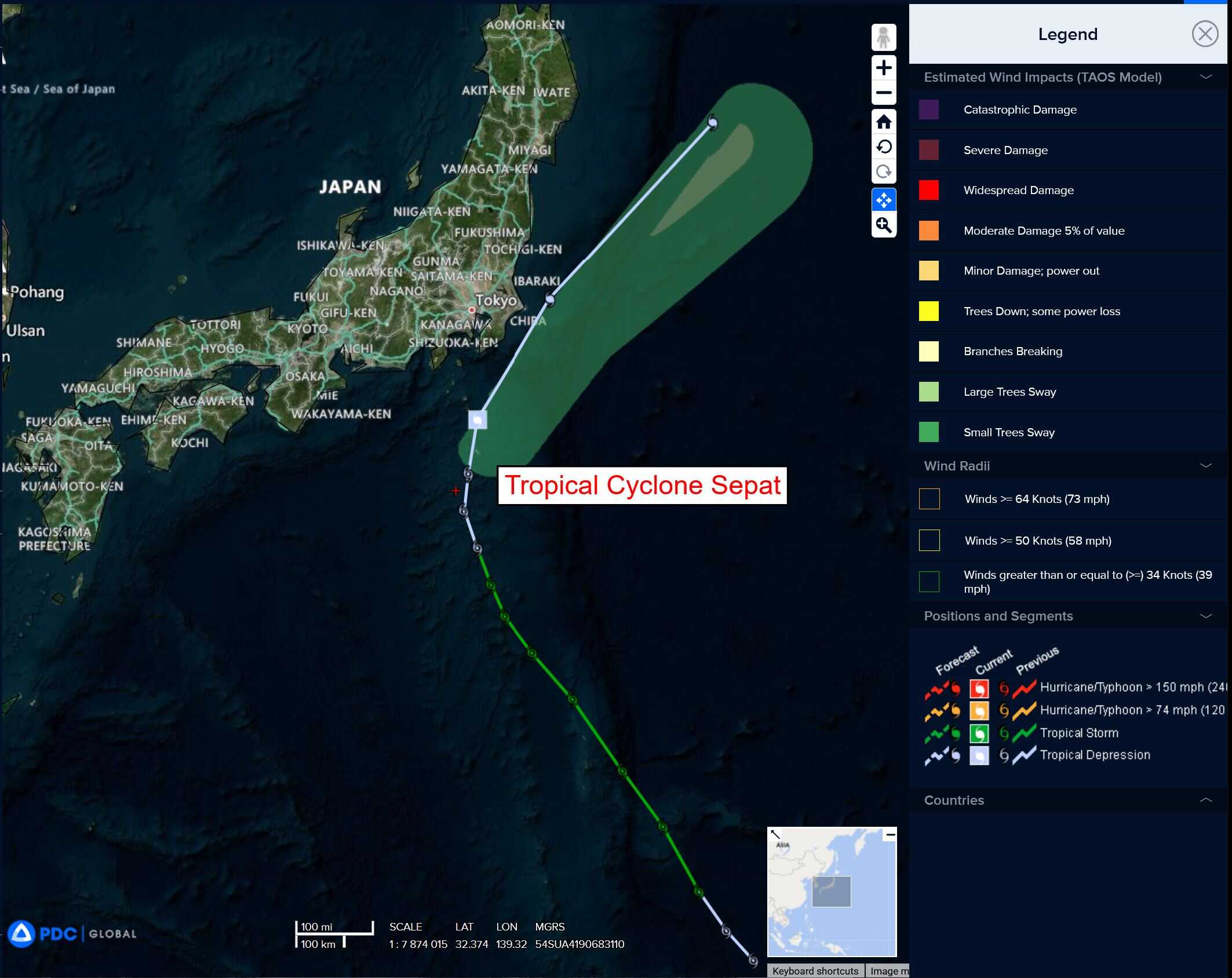
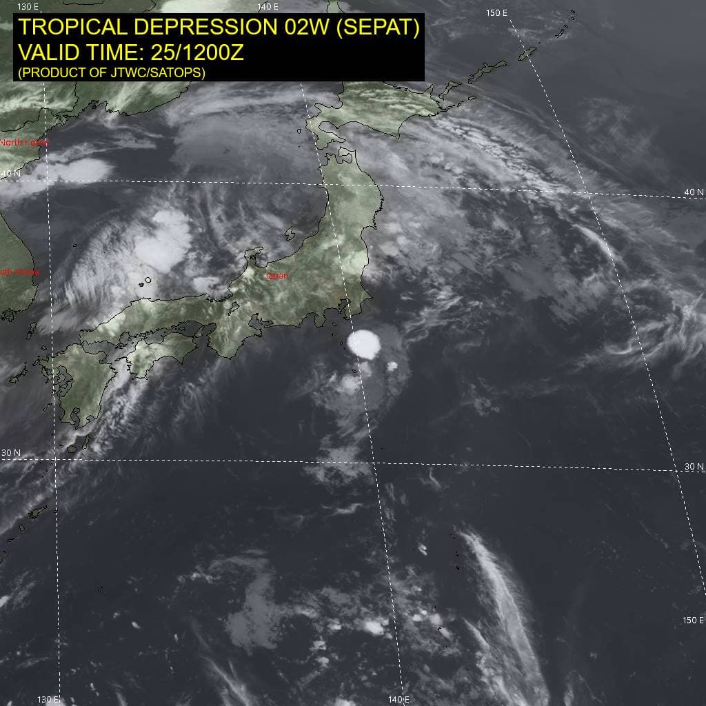
Tropical Cyclone 02W (Sepat) is located approximately 86 NM east-northeast of Yokosuka, Japan
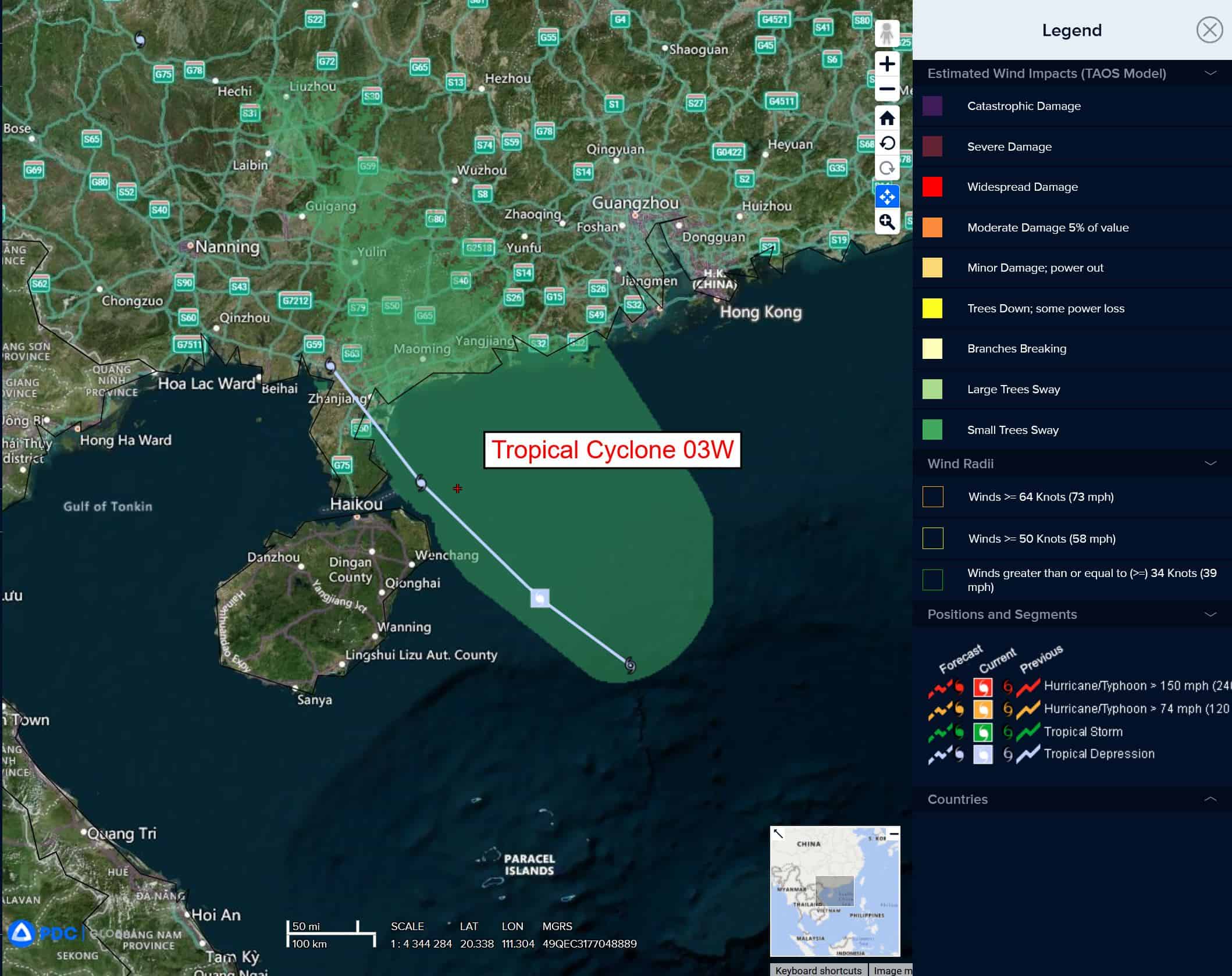
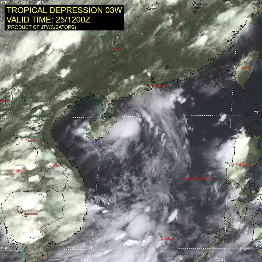
Tropical Cyclone 03W is located approximately 236 NM west-southwest of Hong Kong
Northeast Pacific Ocean: There are no Tropical Cyclones
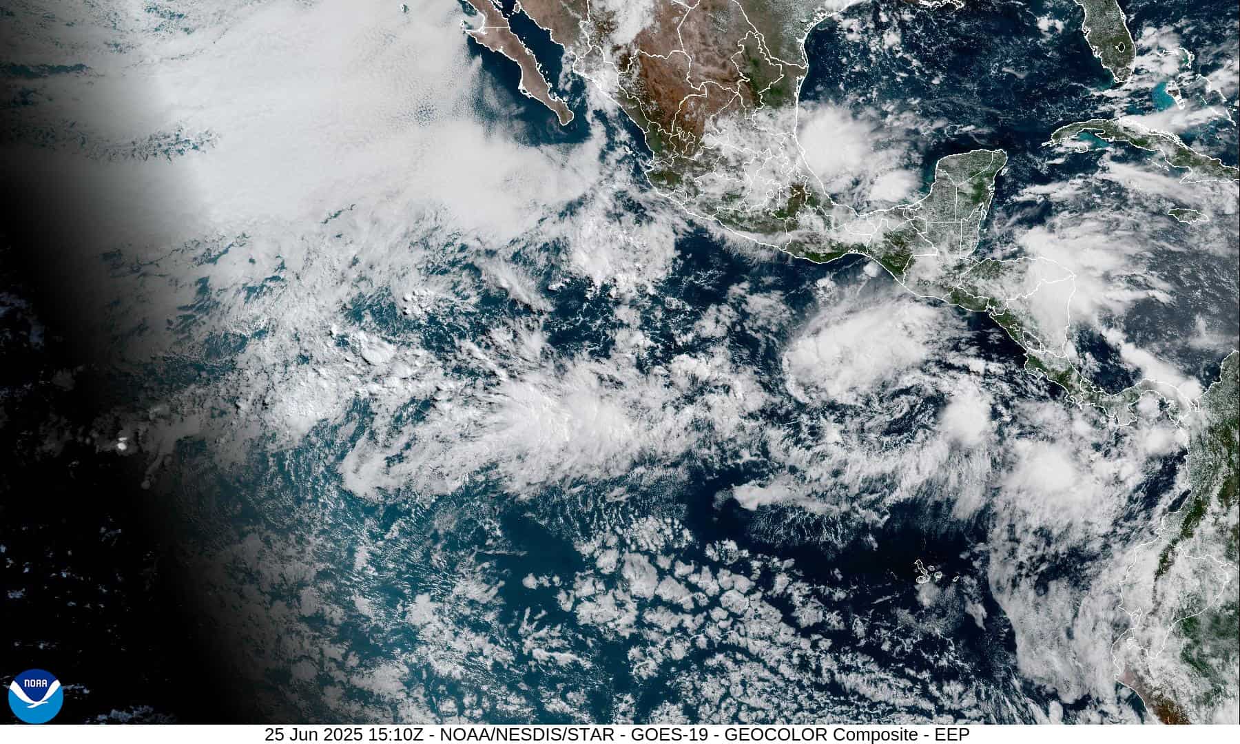
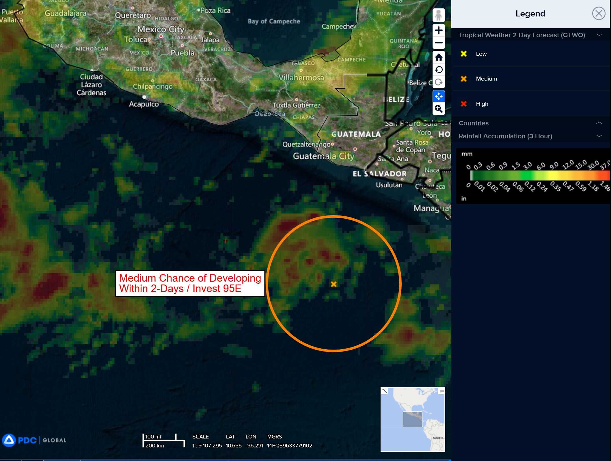
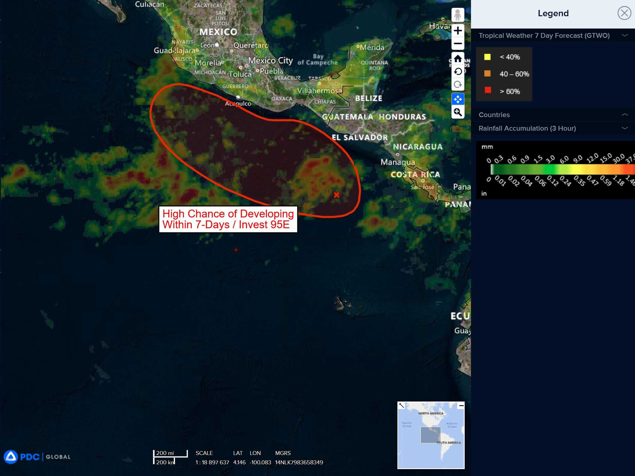
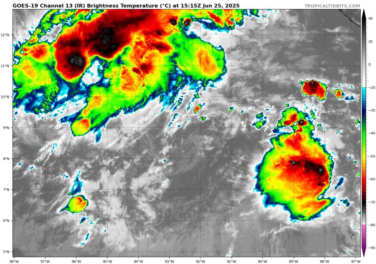
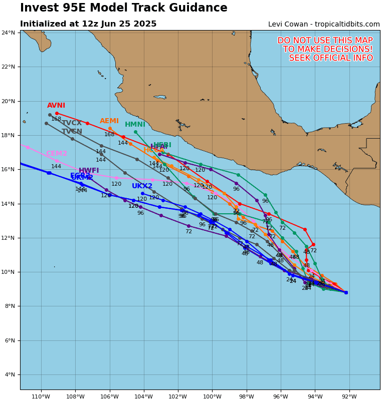
Offshore of Central America and Southern Mexico:
Invest 95E
>>> Showers and thunderstorms associated with an area of low pressure located a few hundred miles south of the coast of Guatemala have changed little in organization during the past day or so. Environmental conditions appear conducive for gradual development of this system during the next few days, and a tropical depression or tropical storm is likely to form by late this weekend while the system moves slowly west-northwestward, off the coast of southern Mexico.
* Formation chance through 48 hours…medium…40 percent
* Formation chance through 7 days…high…80 percent
Central Pacific Ocean: There are no Tropical Cyclones
Tropical cyclone formation is not expected during the next 7-days.
Western Pacific, Indian Ocean, and adjacent Seas:
Western Pacific
Tropical Cyclone 02W (Sepat)
According to the JTWC warning number 15, sustained winds are 25 knots with gusts to near 35 knots
Animated enhanced infrared satellite imagery depicts a flare of convection building east of an exposed low-level circulation center. An approaching trough from the west has clearly begun to influence the tropical depression, inducing strong westerly vertical wind shear.
The system is approaching the baroclinic zone, which is an unfavorable environment for tropical cyclone development. Water vapor imagery reveals that the upper level environment is unfavorable as TD 02W is centered in an upper-level deformation zone.
TD 02W is approaching the baroclinic zone and is anticipated to pass over cool waters within the next 12 hours, initiating a period of extratropical transition. The primary steering mechanism driving the system to the northwest is the subtropical ridge to the east.
An approaching deep-layer trough will increase track speed for the remainder of the forecast period. The system is forecast to maintain an intensity 25 knots for the next 12 hours. TD 02W will intensify to 30 knots after 12 hours due to baroclinic forcing as the system becomes fully extratropical.
Tropical Cyclone 03W
According to the JTWC warning number 04, sustained winds are 25 knots with gusts to near 35 knots
Animated enhanced infrared satellite imagery depicts building deep convection obscuring the low-level circulation center of tropical depression 03W.
Favorable upper-level divergence allows for equatorward outflow aloft. Low vertical wind shear and warm sea surface temperatures also have supported growing convection over the last six hours.
Tropical depression 03W will continue to track northwestward for the next 36 hours under the steering influence of the subtropical ridge to the northeast. As the system moves northwestward, TD 03W will make landfall between 12 and 24 hours on the Leizhou Peninsula.
The system is expected to maintain intensity as the system approaches land, and weaken below warning threshold due to topographic interaction by 36 hours.