
")
Current Snapshot
For all the latest updates visit: DisasterAWARE
1800x1080a
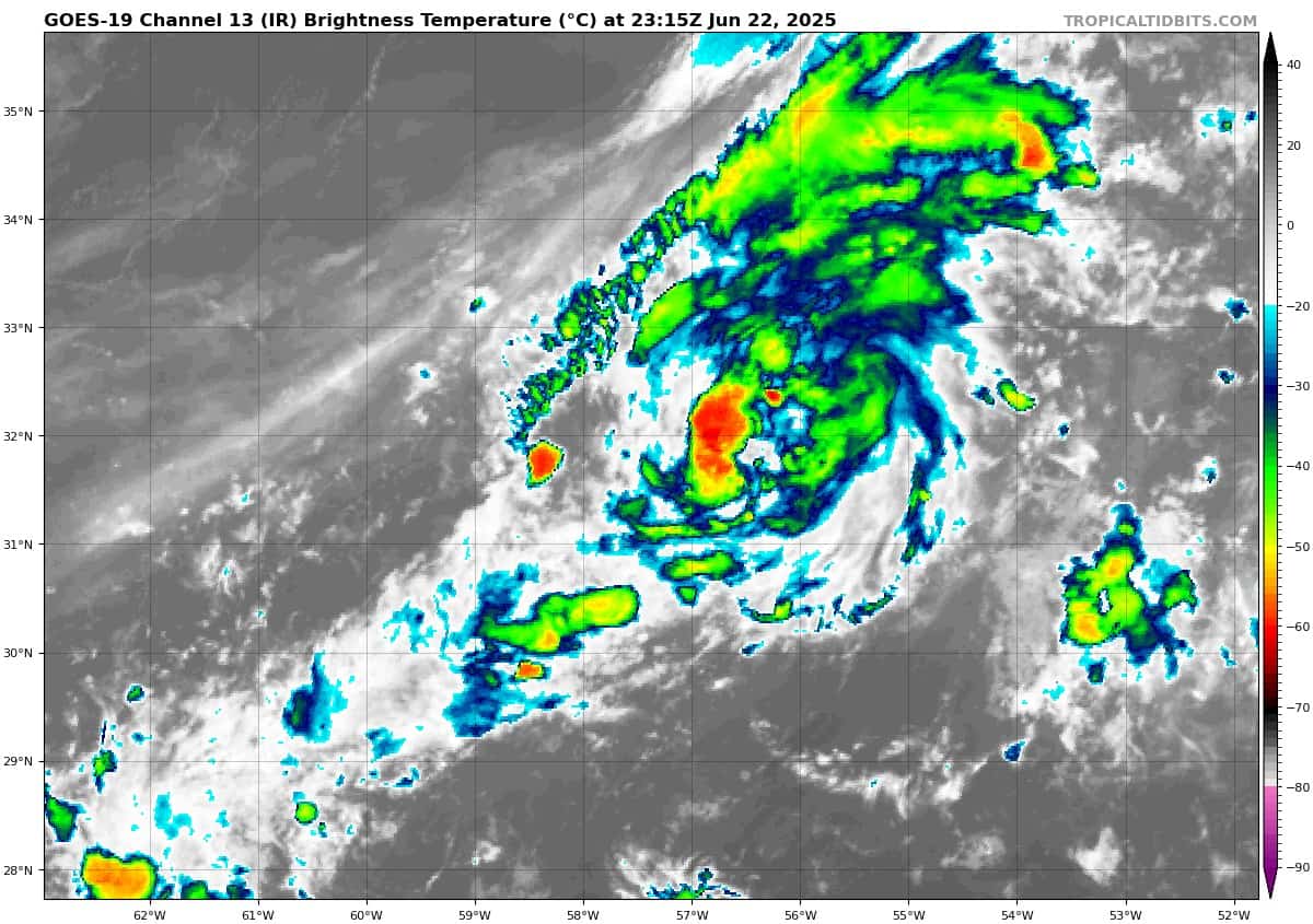
goes19_ir_90L_202506222315_lat31.5-lon-57.4
By PDC’s Senior Weather
Specialist Glenn James

The Pacific Disaster Center’s (PDC Global) Sunday, June 22, 2025, Tropical Cyclone Activity Report…for the Atlantic Ocean, the Caribbean Sea, and the Gulf of America
Current Tropical Cyclones:
There are no Tropical Cyclones
Central Subtropical Atlantic:
Invest 90L
>>> Showers and thunderstorms continue to show signs of organization overnight with an area of the low pressure located about 500 miles east of Bermuda. Recent satellite-derived wind data also indicates the system has a well-defined surface circulation with maximum sustained winds of 30-35 mph. While environmental conditions are only marginally favorable, only a small increase in organization and persistence of the current shower and thunderstorm activity is likely to result in the formation of a short-lived tropical depression or storm, as soon as later today. By Tuesday, this system is expected to encounter less favorable environmental conditions, ending its opportunity for further development. Regardless of development, the system is forecast to move northeastward at 5 to 10 mph, remaining over the open central Atlantic.
* Formation chance through 48 hours…high…70 percent
* Formation chance through 7 days…high…70 percent