
")
Current Snapshot
For all the latest updates visit: DisasterAWARE
pdcdalila
1800x1080e
04E_tracks_latest
2
7
wutip
01W_140600sair
01W_tracks_latest
By PDC’s Senior Weather
Specialist Glenn James

The Pacific Disaster Center’s (PDC Global) Saturday, June 14, 2025, Tropical Cyclone Activity Report…for the Pacific Ocean, the Indian Ocean, and adjacent Seas
Current Tropical Cyclones:
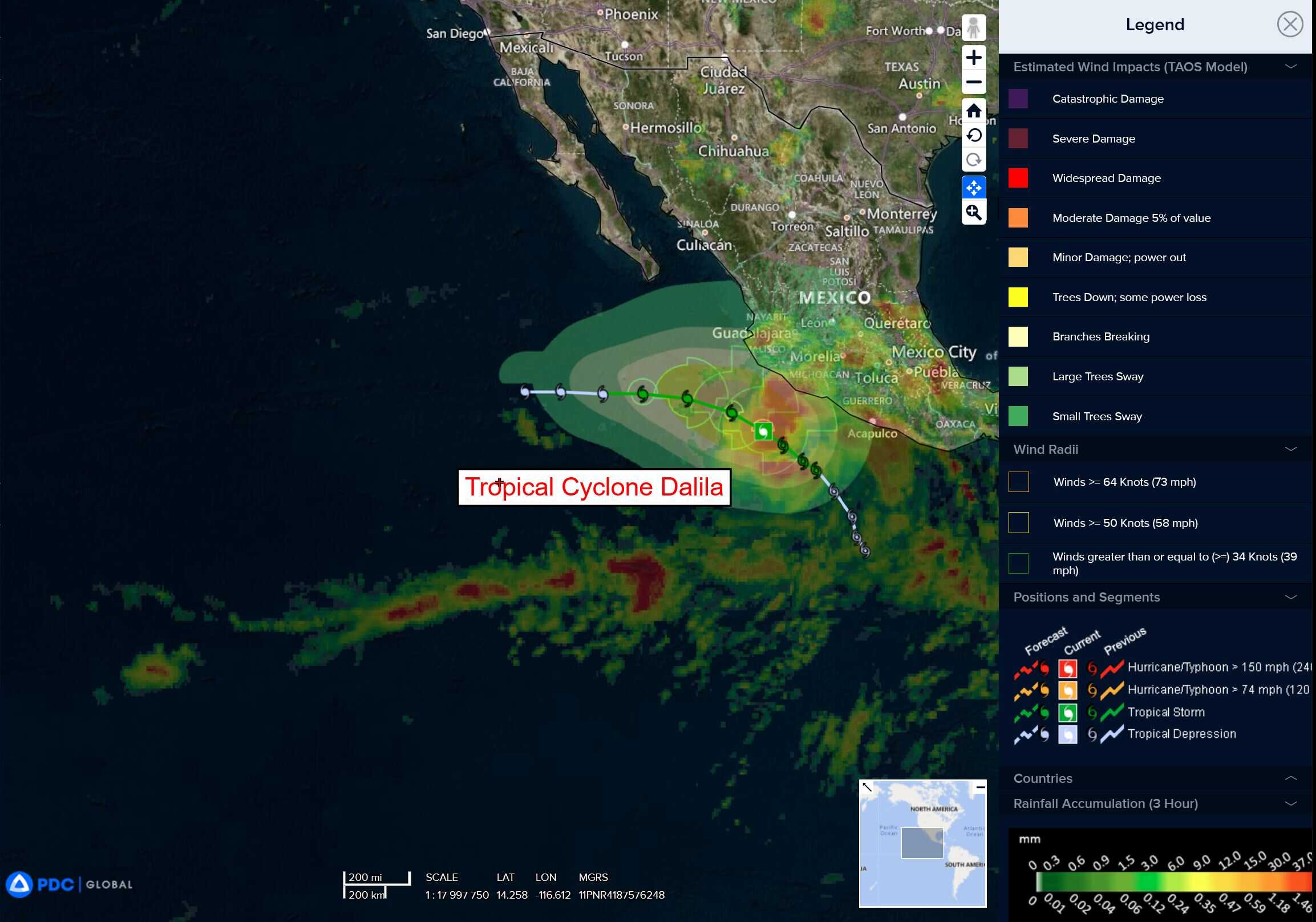
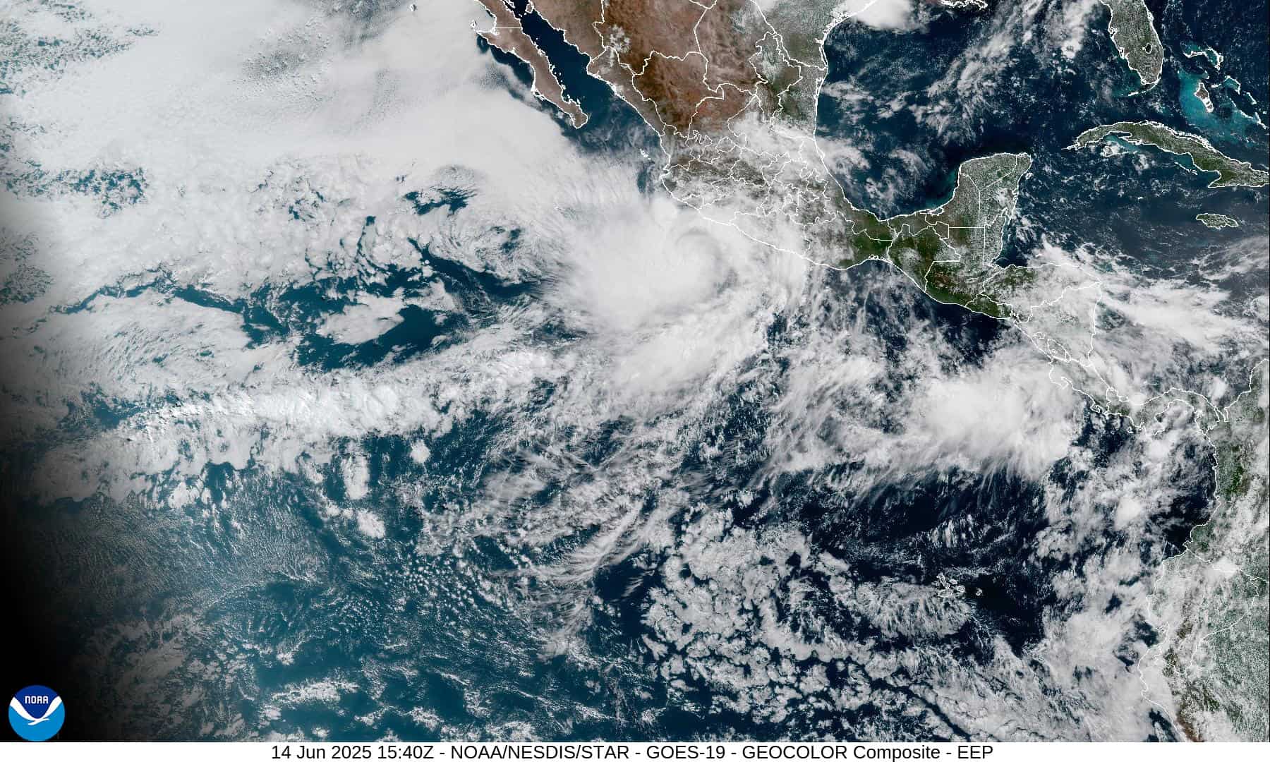
Tropical Cyclone 04E (Dalila)…is located about 185 miles west-southwest of Manzanillo, Mexico
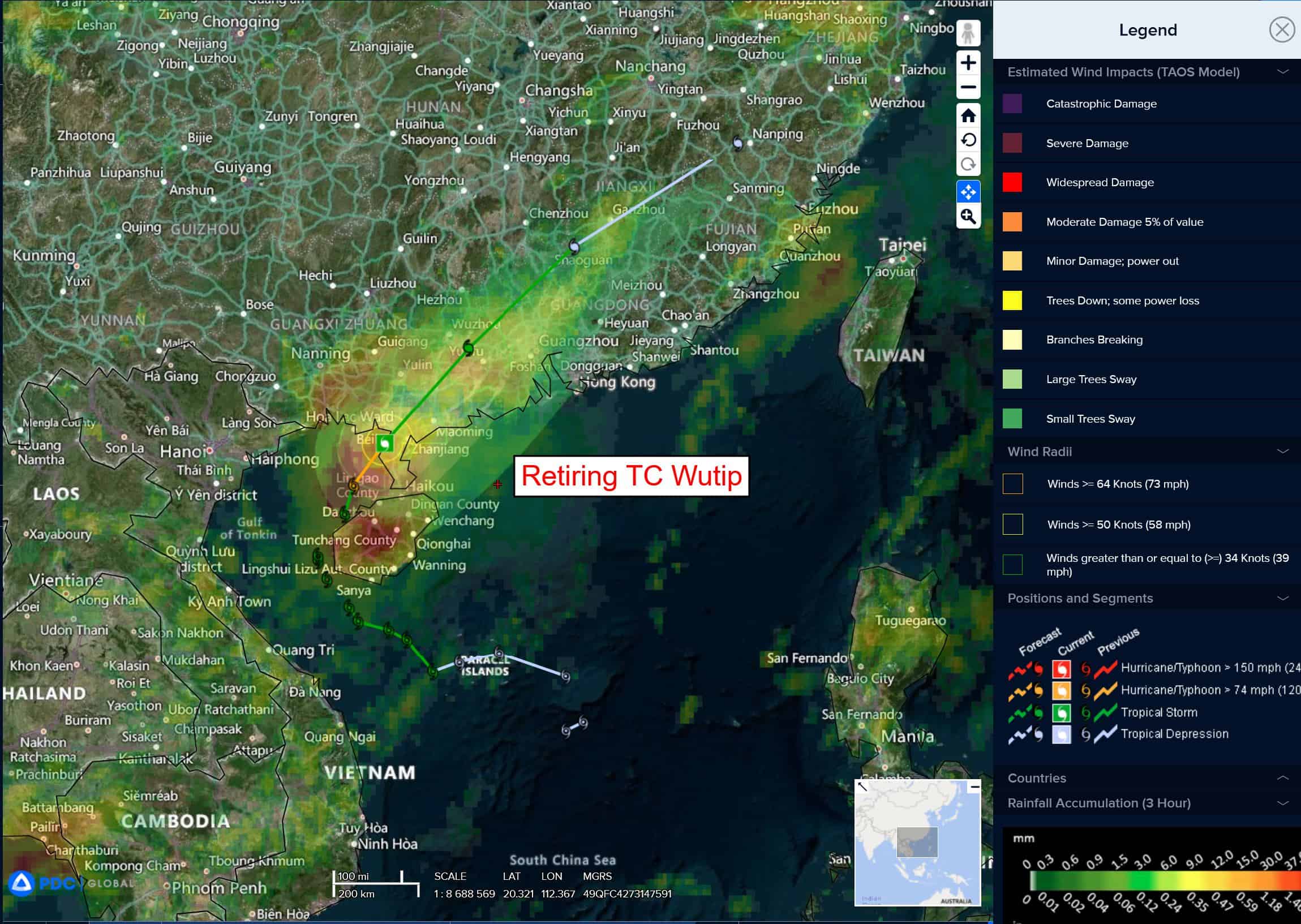
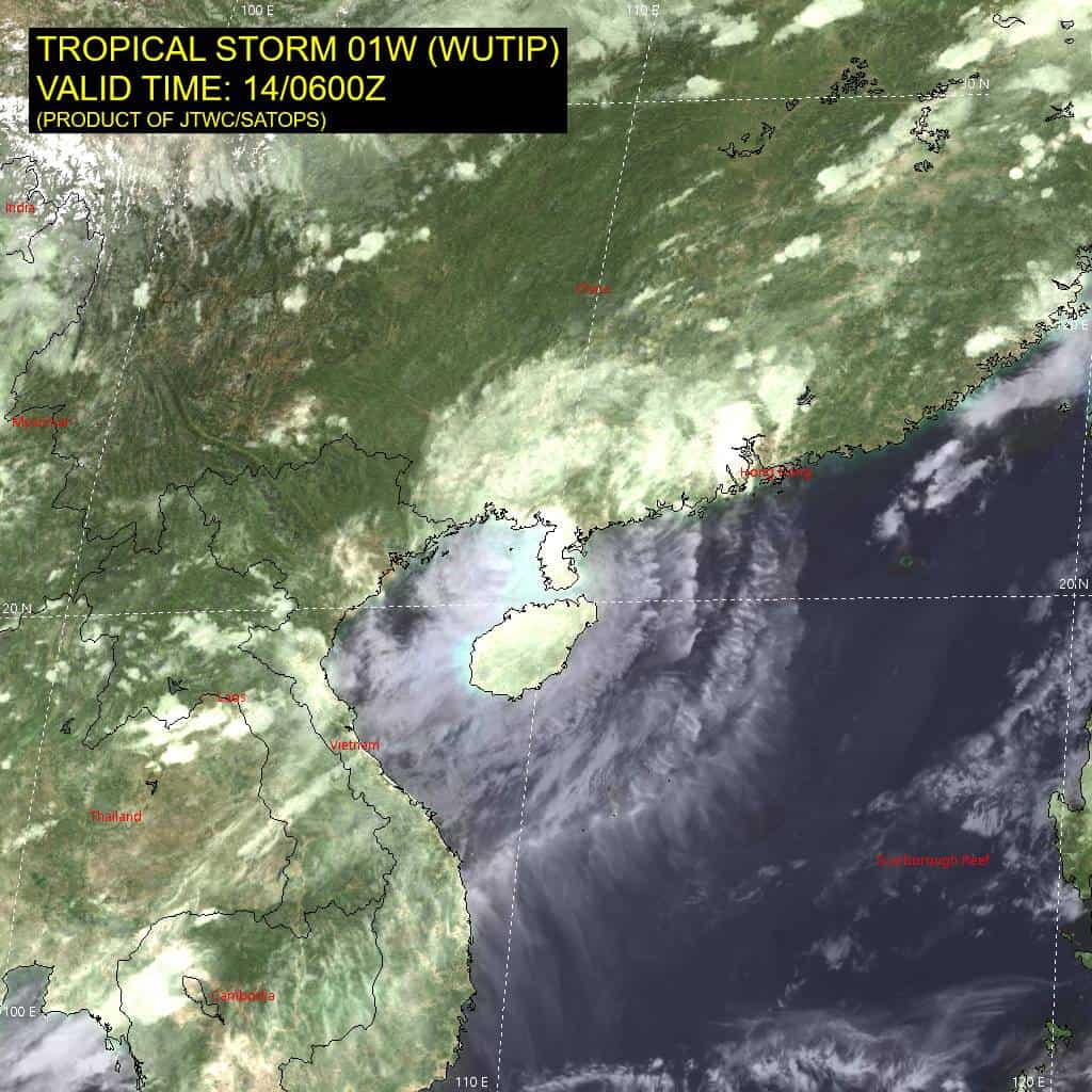
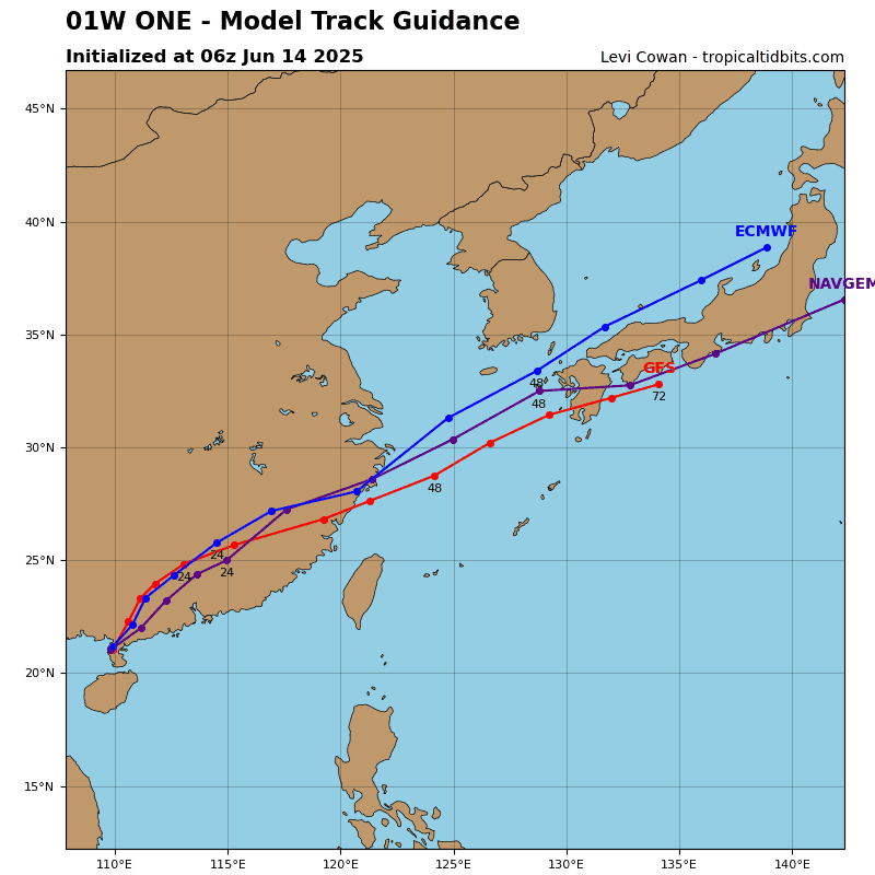
Tropical Cyclone 01W (Wutip)…is located about 254 NM west-southwest of Hong Kong – Final Warning
Northeast Pacific Ocean:
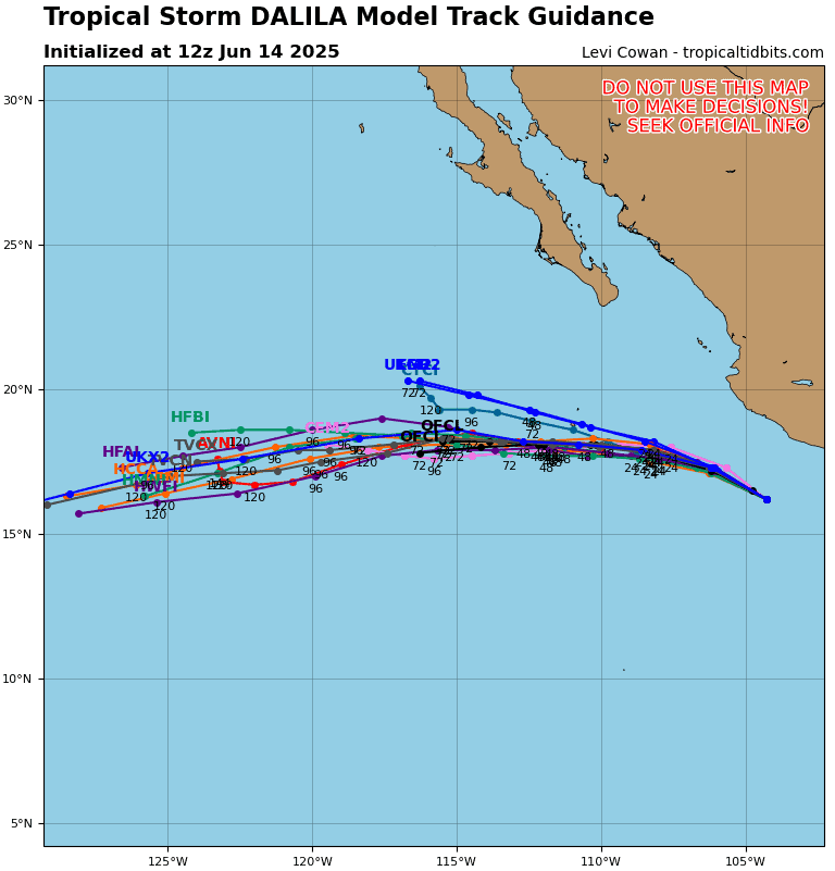
Tropical Cyclone 04E (Dalila)
DALILA CONTINUES TO BRING STRONG WINDS AND HEAVY RAIN TO PORTIONS OF SOUTHWEST MEXICO
According to the NHC Advisory number 10A
Dalila is moving toward the west-northwest near 12 mph (19 km/h). A turn toward the west is expected later tonight and Sunday. On the forecast track, the center of Dalila is forecast to remain offshore the southwestern coast of Mexico. Maximum sustained winds remain near 65 mph (100 km/h) with higher gusts. Dalila is likely near its peak intensity and will begin to gradually weaken later tonight or Sunday. Tropical-storm-force winds extend outward up to 140 miles (220 km) from the center.
HAZARDS AFFECTING LAND RAINFALL:
RAINFALL: Additional rainfall amounts of 3 to 6 inches are expected across portions of the Mexican states of Michoacán and Guerrero through Sunday morning, with localized storm totals up to 9 inches near the coast. This rainfall will lead to areas of flooding and mudslides, especially in areas of steep terrain near the coast.
WIND: Tropical storm conditions are expected within the warning area today.
SURF: Swells generated by Tropical Storm Dalila will affect portions of the coast of southwestern Mexico during the next couple of days. These swells are likely to cause life-threatening surf and rip current conditions.
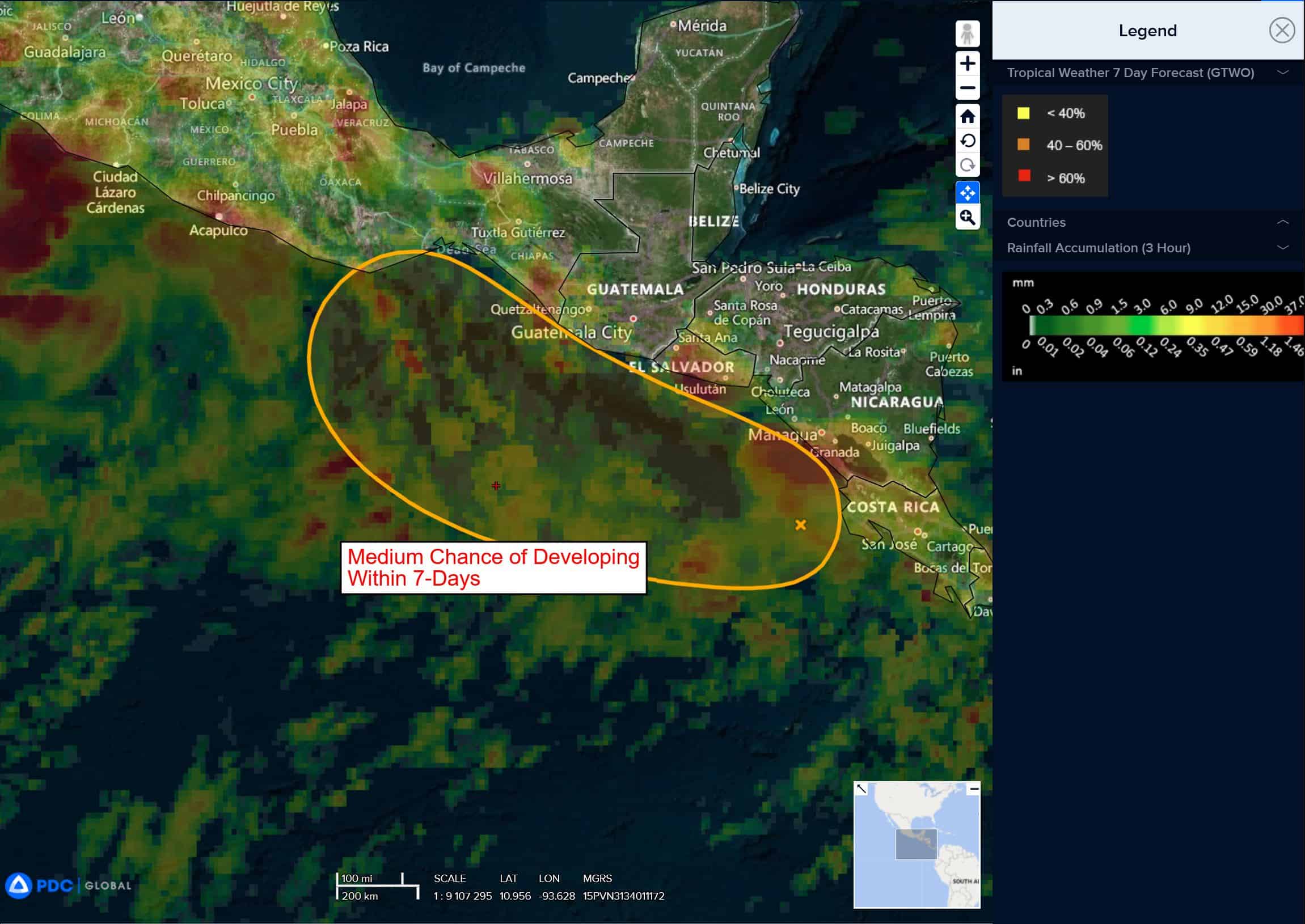
Offshore of Central America and Southern Mexico
Invest 94E
>>> A broad area of low pressure, associated with a tropical wave, is located offshore of the Pacific coast of Costa Rica and is producing disorganized showers and thunderstorms. Environmental conditions appear conducive for gradual development of the low, and a tropical depression could form by the middle of next week while moving westward to west-northwestward just offshore of the coasts of El Salvador, Guatemala, and southeastern Mexico.
* Formation chance through 48 hours…low…30 percent
* Formation chance through 7 days…medium…60 percent
Central Pacific Ocean: There are no Tropical Cyclones
Tropical cyclone formation is not expected during the next 7-days.
Western Pacific, Indian Ocean, and adjacent Seas:
Western Pacific
Tropical Cyclone 01W (Wutip) – Final Warning
According to the JTWC Warning number 16, sustained winds are 55 knots with gusts to 70 knots
Animated multi-spectral imagery reveals an eye feature that has filled over the last six hours. The system has made landfall on the Leizhou Peninsula. Water vapor imagery reveals an encroaching upper-level trough to the northwest which is creating an unfavorable environment for development in step with unfavorable topographic interaction.
TS 01W will continue to weaken to dissipation over land during the next 36 hours and track northeastward for the remainder of the forecast period with the low-level flow of the southwest monsoon.