
")
Current Snapshot
For all the latest updates visit: DisasterAWARE
1800x1080e
pdc04e
goes19_ir_04E_202506131515_lat13.5-lon-101.3

04E_tracks_latest
pdc7
pdcwutip
01W_131200sair
01W_tracks_latest
By PDC’s Senior Weather
Specialist Glenn James

The Pacific Disaster Center’s (PDC Global) Friday, June 13, 2025, Tropical Cyclone Activity Report…for the Pacific Ocean, the Indian Ocean, and adjacent Seas
Current Tropical Cyclones:
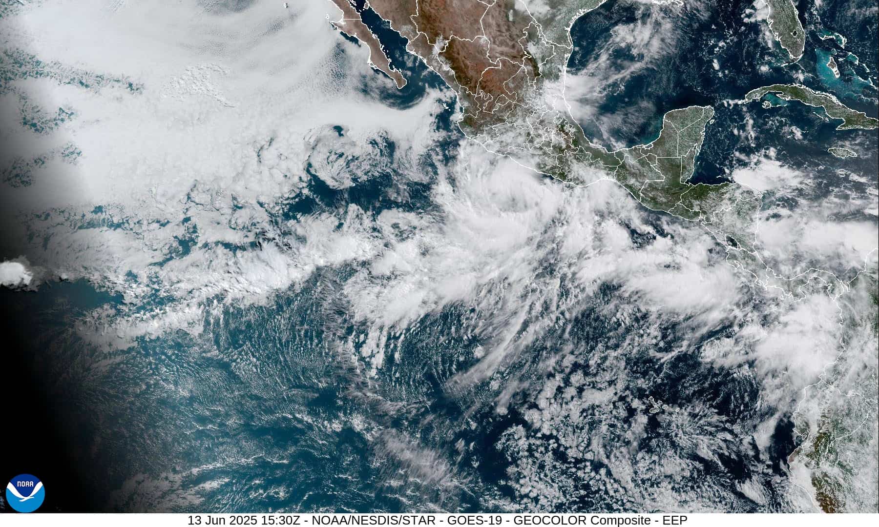
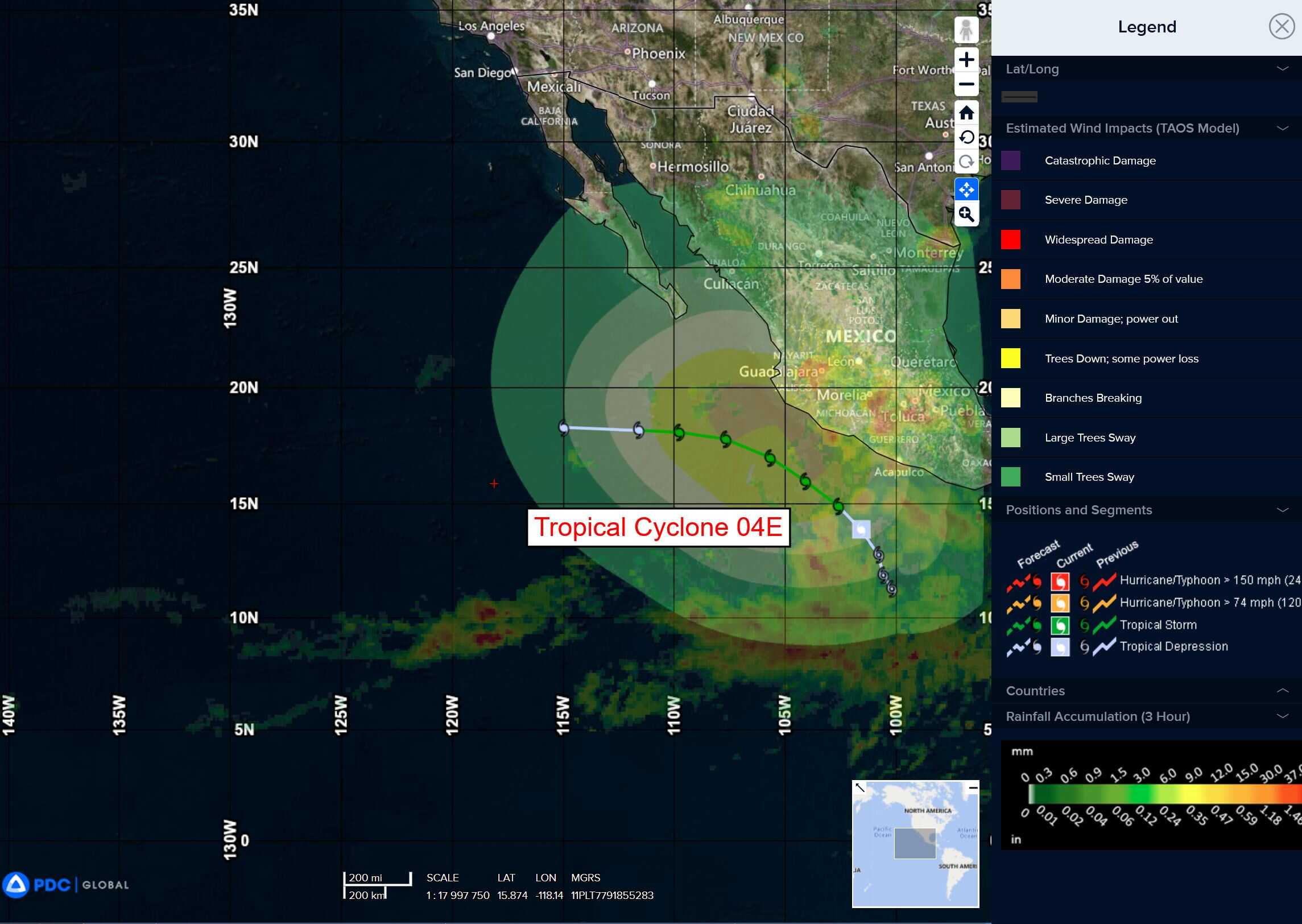
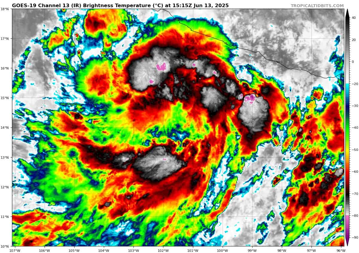
Tropical Cyclone 04E (Dalila)…is located about 195 miles south-southwest of Zihuatanejo, Mexico
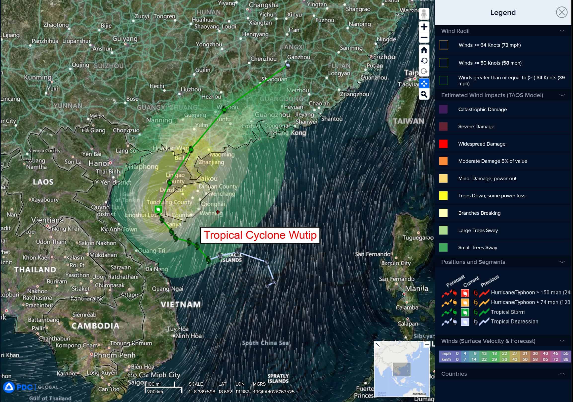
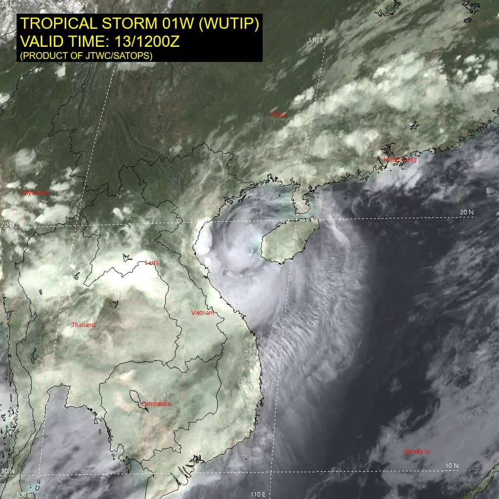
Tropical Cyclone 01W (Wutip)…is located about 185 NM east-southeast of Hanoi, Vietnam
Northeast Pacific Ocean:
Tropical Cyclone 04E (Dalila)
TROPICAL STORM WARNING ISSUED FOR THE COAST OF MEXICO FROM LAZARO CARDENAS TO TECPAN DE GALEANA
According to the NHC Advisory number 6
Dalila is moving toward the northwest near 12 mph (19 km/h), and this general motion is expected to continue through Saturday. A turn toward the west is forecast by Sunday. On the forecast track, the center of Dalila is forecast to move parallel to, but offshore of, the southwestern coast of Mexico. Maximum sustained winds are near 40 mph (65 km/h) with higher gusts. Gradual strengthening is expected during the next day or so. Weakening should begin by Sunday. Dalila is a large storm. Tropical-storm-force winds extend outward up to 310 miles (500 km) from the center.
HAZARDS AFFECTING LAND RAINFALL:
RAINFALL: Rainfall totals of 2 to 4 inches, with localized amounts up to 6 inches, are possible across portions of the Mexican states of Guerrero, Michoacan, and Colima through this weekend. This rainfall may lead to areas of flooding and mudslides.
WIND: Tropical storm conditions are expected within the warning area, and tropical storm conditions are possible within the watch area tonight and Saturday.
SURF: Swells generated by Tropical Depression 04E will affect portions of the coast of southwestern Mexico during the next few days. These swells are likely to cause life-threatening surf and rip current conditions.
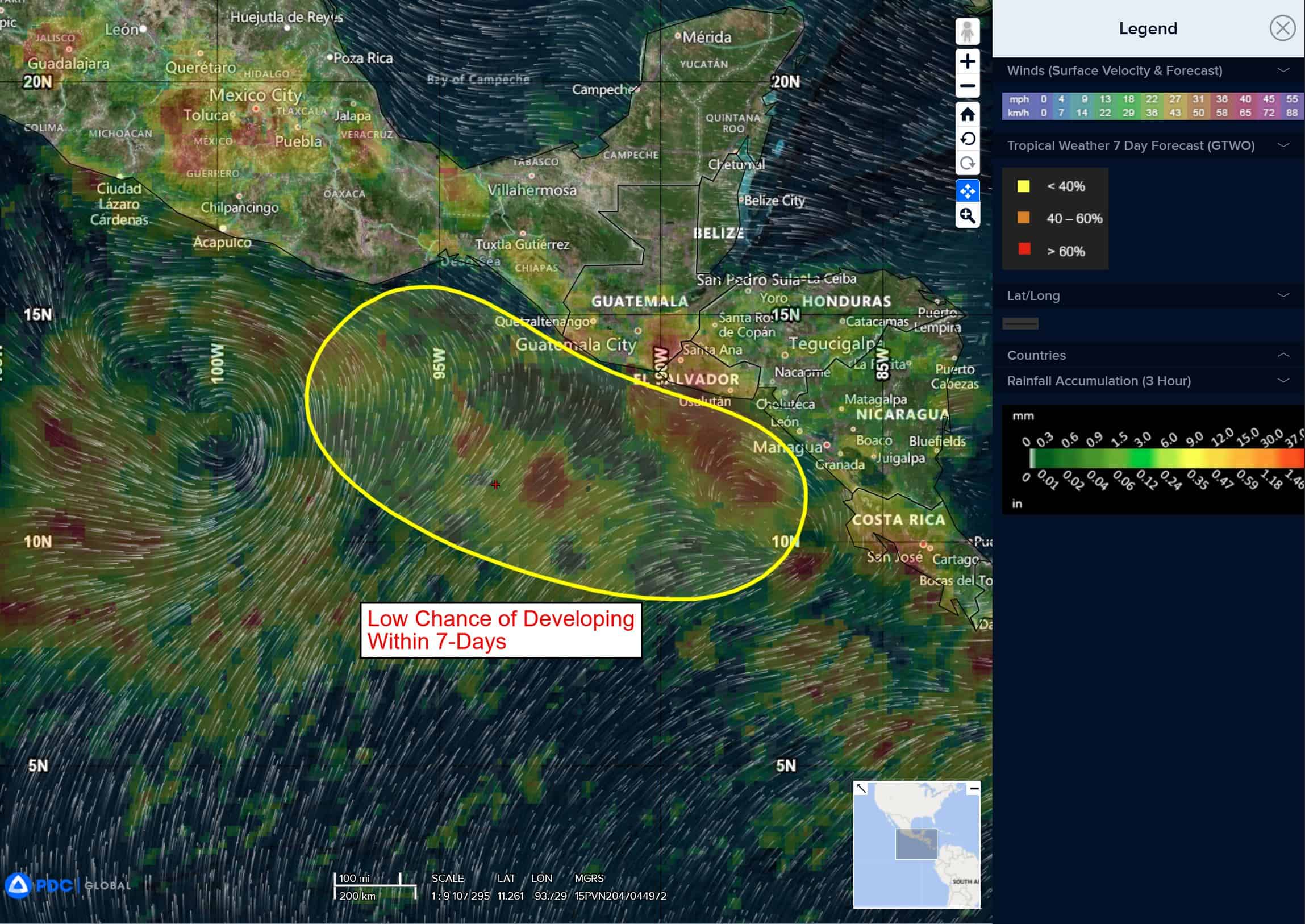
Offshore of Central America and Southern Mexico
>>> An area of low pressure is forecast to develop late this weekend or early next week near the coast of Central America. Environmental conditions appear conducive for some gradual development of this system as it moves west-northwestward near the coasts of Central America and southern Mexico.
* Formation chance through 48 hours…low…near 0 percent
* Formation chance through 7 days…low…30 percent
Central Pacific Ocean: There are no Tropical Cyclones
Tropical cyclone formation is not expected during the next 7-days.
Western Pacific, Indian Ocean, and adjacent Seas:
Western Pacific
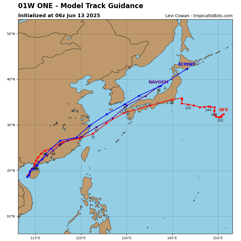
Tropical Cyclone 01W (Wutip)
According to the JTWC Warning number 15, sustained winds are 65 knots with gusts to 80 knots
Animated enhanced infrared (eir) satellite imagery depicts tropical storm 01W (Wutip) as having stayed nearly stationary over the past 6 hours, staying west of Hainan. A microwave image shows the microwave eye feature with convective banding surrounding the southern semicircle of the system. Central convection has become a bit less organized compared to 6 hours ago, but the cirrus filaments extending equatorward have become more pronounced.
Environmental analysis indicates that 01W is in a favorable environment characterized by strong equatorward outflow aloft, low (10-15 knot) vertical wind shear, and warm sea surface temperatures. The proximity to land is the only negative factor at the moment.
01W is forecast to begin a northwestward track over the next 12 hours as it rounds the ridge axis. The system will then continue on a northwestward trajectory through the remainder of the forecast period as it tracks along the western periphery of the str. Landfall is forecast to occur just west of the Leizhou Peninsula between 18-24 hours.
Regarding intensity, 01W is forecast to maintain its current intensity of 60 knots through 12 hours and up until the time of landfall due to the low vertical wind shear and warm waters within the Gulf of Tonkin. However, if the system maintains its sluggish movement, rapid upwelling could cause weakening of the vortex. After landfall, 01W will quickly weaken as terrain interaction degrades the system. Dissipation is forecast to occur near 48 hours as the vortex accelerates northwestward.