
")
Current Snapshot
For all the latest updates visit: DisasterAWARE
epac2
goes18_ir_barbara

02E_tracks_latest
goes18_ir_cosme
03E_tracks_latest
70
01w
01W_101200sair
01W_tracks_latest
By PDC’s Senior Weather
Specialist Glenn James

The Pacific Disaster Center’s (PDC Global) Tuesday, June 10, 2025, Tropical Cyclone Activity Report…for the Pacific Ocean, the Indian Ocean, and adjacent Seas
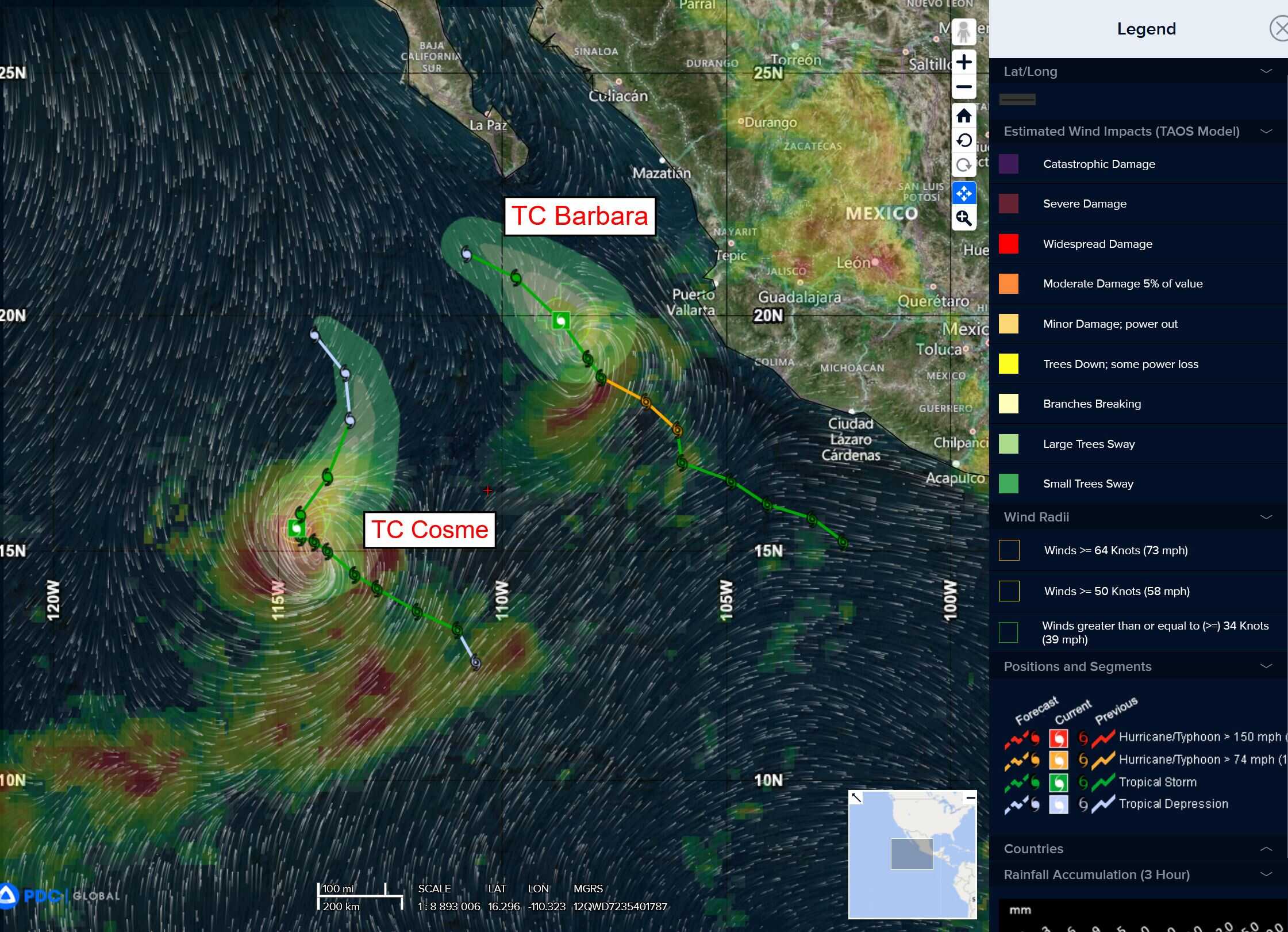
Current Tropical Cyclones:
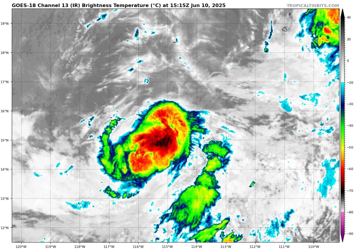
Post-Tropical Cyclone (02E) Barbara…is located about 160 miles west-northwest of Cabo Corrientes, Mexico – Last Advisory
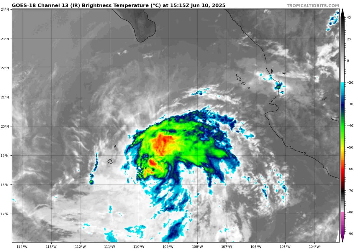
Tropical Cyclone 03E (Cosme)…is located about 585 miles southwest of the southern tip of Baja CA
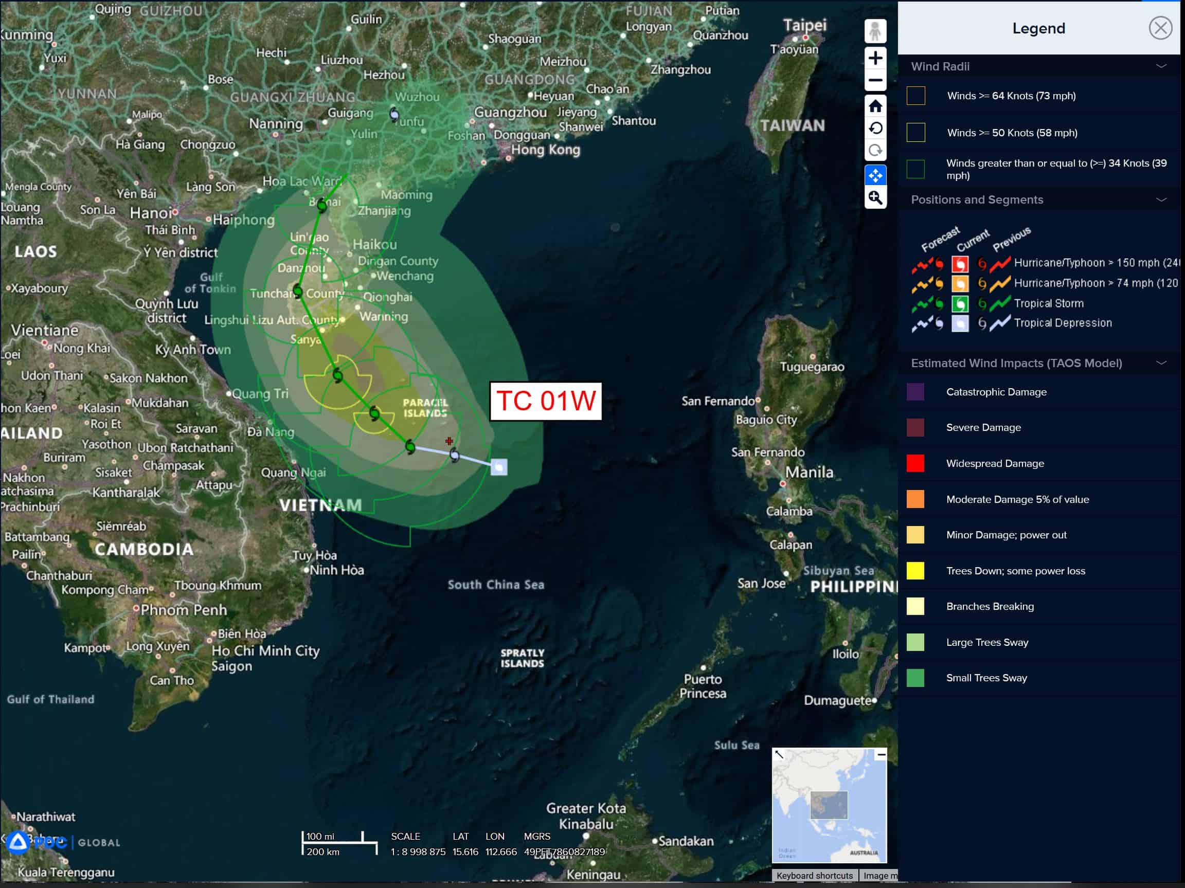
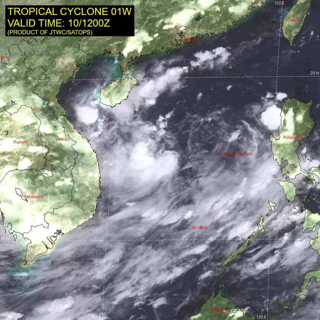
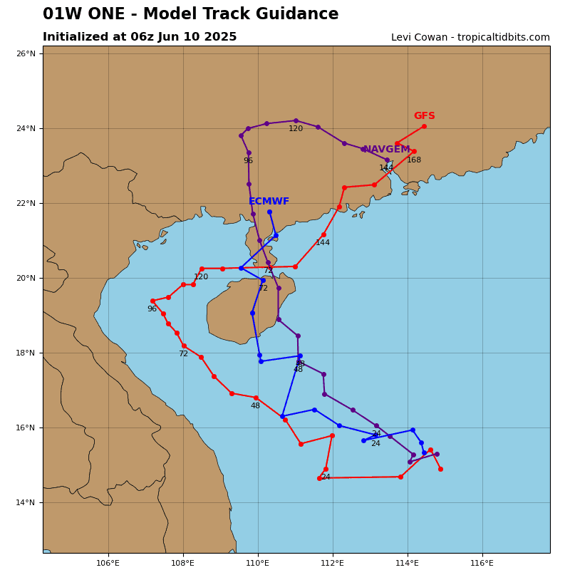
Tropical Cyclone 01W…is located about 323 NM east of Da Nang, Vietnam
Northeast Pacific Ocean:
Post-Tropical Cyclone 02E (Barbara) – Last Advisory
BARBARA HAS BECOME A REMNANT LOW
According to the NHC advisory number 12
The post-tropical cyclone is moving toward the north near 5 mph (7 km/h), and this general motion is expected to continue overnight. Maximum sustained winds have decreased to near 30 mph (45 km/h) with higher gusts. Weakening is forecast, and the system is expected to dissipate in a day or so,
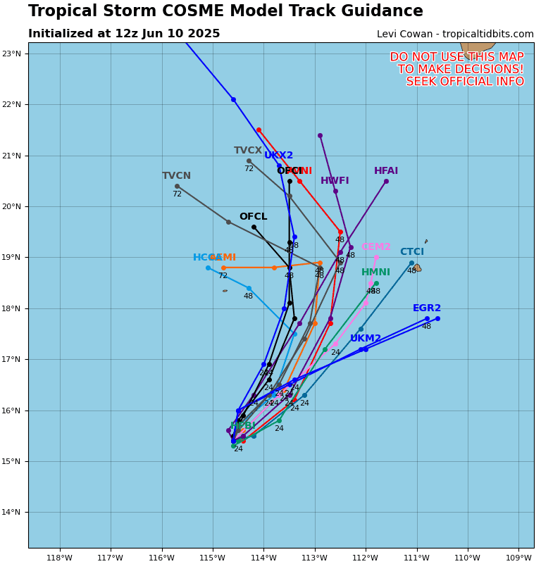
Tropical Cyclone 03E (Cosme)
COSME FORECAST TO BECOME A REMNANT LOW ON WEDNESDAY
According to the NHC advisory number 11
Cosme is moving toward the north-northeast near 5 mph (7 km/h). This general motion with an increase in forward speed is expected through Wednesday, followed by a turn back to the north-northwest on Thursday. Maximum sustained winds have decreased to near 45 mph (75 km/h) with higher gusts. Additional weakening is forecast, and Cosme is expected to degenerate into a remnant low on Wednesday. The remnant low is forecast to dissipate by late Thursday or Friday. Tropical-storm-force winds extend outward up to 35 miles (55 km) from the center.
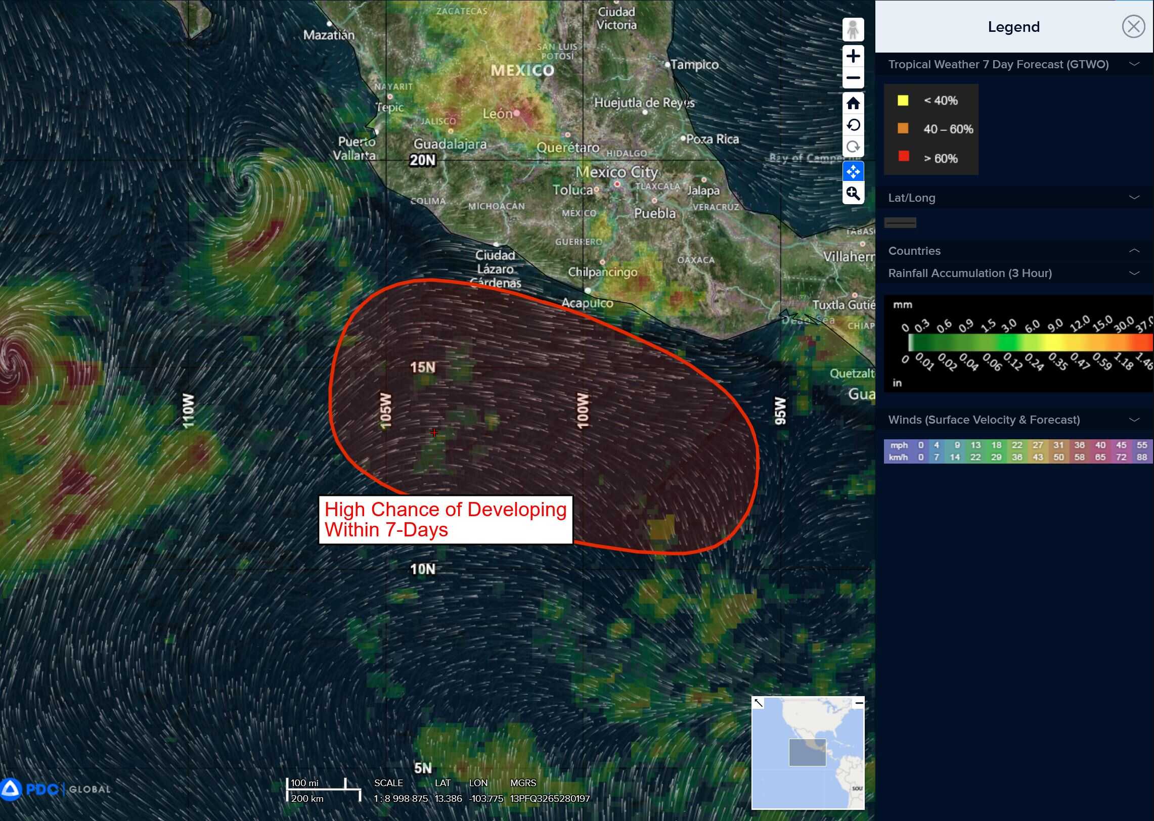
South of southern Mexico
>>> A broad area of low pressure located several hundred miles south of the Gulf of Tehuantepec continues to produce disorganized shower and thunderstorm activity. Environmental conditions appear conducive for gradual development of this system, and a tropical depression is expected to form late this week or over the weekend while it moves generally west-northwestward just offshore the southwestern coast of Mexico.
* Formation chance through 48 hours…low…20 percent
* Formation chance through 7 days…high…90 percent
Offshore of Central America and Southern Mexico
>>> An area of low pressure could form by late this weekend or early next week near the coast of Central America. Gradual development is possible thereafter as it moves slowly west-northwestward near the coasts of Central America and southern Mexico.
* Formation chance through 48 hours…low…near 0 percent
* Formation chance through 7 days…low…20 percent
Central Pacific Ocean: There are no Tropical Cyclones
Tropical cyclone ormation is not expected during the next 7-days.
Western Pacific, Indian Ocean, and adjacent Seas:
Western Pacific
Tropical Cyclone 01W
According to the JTWC Warning number 3, sustained winds are 30 knots with gusts to 40 knots